

Herb@MAWS
-
Posts
2,075 -
Joined
Content Type
Profiles
Blogs
Forums
American Weather
Media Demo
Store
Gallery
Everything posted by Herb@MAWS
-
Satellite and wind vector maps suggest a small circulation possibly developing just east of Mayaguana in The Bahamas on 5/21/23 in the morning.
-
0.17" Saturday here on east side of Columbia. 0.15" at BWI.
-
0.29" imby in Columbia
-
38 morning low east side of Columbia.
-
I have an outside band job 2 weeks from today. Hopefully the wet weekend pattern changes by then. Morning low 51. At 55 approaching 11am with sun just poking through now.
-
A light shower in Columbia in last hour despite a good amount of thunder all around for past few hours. Had to go to Catonsville around 2:30 and they had a decent heavy rain. Drove straight into a very dark sky heading up I-95NB. Cleaned off the car pollen, and wipers were a must.
-
Curious if anyone knows -- as to if this image is from a public online source ? or perhaps a personal wx program or private site ?
-
A few flakes.
-
4:45pm Columbia-- starting as sleet, 41.4°.
-
70.2 imby Thursday.
-
Low of 11 today. Much colder here during the December '22 cold.
-
This cold shot not such a big deal here in central Md., I think. 12 tonite, yes cold but not awful even with windchills. We've seen this before. Tomorrow night only down to about 26 and then a quick warm-up. Seems like basically 24 miserable hours then back to where we've been.
-

Jan 31 - Feb 1 Snow/Sleet/Misery Obs & Disco
Herb@MAWS replied to NorthArlington101's topic in Mid Atlantic
Whitened! 31.9° at 5:25am and a few flurries. -
6am 1/29/23 wide range of temps: DCA 43 IAD 42 Laurel 40 BWI 32 Columbia imby 31.5
-
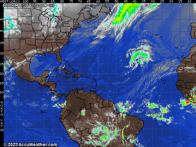
Something almost semi-tropical looking moving into the central Atlantic.
-
January/February Mid/Long Range Disco IV: A New Hope
Herb@MAWS replied to stormtracker's topic in Mid Atlantic
High temps in Chicago next Monday and Tuesday: 18 and 22. -
Just tiny raindrops IMColumbiaBY ☹️
-
Central pressure about 29.23" at 10am Monday. About the same as on Sunday.
-
With a couple of flurries here in Columbia Saturday morning and low level moisture around, I guess I'll hallucinate and watch today the low pressure and clouds developing off Carolinas.
-
Columbia 6:15am -- flurries 33.3° seasonal snow total increases from trace to trace-plus
-
Light rain. Temp dropped from 38.4 to 36.9.
-
..... at this point I'd be happy just to see flakes falling. Morning low 34 imby.
-
Dark skies. Quick 4° temp drop.
-
Thursday hi BWI 58. My high 15 miles to the west in Columbia only 46 according to both of my outside thermometers. 30.4 at 6am Friday.
-
Imby today -- High 15.3, Low 2.7

