

78Blizzard
-
Posts
4,066 -
Joined
-
Last visited
Content Type
Profiles
Blogs
Forums
American Weather
Media Demo
Store
Gallery
Everything posted by 78Blizzard
-
Possible coastal storm centered on Feb 1 2026.
78Blizzard replied to Typhoon Tip's topic in New England
Still early on the NAM, but the h5 is trending west from the last run. That ridge out west has trended west as well. -
Possible coastal storm centered on Feb 1 2026.
78Blizzard replied to Typhoon Tip's topic in New England
There were a dozen good hits in there for E MA. -
Possible coastal storm centered on Feb 1 2026.
78Blizzard replied to Typhoon Tip's topic in New England
The Euro AI trend has been SE the last 3 runs. -
Possible coastal storm centered on Feb 1 2026.
78Blizzard replied to Typhoon Tip's topic in New England
I remember the one almost 16 years to the day back in 2010 while my son and I were attending the commemoration of the 125 year anniversary of the Blue Hill Observatory. Kocin and Uccellini during their lectures were wondering if they were going to be able to get back to Baltimore/DC with a massive storm down there while we were sucking extreme cold and cirrus. Maybe we weren't that close on that one. But at least we got signed copies of "Northeast Snowstorms". -
Possible coastal storm centered on Feb 1 2026.
78Blizzard replied to Typhoon Tip's topic in New England
EPS followed the Euro with a marked improvement to the NW. One more run like that and much of E MA will be sharing the cape's good stuff. I was comparing to 12z. -
Possible coastal storm centered on Feb 1 2026.
78Blizzard replied to Typhoon Tip's topic in New England
It's the GFS against the world. But the Euro gives the cape 1"+ qpf. Another move nw like this one would get that qpf up to the Boston area. But if the GFS starts heading east at 06 and/or 12z, it's probably time to move on to the next threat. -
Possible coastal storm centered on Feb 1 2026.
78Blizzard replied to Typhoon Tip's topic in New England
Euro AI not on board. -
Possible coastal storm centered on Feb 1 2026.
78Blizzard replied to Typhoon Tip's topic in New England
One more move west and tomorrow the media will be the battle cry for everyone to start running to empty the grocery store shelves. -
Possible coastal storm centered on Feb 1 2026.
78Blizzard replied to Typhoon Tip's topic in New England
What's interesting on that GFS run is that the heavy convection was to the north and northwest, while the storm took an eastward track. Usually we see these setups where it chases the heavy convection to the east of the center and we lose out. That's why I'm not buying this eastward track. -
Possible coastal storm centered on Feb 1 2026.
78Blizzard replied to Typhoon Tip's topic in New England
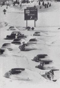
NIce timing for the 48 year anniversary. -
Possible coastal storm centered on Feb 1 2026.
78Blizzard replied to Typhoon Tip's topic in New England
Not only was the GEFS west of the 18z run, the members are more consolidated to the west. -
Possible coastal storm centered on Feb 1 2026.
78Blizzard replied to Typhoon Tip's topic in New England
Hangs around NC too long and then gets kicked east. I'd like to see that stall just 100 mi southwest of the Cape. -
Possible coastal storm centered on Feb 1 2026.
78Blizzard replied to Typhoon Tip's topic in New England
I'll take either the GFS or the CMC here. -
Possible coastal storm centered on Feb 1 2026.
78Blizzard replied to Typhoon Tip's topic in New England
Besides those two outliers to the south, there are 5 others that are far to the east, and that is obviously pulling the mean more to the east than what the rest of the members would suggest. The vast majority of the members are to the west of the mean. -
Possible coastal storm centered on Feb 1 2026.
78Blizzard replied to Typhoon Tip's topic in New England
Hopefully not an inland runner. -
Possible coastal storm centered on Feb 1 2026.
78Blizzard replied to Typhoon Tip's topic in New England
There are a dozen big hits there. -
Visibility now is the lowest its been so far.
-
Yeah, shows a total of 14" more for this area, subtracting 2-3 inches for the last 2 hours, leaves an additional foot from this time forward.
-
RH been inching up since the start of the storm, from 91% to now 97%.
-
Judging from the radar, the main sleet line is still well south of where the NAM had it at this time, as well as other models.
-
7", 9º F here now. Nothing much accumulated in the first hour, only adding up in the past 5 hours, so over 1"/hr now. Wind is picking up, so there will be some drifting. Evidence of that was against the garage doors with 8" there.
-
The sleet, freezing rain line is further south than the 0z Euro had it down in the mid Atlantic.
-
“Cory’s in LA! Let’s MECS!” Jan. 24-26 Disco
78Blizzard replied to TheSnowman's topic in New England
Canadian is weak sauce - no surprise. -
“Cory’s in LA! Let’s MECS!” Jan. 24-26 Disco
78Blizzard replied to TheSnowman's topic in New England
GFS held serve here with 1.78 qpf both 18z and 0z. -
“Cory’s in LA! Let’s MECS!” Jan. 24-26 Disco
78Blizzard replied to TheSnowman's topic in New England
Maybe for you, but it cut back Monday in E MA. Still had the same output through 12z Monday as did the 18z run.




