SnoSki14
-
Posts
16,066 -
Joined
-
Last visited
Content Type
Profiles
Blogs
Forums
American Weather
Media Demo
Store
Gallery
Everything posted by SnoSki14
-
In what world?
-
Driving home in what looks like the apocalypse Never thought I'd see this
-
Red flag warnings up. Risk is higher than normal with very dry fuels present Dry Tstorms will add to the risk
-
April was still record warm regardless, which if you believe only had 1 intense week makes it that much more impressive. And sure spring isn't warming as fast but it's still warming. Our "cool" May would've been AN if we used earlier averages. To each their own but I consider spring March-May, summer June- August and so forth.
-
We just had the warmest April on record and March was pretty warm too. I swear everyone has the memory of a goldfish
-
In a couple weeks it'll struggle to dip below 70 at night with high dews so I'll happily take this
-
46 this morning in New Brunswick More 40s tonight too
-
I don't see reservoirs getting too low but aesthetically it's gonna look dry for sure especially if we keep dodging rain chances
-
The dry weather helps greatly. Its also been allowing temps to get quite chilly at night. Not too often we get huge diurnal swings in June
-
Outside of some very warm to hot days (still dry though) today and tomorrow it mainly looks at or below normal with 70s. We should still dip into the 40s at night quite easily.
-
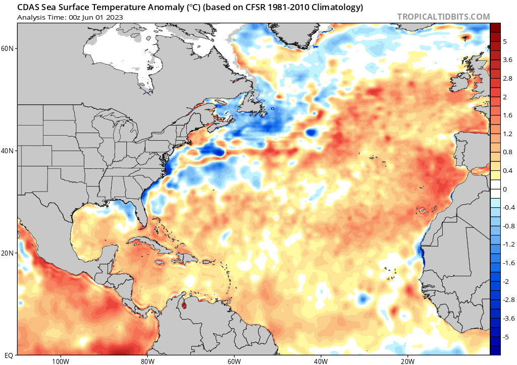
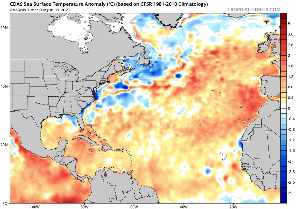
A complete 180 from last winter would not surprise me. In this era we flip from one extreme to the next. Also am noticing cool SST anomalies building off the SE Canada & Atlantic coasts while MDR cooks. That supports the cool backdoor pattern for June expected to develop in the northeast.
-
Noticed there's some pretty cool SST anomalies off of SE Canada and Atlantic costs just north of Gulf stream. So the backdoor fronts have merit
-
May obs/discussion thread - Welcome to Severe Season!!
SnoSki14 replied to weatherwiz's topic in New England
One bad weekend out of many is fine and rain is needed. The cutoff placement will be interesting though. GFS much further SW with it -
The agenda is pretty clear. He's all in on a super east-based Nino and is finding random Twitter threads to back that up. Notice how he doesn't actually counter the posts arguing against it. He even posted JBs pro Super Nino tweets on here when he despises JB & his forecasts. I'm not saying a strong to super east based Nino can't happen but the data Bluewave and other mets on here have posted do not point in that Super Nino direction. In fact right now it's more likely the Nino never fully couples than us getting a full blown Super Nino.
-
Why are you pulling up random twitter threads and who are these people? I'll trust Bluewave's analysis 10x more than whatever these people have to say.
-
That's the status quo nowadays. I imagine a strong ridge would get us to 100+ pretty easily given how dry its been
-
I don't see the ridging push east. We'll probably have to wait until the WAR gets into gear to get into the real dewy heat. Some showers/t-storms due to the cool/hot gradient seem probable
-
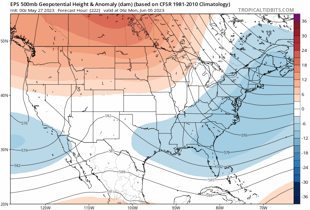
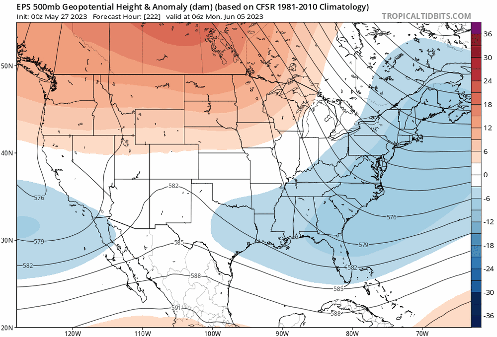
Still dropping into the 40s by morning and that could continue for a bit Nice trough on ensembles showing up for June too
-
Eastern trough on ensembles to start June. So any sustained heat/heat waves will have to wait.
-
There's no major heat indicators atm. Maybe near to slightly AN overall but definitely some cooler days mixed in too.
-
GFS & GEFS trending uglier.
-
May obs/discussion thread - Welcome to Severe Season!!
SnoSki14 replied to weatherwiz's topic in New England
Trending in the wrong direction though -
May obs/discussion thread - Welcome to Severe Season!!
SnoSki14 replied to weatherwiz's topic in New England
If that low cuts off then it won't be great. Doesn't mean rain & cold everyday but definitely not summer like -
May obs/discussion thread - Welcome to Severe Season!!
SnoSki14 replied to weatherwiz's topic in New England
Not on Euro -
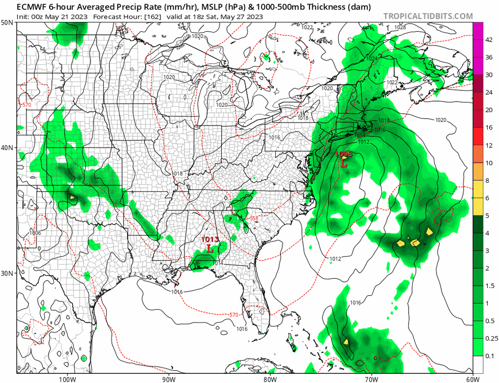
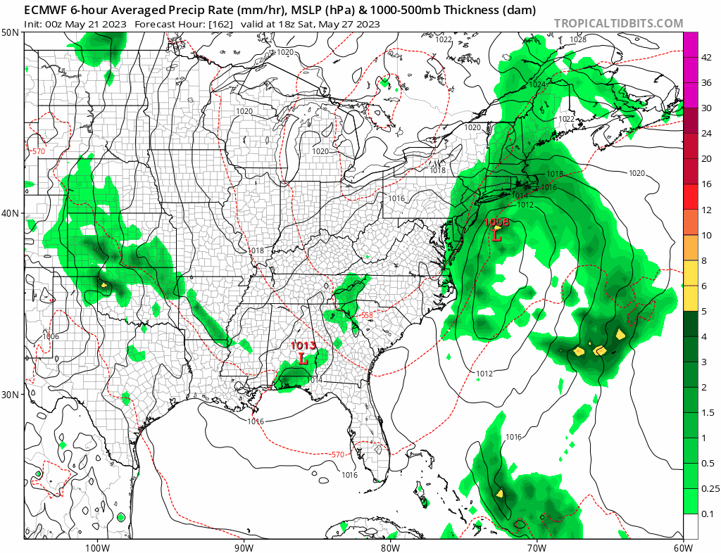
Another ugly holiday weekend?