-
Posts
9,272 -
Joined
Content Type
Profiles
Blogs
Forums
American Weather
Media Demo
Store
Gallery
Everything posted by Hurricane Agnes
-

E PA/NJ/DE Winter 2023-2024 OBS/Discussion
Hurricane Agnes replied to The Iceman's topic in Philadelphia Region
-

E PA/NJ/DE Winter 2023-2024 OBS/Discussion
Hurricane Agnes replied to The Iceman's topic in Philadelphia Region
-

E PA/NJ/DE Winter 2023-2024 OBS/Discussion
Hurricane Agnes replied to The Iceman's topic in Philadelphia Region
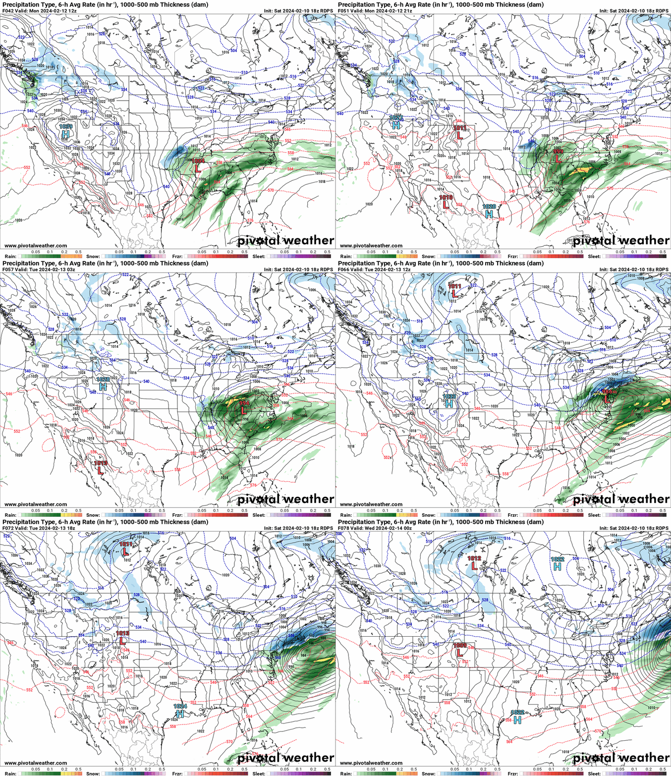
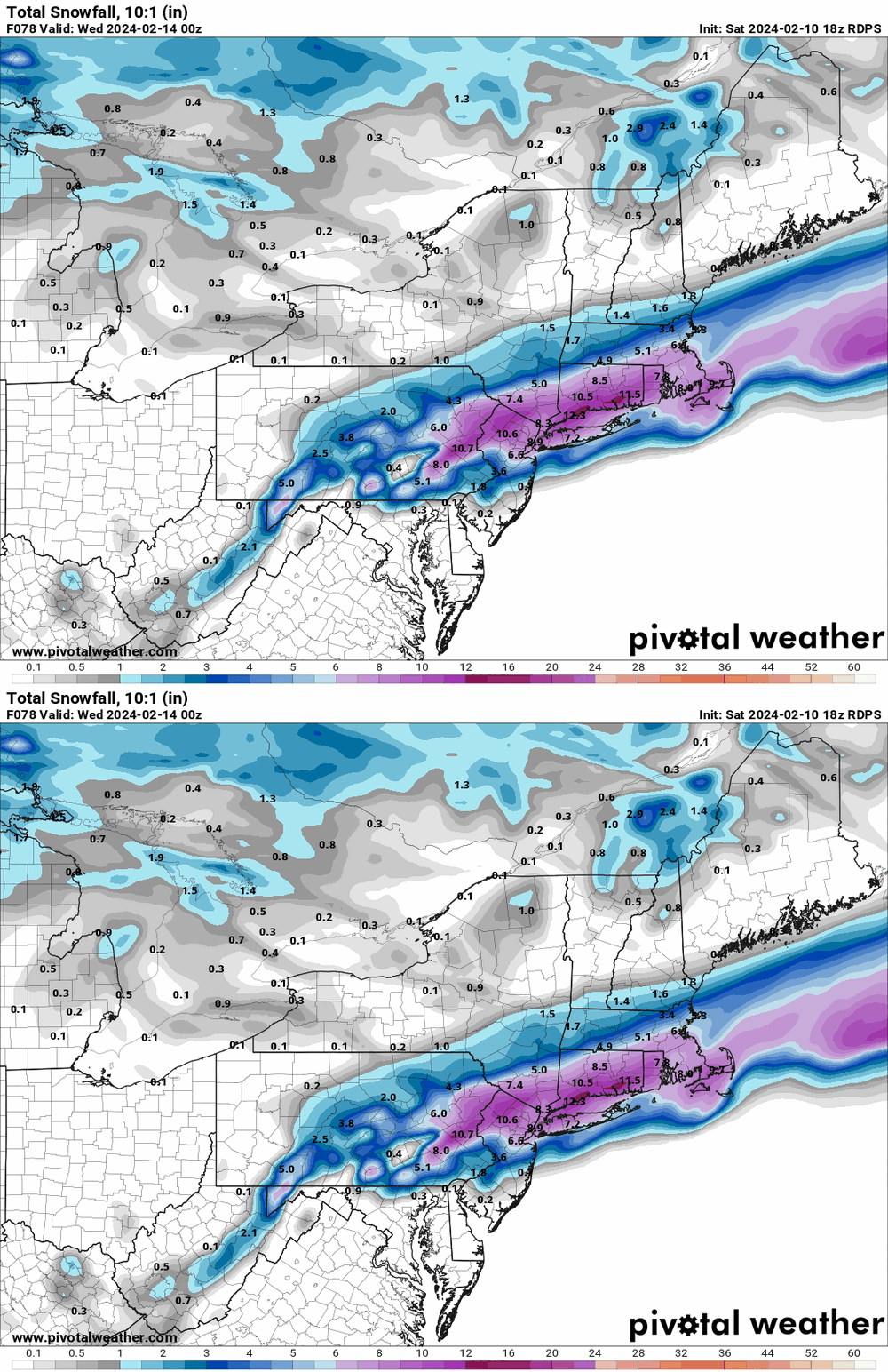
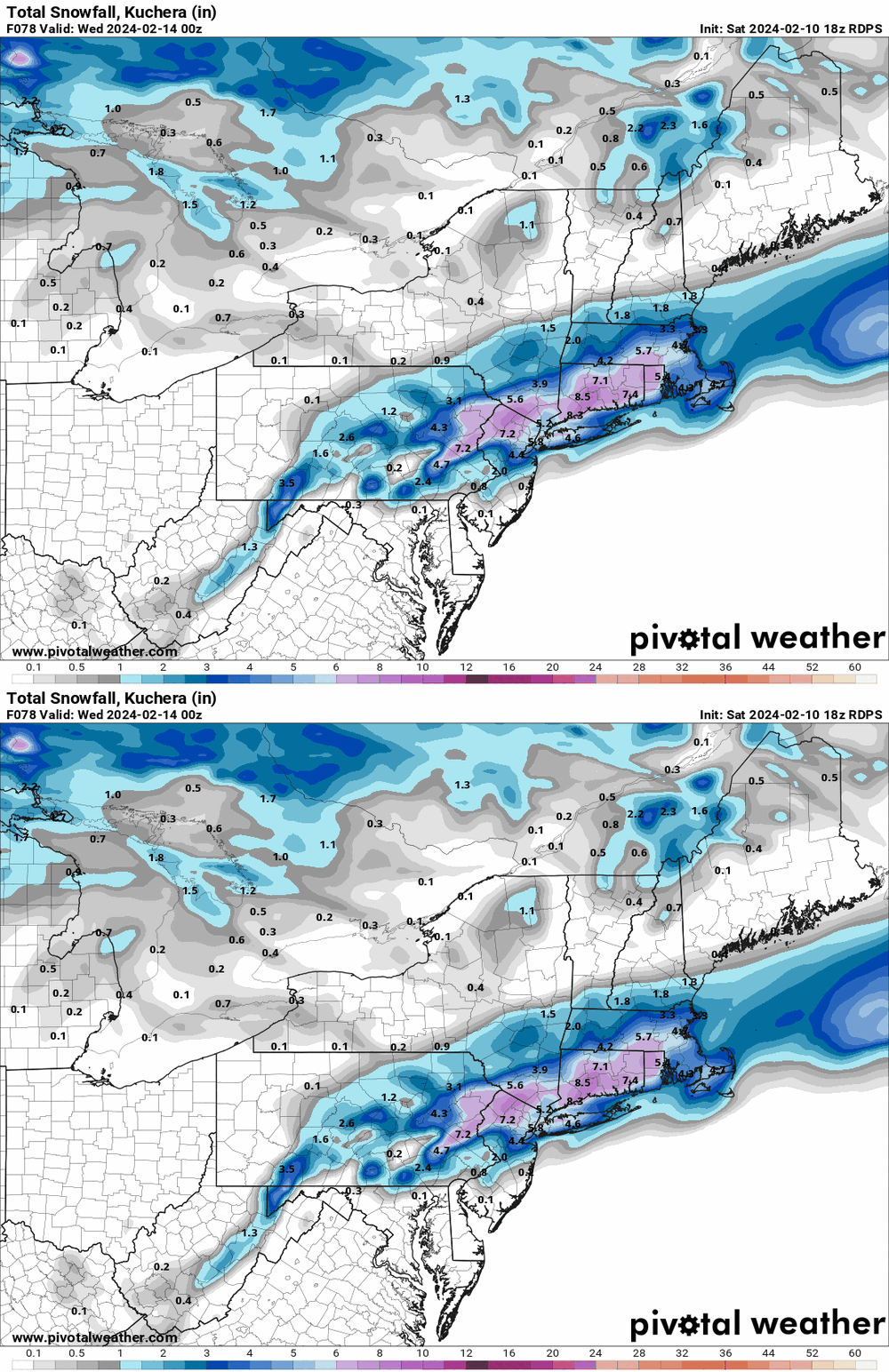
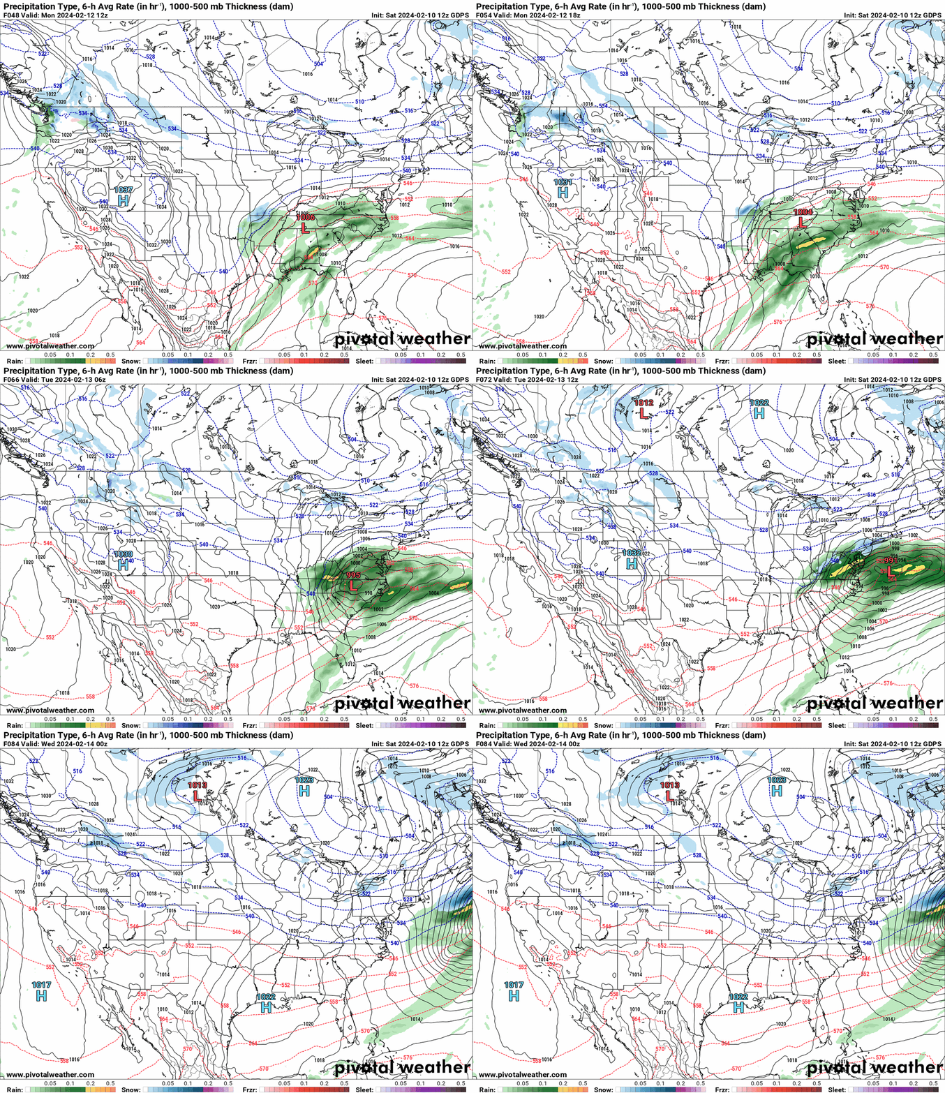
18z Canadian seems to keep the same more-north theme. And as an obs - I bottomed out at 40 this morning and made it up to 55 as a high. Currently 51 with dp 46. -

E PA/NJ/DE Winter 2023-2024 OBS/Discussion
Hurricane Agnes replied to The Iceman's topic in Philadelphia Region
-

Philadelphia Historical Snowfall Data:
Hurricane Agnes replied to ncforecaster89's topic in Philadelphia Region
Thanks for posting! I was here for 7 of the 10 (missed #6 by a couple weeks because I was 2 weeks late being born according to my mom ). I still laugh with one of my sisters about the '66 blizzard when we had our snowsuits and Yogi Bear snow boots, with shovels ready to dig out the area in front of the garage at our first house. The summer of '66 was a hot one as a note (at least for back then - hit 104 at one point which I think still stands as the 2nd highest ever recorded in Philly to date). My mom was pregnant with my little sister at the time. -

E PA/NJ/DE Winter 2023-2024 OBS/Discussion
Hurricane Agnes replied to The Iceman's topic in Philadelphia Region
-

E PA/NJ/DE Winter 2023-2024 OBS/Discussion
Hurricane Agnes replied to The Iceman's topic in Philadelphia Region
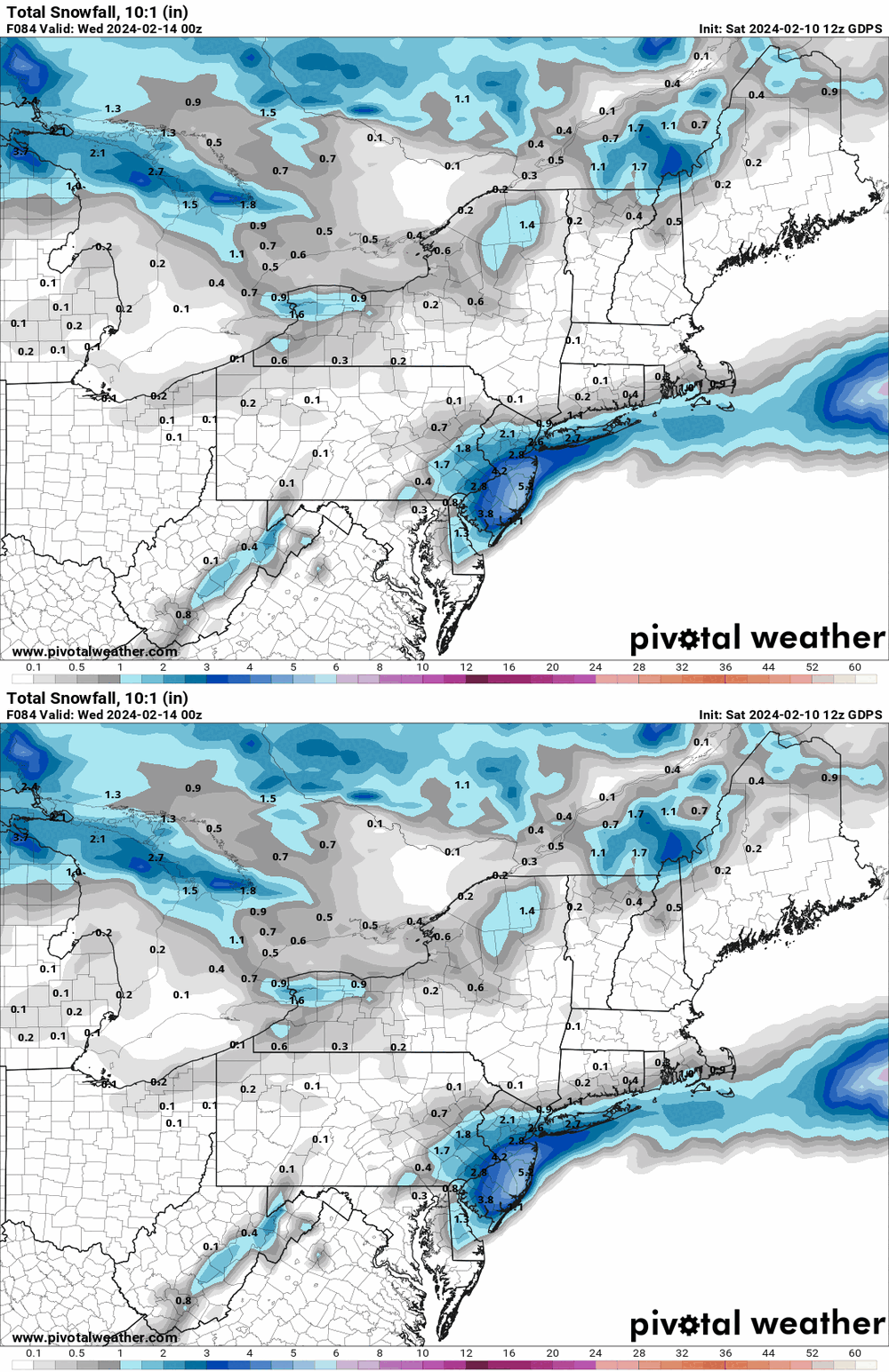
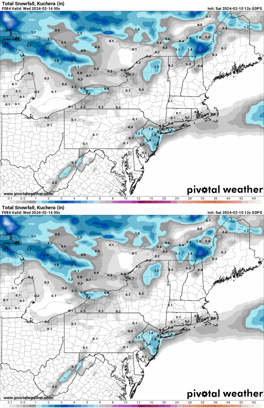
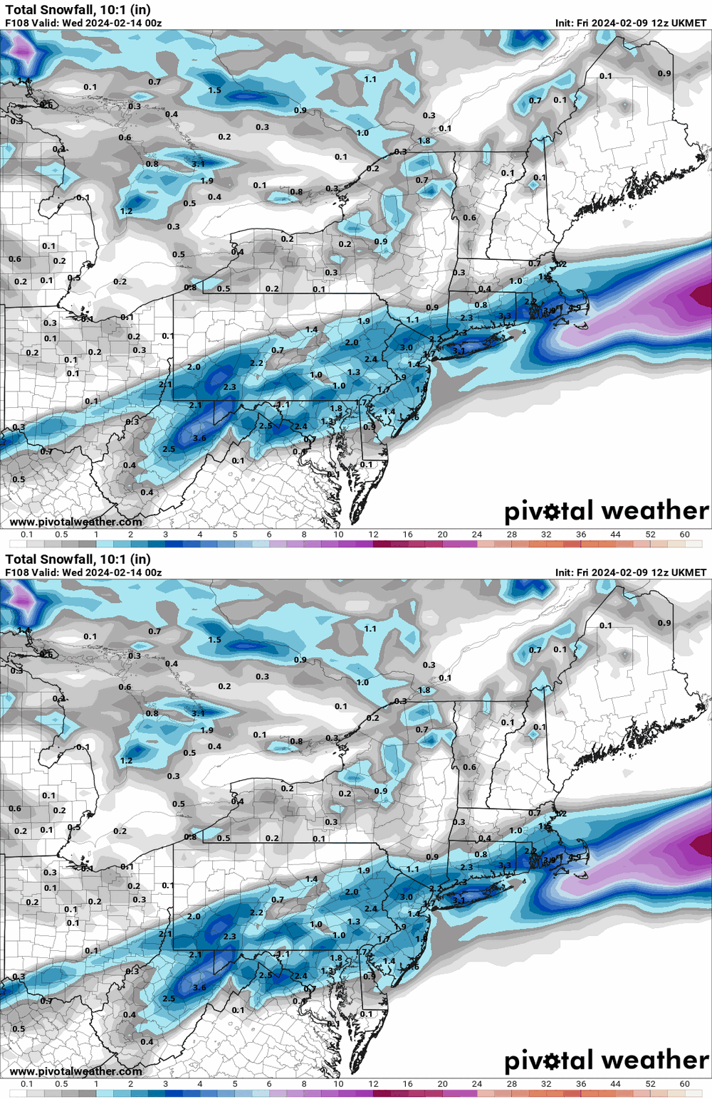
I'm waiting for the 12z of that (for today) to run. But here's the 12z CMC (only a tad bit better than the ICON ). -

E PA/NJ/DE Winter 2023-2024 OBS/Discussion
Hurricane Agnes replied to The Iceman's topic in Philadelphia Region
-

E PA/NJ/DE Winter 2023-2024 OBS/Discussion
Hurricane Agnes replied to The Iceman's topic in Philadelphia Region
-

E PA/NJ/DE Winter 2023-2024 OBS/Discussion
Hurricane Agnes replied to The Iceman's topic in Philadelphia Region
-

E PA/NJ/DE Winter 2023-2024 OBS/Discussion
Hurricane Agnes replied to The Iceman's topic in Philadelphia Region
-

E PA/NJ/DE Winter 2023-2024 OBS/Discussion
Hurricane Agnes replied to The Iceman's topic in Philadelphia Region
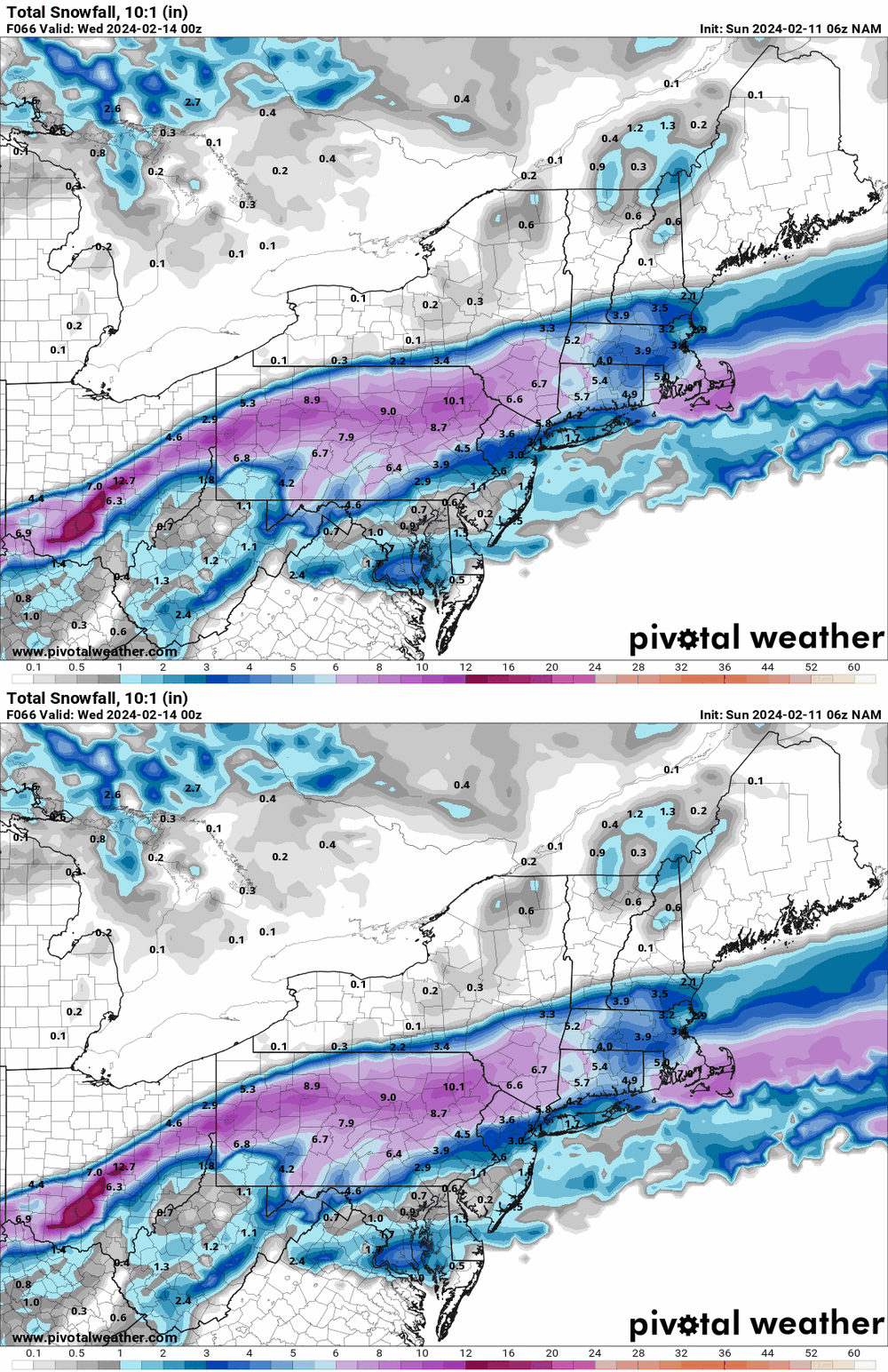
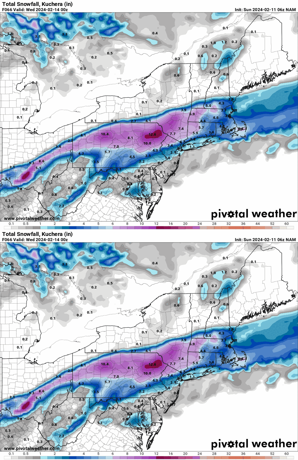
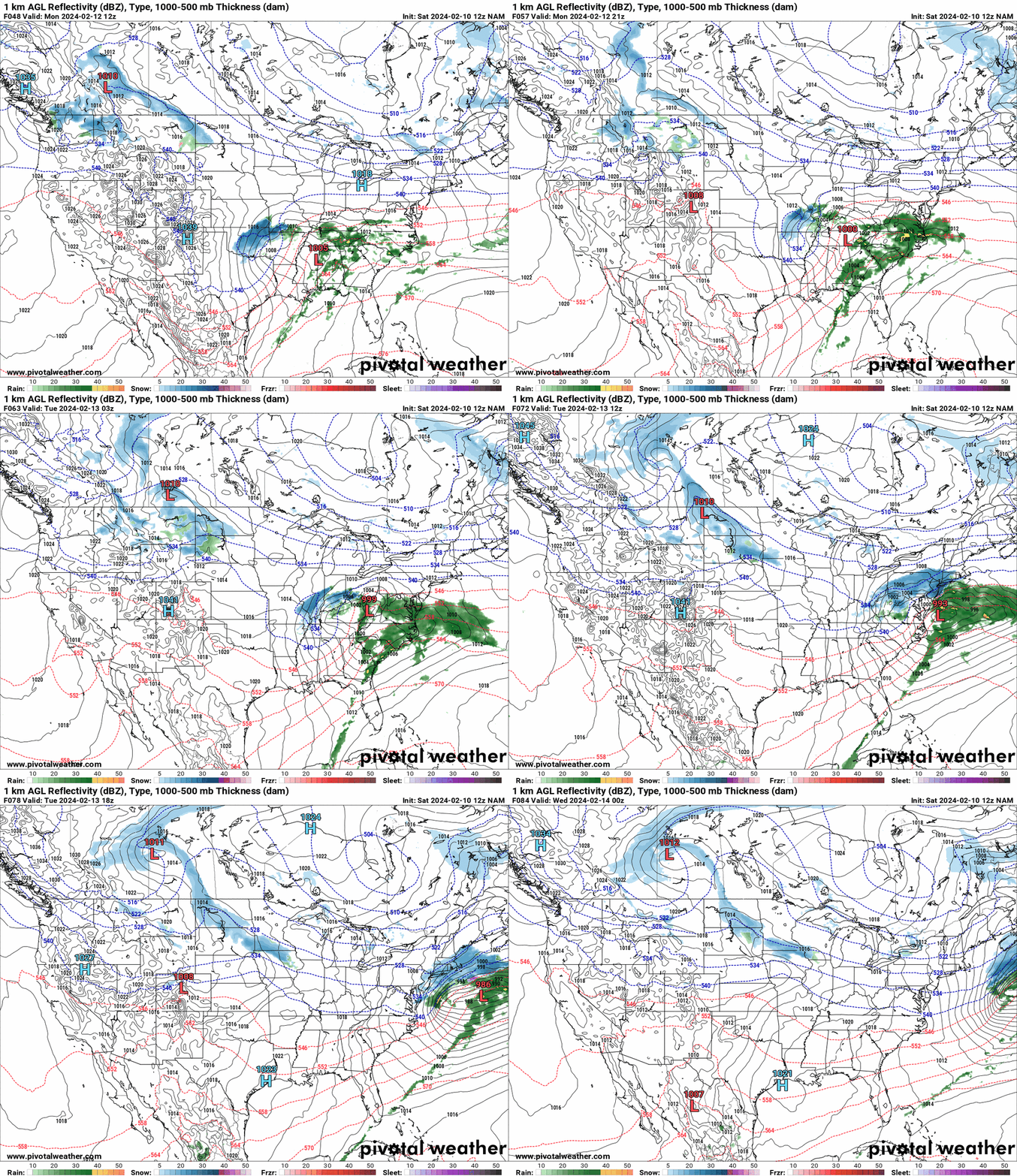
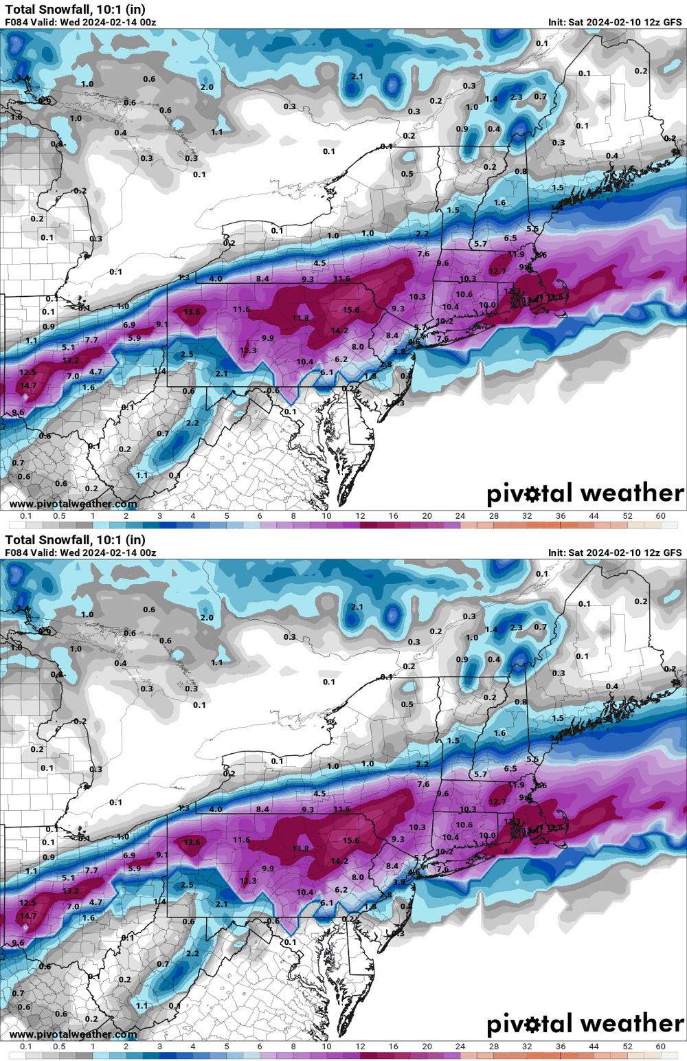
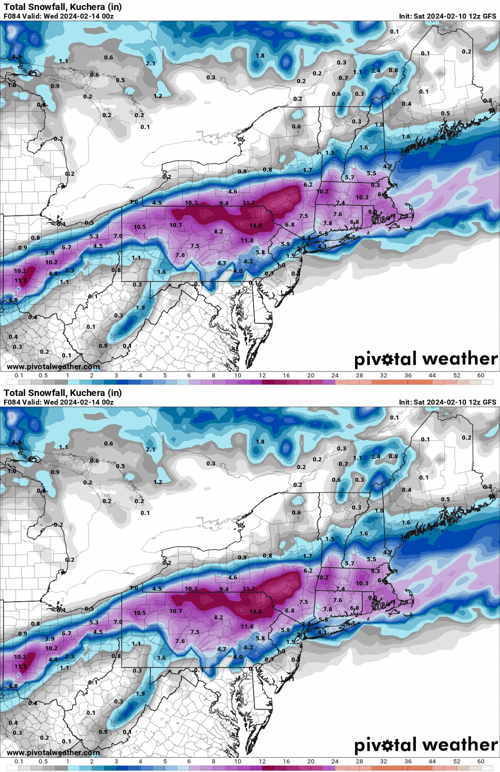
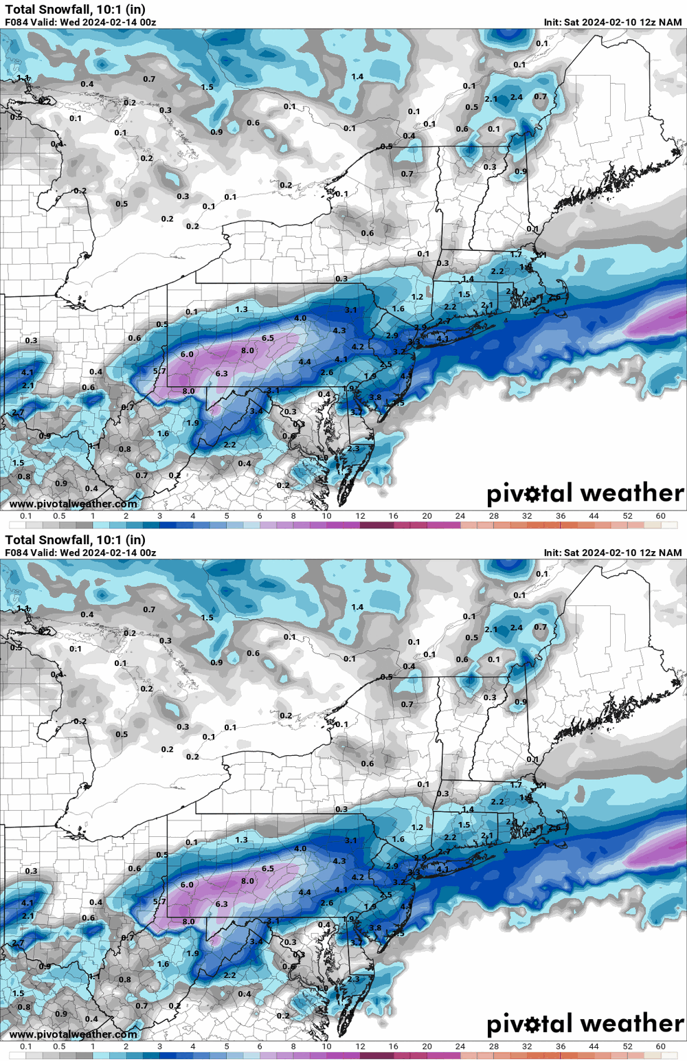
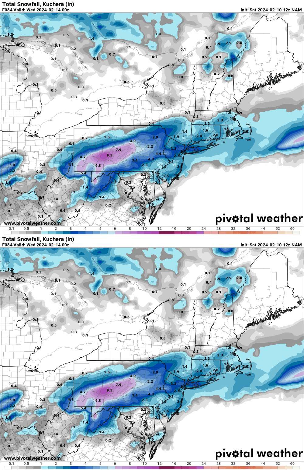
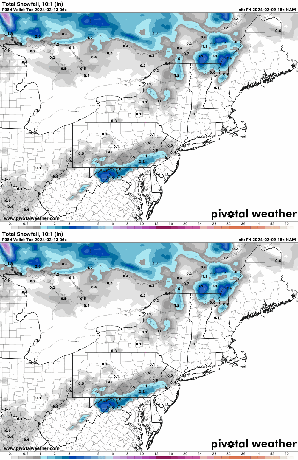
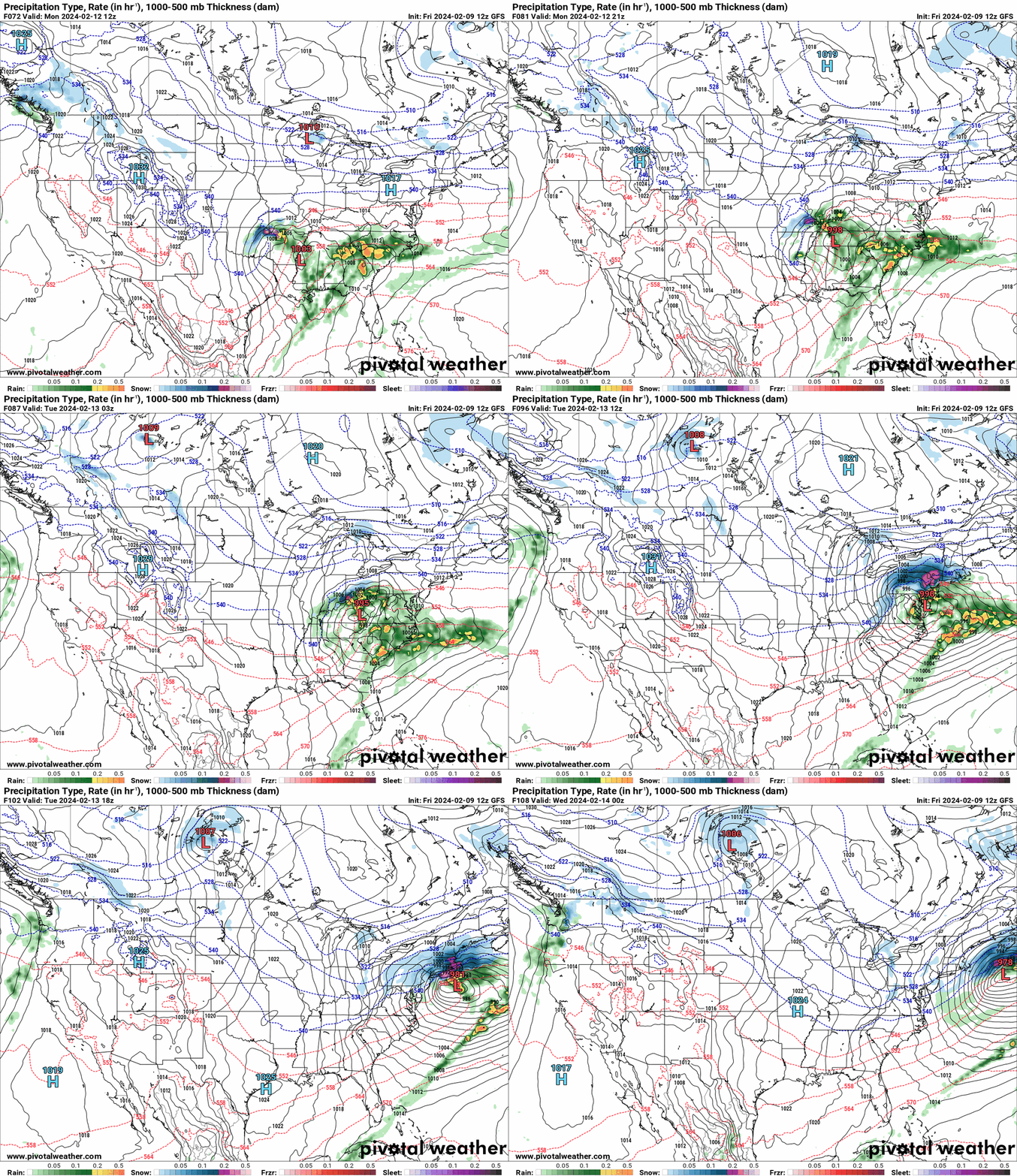
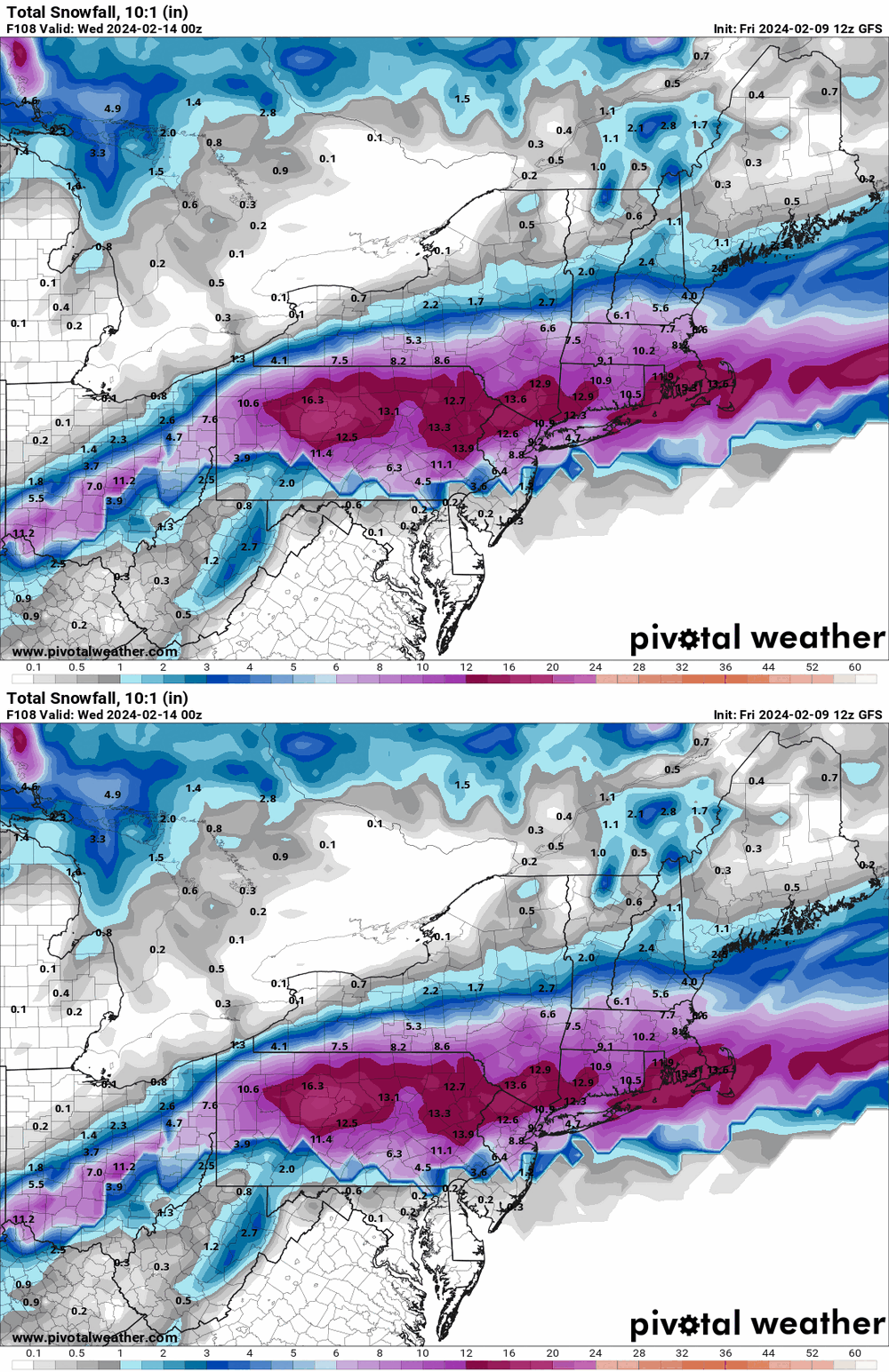
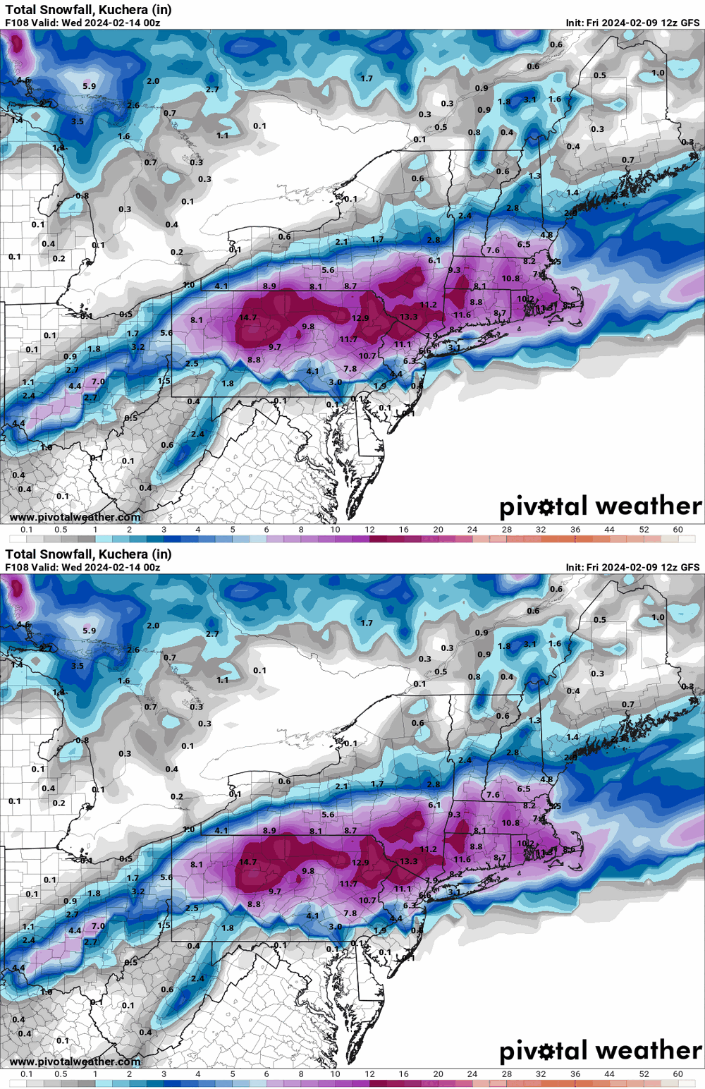
12z GFS was slower than the 12z NAM and further north, where the NAM had that southern look with a bulk of precip way west. -

E PA/NJ/DE Winter 2023-2024 OBS/Discussion
Hurricane Agnes replied to The Iceman's topic in Philadelphia Region
-

E PA/NJ/DE Winter 2023-2024 OBS/Discussion
Hurricane Agnes replied to The Iceman's topic in Philadelphia Region
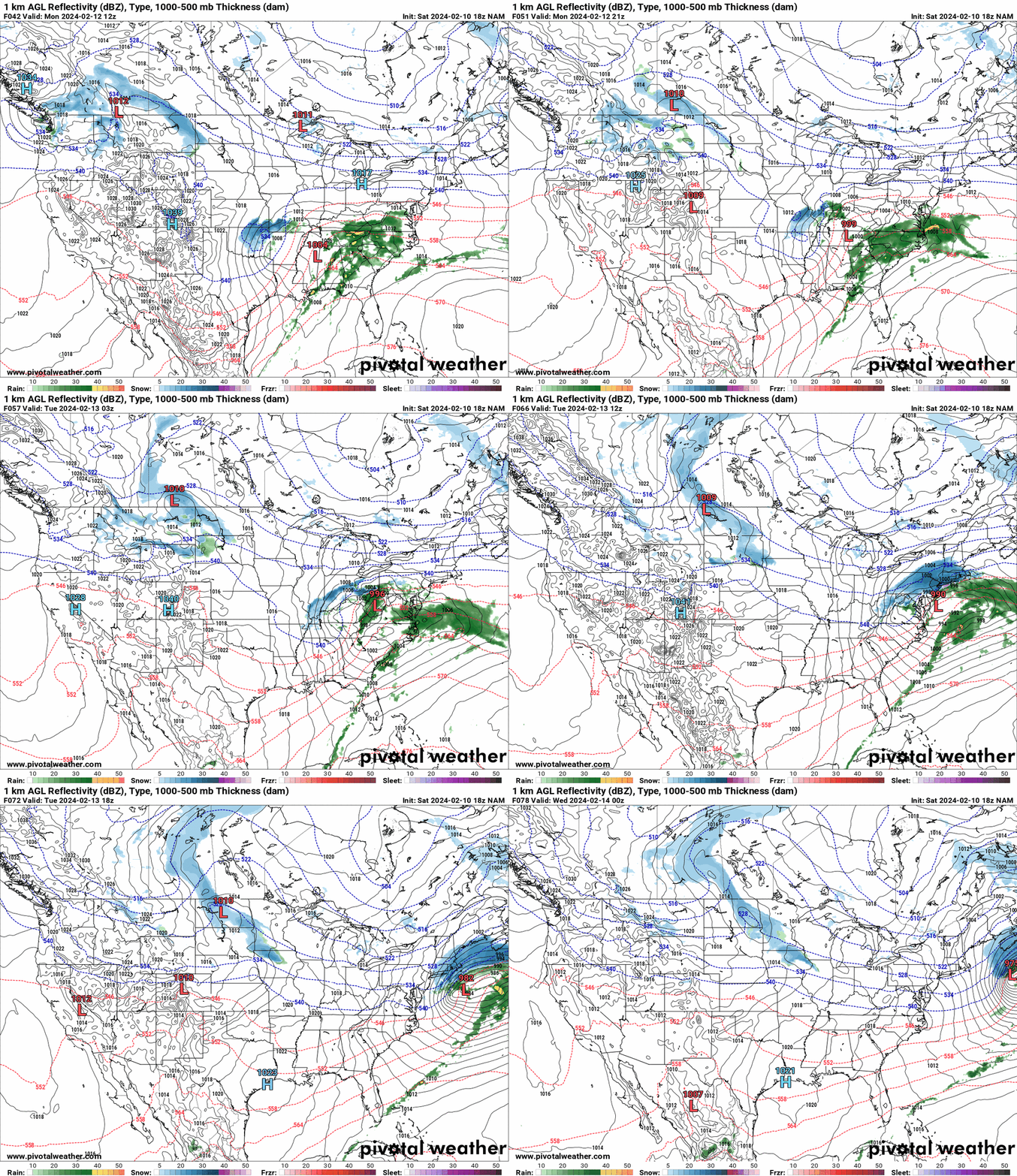
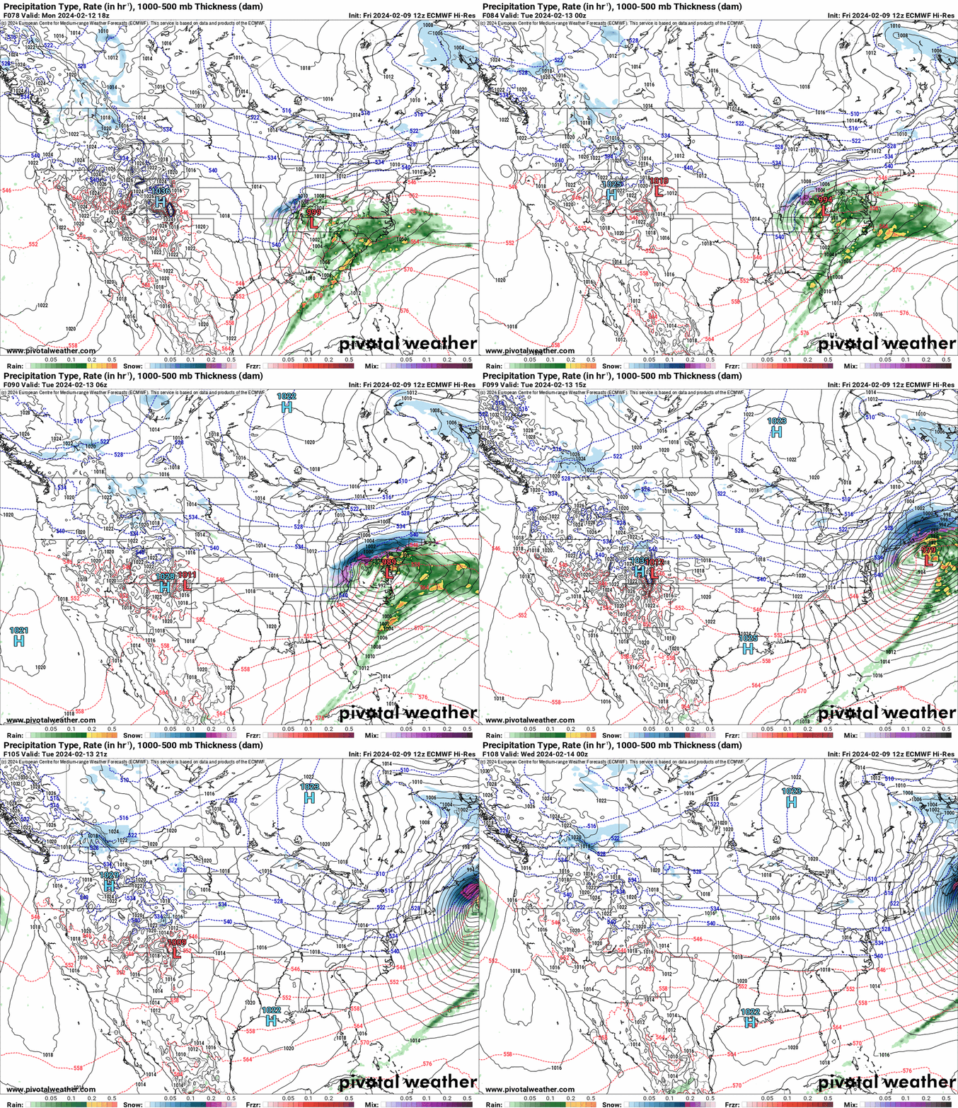
12k NAM is slowly coming into range and the last frame of the run does hint at the same "north and west" trend. -

E PA/NJ/DE Winter 2023-2024 OBS/Discussion
Hurricane Agnes replied to The Iceman's topic in Philadelphia Region
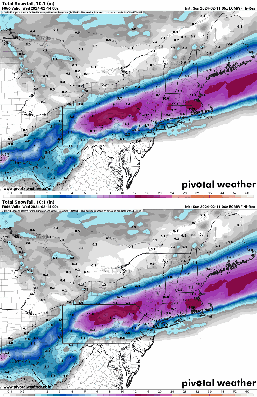
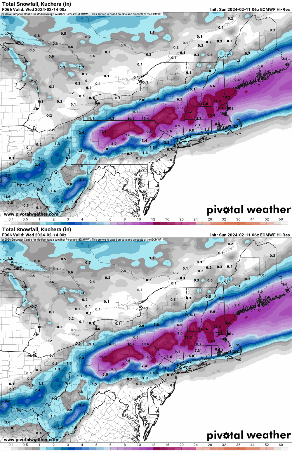
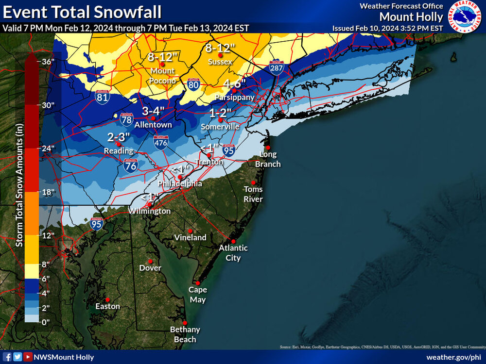
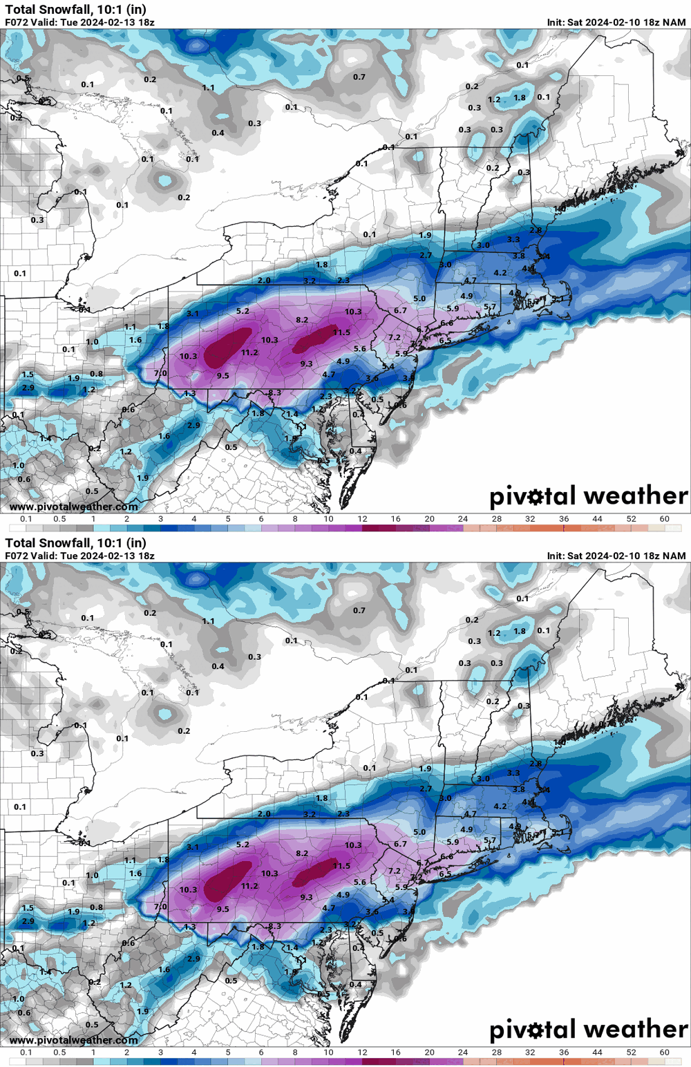
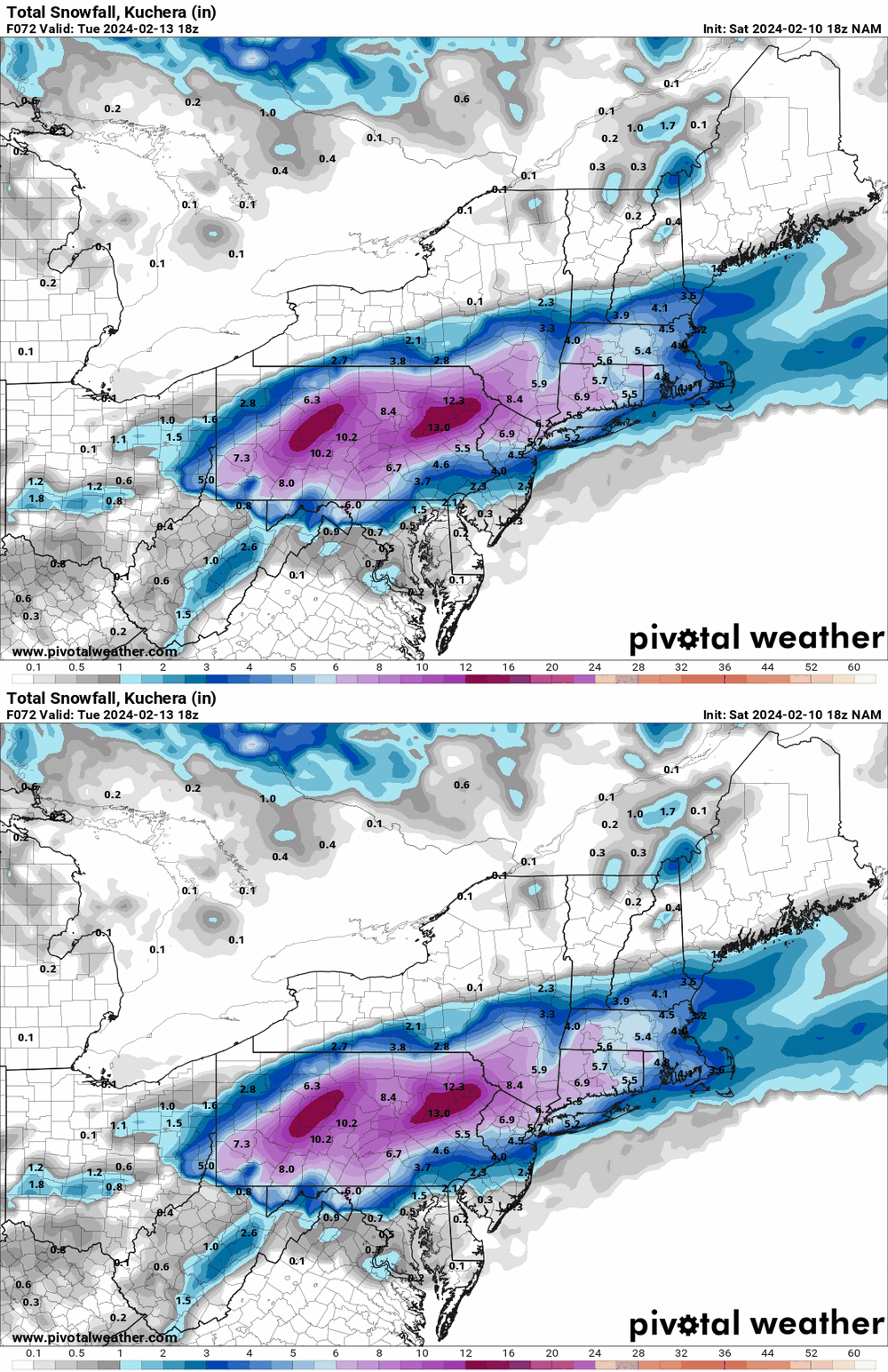
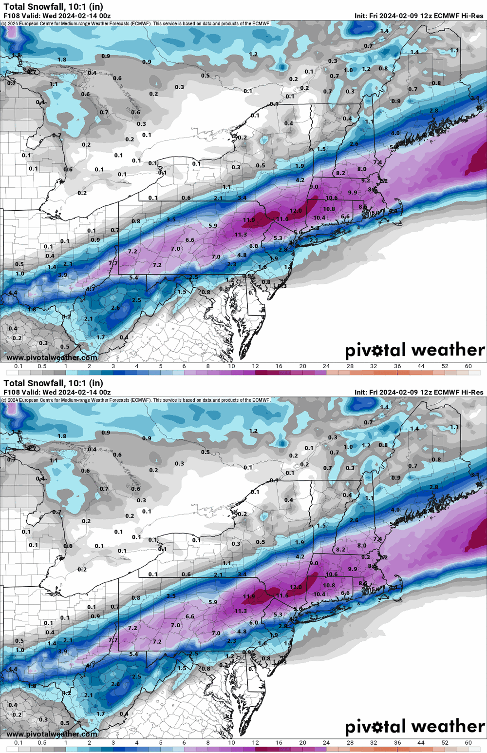
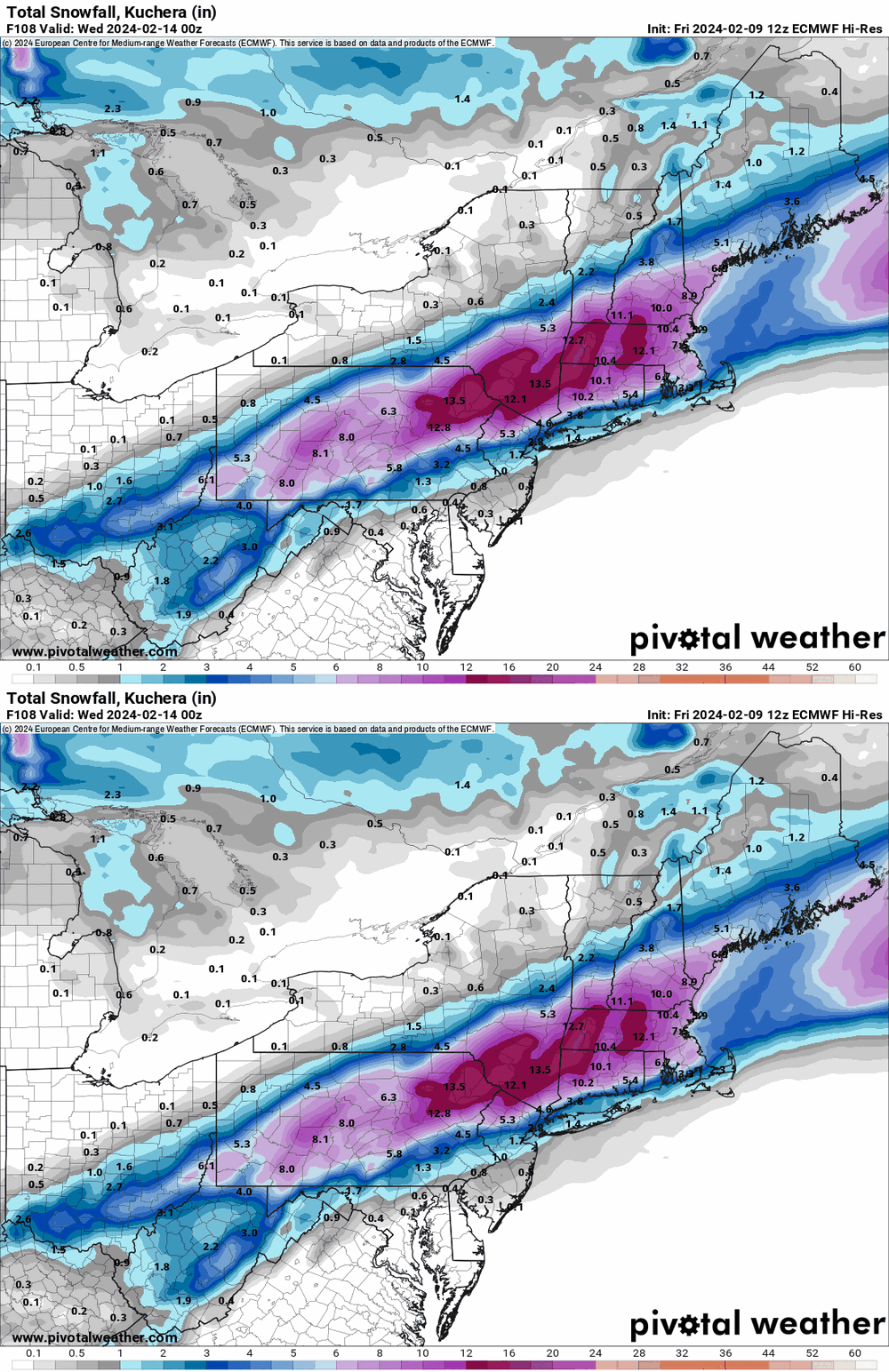
I think it's a foregone conclusion that it is an I-78 / I-80 special. The track and any deathbands that might set up (including with the pivot) will determine how much. -

E PA/NJ/DE Winter 2023-2024 OBS/Discussion
Hurricane Agnes replied to The Iceman's topic in Philadelphia Region
-

E PA/NJ/DE Winter 2023-2024 OBS/Discussion
Hurricane Agnes replied to The Iceman's topic in Philadelphia Region
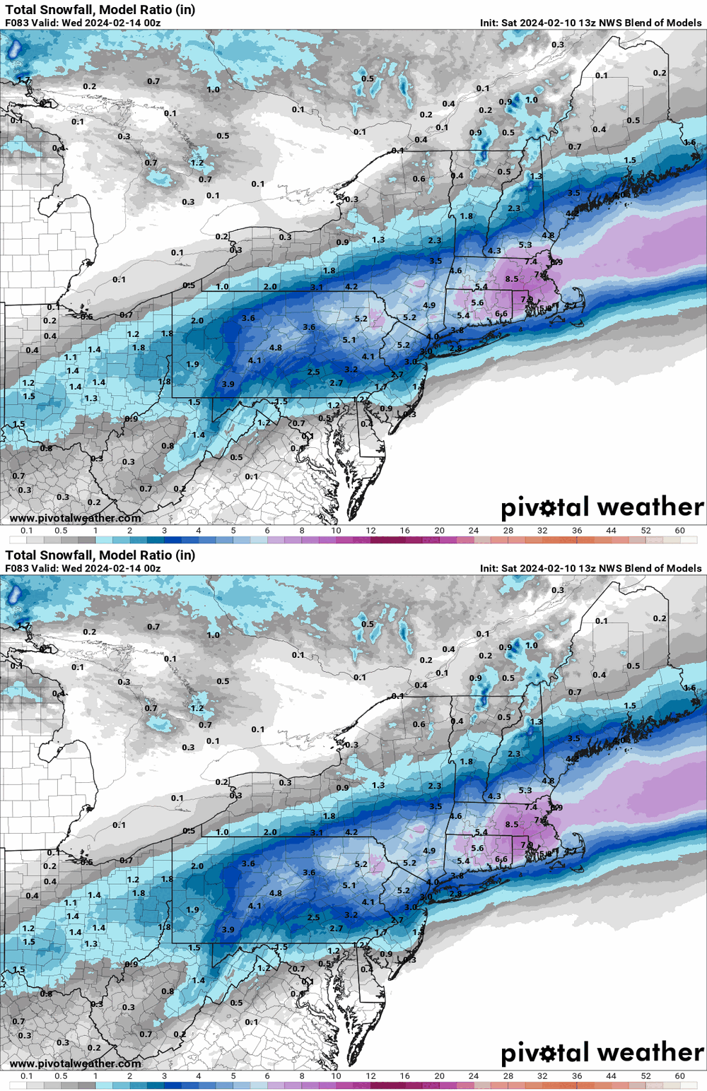
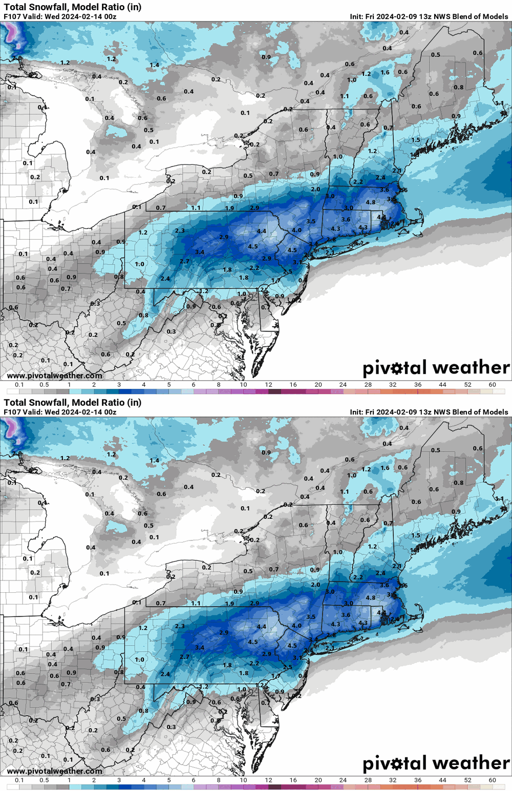
GFS basically looks like what the NBM had. It seems similar to our earlier first "threat" storm 1/15 - 1/16 with the antecedent warm temps and the attempt at a hop, skip, and jump (although missing a 2nd coastal nearby). -

E PA/NJ/DE Winter 2023-2024 OBS/Discussion
Hurricane Agnes replied to The Iceman's topic in Philadelphia Region
13z NBM looks more realistic with that uncertainty about what might or might not happen with that "jump" (and how close to the coast or even inland the low goes). -

E PA/NJ/DE Winter 2023-2024 OBS/Discussion
Hurricane Agnes replied to The Iceman's topic in Philadelphia Region
-

E PA/NJ/DE Winter 2023-2024 OBS/Discussion
Hurricane Agnes replied to The Iceman's topic in Philadelphia Region
-

E PA/NJ/DE Winter 2023-2024 OBS/Discussion
Hurricane Agnes replied to The Iceman's topic in Philadelphia Region
I know I have skunks around here and will go out to the patio and get greeted by their hellish "perfume"! It definitely appears to have ticked north and looks like it wanted to be an apps runner and then does the Miller-B jump. -
I had mentioned it here - It happened sometime in November around Thanksgiving.
-

E PA/NJ/DE Winter 2023-2024 OBS/Discussion
Hurricane Agnes replied to The Iceman's topic in Philadelphia Region
My Wyndmoor sister had texted yesterday about the foxes on her street whining and screaming all night. Am guessing it must be mating season or something. The 12z GFS is running so will see what happens. I bottomed out at 39 this morning and had noticed it had clouded over overnight. It's currently partly cloudy and 48 with dp way up there at 41. -

E PA/NJ/DE Winter 2023-2024 OBS/Discussion
Hurricane Agnes replied to The Iceman's topic in Philadelphia Region
It looks like it has the cold air coming in after the storm is off the coast though (unless it thinks some cold air will come with a little clipper-like low that precedes the coastal). -

E PA/NJ/DE Winter 2023-2024 OBS/Discussion
Hurricane Agnes replied to The Iceman's topic in Philadelphia Region
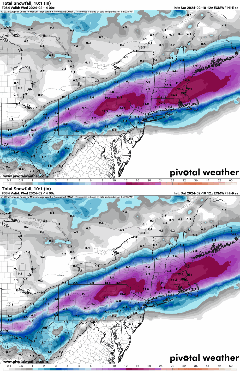
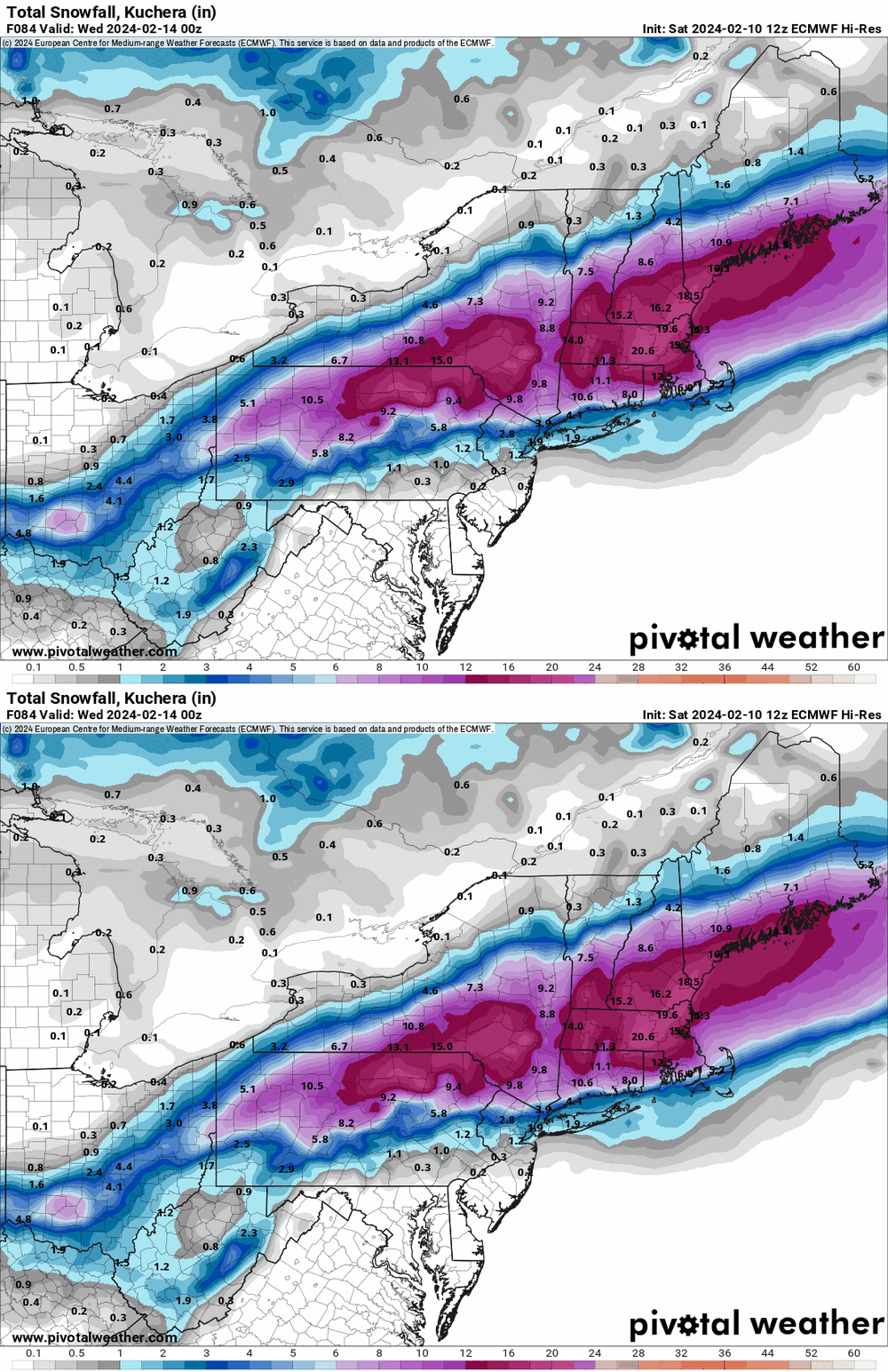
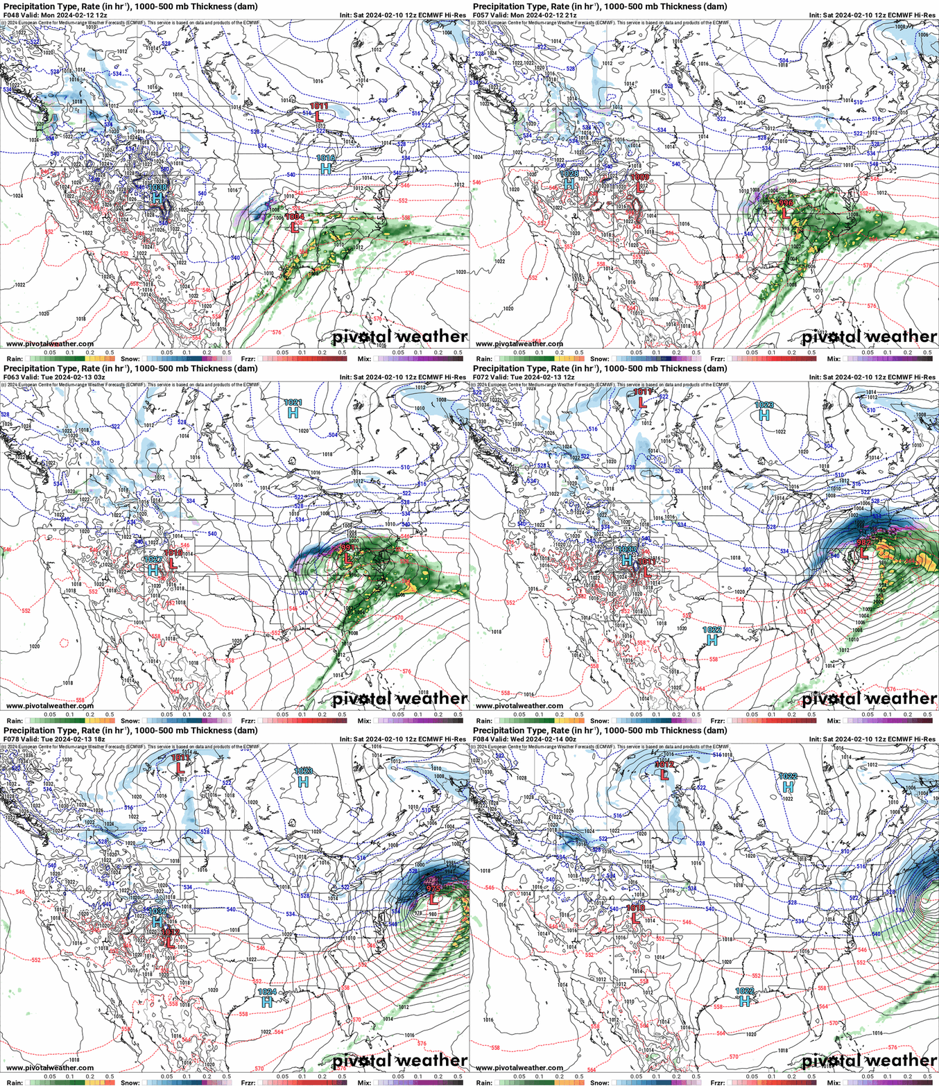
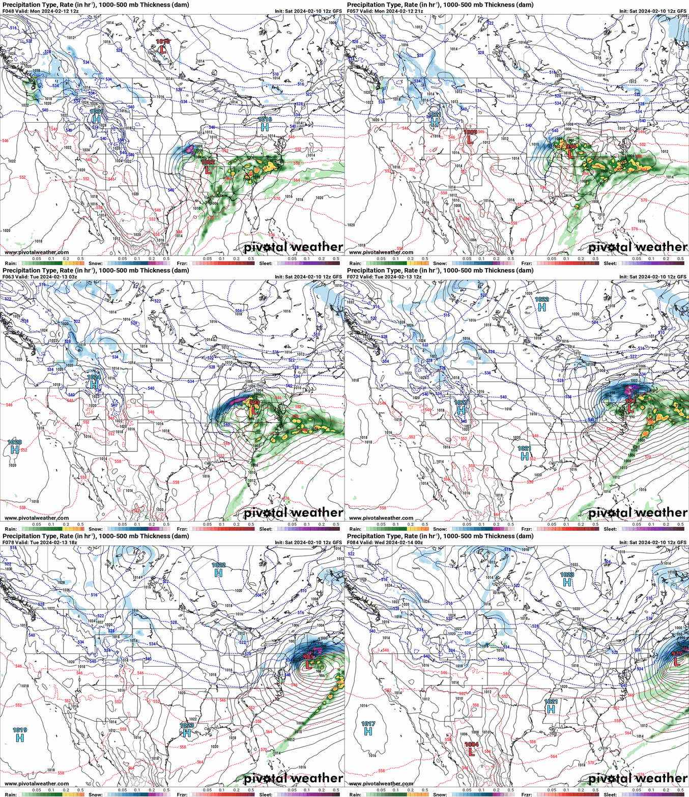
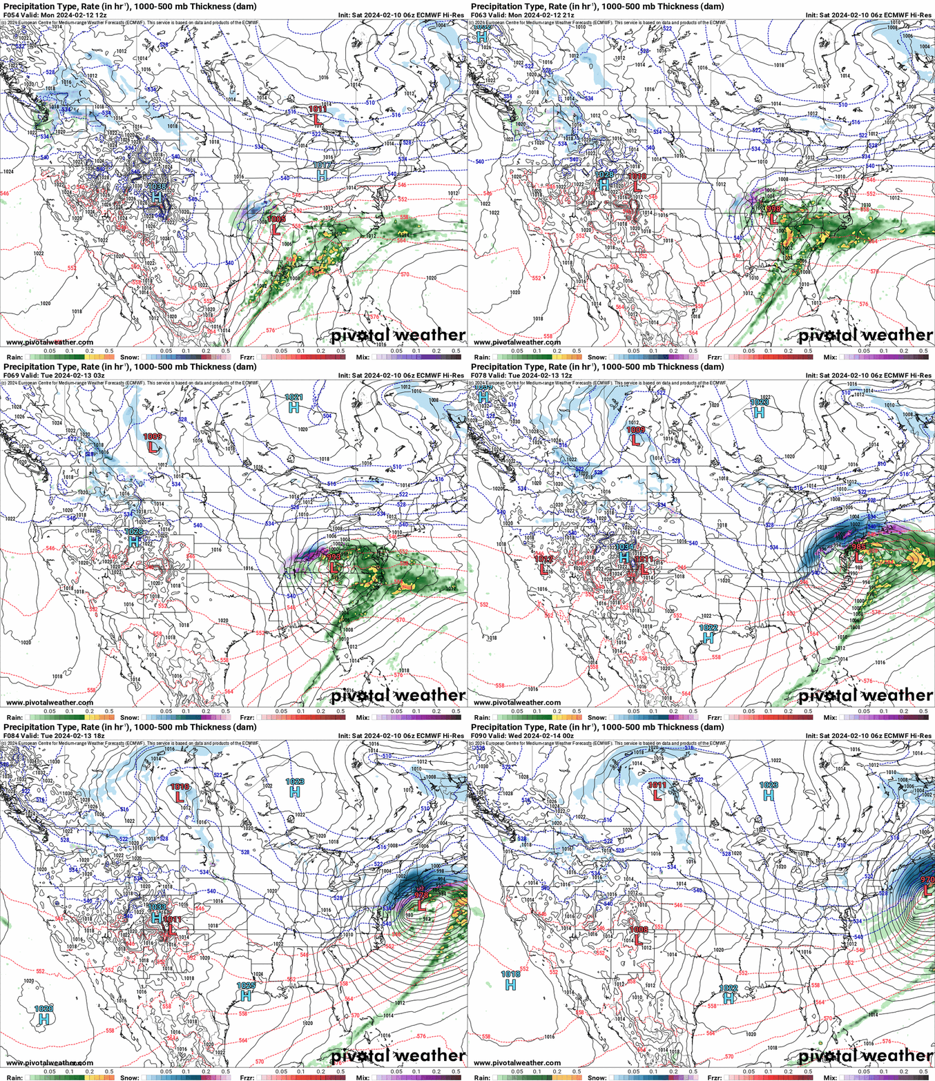
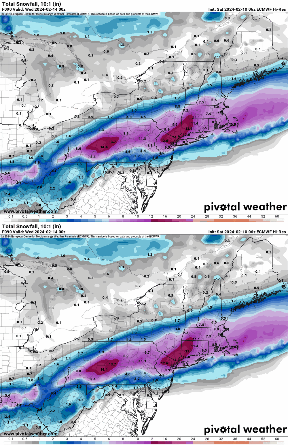
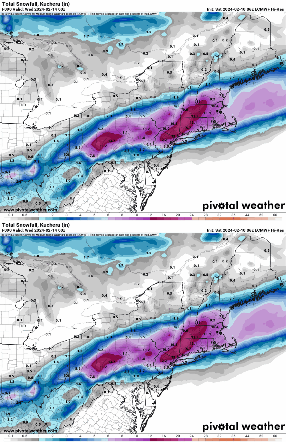
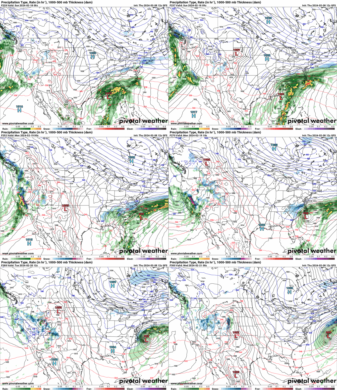
I just took a peak at the 12z Euro and 12z GFS for the 2/13 storm and they are like polar opposites (Euro north and GFS a DC metro bonanza). But thing is - the snow from them seem to happen for VD and stays around for the following week or so, and you can't really tell what any additional contribution would have been after VD with a 2nd storm around 2/18 - 2/21. And at least for the GFS range, the storm from the 18th - 21st is a slider, going south of Philly metro.


