Hurricane Agnes
-
Posts
9,336 -
Joined
Content Type
Profiles
Blogs
Forums
American Weather
Media Demo
Store
Gallery
Everything posted by Hurricane Agnes
-
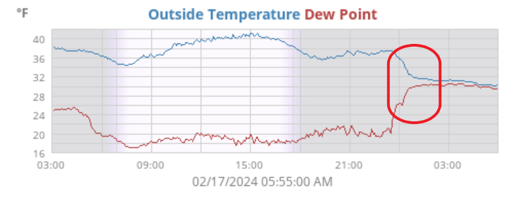
Interesting temp eval here where it was mostly mid-30s until the storm came in between 1 - 2 am and crashed the temp to right around or just below freezing and raised the dp. I expected wet slop on the streets but although I expect they brined/salted, the areas on either side of my car have little or nothing.
-
The low is still inland and south and it's like we are in a dry slot before a potential additional batch if that holds together. Not sure how strong it would be though.
-
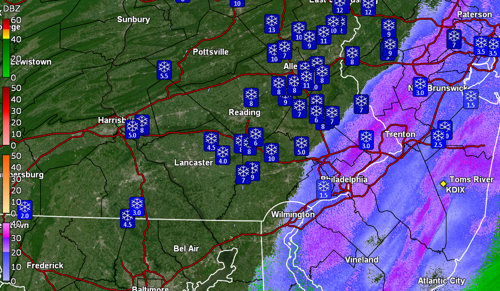
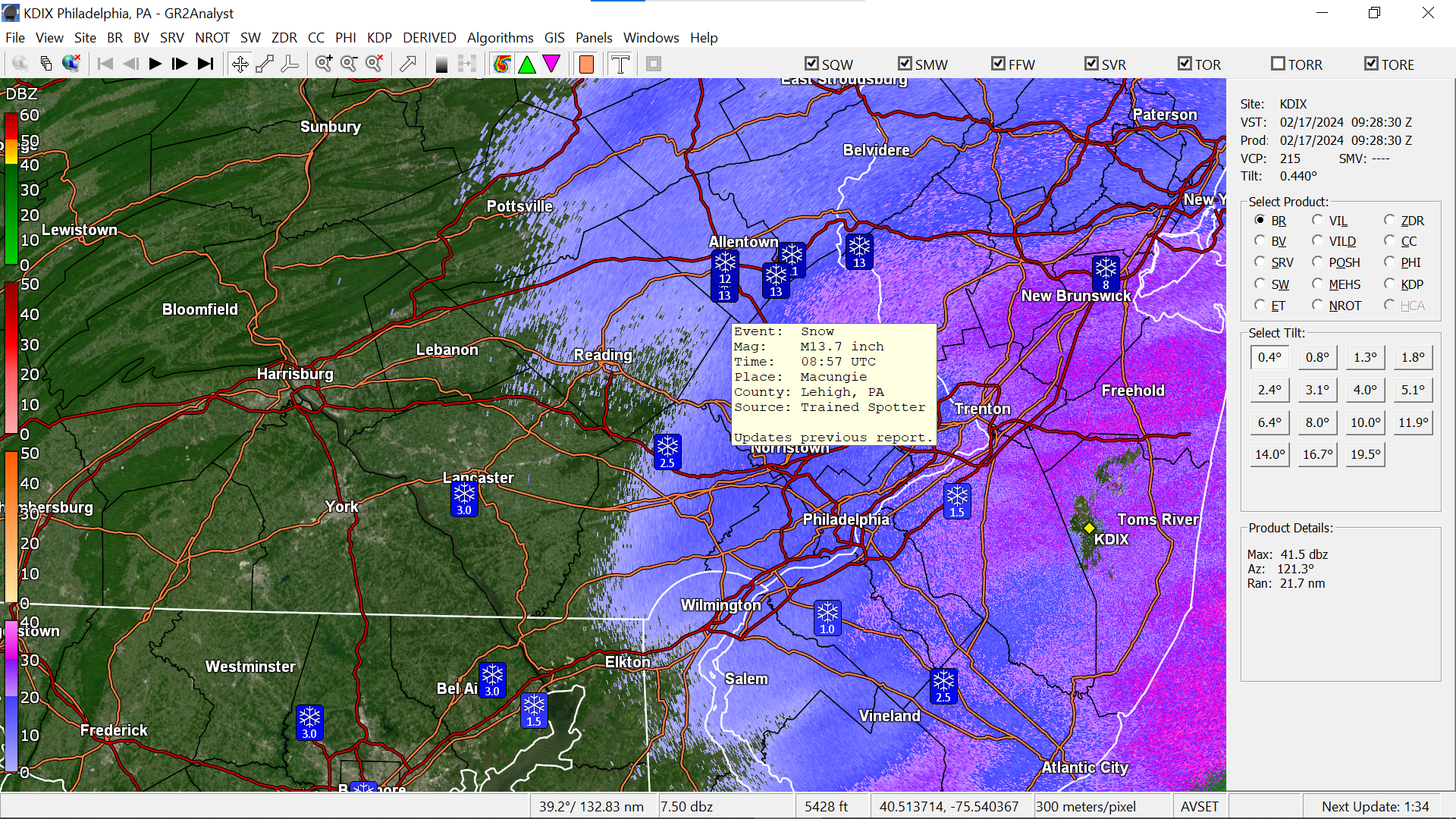
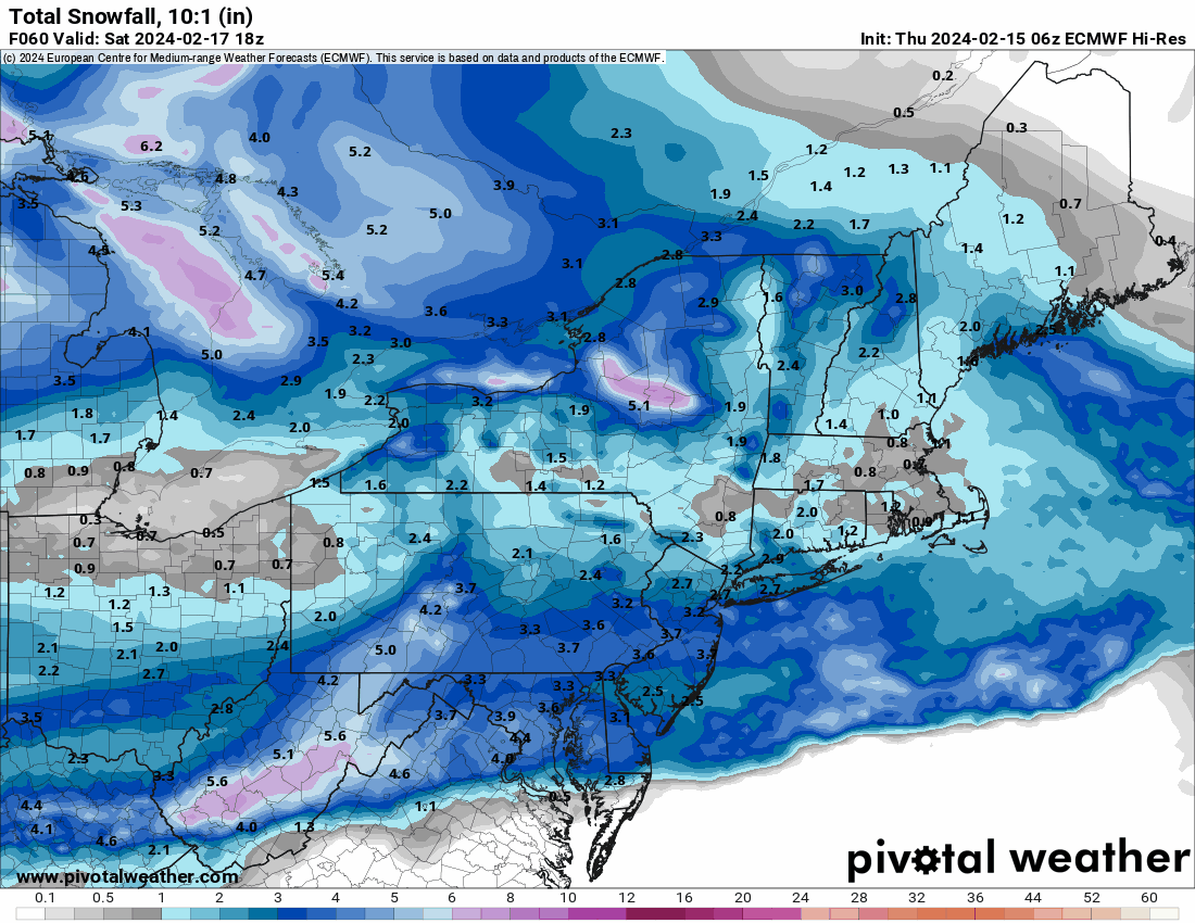
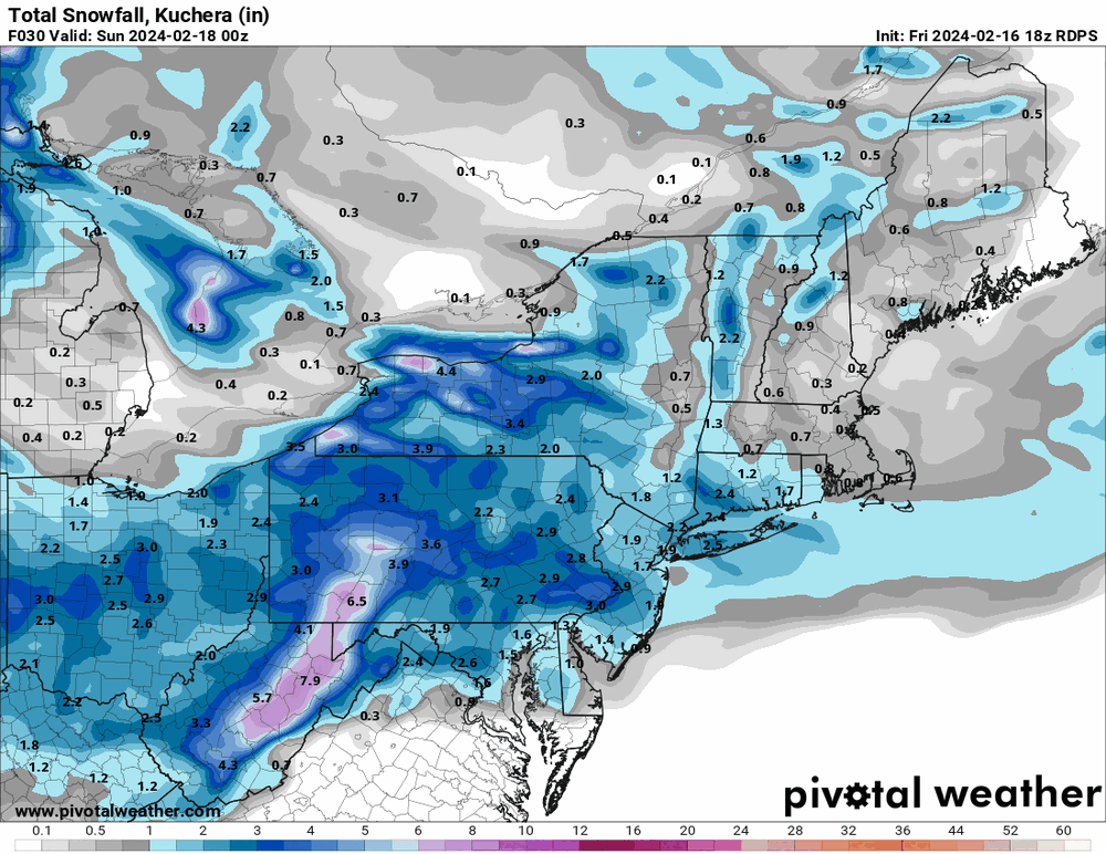
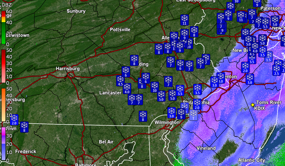
Down to flurries and measured 3.5" of wet snow that is sloughing off the cars and trees/shrubs. This came in "wetter" than I expected as there was all the talk about the high ratio snow ... Seems this was a forecasting faux pas with respect to the areas north that got walloped. Had grabbed a screen shot from about an hour ago that showed a 14" (13.7") total up in Macungie (and there are other 13" reports around the same area). It's currently 30 IMBY with dp 30.

-
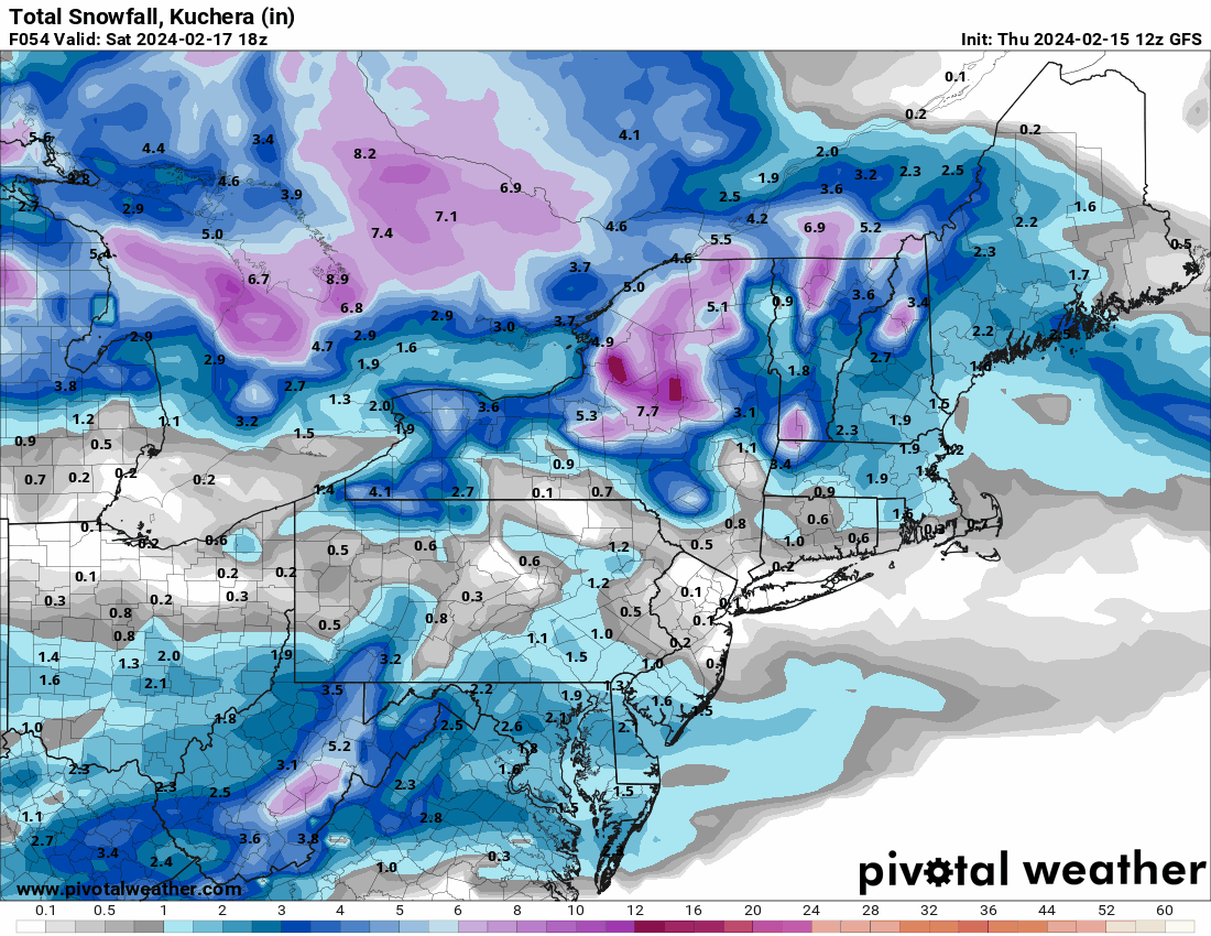
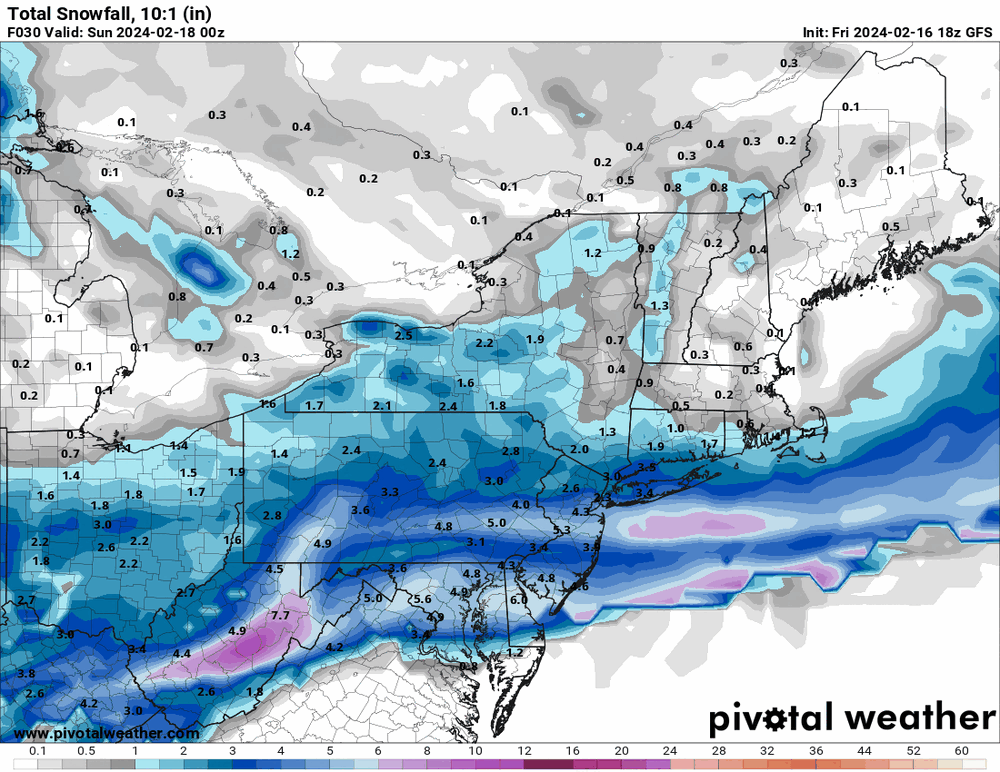
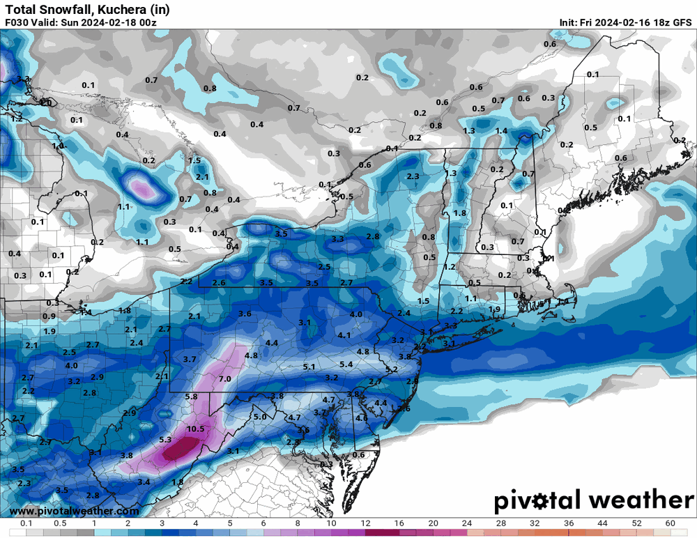
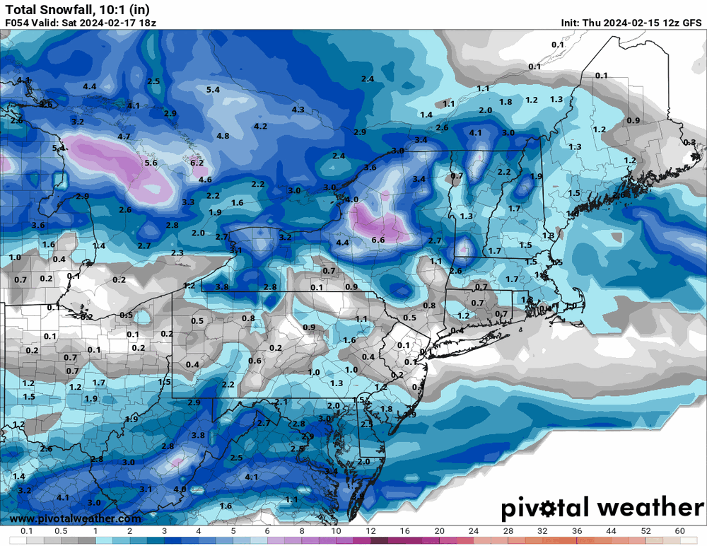
Although obviously not a good short range model, it ran so.... here's the 18z GFS -
-
Throwing in the 18z Canadian.

-
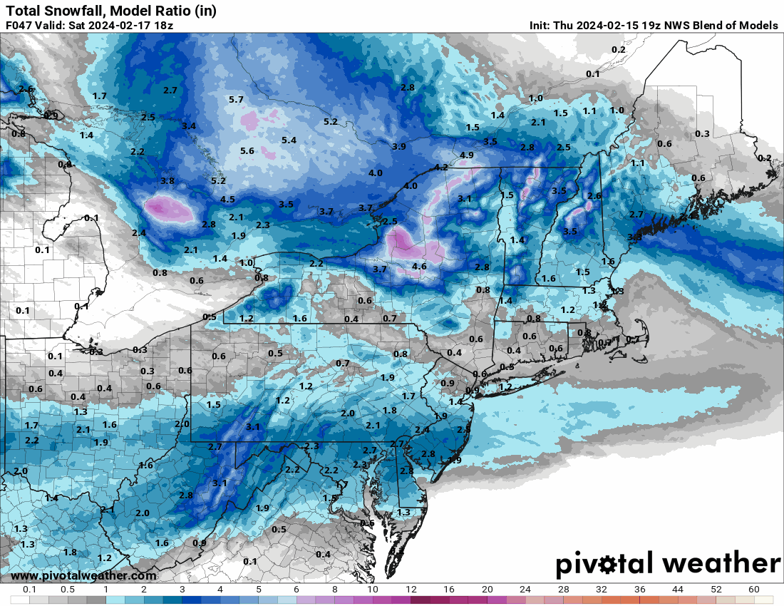
Throwing the 13z NBM in

-
E PA/NJ/DE Winter 2023-2024 OBS/Discussion
Hurricane Agnes replied to The Iceman's topic in Philadelphia Region
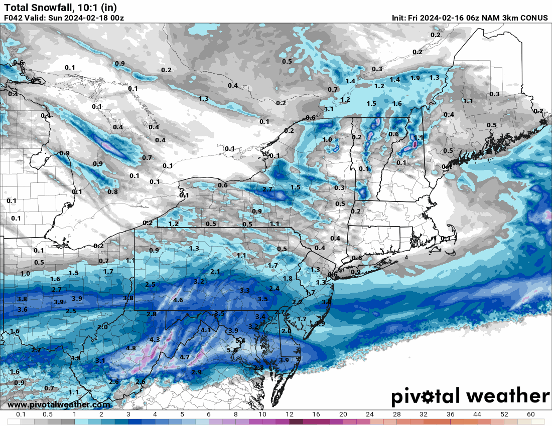
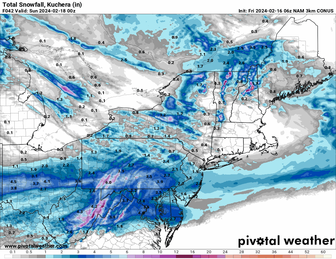
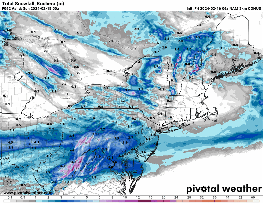
6z 3k NAM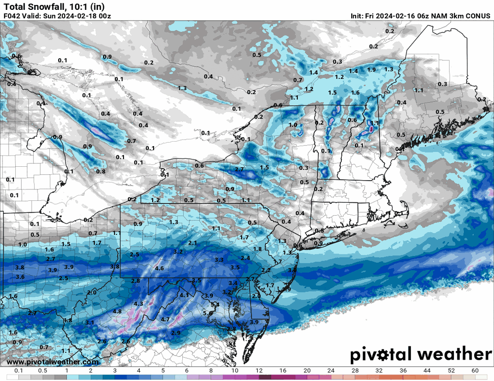
-
E PA/NJ/DE Winter 2023-2024 OBS/Discussion
Hurricane Agnes replied to The Iceman's topic in Philadelphia Region
It nailed the city but was a little low for the northern fringes of the CWA. It's not really a model per se but blends the MOS data from the main models and then gets some other ancillary data thrown in. I've noticed that whenever we get NAM'd, it just cancels that mess out until the NAM settles down. -
E PA/NJ/DE Winter 2023-2024 OBS/Discussion
Hurricane Agnes replied to The Iceman's topic in Philadelphia Region
19z NBM
-
E PA/NJ/DE Winter 2023-2024 OBS/Discussion
Hurricane Agnes replied to The Iceman's topic in Philadelphia Region
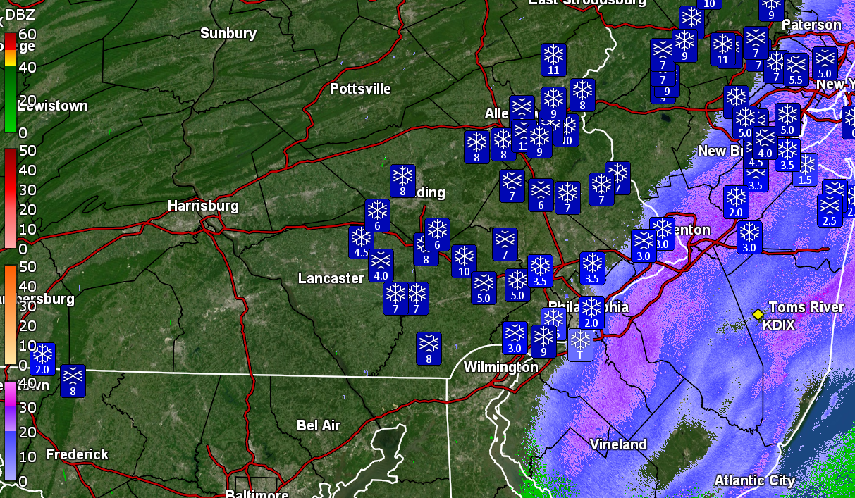
Mt. Holly 1 pm snow map -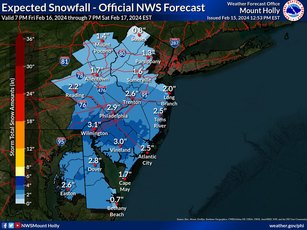
-
12z GFS definitely shows that "south" thing...
-
E PA/NJ/DE Winter 2023-2024 OBS/Discussion
Hurricane Agnes replied to The Iceman's topic in Philadelphia Region
Bottomed out at 24 this morning but am only at 34 at near 11 am so am wondering if it will really warm up much. Dp has been hanging in the dry teens but finally hit 20. The cirrus has moved in although the sun is still breaking through it. -
E PA/NJ/DE Winter 2023-2024 OBS/Discussion
Hurricane Agnes replied to The Iceman's topic in Philadelphia Region
6z Canadian is similar to the NAM although it shows more across the northern areas.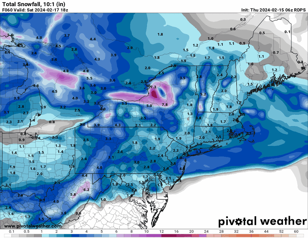
-
E PA/NJ/DE Winter 2023-2024 OBS/Discussion
Hurricane Agnes replied to The Iceman's topic in Philadelphia Region
LOL Looks like the 6z Euro NAM'd us.

-
E PA/NJ/DE Winter 2023-2024 OBS/Discussion
Hurricane Agnes replied to The Iceman's topic in Philadelphia Region
6z EC is running but here is the 6z 3k NAM that is now in range.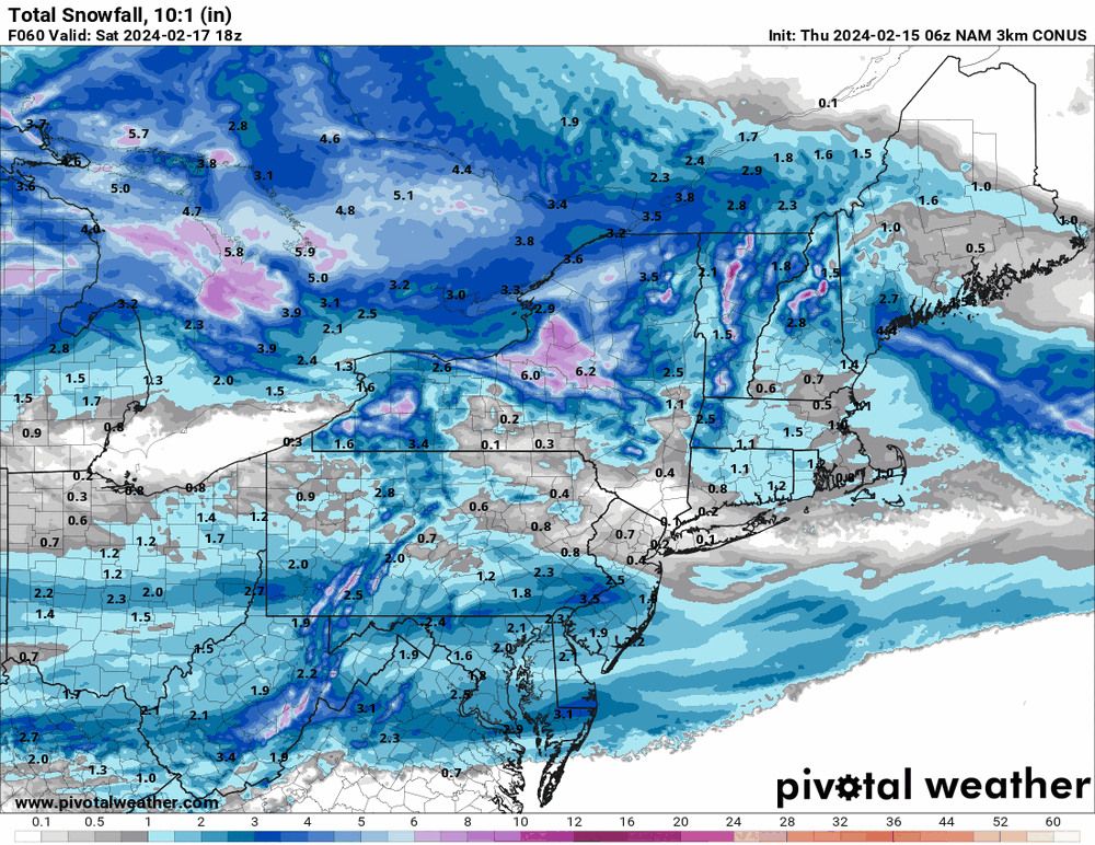
-
E PA/NJ/DE Winter 2023-2024 OBS/Discussion
Hurricane Agnes replied to The Iceman's topic in Philadelphia Region
Throwing the 19z NBM in for Friday night/Saturday morning. As an obs - I actually managed to stay above freezing all night and then finally dropped to 31 for a "low" at 9 am this morning. Was actually surprised at the temps as I expected to get higher today but nope. High ended up at 36 with a chilly breeze to boot. Lots of snow melt on roofs and streets/walks but parking lot mounds that were still around from the last storm, got a complete refresh. When I was out today I noticed there was a "haze" of very high clouds that the sun was blazing through. In any case, am currently 35 with an arctic-like dp of 13.
-
They used to do measurements from National Park, NJ but I have noticed in the PNS's that they are using an ASOS. The full PNS - Well my "high" for the day was 40 at midnight, but after the storm was done and the sun came out, I did get close, hitting around 38 briefly. It's currently 36 with dp 29.
-
E PA/NJ/DE Winter 2023-2024 OBS/Discussion
Hurricane Agnes replied to The Iceman's topic in Philadelphia Region
Sun is out and melting is underway. Temp now up to 35 with dp 35. -
And the sun has started to pop out. Temp now up to 35 with dp 35 and dripping.
-
That thing hopped an express train and is booking it outta here.
-
The back edge is now past me and I'm down to flurries. Final measurement at 11:45 am was 3.5" (so got 1" over the 3 hours since the earlier measurement). Currently have some stray flurries and it's 33 with dp 33 and all kinds of melting and sloughing going on. Am hoping more can slough off the car the rest of today.
-
E PA/NJ/DE Winter 2023-2024 OBS/Discussion
Hurricane Agnes replied to The Iceman's topic in Philadelphia Region
One of my nieces has an 18th birthday this weekend (Sunday) and she wanted to do a restaurant out in KOP on Saturday. Was hoping to squeak by without precip. although my BIL is gonna drive (I'm not about to get lost out there ). My lowest bottom out this morning was 32.2 at around 7:15 am, the storm has pivoted past me now, and I'm down to flurries. Gonna go out and get the last measurement before it melts/compacts more. Currently have flurries and it's 33 with dp 33. -
I got into them thanks to a book that I ordered with the monthly book order thing they did while I was in middle school! My mom was 9 when that came out and she said her generation was enamored by the fact that half the film was "in color". Hell many of us grew up with TV shows that had the opening of "in color" on the screen to let you know that the show was actually "in color" (if you even had a color TV).
-
Have been under one of the stronger pivot bands with some SN+ and pancake flakes. Back edge is approaching though. Temp 33 with dp 32. That sucker wants to bomb out!