Hurricane Agnes
-
Posts
9,343 -
Joined
Content Type
Profiles
Blogs
Forums
American Weather
Media Demo
Store
Gallery
Everything posted by Hurricane Agnes
-
E PA/NJ/DE Winter 2023-2024 OBS/Discussion
Hurricane Agnes replied to The Iceman's topic in Philadelphia Region
-
E PA/NJ/DE Winter 2023-2024 OBS/Discussion
Hurricane Agnes replied to The Iceman's topic in Philadelphia Region
It (at least the 12k) still brings more further south. But the LV / I-78 and north has always been persistent with all of the models. ETA - RedSky would like this...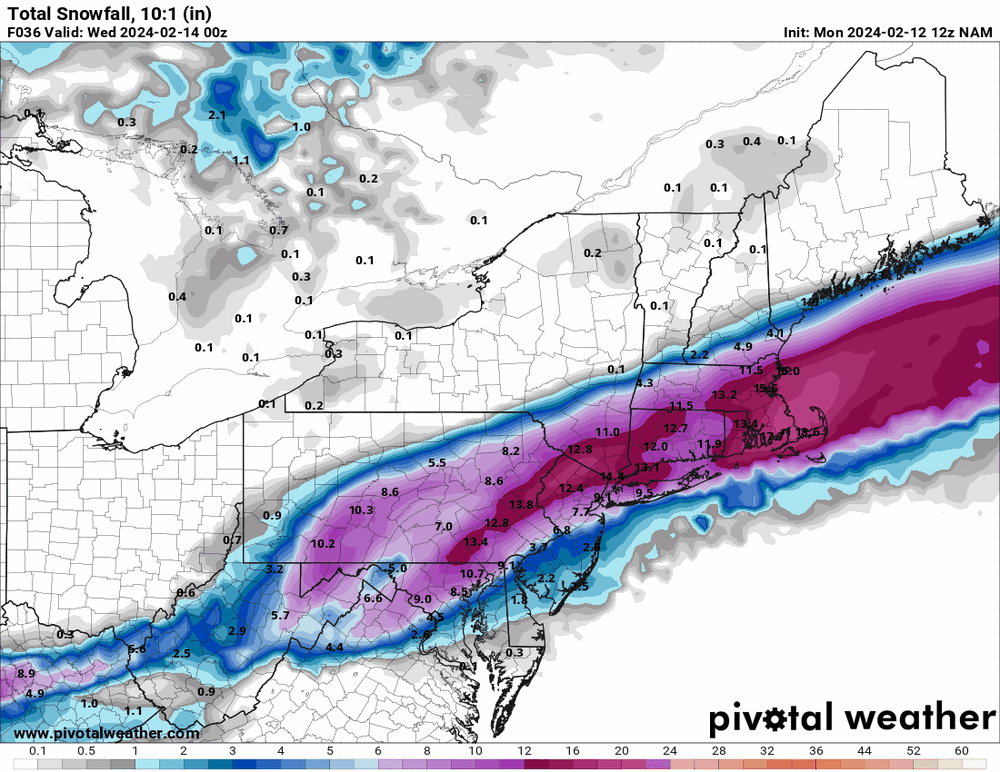
-
E PA/NJ/DE Winter 2023-2024 OBS/Discussion
Hurricane Agnes replied to The Iceman's topic in Philadelphia Region
12z NAM is running so will see how that goes. -
LOL I just saw this trailer this morning - The trailer scenes almost look like a remake of the original "Twister" but I think this is supposed to be a sequel. Hard to believe it's been almost 30 years. I have the original on laserdisc and used to use it as one of my "demo" films for my early Dolby Digital 5.1 home theater back then (complete with subwoofer).
-
E PA/NJ/DE Winter 2023-2024 OBS/Discussion
Hurricane Agnes replied to The Iceman's topic in Philadelphia Region
6z EC seems to be matching the 6z GFS, ticking the low a bit to the east off the coast.
-
E PA/NJ/DE Winter 2023-2024 OBS/Discussion
Hurricane Agnes replied to The Iceman's topic in Philadelphia Region
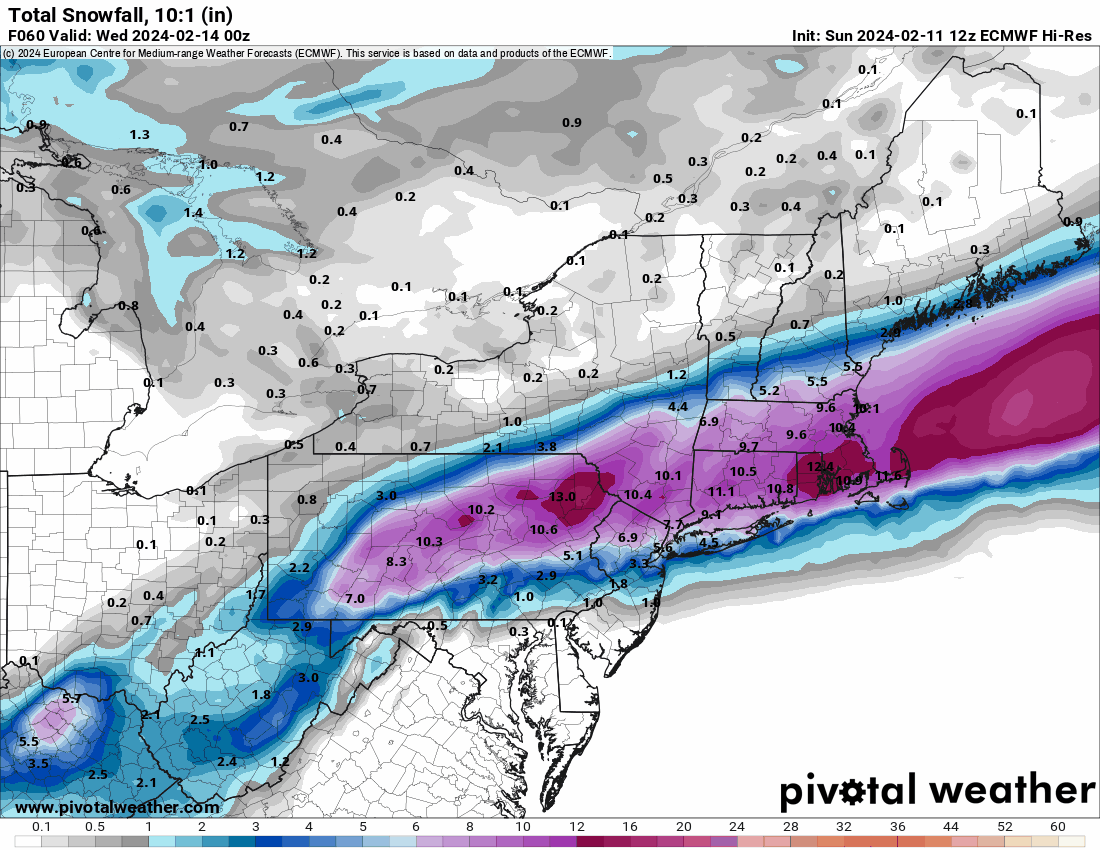
6z hi-res EC has moved south.
-
E PA/NJ/DE Winter 2023-2024 OBS/Discussion
Hurricane Agnes replied to The Iceman's topic in Philadelphia Region
Up your way has definitely been in the target zone for days now. It's a matter of how much. -
E PA/NJ/DE Winter 2023-2024 OBS/Discussion
Hurricane Agnes replied to The Iceman's topic in Philadelphia Region
7z NBM not buying it. I almost want to say it could be convective feedback but I suppose the 12z will be instructive.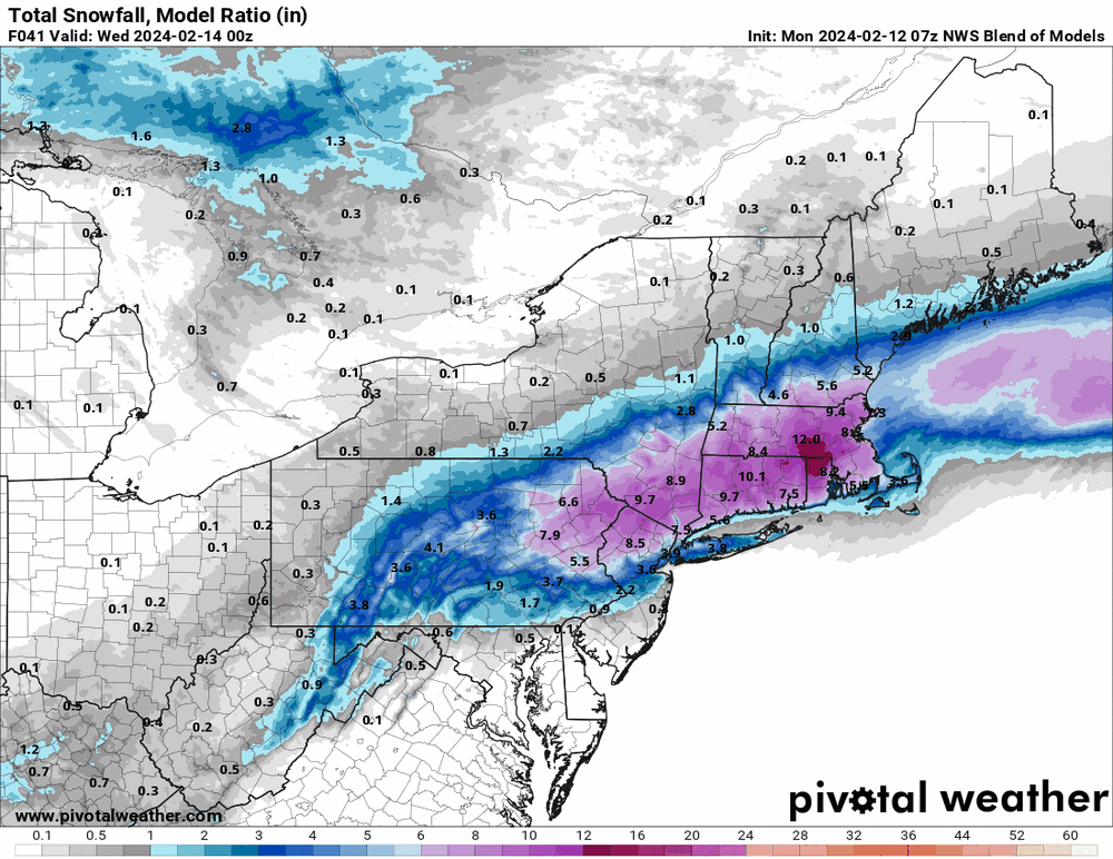
-
E PA/NJ/DE Winter 2023-2024 OBS/Discussion
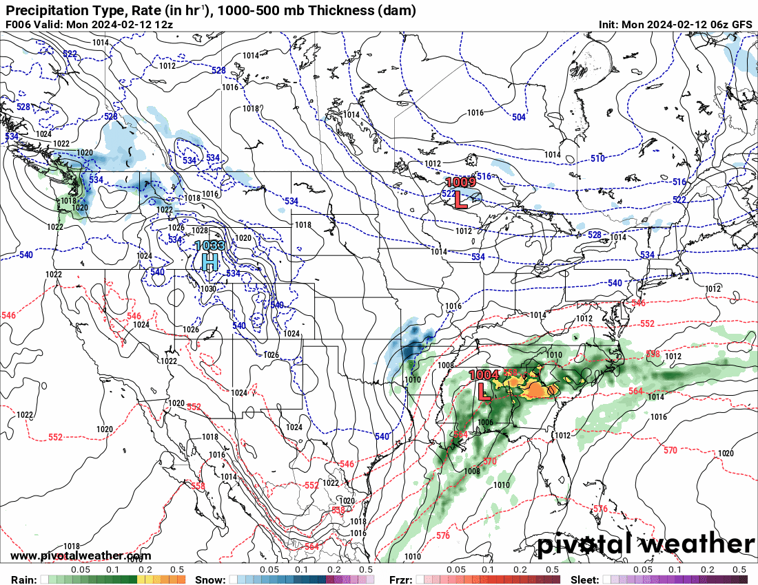
Hurricane Agnes replied to The Iceman's topic in Philadelphia Region
Was trying to see what the GFS was trying to do and I guess it wants to start bombing out the low when it gets out into the ocean.
-
E PA/NJ/DE Winter 2023-2024 OBS/Discussion
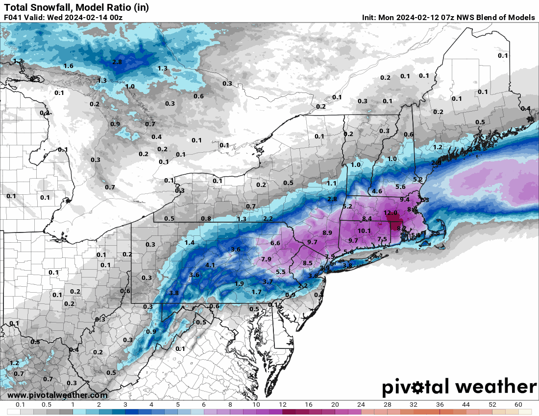
Hurricane Agnes replied to The Iceman's topic in Philadelphia Region
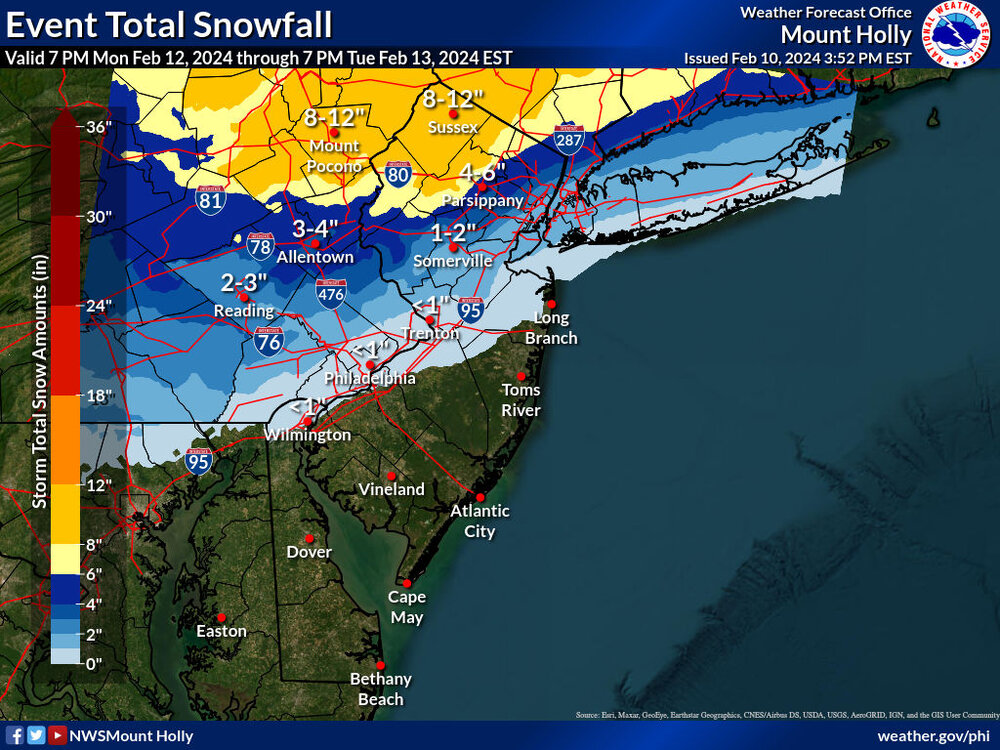
Latest Mt. Holly map -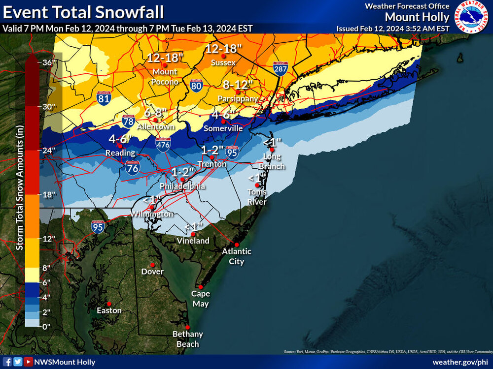
-
E PA/NJ/DE Winter 2023-2024 OBS/Discussion
Hurricane Agnes replied to The Iceman's topic in Philadelphia Region
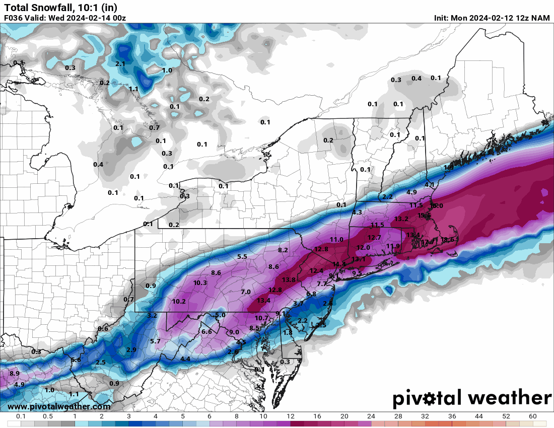
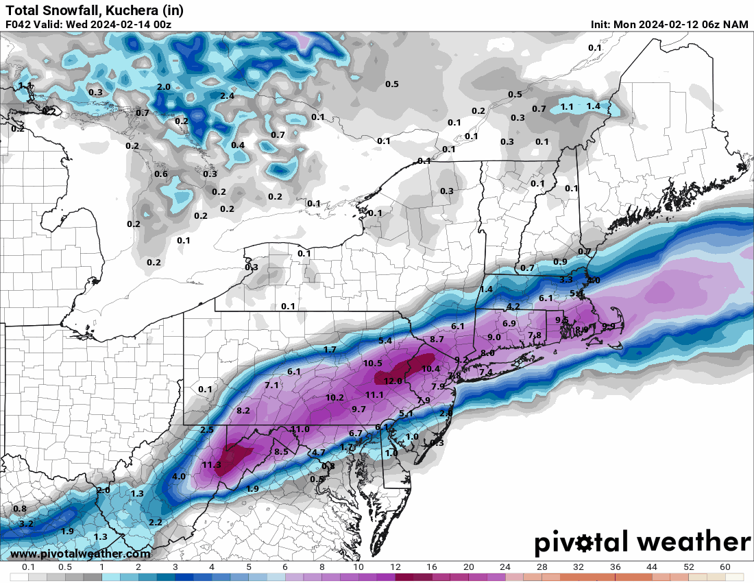
6z 12K NAM
-
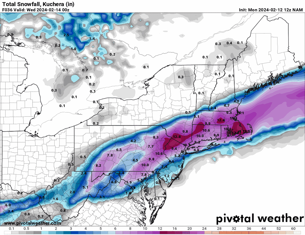
E PA/NJ/DE Winter 2023-2024 OBS/Discussion
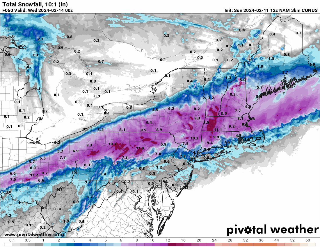
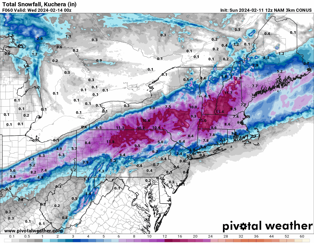
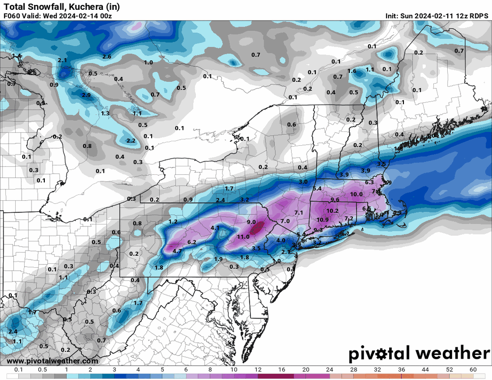
Hurricane Agnes replied to The Iceman's topic in Philadelphia Region
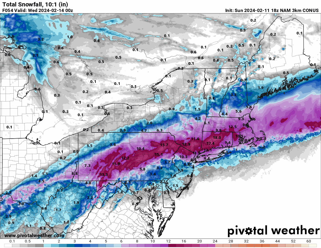
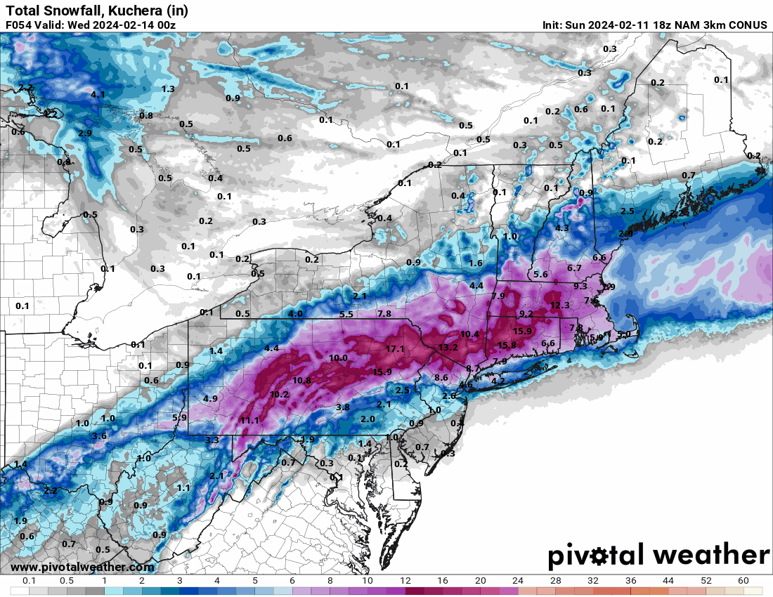
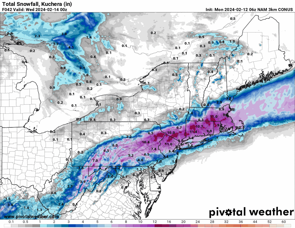
6z 3k NAM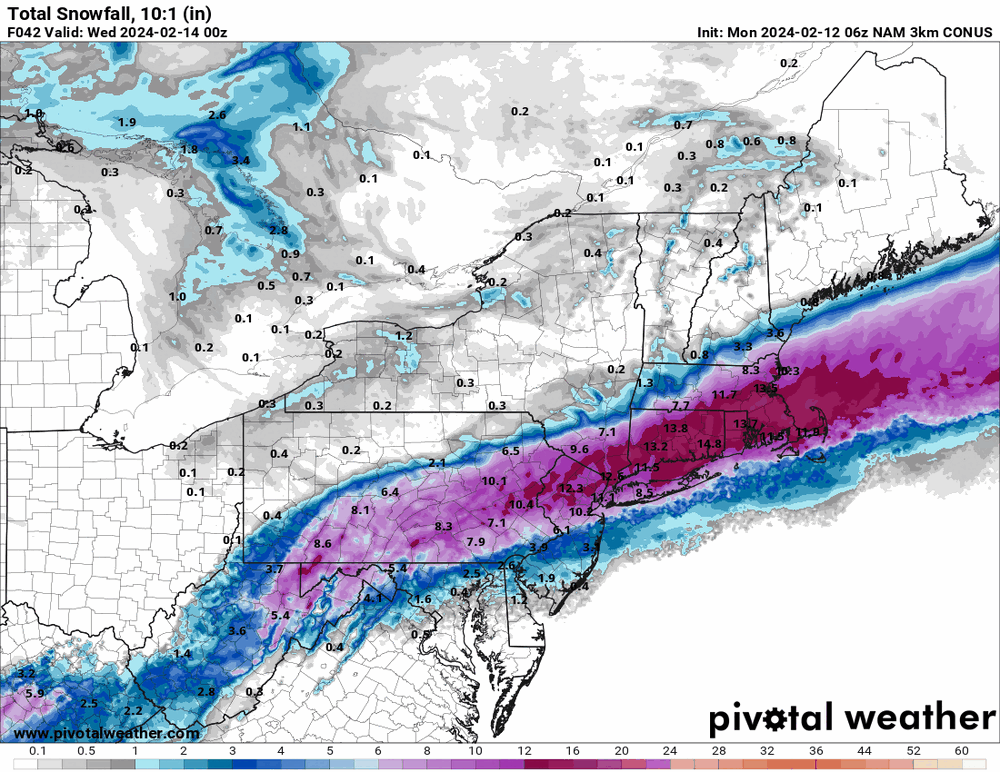
-
E PA/NJ/DE Winter 2023-2024 OBS/Discussion
Hurricane Agnes replied to The Iceman's topic in Philadelphia Region
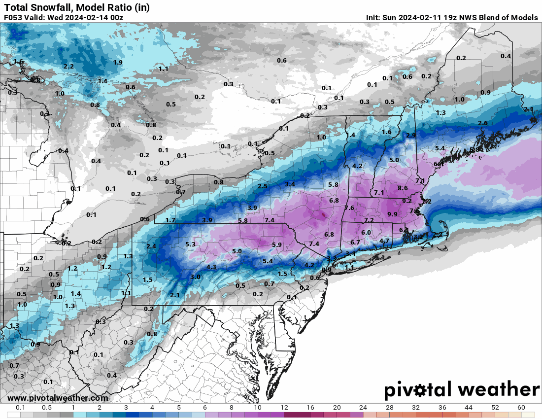
19z NBM.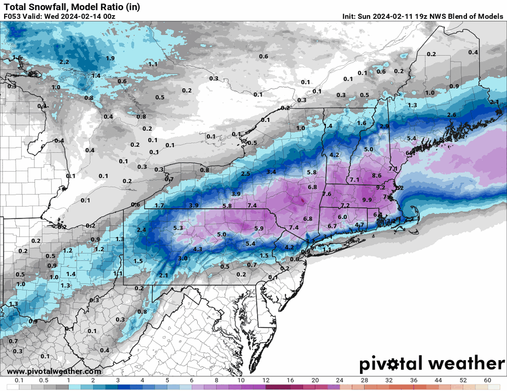
-
E PA/NJ/DE Winter 2023-2024 OBS/Discussion
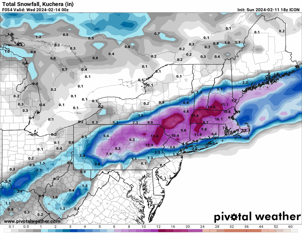
Hurricane Agnes replied to The Iceman's topic in Philadelphia Region
18z ICON kept the same theme as others.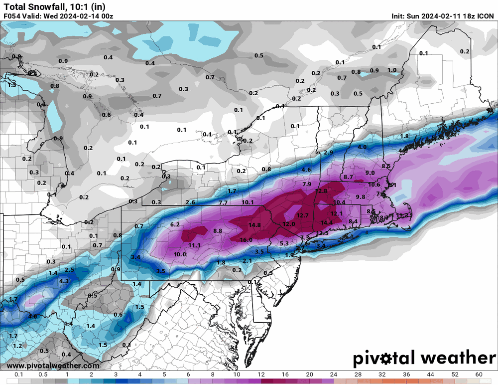
-
E PA/NJ/DE Winter 2023-2024 OBS/Discussion
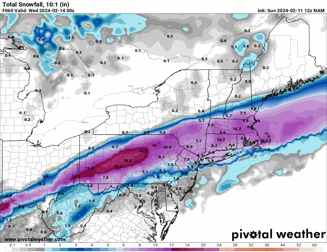
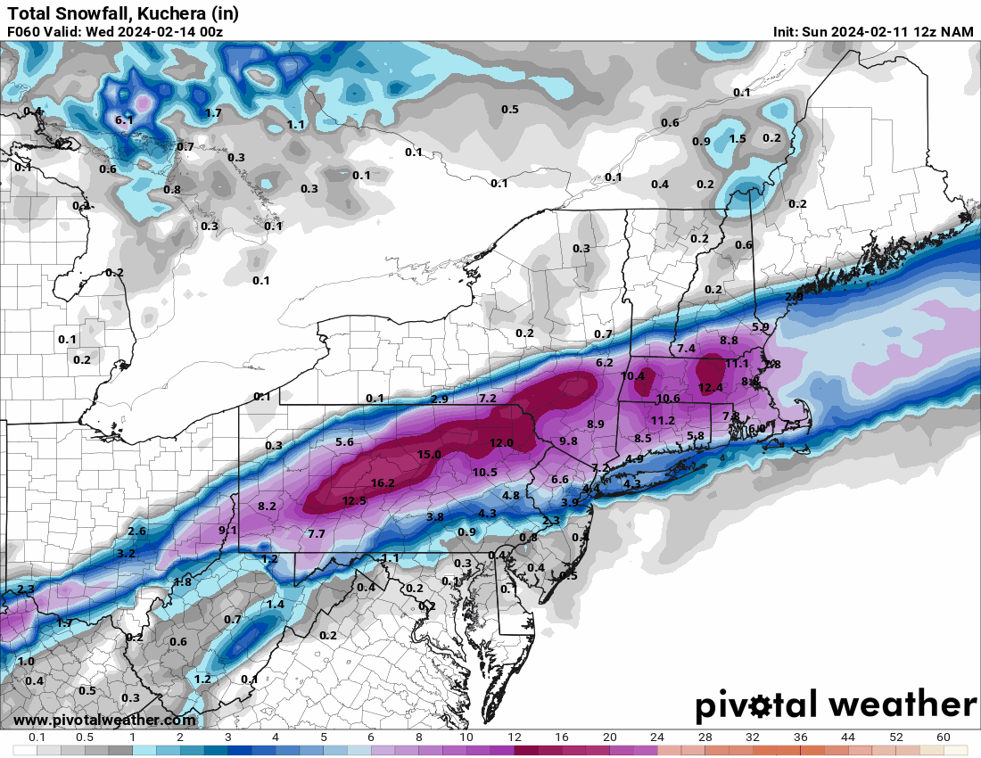
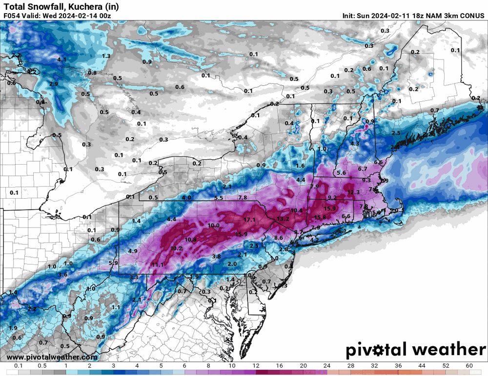
Hurricane Agnes replied to The Iceman's topic in Philadelphia Region
18z 3k NAMs...
-
E PA/NJ/DE Winter 2023-2024 OBS/Discussion
Hurricane Agnes replied to The Iceman's topic in Philadelphia Region
Well the 12z Canadian gave you a little... I think, at least as of today, it's near 100% I-78 -> I-80 and north jackpot.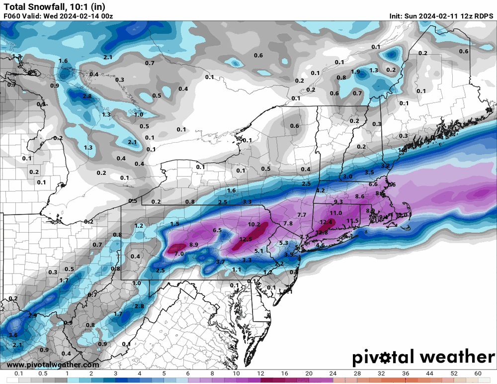
-
E PA/NJ/DE Winter 2023-2024 OBS/Discussion
Hurricane Agnes replied to The Iceman's topic in Philadelphia Region
I'll give you the Ukie (that came west) + a couple ICONs (where the ICON finally put the crack pipe down and caved).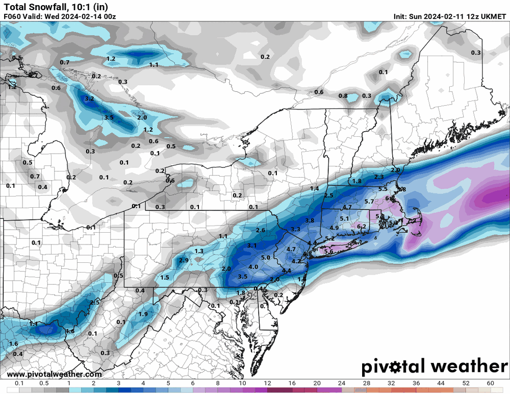
-
E PA/NJ/DE Winter 2023-2024 OBS/Discussion
Hurricane Agnes replied to The Iceman's topic in Philadelphia Region
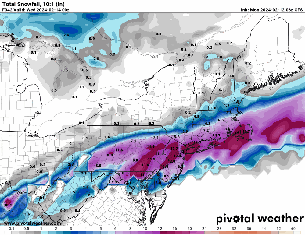
The 10:1 looks better but is a non-starter given that low is pulling all kinds of warm moisture out of a warm GOM.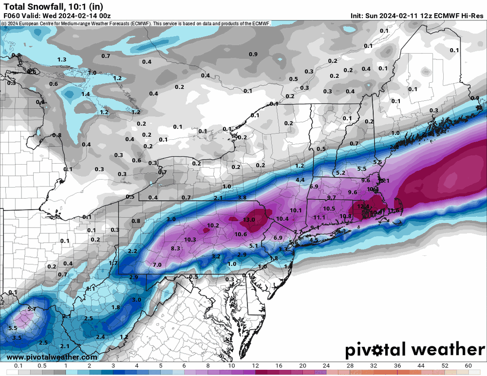

-
E PA/NJ/DE Winter 2023-2024 OBS/Discussion
Hurricane Agnes replied to The Iceman's topic in Philadelphia Region
12Z GFS similar although still hanging with some for most inland (pretty much nothing for coastal plain/I-95 south and east).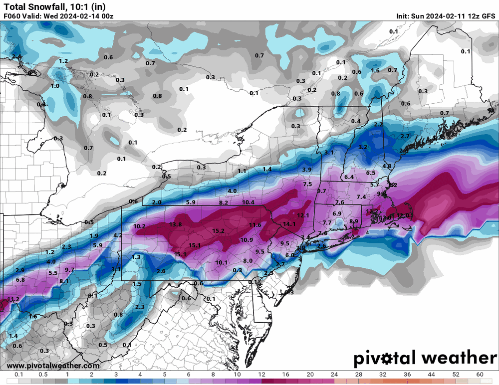
-
E PA/NJ/DE Winter 2023-2024 OBS/Discussion
Hurricane Agnes replied to The Iceman's topic in Philadelphia Region
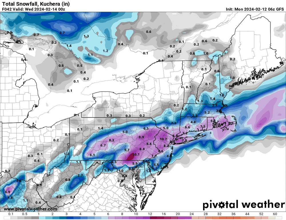
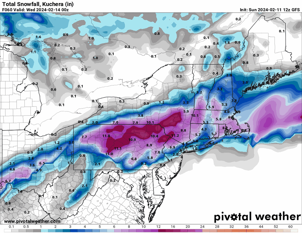
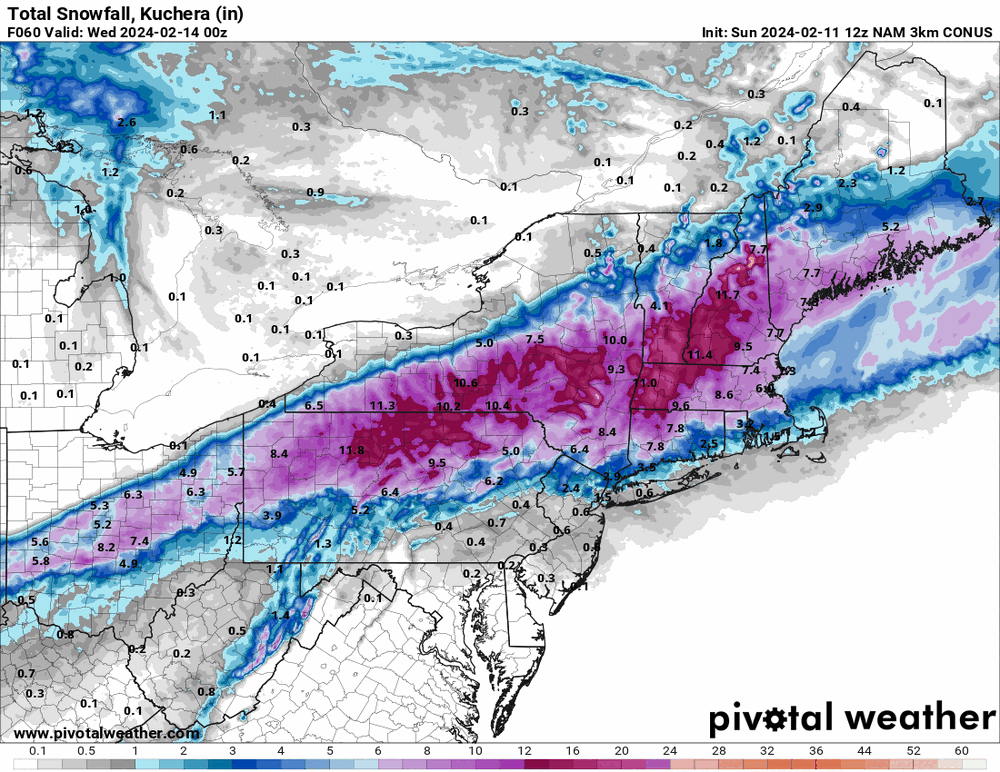
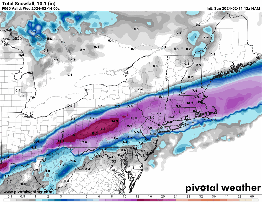
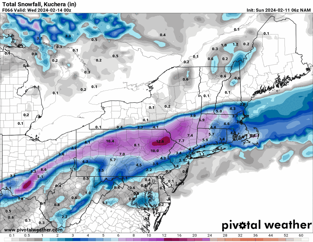
The 12z 3k NAM really came in north in terms of drying up the south (more than the 12k).
-
E PA/NJ/DE Winter 2023-2024 OBS/Discussion
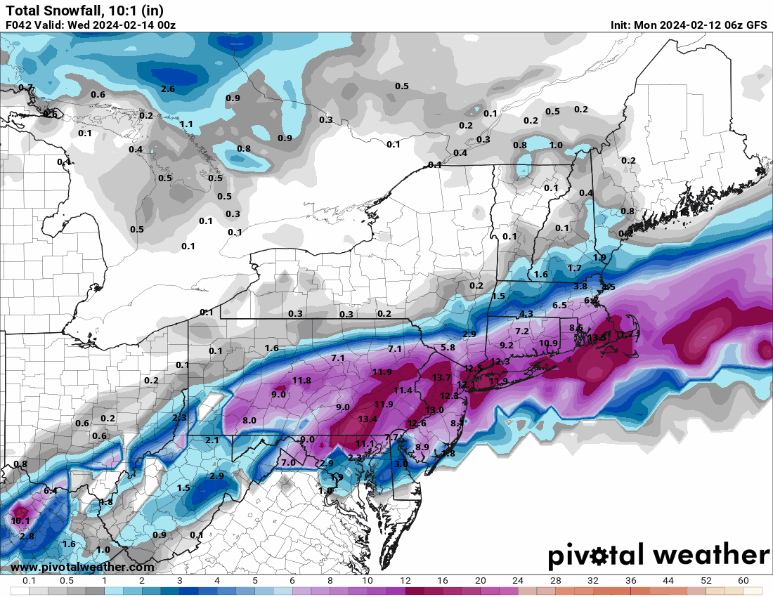
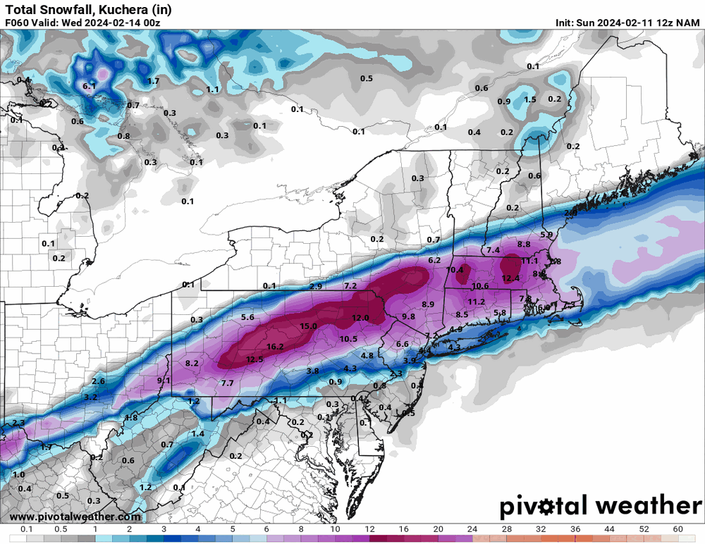
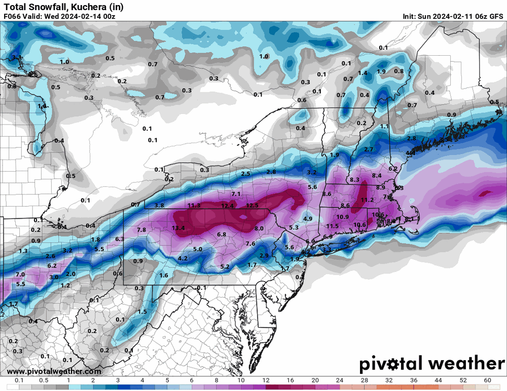
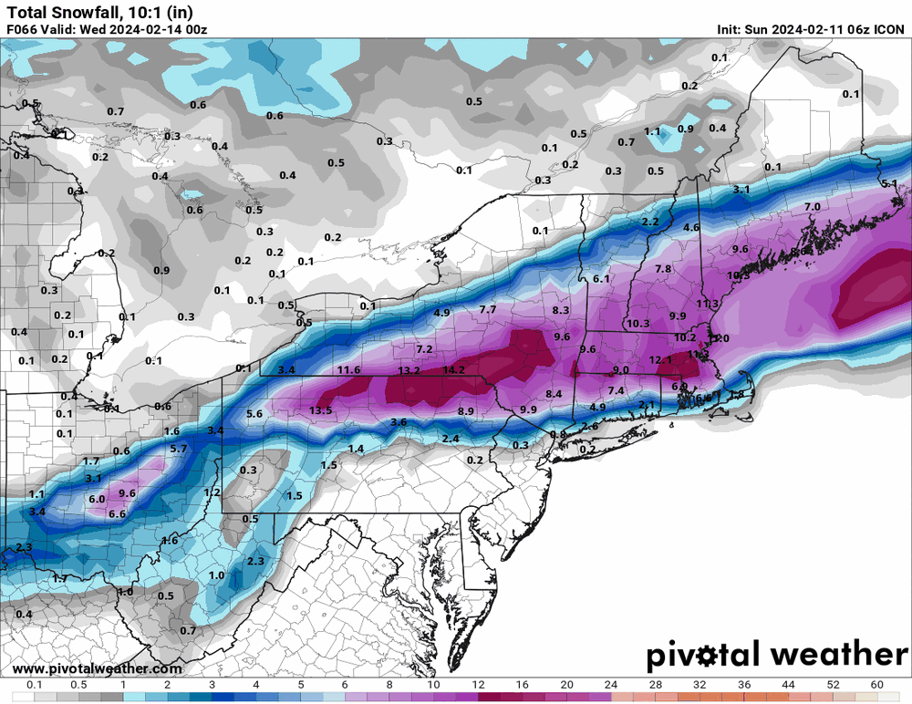
Hurricane Agnes replied to The Iceman's topic in Philadelphia Region
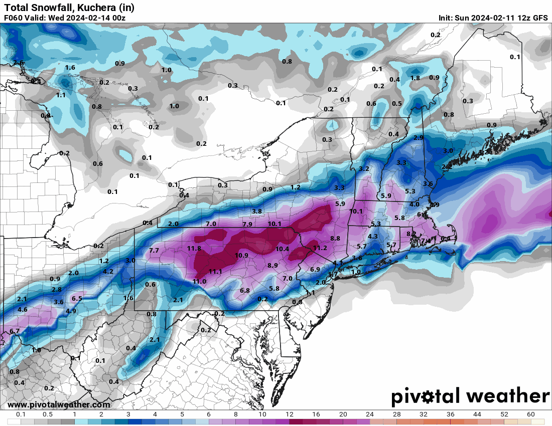
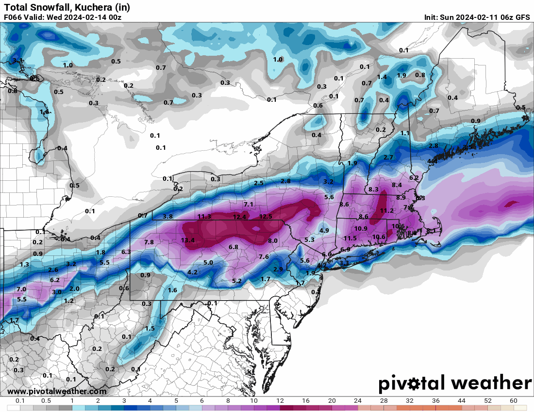
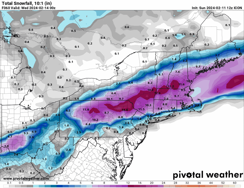
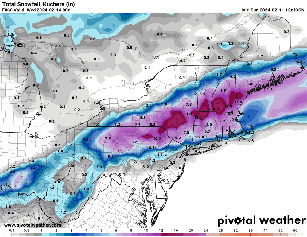
For completeness - 6z GFS & 6z ICON.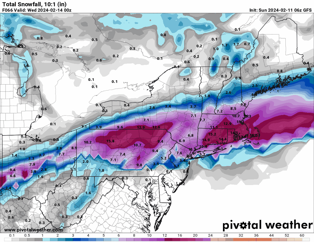
-
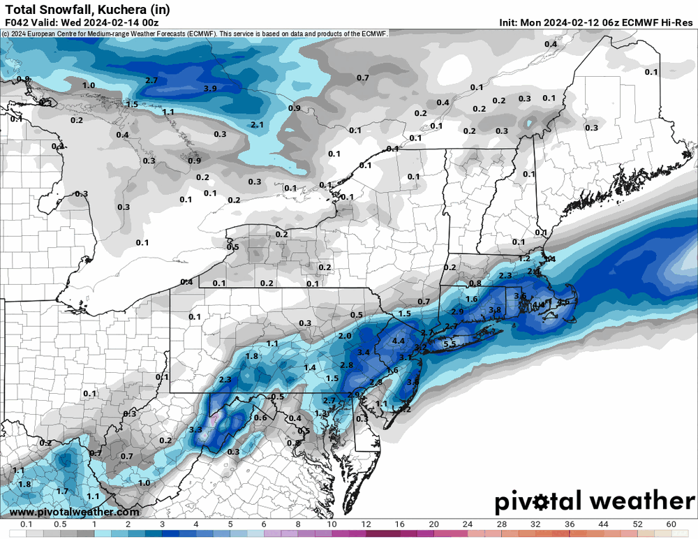
E PA/NJ/DE Winter 2023-2024 OBS/Discussion
Hurricane Agnes replied to The Iceman's topic in Philadelphia Region
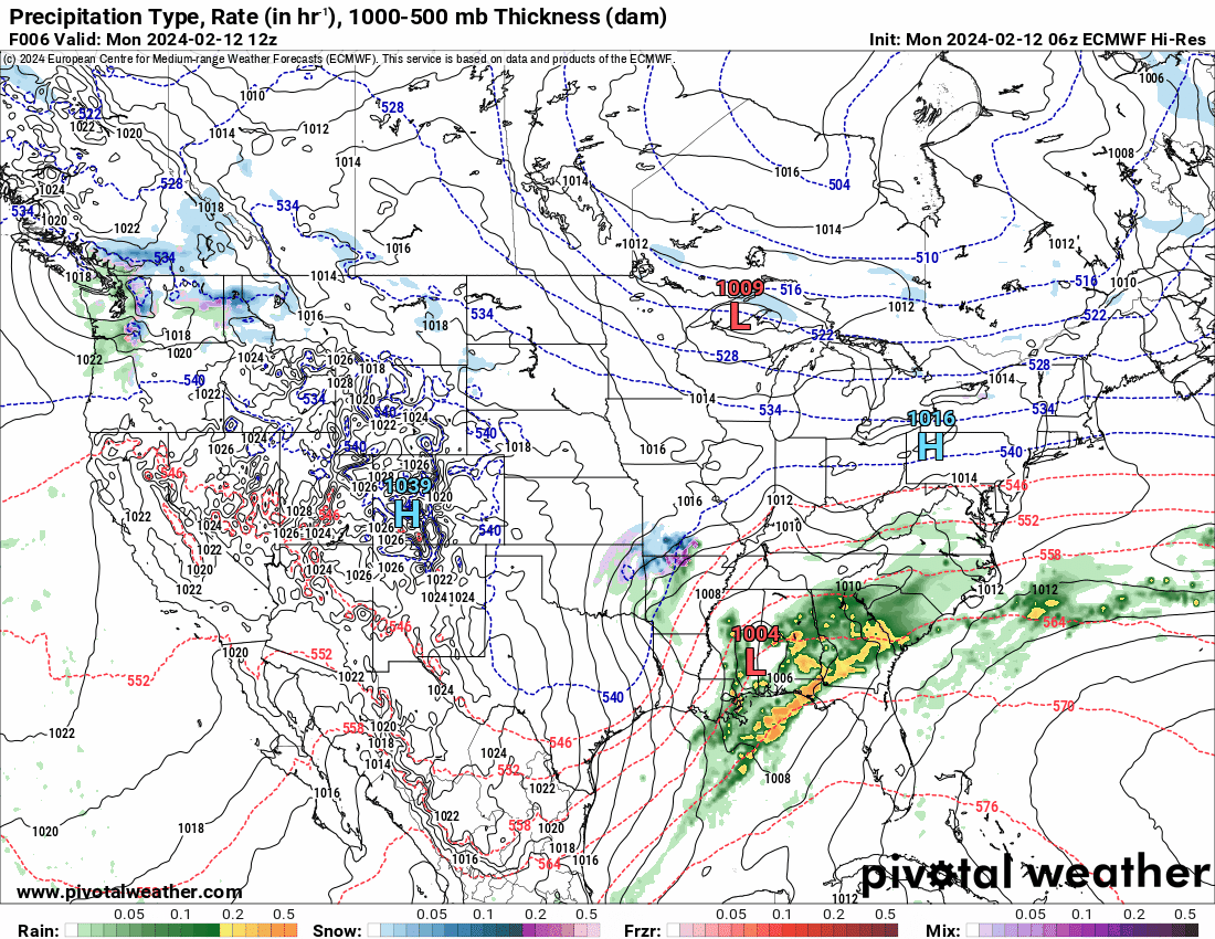
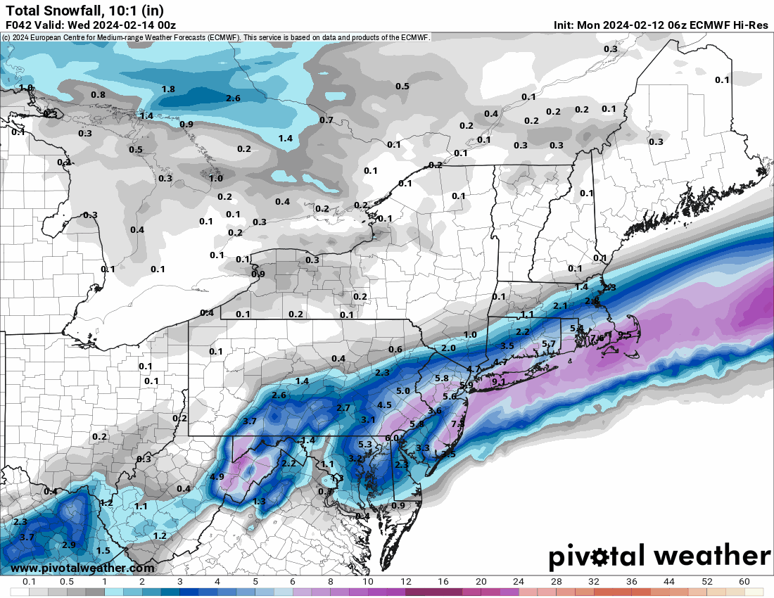
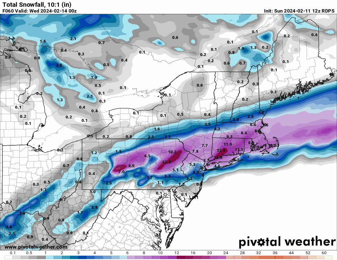
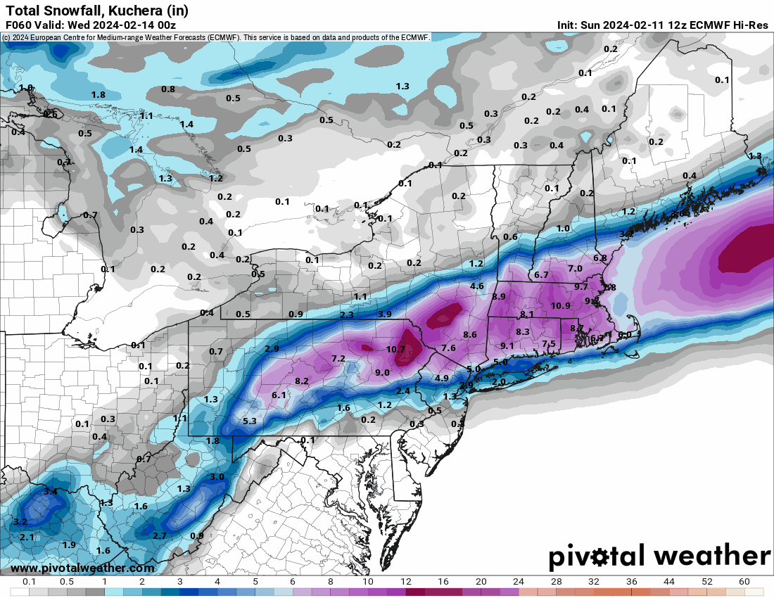
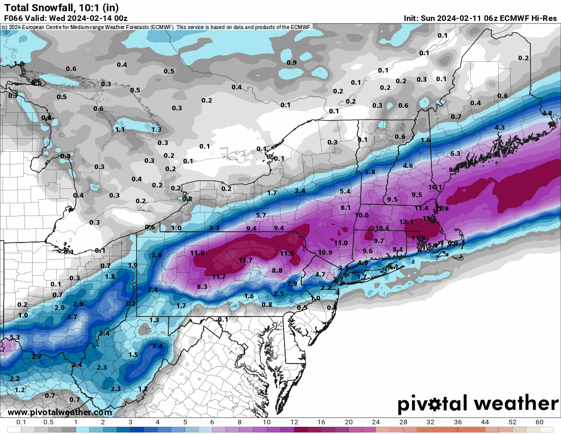
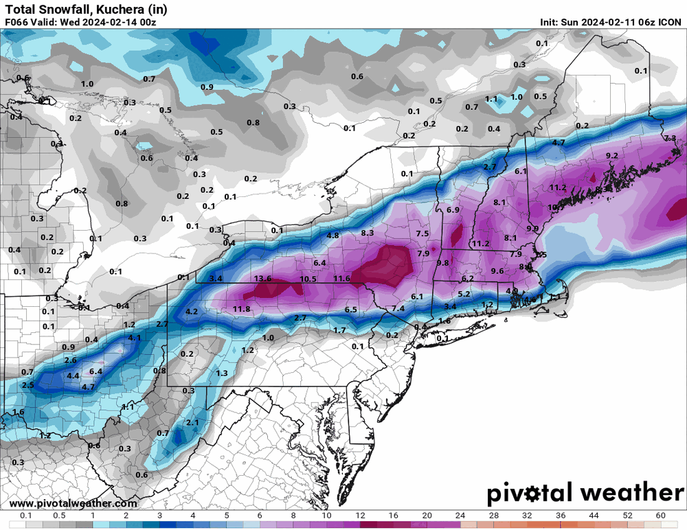
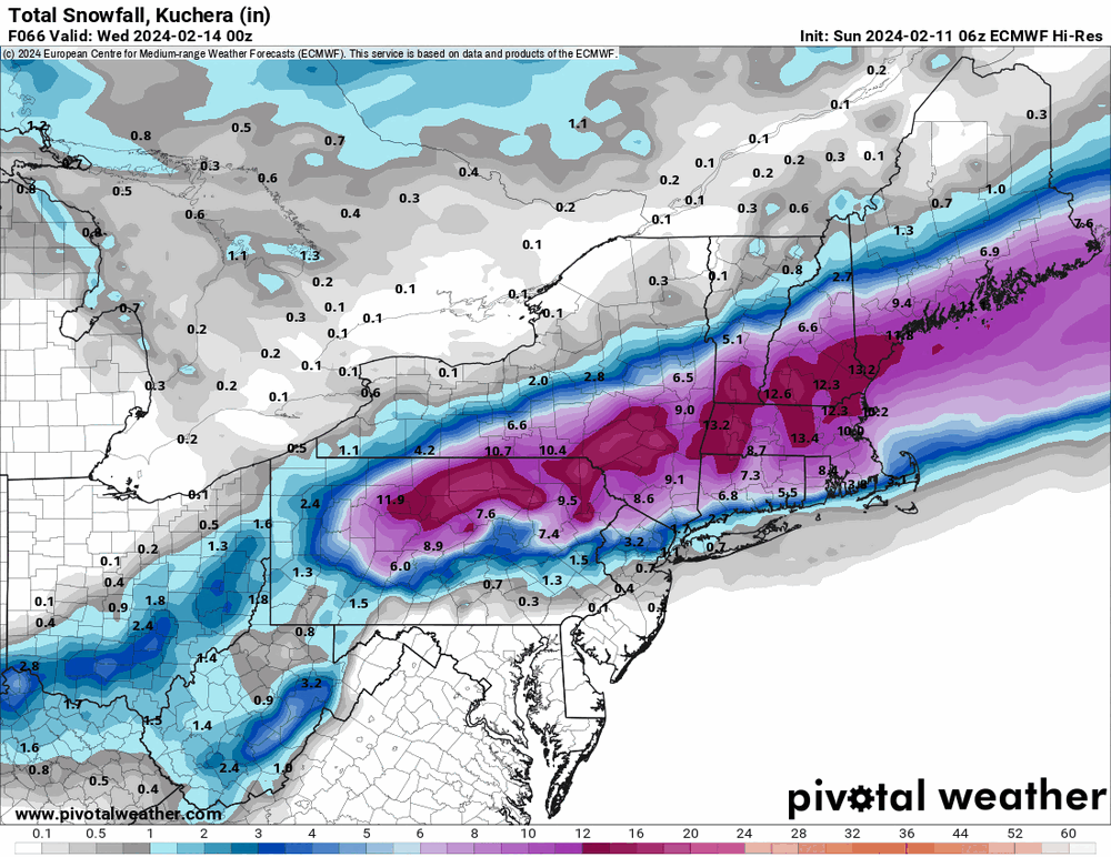
6z hi-res Euro.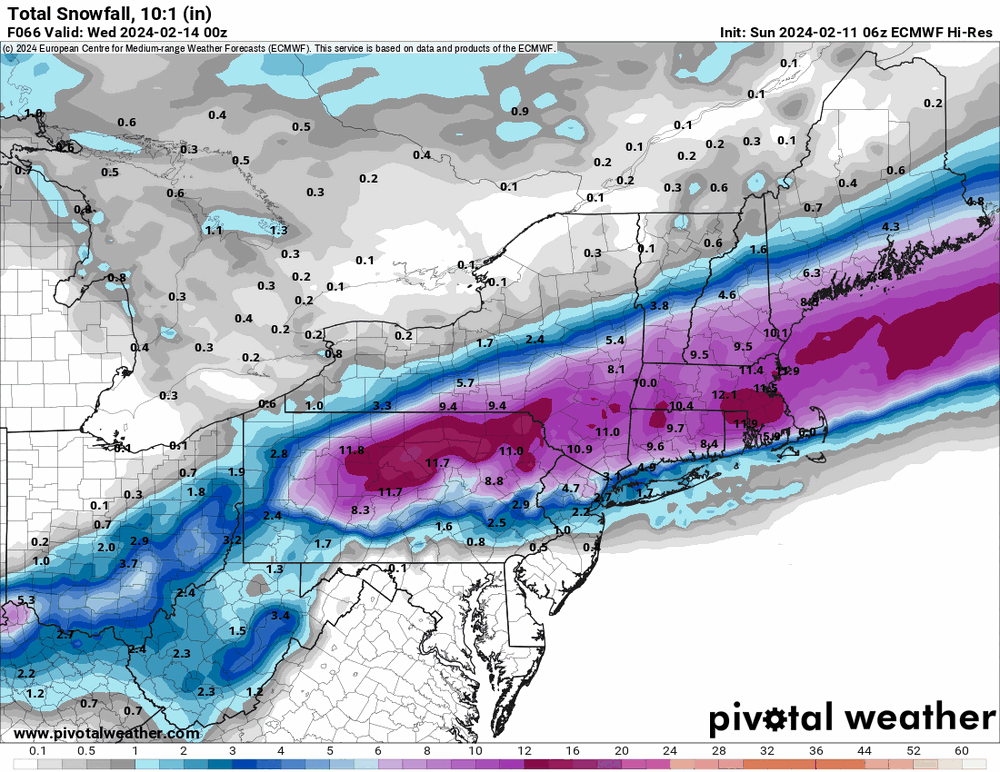
-
E PA/NJ/DE Winter 2023-2024 OBS/Discussion
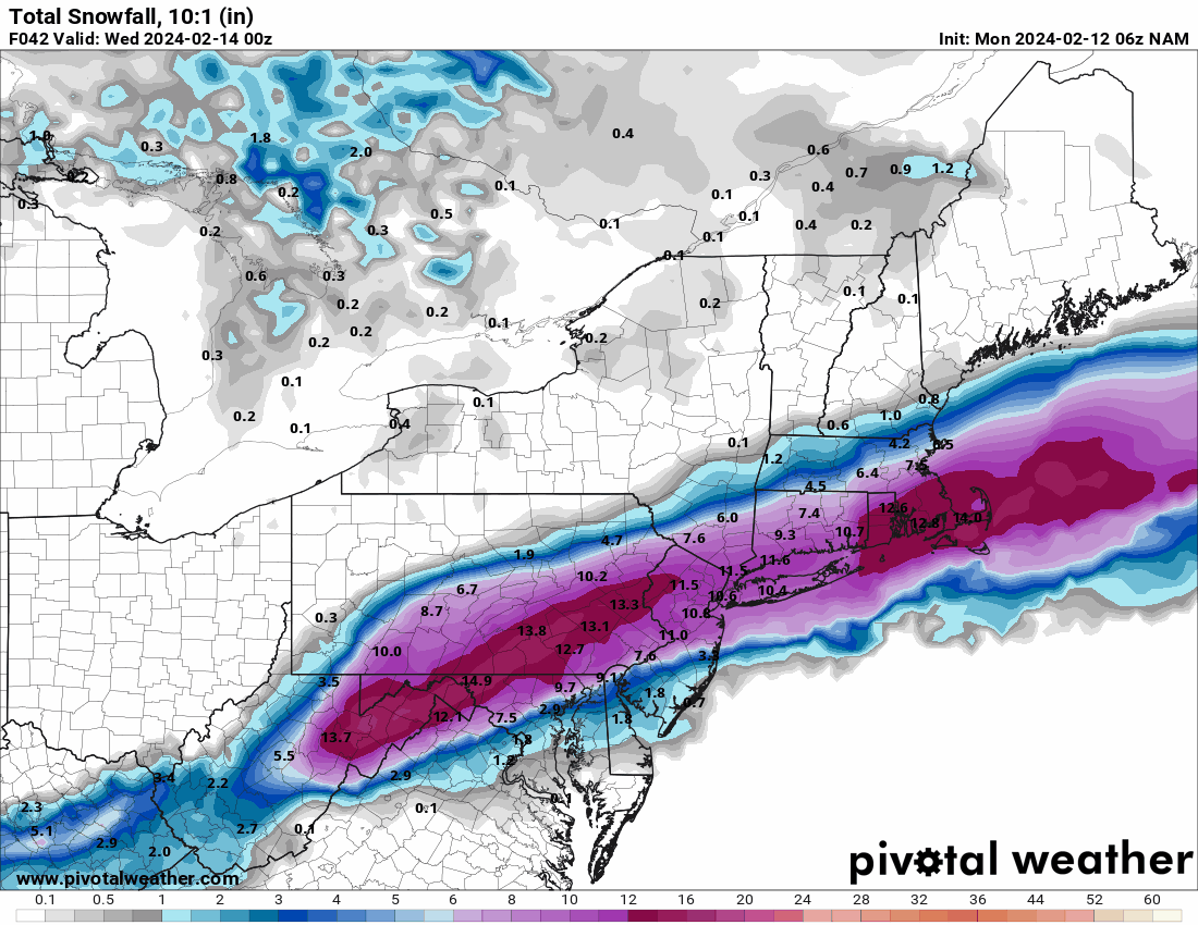
Hurricane Agnes replied to The Iceman's topic in Philadelphia Region
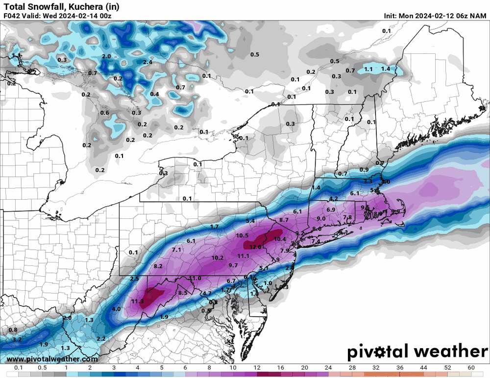
6z NAM was more north than it had been before (it was a southern outlier). 6z EC is running.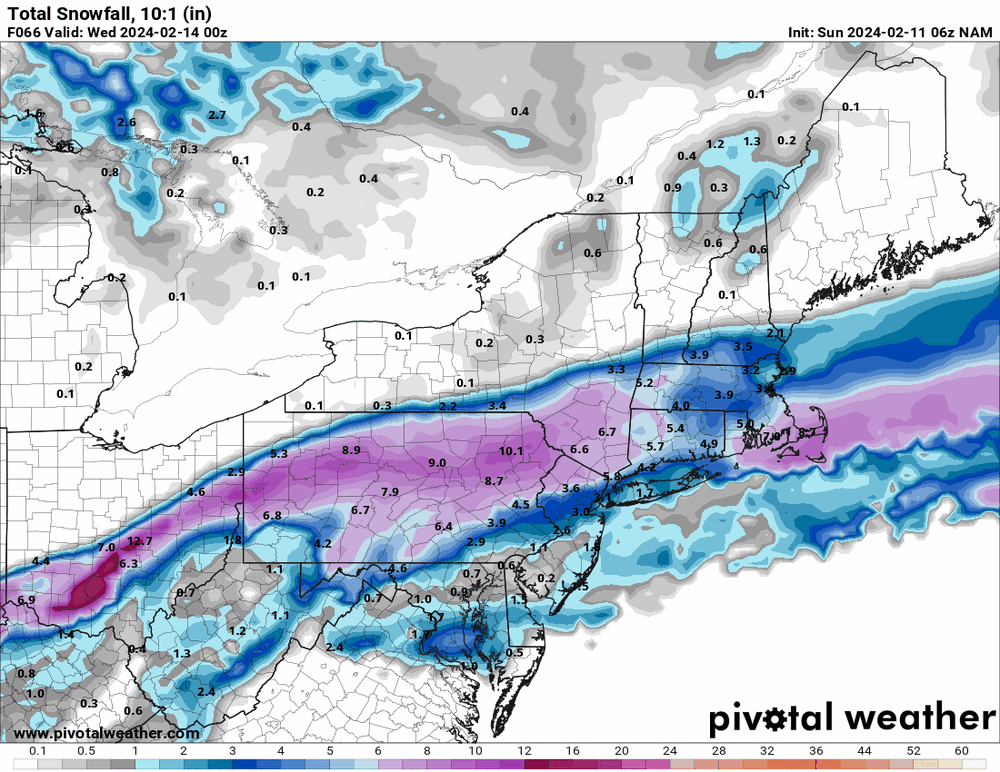
-
E PA/NJ/DE Winter 2023-2024 OBS/Discussion
Hurricane Agnes replied to The Iceman's topic in Philadelphia Region
18z Canadian seems to keep the same more-north theme. And as an obs - I bottomed out at 40 this morning and made it up to 55 as a high. Currently 51 with dp 46.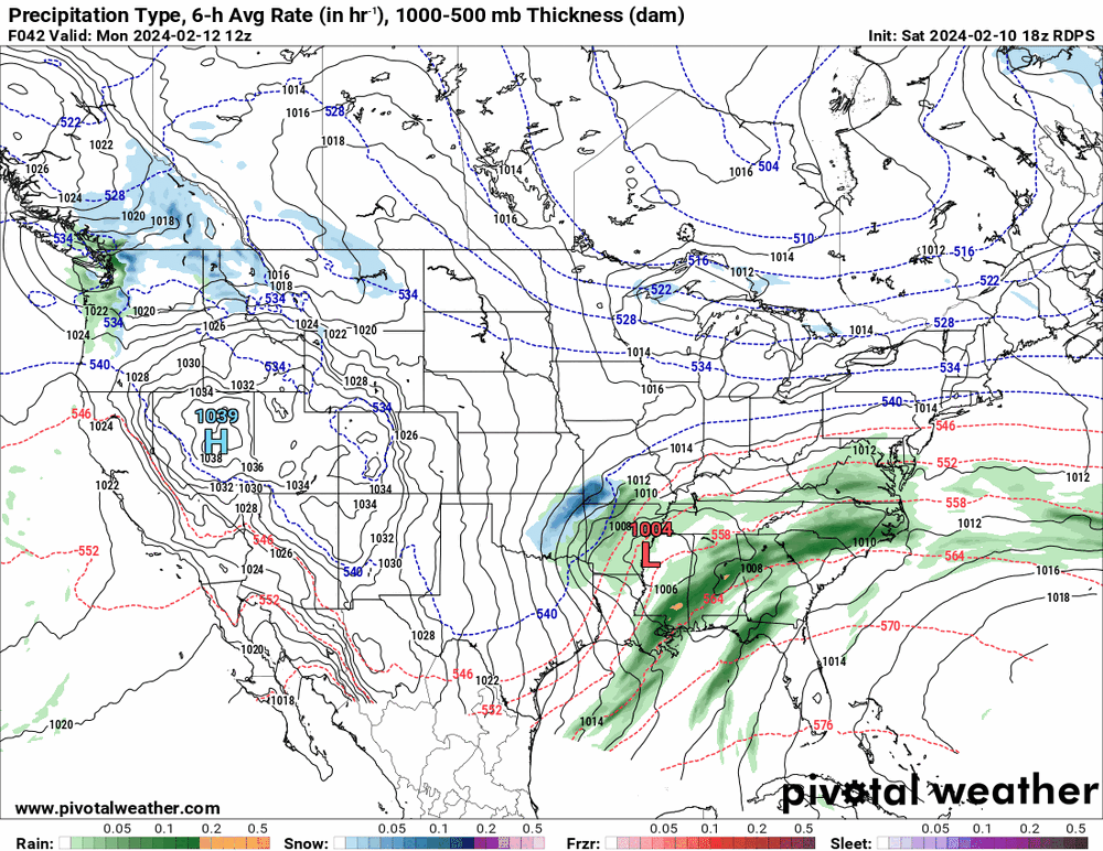


-
E PA/NJ/DE Winter 2023-2024 OBS/Discussion
Hurricane Agnes replied to The Iceman's topic in Philadelphia Region
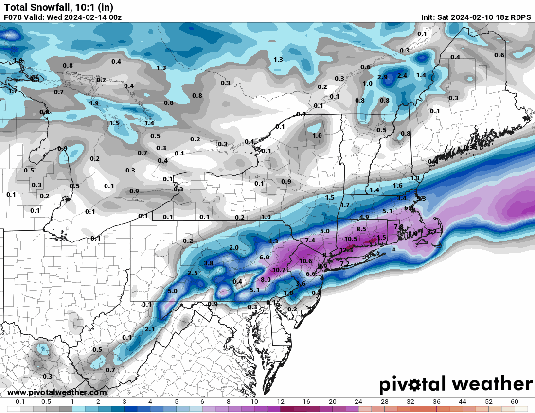
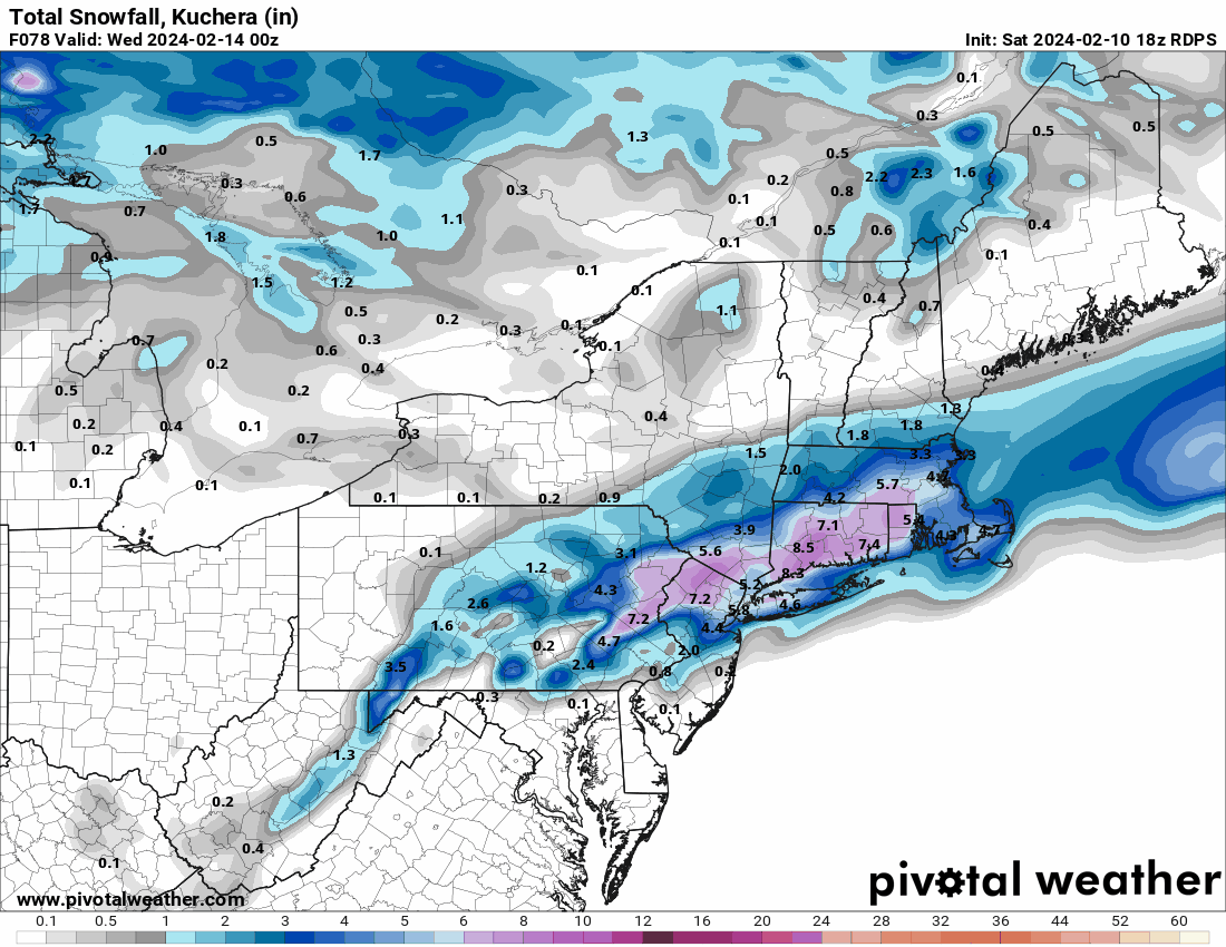
Mt. Holly's first call -