Hurricane Agnes
-
Posts
9,343 -
Joined
Content Type
Profiles
Blogs
Forums
American Weather
Media Demo
Store
Gallery
Everything posted by Hurricane Agnes
-
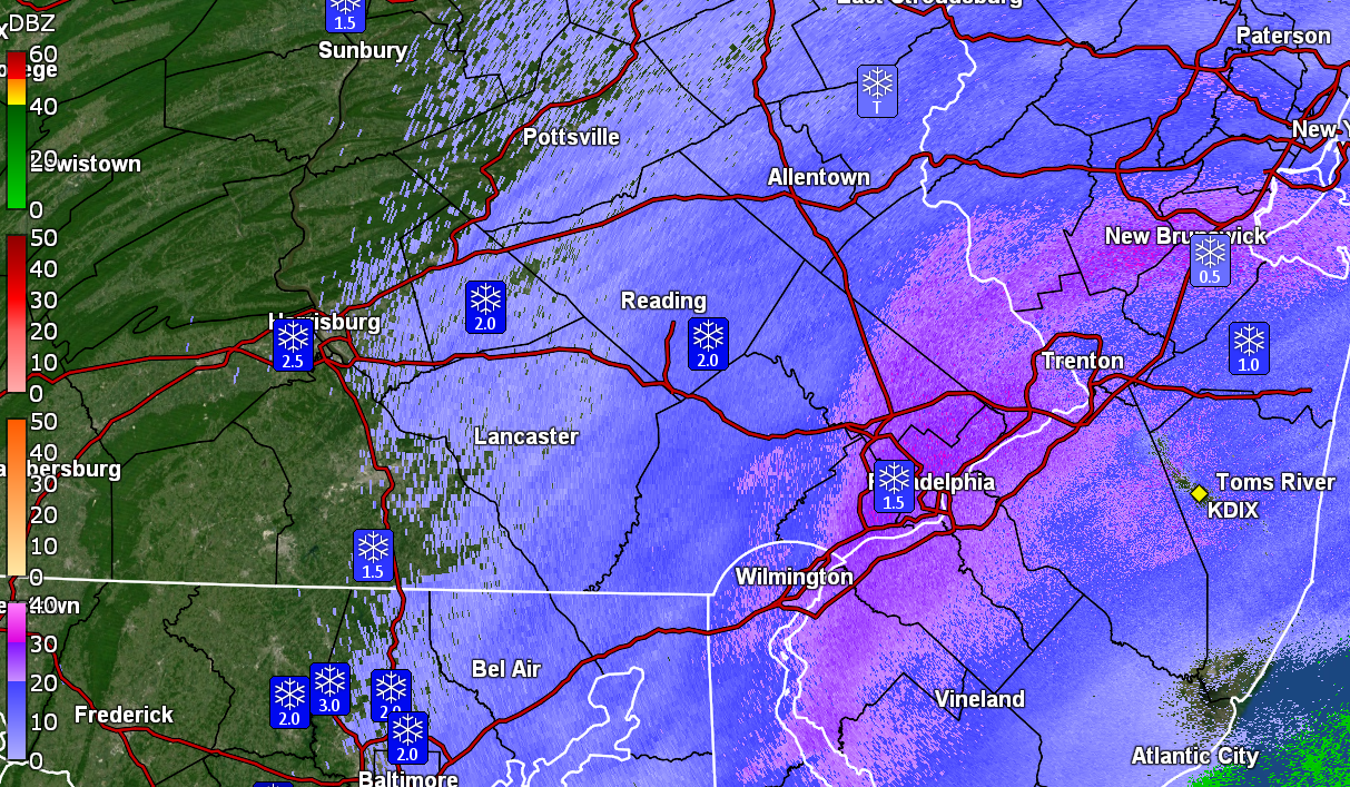
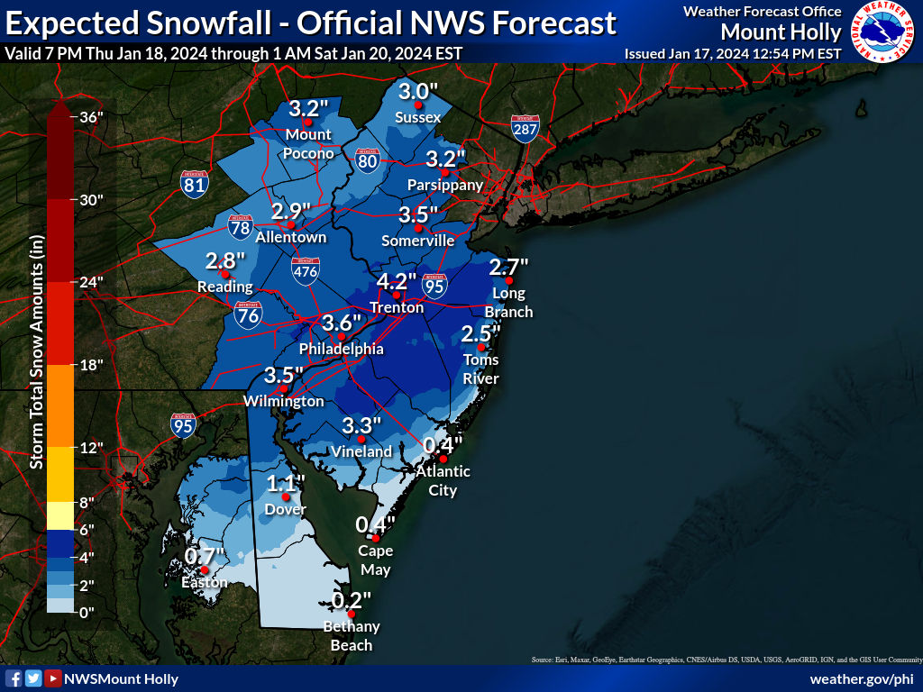
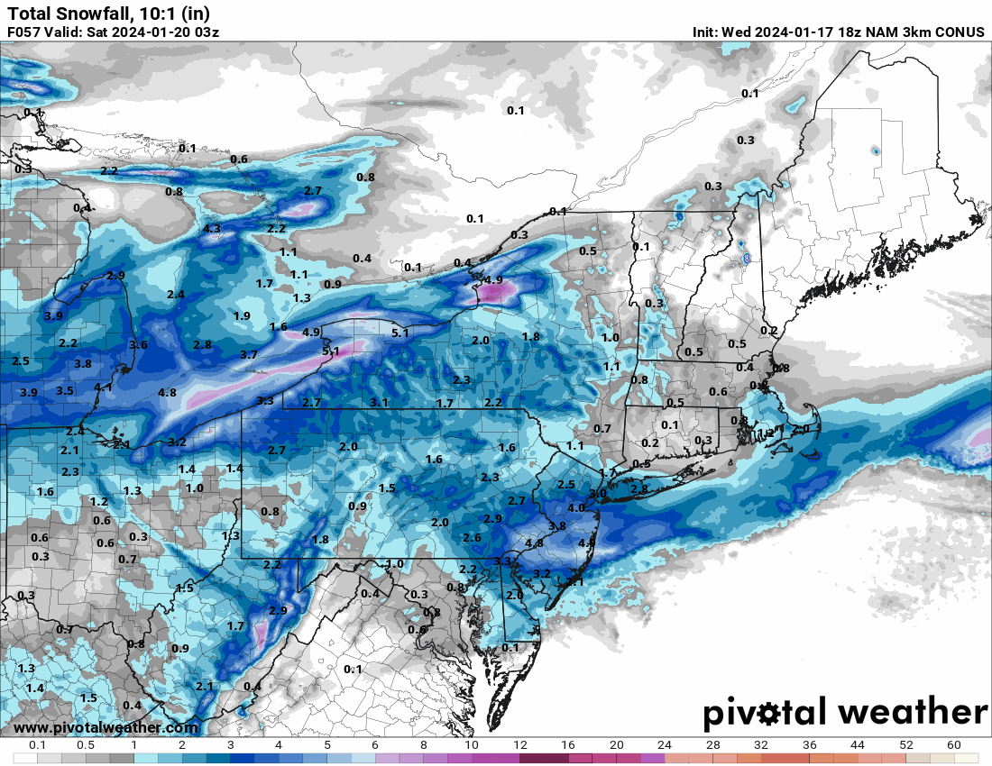
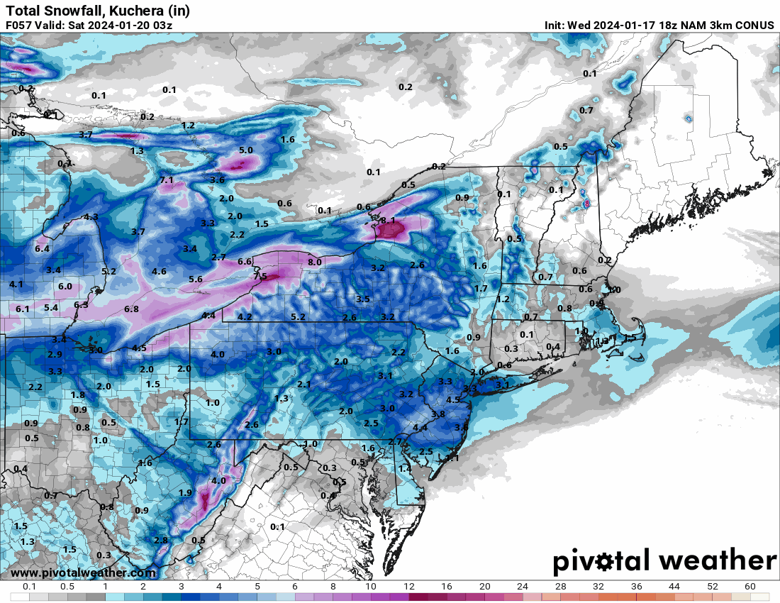
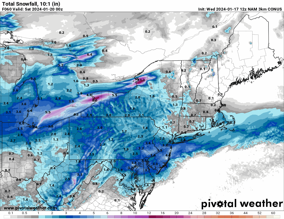
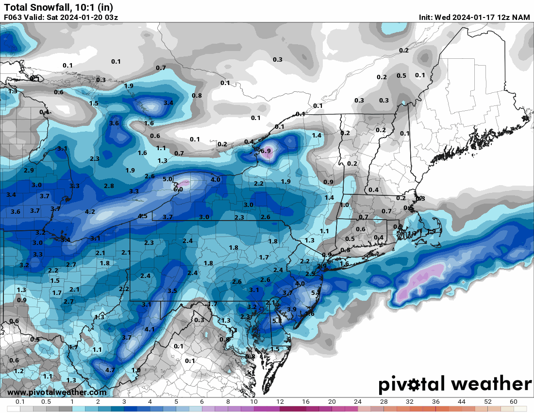
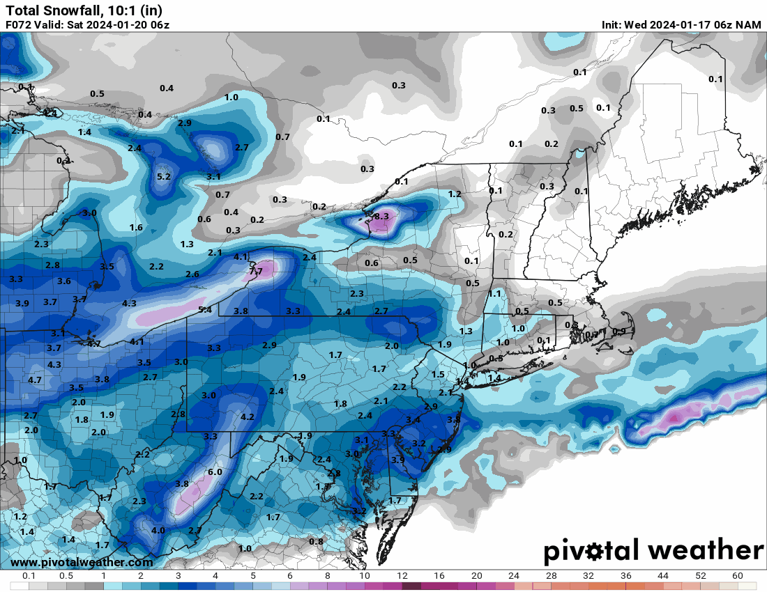
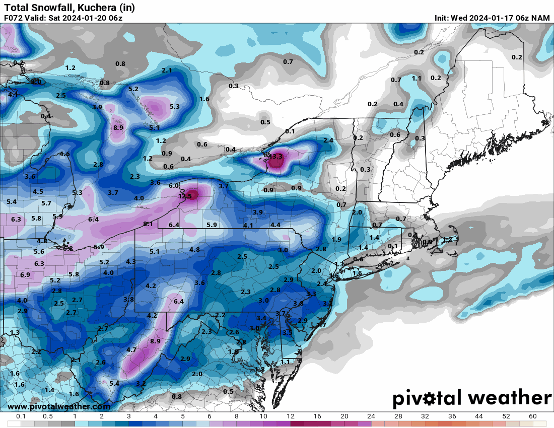
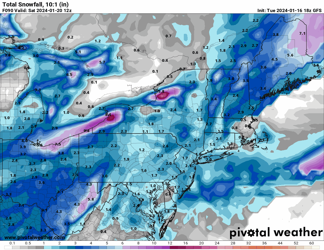
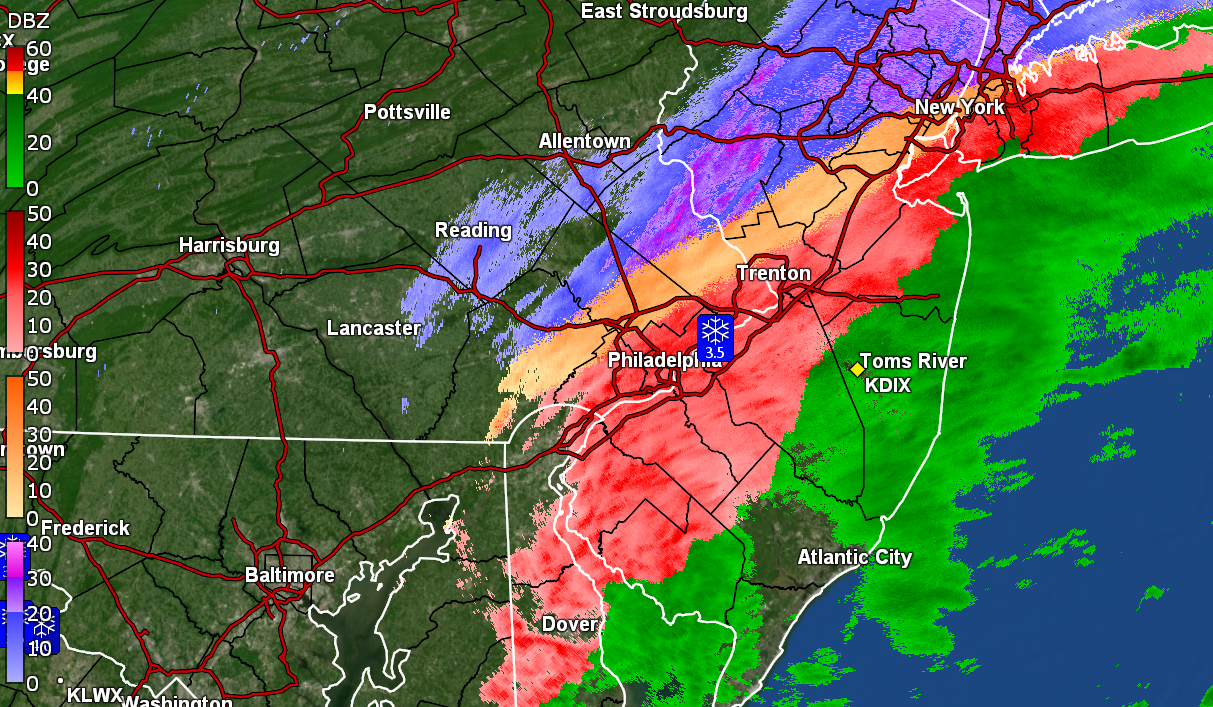
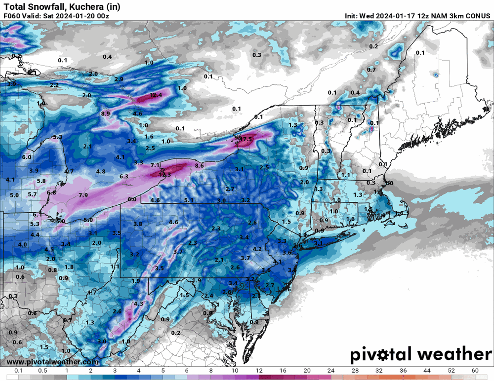
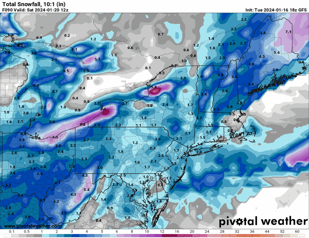
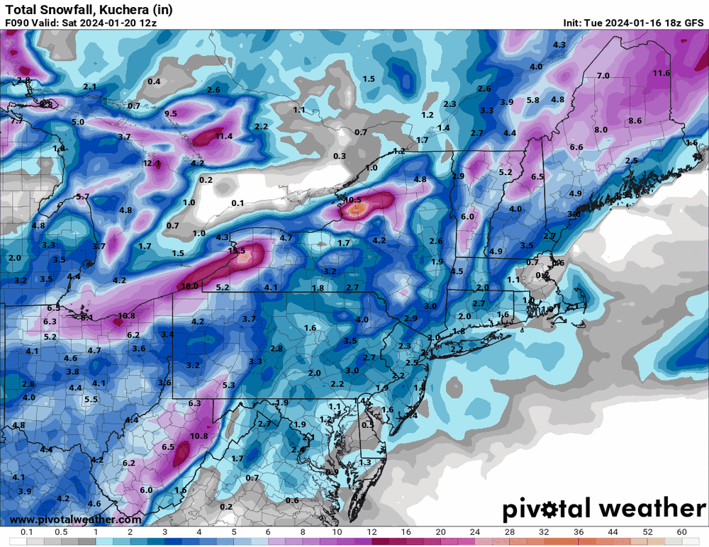
January 19, 2024 Powder Snow Event
Hurricane Agnes replied to Ralph Wiggum's topic in Philadelphia Region
12:15 pm measurement was 3.25" and the flakes are back to the smaller/finer type and still going at a steady SN rate. Temp is now 28 with dp 26. -
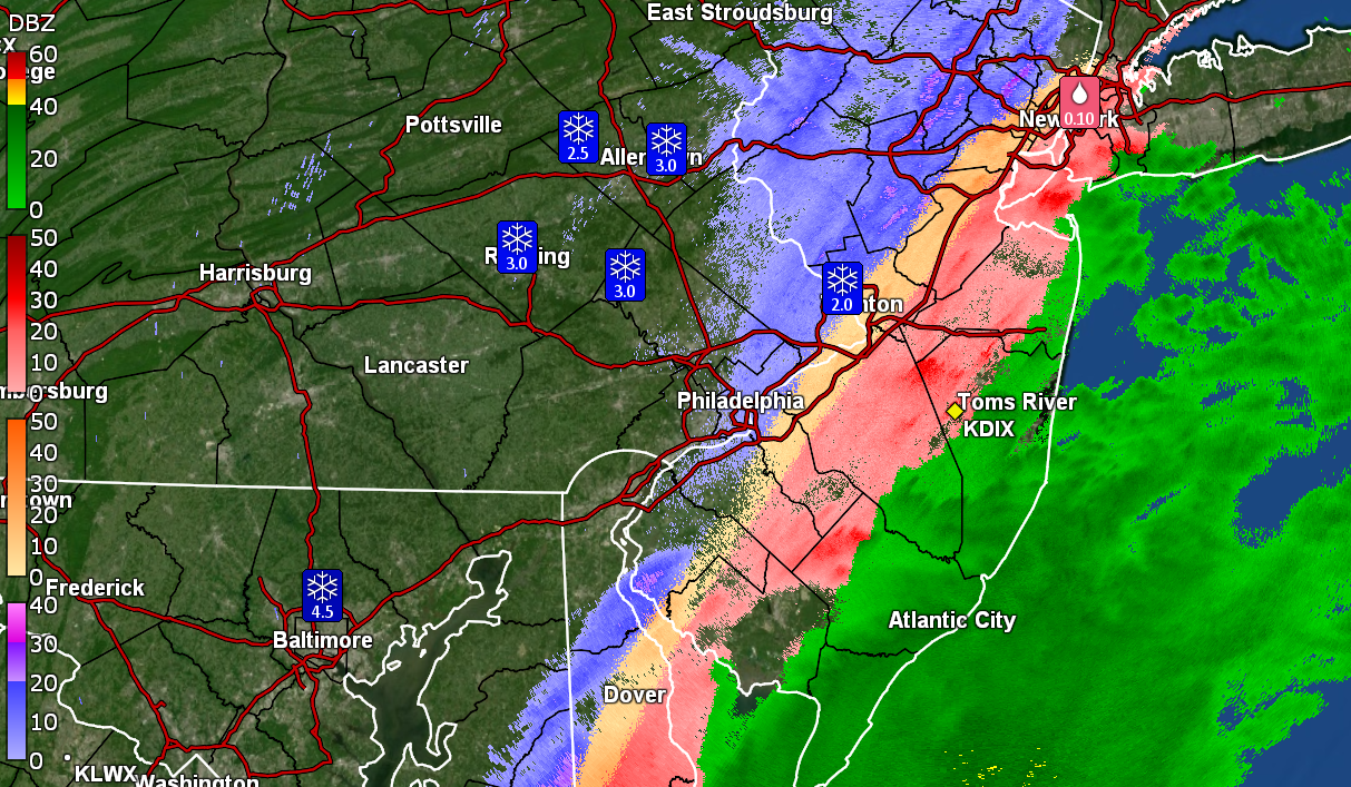
January 19, 2024 Powder Snow Event
Hurricane Agnes replied to Ralph Wiggum's topic in Philadelphia Region
Must be some kind of warm layer up in the atmosphere as I'm starting to get some pancakes mixed in with regular flakes (the fine stuff has been reduced to a min, although the pancakes will help increase the snow pack faster). Temp is still 27 with dp now 26 with some fog. ETA - running an animation of the radar suggests a band is back-building over I-95 so what might have appeared to be a "back edge" hasn't moved that much. -
January 19, 2024 Powder Snow Event
Hurricane Agnes replied to Ralph Wiggum's topic in Philadelphia Region
Just measured and have 1.75" on the board with moderate snow. Getting bigger flakes mixing in now and am under a stronger blob. Temp is 27 with dp 25.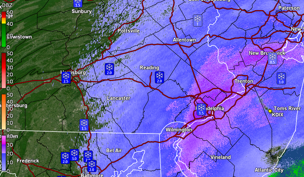
-
E PA/NJ/DE Winter 2023-2024 OBS/Discussion
Hurricane Agnes replied to The Iceman's topic in Philadelphia Region
I am at my low for the day so far (26) where I had a high of 30 (so far) just after midnight. Currently light snow and 26 with dp 24. -
January 19, 2024 Powder Snow Event
Hurricane Agnes replied to Ralph Wiggum's topic in Philadelphia Region
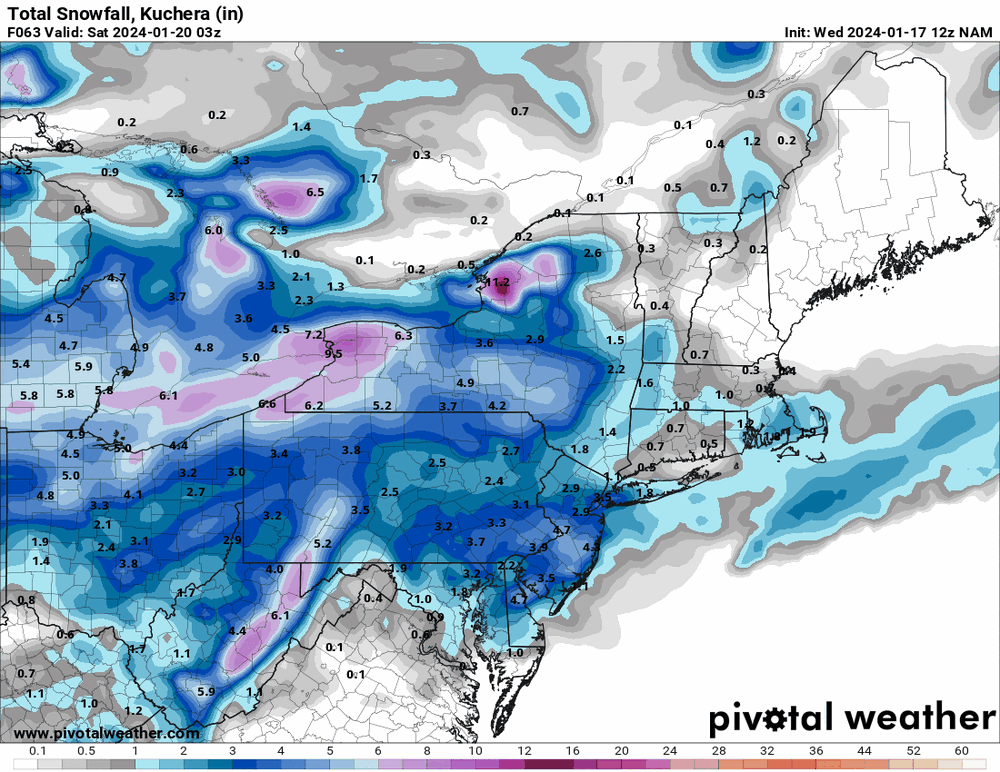
Now have SN with fine powdery flakes quietly building up a bed of frozen precipitation. Eyeballing about 1/2" so far IMBY, with temp at 26 and dp 24. My station anemometer and vane are frozen over (the station is about 7.5ft above the ground so would probably need a ladder to carefully knock off the chunk of frozen slushy snow sitting on top of it, without breaking the wind instruments). -
January 19, 2024 Powder Snow Event
Hurricane Agnes replied to Ralph Wiggum's topic in Philadelphia Region
It's showtime! At some point before 6:30 am here, I looked out and a burst of snow apparently came through and added a dusting to cold/untreated surfaces. Currently SN- and 26 with dp 23. -
E PA/NJ/DE Winter 2023-2024 OBS/Discussion
Hurricane Agnes replied to The Iceman's topic in Philadelphia Region
Yeah but the HRRR updates every hour so with each run, you have a new chance at winning! -
January 19, 2024 Powder Snow Event
Hurricane Agnes replied to Ralph Wiggum's topic in Philadelphia Region
Currently bopping between 29 & 30 with dp 20. I did finally clear my board this afternoon, so we wait. If the winds appear as progged, it might be tricky to get a good measurement assuming snow ratios will allow it to blow around more. -
E PA/NJ/DE Winter 2023-2024 OBS/Discussion
Hurricane Agnes replied to The Iceman's topic in Philadelphia Region
Gonna have to rely on the short-range models now though. The HRRR will become a friend. -
January 19, 2024 Powder Snow Event
Hurricane Agnes replied to Ralph Wiggum's topic in Philadelphia Region
There was something more recent although the band set up just to the north of Philly and Philly (at least IMBY) ended up in a dry slot for an extended period of time hoping for some kind of pivot and/or back-building (that did eventually come). Forgot what year but I am sure the thread is still here! -
E PA/NJ/DE Winter 2023-2024 OBS/Discussion
Hurricane Agnes replied to The Iceman's topic in Philadelphia Region

-
January 19, 2024 Powder Snow Event
Hurricane Agnes replied to Ralph Wiggum's topic in Philadelphia Region
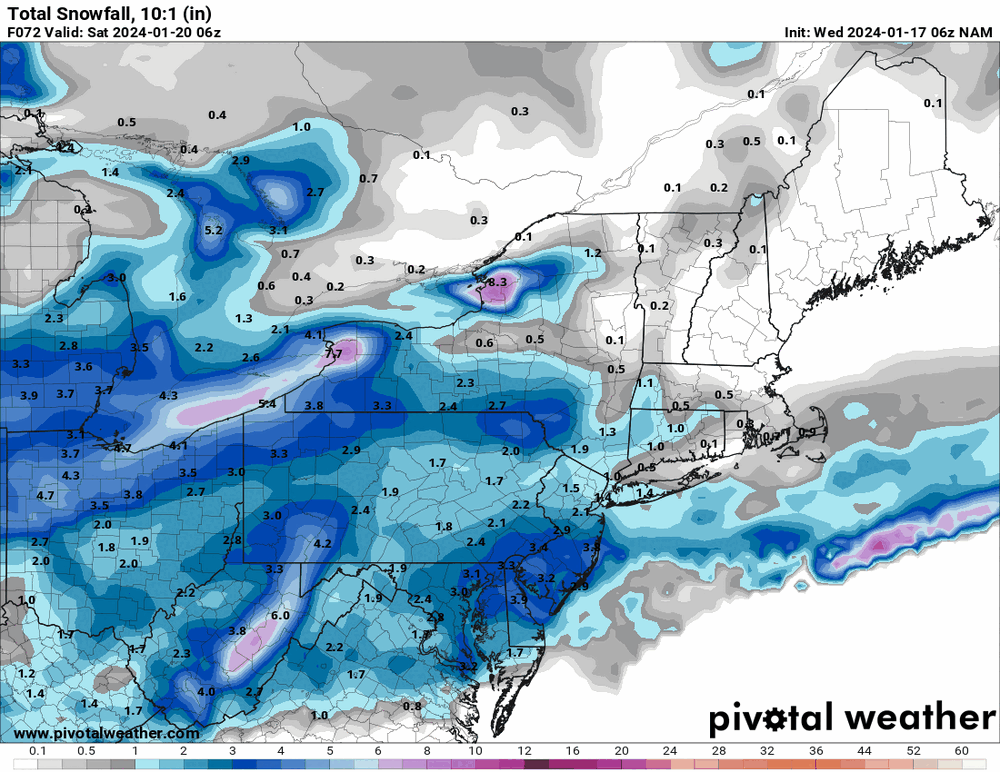
I actually made it above freezing today, with a high of 33 (when the sun briefly attempted to show through the clouds), a low of 19, and a dp as low as 5 earlier this morning. I meant to tell RedSky that I "saw him" in the east around sunrise before it clouded over, so I knew something was on its way. It's currently overcast and 30 with dp 19. The 19z NBM seems to have the max accumulation right along the I-95 corridor. I suppose a concern might be if a dry slot appears, which I recall happening with past Norlun setups (with one area under a death band and others with zippo).
-
E PA/NJ/DE Winter 2023-2024 OBS/Discussion
Hurricane Agnes replied to The Iceman's topic in Philadelphia Region
My high so far today has only been 23, which is my current temp, with dp 8. Have been getting some insolation of the snow in south/southwest-facing areas but anything that had melted after being treated last night, froze into a glacier. I did finally start clearing the car and there was a solid 1/4" layer of ice on top of a couple inches of powder. Mt. Holly's first cut + 3k 18z NAM and a WWA is up.


-
E PA/NJ/DE Winter 2023-2024 OBS/Discussion
Hurricane Agnes replied to The Iceman's topic in Philadelphia Region
12z 3k NAM.
-
E PA/NJ/DE Winter 2023-2024 OBS/Discussion
Hurricane Agnes replied to The Iceman's topic in Philadelphia Region
12z (12k) NAM. Take your pick.
-
E PA/NJ/DE Winter 2023-2024 OBS/Discussion
Hurricane Agnes replied to The Iceman's topic in Philadelphia Region
Was going through my station data and the December 2022 low (on Christmas Eve 12/24/22) was 5 here. That was my last single digit temp, and only one since I have had this station (got it in 2020). Before that there was an 8F on 1/21/19 on my previous station and a bunch of single digits during the first week of January in 2018. Temp is recovering now with the low now confirmed as 13 (12.9) and am up to 15 with dp 8. 12z 12k NAM is running and will soon see if there are any changes. -
E PA/NJ/DE Winter 2023-2024 OBS/Discussion
Hurricane Agnes replied to The Iceman's topic in Philadelphia Region

-
E PA/NJ/DE Winter 2023-2024 OBS/Discussion
Hurricane Agnes replied to The Iceman's topic in Philadelphia Region
Bottomed out at my current 13 (dp 7) as a low for the day so far, the coldest since a temp of 12 recorded IMBY back on Feb. 4, 2023. Looks like my anemometer froze over at some point during the storm yesterday. The 6z 12k vs 3k NAMs have interesting variations of a solution for Thurs - Fri.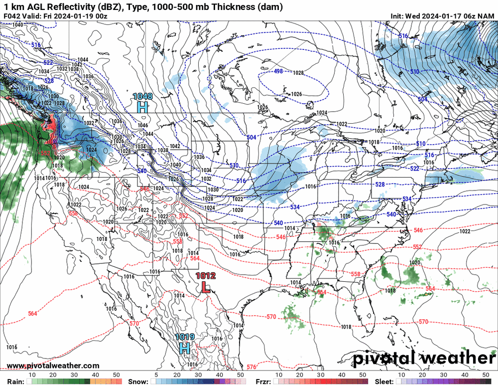

-
E PA/NJ/DE Winter 2023-2024 OBS/Discussion
Hurricane Agnes replied to The Iceman's topic in Philadelphia Region
18z GFS seems a bit out to lunch with the near OTS system but still showing precip (although maybe it's hinting at a fropa). I know it's not really good at mid-short term.
-
E PA/NJ/DE Winter 2023-2024 OBS/Discussion
Hurricane Agnes replied to The Iceman's topic in Philadelphia Region
They have a mobile version but for "Windows phone" only (I don't even know if M$ makes a phone anymore although I think they still have the Surface tablet). http://www.grlevelx.com/mrlevel3/ RadarScope is probably the best bet for mobile (also recommended by users of the GRLevelX products). -
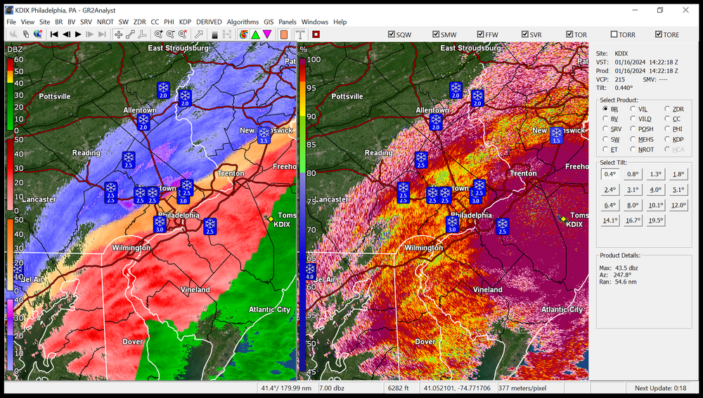
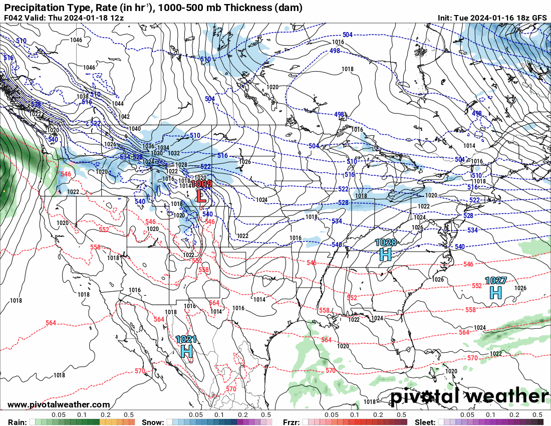
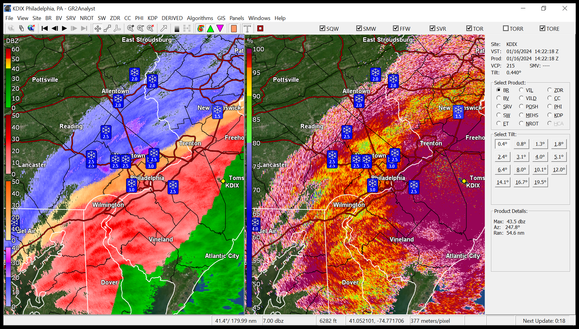
January 15-16 winter storm OBS
Hurricane Agnes replied to Hurricane Agnes's topic in Philadelphia Region
Looks like I finished up with 2.35" of snow/sleet (including the initial measurement and the remaining snow/sleet mix before the rain set in). At least this go-around, the sleet was never prominent - it was mostly snow and then ZR. My "high" ended up being 28. Currently 26 with dp 22. -
January 15-16 winter storm OBS
Hurricane Agnes replied to Hurricane Agnes's topic in Philadelphia Region
Still have ZR with a temp of 27 and dp of 26. The back edge seems to be near but don't want to touch the blanket of snow on the car. Makes me want to do like those old grandmas in South Philly would do - boil a pot of water, open the door and dump it out on the front stoop, and then come back inside and call it a day.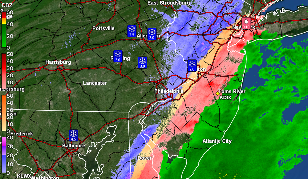
-
January 15-16 winter storm OBS
Hurricane Agnes replied to Hurricane Agnes's topic in Philadelphia Region
Going to try to avoid removing any of the snow from the car until this thing is done due to the ZR that will inevitably encase everything (as noted from folks above). Might be time for a Currently 27 with moderate ZR and dp 26.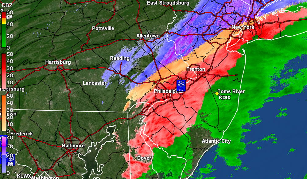
-
January 15-16 winter storm OBS
Hurricane Agnes replied to Hurricane Agnes's topic in Philadelphia Region
Looks like D.C. metro cashed in with 4 - 5" or more snow. Federal offices are "closed" (i.e., the buildings are as most down there have a WAH policy for inclement weather). Currently oscillating between ZR and ip and between 26 & 27 for the temp, with dp 26. -
January 15-16 winter storm OBS
Hurricane Agnes replied to Hurricane Agnes's topic in Philadelphia Region
Now getting sleet. Temp is at 26 with dp 26. Had about 0.1" from the final light snow before the rain and now sleet.