Hurricane Agnes
-
Posts
9,343 -
Joined
Content Type
Profiles
Blogs
Forums
American Weather
Media Demo
Store
Gallery
Everything posted by Hurricane Agnes
-
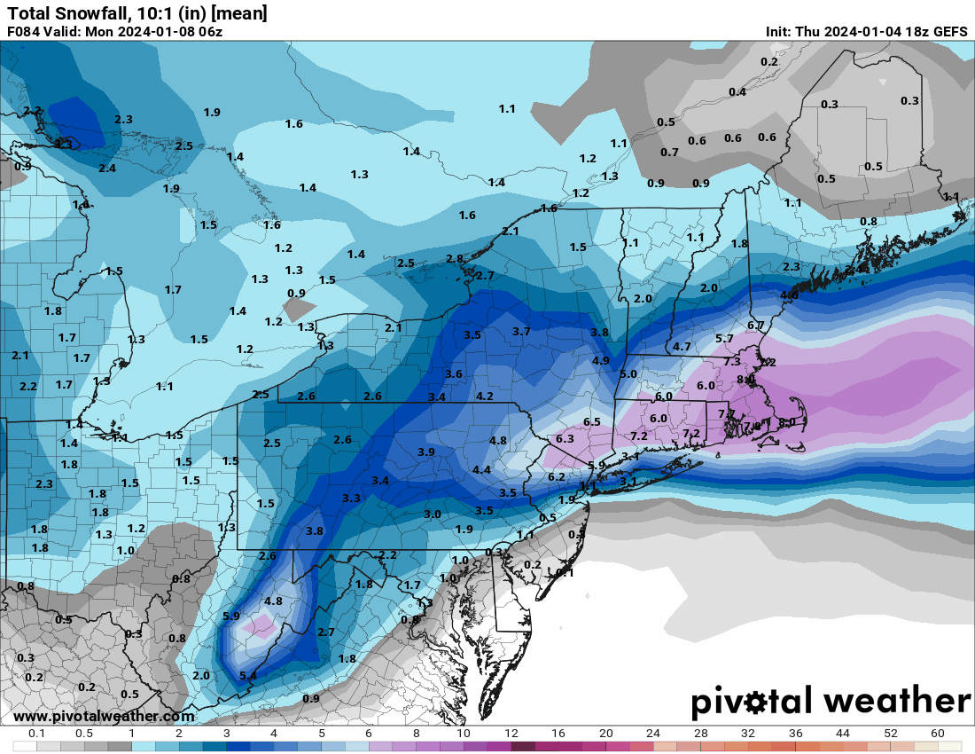
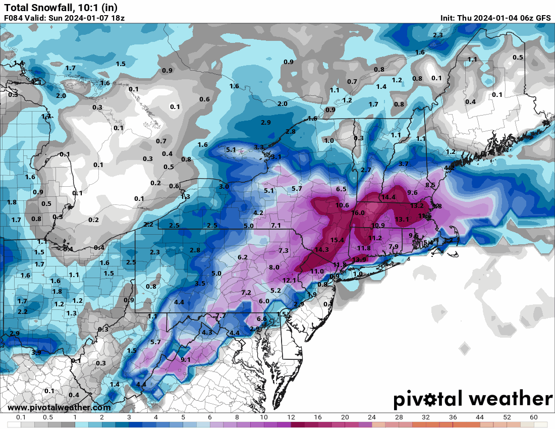
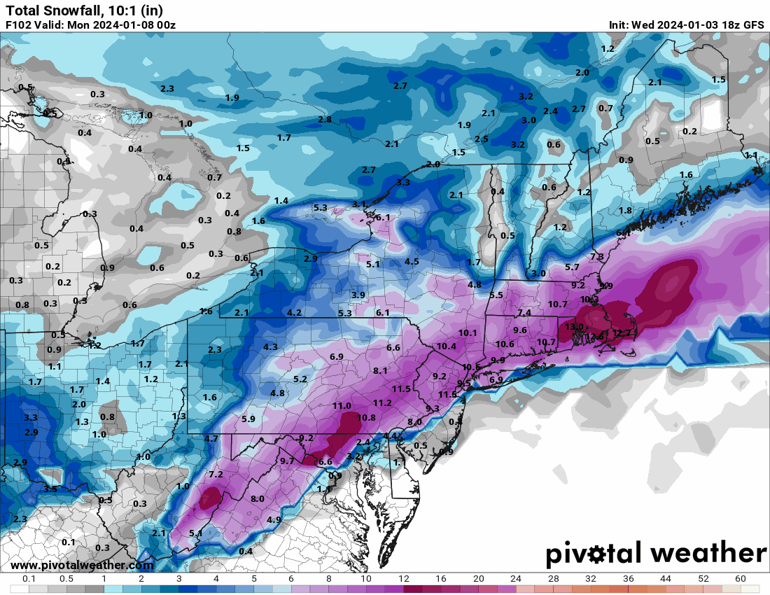
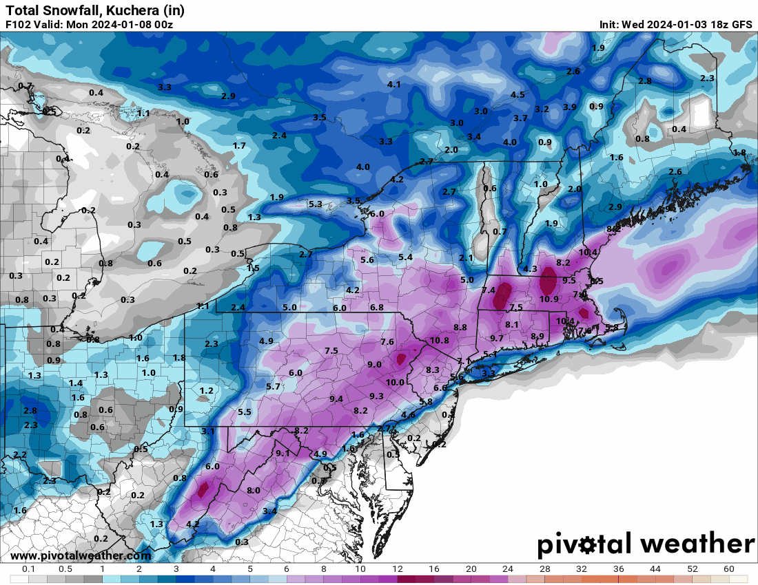
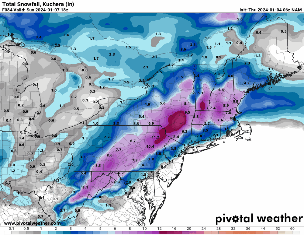
GEFS... (no matter what happens down our way, north of NYC and SNE look to be bullseyed)

-
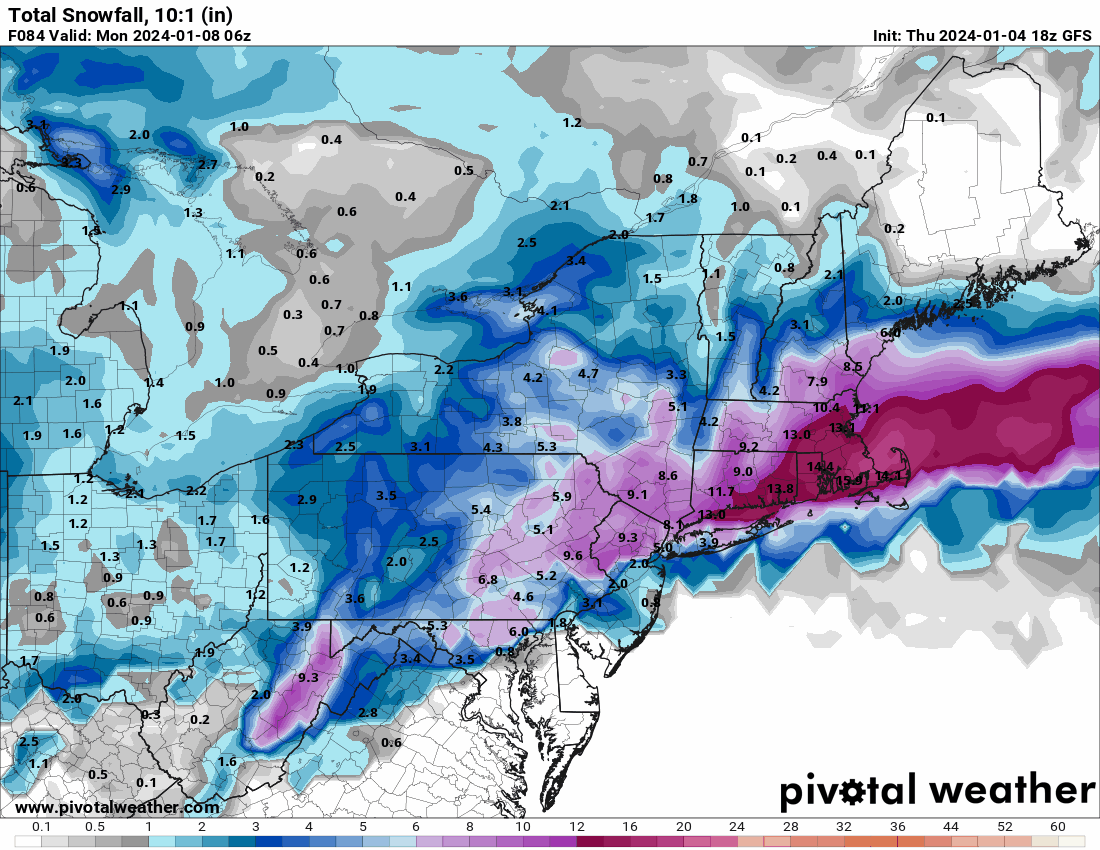
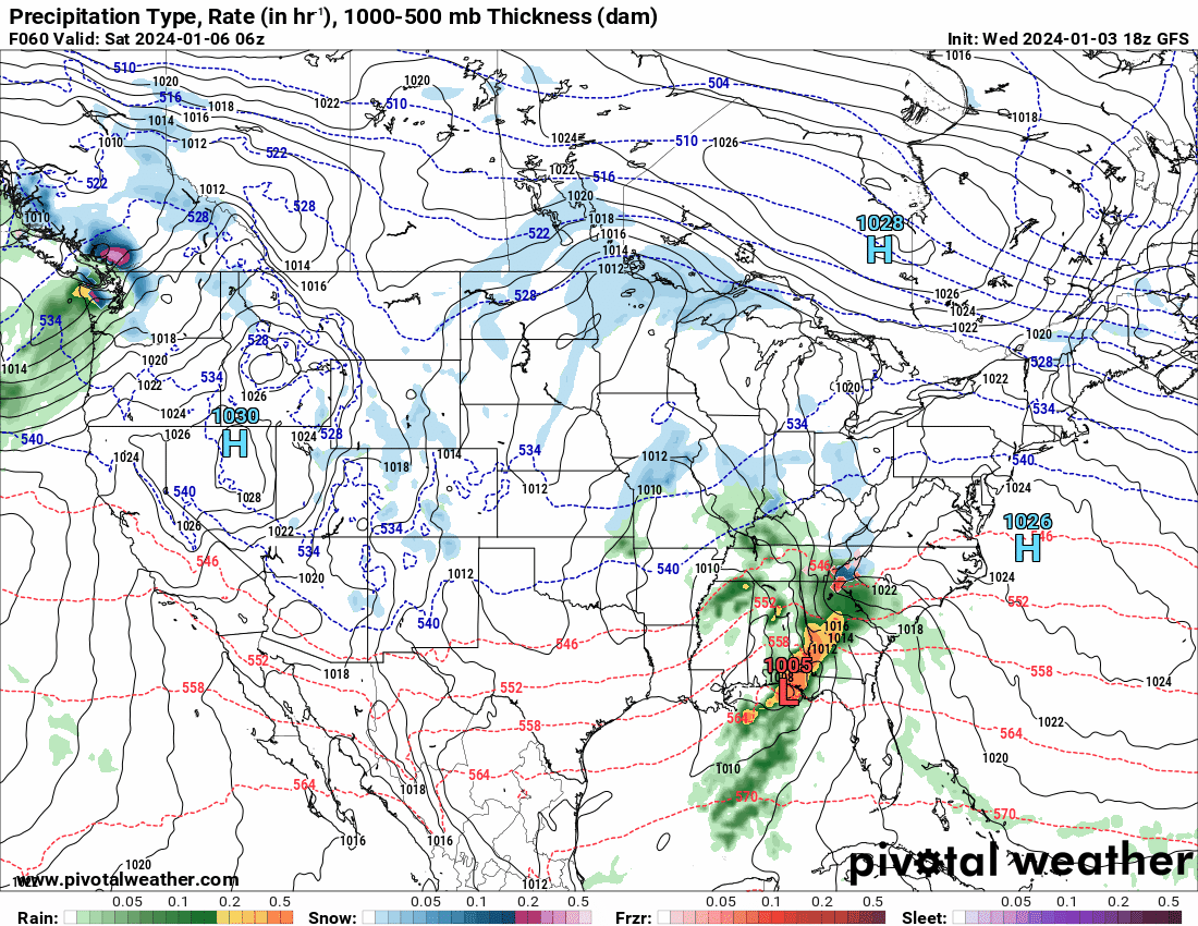
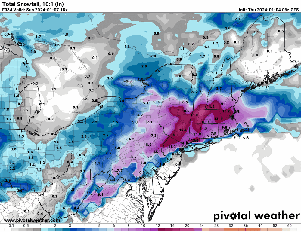
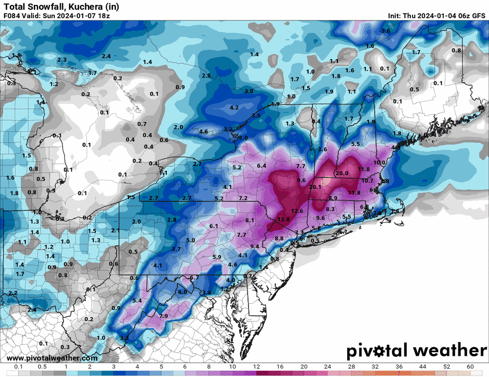
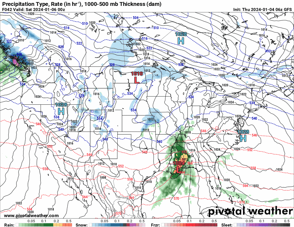
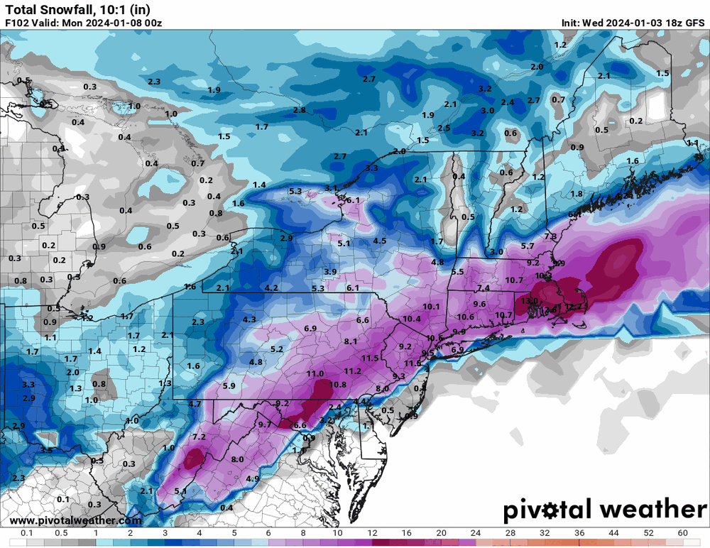
18z GFS obviously drier.


-
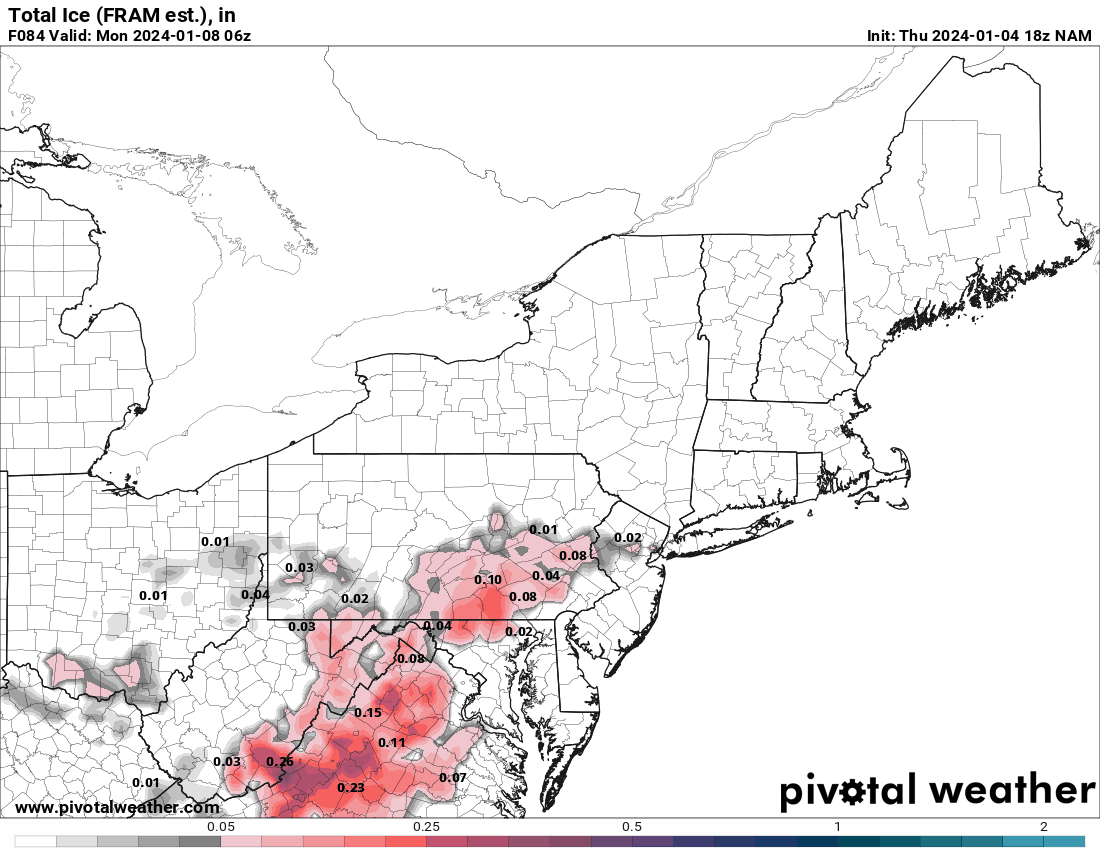
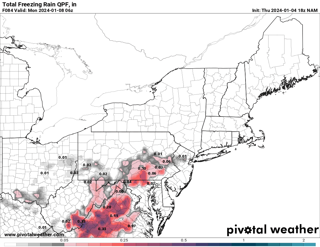
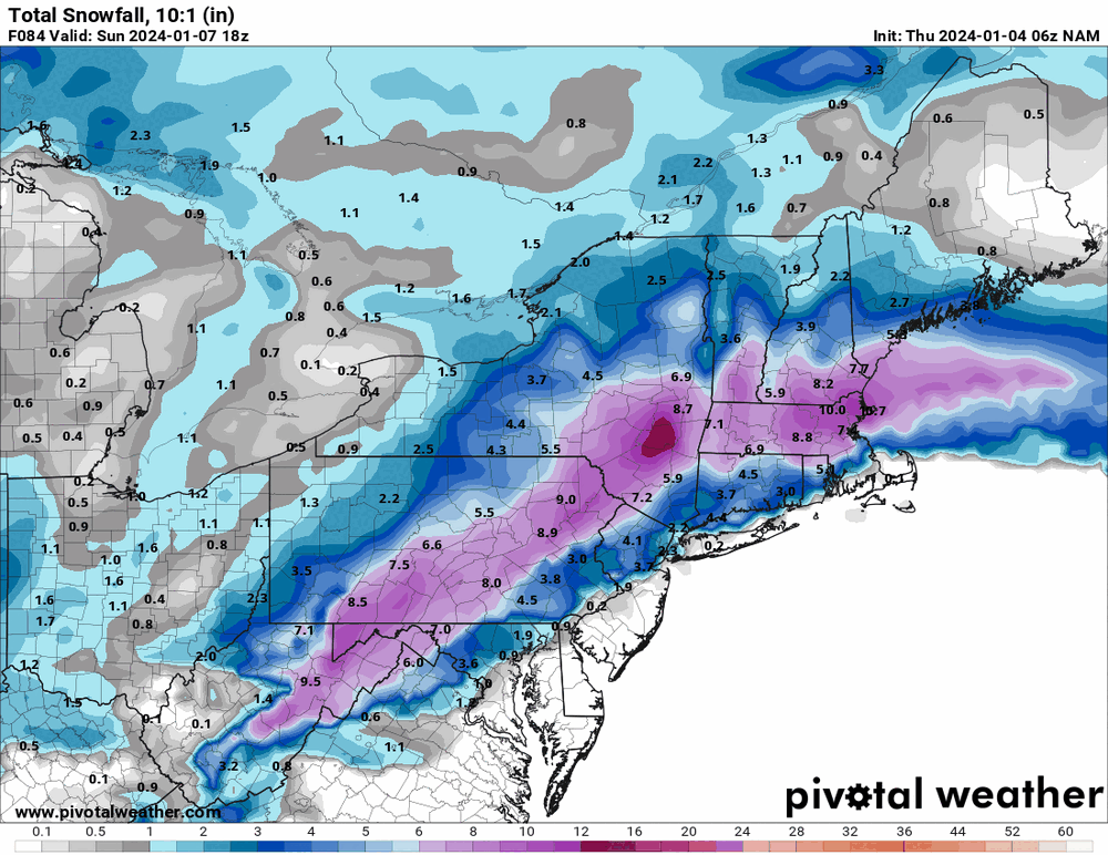
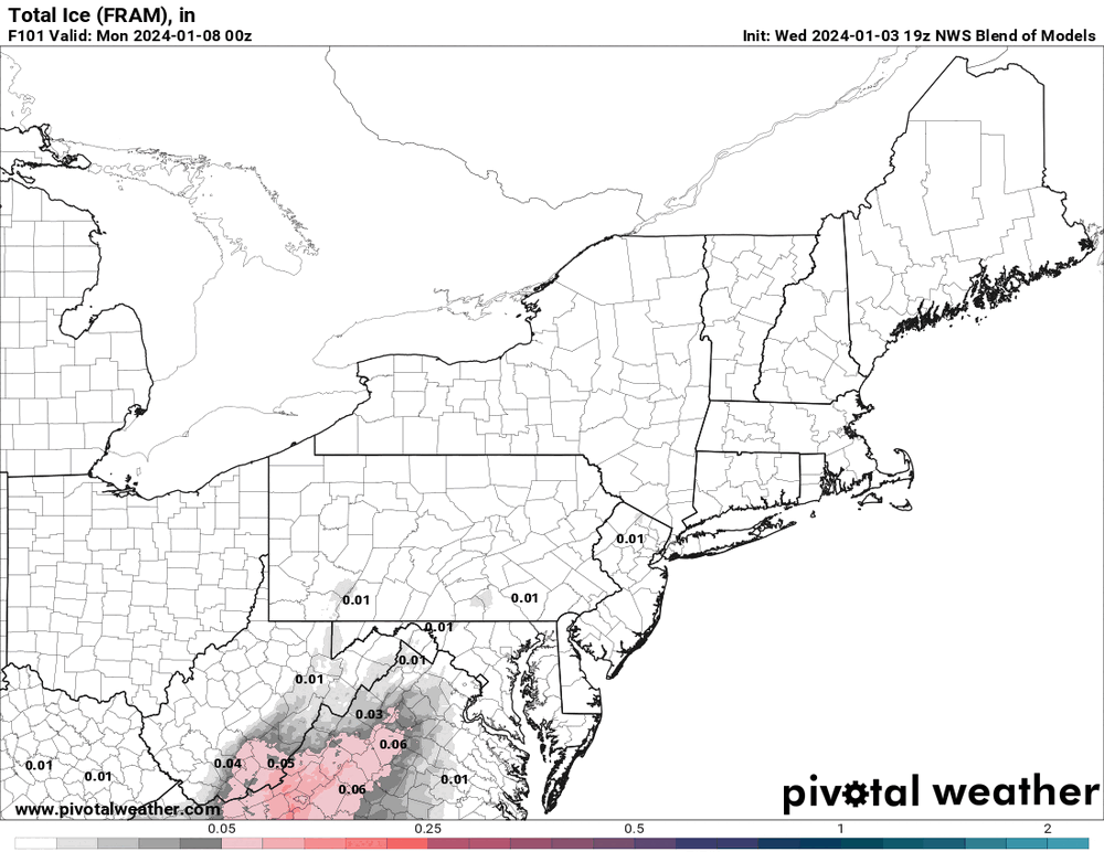
Note the NAM ice & ZR maps. 18z GFS is running but the 19z NBM ain't buying what the NAM is selling.


-
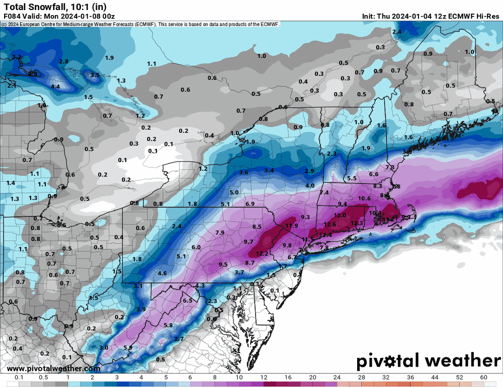
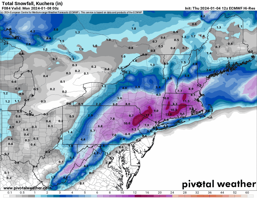
12z Euro out to 84.
-
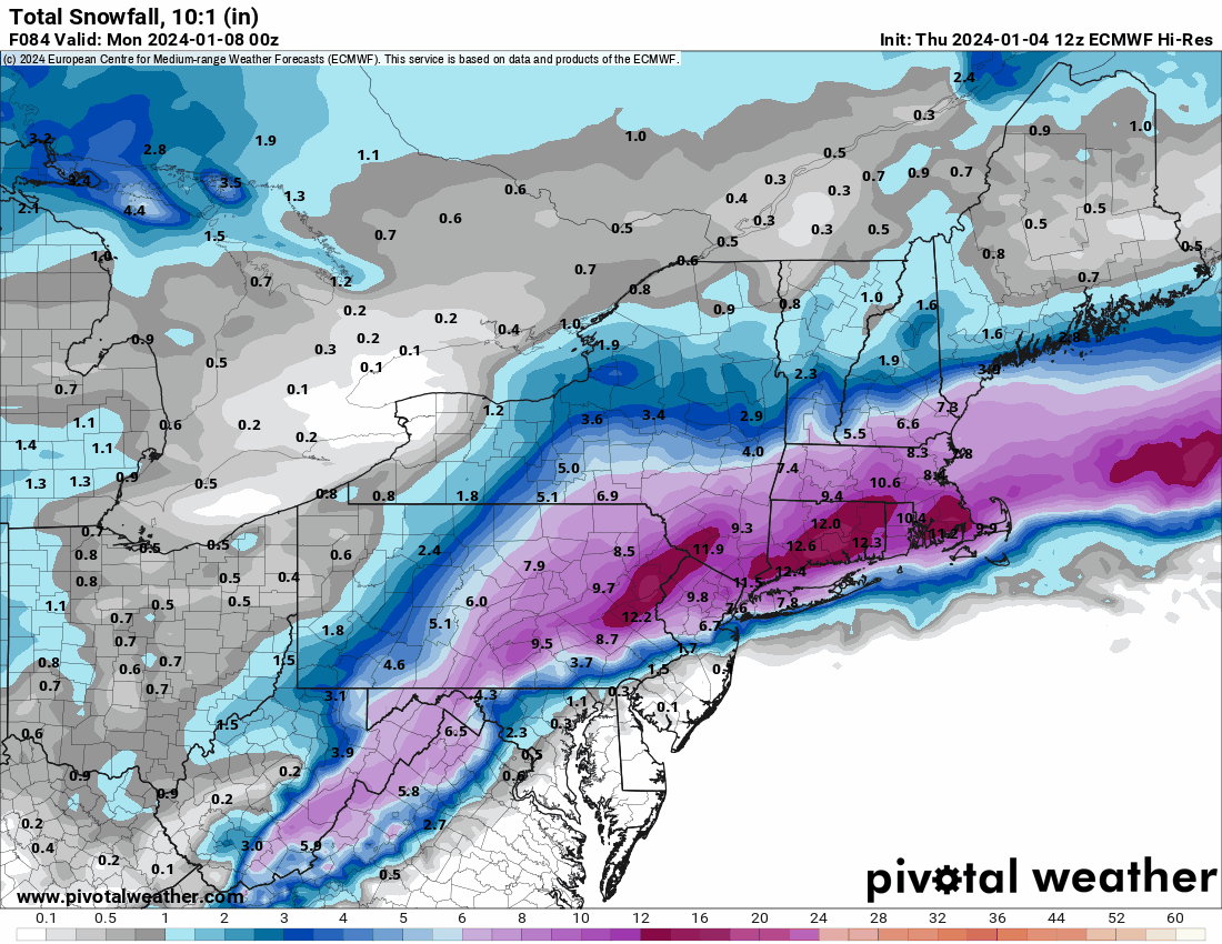
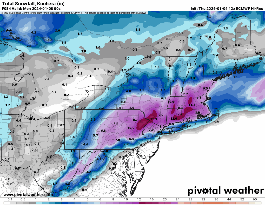
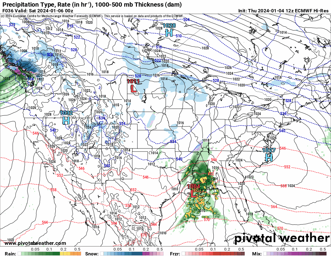
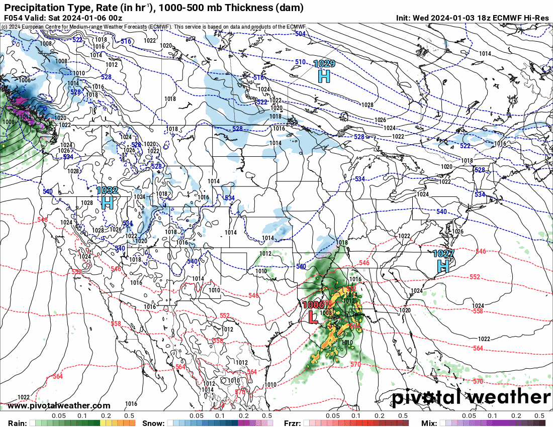
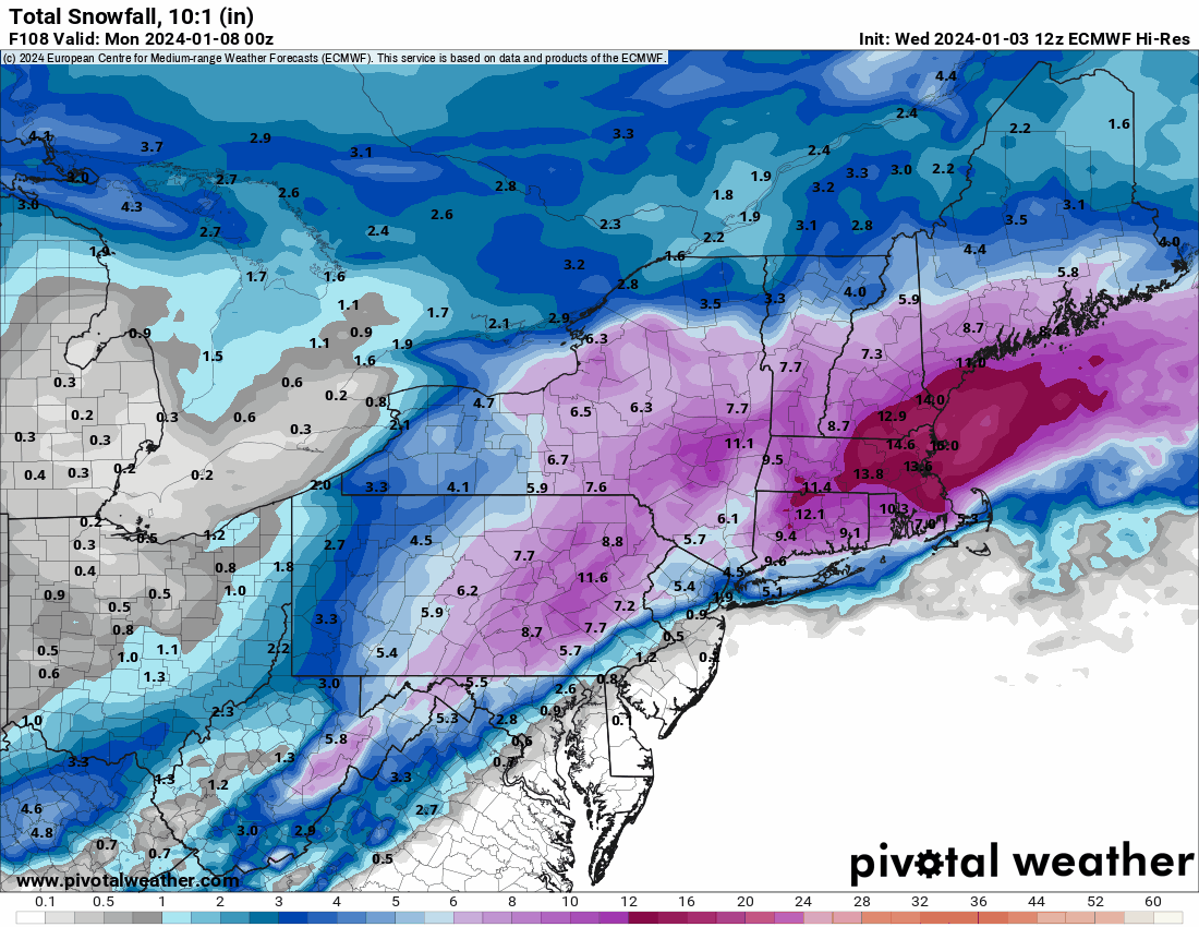
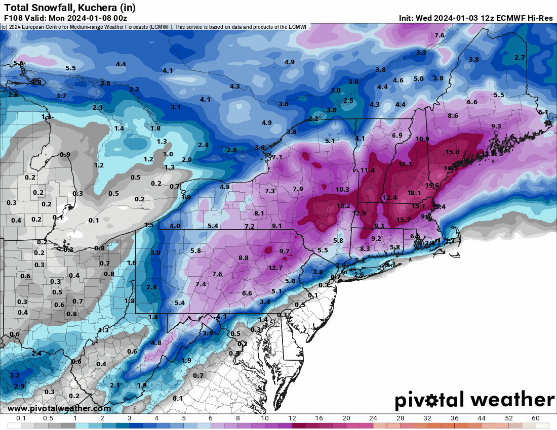
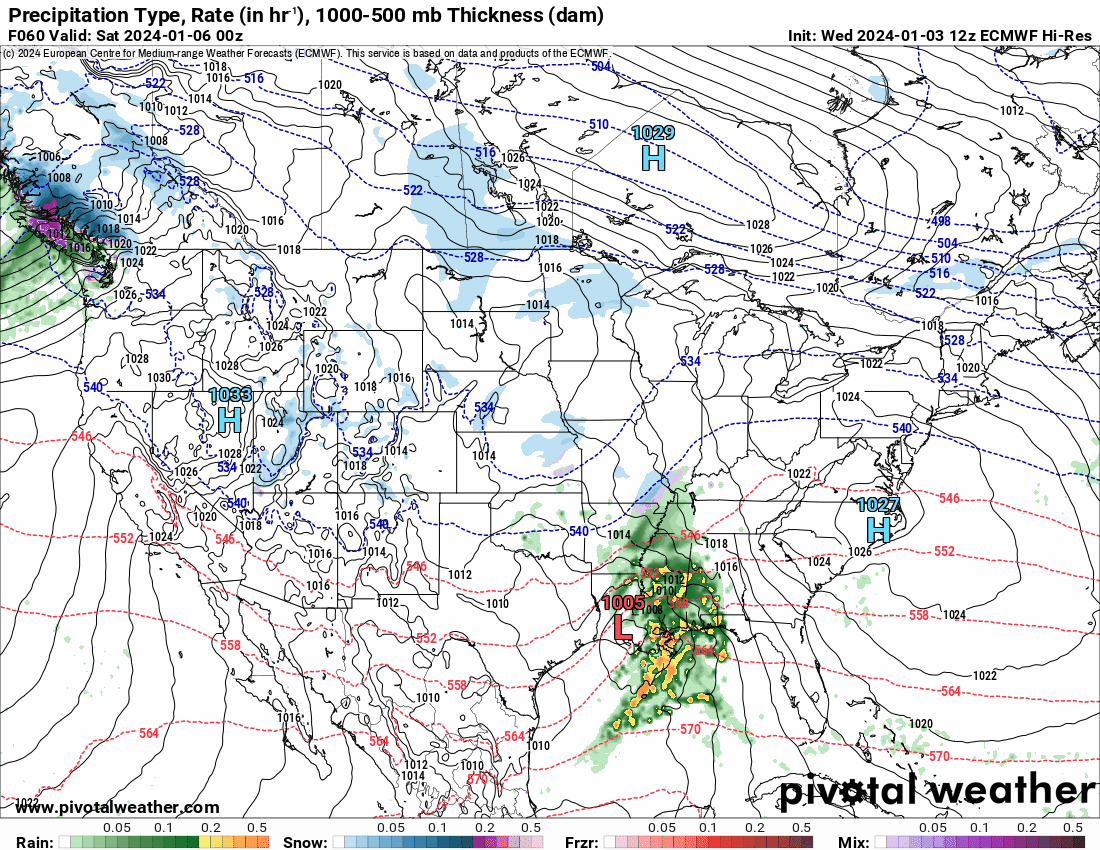
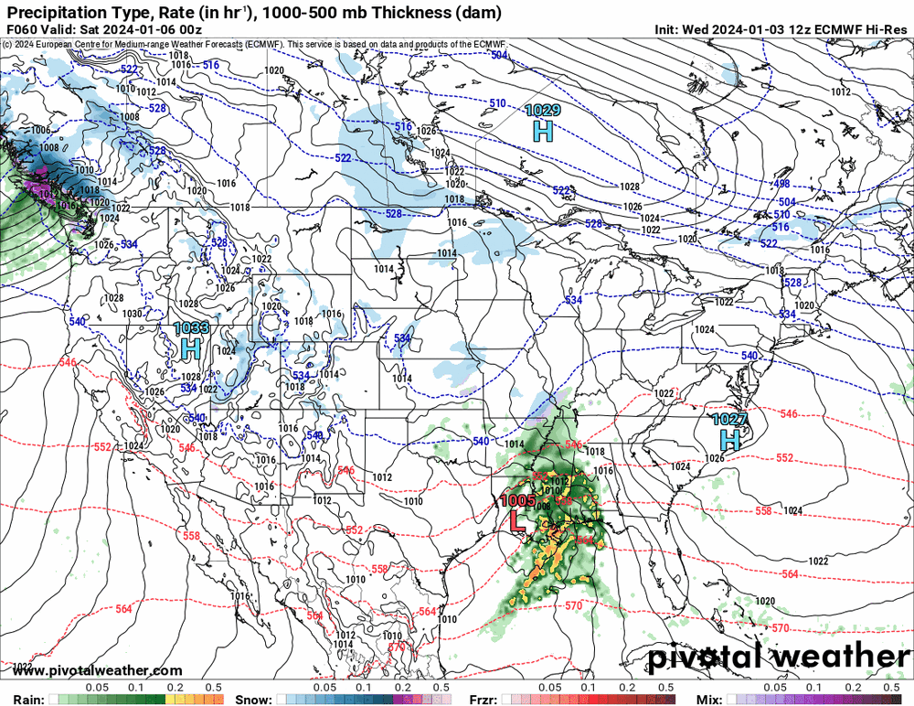
12z hi-res EC.

-
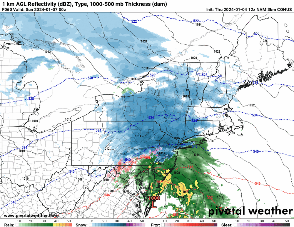
Hi-res NAM (last) hour 60 frame (coast scraping).
-
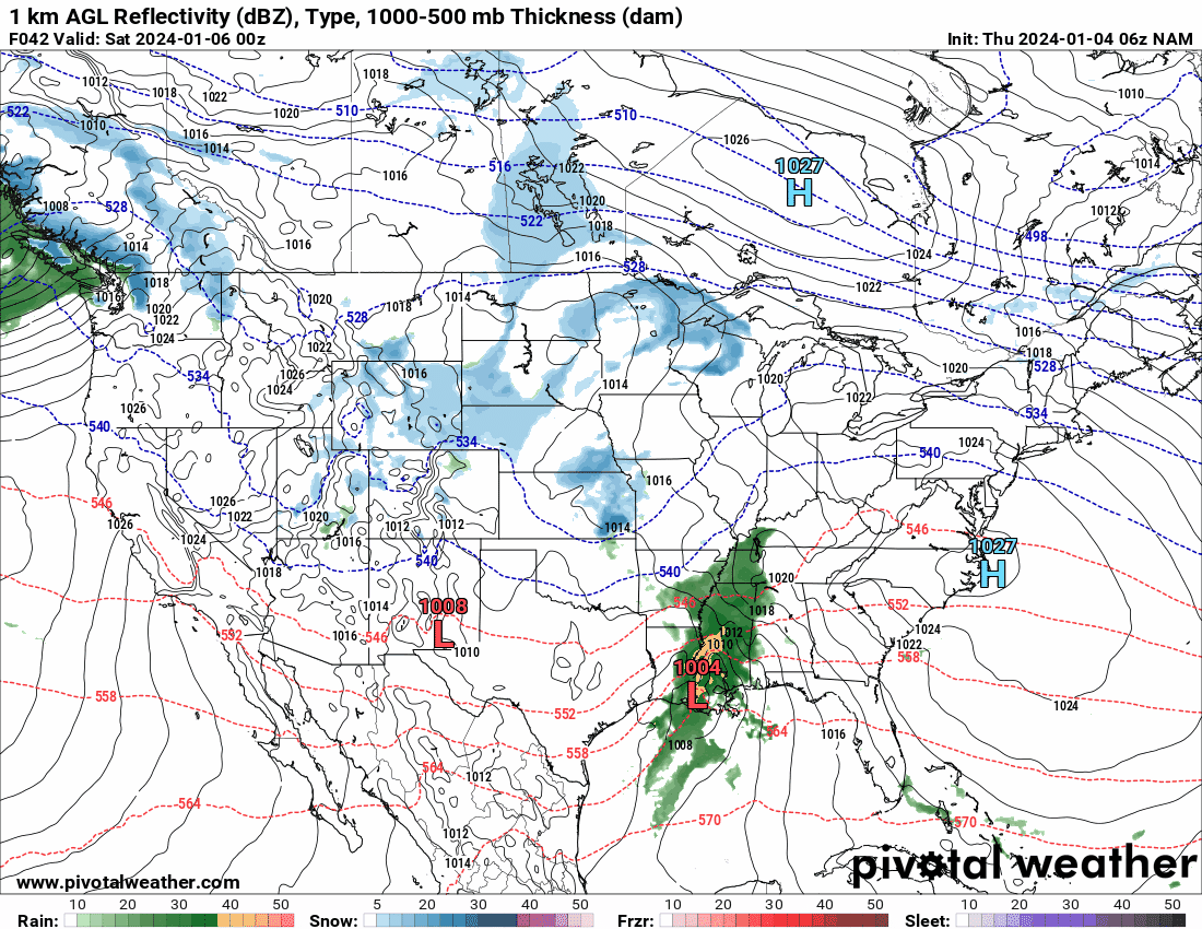
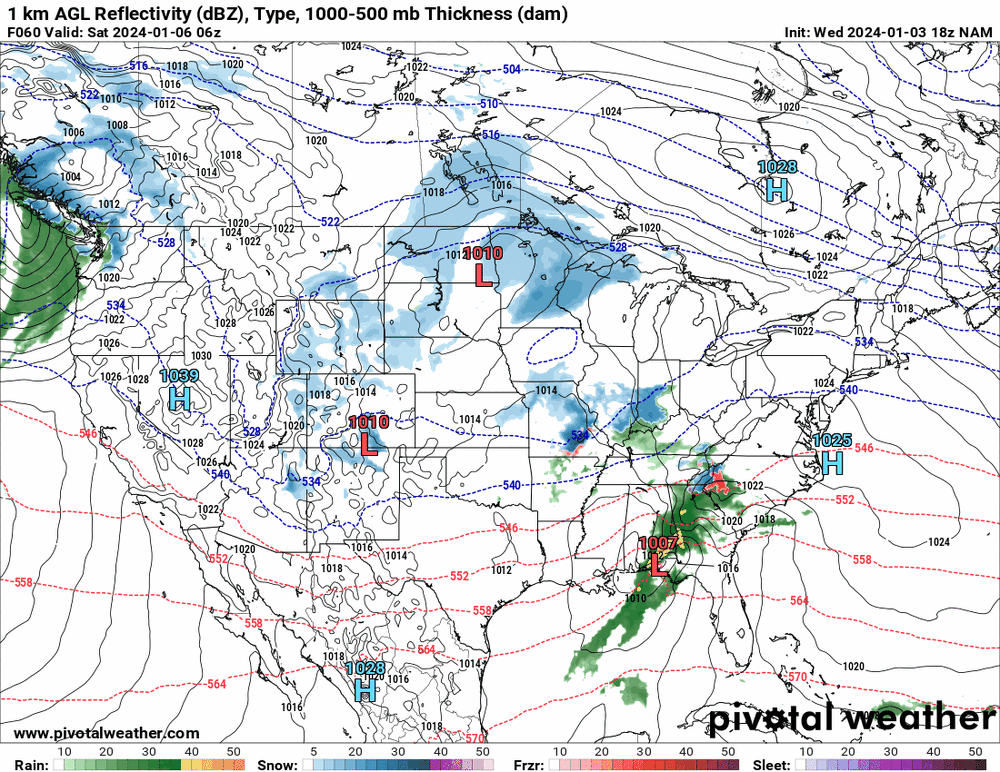
12z NAM is running right now (and we are coming into its range). Will have to see how it depicts any dynamics (since it is a convective model).
-
I saw this video this morning on a news site and thought of this group! This is where the snow went (on the other side of the planet).
-
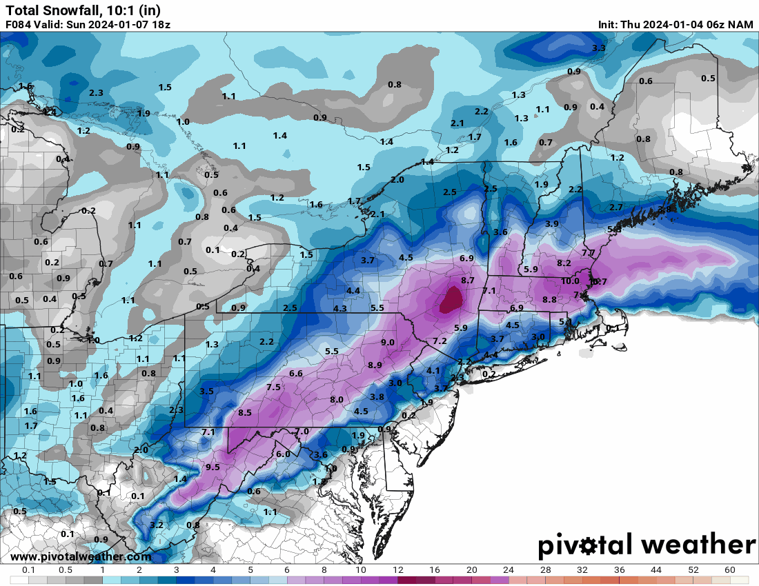
Interesting that the NAM is drier than the GFS.
-
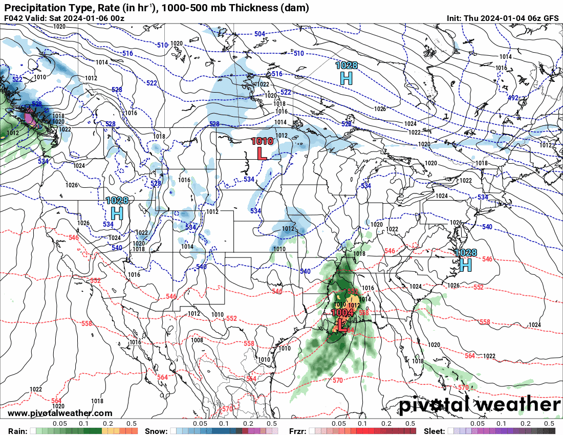
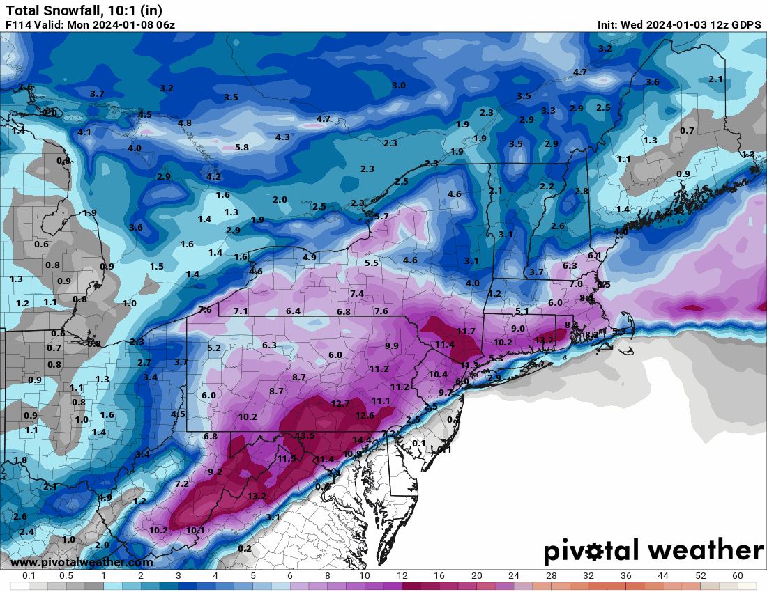
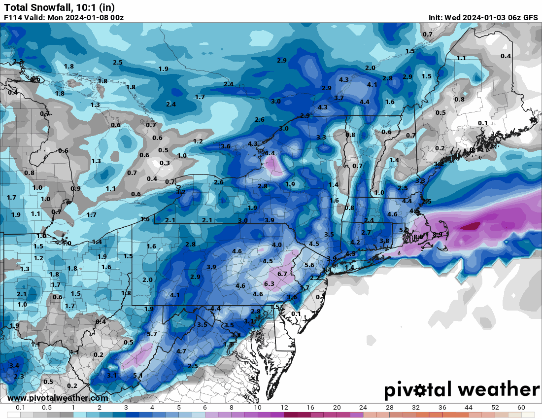
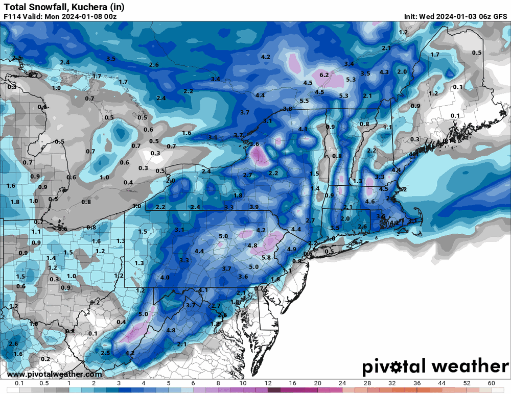
A couple 6z runs (GFS & NAM 12k). Coast-scrapers.
-
The 18z EC goes out to 90, enough to get the gist of the coastal. Looks like the wacky (or as the AFD had it "windshield wiper" solutions from run to run) GFS.

-
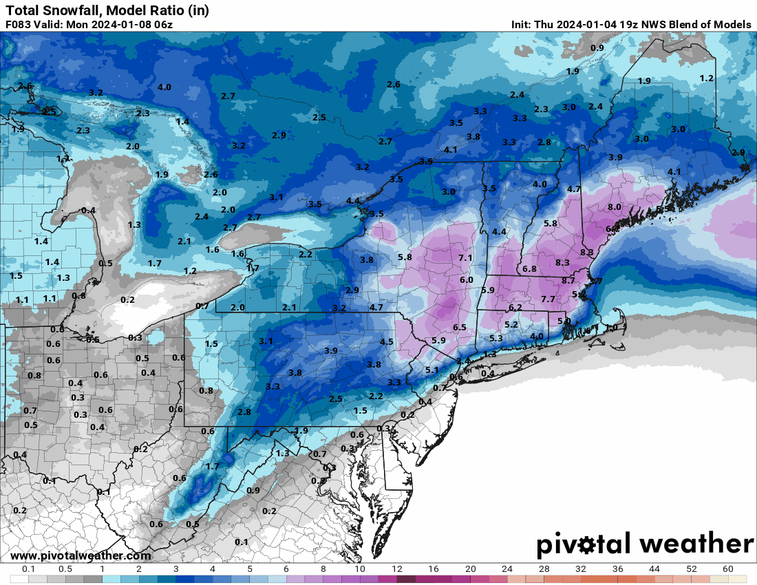
NBM has that built-in compromise... But the MA people further south from here look to be iced up real good.
-
Juiced!

-
The 18z 12k NAM is just barely in its range. Oddly it seems similar to the 18z GFS (although the GFS won't get off the Miller-B type transfer - maybe its seeing a double-barrel or stacked low or something).

-
12z Canadian for the heck of it, with the I-95 line...

-
Pick your poison.


-
12z hi-res EC -
-
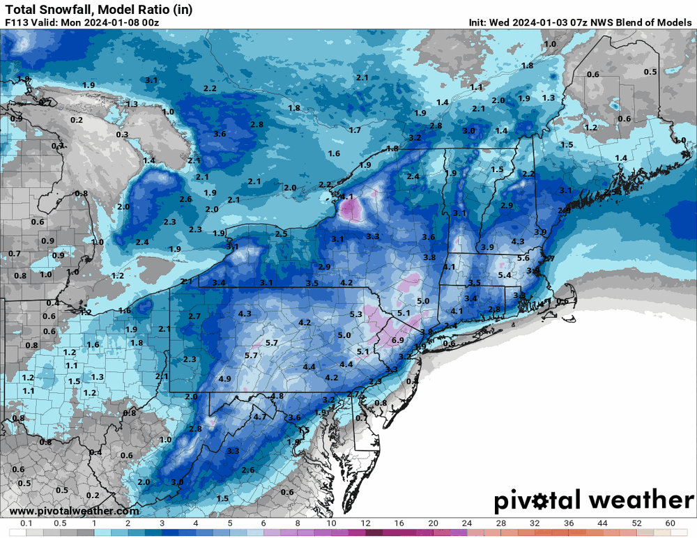
7z NBM snow...
-
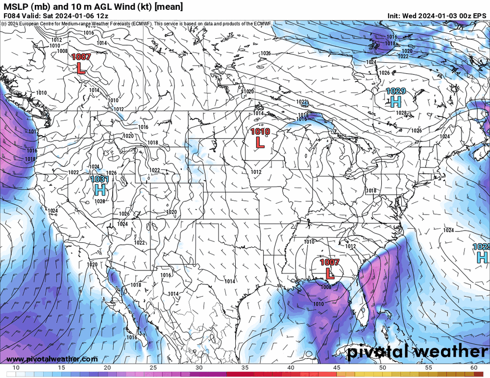
6z EPS -
-
Choice of maps...

-
6z GFS still has a 2-low solution but the 1st low goes shuttling off OTS far south and the other eventually emerges near the Chesapeake Bay. Looks to have a back end thump as it pulls away.
-
Yeah I had looked at the 850s and 925s but in general, "warmer" means more moisture the air can hold, so you get a juicier storm. And then you have warmish wet ground (wet from the previous storm's couple inches of rain), and it would hard to get some accumulation. I haven't tried looking for any soundings but some forecasts were mentioning sleet and if that happens, that might actually chill the ground enough to produce a frozen bed for snow to pile on top of. I know the year before last, we had piles of sleet.
-
We have this ocean temps issue going on too. Zoom in -
-
The models need data from when a PAC system finally comes ashore into California - I think expected within the next 12 hours or so (based on the HPC surface forecast).
-
Even then, it would be that wet heavy stuff. But I guess beggars can't be choosers.