Hurricane Agnes
-
Posts
9,343 -
Joined
Content Type
Profiles
Blogs
Forums
American Weather
Media Demo
Store
Gallery
Everything posted by Hurricane Agnes
-
January 9th Wind/Rain/Flood OBS
Hurricane Agnes replied to Mikeymac5306's topic in Philadelphia Region
Currently up to 57 with dp 56 and 2.47" in the bucket with moderate rain. The rope looks ominous.
-
January 9th Wind/Rain/Flood OBS
Hurricane Agnes replied to Mikeymac5306's topic in Philadelphia Region
Rain intensity has increased and am getting rain/winds against my front (which faces SW). Temp still climbing and up to 54 with dp 53. Have 1.70" in the bucket so far at post time. -
January 9th Wind/Rain/Flood OBS
Hurricane Agnes replied to Mikeymac5306's topic in Philadelphia Region
I bottomed out at 28 this morning and the temp has been rising steadily ever since and am at 51 with 51 dp. First measurable came between 10 - 11 am and the rates have been variable most of the day, with the heaviest happening (so far) between 4 - 5 pm. The winds started picking up more after 3 pm. Currently light - moderate rain and 1.28" in the bucket so far at post time. -
I was clearing out some old Inky News Alert email messages and saw one from a year ago today, where they announced that the Eagles snagged the #1 seed. Also had old messages about how right after the SB last year, our OC was hired by the Colts and DC by the Cardinals as head coaches. And here we are today. Despite the record leading up to this, those last set of Ws were stress-out nail-biters which foretold the future. Seems like the team has been "quiet quitting" the latter part of the season.
-
E PA/NJ/DE Winter 2023-2024 OBS/Discussion
Hurricane Agnes replied to The Iceman's topic in Philadelphia Region
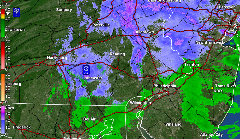
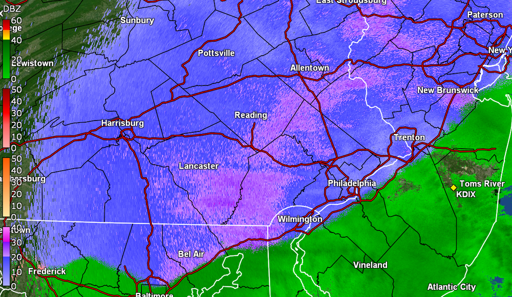
My low ended up being 34 this morning and I hit 40 for a high. Got one more hundredth of an inch of rain to make it 0.12" for the day & 1.30" for the 2 days, with 0.20" of snow yesterday. Since the temp stayed above freezing all last night and during the daytime today, whatever wrap-around snow bands came through here melted into drizzle IMBY, where a few miles north and west (which is more open) apparently resulted in some accumulation. Currently clearing (the sun even tried to pop out earlier today) and 38 with dp 32. -
My low ended up being 34 this morning and I hit 40 for a high. Got one more hundredth of an inch of rain to make it 0.12" for the day & 1.30" for the 2 days, with 0.20" of snow yesterday. Currently clearing (the sun even tried to pop out earlier today) and 39 with dp 32.
-
Some junk-n-stuff incoming although 1 little band has started to fizzle as it approaches the city. Currently, the temp here has dropped to 34 with dp 33 and I have picked a total of 0.11" of rain this morning from the light rain (2-day total 1.29"). Have a find mist/drizzle going on at the moment.
-
PNS as of just after midnight - PHL <1" event streak continues!
-
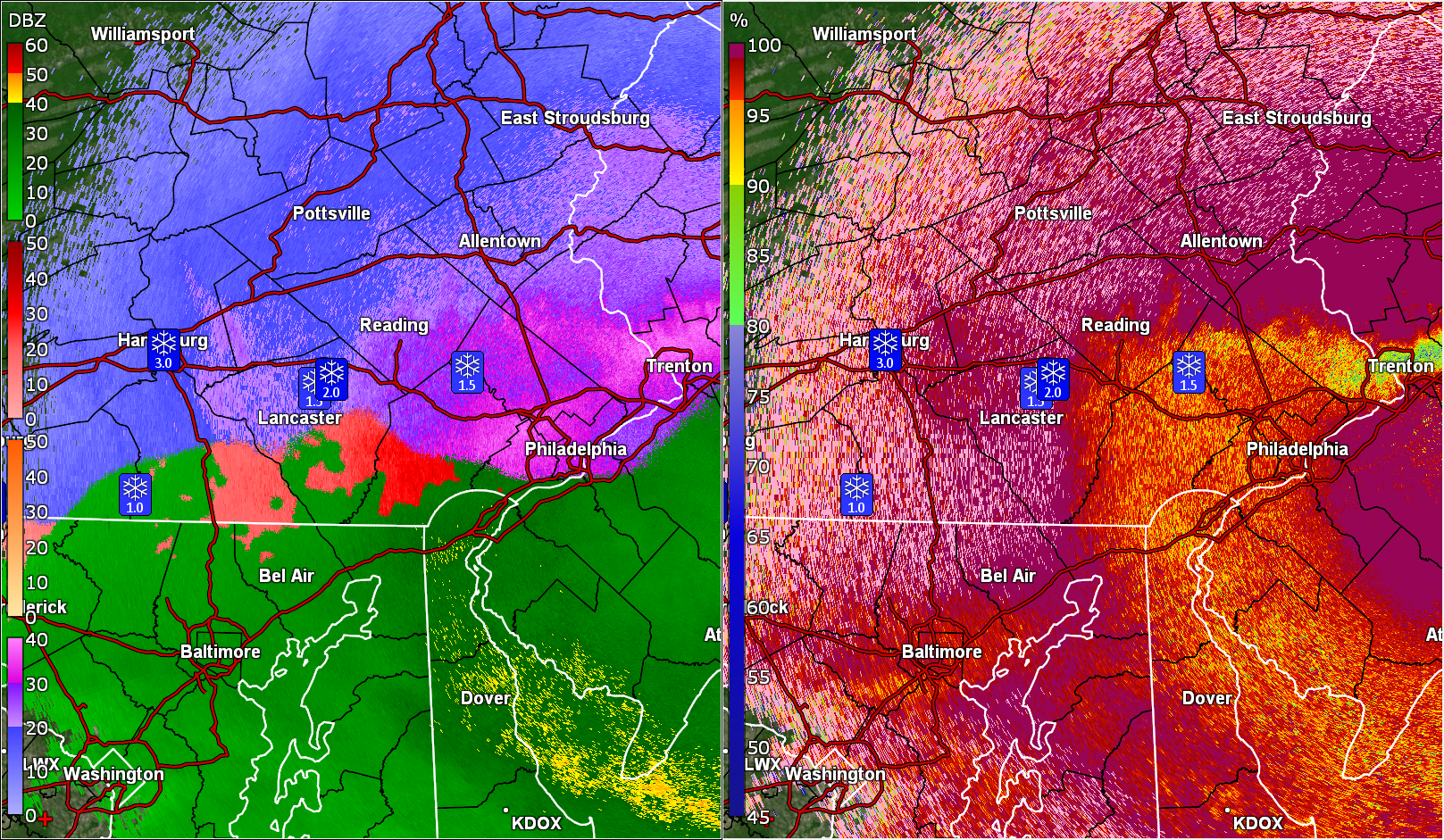
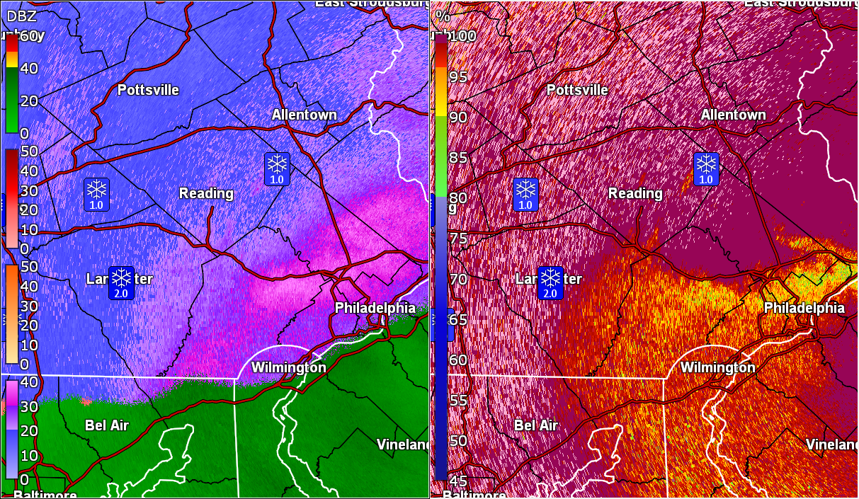
So far, it looks like I finished up yesterday with 0.20" of snow and 1.18" rain/sleet/snow mix. Am still getting some backwash light rain/drizzle this morning and so far have 0.06" (1.24" for a 2-day event total so far). Whatever slush that had remained on the cars and grassy surfaces after the transition, is all gone. Currently have light rain, low stratus, and a temp of 35 with dp 34.
-
Temp has dropped back to 36 with dp 36 and 1.13" rain. Lows are upon us and are pushing to the NE.
-
Temp continues to rise here in NW Philly with steady rain. Currently 37 with dp 36 and 0.89" of rain registered so far.
-
Warming continues with the light rain. Now up to 35 with dp 35 and 0.54" rain.
-
I think a mix line is getting close to you guys up there. Currently 34 here in NW Philly with dp 34 and 0.41" in the bucket (post freeze-up) and light rain.
-
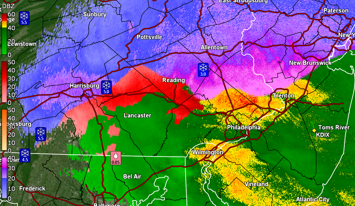
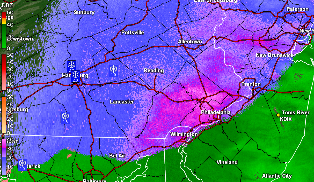
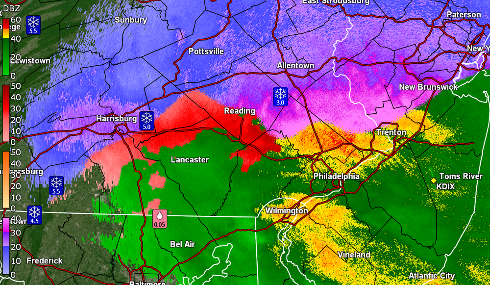
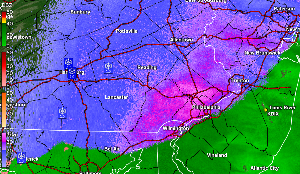
Temp 34 with dp 33 and moderate rain. Have 0.35". Still have slushy snow on the car and some colder grassy surfaces. Saw the spotter reports of 5" and 5.8" in Hershey & Cashtown (Adams Co) before they got the transition to sleet and rain.
-
My station gauge bucket finally tipped with a glug and now have 0.14" (expect it would have been much more but will need to wait until the storm is over and I go out and check the Stratus). Still have light - moderate rain and its 33 with dp 33 and southeasterly winds picking up.
-
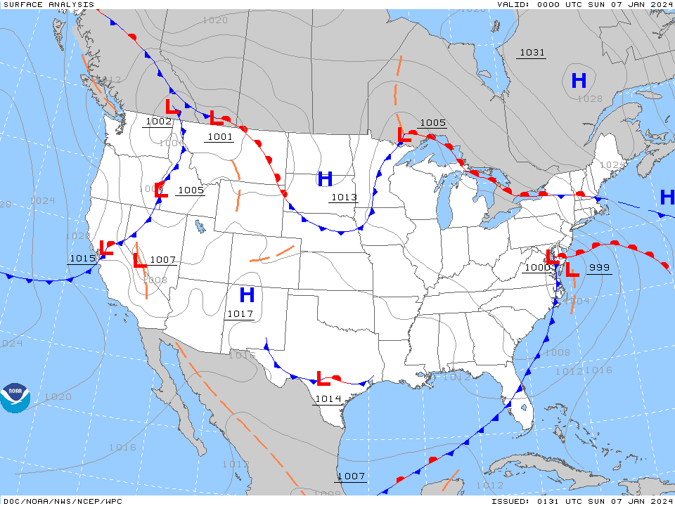
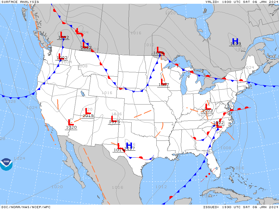
Once the low goes out into bay/ocean and eventually starts to move NE, there should be some wrap-around. Here're the "2" lows! ETA - remember the models kept have "a low" hop skip jumping around.
-
Temp now 33/dp 32 with light to moderate rain and lots of slush/melt. My rain gauge bucket is frozen at the moment so don't have a reading but do have a Stratus out there to get whatever the final total at some point.
-
Temp is creeping up now and am at 32 with light rain and dp 31. Sidewalks that did manage to cave are now wet.
-
And the changeover is in progress. Now getting light rain mixing in with some ip and flakes. Temp bobbing between 31 and 32 with dp 31.
-
My Upper Darby sis said she has had sleet for the past 1/2 now. For Haz...
-
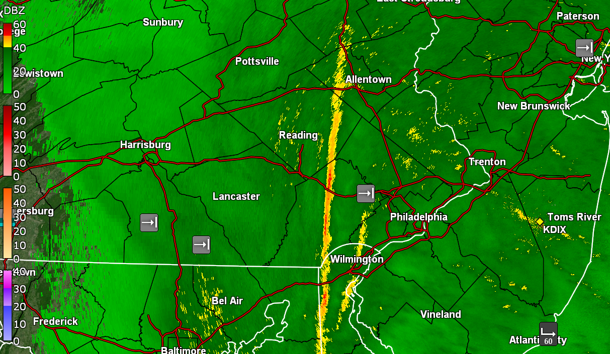
My SN with pancakes now has sleet mixing in. Temp down to 31 with dp 30. Measured 0.2" of a coating on cold/untreated surfaces. Classic sleet bright blob on the radar.
-
Thank you!
-
Still have light snow but now getting car topping of it as the flakes cool the surfaces. Temp now down to 32 with dp 30. Am seeing a heavier band to my west that some are under at the moment. Need some Jersey input for how accurate (if at all) that rain/snow line is.
-
Have been getting variable rates/flake sizes but it's now starting to stick to the grass and mulched surfaces. Still holding at 33 with dp now 29.
-
Have flakage going on. So far melting on surfaces. Temp is 33 with dp 28. Upper Darby and Wyndmoor sisters reporting flakes as well.