Hurricane Agnes
-
Posts
9,336 -
Joined
Content Type
Profiles
Blogs
Forums
American Weather
Media Demo
Store
Gallery
Everything posted by Hurricane Agnes
-
Since you mentioned that, here is the latest PNS (as of 6:47 pm) -
-
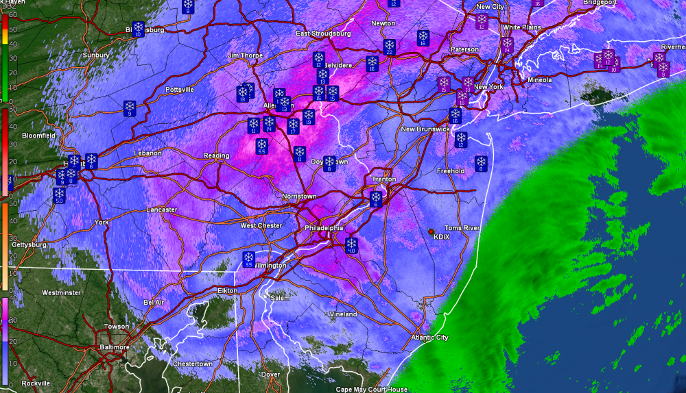
Holy crap! I just looked out and yes, some more pieces of the bands have wrapped back around over here too and people who had cleared off their cars have them completely sugar-coated again. And it's currently snow here - SN- but definitely there and pretty steady. Looks like a heavier snow blob developed over here between 6:30pm - 7:30pm. The storm that keeps on giving. There's a broad circulation wrapping bands around PA that is pretty fascinating and the coastal continues to meander due east. Currently light snow and 30.
-
You are about 4 or 5 miles from me as a note (I bought my current car at a dealer on the Fairway) and since you recently moved here, then you missed 1996 (which was a multi-day event but one that bulls-eyed this area like this storm did further north of here). After I had cleared off a chunk of my board, despite the somewhat marginal temps, I did get about 1/10" of a dusting that survived and the on and off flakes have pretty much ended (outside of possible flurries that might pop up here and there), so will call the event 10.1". Temp still sitting at 34 with dp 30, and mostly cloudy.
-
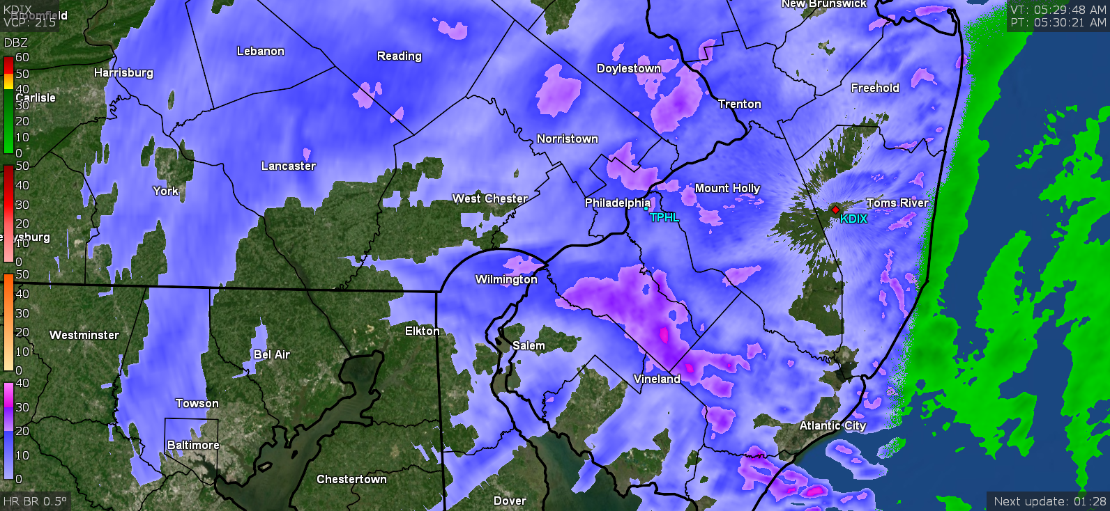
Snow picked up again and went from mood flakes back to varying between SN- and SN. Temp is up to 34 so some melting going, plus the sun is trying to break through the clouds but not quite there yet. There have been undulating breaks in radar-indicated precip but stuff still continues to generally fly from the sky. The little band over the area has shifted from a N --> S orientation to a NNW --> SSE flow as it slowly pivots.

-
Did see the sun attempt to show a few times the past hour but it has also been quickly clouding over, so it never full came out and was behind hazy clouds. Finally got out to measure on the board (and a few other flat spots) and got 10" (compacted underneath) almost on the nose. I carved out a portion of snow from the board to look at layers and found a 1/2" layer of sleet pellets with a semi-solid thin layer above that of what I expect is compacted snow from the FZRA that was part of the "mix" (at one point, all FZRA) before the snow came back in earnest and smooshed it. So on top of the initial 4.5" on Sunday, I literally picked up at least 5.5" from about 2 pm yesterday (Monday) afternoon when the snow started up again after a 14 hour sleet fest, where the snow continued through Monday night (which was probably the heaviest) and into early this morning. I forget to take the funnel and inner tube out of the Stratus so I can do a water content from it and don't feel like trying to traipse through the snow to get to it to do a "core" sample for water content, but I know the last "significant" (if you can call it that) snow we had back in December, I had calculated an approx. 6:1 ratio IIRC, and am noticing this is a bit "wetter" than even that snow. Currently have some on and off mood flakes and 33.
-
You are welcome They think the low might get cut off and then start drifting further out to sea and then eventually get absorbed into another low on its way towards New England and the maritimes. So there may be on and off bandlettes (my term) of precip today) Temp here ticked up another degree and am at 33.
-
Still SN-. Temp has actually hit 32 here so there is a small amount of melting going on. Low is out there off the coast spinning! Looks like the diffuse band has pivoted from a NE --> SW orientation to a N --> S orientation.

-
Almost every plant in your yard is also a potential "deer feeder".
-
Need an electric fence around that (but then it would become its own "snow fence" at that point)!
-
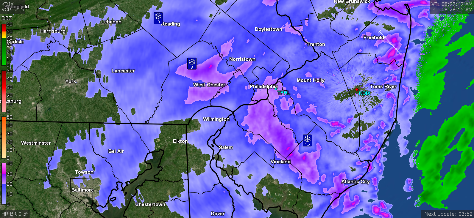
Still going here with with upped intensity to fine-flaked SN. Temp is down to 29 with fog. Still sitting under an undulating "flow" of various snow intensities. My back faces NE and the snow drifted up against the door (there is 1 step before getting to the ground level) so pushing the storm door was required to push aside about 4" that drifted on top of the 8" from the doorway to the ground. Mt. Holly mentioned "nickled and dimed" 1" - 2" additional accumulation today in their AFD and I believe that if this continues.

-
There are and will always be people who DO "pay attention to that" and other things going on and do not always model hug (there are/were multiple lows swirling around those directly associated with this storm, including a weak one that rolled off the coast of the Carolinas). My own personal analogy to trying to nail down a Miller B is somehow creating an algorithm that can determine where an Olympic long-jumper will land at the end of a jump, once they start their run, and finally launch themselves off the ground. There are all sorts of parameters associated with that process and the use of statistics, although helping to narrow the possibilities, still introduces errors that really can't be helped due to other factors that can impact result (the runner and their vitals, the track type and conditions, the air conditions, etc). You can ballpark it but that is about all. Sometimes "common sense" needs to be used. When one storm weakens and starts to die out just as another one starts to form some distance away, and you are located somewhere between them, then that equals "dry slot" (an area of little or no precipitation). In other words, you are now "between 2 systems". There really is nothing more "complex" or "meteo" about that. I do agree that climate change is impacting these models in terms of an assumption that they are including some type of typical "climo" data (i.e., based on some past "x" years of weather conditions to determine what is "more likely to happen" in a particular case). There will always be a "freak" set of circumstances that will be outliers but I think other factors, like climate cycles, are also hard to nail down to include in that "climo" data, and might or might not be used in a model. For example, the current PHL all-time record low of -11F (2/4/34) since record-keeping began back in 1870 here, hasn't been matched again (yet). And so far, since 1994, the city still hasn't registered a temp below 0. The heat island (often mentioned by Paul) is real. The city's defacto building height restrictions were breached in the mid-80s and the skyscraper construction since has created a dense masonry/metal/glass heat sink. This area's proximity to a HUGE body of (relatively warm) water means an increased possibility of large precipitation events, any time of the year. It's that simple. Whether it is a noreaster in the winter or a hurricane in the summer. I have taken note a couple decades ago when the Carolinas were plagued with ice storms. That phenomena gradually moved north including this area - notably 1994 when we started getting an increase in ice storms. It was sortof the canary in the coal mine (1996 aside). That also corresponded with the year with the last below 0 temp in the city proper as well. The ocean SSTs have warmed further north over time and that large body of water off the coast has a major say in what happens here. Thankfully I'm retired so I don't have to deal with trying to drive in this. It'll be enough of a PITA to clear off my SUV. And regarding chasing, I expect you missed back when this place was called "Eastern Weather" and the Admins (including Randy), along with a bunch of others who frequent the MA Forum, chased a Tug Hill Plateau lake effect monstrosity and "live blogged it", complete with pics. I'm not sure whether that got archived on the site somewhere with the name change of this site, but it was fascinating to follow. I know there are chasers at AmWx (notably chasing hurricanes - e.g., Josh) and Wentzadelphia does appear to try to chase winter storms and BBasil chases severe for photos. I always appreciate the contributions of many who post here. This place has as variety of weather lovers who either enjoy a specific type or all types of weather situations - whether winter-related and/or severe and/or tropical. Much of what goes on here involves a lot teasing and "banter", and there will always be trolling (as with any web discussion forum and mods usually take care of it). In general, this particular sub-group is pretty laid back compared to the others. But I think people will eventually move on to the next event and I expect that most here are "adults", so "parenting" (when not a mod) probably isn't called for.
-
Something made up for it overnight but I had to have had another 4" overnight and it's still going. There is a narrow diffuse "band" across the city that is producing bubbles of heavier rates, that is coming out of the NE. The temp briefly tapped 32 about an hour ago but it has been hanging around 31 for the most part overnight. Currently 31 with light snow and fog.
-
You're a youngin'. There's plenty more time for non-Miller Bs. Whenever you get a whiff of "Mr. Miller B" in the air, run the other way from the models, assume a dry slot will set up somewhere near or on top of you, or you get stuck under the subsidence of some Canadian high, and you'll get screwed while someone else cashes in. And if you are fortunate to get under a norlun, celebrate.
-
Have been under SN- for the past hour or so but at least there's no sleet mixed in. The deathband is to the north. Will have to see if/when the storm starts drifting NE whether it will pivot this way. Currently 29 with dp 28 and light snow & fog.
-
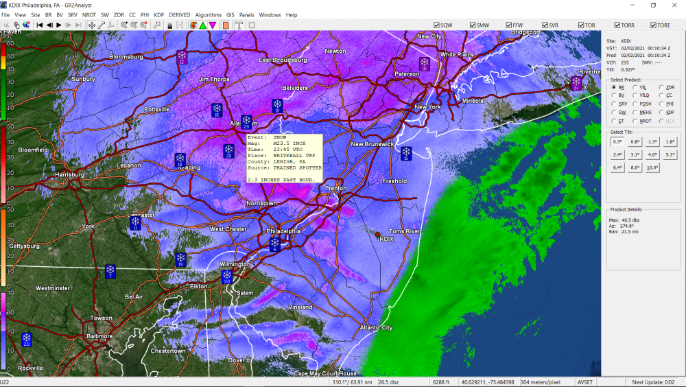
There's a spotter report for it.
-
You could try ballparking from their ASOS (which I believe is what gets reported in the LSRs), although I wouldn't know what ratio to use - https://w1.weather.gov/data/obhistory/KABE.html
-
Yup. That was my concern if that thing sits and spins and slowly creeps to the NE with us just coming off a full moon a few days ago.
-
Finally got up to SN with some blowing and fog now. Temp is 31 and dp 30 some a definite change underway.
-
(do you really want to do that? )
-
He just came back on again a couple minutes ago and said he expected "heavy snow tonight" that will be "tapering off", but then tomorrow there would be "periods of snow"-- so maybe he's thinking of a few wrap-around bands if that low meanders off the Jersey coast. Rates are picking up just a touch here now. Not quite out of the SN- but still no pingers in it, even with the temp slowly creeping up.
-
You don't need a model to tell you a dry slot will be there. Because. Miller B. Still snowing here but SN- and not mixing with anything. Temp is now up to 31 & dp 29. Hearing Glenn on KYW right now and he is saying "it may be snowing all day tomorrow". And then saying the leftovers might still be going into Wednesday.
-
If that verifies (and it seems that most forecasts have said "long duration") that will just tear up the coastal areas. We are just coming off a full moon a few days ago too.
-
It took over 14 hours but now getting flakes. Good sized ones too... not the fine stuff like what was mixed in with the FZRA/sleet earlier. This seems to be all wet snow.
-
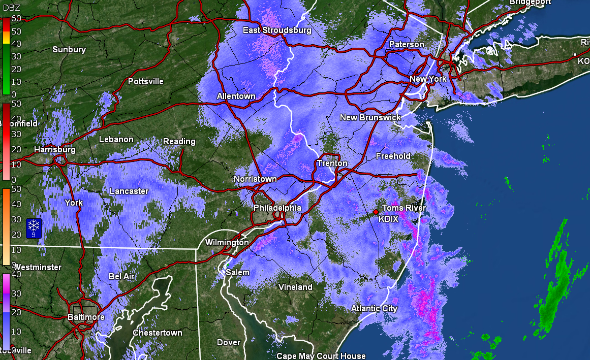
The potential is there, and we have seen it, for some heavy bands to move back over the area from NW --> SE as the low moves away to the NE and if that movement is "slow", someone can get under a deathband with the pivot. At that point, it would be pulling colder air from further north over land vs pulling stuff in off the ocean with water temps in the 40s/50s or more (below pic from yesterday's readings).
-
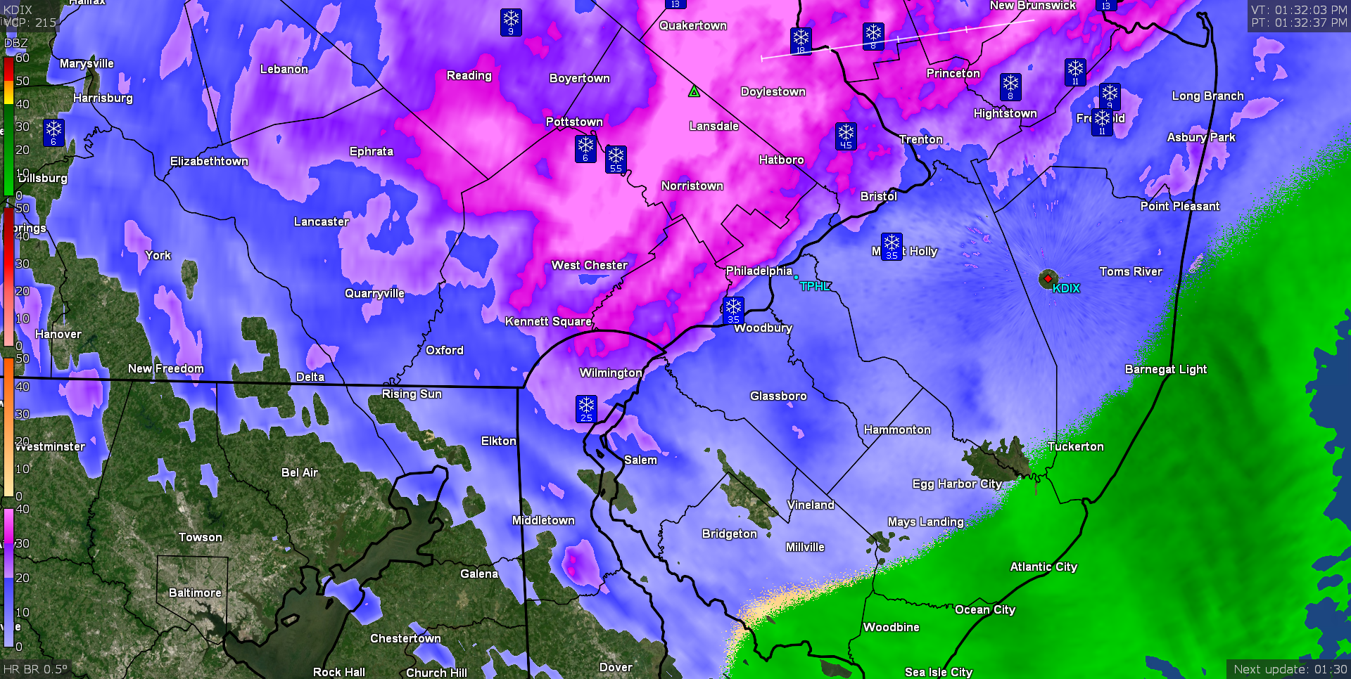
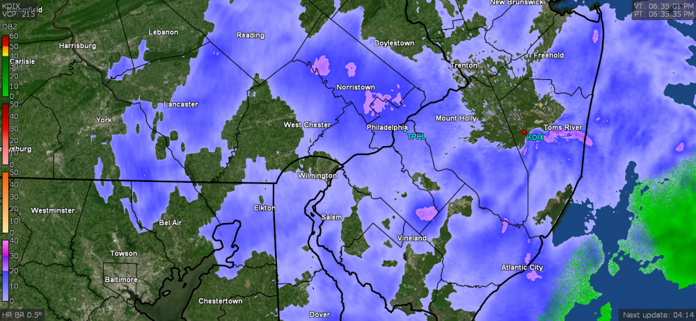
Now have all sleet. Must have almost an inch so far since last night and it has completely compacted my fluffy 4.5 " down to maybe a couple inches. Temp holding at 30. The hot pink on the radar, at least in NW Philly, is sleet.