Hurricane Agnes
-
Posts
9,362 -
Joined
Content Type
Profiles
Blogs
Forums
American Weather
Media Demo
Store
Gallery
Everything posted by Hurricane Agnes
-
Had a thunder about 20 minutes ago. I was able to push myself yesterday to finally get my overwintering tender tropical plants out on the patio and get everything fed in preparation for last night's progged qpf that yielded nothing IMBY. But at least I know I'll be getting it now. Currently light rain and 73 with dp 71 and 0.03" so far in the bucket.
-
Late to this thread but I do remember 2002 pretty clearly because that drought sortof started in fall 2001 right after 9/11 when we (at least here down in Philly) had minimal snow and a dry spring and that lead to a literal blast furnace summer, reaching extreme drought by the end of summer. I think it finally broke with some remnant moisture from tropical systems Isidore and Kyle -
-
Norman, OK has awoken. Currently 80 with dp 68 and overcast, with breaks of sun.
-
Sun has popped out and it's partly sunny with lots of scattered cumulus. Temp recovered quickly with the sun and is up to 56 and rising.
-
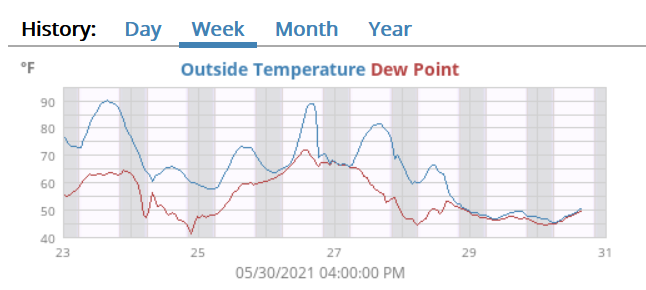
Final rainfall for yesterday was 0.36" for an event total of 2.27". My low this morning was 47 but at least I did move up above 50 much quicker and am currently at 51 and overcast (had a brief break of sun earlier before it clouded over again). In other news, pretty much everyone forecast to do so or get close in the Mt. Holly CWA blew up their record low max temps -
-
It would like a fall cookout! All you need is the Kamu firepit and you can get your grill-on! I finally made it above 50 and am currently (barely) at 51, overcast, and misty, and I think this may be it for the day, but we will see. KPHL is showing 52, so unless some sudden WAA comes blowing in down there, I think the previous record low max of 59 for this date is toast. Current precip for the day IMBY is 0.35" (2.26" event total). ETA - a snip snapshot of my temps (from my little local weewx setup that I have to get back to tweaking). Amazing the 40 degree temp swings for highs (91 vs 51).
-
That's true. I had expected the guidance for a halfway decent Sunday to verify since what usually happens is either a Saturday or a Sunday washout and you can at least salvage one or the other. But didn't expect a Friday - Sunday wipe out.
-
Sadly once we had moved to a different house in '68, that house didn't have a garage but had that covered patio (with one of those near bullet-proof aluminum awnings). One of my sisters did eventually buy a house with a garage however, and that's where they move the grill during inclement weather (including in winter since they like to grill year-round and will shovel a path to the grill if there is snowpack). And of course there's an extra fridge out there for adult beverage storage too. The winters of 2013 & 2014 managed to absolutely destroy that awning after what was about 60 years of life due to the weight of the glaciers of ice that resulted from the freezes/thaws of the snow that didn't slide off or get knocked off. My temp ticked up to 49 with on and off light rain and rainfall for today now up to 0.32" (event total 2.23" so far).
-
For most of my life, it's almost always been cool and/or rainy around Memorial Day weekend (no matter what day the actual holiday came on and regardless of whether there was some heatwave or above average temps before or after). There were the rare few years with some of the weekend days that had weather that was decent (I think last year was one of those times), but more often than not as a kid, we would go out on our back covered patio with the grill due to rain or threat of rain. Of course July 4 was almost always the polar opposite. Pretty much guaranteed to be hazy, hot, and humid (with a few years when it was actually "nice" ). Am guessing it's the climatology of the month (based on sun angles). Am currently at 48 and up to 0.20" in the bucket this morning. Looks like that potential for a record low max for PHL for today might be do-able.
-
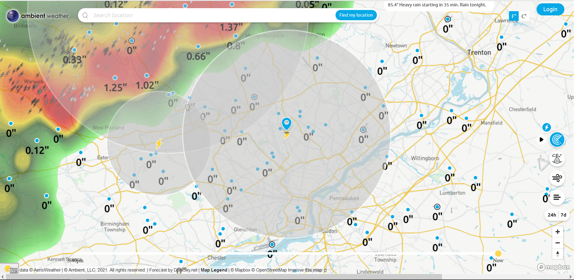
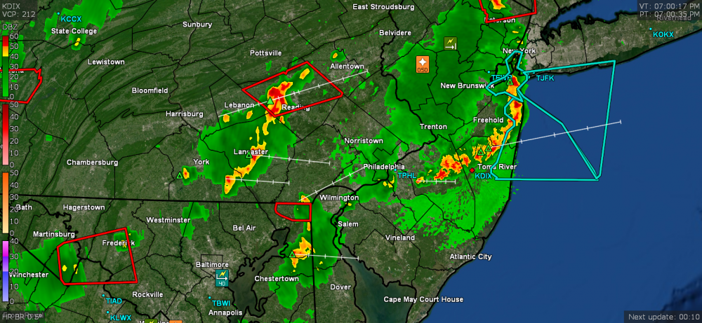
I have a couple plumerias, a stephanotis, a hibiscus, and a coffee arabica that would not appreciate those temps. I probably could have put my citrus and figs out because they are more subtropical and could do those temps, but they're not acclimatized to that at the moment. Looks like most of the sites got their RERs - Another set of vulnerable highs, is up today - Currently 46 here and getting some light rain (0.03" at post time) that started within the past hour.
-
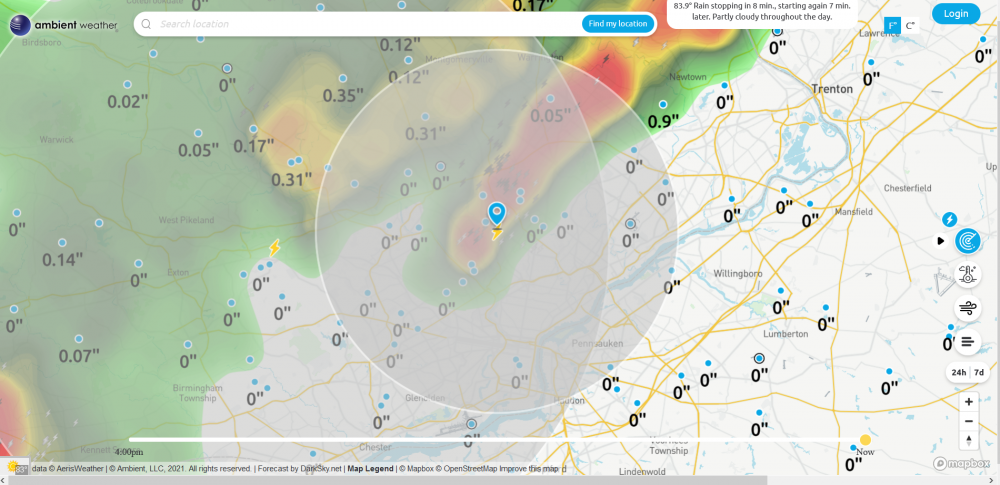
So far am up to 0.86" of rain today (1.90" event total). My "high" for the day is 50 so far, but that was just after midnight, so will see if I even manage to hit it again before the day is out. I usually have my overwintering tender tropical plants back outside by now but they don't like night temps below the mid-50s and I can only imagine what they would think about "day" temps not even reaching that. Currently 49, overcast and misty.
-
It took awhile but I ended up with 1.04" yesterday, with a 69 high and 49 low. Am up to 0.56" so far this morning, with a steady moderate rain and 47, which is my low so far. Amazing that Mt. Holly has a Climatology section up for possible record low maxes for the area this weekend!
-
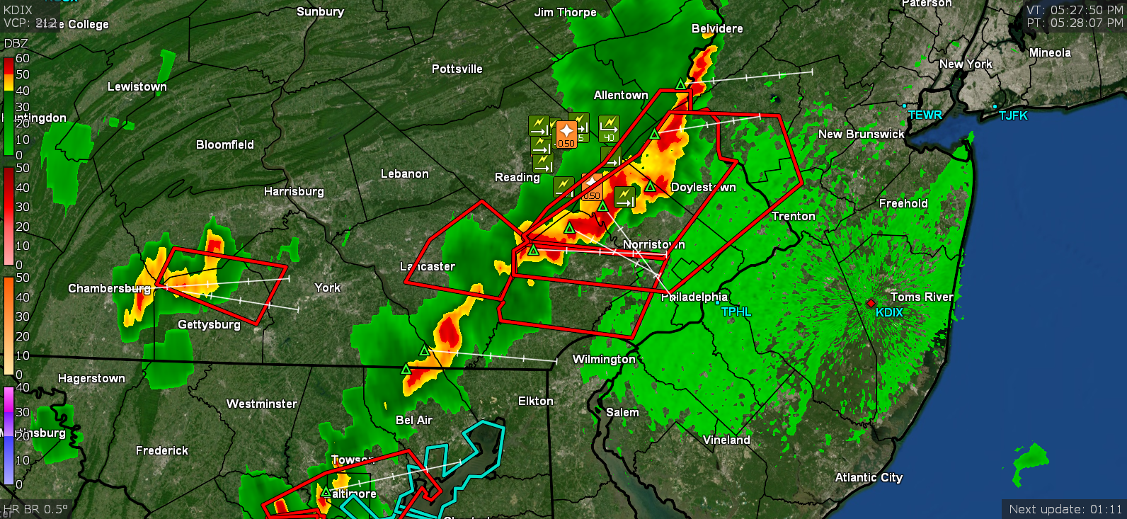
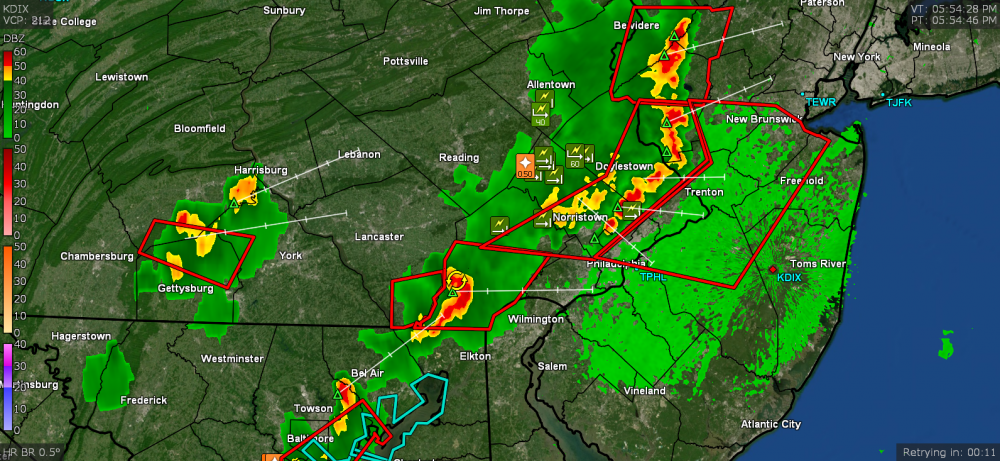
What I am dubbing "round 2 1/2" was rockin' and rollin' more than anything when under the warnings and afterwards the round 3, deposited just over 1/2" additional rain. Finished up at 0.77" for the day and it was MUCH needed! Currently a steamy (steamed up windows) 66 with dp 65.7, as the sun gets ready to rise through a deck of high clouds.
-
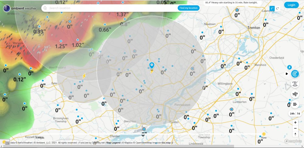
So far picked up 0.05" more from round 2 (total getting close to a total of 1/4" at 0.23") and I see a possible round 3 off to the west! The temp has still been holding in the 69/70 range here with dp 67.

-
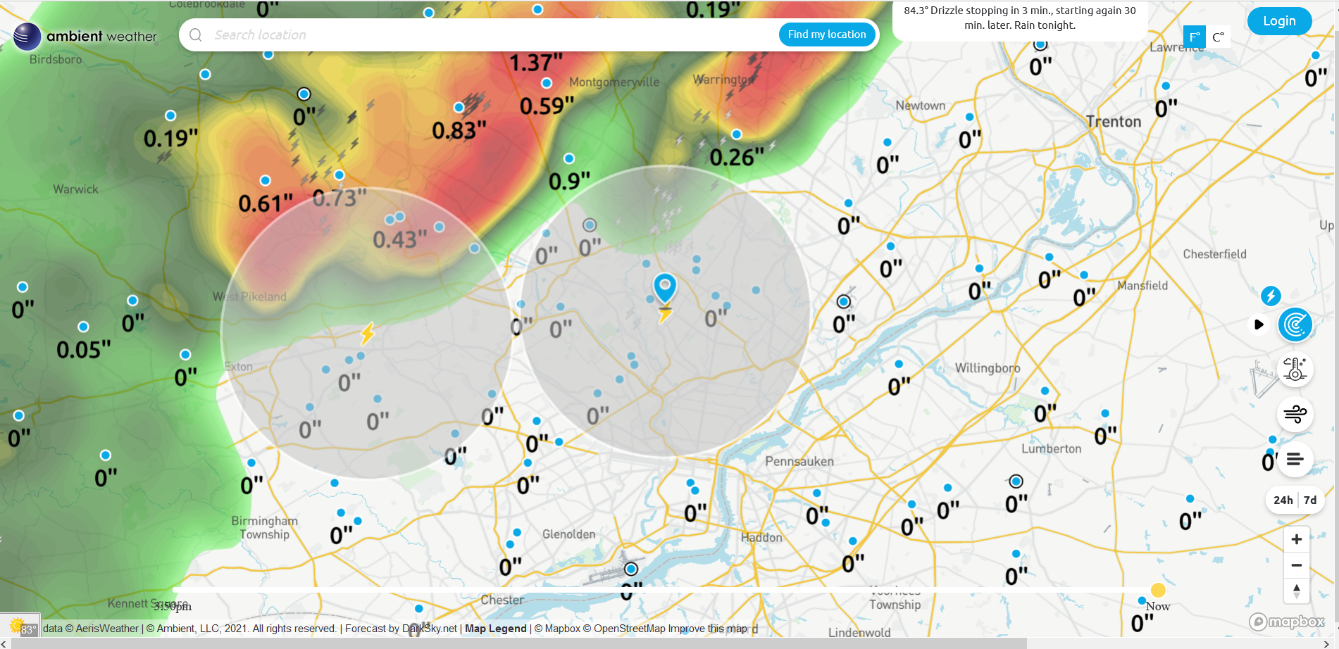
Getting an extended rumble of thunder and another little batch of needed rain. Now up to 0.18". Temp has bopped up and down between 69 and 70. Don't know if this other little line will hold together long enough though but we'll see.
-
I did hear one low rumble of thunder from a distance and there is a lighter return band incoming here (hopefully it will provide some more). Am up to 0.17" of rain and temp at 68 w/66dp. I heard Glenn on the radio earlier this afternoon talking about upper 50s for the weekend for highs.
-
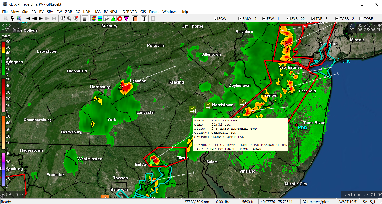
I saw a tree down report near you.

-
Briefly had 1"/hr rate but briefly. So far up to 0.13". Need some more but at least that washed some of the pollen off. Temp is down to 70, dp 64. Looks bright to the west.
-
Getting pea-sized hail!
-
Getting big rain droplets. I'll take anything at this point. Getting fringed from a little blob. Warning expanded into Jersey. Temp is down to 75, dp 63.

-
Getting some good continuous gusts. Temp is down to 78 and dp down to 64.
-
Getting winds although I don't think it is the gust front yet. Lots of lightning being picked up by my detector.
-
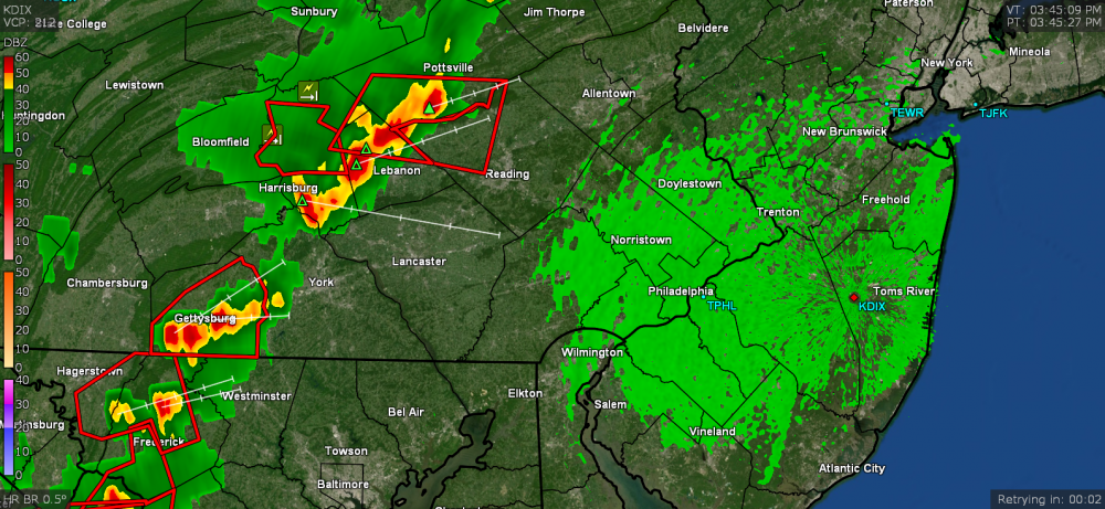
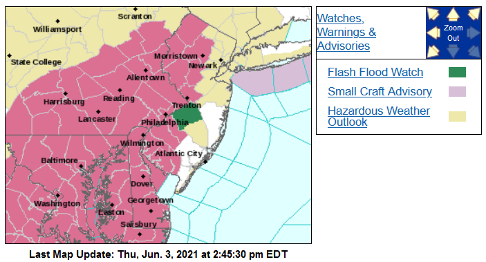
Am seeing the line of dark clouds to the west of me. Sky now mostly cloudy and temp is down to 87, dp 68. ETA - Warning just issued over my area (all the alerts came in).

-
My high (so far) just tapped 90 right before 3 pm so with that incoming line, that will probably be it for the day. Currently partly cloudy and 89 with dp 68.
-
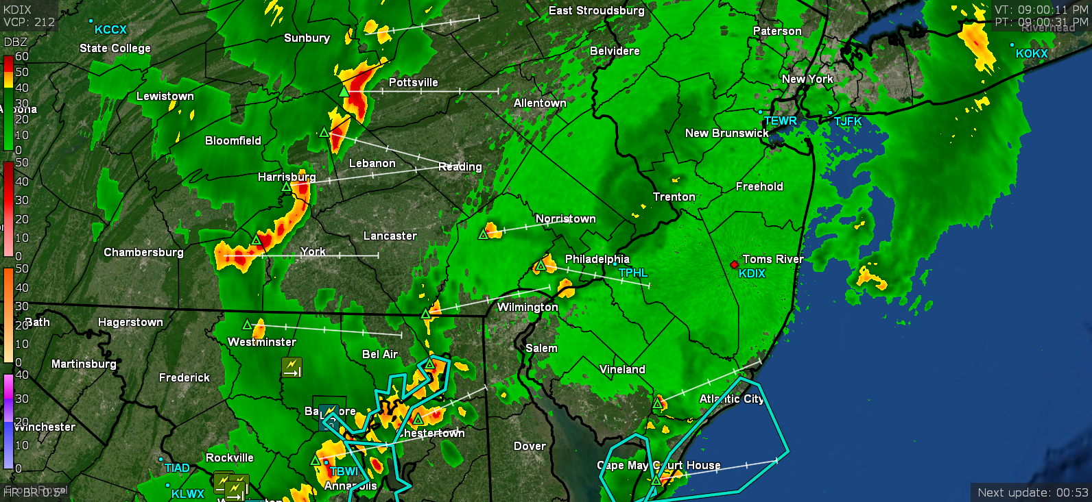
Headed right for you!