Hurricane Agnes
-
Posts
9,332 -
Joined
Content Type
Profiles
Blogs
Forums
American Weather
Media Demo
Store
Gallery
Everything posted by Hurricane Agnes
-
Still have non-descript lazy flurries and temp is 32 so stuff is melting.
-
Have mood flakes here that I suppose if they went on long enough, could add a dusting, but am not real confident. Temp still 31/dp 29. Am guessing south Jersey is getting a sleetfest.

-
Down to some lazy flurries and I suppose virga despite the radar look. Have a light 0.1" dusting on the colder surfaces and walks where the treatment washed away with melt. Temp is up to 31.
-
Getting white rain here now. Temp is up to 30.
-
And the ZR/freezing mist continues here. Temp still 29/dp28.
-
Has been ZR and freezing mist this morning adding a glaze on everything. Temp has crept up to 29 with dp 28.
-
Now just have a cold light FZRA event here. My last little measurement around 2 pm of a "core" showed about 1/2" of sleet that compacted down the last 5.5" of snow, so calling it 6" of snow/sleet/ZR (compacted).
-
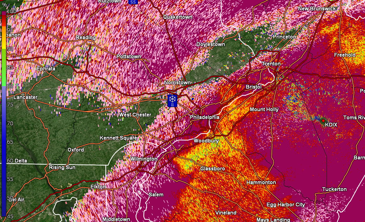
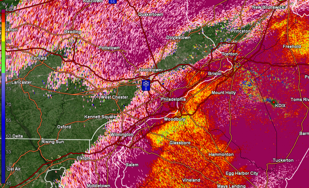
Currently have light sleet and ZR ad temp of 27 (dp 24). I think the radar in this instance, says it all!

-
LOL Not far outside to the west of me. Whenever I got out that way, I go out Ridge Pike.
-
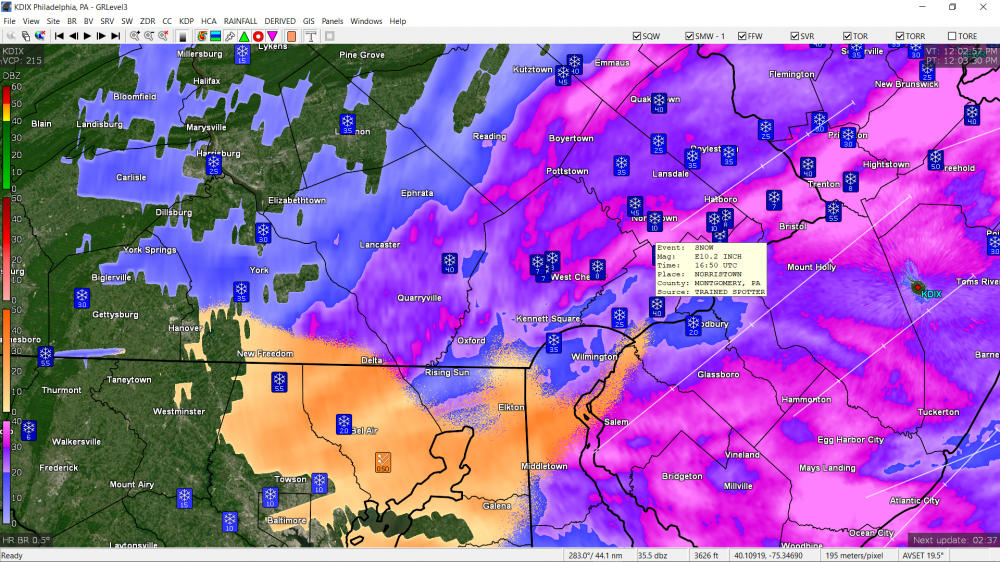
There's a spotter report of 10" in Norristown and a "public" report in Abington of the same.
-
Now I am getting a mix of about 2/3rd sleet and 1/3rd FZRA. That is knocking the snowpack down pretty good. Temp has crept up to 25 with dp 24.
-
Now 50/50 sleet/graupel. Has knocked the total down almost an inch.
-
Wow. Some wild stuff here now. About 2/3rd graupel/sleet and 1/3rd pancake snowflakes. The graupel is almost getting to hail density the way it is hitting and bouncing and is loud as hell! It also briefly looked like there may have been some FZRA in there too. No changes in temp/dp.
-
Well technically I didn't have to go out to confirm but could hear the pingers over the sound of the humdifiers. Just came back in after another measurement before it compacted and have 5.5" along with it puking sleet.
-
Back to SN now. Not hearing any pingers. Temp still holding 24/dp 22.
-
Born and raised in "Mt." Airy and living in Chestnut "Hill". I think the highest elevation up in this area... not too far up the way from me to the west, is about 425 ft elevation. There are the little Montco towns literally about 4 - 5 miles to my north (and either west or east - Whitemarsh and Glenside) that have been reporting 8", so I am sortof on the southern fringe of the heavier band.
-
Welcome! There are a couple of us city-proper posters here. Seems we have issues beyond the snow/sleet line that have to do with what is going on in the upper atmosphere with warm noses and whatnot! I think this was pretty much expected - a "front end thump" followed by mixing and then when the coastal takes over, some possible additional, although it remains to be seen if more rain happens with that. If anything, it is interesting to see where the band of heaviest snow had/had set up and it's a pretty narrow gradient for that at the moment.
-
Getting rimed flakes along with some graupel mixed with pancakes now and am up to 5". Temp is 24/dp 22.
-
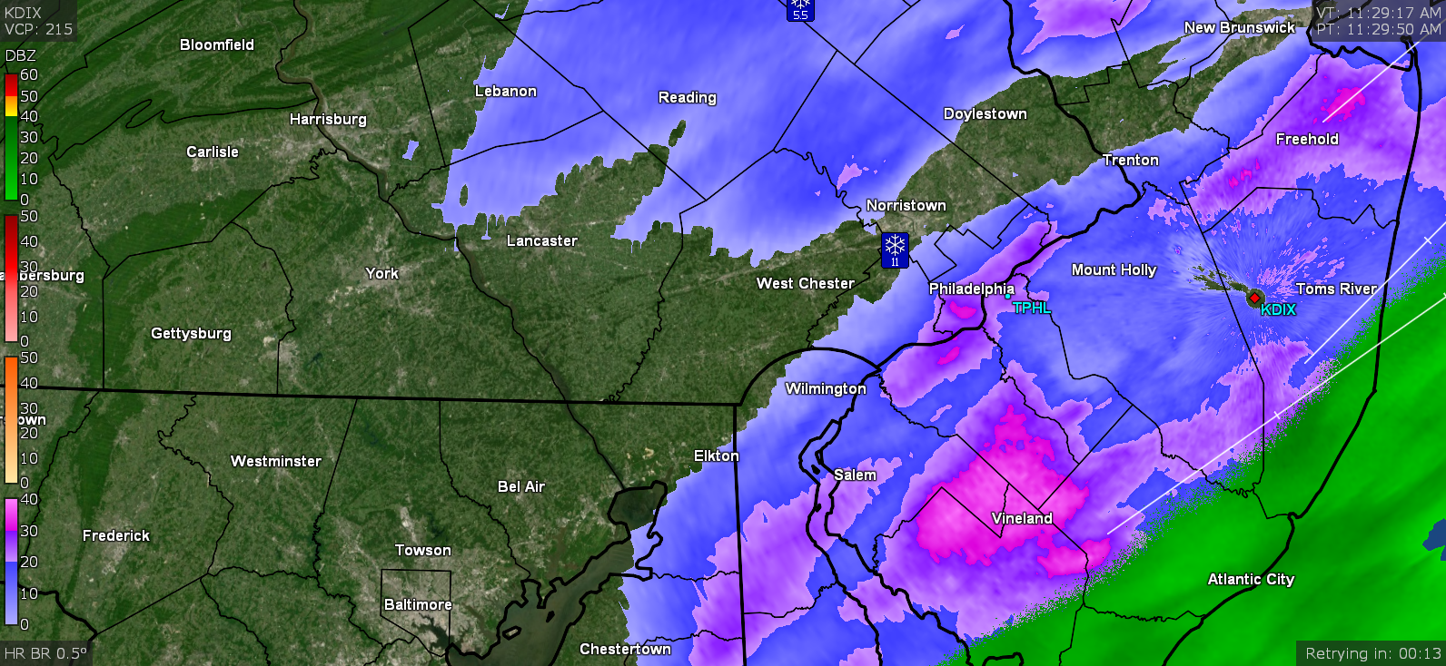
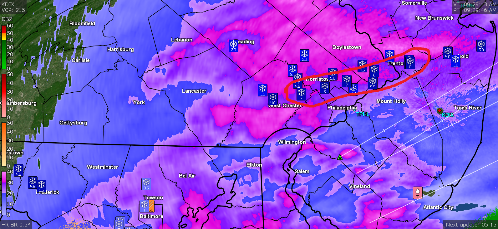
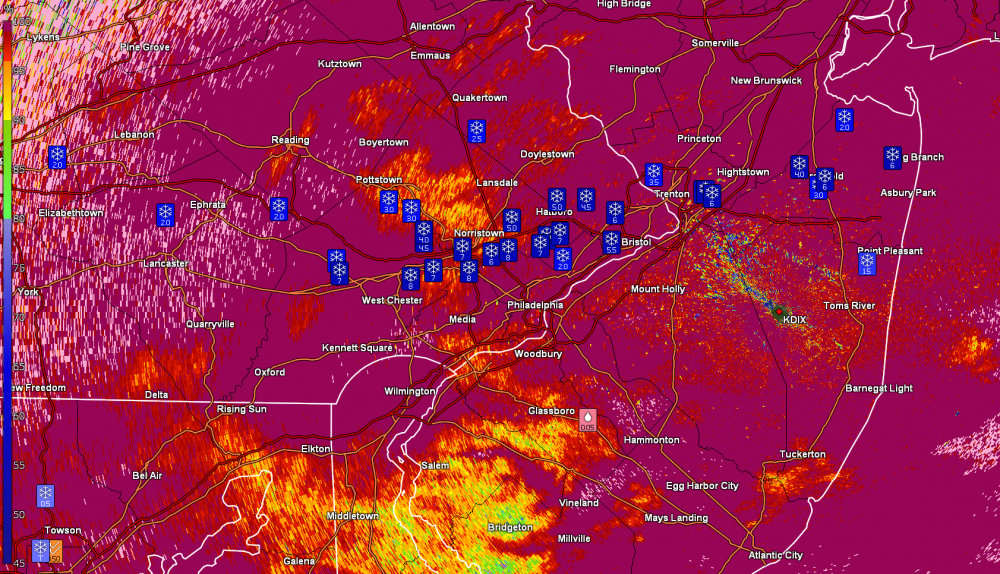
Narrow stripe of heavy snow still holding. CC radar of it -
-
Still steady snow here shifting between SN- and SN. Picked up at least another 1/2" of powdery stuff that is starting to blow around. Temp is 23 with dp 21. You can see a bit of the gradient for the band that seemed to dump on a relatively narrow strip...
-
IP has stopped and back to all snow but with pancake flakes.
-
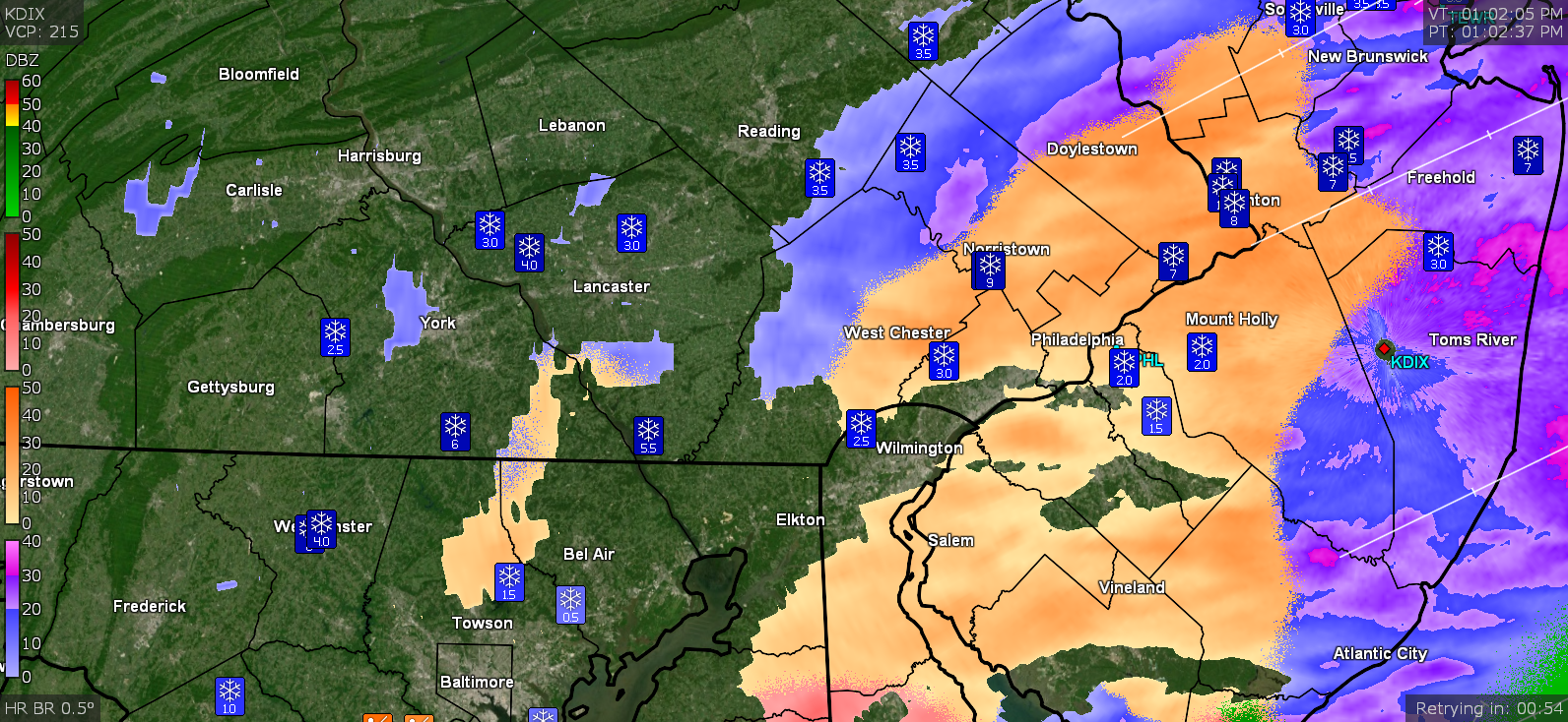
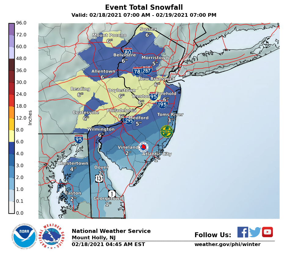
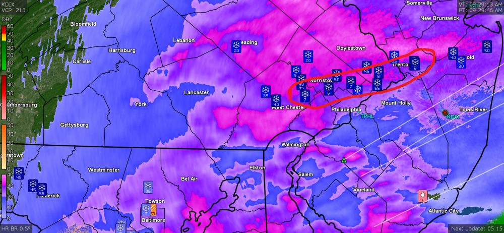
Mt. Holly's earlier snow & ice maps -

-
Threw on the boots and went to the board to measure. Real light fluffy snow and measured 4". BUT the pingers are here mixed in with the snow. There was no pancake flake transition to that. Temp is down to 23 with dp still 22.
-
Still getting normal flakes so far - SN to SN- (could be elevation). No change in temp/dp (24/22).
-
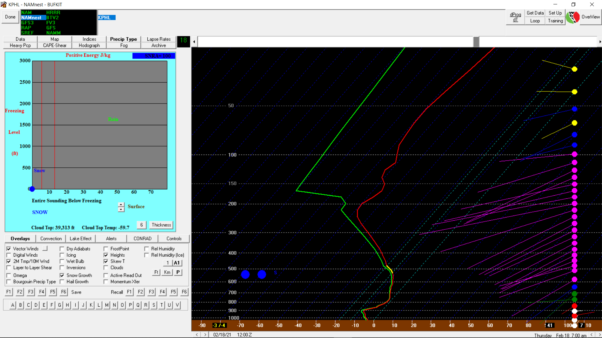
NAM nest sounding -