Hurricane Agnes
-
Posts
9,336 -
Joined
Content Type
Profiles
Blogs
Forums
American Weather
Media Demo
Store
Gallery
Everything posted by Hurricane Agnes
-
I've been posting on and off in this thread from NW Philly (near Montco border). Am up near 4" where I am. Getting light but steady snow now with normal flakes. Still have not gone below freezing the entire event and it's currently. 33.
-
Isn't there a piece of polar vortex headed your way next week ("blue norther")?
-
Still getting variable rates and flake sizes. Had about an hour of the "normal" flakes but moderate/steady and now back to the pancakes. Up to 3" here now but still riding the 33 train for temps.
-
Had to look up where that was - up in the hinterlands of Montco!
-
You can see where the heaviest band has setup so far - just a few ticks N/W of the I-95 corridor (based on mPINGs). I have so far been above freezing through the whole event...
-
Up to 2.5" here and still have marginal temps at 33. Getting various intensities with variable sizes of flakes, from normal to pancake to dinner plate. That's gonna be some wet heavy snow!
-
Still have marginal temps at 33 but pancakes and dinner plates have me up to about 1.5" on the board. Streets are caving although some parts haven't succumbed yet.
-
LOL okay. He is really puffy! Looking for his mound!
-
Now getting lots of pancakes with increased rates. Temp down to 33 and now starting to stick on streets and a little bit on treated walks.
-
Trying to figure out what that is. Skunk? Cat? The apparent "band" across the tail doesn't seem to suggest squirrel and head looks too small to be a raccoon but...?
-
Dynamic cooling continuing. Down to 34 with SN now (clumped flakes) but laying down a chilled coating on the colder surfaces (mostly the cars for the moment) to form a base. Still melting on treated surfaces including streets/walks.
-
Dynamic cooling starting. Temp has dropped to 35 and wet flakes are flying now.
-
Temp had gone up to 37 but bopping between 36/37 and currently light drizzle.
-
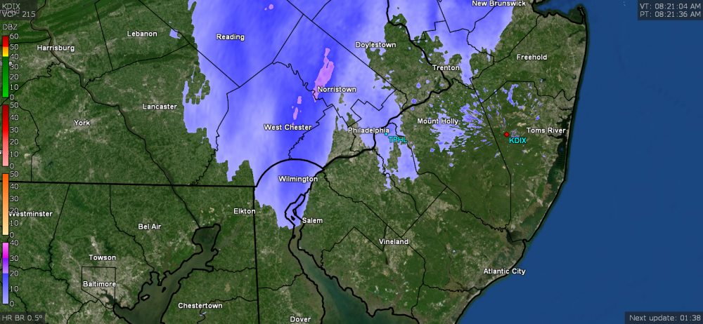
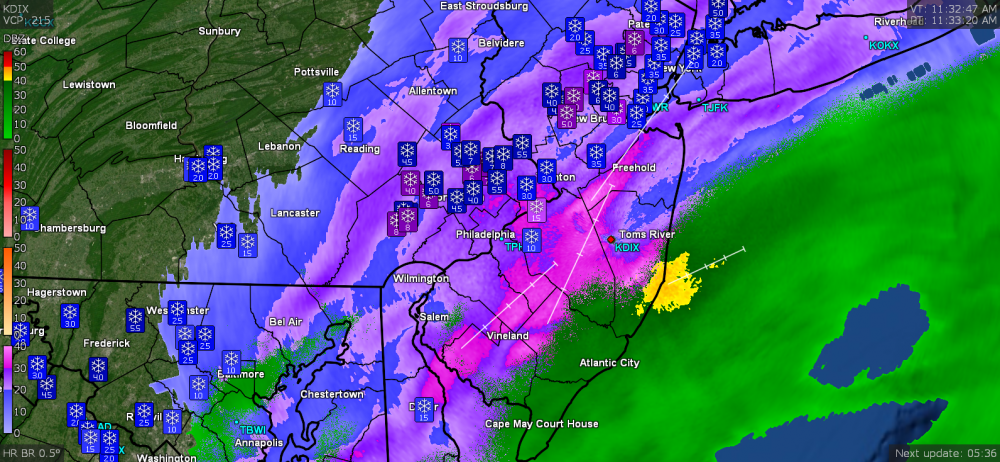
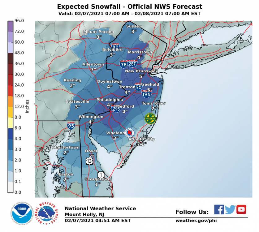
Well didn't quite expect the temps to stay up this "high" overnight but it's currently 36 here and overcast. Precip seems to be closing in. Mt. Holly downgraded to 3" - 6" due to the track shift. Current snow map this morning -
-
E PA/NJ/DE Winter 2020/2021 OBS Thread
Hurricane Agnes replied to Rtd208's topic in Philadelphia Region
Looks like it's done, sky is clearing, and sun is trying to come out. Temp is up to 39. -
E PA/NJ/DE Winter 2020/2021 OBS Thread
Hurricane Agnes replied to Rtd208's topic in Philadelphia Region
Now raining. Had 0.2" of pancake flake coating on the cold surfaces just as the rain was starting. Temp 34. -
E PA/NJ/DE Winter 2020/2021 OBS Thread
Hurricane Agnes replied to Rtd208's topic in Philadelphia Region
Was surprised the temps rose overnight and shot up to 37 just after 6 am and now it's SN with wet flakes (and they're sticking on cold surfaces) and temp is back down to 34.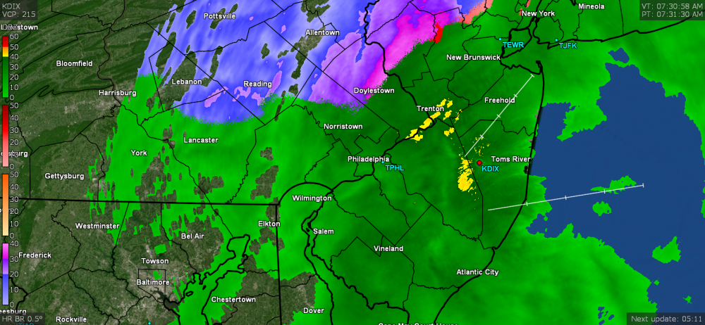
-
I think a number or reports also come from members of CoCoRaHS - https://www.cocorahs.org/ They have a series of "how-to" videos for measuring various types of precipitation including snow, that follows the standard protocols - I expect that the more serious dedicated ones will then go on and attend the NWS Spotter training course (when available).
-
You are one of the few who try to "keep it real" here.
-
Wow. Not just the one "classic" pile but a second?? The snow seems to have stopped here for the moment but it looks like something out west in Lancaster has spontaneously developed. Not sure if that will survive the trip east but we shall see. Temp is currently up to 35 with melting going on.
-
Now getting SN. lol Temp down to 32.
-
Temp is starting to rise at a good clip and now bopping between 33 and 34 here but still flakes are flying!
-
Finally checked my board and I actually got another 1/4" overnight and this morning with the mini-bands that have been swinging through. Sun is trying to show through the clouds but it is still flurrying and 31.
-
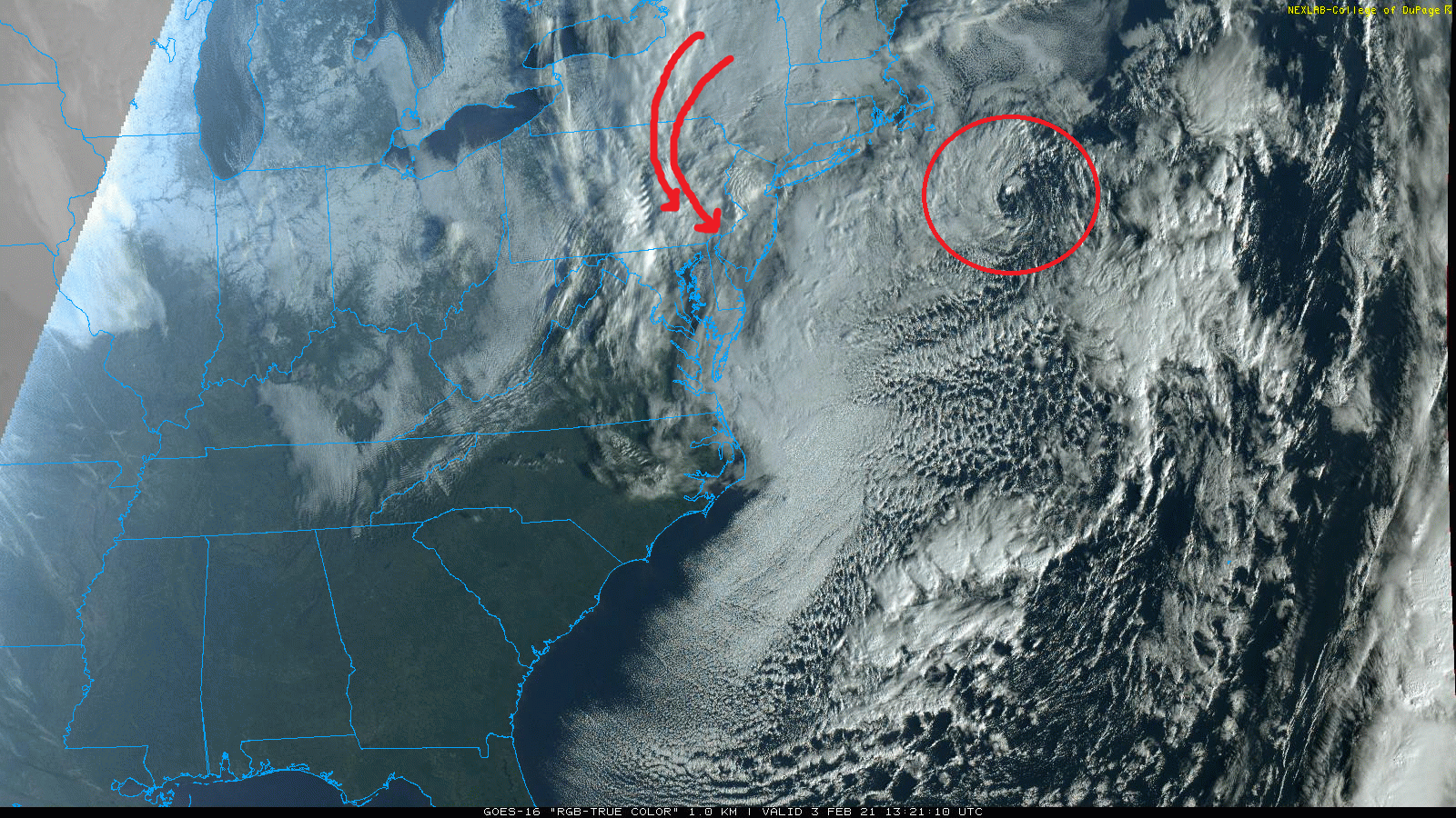
There's this firehose of flow just rolling around the complex and throwing stuff in from the NW.

-
The light bands kept swinging through all night. I'm not sure yet how much they added to the accumulation but this thing is still rolling! Currently 31 and mostly cloudy but it looks like something might be incoming if it holds together! ETA - just looked out and the flakes are flying!