Hurricane Agnes
-
Posts
9,336 -
Joined
Content Type
Profiles
Blogs
Forums
American Weather
Media Demo
Store
Gallery
Everything posted by Hurricane Agnes
-
December 16/17 Snow Wall Obs Thread
Hurricane Agnes replied to hazwoper's topic in Philadelphia Region
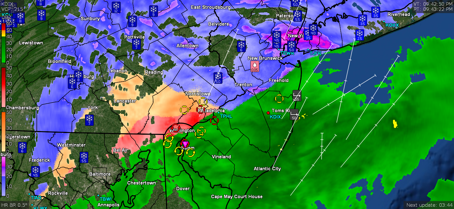
Some wild dynamics going on. Looks like the warm nose has pushed back to the west, I guess as the low approaches from the S. At one point, the rain line had moved up over 3/4 of the city.... Eventually as the low moves to the NE, the bands should pivot back to the east again. Currently back to all SN, blowing and drifting, and 26 (26.2) with dp 26 (25.7).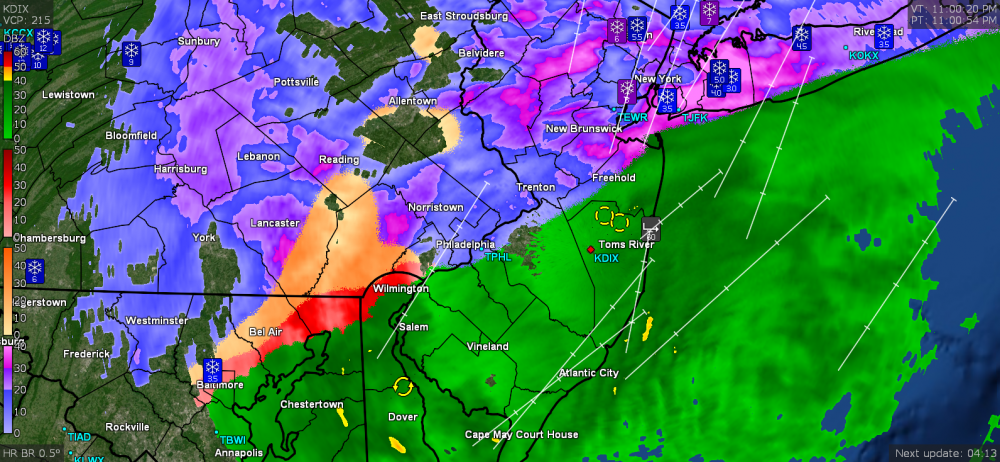
-
December 16/17 Snow Wall Obs Thread
Hurricane Agnes replied to hazwoper's topic in Philadelphia Region
Sounds like it's pouring sleet here again. Hearing the loud pings on the windows. A veritable club sandwich of p-types. -
December 16/17 Snow Wall Obs Thread
Hurricane Agnes replied to hazwoper's topic in Philadelphia Region
And I peeped out at a light and the snow is back. Cracked the door open and could hardly budge it due to the winds. Getting a snow/sleet mix at the moment that is really blowing around. Temp is still 27 w/dp 26. -
December 16/17 Snow Wall Obs Thread
Hurricane Agnes replied to hazwoper's topic in Philadelphia Region
There's a band of snow back around Harrisburg but am not sure if that will warm as it moves east or what. There is a little battle going on between the "relatively" warm rain line and the "cold" ZR/sleet line that caused some convective cells to briefly fire.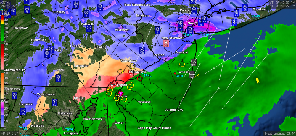
-
December 16/17 Snow Wall Obs Thread
Hurricane Agnes replied to hazwoper's topic in Philadelphia Region
Well I doubled in one storm, what I had all last season. -
December 16/17 Snow Wall Obs Thread
Hurricane Agnes replied to hazwoper's topic in Philadelphia Region
I'm guessing that is including sleet (it's an ASOS reading) since they would have changed over way before the rest of us in the city. -
December 16/17 Snow Wall Obs Thread
Hurricane Agnes replied to hazwoper's topic in Philadelphia Region
I think most of the calls for the city was 3" - 6" so it fell within that (assuming the wrap-around is minor. I think the models depicted the rain/snow line pretty well but the devil was in the sleet details (although as we got closer to the event, it was evident that there would be a good amount of sleet). I got about 5.3" of snow in IMBY before the sleetfest. Will have to see if I can core some tomorrow to approximate the sleet amounts before the ZR came (assuming it didn't completely soak through). I was going to practice getting a ratio (bought a Stratus gauge over the summer to try out). -
December 16/17 Snow Wall Obs Thread
Hurricane Agnes replied to hazwoper's topic in Philadelphia Region
The 8:34 pm PNS lists 5.7 at PHL - https://www.wrh.noaa.gov/total_forecast/getprod.php?new&prod=XXXPNSPHI&wfo=phi ETA - am guessing that is including IP. -
December 16/17 Snow Wall Obs Thread
Hurricane Agnes replied to hazwoper's topic in Philadelphia Region
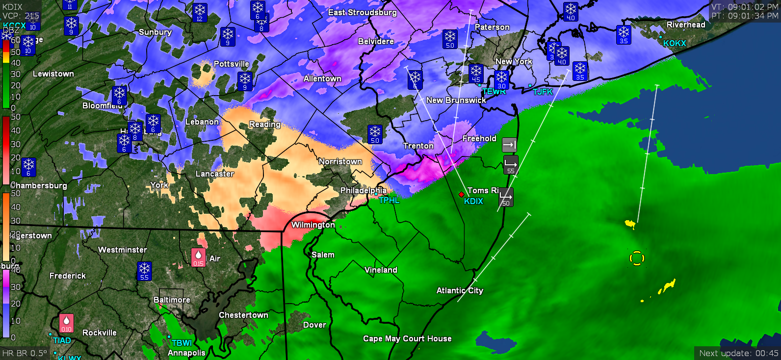
I noticed the fog was back (vis. about 1/2 mile) and checked outside and am now getting ZR. Will have a crust of ice over the sleet over the snow - a real snow cone.. Temp is 27/dp 26.
-
December 16/17 Snow Wall Obs Thread
Hurricane Agnes replied to hazwoper's topic in Philadelphia Region
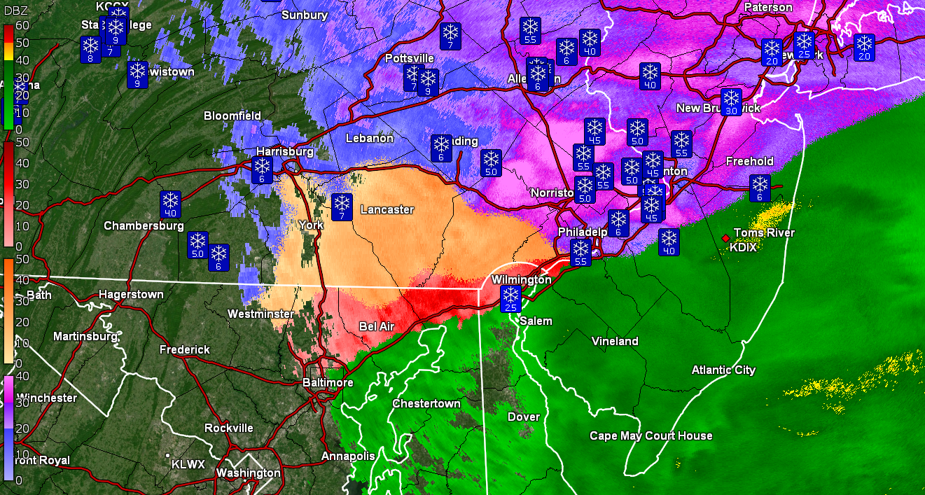
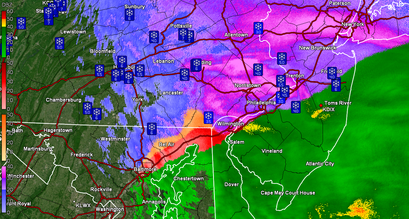
There's a big hole right over Philly.
-
December 16/17 Snow Wall Obs Thread
Hurricane Agnes replied to hazwoper's topic in Philadelphia Region
I popped open RadarScope and it is really show the incoming dry slot.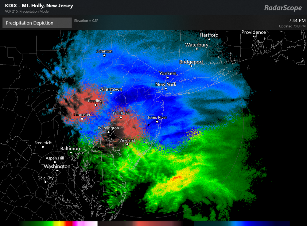
-
December 16-17, 2020 Winter Storm
Hurricane Agnes replied to Ralph Wiggum's topic in Philadelphia Region
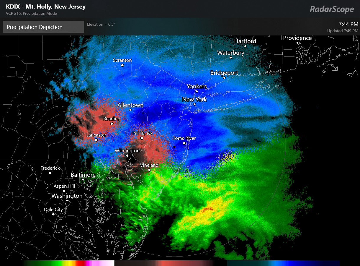
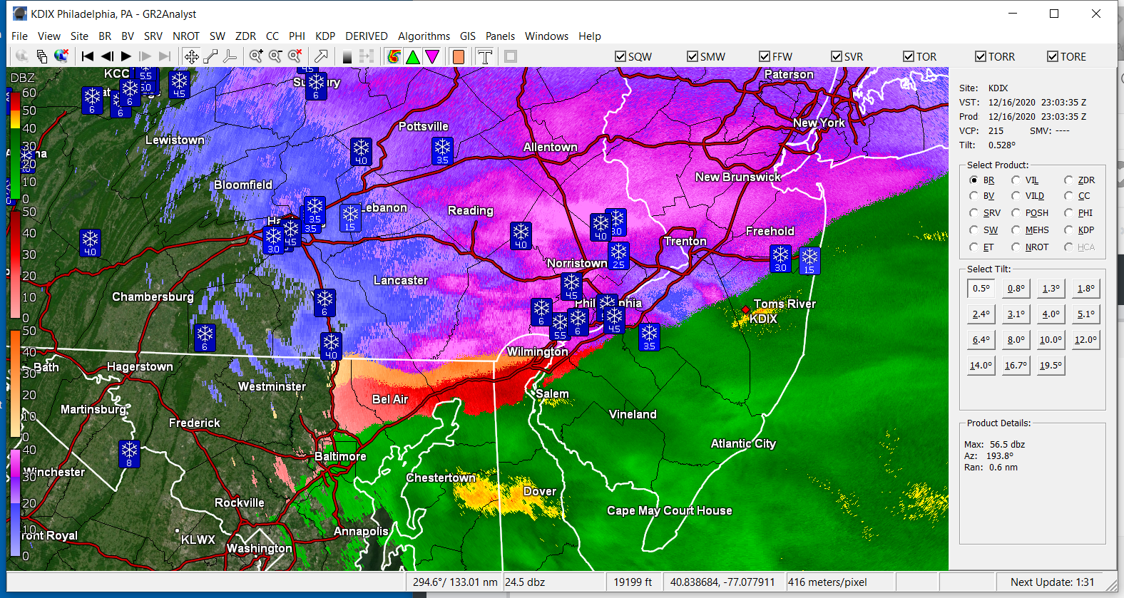
Since you posted this awhile ago, I don't know if you finally figured it out but I think by default it comes up in "Base Reflectivity" mode and if you click on the block in the upper left corner that says that, it will activate a drop-down menu where you can select other views including "Precipitation Depiction". I just have the basic version on the phone and om windoze 10 without any subs to other data services. -
December 16/17 Snow Wall Obs Thread
Hurricane Agnes replied to hazwoper's topic in Philadelphia Region
Based on Mt. Holly's climatology report if they get no wrap-around, it would be a couple inches short of the record for the date (other locales probably broke theirs like Allentown definitely and possibly Wilmington, depending on any other reports) - -
December 16/17 Snow Wall Obs Thread
Hurricane Agnes replied to hazwoper's topic in Philadelphia Region
It'll be like a cement mountain. -
December 16/17 Snow Wall Obs Thread
Hurricane Agnes replied to hazwoper's topic in Philadelphia Region
Snow and ice sandwich! -
December 16/17 Snow Wall Obs Thread
Hurricane Agnes replied to hazwoper's topic in Philadelphia Region
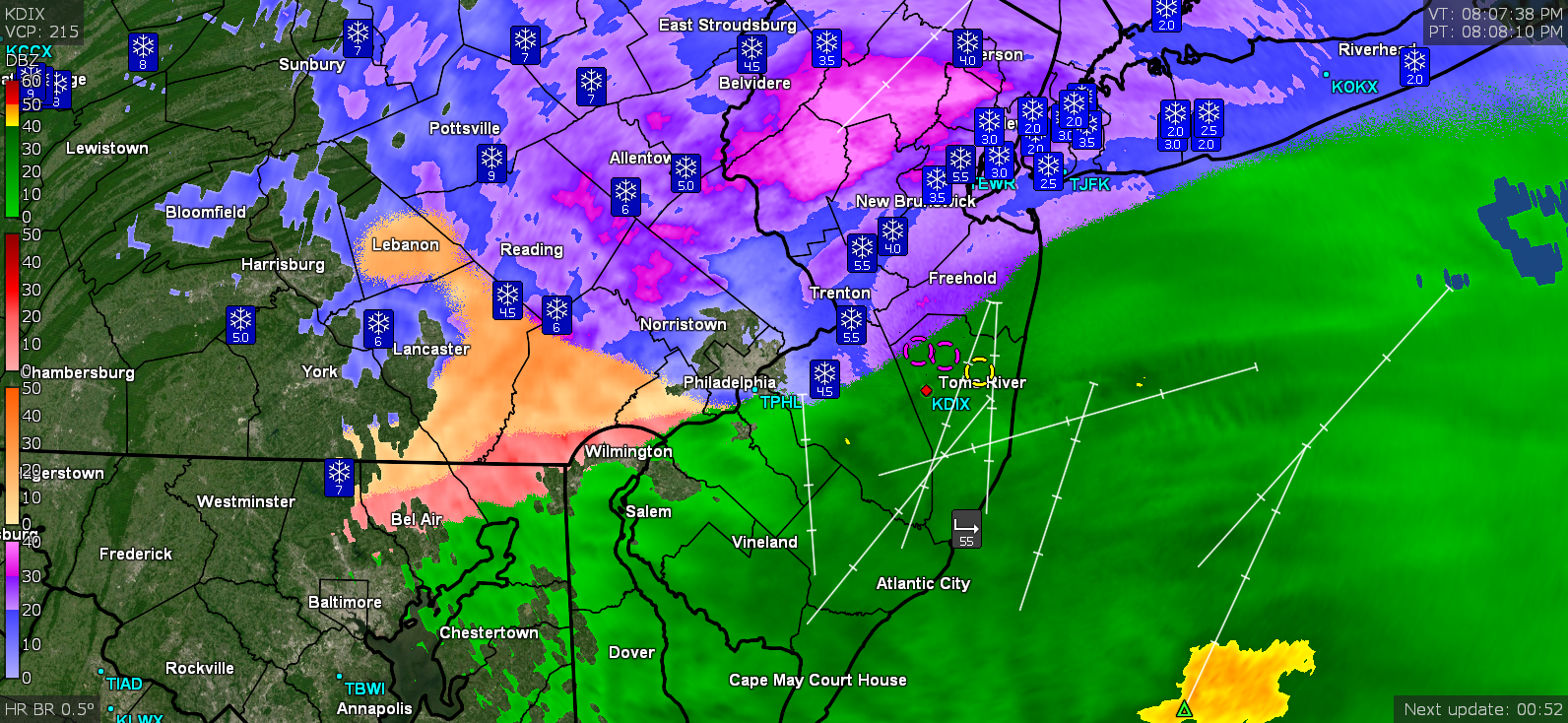
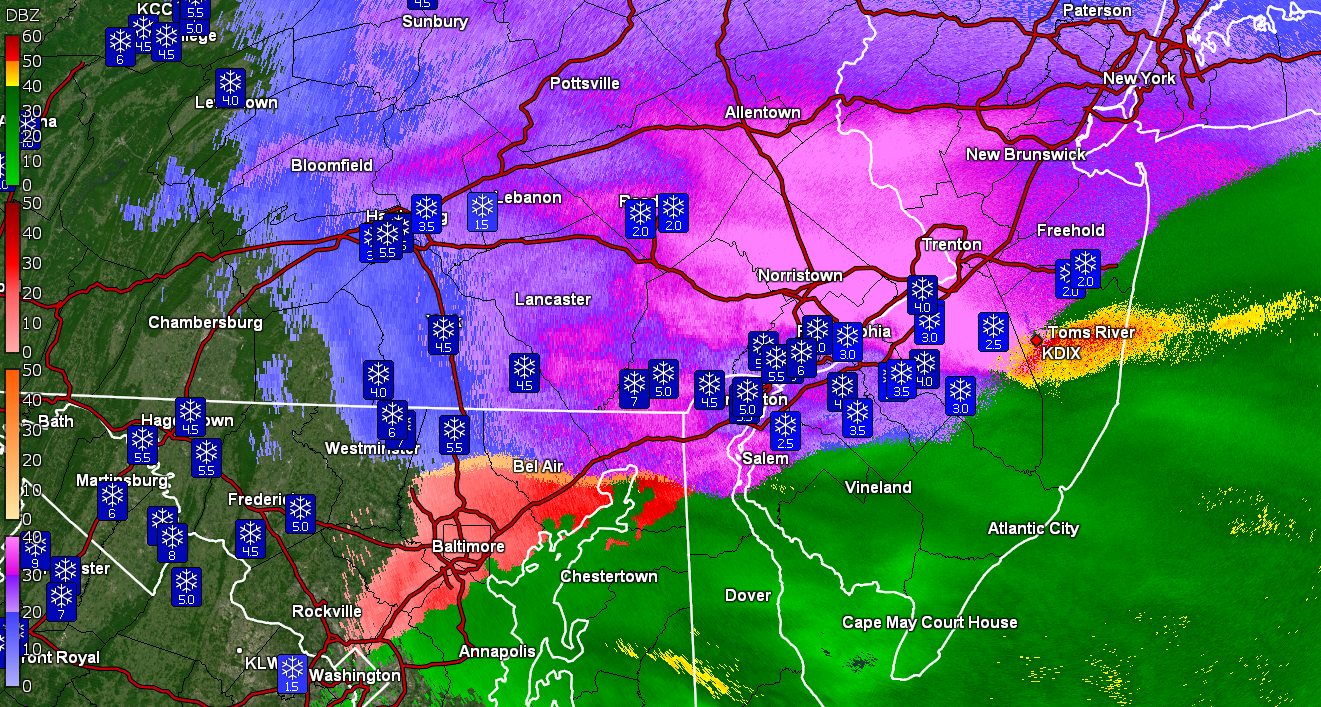
Looks like the blob of sleet is up to Lebanon County and ZR is cutting across Wilmington (haven't seen any of our Delaware folks check in yet).
-
December 16/17 Snow Wall Obs Thread
Hurricane Agnes replied to hazwoper's topic in Philadelphia Region
-
December 16/17 Snow Wall Obs Thread
Hurricane Agnes replied to hazwoper's topic in Philadelphia Region
I have a couple humidifiers and an air purifier going and I can hear the pingers over all that. It's literally pouring sleet. It has compacted my snowpack down almost an inch already. Temp creeping down again and down to 27 (27.3) with dp 27 (26.8). Looks like the r/s line is almost right along the Delaware river.
-
December 16/17 Snow Wall Obs Thread
Hurricane Agnes replied to hazwoper's topic in Philadelphia Region
Glad I had checked. The r/s line is still hanging in Jersey. I can really hear the pingers against the window.
-
December 16/17 Snow Wall Obs Thread
Hurricane Agnes replied to hazwoper's topic in Philadelphia Region
5.3" and I noticed the fog disappeared along with the SN+ and has now officially been replaced with.... SLEET. ETA - temp still 28 w/dp 27. -
December 16/17 Snow Wall Obs Thread
Hurricane Agnes replied to hazwoper's topic in Philadelphia Region
I opened my back door to peep out and almost got knocked out by the dinnerplate flakes. Have officially surpassed my 2019/2020 season totals and am at 4.5" and rising. The temp is still holding at 28 with dp now 28 (28.0/27.5), with vis still < 1/4 mile and SN+ with fog. The pink blob continues to move to the NE.
-
December 16/17 Snow Wall Obs Thread
Hurricane Agnes replied to hazwoper's topic in Philadelphia Region
Finally getting under the pinks and SN+. Temp holding at 28 with dp 27 and vis down to about 1/4 mile with fog and heavier snow. Lots of pancake flakes in with the larger flakes and wind has really picked up. Up to 2.5" with some blowing (but the spot where I have the board is a bit more protected).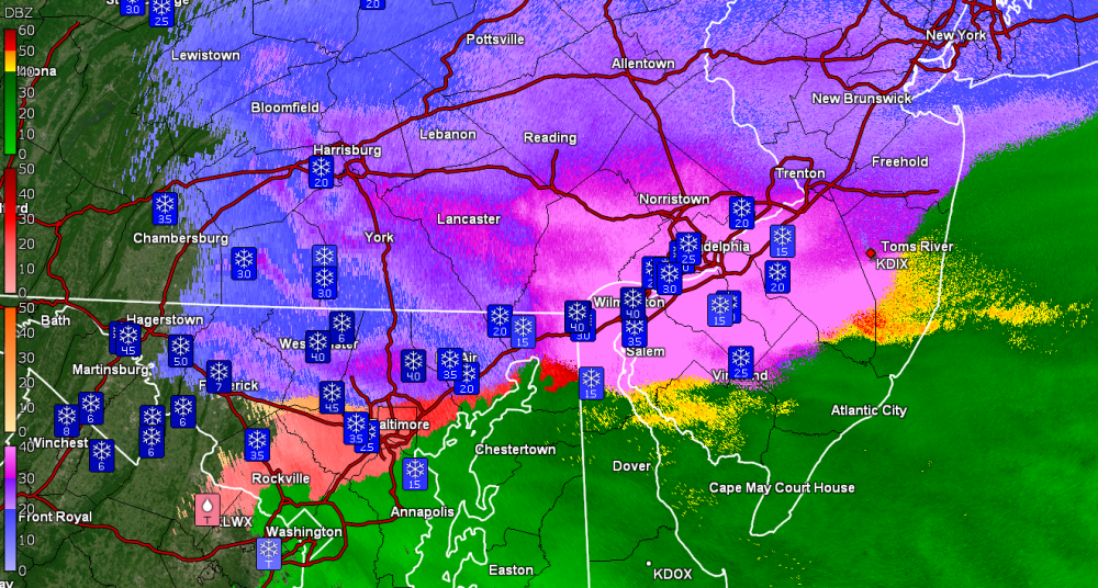
-
December 16/17 Snow Wall Obs Thread
Hurricane Agnes replied to hazwoper's topic in Philadelphia Region
Up to about 1.5" now with SN blowing and temp 28/dp 27 (vs down to about 1/2 mile). The "heavy" line has been lapping at me to the south. -
December 16/17 Snow Wall Obs Thread
Hurricane Agnes replied to hazwoper's topic in Philadelphia Region
That's from GRLevel3. I think they pull it directly from the Dopplers and the program can be configured to adjust the color scheme.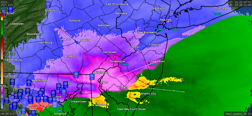
-
December 16/17 Snow Wall Obs Thread
Hurricane Agnes replied to hazwoper's topic in Philadelphia Region
Winds have picked up and the pressure has been slowly falling and was watching some blowing snow (off the car) so there is some powder in it. Temp has crept up to 28 and dp is 26, but still have light snow. That heavier stuff hasn't moved over here yet.