Hurricane Agnes
-
Posts
9,336 -
Joined
Content Type
Profiles
Blogs
Forums
American Weather
Media Demo
Store
Gallery
Everything posted by Hurricane Agnes
-
Now getting moderate rain. Dropped the temp down to 78 (so far).
-
Getting lightning and thunder... temp down to 85 with dp 75. Skies dark.
-
Just issued...
-
I heard the post alert in my browser, looked at my radar, and figured what it is about. Some smackage about to happen! ETA - am seeing some foreboding clouds to my west and south. I just hit the 90 mark with dp 76, so definitely steamy out.
-
Well my "low" this morning wasn't much of a "low" at 75. The dp has been horrible this morning too - currently 76 and got as high as 78 earlier. Current temp is 87 with a hazy deck of cumulus keeping the sun appearances down.
-
Well I tapped 94 just before 3 pm and am now in the 3rd day of 90s as an "official heatwave". There was a bit of a breeze here that seemed to help mix out some of the worst of the humidity, although it was still like a furnace out there for this early in the season. Currently down to 86 and party cloudy, with dp 70.
-
Yeah, the cirrus of this morning has been replaced by some ominous cumulus and that cloud over knocked me down from 93 to around 88. I did recover back to 92 (even with the mostly cloudy), but the dews dropped out of the mid-70s down to 71.
-
Damn. Already 91 here and it's before noon. Dewpoint is a bopping between a juicy 75 and 76. I'm afraid to walk outside! Glad I did what I had to do early this morning.
-
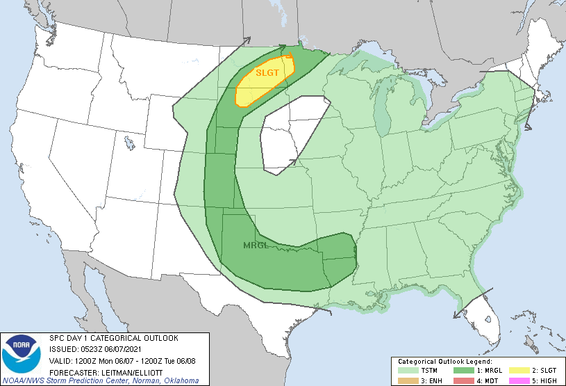
I think there was the possibility of that today. Probably pop-up/pulse type. They may get more of the severe north of here too... ETA - SPC has almost 1/2 of the CONUS painted with a t-storm outlook.
-
I just came back in from transplanting some seedling basils that I couldn't get out earlier due to the too-cool temps Memorial Day weekend, and the soup is on. Temp 83 with a dp bopping between 74 and 75 here!
-
I had one of those for a couple years (except it was a late '70s 4-cylinder with AM-only radio and no power-steering). I was always on the lookout for some kind of "car fan" that could plug into the 12-volt cigarette lighter socket. My low so far has been 71 this morning. Currently 72, with dp 69 and steamy.
-
I think I have now hit my high for the day at 93, just after 2:30 pm. Currently 90 and partly cloudy with some puffy cumulus, and dp bopping between 69 and 70.
-
Tapped 90 just before noon and now at 91 with dp 68. Glad we had that rain in advance of this for the plants' sake!
-
Now up to 88 with dp bopping between 68 - 70 and definitely has the "blast furnace" feel out there now! And I did see my first lightning bug - but early this morning (wrong time ). So they are out and about around here.
-
Already up to 83 here with dp 68 at post time (8:52 am) and mostly sunny.
-
Mt. Holly did put up a Heat Advisory for down here in Philly metro and surrounding counties. I maxed out at 92 but at least the humidity stayed in the 40% range. It's starting to creep up now though, with the dp at 66. Current temp is 86.
-
Wow. I know my area is under the flight path of circling planes headed for PHL and PNE, as well as some of the small airports nearby like Wings Field, but not right up next to any of them. Excellent pic of that though!!!
-
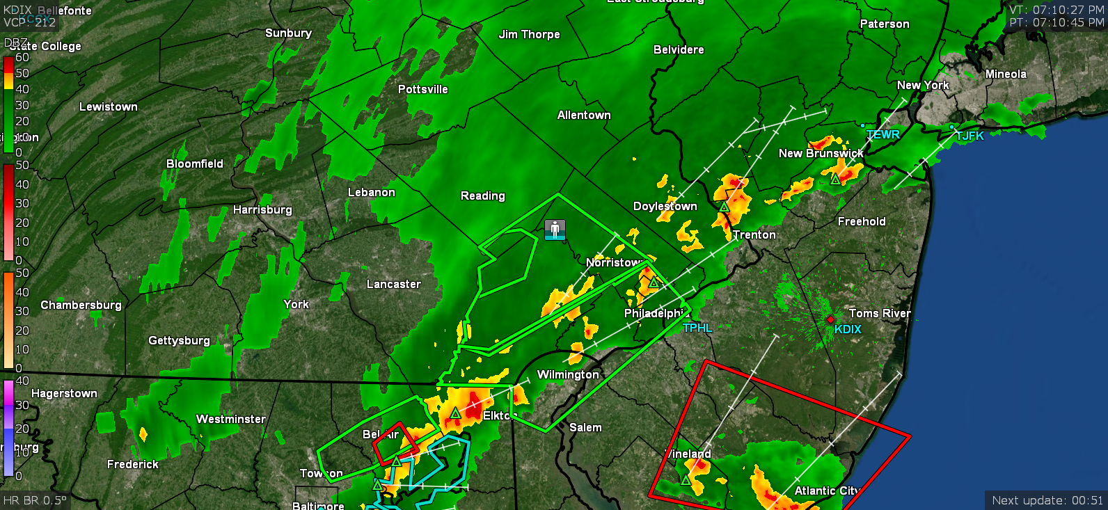
Looks like the heaviest line is past me now and moving quickly to the east. Just some lighter returns to the west and sun has popped out. Currently up to 0.59" from that and the temp is recovering a bit and up to 66.
-
I'm up to 0.3" and getting the southern fringe of a couple blobs... Temp down to 66 and rate is 1.3"/hr. ETA - jumped up over 2"/hr and am now at 0.50" with temp down to 65.
-
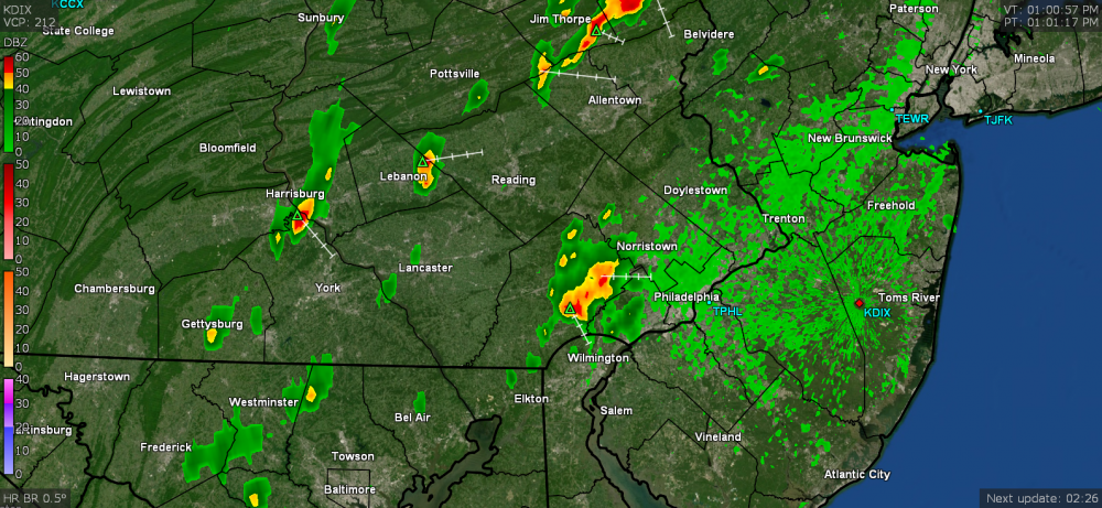
Getting a heavy thundershower. Had 0.02" of a light shower earlier today but am now up to 0.20" with just over 1"/hr rates (keeps changing higher). The temp dropped to about 75 just before the rains came in and is now down to 68.
-
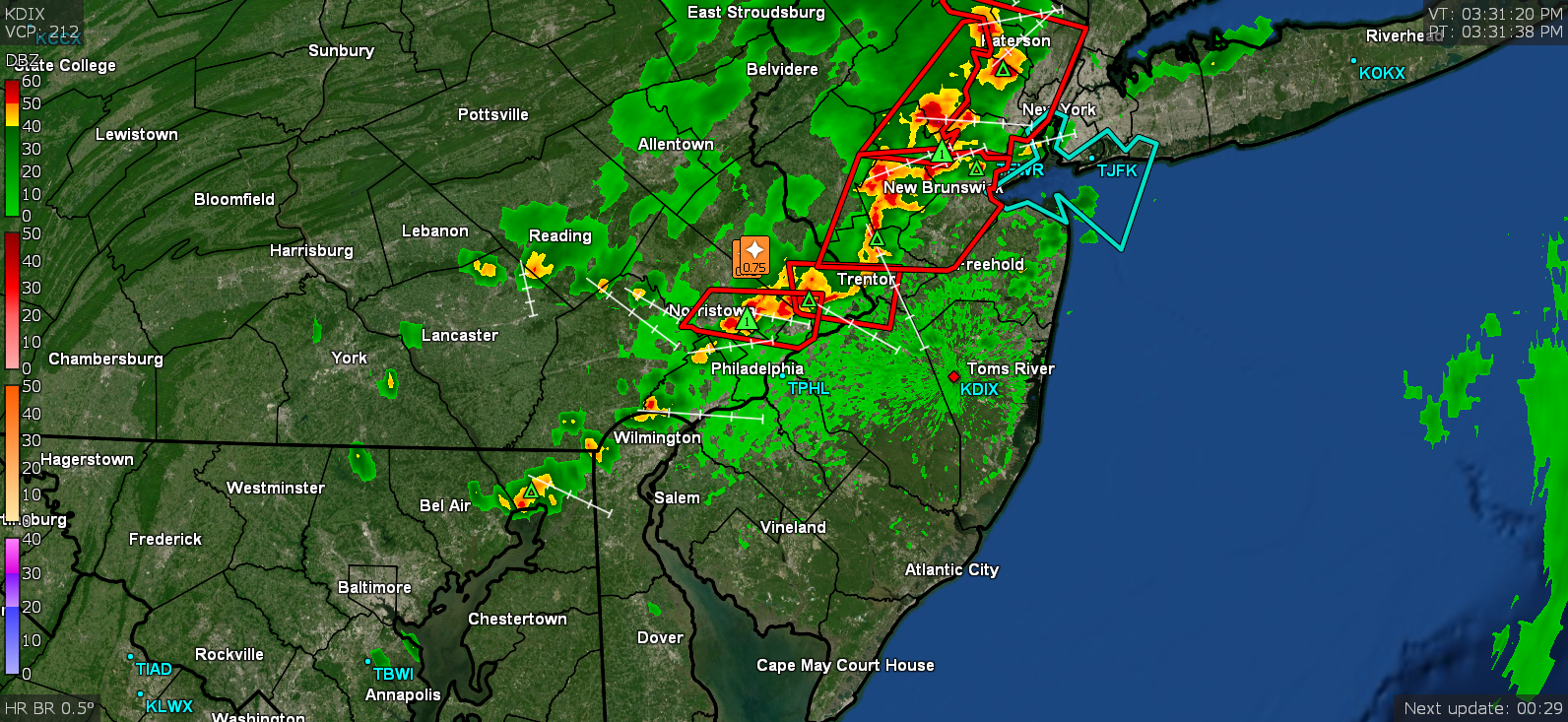
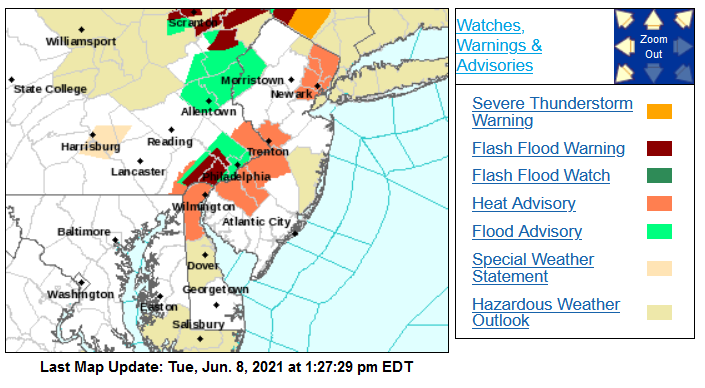
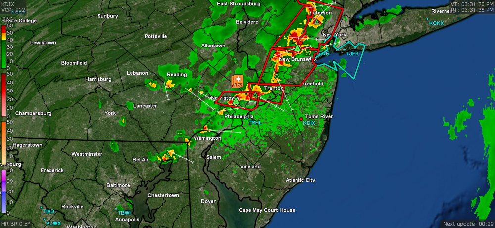
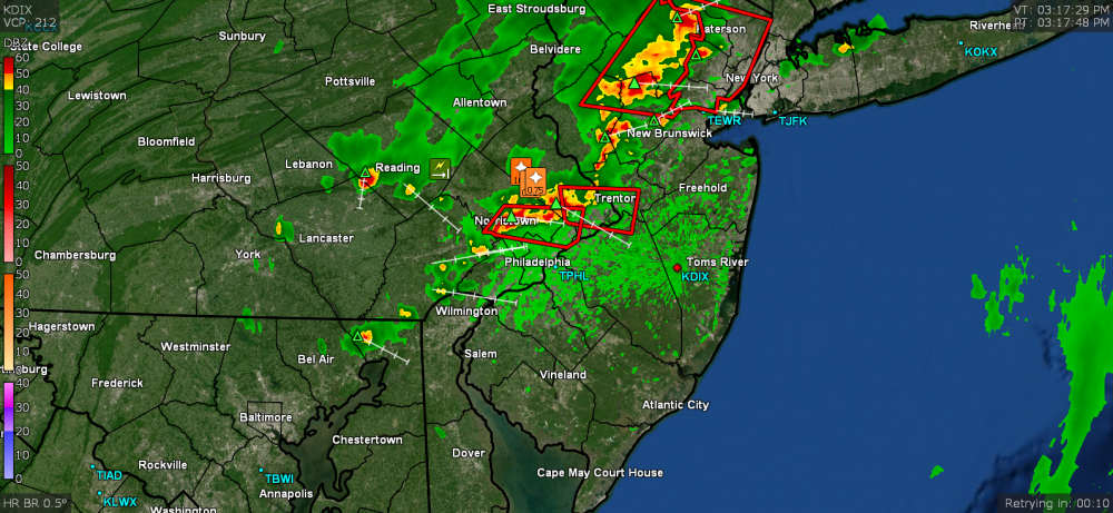
SPC up with the Watch (plus a Warning just over top of me and up just north of me in Montco). Temp is 81 here with dp 69 and some real nasty clouds to my north!
-
Finished up with 1.26" of rain yesterday, so a good soaking ahead of the progged heatwave. Currently 68 and overcast.
-
Now up to 1.02" in the past 90 minutes. Peak rate briefly got up to almost 2"/hr. Currently light rain and 68.
-
Getting a gully washer here with 1.8"/hr rates. Already up to 0.38". They just lofted FFW for this area.

-
Had a thunder about 20 minutes ago. I was able to push myself yesterday to finally get my overwintering tender tropical plants out on the patio and get everything fed in preparation for last night's progged qpf that yielded nothing IMBY. But at least I know I'll be getting it now. Currently light rain and 73 with dp 71 and 0.03" so far in the bucket.