

Hurricane Agnes
-
Posts
9,344 -
Joined
Content Type
Profiles
Blogs
Forums
American Weather
Media Demo
Store
Gallery
Everything posted by Hurricane Agnes
-
-
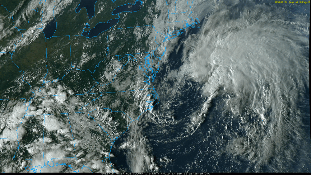
Had a low of 70 this morning and a high of 77, with some scattered rain that netted 0.03" so far. It's currently 74 and mostly cloudy, with dp 70 and a newly minted TS Odette sitting right off the coast!
-
I actually got 0.25" of rain last night from some cells that blew by here, complete with some chimney-rattling thunder. Had an additional 0.02" of leftovers early this morning so have 0.27" for the event. After a low of 68 this morning, am currently mostly sunny and 78 with dp 69.
-
Nice! Will have to see if that line lasts to reach here... It got up to 88 here today after a low of 70. Currently 81 with dp that has bopped up and down (and briefly hit 66) but is now at 69.
-
Yeah the haze is pretty bad late this afternoon but it's interesting how wide the spread has been today - Mt. Holly is watching for possible action tomorrow - Am keeping an eye on these guys too - Ended up with a low of 68 this morning and a high of 86. The humidity was definitely more noticeable. It's currently a hazy 83 with dp 72.
-
Low this morning was 68 and did make it up to 86 as a high today (so far) and yeah, the smokey haze has left a pall over the area. Currently 85 and hazy with dp definitely back up there at 71.
-
SPC SWDY2 has some of us in a marginal for severe - Currently clear and 62 with dp that has crept up a bit to 60.
-
I made it up to 78 today after a low of 55 with blissfully low humidity. I know this is probably the last "reasonable" day before the summer says "I'm not done yet", but I'll take it. Currently partly cloudy and 74 with dp 57.
-
Mt. Holly had posted that rainfall maps from yesterday -
-
I did manage to drop to 59 for a low this morning before it headed up to what is probably my high for the day at 75. Currently 74 and mostly sunny with a nice low dp of 51. Really nice day!
-
As the temps start to drop, the critters become less active and if the temps go below 60, many actually go into a torpor and hibernate. Didn't get any more precip yesterday so the 0.40" was it. Currently 60 with dp 58. I expect I'll probably drop a little lower this morning as a low although I'm not completely decoupled and am getting a few puffs of wind.
-
The 66 ended up being my low this morning and 74 was my high. I also got a few more hundredths of an inch of rain and stand at 0.40" for the day (so far). That little line was holding together pretty good until it started approaching the city and has really broken up now, so not sure what will be left once it reaches here (if it ever does). Currently 71 and mostly cloudy with dp 66.
-
Another little band came through for a little bit more than 1/10" additional and now have 0.36" in the bucket for the day so far. Am dry at the moment but may get some scattered stuff as the morning goes on. Currently 67 and overcast with dp 66.
-
I think one thing to keep in mind is the time of year. This is literally when both the ground and (large body) water temps are at their warmest. So although there might be less daylight hours to produce heat higher up, the night time ground radiation into the air of that stored heat, could help fuel those night/early morning storms. The band sortof broke up as it got here and the rain that I have received only started sometime after 2 am, and had been on and off through about 6:30 am. Am currently misty and have 0.25" from it (so far) with temp of 66 and dp 66 with the frontal passage.
-
SPC woke up and threw up Severe Thunderstorm Watches for the CWA -
-
I think it is more due to the potential for creek and river flooding, particularly to the north. For example, the Passaic near Pine Brook and Morristown in Jersey has been under a flood warning since Ida - And if that line moves as slowly as it has been, any training would just exasperate the flashier creeks. Plus you have people who were impacted by tornadoes last week with obliterated and/or damaged homes and I expect that if any cells pop up with some gusty winds, those can take down any trees that made it through Ida. I have heard (at least on KYW and from the NWS AFD) that it wasn't going to be anything like last week but because the ground is so saturated, it might not take much to overwhelm an area. I even heard that here in Philly, PennDOT literally pumped out 30 million gallons of water out of what I dub the "Vine Street Expressway Canal", in a couple days, so thankfully they got that out of the way.
-
Definitely looks like a lenticular cloud! https://www.weather.gov/abq/features_acsl
-
LOL This is what WPC has for its twitter profile pic - It's definitely gotten juicy here today. Had a low of 64 but it's currently 84 with a dp of 72 and starting to cloud up but with breaks of sun. Mt. Holly has its precip outlook out and will see how this verifies.
-
Ended up with 83 as a high yesterday and a low of 62 this morning. Currently mostly sunny and 78 with dp 61, so definitely not bad out...
-
My high for today appears to have been 74 and currently have 0.04" in the bucket (from 2 rounds of light rain). It's currently 71 and overcast with occasional light rain and drizzle, and dp 69.
-
My low ended up being 61 this morning and the rain that was supposed to evaporate before getting here, is here (although it hasn't tipped the bucket yet). Currently 70 with light rain and dp 66.
-
Most of the precipitation was to the north and west of downtown (I am like 20 miles from the airport as the crow flies and was probably around the southern fringe of the heavy rain). The southern parts of the city had less, which for people like those in Eastwick (in SW Philly), which continually gets flooded with this type of event, was spared this time (usually getting swamped by the Darby Creek and Cobbs Creek)! They got walloped last year by Isaias. The neighborhood is adjacent to the airport. Hilly areas south of me - like East Falls and Manyunk, got hit with flooding from the Schuylkill as they are situated alongside the river or at the bottom of the hills coming out of Roxborough and got the brunt of the river and runoff of water down the hills. As a side note, when I was just looking for something else, I did stumble on this compiled from Mt. Holly data regarding TORWs over the past 25 years or so (so throwing in this thread just for FYI) -
-
I wish I were "well-versed" in those programs! There is so much in them, so am still trying to get a handle on them. As an obs, the high deck of cirrus did eventually clear out yesterday and I managed to get up to 77 as a high and the weather was about as perfect as you could get - not humid but comfortable and warm. There was some low-hanging stratus earlier this morning but that seems to have lifted, and it's currently clear and 64 (will see if that is my low or it will drop down any more before sunrise), with dp 62.
-
As a post-script, all Mt. Holly sites (except GED) broke records for rainfall (associated with Ida) -
-
Ended up with a high of 73 yesterday (low of 56). It's currently mostly cloudy with some breaks in the high cloud deck, but including a vivid red sky in the east and 58, with dp 56.


