Hurricane Agnes
-
Posts
9,337 -
Joined
Content Type
Profiles
Blogs
Forums
American Weather
Media Demo
Store
Gallery
Everything posted by Hurricane Agnes
-
And WPC because they were nailing what would be the hardest hit areas.
- 487 replies
-
- 1
-

-
- hurricane
- flooding potential
- (and 2 more)
-
I would think pure adrenaline and love for the job. I will say - you can't say they didn't "warn" people. TORs and FFWs have been flying all afternoon and evening and good use of the EAS because that damage looks pretty bad from the tornadoes. And we haven't even seen the poor people who keep getting flooded out by the creeks they may live near.
- 487 replies
-
- 2
-
-
- hurricane
- flooding potential
- (and 2 more)
-
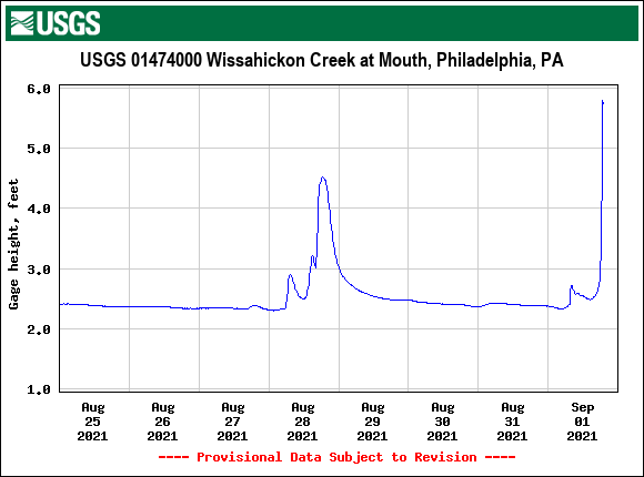
Rain has let up a bit and down to about 1/2"/hr but am now at 4.03" for the event (3.47" for round 2), so the calls for " 4" - 6" " in the I95 corridor have definitely verified. There are some other streaky blobs to the west and am not sure if they will go over me but, we shall see.
-
Wissahickon looks to probably be out of its banks.
-
Getting hammered with heavy rain now. Getting close to 3"/hr. Am up to 3.66" for the event at post time.
-
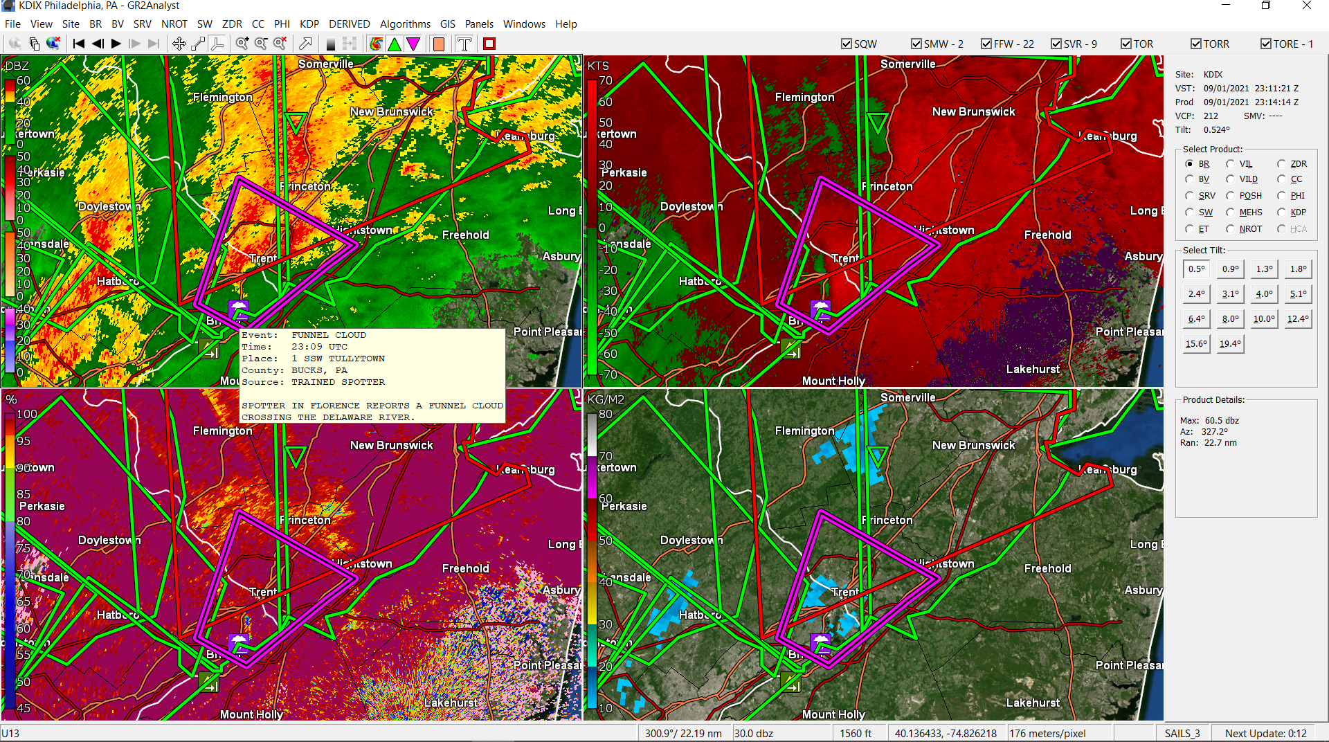
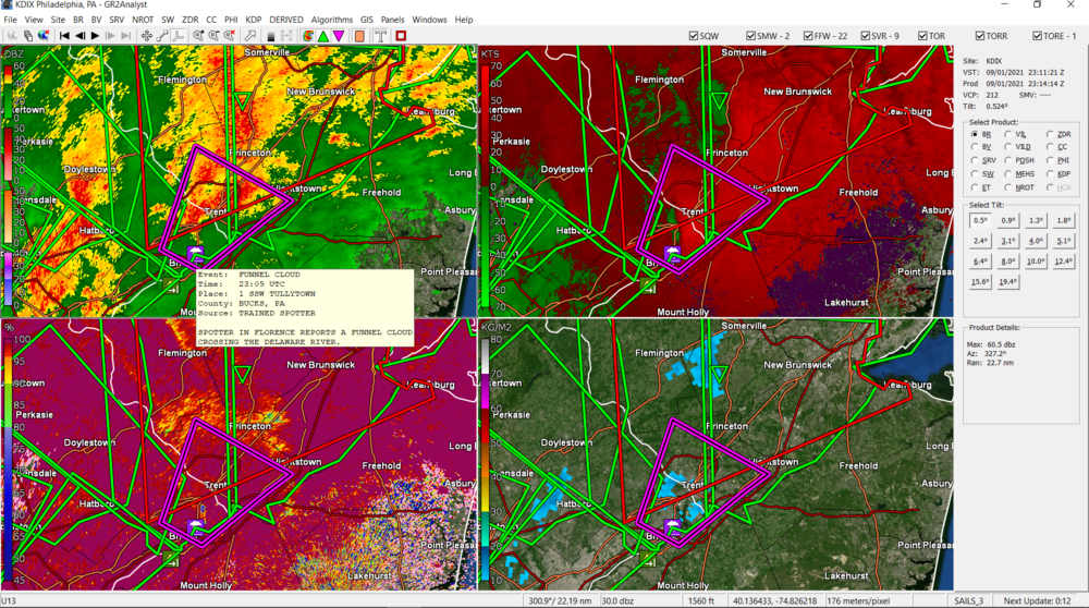
Spotter reported a funnel cloud near Tulleytown.
-
Just had a close loud lightning strike.
-
Have been hearing thunder hear. Rain has started back up again and just over 1"/hr rates. Temp and dp at 75.
-
WPC 5 pm update (winds have picked up, system has deepened a bit, but still moving at 25 mph ENE) -
-
Rain has lightened a bit at the moment but am at 3.00" on the dot at the moment (total for the event).
-
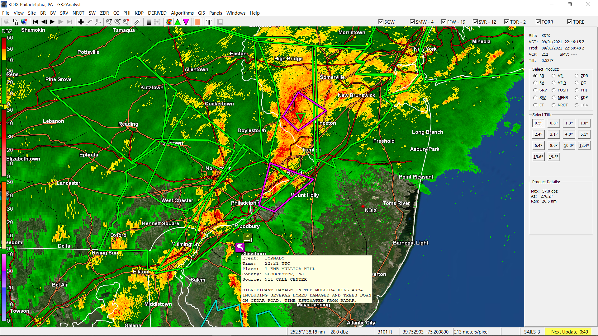
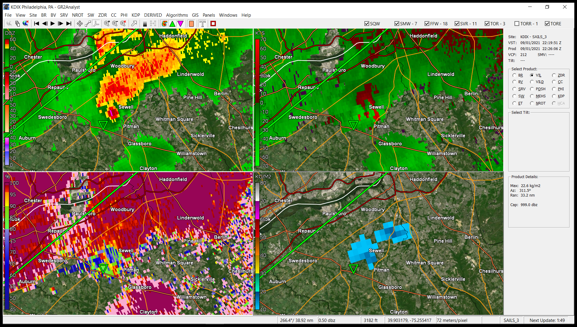
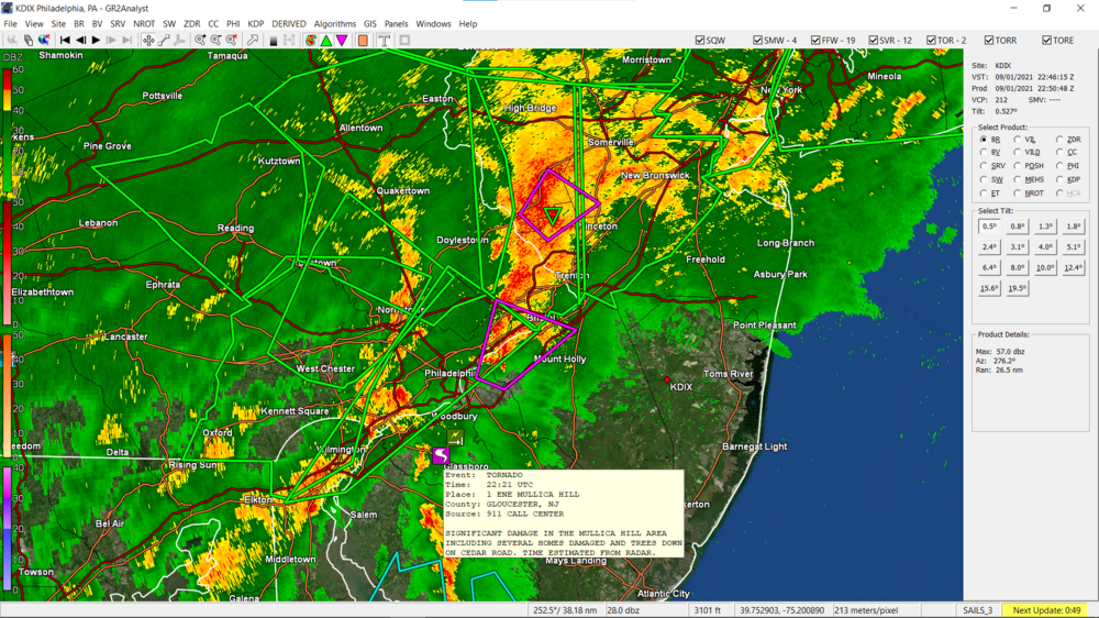
Saw that they were indicating it was in the Mullica Hill area.
- 487 replies
-
- 1
-
-
- hurricane
- flooding potential
- (and 2 more)
-
I was just thinking that. Looks like your avatar!
- 487 replies
-
- 2
-

-
- hurricane
- flooding potential
- (and 2 more)
-
I've been staring at stuff in Jersey.
-
Theoretically, that is what the NAM was designed to do. I know people have made fun of it over the years but I think whatever they did to improve it a year or so ago, seemed to have helped.
-
Stay safe. That was probably the only thing to get you out of summer hibernation. I'm at 1.5"/hr rain and am up to 2.81" so far for the event. Temp and dp both 75. Windows steamed.
-
Getting just over 3 1/4"/hr rates. Am up to 2.08" for the day so far.
-
Getting a gully washer again, over 1" an hour. So loud I can hear it. Temp up to 75 with dp 74/
-
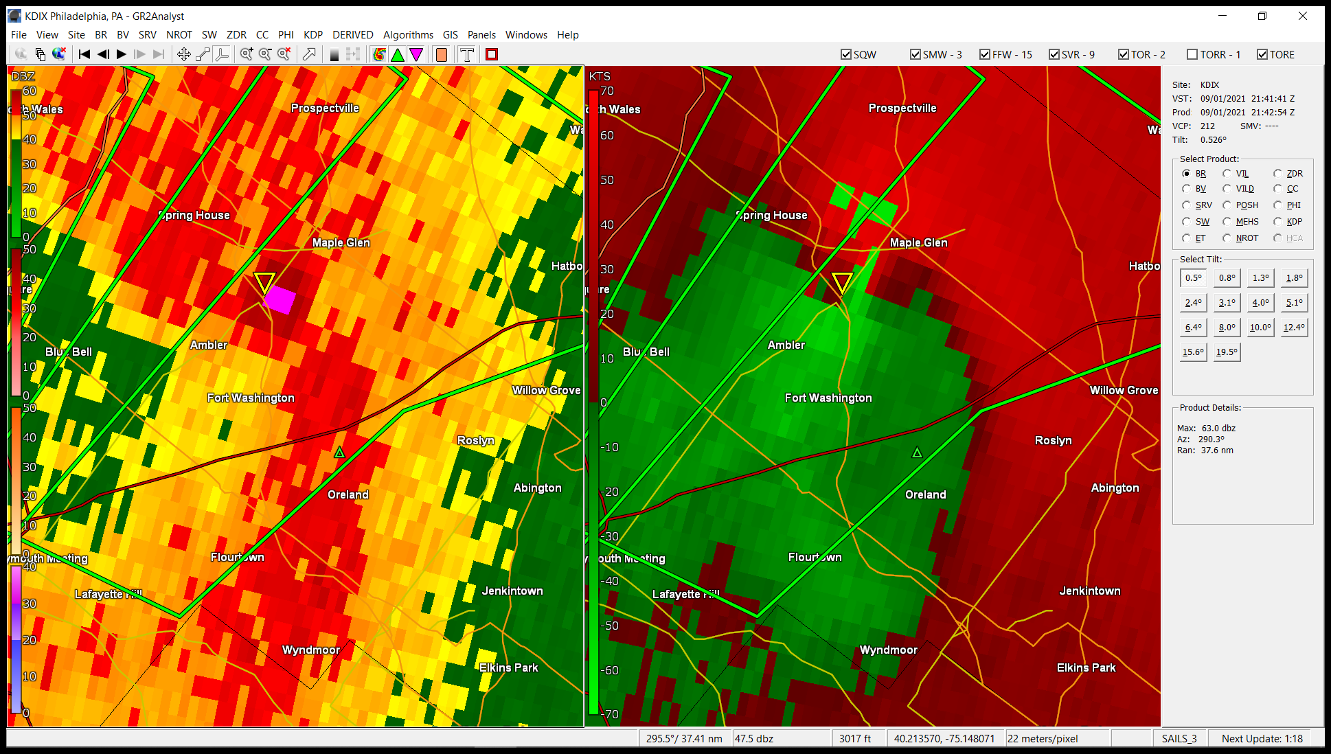
New TOR over me and am seeing what looks like something that could be at Plymouth Meeting (about 5 miles from me).
- 487 replies
-
- 1
-

-
- hurricane
- flooding potential
- (and 2 more)
-
Hope they get you back quickly. I know the last heavy rain here mine went out, but PECO got to it within a couple hours.
- 487 replies
-
- 1
-
-
- hurricane
- flooding potential
- (and 2 more)
-
Under a TOR with Emergency Alert. Phones going nuts. I heard a big thump before it (thunder?)
-
Getting moderate rain and am now at 1.10" for the event so far (0.54" from round 2). There's a heavier slug to my SW that if it holds together, may rotate up through the city to here.
-
I was seeing this type of stuff over by North Wales and Landsdale.
- 487 replies
-
- 2
-
-
- hurricane
- flooding potential
- (and 2 more)
-
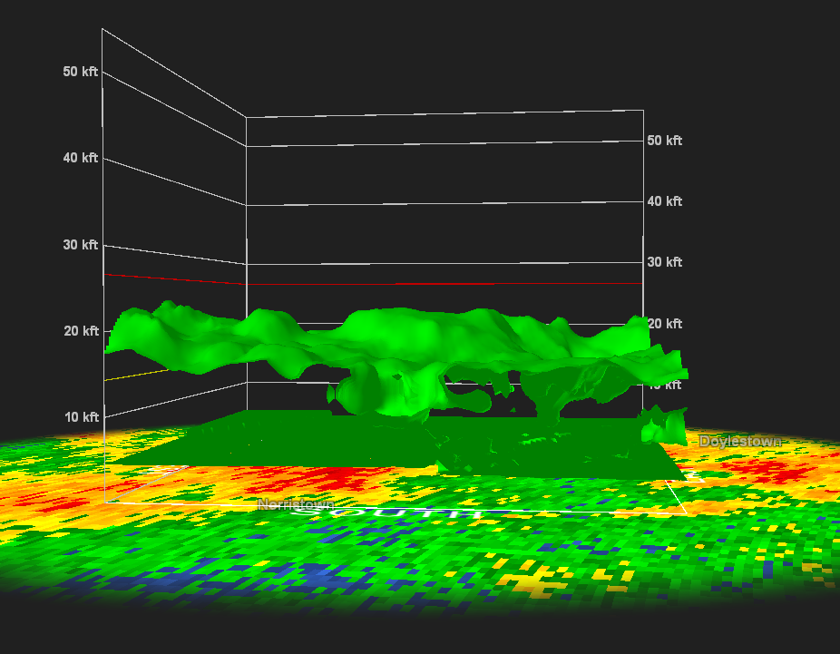
Still getting some rain - light to moderate (at around 1/3rd inch/hr). Temp is 74 but dp is now up to 73. Was looking at those cells up by Landsdale and the other by Doylestown. They looked almost like they were trying to make some funnels.