Hurricane Agnes
-
Posts
9,346 -
Joined
Content Type
Profiles
Blogs
Forums
American Weather
Media Demo
Store
Gallery
Everything posted by Hurricane Agnes
-
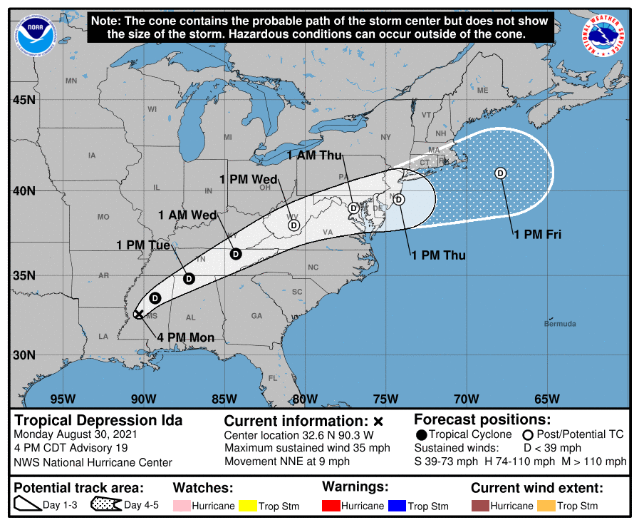
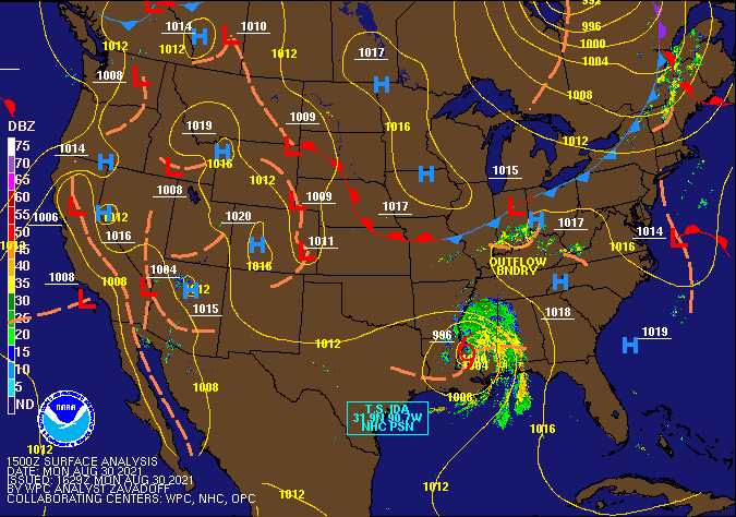
WPC 11 pm update (holding steady at 35 mph, pressure deepend a bit to 998, moving 10 mph to NE) - Entire Mt. Holly CWA in WPC Day 2 "moderate risk" for excessive precipitation -
-
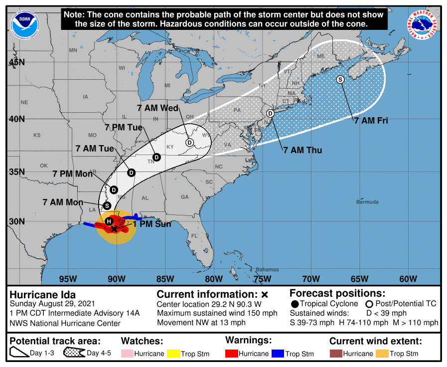
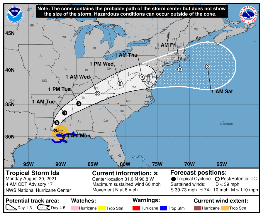
NHC 5 pm update (Ida now downgraded to a tropical depression, 35 mph, 999 mb, movement unchanged 9 mph NNE) -
-
It's probably related to the little Low associated with a cold front that will eventually make contact with Ida to shunt moisture this way.
-
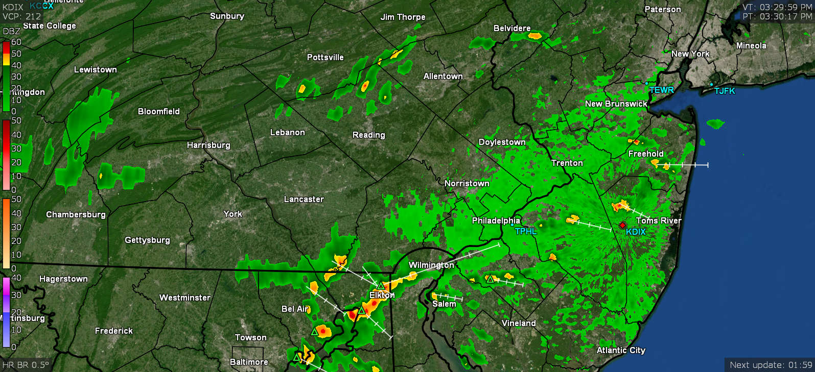
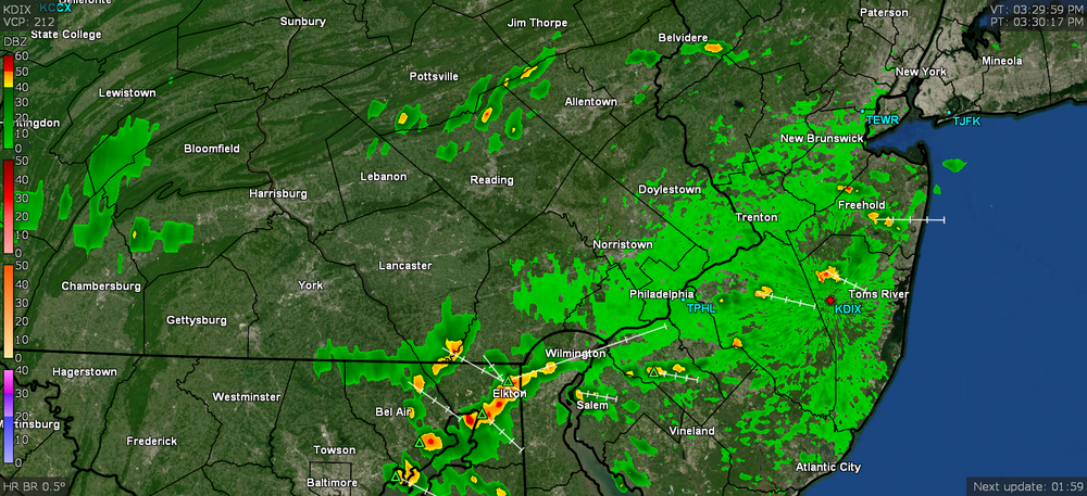
Radar lighting up to the north and south of Philly metro. So far my high has been 88 today (just happened as I am typing this) and currently 88 and mostly sunny, with dp 75.
-
NHC 2 pm EDT update (still 40 mph, weakend to 997 mb, no change in speed but now moving to the NNE) -
-
NWS MARFC following the latest models bullseying Central PA with heavier rain from Ida remnants - I know that part of the state has had excessive rain give how many of the convective lines that have made it this far east, but also how many fizzled before getting here where they were dumped on. Haven't looked at their stats but it definitely has to be above normal.
-
NHC 11 am EDT update (further weakened and at 40 mph, pressure 996 mb, and has speeded up a bit to 9 mph) -
-
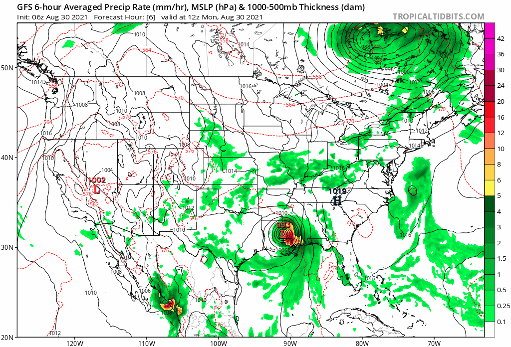
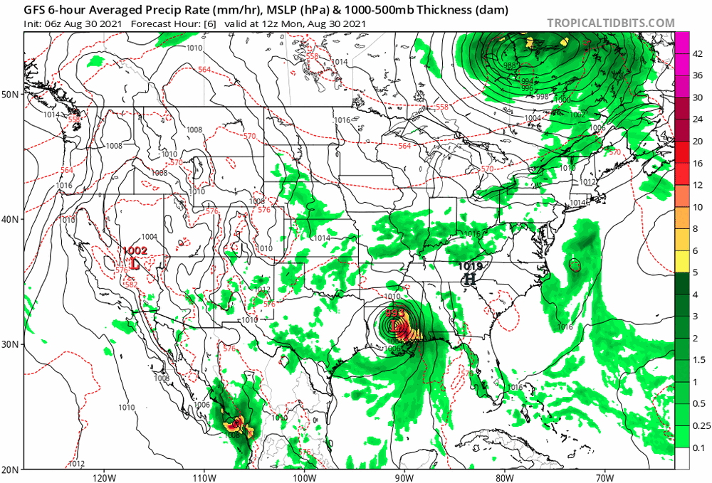
I noticed some of the 6z models (GFS, NAM, Icon) are basically showing the remnant Low running through or just south of Philly throwing a lot of moisture north but still filling in over Philly metro. They were showing western and central PA getting the hit first before it spreads east.
-
Stratus is lifting here now this morning and the sun is emerging. Looks like my low was 73. Currently partly cloudy and 75 with dp 73.
-
NHC 8 am EDT Update (now down to 45 mph, slowed to 8 mph, pressure gradually rising and at 993) - The SE ridge needs to shunt it up to the cold front in order for it to get sucked onto the highway to here. Otherwise it is crawling along at 8 mph and just pouring rain on those folks.
-
Flash Flood Watch lofted for the CWA -
-
Mt. Holly retweet of WPC's Day 3 (a rare "moderate risk") for excessive rain - SPC has the southern 1/3rd of the CWA under a "marginal risk" for severe -
-
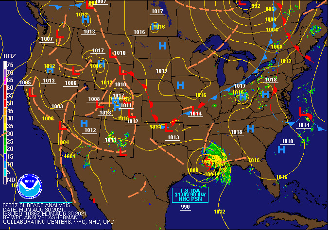
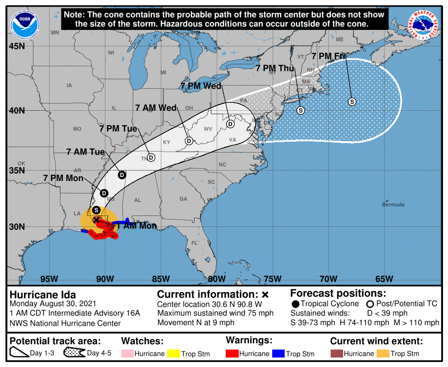
NWS 5 am EDT Advisory (downgraded to a TS, 60 mph, 990 mb, 8 mph) - With all the power in the New Orleans metro area out, KLIX is down.
-
NWS 2 am EDT update (has weakened to a Cat 1 at 75 mph, 972 mb, and moving N at 9 mph) -
-
NHC 9 pm EDT update (continues to weaken with sustained @115 mph, pressure 947 mb, and slowing to 9 mph) -
- 487 replies
-
- 1
-

-
- hurricane
- flooding potential
- (and 2 more)
-
NHC 8pm Intermediary Advisory (continues to weaken and down to 120 mph & 944 mb, forward motion unchanged) -
-
NHC 7 pm EDT update (weakened to a Cat 3 125 mph, 941 mb, 10 mph NW) -
-
It's coming.
-
NWS 6 pm EDT update (no change in speed, direction, pressure) -
-
NWS MARFC calling for 4" in Central PA through Wednesday (am guessing we will get the bulk of ours that night into Thursday) -
-
Looks like 81 was my high today when the sun popped out (after a low of 66) and then the sun self-destructed and it's been overcast much of the rest of the afternoon. Currently 78 with the dp back up again at 72.
-
NHC 5 pm Advisory (still Cat 4, but minimal, slowed to 10 mph and near steady at 938 mb) -
-
When it first made landfall, it looked like it was rolling like a bowling bowl almost due W or WNW but then it looked like it hit a "wall" and is drifting now more to the NW again. It's been 4 hours since landfall and it is still a minimal Cat 4 @ 130 mph.
-
NHC 4 pm EDT Update to Advisory - WPC D3 -