Hurricane Agnes
-
Posts
9,336 -
Joined
Content Type
Profiles
Blogs
Forums
American Weather
Media Demo
Store
Gallery
Everything posted by Hurricane Agnes
-
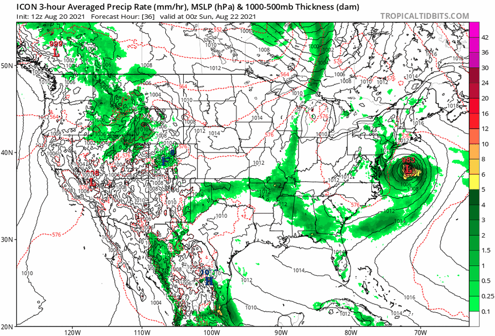
0z ICON doing a loop-de-loop around NE PA.
-
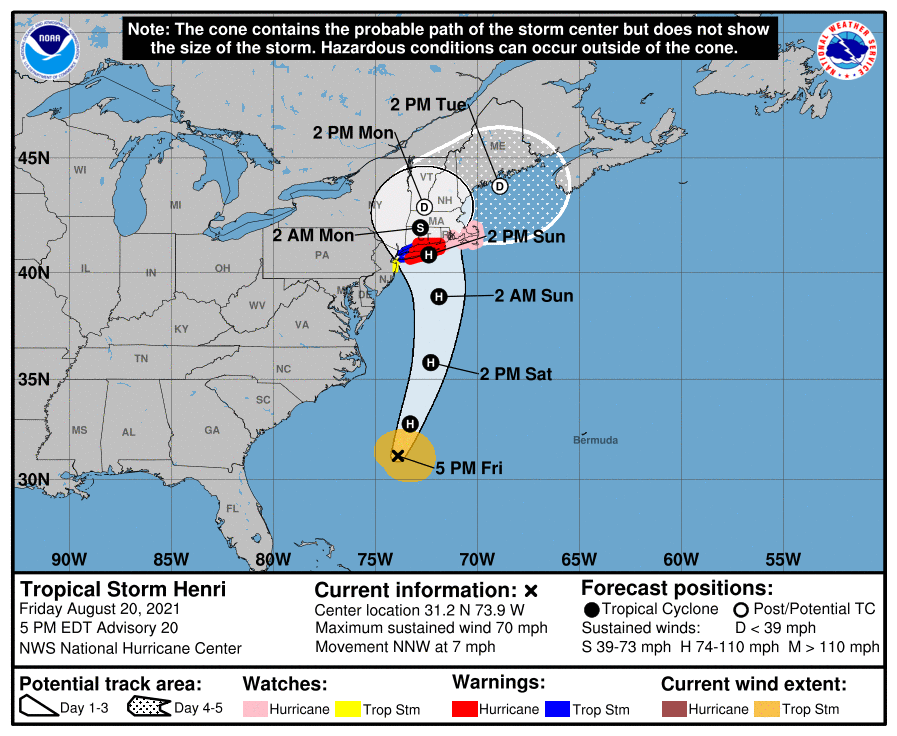
11 pm Advisory. Cone (with landfall) about the same but possibly a tiny tick west. Speed has picked up a little...
-
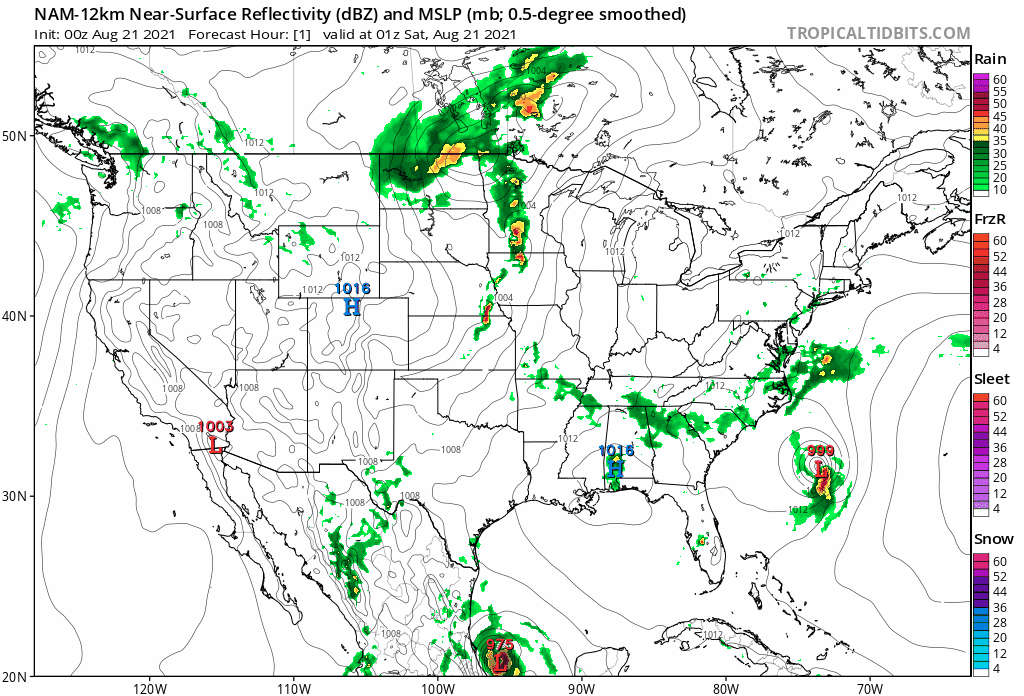
It's a shame we are 24 hours out from it and the models are all over the place. The shear had been keeping it from moving much but the visible looks like it is trying to stack and it is getting into a more favorable area.

-
NAM running... swings out east and then hooks around and hits eastern LI to crush the whole state of CT.
-
Yeah, there are/were a couple recons going around and in it, so will see if any new data shifts it either way to start (or continue) a trend.
-
NHC 8pm Advisory -
-
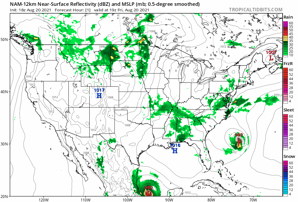
18z NAM is saying not so fast and starts sending it east again (although it does seem to be picking up what I was seeing on the visible sat wihere the naked lower level swirl of the system seems to be tugging the rest of itself slightly to the east).

-
NHC 5 pm Public Advisory (forward motion a little quicker but winds/pressure the same) -
-
Sun popped up later this afternoon, although the skies have been variable. The high (so far) has been 82 and it's currently 81 with dp 71.
-
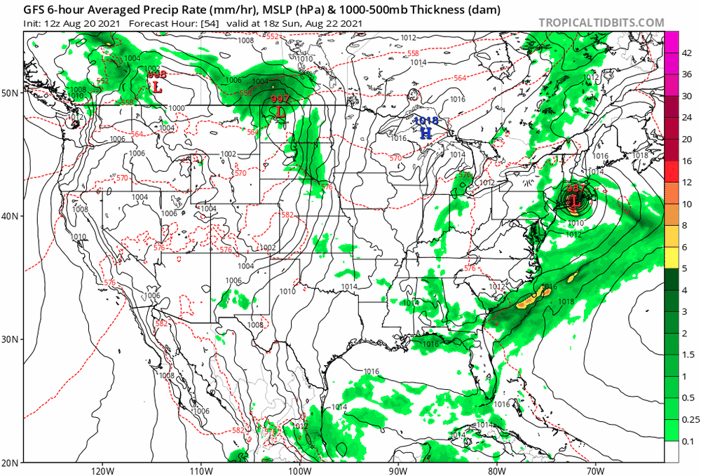
With almost all but the GFS going west, will be interesting to see if the GFS caves...
-
NHC intermediate advisory -
-
I know right? I know when Fred was making landfall, it looked like Henri would be a fish storm, looping around Bermuda and out to sea.
-
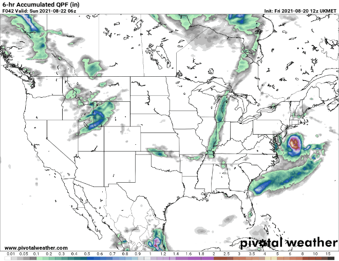
Seems to be getting closer and closer to the CWA with rain impacts. Ukie, hot off the press.
-
Looks like it plowed into N. Jersey a tick further south. I'm gonna go ahead and make a thread...
-
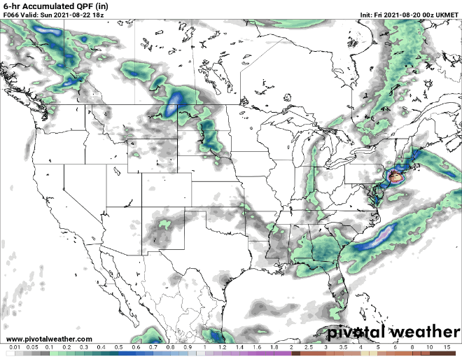
Looks like the Ukie 12z is running now. I finally checked over in the NY Metro forum and yeah, they are hot on its tail. Was wondering if we should go ahead and make a separate thread on it just in case.
-
That's what's bugging me out - seeing the inland loop-de-loops coming out of the recent runs across models. Am guessing they are all trying to resolve what will happen with the ridge up in Canada and where it will be by the time Henri gets closer to it.
-
Backroom deal (although the latest contract details are not known yet).
-
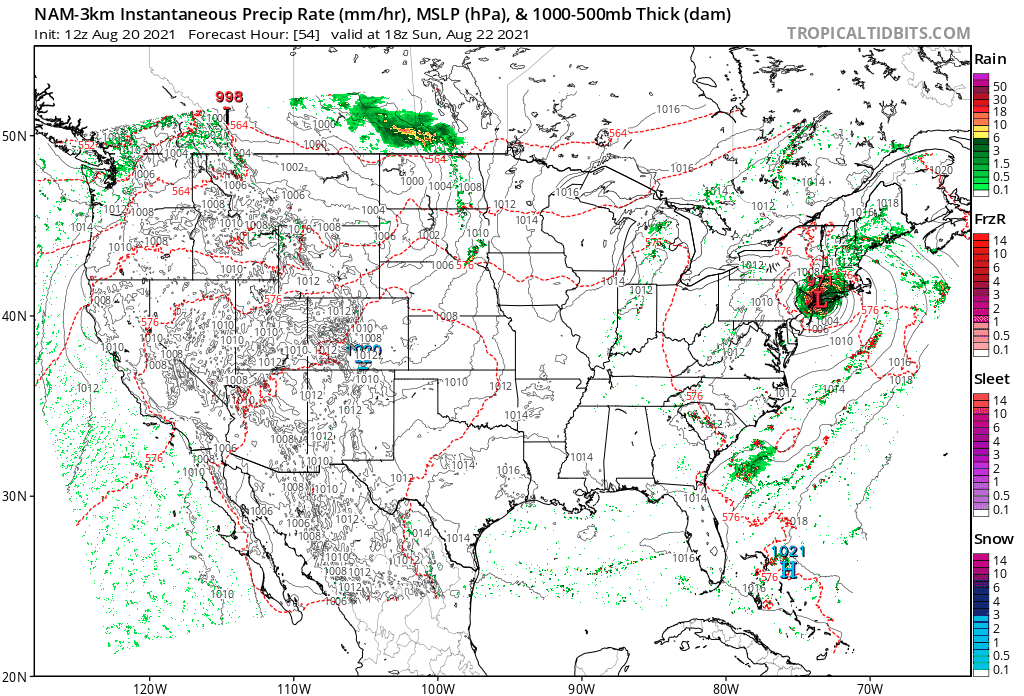
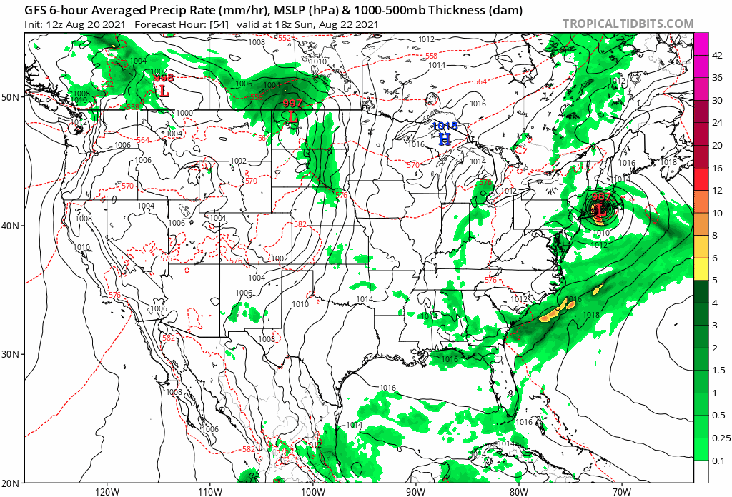
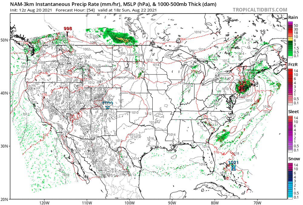
At a landfall (hour 54) the 3k NAM is actually closer to the ICON and the others hooking into NYC, vs the GFS, which is further east.
-
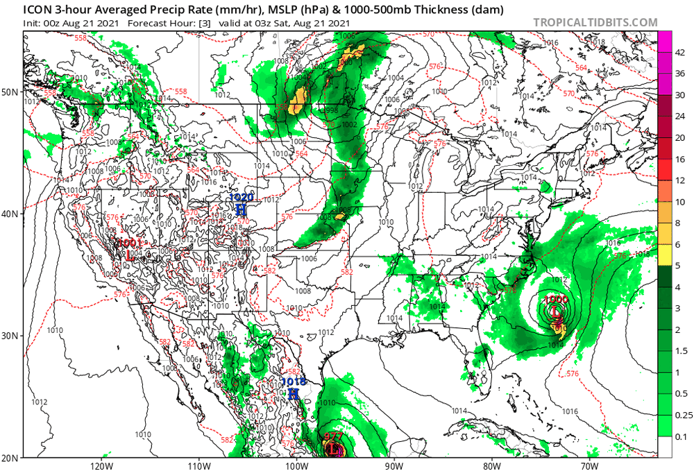
I'll do a Ralph with the ICON.
-
WPC is baking some of that now in their Day 2 & Day 3 (will have to watch for changes - ETA to add Day 1 since S. Jersey is featured in that) -
-
The ssts north of 40N nearer to LI are cooler which could weaken it (wind wise) but agree that this could be a big rain producer. Will have to see what the warm water does to the cyclone once it starts recurving to the north.
-
All but one are hitting either LI or SNE so that is definitely concerning. Haven't looked at any threads in the NE forum but I'm sure they are jumping.