Hurricane Agnes
-
Posts
9,336 -
Joined
Content Type
Profiles
Blogs
Forums
American Weather
Media Demo
Store
Gallery
Everything posted by Hurricane Agnes
-
After a low of 71 this morning, am currently partly sunny and 91 with dp 68 (so the "cool" front did a little bit to take the dews out of the mid-70s).
-
Made it up to 88 here today and just got done a perfectly targeted pop-up shower (no convective thunder/lightning) to top off my hose-watering from Friday. I got 0.33" from it and along with this morning's fringe popup, that makes it 0.36" so far for today. Currently 80 and partly cloudy but the dp is is 77 (had already been in the mid-70s earlier).
-
As an anecdotal observation, and obviously not a solid prediction for some future extreme event given the issues in the arctic region that can move the PV into odd locations, but KPHL has not recorded a below 0F temp since January 19, 1994 (which was a -5 during an arctic outbreak that impacted the midwest to the east coast). For us gardeners, it makes a difference in terms of the average of the yearly lowest min temps (over some "x" period of time) with respect to plant hardiness for temperate plants, and what might be planted that could survive (and thrive) in this area. And those values are part of what gets factored into the USDA hardiness zones. The last closest-to-0 temp more recently, was a +2 on February 20, 2015. Of course that is the "airport" temperature. But there has definitely been an upward shift in temps - and moreso seen in the lows in winter. In summer, the average night lows have also slowly edged up as well, but regarding the highs, it appears that will depend on the antecedent precipitation and ground moisture, which usually precludes our getting the occasional triple digit temps. In fact, believe it or not, the last triple digit temp at KPHL was almost 10 years ago - a 101 on July 07, 2012. Going into a summer with drought conditions definitely improves the chance of triple digits, but the general climatology here doesn't get us to that point with any consistent frequency when compared to other parts of the country, and proximity to the ocean is probably a big reason why. And as a sidenote - yesterday afternoon, I was watching a seabreeze front come all the way inland, cut across Jersey, hop over the river, and slam right into NE Philly.
-
My low so far this morning had been 70 and just as the temp was slowly starting to creep up a bit, in came a little pop up shower that was much appreciated. It wasn't really expected given the warm front had already passed through here and formed a line that barreled through Jersey. Currently getting some light rain (0.03" so far) and 69, with dp 67.
-
My low this morning was a warmer 66. It's currently sunny and clear and 77 with dp slowly creeping up, but reasonable at 62. Today will probably be about the last before the humidity starts to reappear. Am also watching the disturbance down near FL that may become a TD in the next few days depending on the sheer. If it does ever become a TS, it would be "Fred".
-
Well my low this morning was 63 but what was really different is finally getting dps in the 50s. Currently 81 and mostly sunny, with dp 56, which is fantastic (humidity is only 42%). I did have to get out there and water though since that nasty cell didn't give me the rain that was needed.
-
I figured you'd reach for one of these - Will take out all sorts of unwanted critters and drop a hint to any in nearby yards that you mean business.
-
LOL I think I saw one of those yesterday when I was out on the front of the house near my car. First thing that came to mind based on the size was cicada killer. But I wasn't sure because it was too busy following me and I had no weapon like my spiked swatter or a broom. I tried to wait for it to land when I got a little distance away, in order to see the front of it better, and it definitely wasn't a murder hornet or a bald-faced hornet (I have had to deal with the large bald-faced ones before). But it was pretty big, but somewhat long and slender, and I believe the cicada killers nest in the ground, so they will hang around the ground like mine did. Currently just hit 80 here and dp at 59.
-
I guess if you think of the the wind mechanics and dynamics - I can see where briefly sustained strong winds over a short time frame might cause a tree with a large canopy like that, to rock back and forth, breaking the feeder/surface roots in the process, and finally toppling over with root mass intact and now exposed. But in this case (and many others), the tree just snapped, as if smacked by the rapid onset of a very strong, concentrated, and directed force of wind. It's like something you see happen with major hurricanes at a landfall. The trees might not get chance to rock and uproot/topple. The bark gets stripped, the branches get defoliated as they are ripped off, and the tree trunk eventually snaps. I remember the pics out of the FL panhandle near where Hurricane Michael made landfall as a CAT 5 back in 2018. You had trees along the highways looking like this - Anyway, the 63 was my low and it's currently partly cloudy and a confortable 76 with dp 59. Really nice out!
-
Saw this on NBC10's site - The person who tweeted the pic lists herself in Jenkintown. My sis said yesterday that when she drove around Wyndmoor and Erdenheim she saw the same type of thing - trees snapped at or near the base like the above pic. I remember too back during the winters of 2013/2014 when there was similar major tree damage around the area (particularly for people who had white pines or "exploding" Bradford/Callery ornamental pear trees) from snow/ice load.
-
Gonna see how low it'll go here this morning. So far I dropped to 63 just after 5 am (AC is OFF) and it's currently 64 and clear, with dp 58 a little over half an hour before sunrise.
-
I was watching the blobs rolling over that area and had wondered what the impact might have been when there was "radio silence" for a check in. Didn't realize you were down in Jersey. My sister in Wyndmoor still has power out (her whole neighborhood). They made some progress with power restoration in her township (Springfield, Montco) but most of Wyndmoor and Erdenheim in the township, are still out. Her street always has issues too because they are at the bottom of a hill and the electric wires are running along a wooded creek on her side of the street, so downed trees and branches are a continual issue.
-
Of all times for you to be out of town because it looked like a bunch of stuff blew through Reading this time.
-
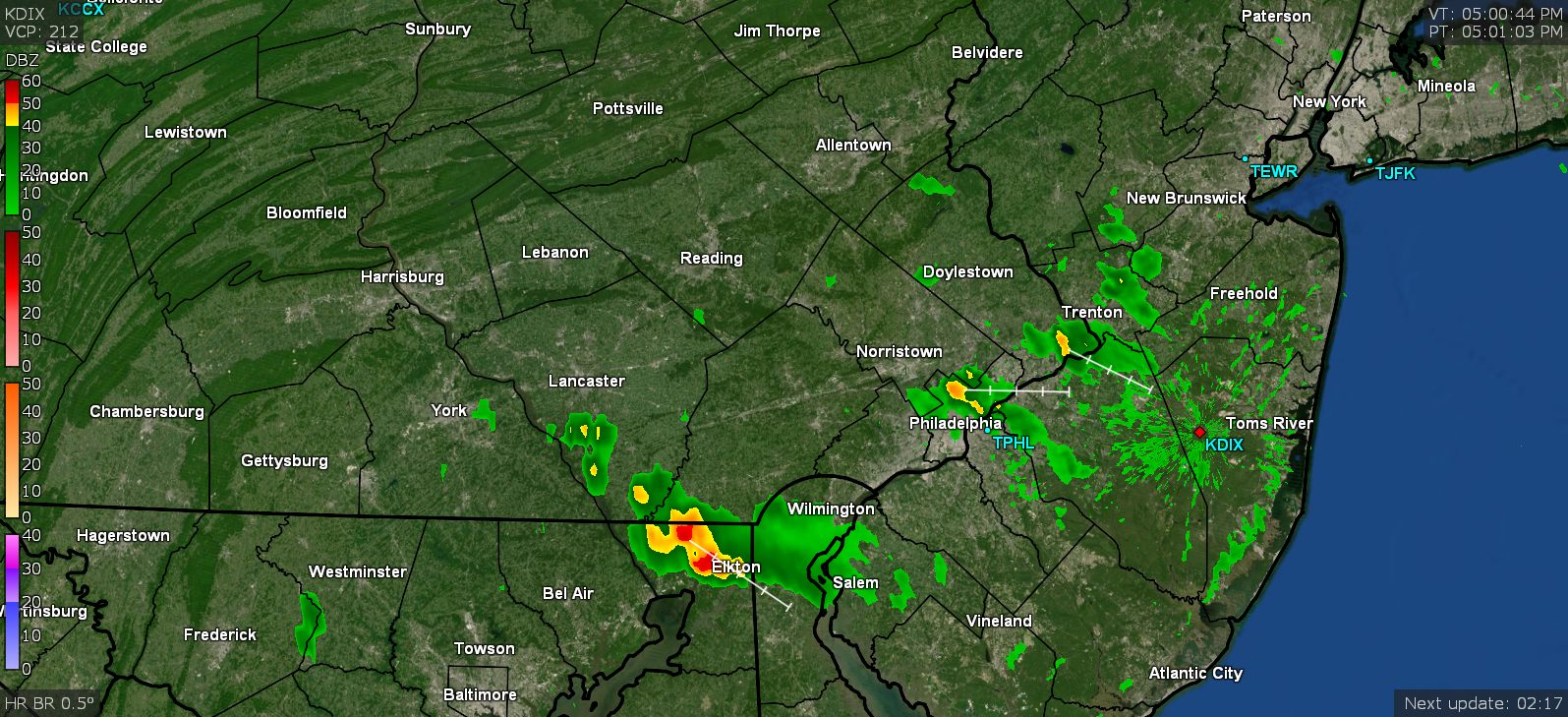
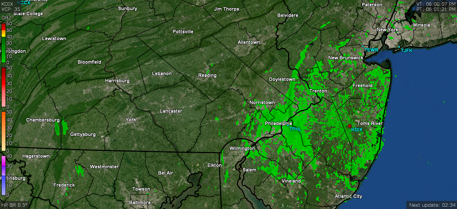
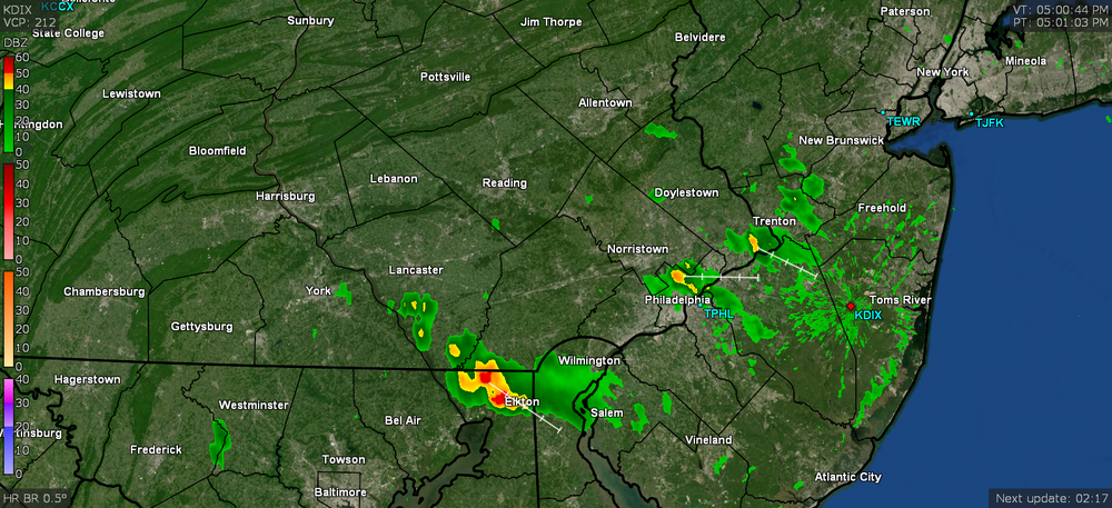
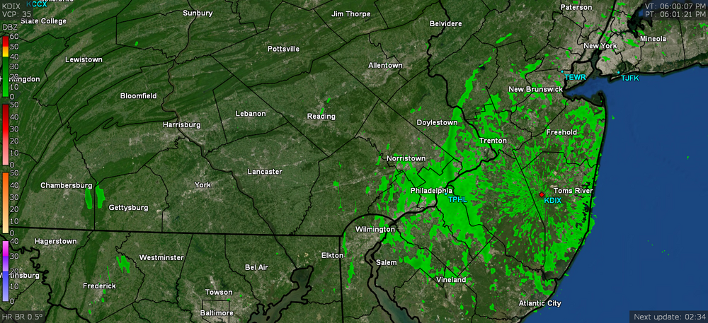
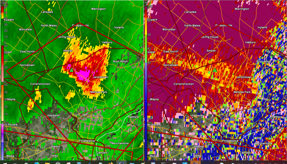
There are a whole pile of LSRs posted. But one caught my attention - for a report at Cape May Point - https://www.wrh.noaa.gov/total_forecast/getprod.php?new&prod=XXXLSRPHI&wfo=phi The Brandywine Shoal Lighthouse has an anemometer on top and it reported an 80 mph gust. A recent video of the lighthouse (you can see the anemometer at the top). Am not sure who is maintaining it but it is an active/working lighthouse. My sis said that she and her hubby drove around Wyndmoor and Erdenheim and she said it looked as if a tornado had hit. I am assuming it was straight-line winds and/or a microburst since there didn't seem to be any rotation signals in that cell. I do know when the gust front came through, it was pretty loud. She said they counted at least 16 houses with trees that fell on that house and many streets are impassable due to trees ("dozens" of them) snapped at the base, many broken branches, and live wires across the roads. She described what were literally leaves and branches ripped from the trees and exclaimed that she had never seen damage like that in her life (and we have seen plenty of tropical storms that did some major tree damage like the back to back years with TS Irene in 2011 and the... ahem.... *unmentionable* storm the following year (both pancaking rows of large street trees). These were a few reports that were from areas within 5 miles of me -
-
Nice spot for it! Maybe looking for seagull food. Got another hundredth of an inch being fringed by that cell so am up to 0.02" for the day so far, but am still grateful for the power. Temp is 74 with dp up a bit to 70.
-
I just watched a cell just blow up out of nowhere, literally a couple blocks from me (could see it out the window). Getting thunder now although it's generally east of me at the moment. I am literally on the western fringe of it. It blew up over the couple blocks of Wyndmoor that might have still had power (I think my side of the county line and theirs share the same substation).
-
Fox29 had some pics of the storm including the hail in Flourtown - https://www.fox29.com/news/severe-storms-bring-hail-damaging-winds-to-area
-
My sister's power is out (looks like her whole township is out) and she texted a couple pics that she said people in the area posted. It literally looked like a winter sleetfest except with hail. Yards and driveways covered with probably 1/2" deep of hail plus trees snapped - I think one of the pics was from Flourtown. The sun is out here (first time this long all day due to the haze), although the temp continues to creep up and is at 77 but at least the dp is below 70 and is at 68.
-
I ended up with a grand total of 0.01" and some pots overturned. But thankfully I still have my power. But about 4 miles north of here in the Jenkintown area (and am guessing the surrounding and nearby communities like Glenside, Roslyn, Elkins Park, Melrose Park, etc..) got hit pretty bad. KYW said there are a lot of power outages and downed trees in that area and included Willow Grove and Blue Bell in the damage area. Temp here is recovering and back up to 72 and overcast with dp at 65.
-
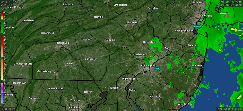
That complex is moving fast and seems to be headed for the river.
-
My sis in Wydmoor texted about getting hail. I have some big drops of rain here (at 0.01"). Temp is down to 68.
-
That's literally a couple miles north of me. KYW said 80 mph reports from that.
-
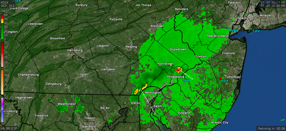
Big gust front just came through here with some loud winds. Temp is down to 75 with dp 63.
-
Mt. Holly just put up a Warning for the area. Temp holding at 86 with dp 68.
-
Watching that. Wonder if CoolHandMike is getting nailed by any of that. Looks like LBI is getting stuff continually back-building over it.