Hurricane Agnes
-
Posts
9,336 -
Joined
Content Type
Profiles
Blogs
Forums
American Weather
Media Demo
Store
Gallery
Everything posted by Hurricane Agnes
-
The sun broke out "early" (vs yesterday) around 9:30, and the temp is now slowly creeping up. Currently mostly sunny with scattered cumulus and 78, with dp 73.
-
Yeah they have an option to reduce the size and I later realized how to edit the captured video to save just one initial multi-frame loop (which for a later attempt, was for 3 seconds covering about 12 frames) and then have it set to loop itself. Doing that would also allow a higher res version for not much difference in size. I have the super duper membership so I can actually upload up to 19 Mb-sized files (since I like doing the hurricane sat loops), but I know I can clear out some of the older stuff too. That one I posted was sortof testing doing it. My low this morning was 72 and I'm currently overcast and 75 with dp 73. We seem to be in a similar situation as yesterday morning (including fog here earlier), where we are mostly under the influence of the troughy part of the front. But once that lifts up again, look out. I have a feeling that the sun might be out earlier today than it was here yesterday (which didn't happen until the early afternoon).
-
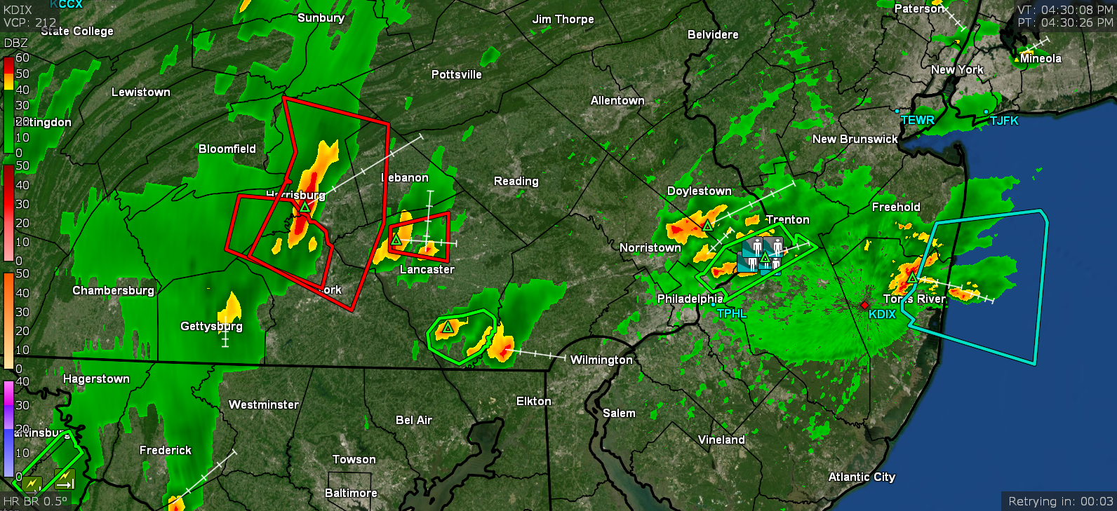
I didn't recognize your screenshot but am guessing it was because you had the satellite overlay layer on yours! I did a screenie of the site last night about 7:45 pm just to pinpoint where the activity was at that time based on how my sensor was reacting (and I usually use them to confirm in any case).
-
I made it up to 88 around 3:15 pm, a couple hours after the sun came out and then self-destructed. It's currently mostly cloudy and 83 with dp 77. Not much on the radar nearby except for some stray cells out west that form and then dissipate.
-
A couple years ago, I even bought a couple 5-gallon jugs and a siphon to store some over the winter so I didn't have too many 1-gallon jugs hanging around and for those dry periods when the rain faucet (or as CoolHandMike calls it - the "free Skywater") shuts off! I was just looking at the radar and a couple blips have been trying to get started in south-central PA around York & Lancaster County so will see what happens with the atmosphere and rain today (I only got 0.05" yesterday).
-
LOL I put clean buckets out and will collect rain water and store it in old milk/water jugs. I have a couple sensitive houseplants that hate the fluoride but seem to appreciate the rain water (I had been initially giving those distilled water but that can get burdensome purchasing after awhile). And here it is, now at 1:30 pm, the clouds and mist have lifted, the sun has finally come out, and the dp has soared again. So I guess the sag in the warm front has moved to the north. Currently up to 81 and rising with dp 75.
-
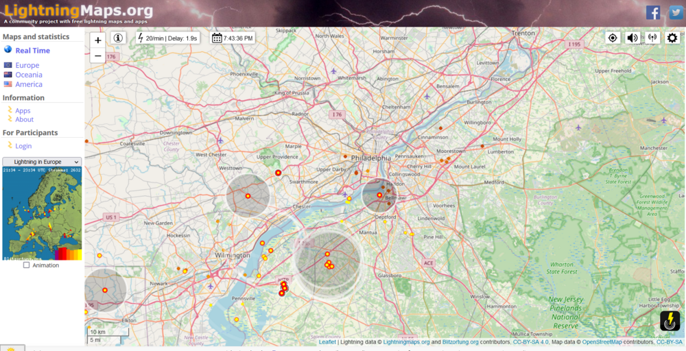
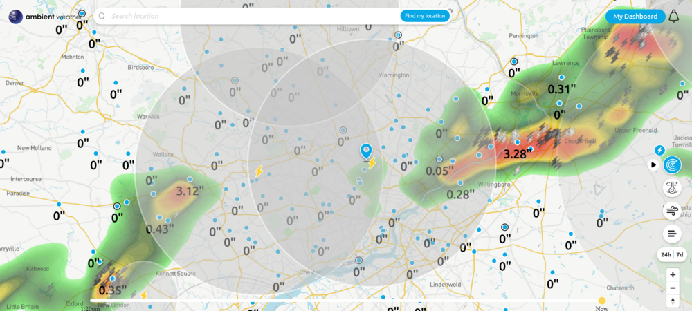
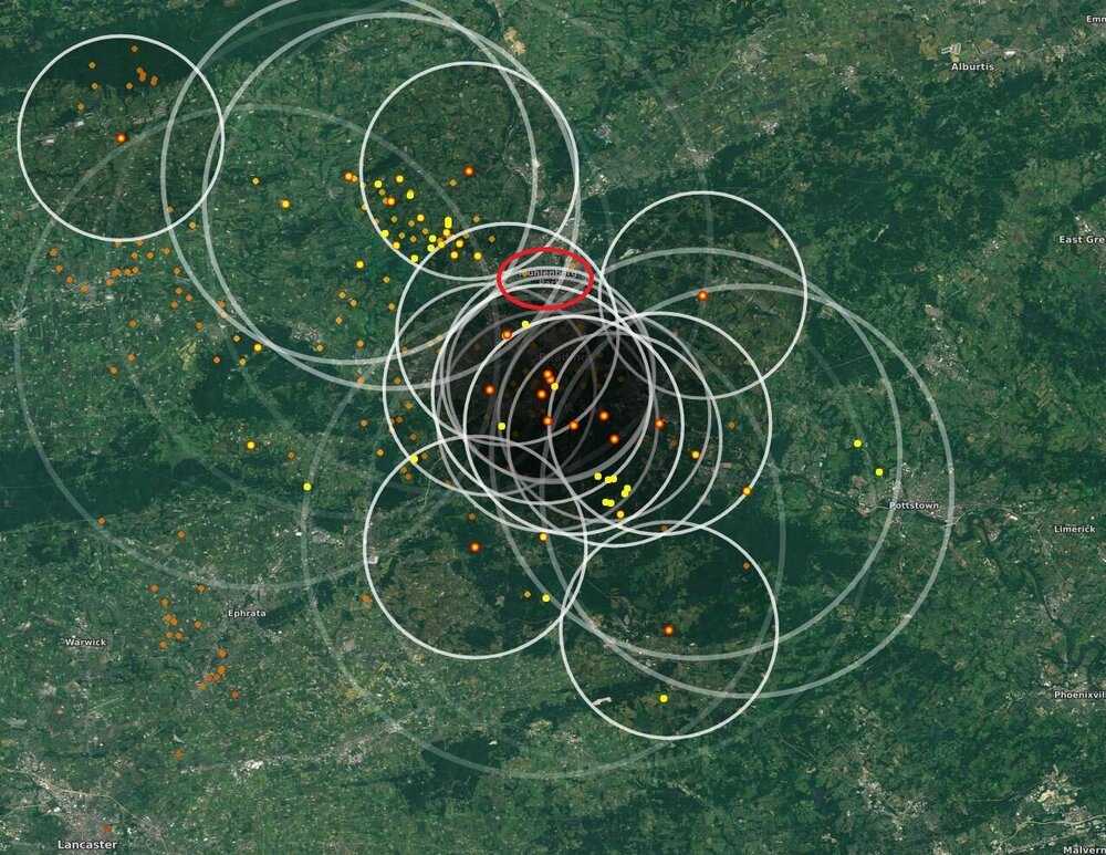
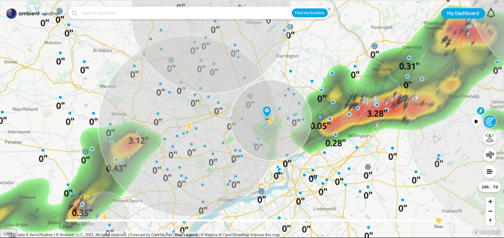
I'm not sure what site that is from but If you go to similar lightning map sites like "lightningmaps.org" - https://www.lightningmaps.org where they depict a lightning strike on the map with a dot that flashes when a strike is detected and then it generates a graphic of a circle that radiates out from the dot. The dots are often color-coded to depict how long ago the strike was registered, and will eventually disappear off the map. I expect it is more for a dramatic visualization vs anything that is meaningful other than maybe the possible intensity (but I don't know if those sites get that fancy with quantitative measuring vs qualitative registering). I have a lightning sensor from Ambient and on their lightning map, the circle that is generated depicts the estimated radius between the sensor location and the general area where the lightning strike appeared to have originated. The console display actually reports the estimate of how far away and how long ago a strike occurred, although I'm not sure if that distance value is captured in the database... haven't had chance to do a deep dive into that yet. I know it at least counts and saves the number of strikes and I'm still fooling around with weewx to get it to at least correctly graph the number strikes per set time increment. For my sensor, Ambient claims the sensor (WH31L) has a range of about 25 mile (40 km). I think the average furthest I've spotted mine detecting was about 17 - 21 miles (radius) away. Being up in the hills obviously helps. Well if I had known the temp wouldn't have hit 80 here by now, I coulda put the oven on! Currently 74 with dp 72 and overcast/misty. There was some drizzle earlier this morning here, enough to somewhat wet the sidewalk but nothing measurable so far. Attached a snapshot of my sensor detecting a strike around 3:22 pm yesterday as a note...
-
I annotated your image to show where you are talking about. The wobbly nature of that warm front is going to be the determinant on where stuff sets up. Some places do seem to have wrung much of the moisture out of the air but then if the sun comes out and heats things up, it'll destabilize again. I know the lightning around the metro area was off the charts yesterday. ETA - the fog has picked up a bit around here, probably around 1/4 - 1/2 mile vis.
-
Heard on KYW that Mt. Holly was estimating it as a 100 year flood. Found the tweet about it - I ended up with 0.05" yesterday. Currently 72 IMBY (will probably be my low) with some stratus, fog, and mist and a dp at 72.
-
Saw on a KYW breaking news alert that the Vine St. Expressway eastbound through the city is flooded out and closed. Now seeing reports of between 8 - 10+" in that same area. It looks like some of the heaviest stuff has shifted a tiny bit to the south and east and is mostly in NJ, running along the river and adjacent areas of Camden and Gloucester Counties. My temp here is 78 with dp 73, and mostly cloudy with some breaks in the cloud deck to the west.
-
I got Snagit a couple months ago and have been wanting to fool with it to do an animated gif of a GR2Level3 loop and managed to give it a test shot for the hell of it to see what all was involved. Apparently the outflow boundary of that convective complex washed over my area and my temp is down to 77 with dp 74. Pretty dramatic change in a relative sense!
-
NWS has been calling the FFW an Emergency with 4 - 7" of rain having fallen so far in the Lower Bucksco area right by the river, and that was almost 30 minutes ago. The heavy rain blob has literally not moved and just keeps going.
-
And Croydon along with Levittown just popped up with reports of water pouring into houses and "waste deep water".

-
Rumbling all around me. I did get up to 93 before the brief shower that netted by 0.04". Currently down to 83 but dp is still 79 so... I saw a reports where Bristol & Tullytown have been doing water rescues with cars underwater, and the same across the river in Burlington. There has been a storm just training right over that area for awhile now.
-
And here comes SPC -
-
And sun back out and I know it has become a sauna with temp at 86 and dp at 80.
-
Getting a thundershower here now, Up to 0.01". Temp down to 87 with dp a disgusting 80.
-
Just tapped 92 with dp 78. Guess the warm front meant some business!
-
Just hit 90 with 77 dp.
-
That impressive-looking line completely missed me. Not a drop of rain here. My low this morning has only been 77 so far and I'm currently at 78 and overcast, with a thick dp of 76 (and yup, the steamy windows). If the sun eventually comes out, oh boy.
-
My low this morning was a degree warmer at 70 vs yesterday morning and it's been overcast much of the morning until about an hour ago when the sun started peaking through the clouds (some light returns have been funneling SW -> NE to the north and west of me this morning. Currently 78 and mostly cloudy with breaks of sun and a dp of 72.
-
Made it up to 87 today as a high for a pretty decent summer day. Currently partly sunny and 81 with dp 67. It's been cool watching a sea breeze front on radar moving inland this afternoon (it's currently most of the way across Burlington County and starting to diffuse a bit as it approaches the river).
-
My low this morning was 69 and currently mostly sunny and 76 with dp finally below 70 @68.
-
It was all swings and misses where I am. Temp did drop down to 76 but dp is still 71. Will have to get the cold front all the way past here enough for the drier air to trickle in... at least temporarily.
-
There's a convergence of stuff headed for Kamu! It's gotten somewhat cloudy here and temp is 83 with dp 72.