Hurricane Agnes
-
Posts
9,344 -
Joined
Content Type
Profiles
Blogs
Forums
American Weather
Media Demo
Store
Gallery
Everything posted by Hurricane Agnes
-
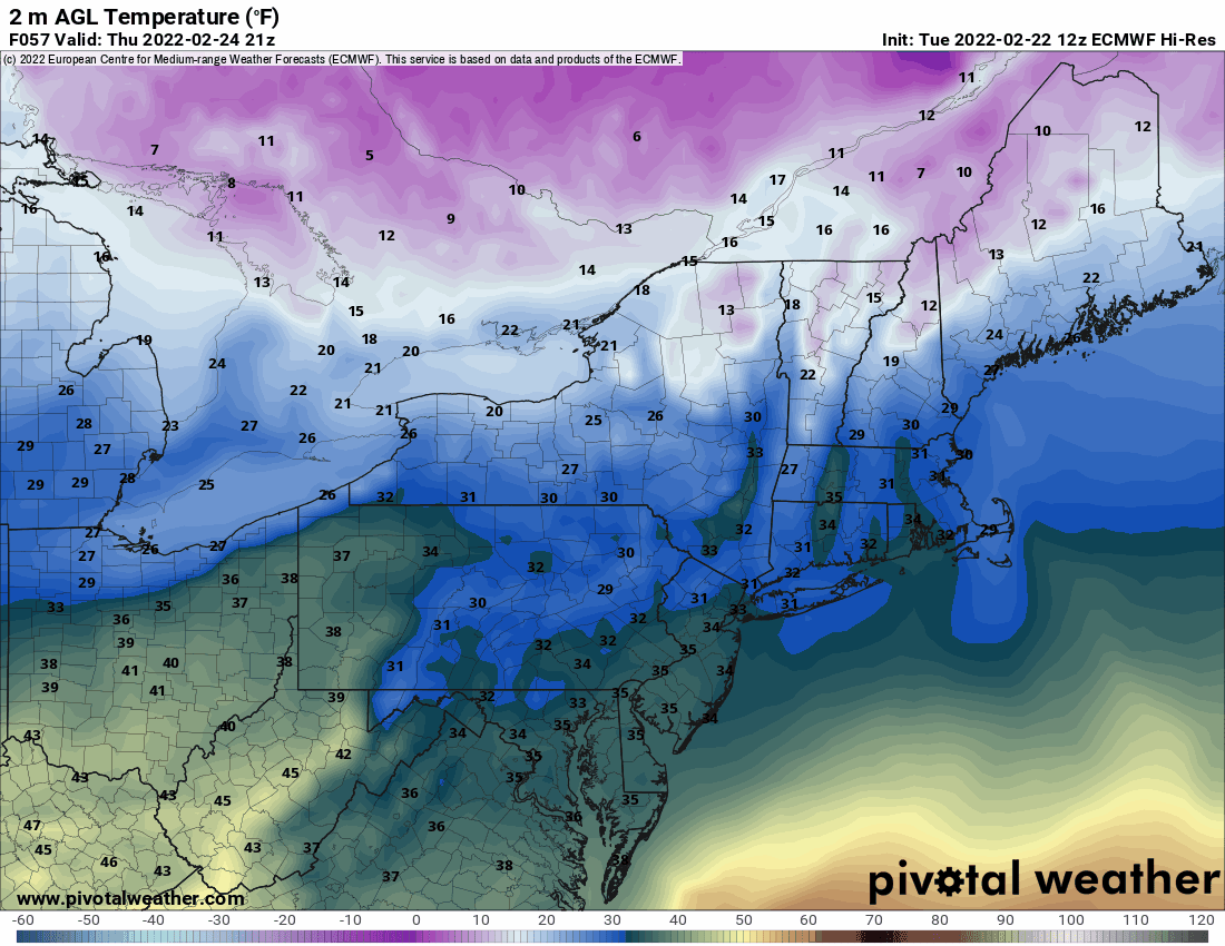
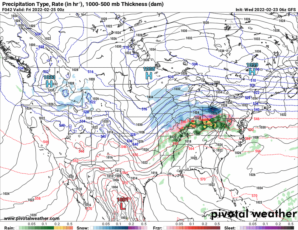
6z Euro - same song different verse, a little bit louder and a little bit worse.

-
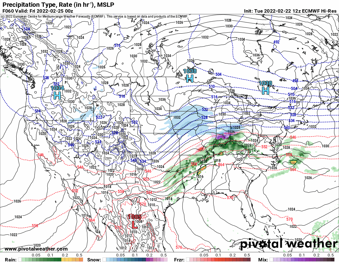
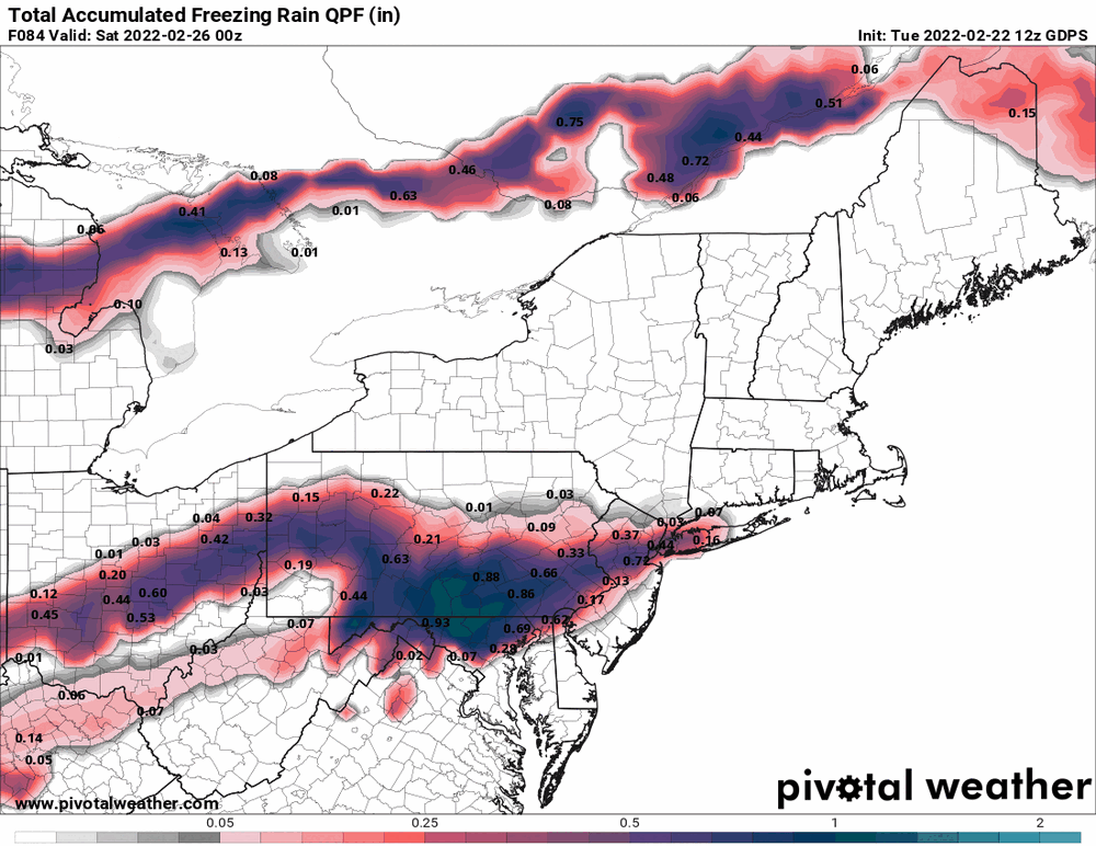
WPC's note last evening on the upcoming event's impact - And this morning's update focusing on the more extreme outcomes in the south central U.S. along with the significant snow north.
-
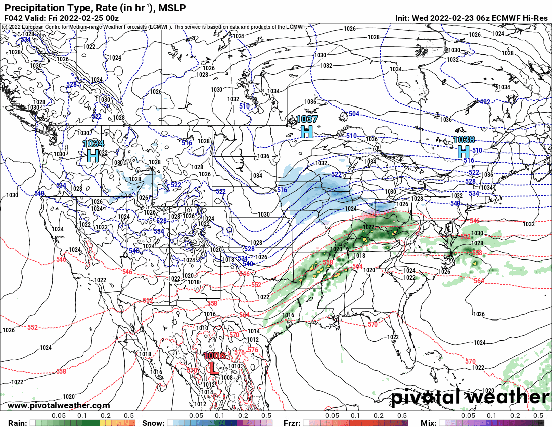
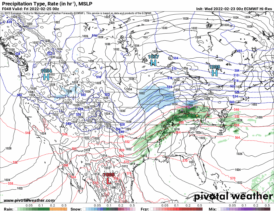
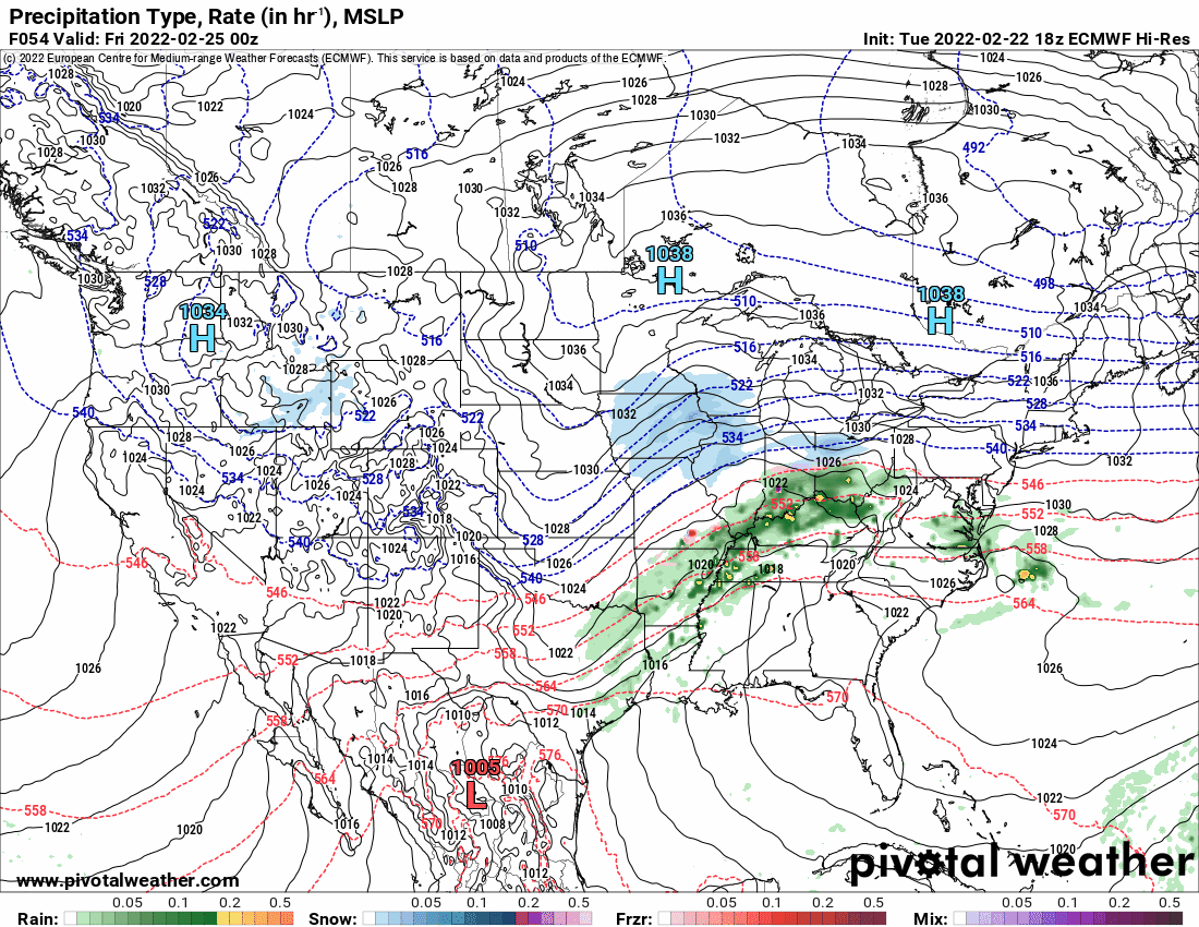
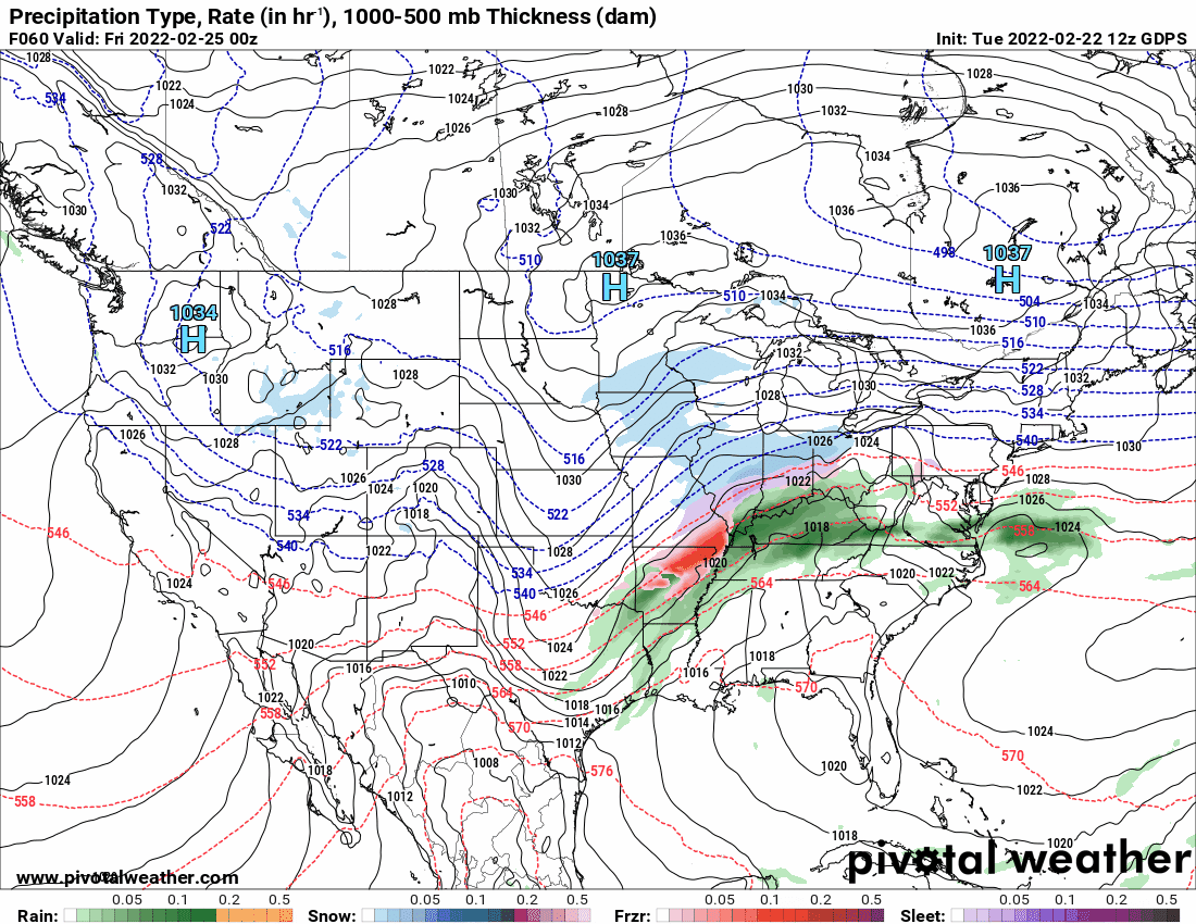
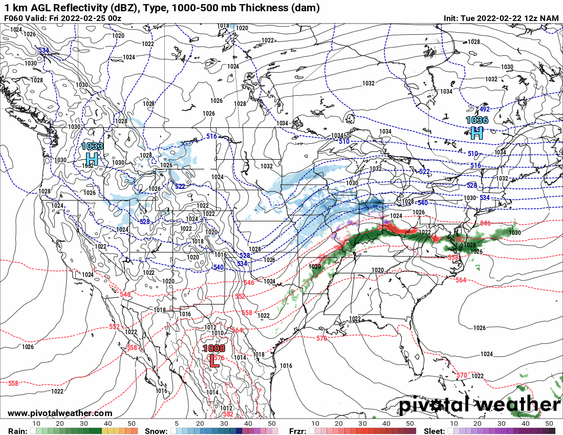
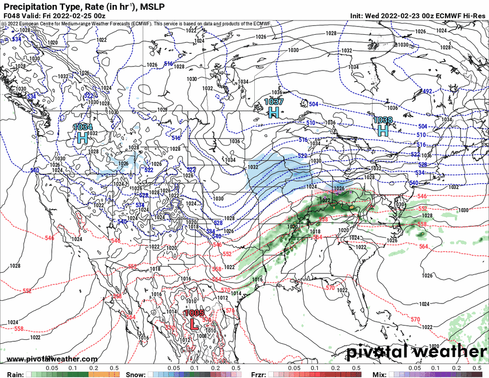
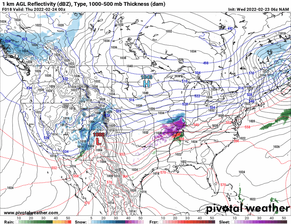
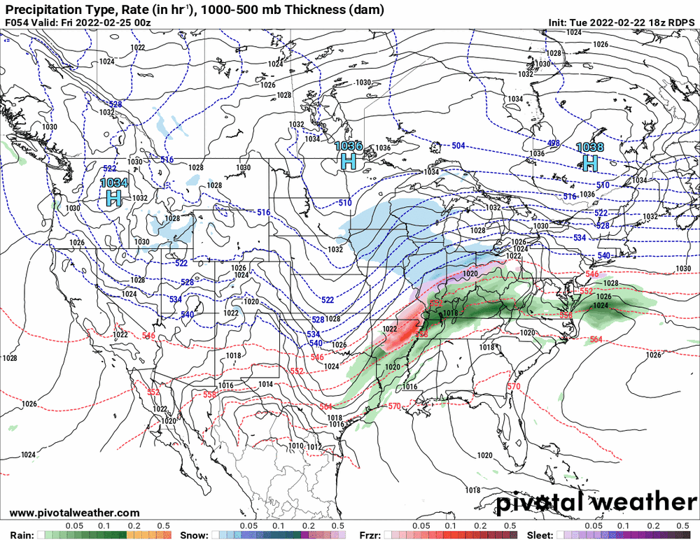
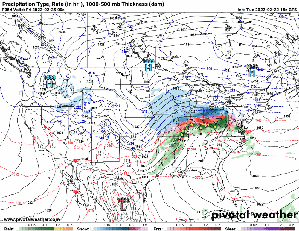
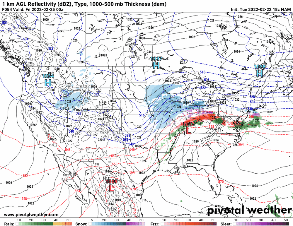
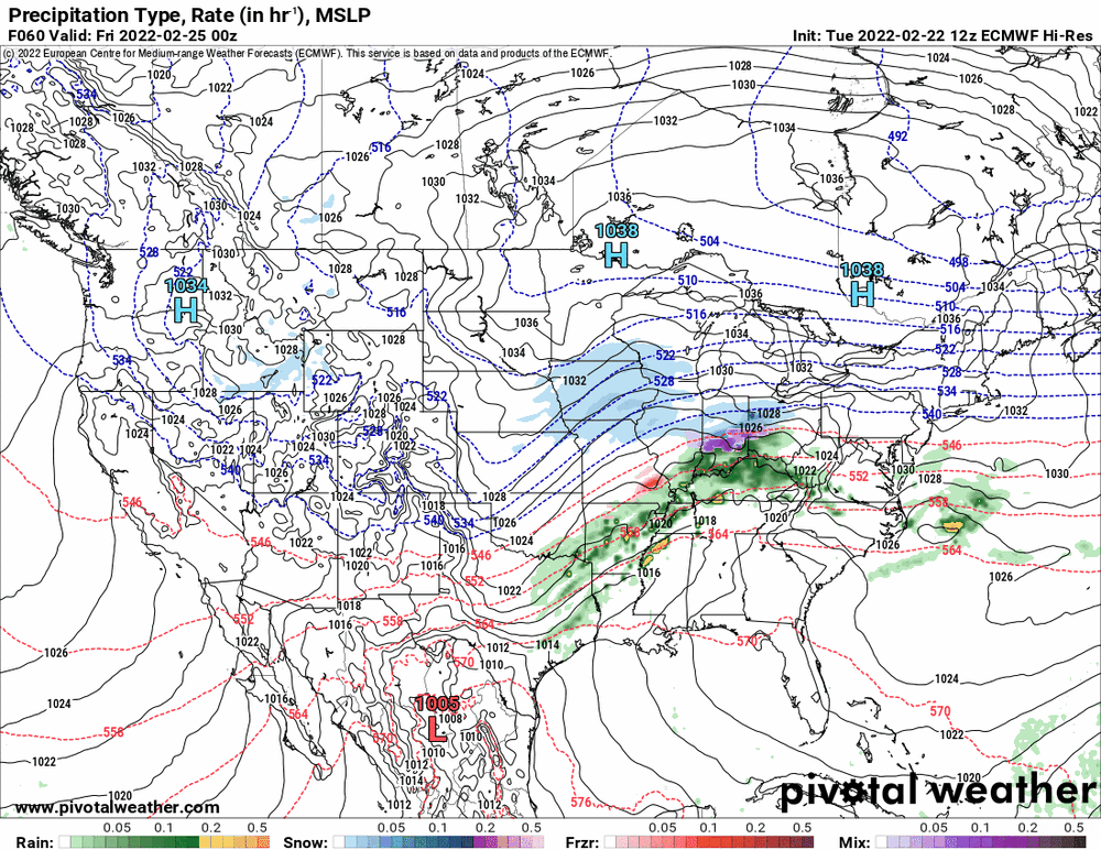
Looks like each side remains in their corners. GFS/EC with some kind of precip through the storm and NAM doing the dryslotting (although the NAM has some kind of antecedent brushes with some precip before the main low comes into play). I think the message is that there will be some kind of overrunning event that will be impacted by whereever the freezing line sets up.
-
That signal has been pretty consistent for all the models today. It seemed to be more sleety up that way and then some kind of atmospheric warming that would change it to rain but the temps would be much colder up there too compared to down here in Philly metro, south and east, so the ZR issue.
-
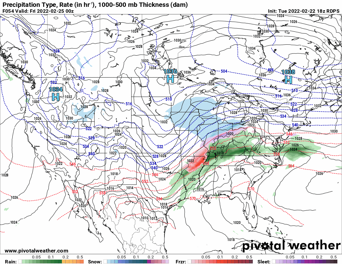
Looks like the 0z NAM did a blend. Not completely caving but moving in that direction.

-
Mt. Holly afternoon update -
-
NAM still stands alone as the Euro holds tight.

-
While the 18z is running the RGEM holds its ground.
-
E PA/NJ/ DE Winter 2021-22 OBS Thread
Hurricane Agnes replied to JTA66's topic in Philadelphia Region
Hit 59 as a high today (so far as the temps have been up and down with the rain). The low was 38 and it's currently 56 with light rain, 0.16" in the bucket, and dp 55. -
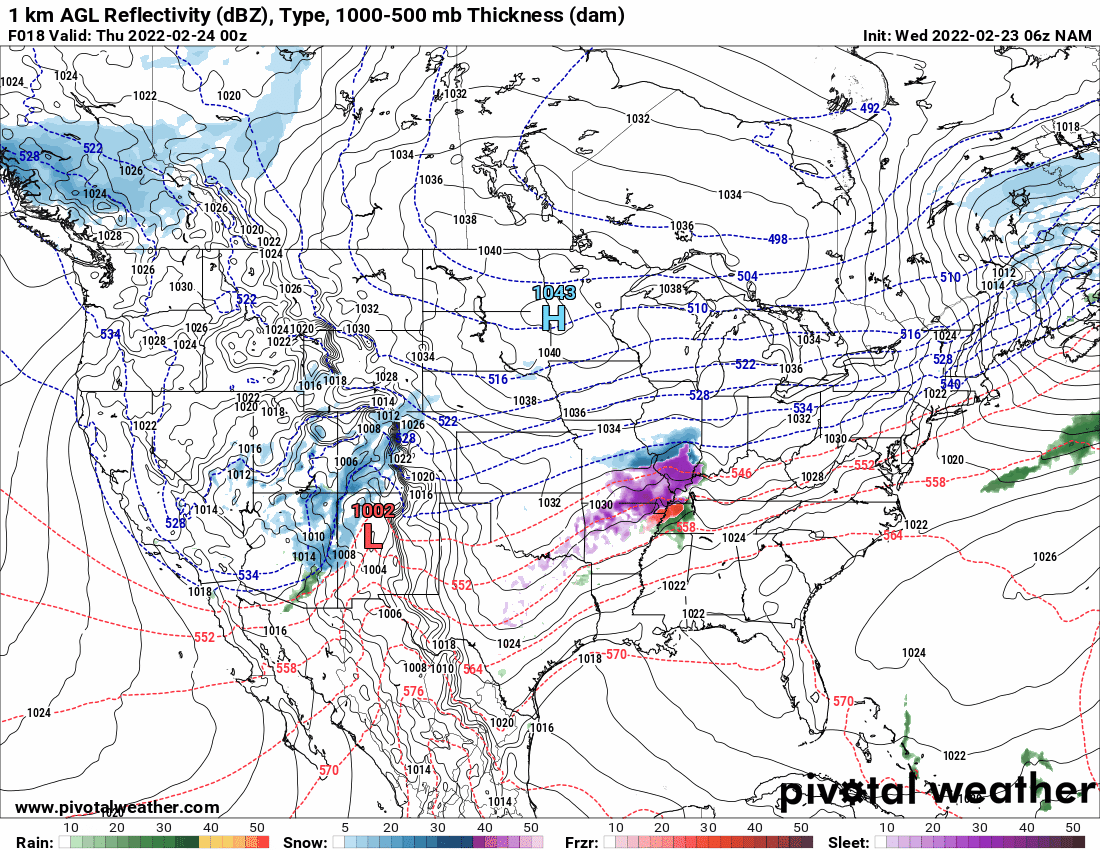
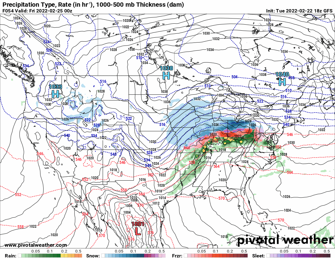
18z GFS still standing it's ground although dries up at the end.
-
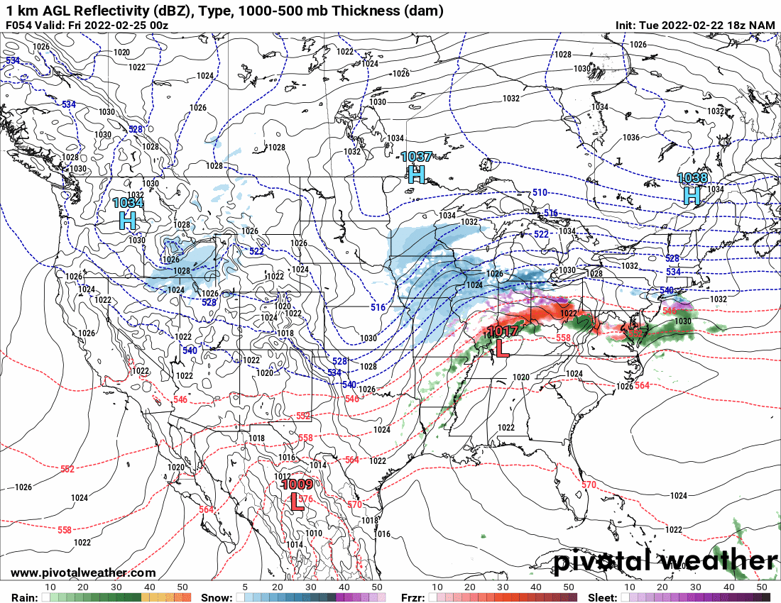
18z NAM still dryslotting.
-
Here was Mt. Holly's take a few hours ago -
-
Was looking at the EC's temps for the period. It's gonna depend on where the warm sector ends up and who gets under it.

-
12z Euro looks real ugly.

-
The Ukie doesn't seem to distinguish so am guessing it would be something that could include sleet/IP, etc.
-
EC has started so will soon see which way it goes! The Ukie did throw some snow down this way.

-
E PA/NJ/ DE Winter 2021-22 OBS Thread
Hurricane Agnes replied to JTA66's topic in Philadelphia Region
LOL -
E PA/NJ/ DE Winter 2021-22 OBS Thread
Hurricane Agnes replied to JTA66's topic in Philadelphia Region
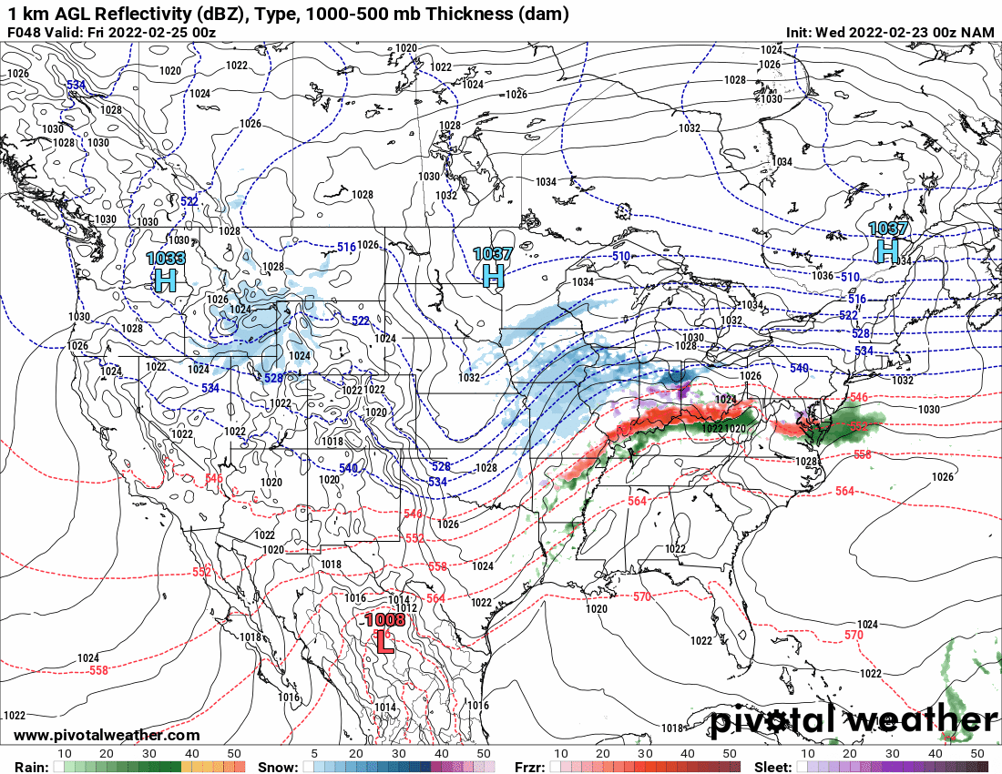
NBM trying to keep it real with the ice and throws some snow up north (might be weighted more to the NAM solution).
-
E PA/NJ/ DE Winter 2021-22 OBS Thread
Hurricane Agnes replied to JTA66's topic in Philadelphia Region
Seems the NAM's "dry" forecast is standing alone. GFS & GEM are not having it (although the GEM sortof spares I95).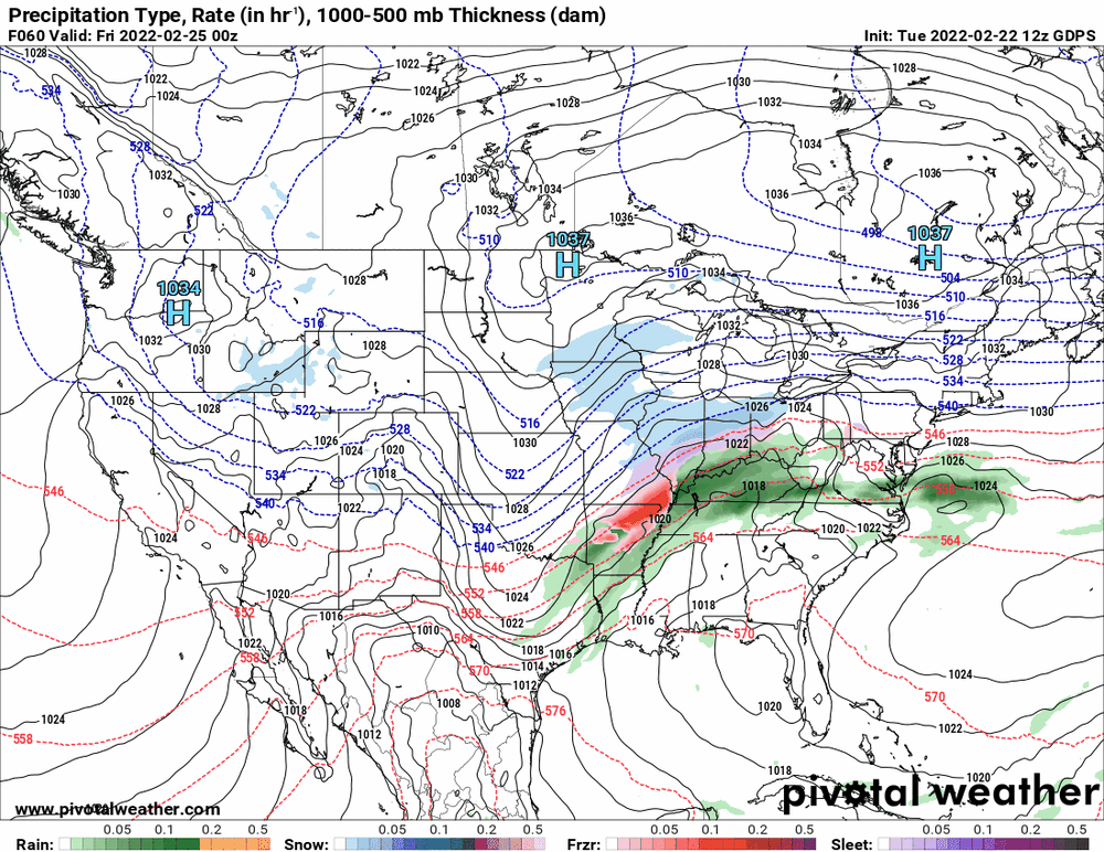


-
E PA/NJ/ DE Winter 2021-22 OBS Thread
Hurricane Agnes replied to JTA66's topic in Philadelphia Region
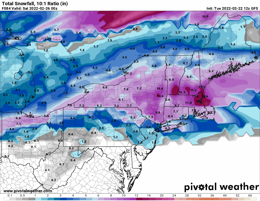
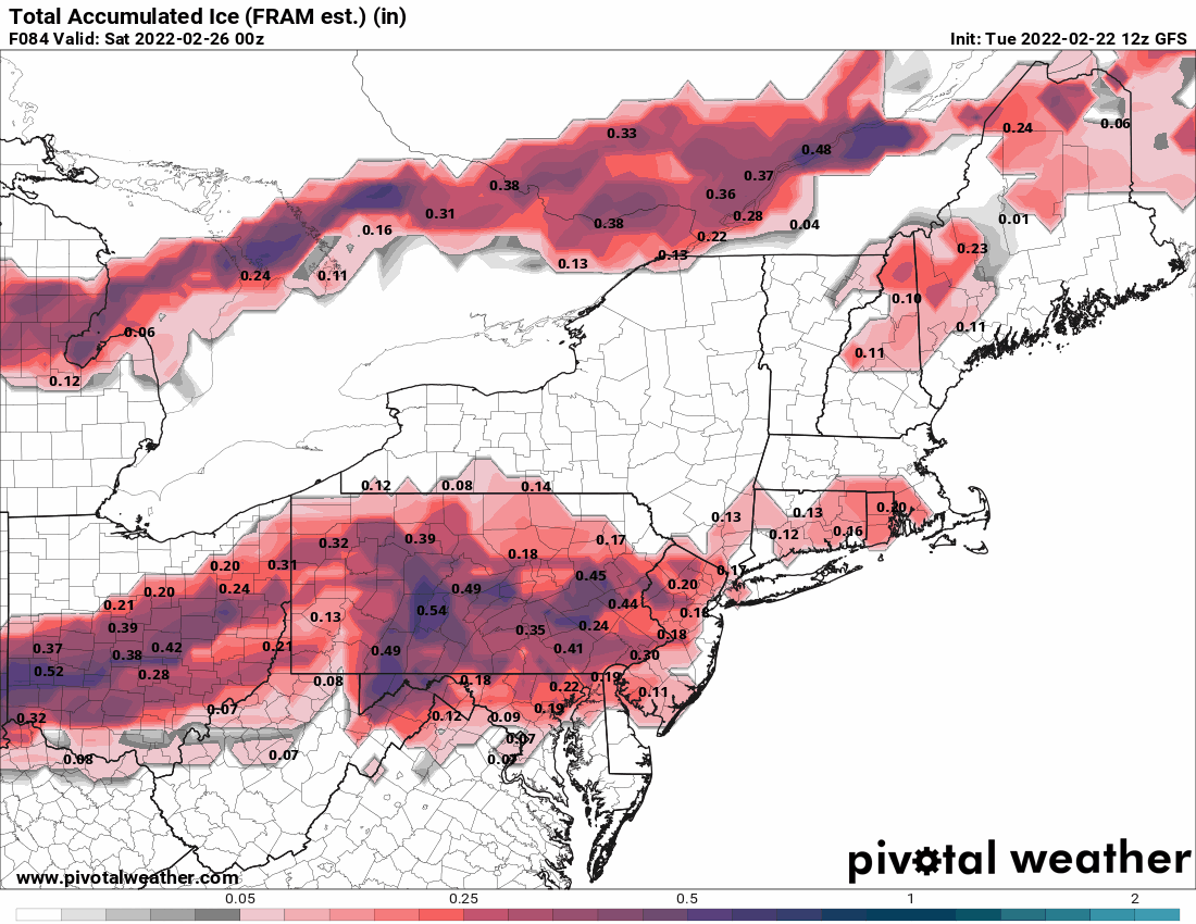
12z GFS even throws snow down into the I95 corridor!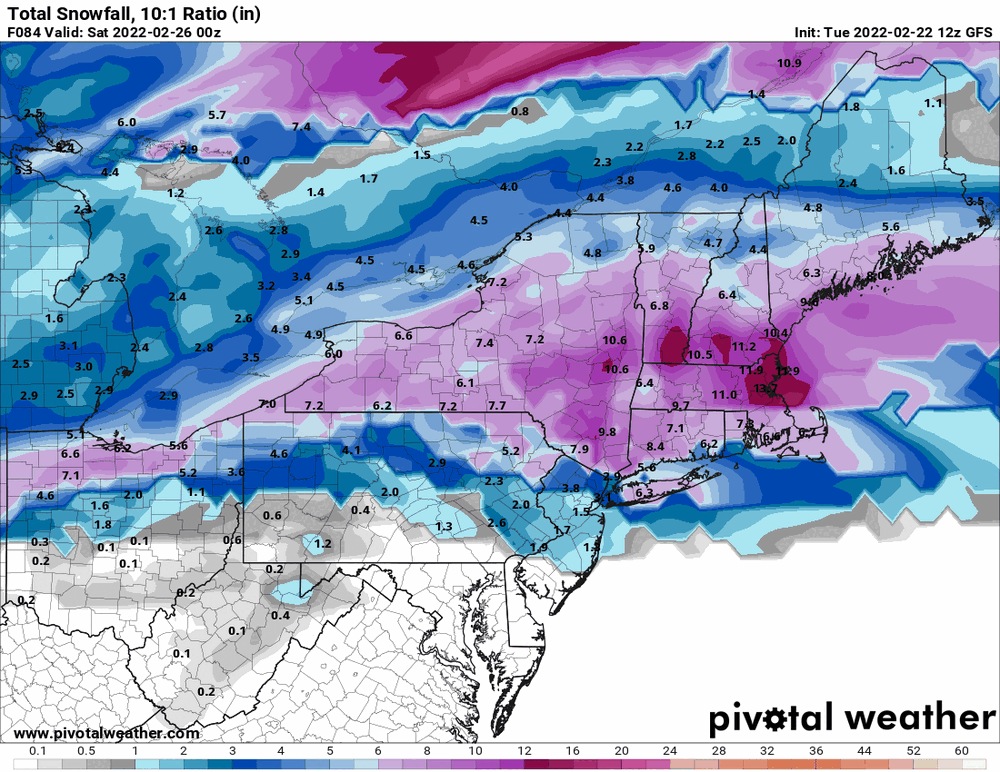

-
E PA/NJ/ DE Winter 2021-22 OBS Thread
Hurricane Agnes replied to JTA66's topic in Philadelphia Region
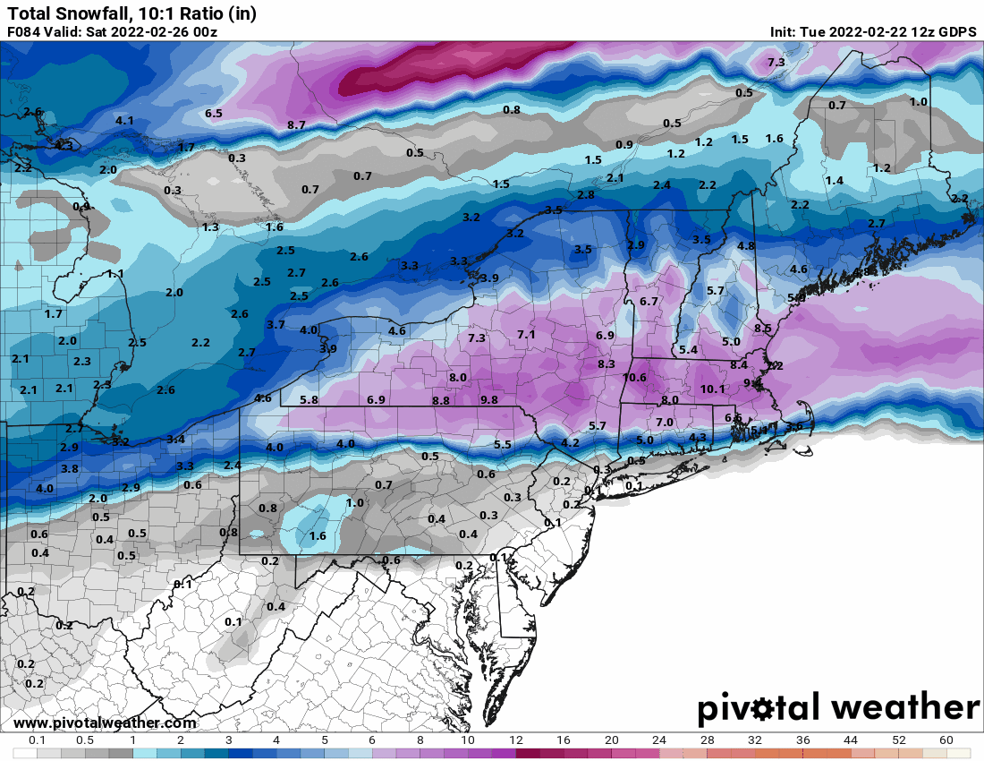
12z GFS still holding with a juicy overrunning storm...

-
E PA/NJ/ DE Winter 2021-22 OBS Thread
Hurricane Agnes replied to JTA66's topic in Philadelphia Region
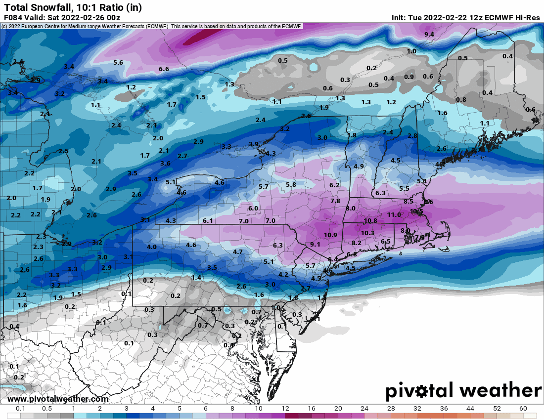
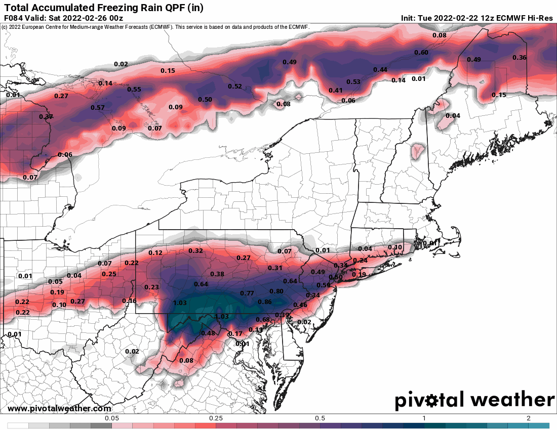
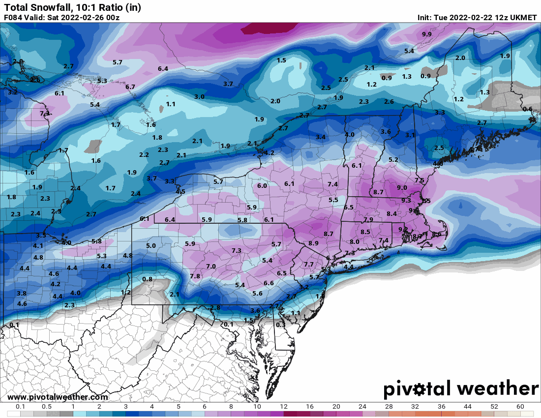
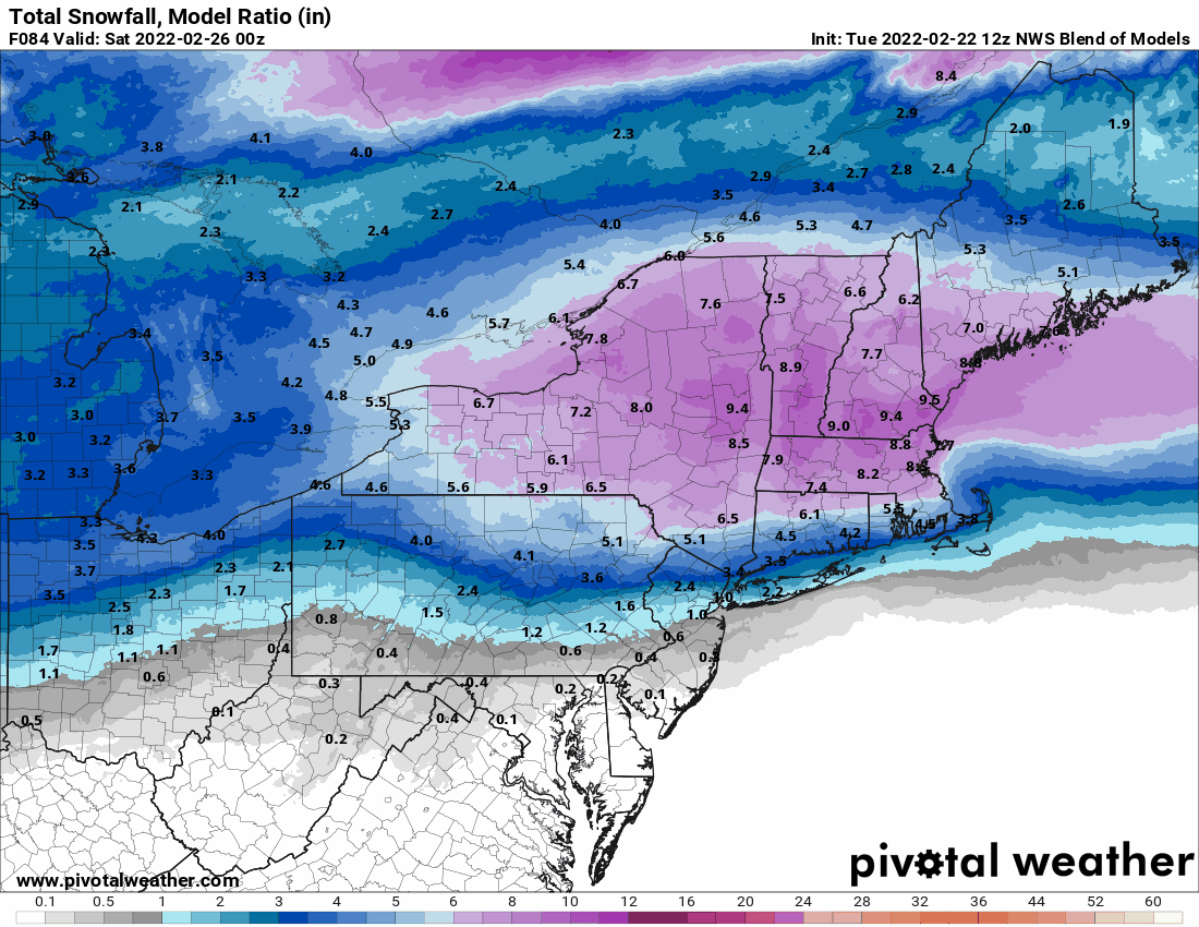
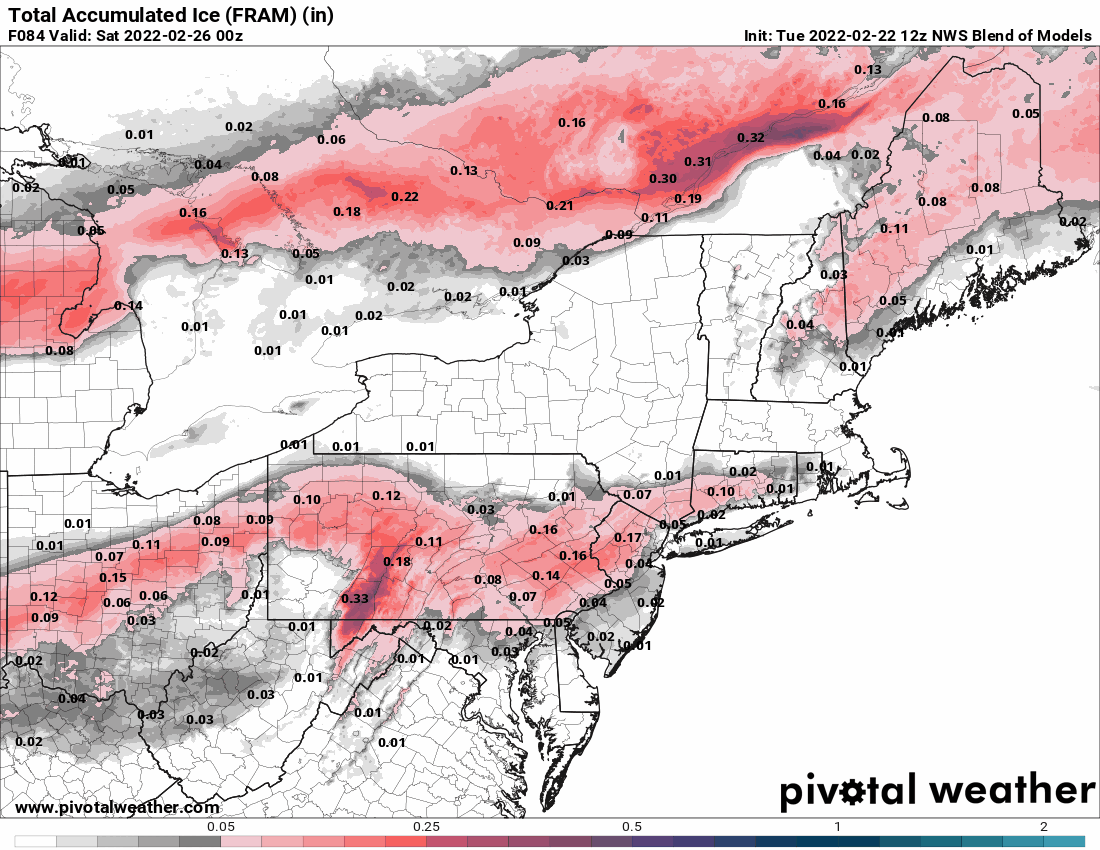
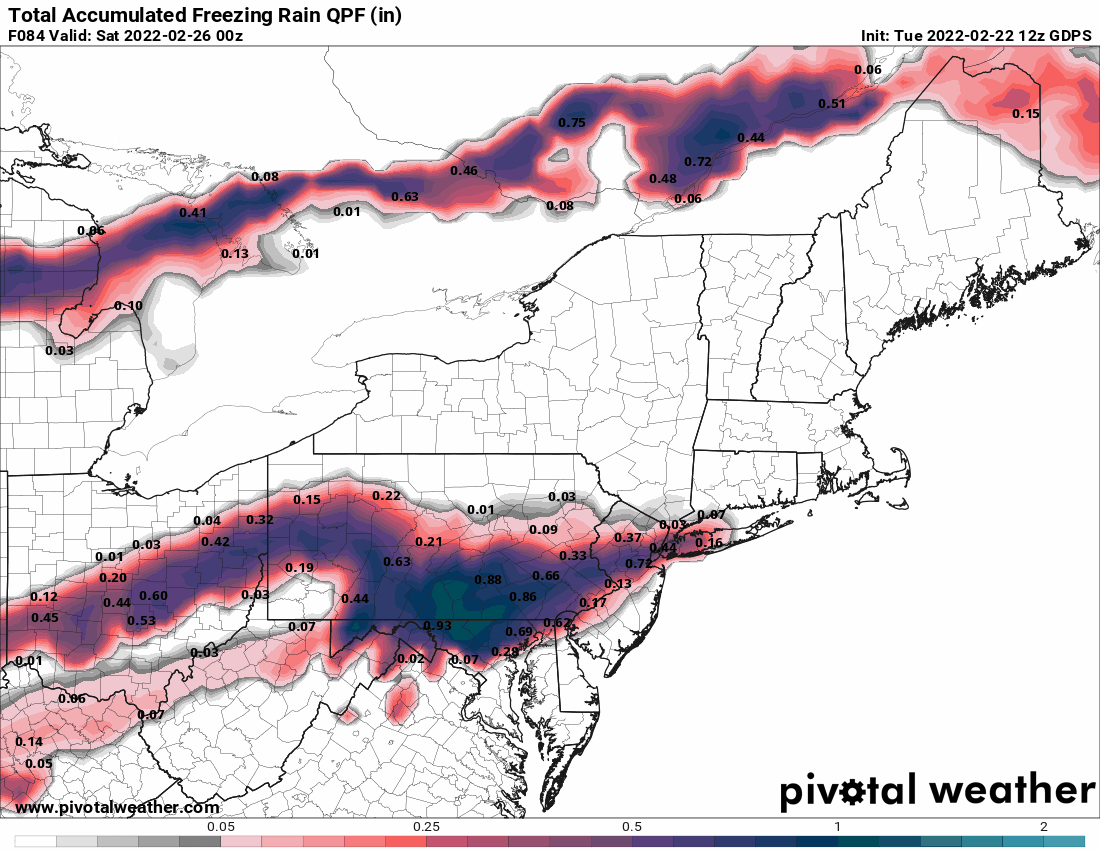
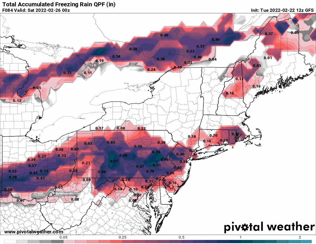
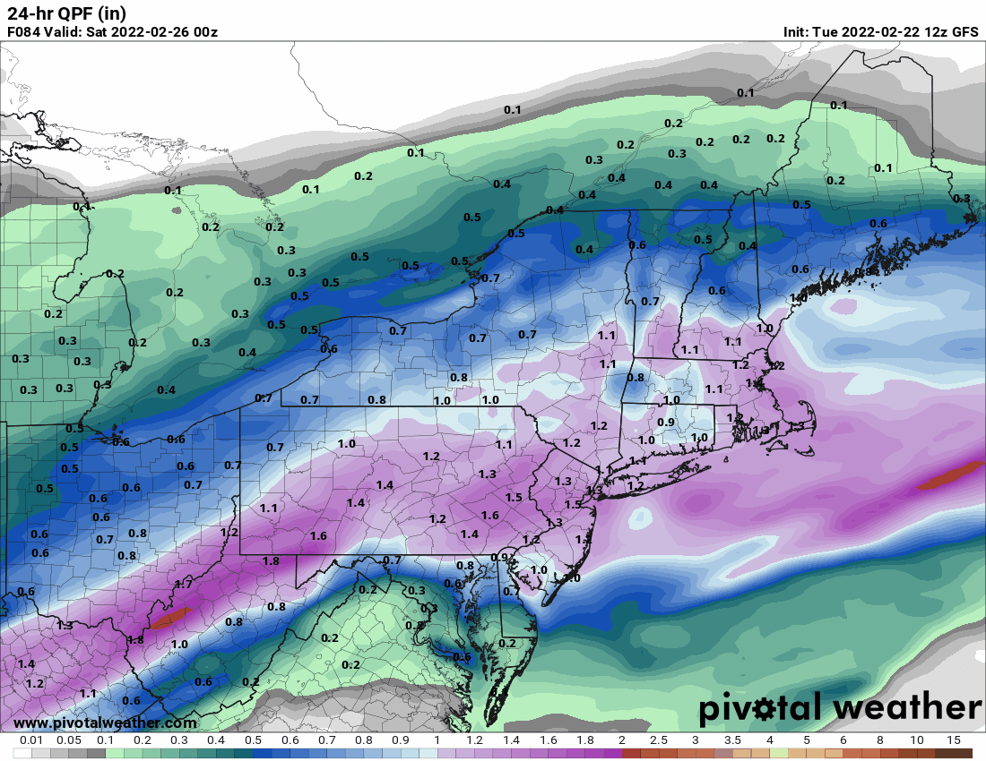
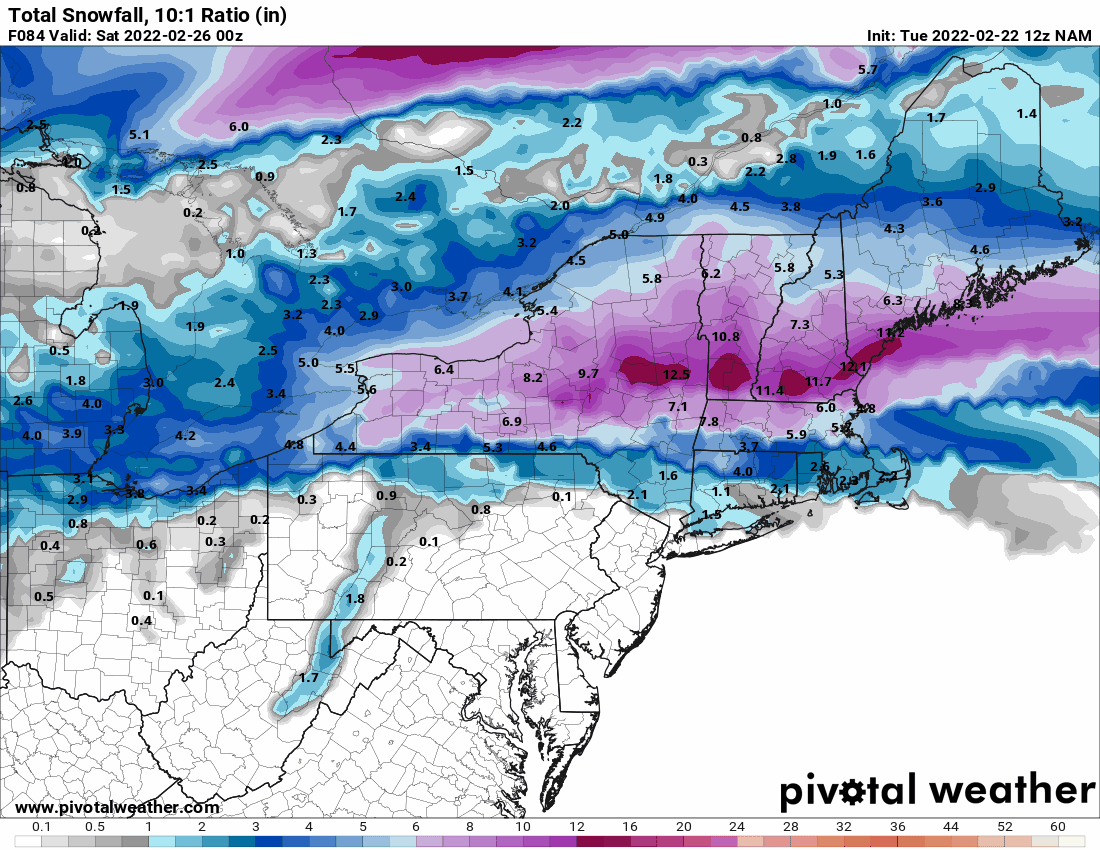
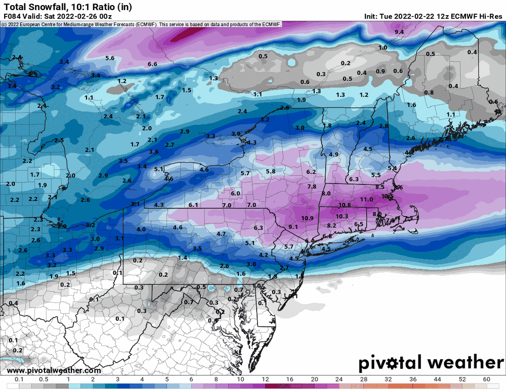
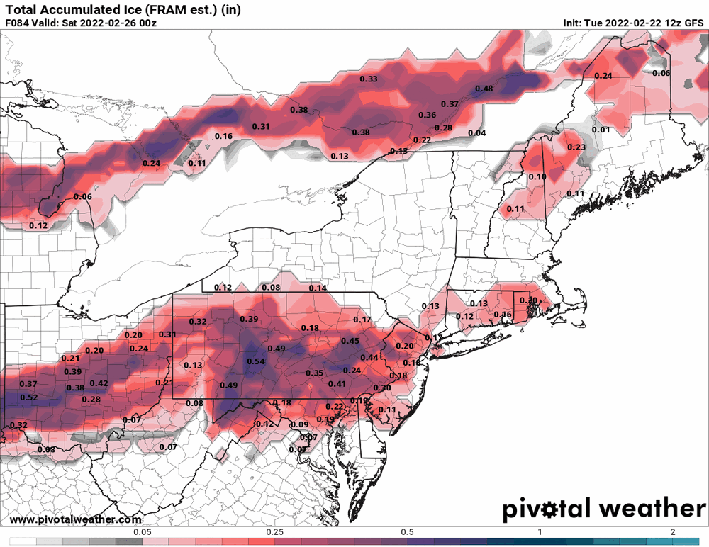
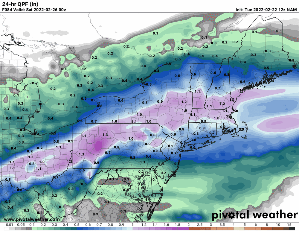
It's drier! anthonyweather beat me to the maps but can add the snow map and the overall 24hr qpf.
-
E PA/NJ/ DE Winter 2021-22 OBS Thread
Hurricane Agnes replied to JTA66's topic in Philadelphia Region
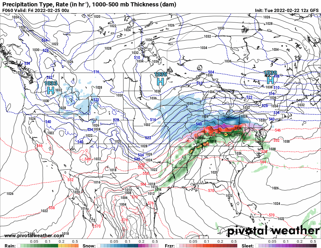
The 12z NAM keeps the same idea...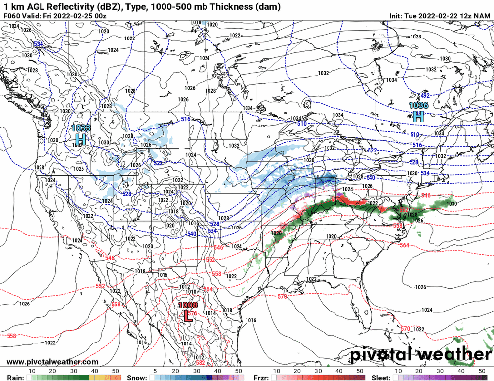
-
E PA/NJ/ DE Winter 2021-22 OBS Thread
Hurricane Agnes replied to JTA66's topic in Philadelphia Region
That's what I'm wondering too although some cold air is supposed to sink down over the area to chill things down (with some temp undulation as the storm moves in - at least looking at the below verbatum).
-
E PA/NJ/ DE Winter 2021-22 OBS Thread
Hurricane Agnes replied to JTA66's topic in Philadelphia Region
I would get the salt out... This seems almost like a weaker warmer version of the pre-VD storm (Feb. 12/13), with the snow pushed much further north.