Hurricane Agnes
-
Posts
9,344 -
Joined
Content Type
Profiles
Blogs
Forums
American Weather
Media Demo
Store
Gallery
Everything posted by Hurricane Agnes
-
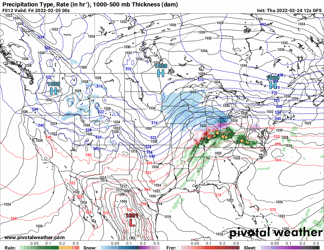
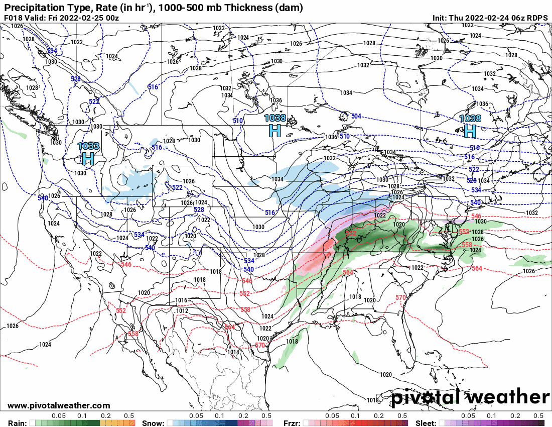
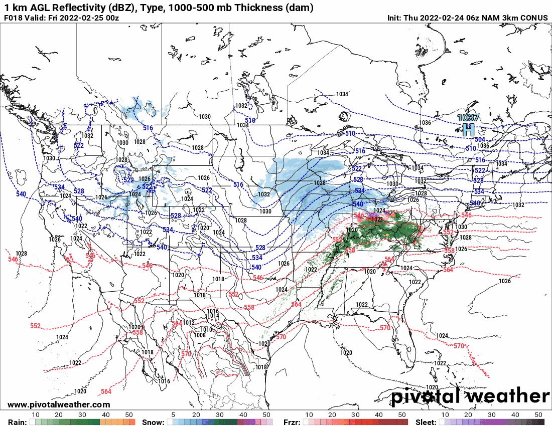
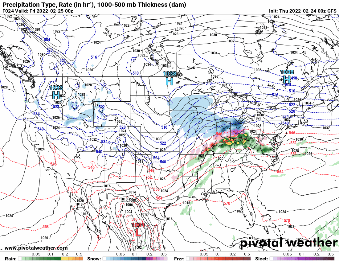
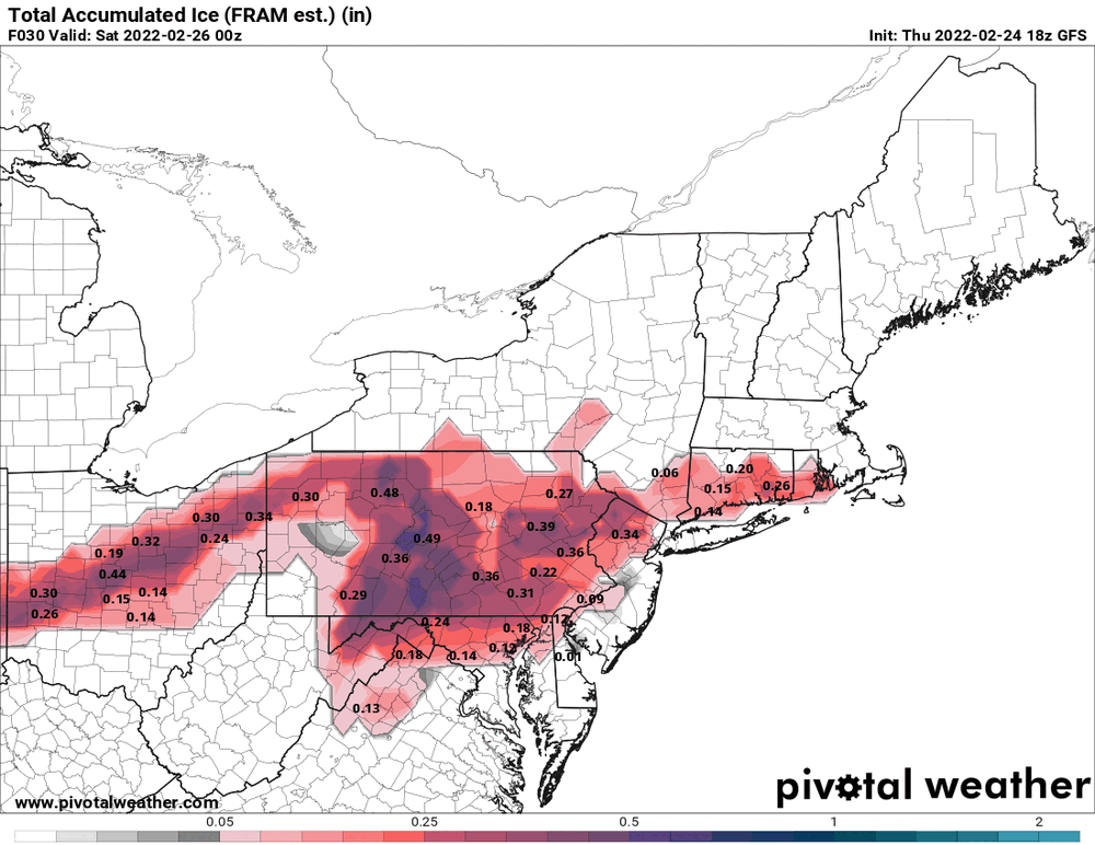
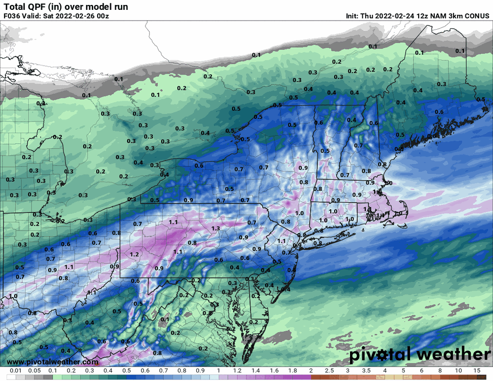
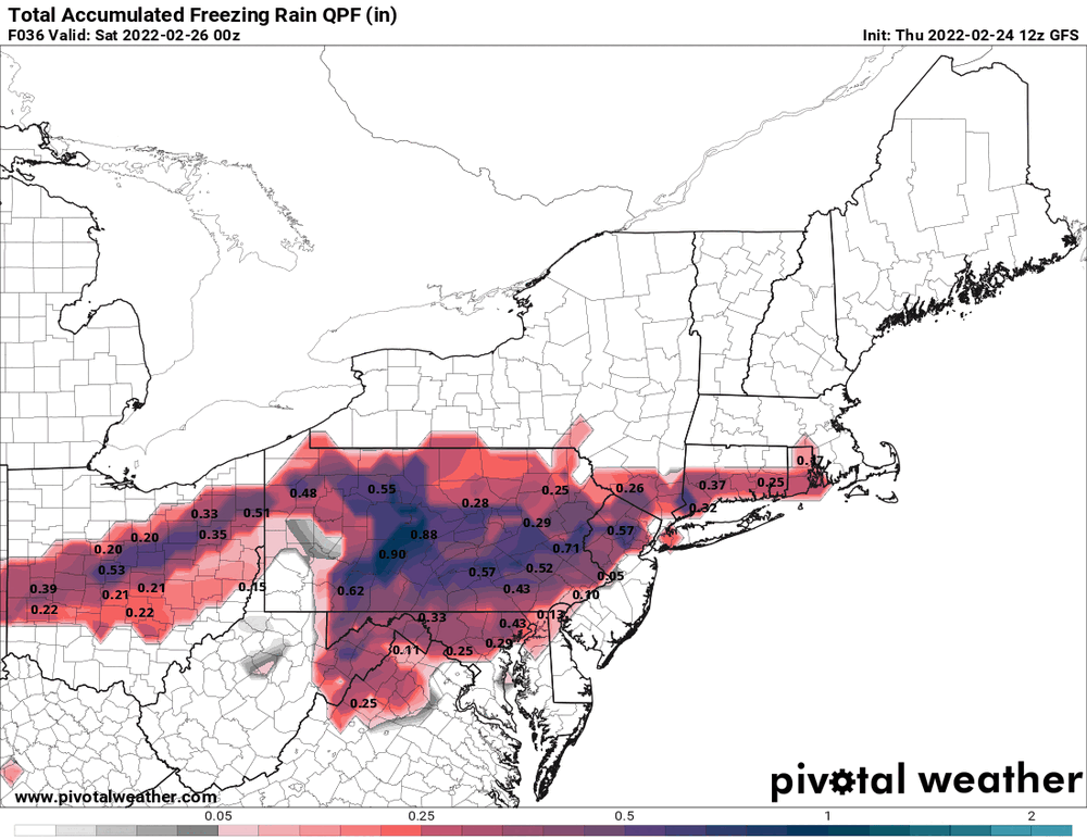
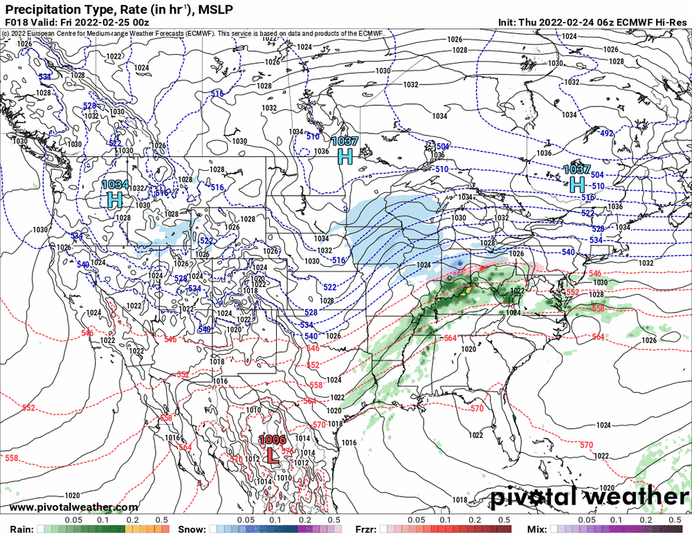
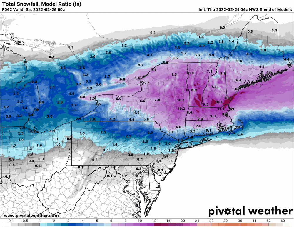
I know the short-range models are probably better for this timeframe but since the 18z GFS is running, I grabbed what it has. It has been echoing the other guidance pushing the heaviest precip to the N & W.

-
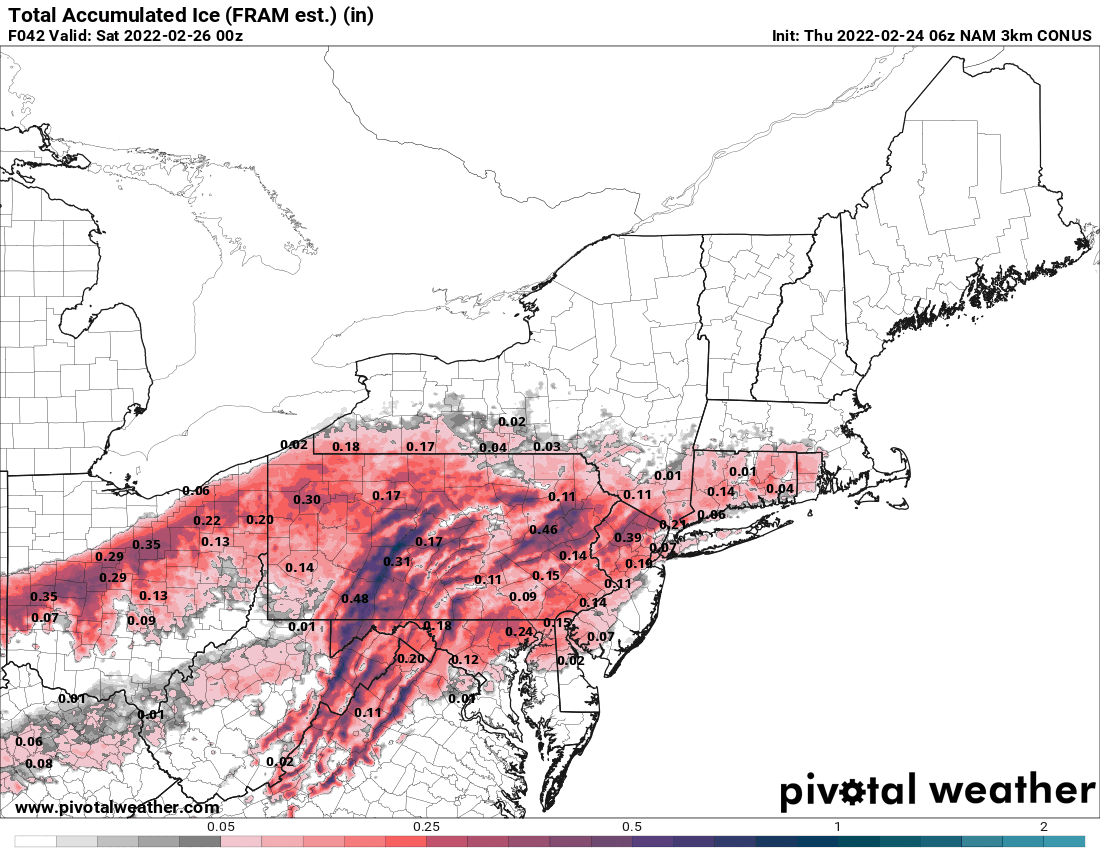
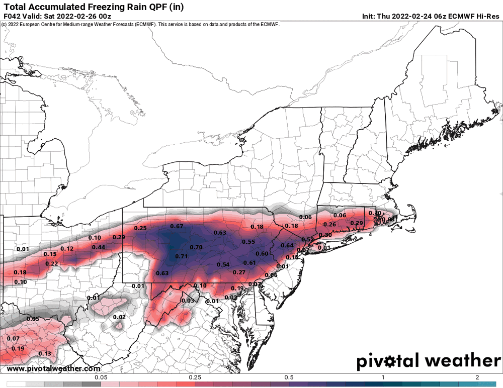
State College WFO put up an Ice Storm Warning earlier this morning for portions of west central PA.
-
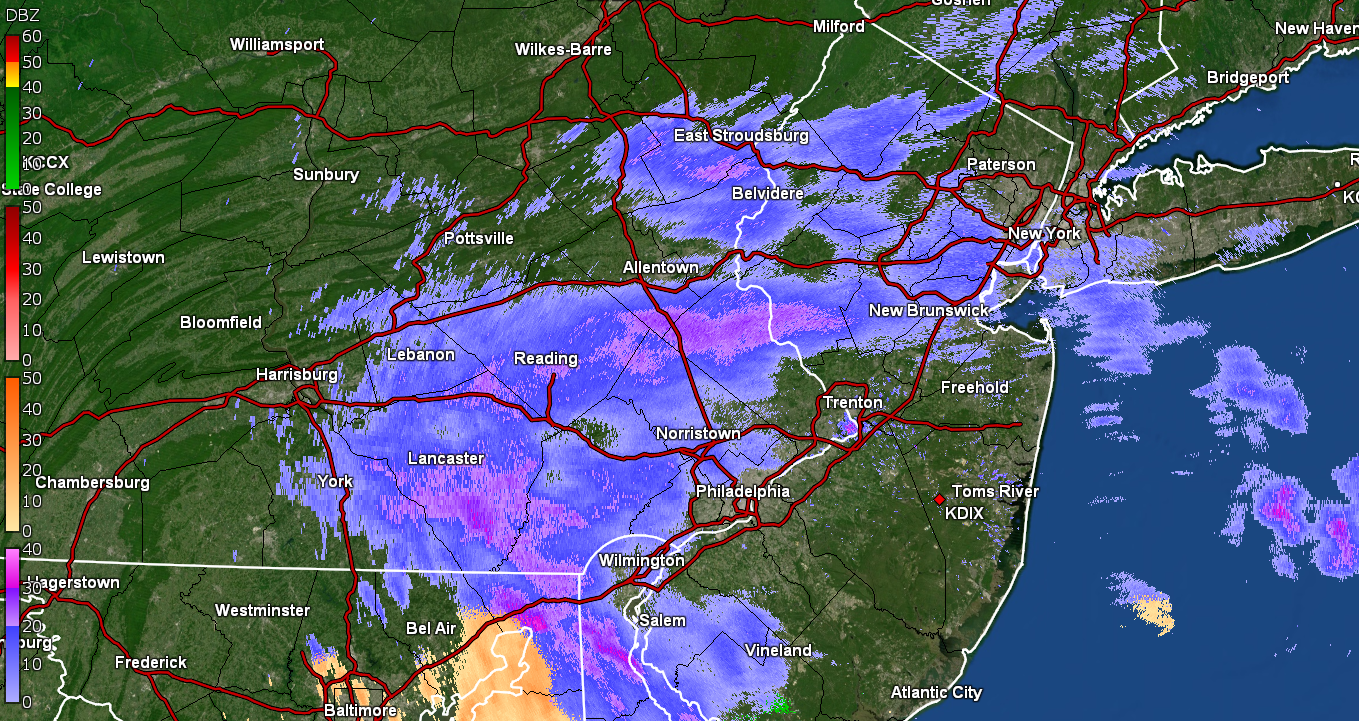
Now getting ZR. Temp bopping between 31/32.
-
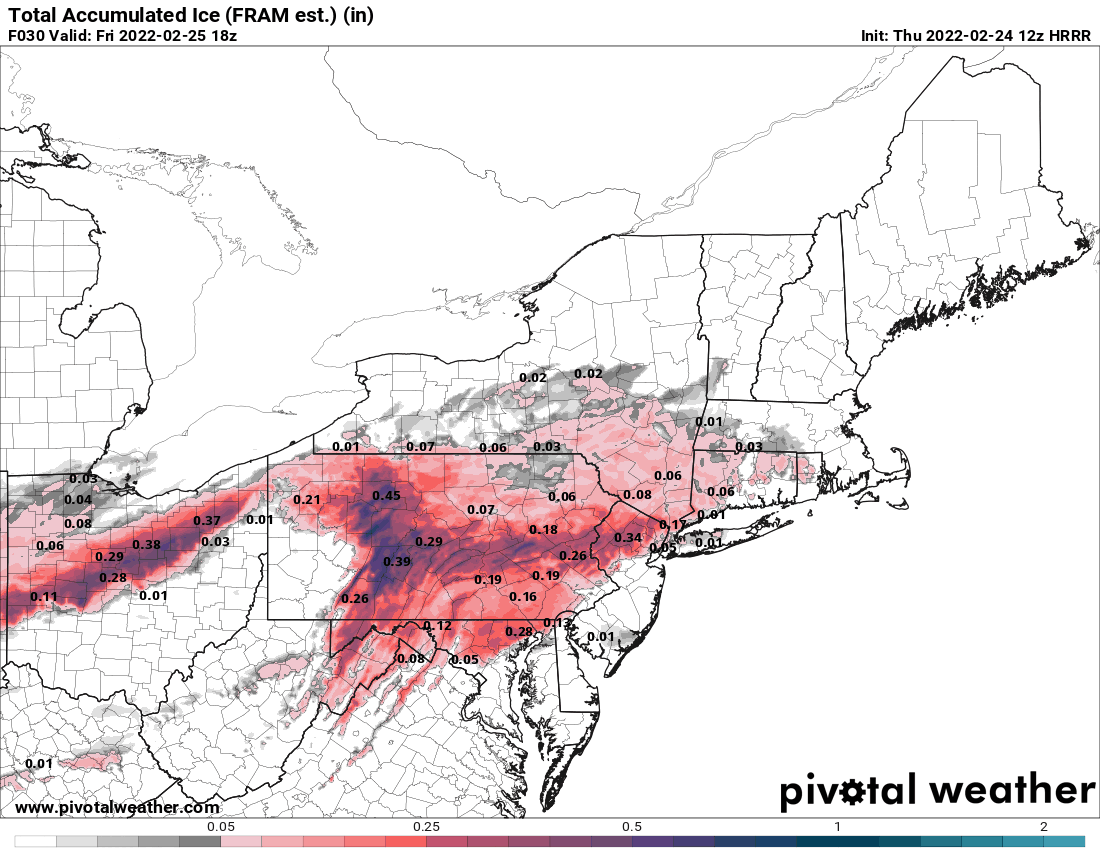
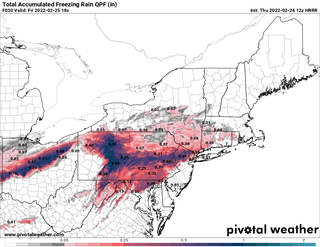
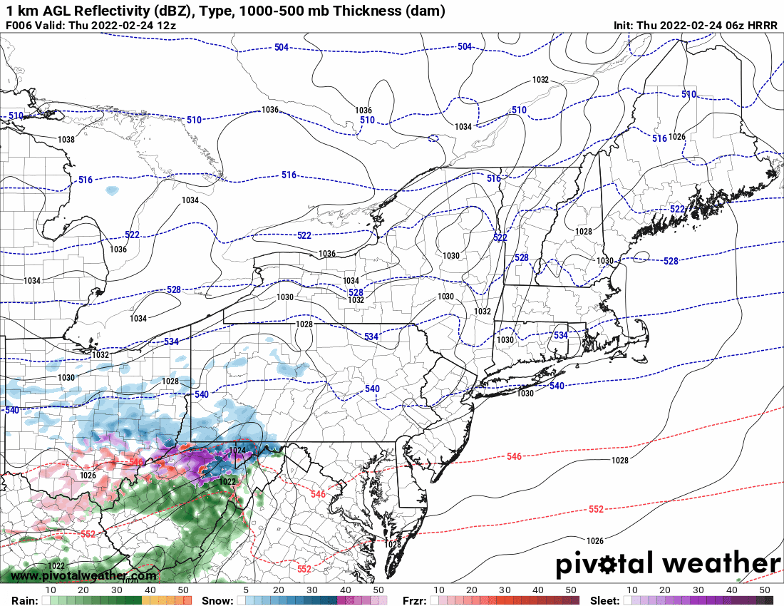
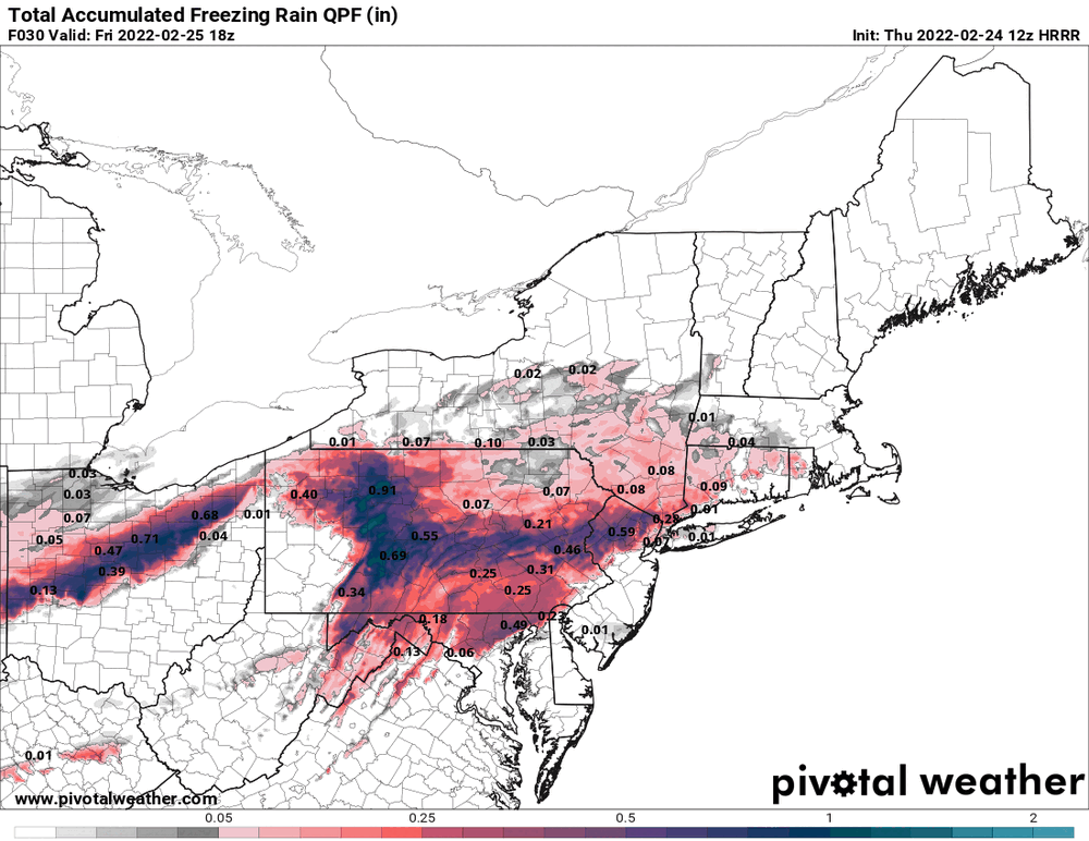
12z HRRR continuing the trend of the higher precip to the west.

-
Getting a mix of sleet and snow. Not really getting anything sticking yet but I am guessing that this is chilling the ground and exposed surfaces. Temp at 32 with dp 20.
-
Was just about to post. Just came in after putting my Polar Shield thingy over my car windshield. Currently 32 with dp 17.

-
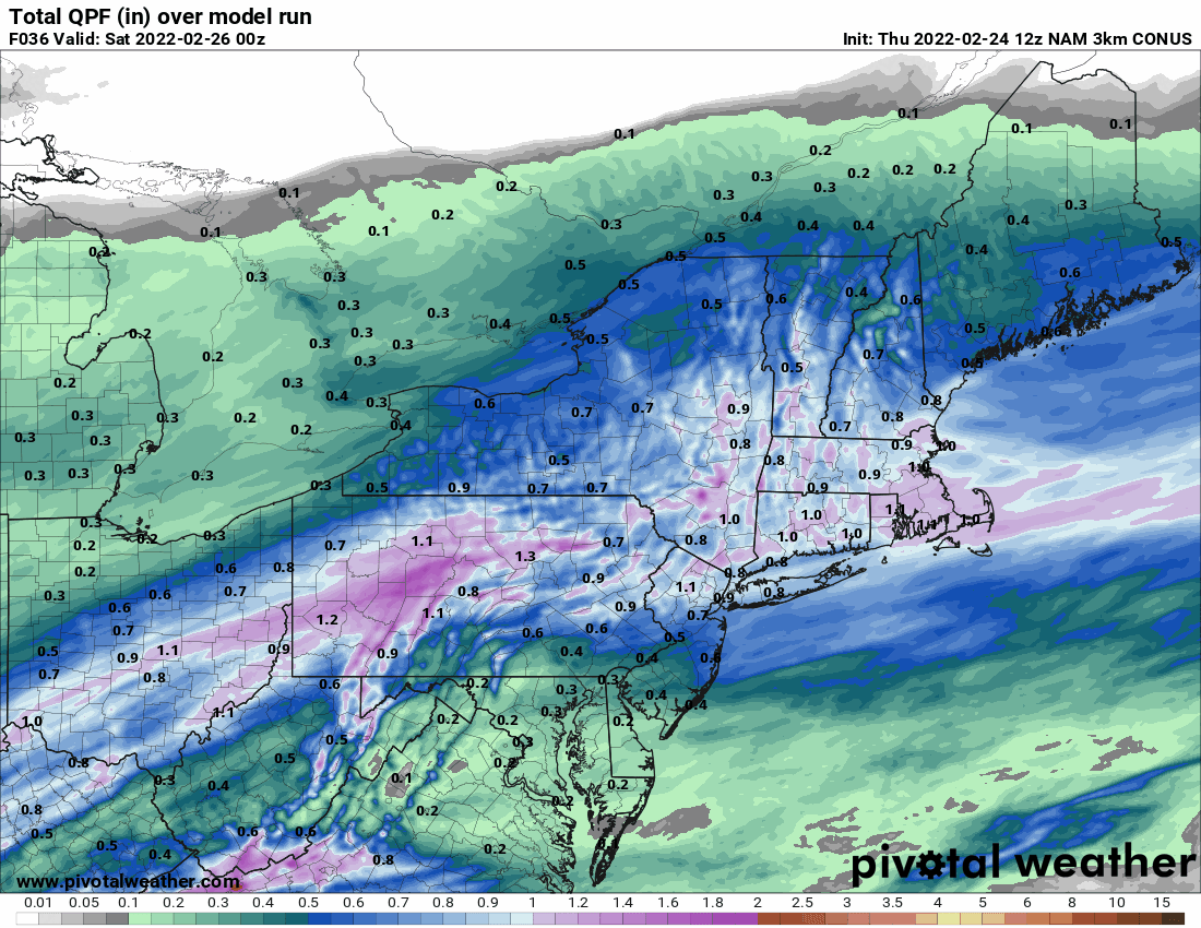
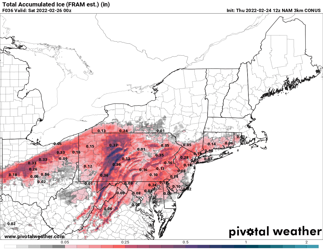
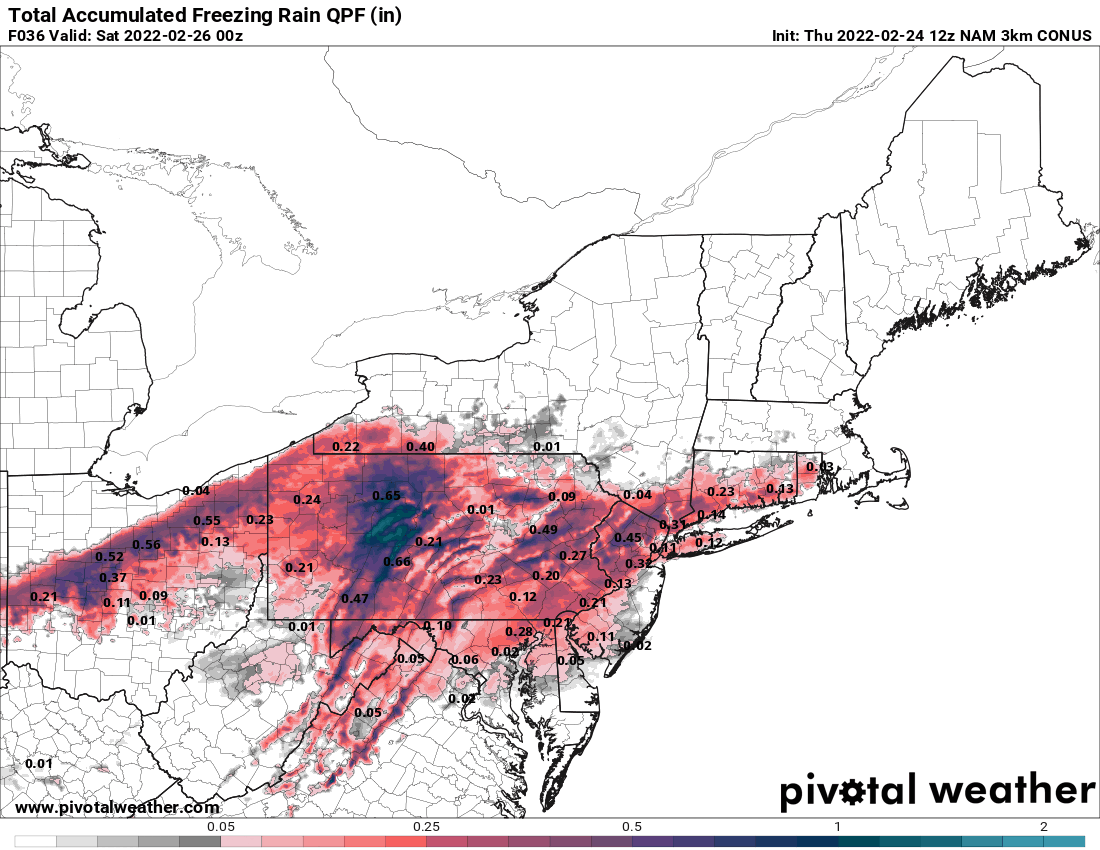
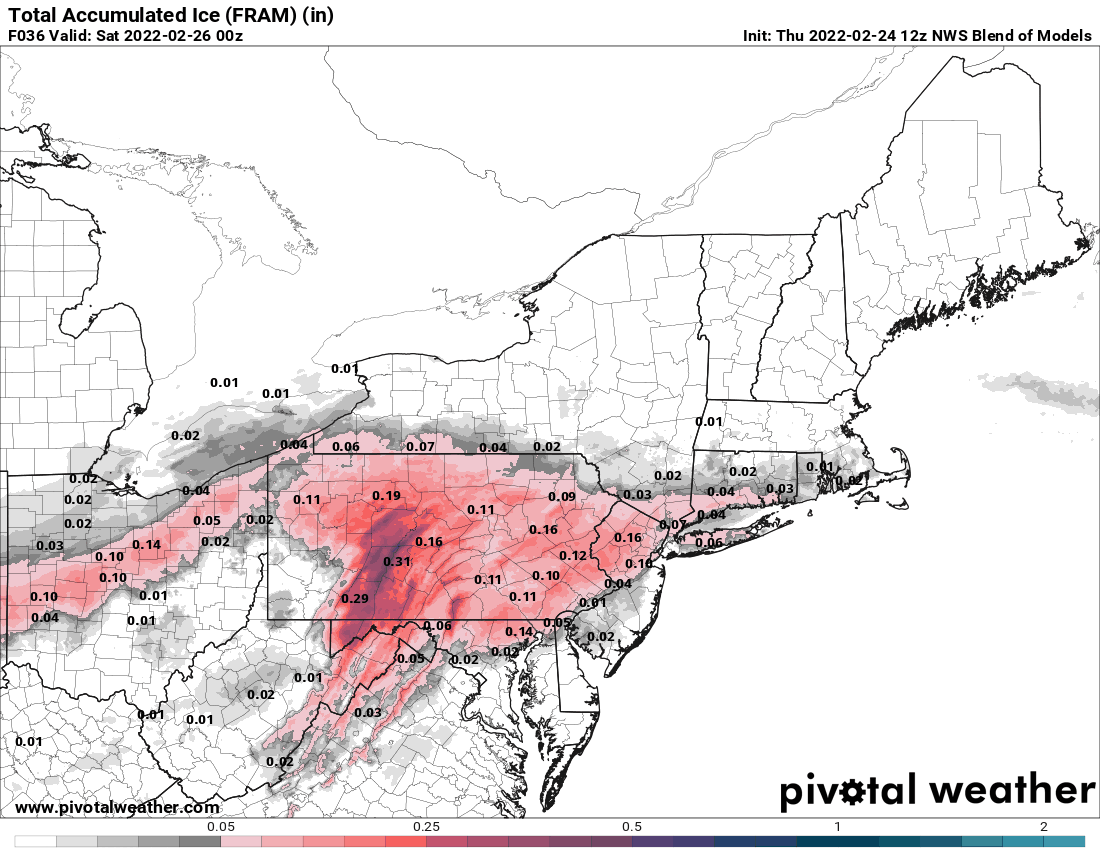
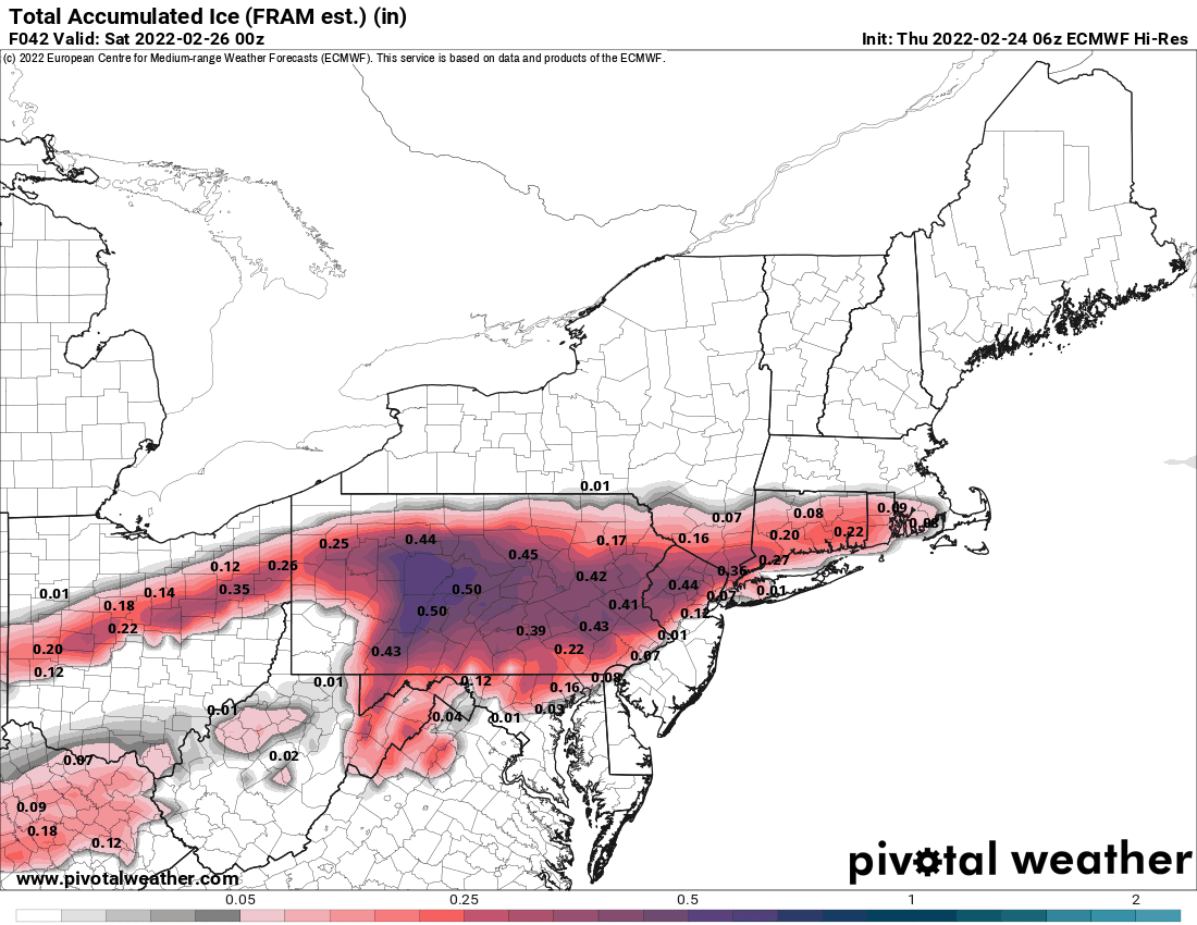
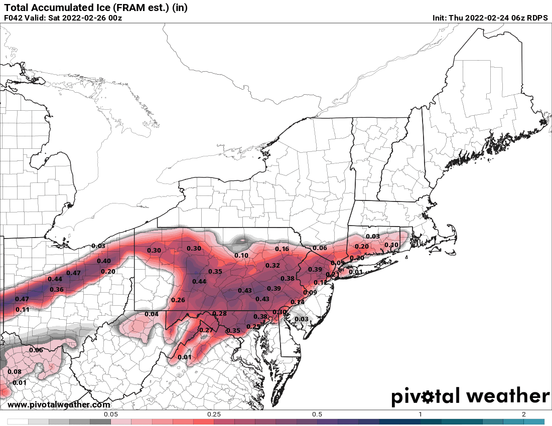
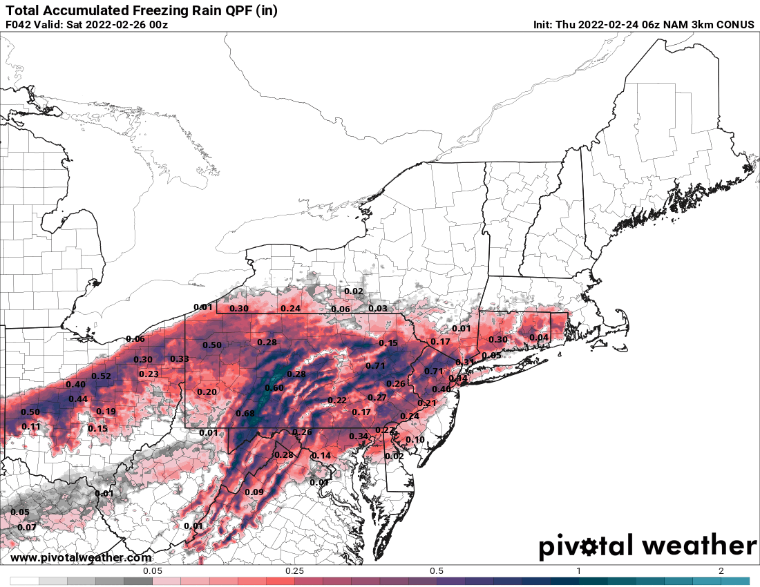
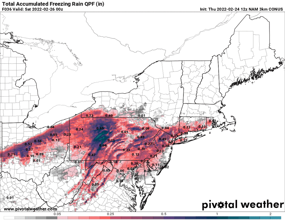
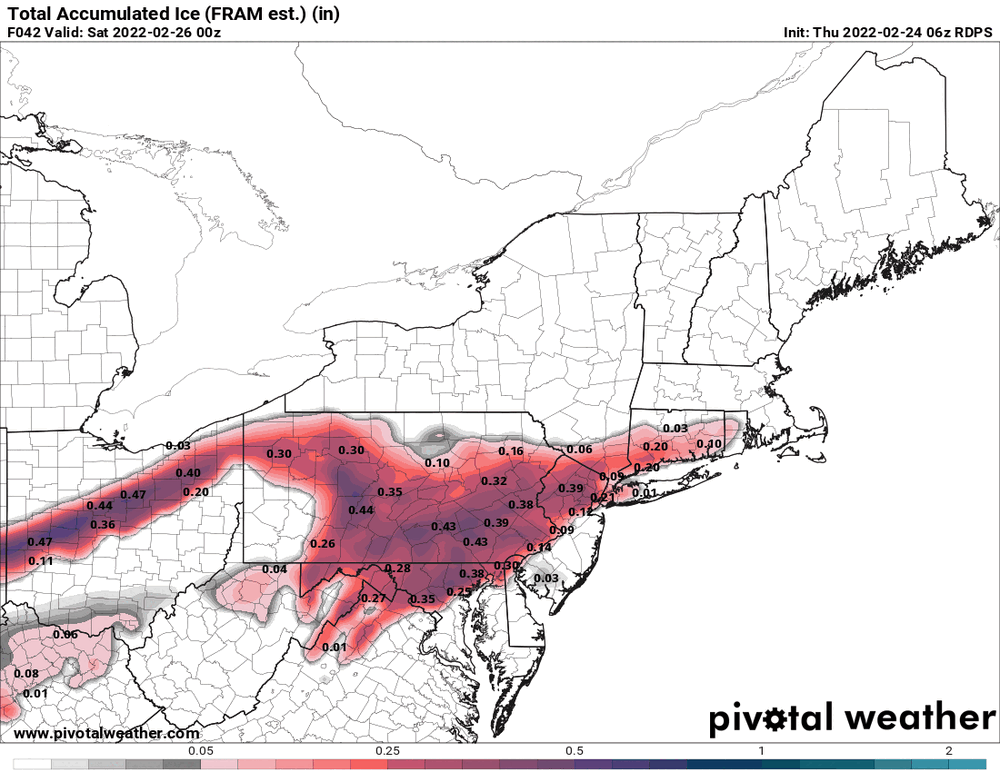
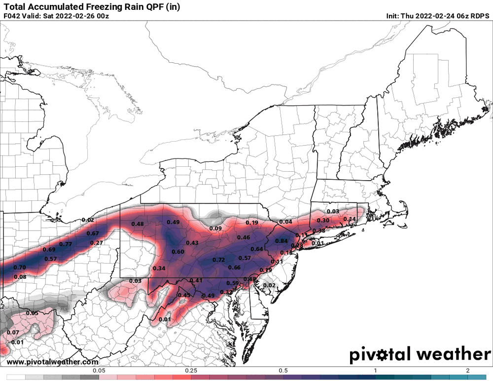
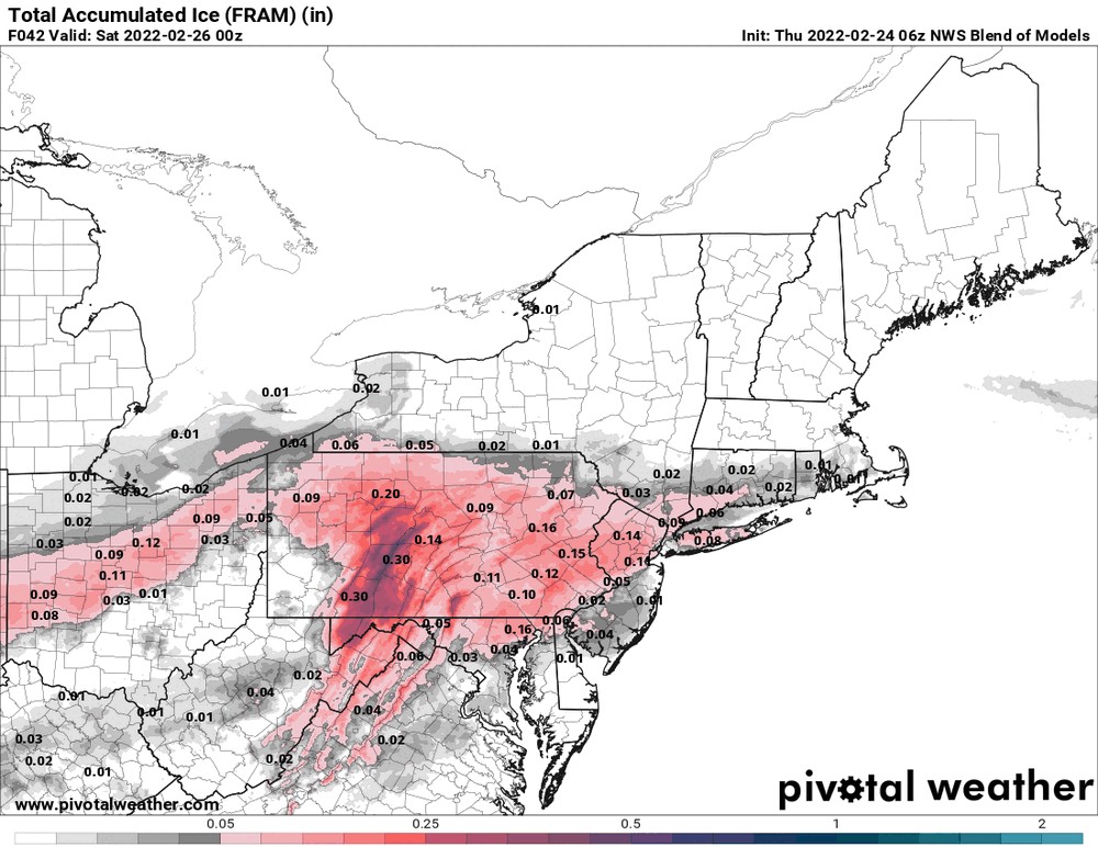
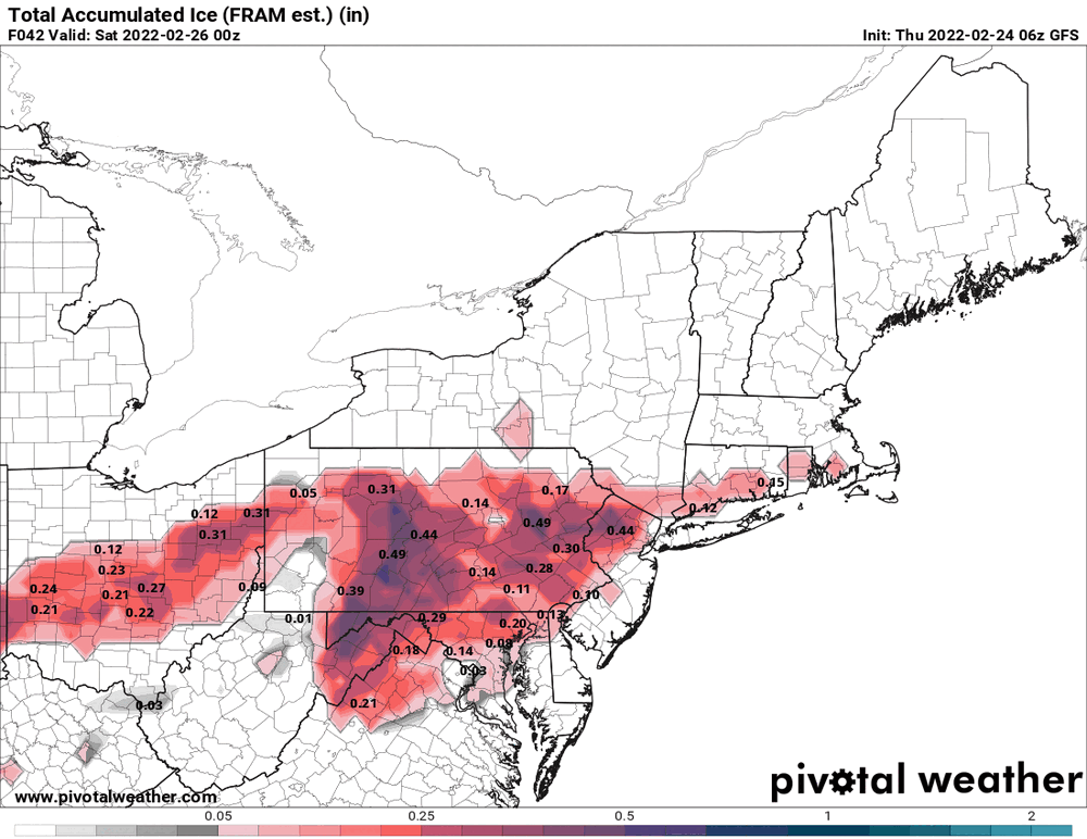
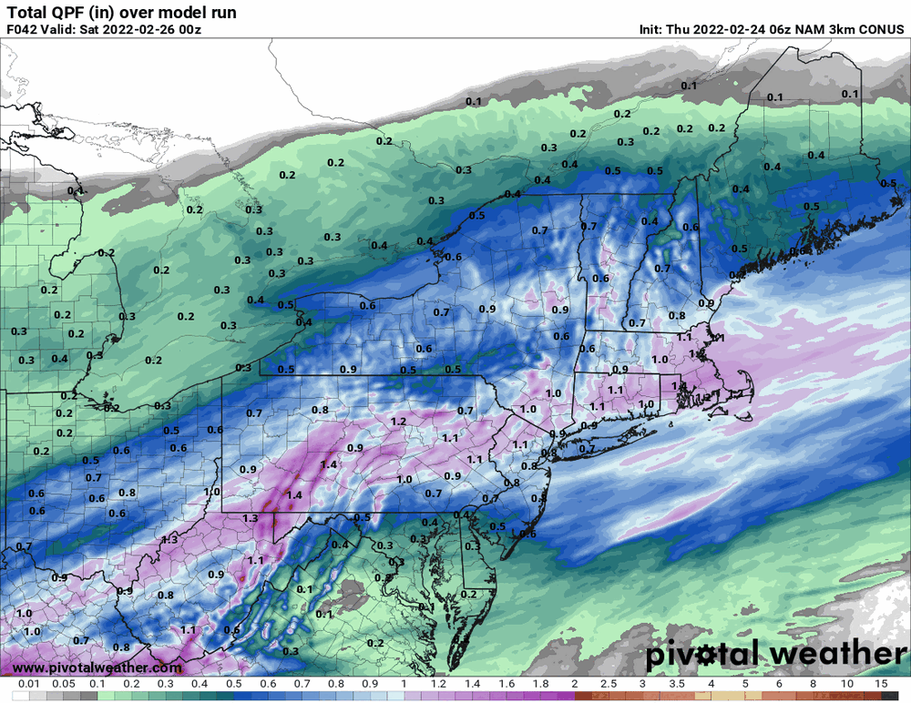
12z NAM a bit icier.

-
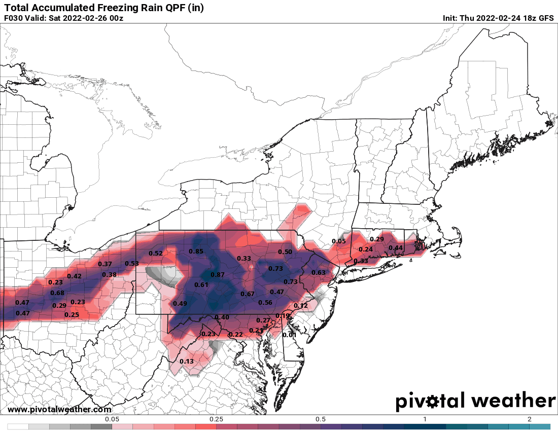
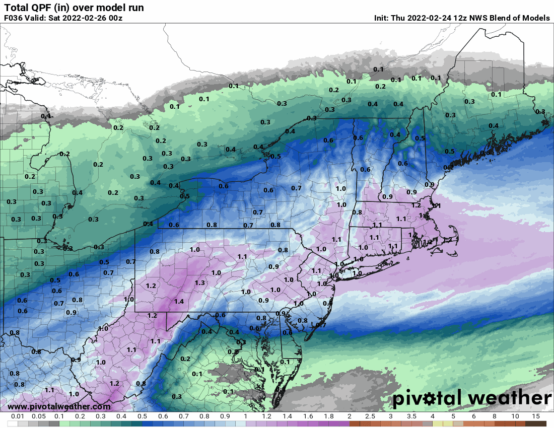
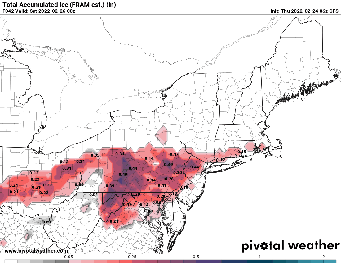
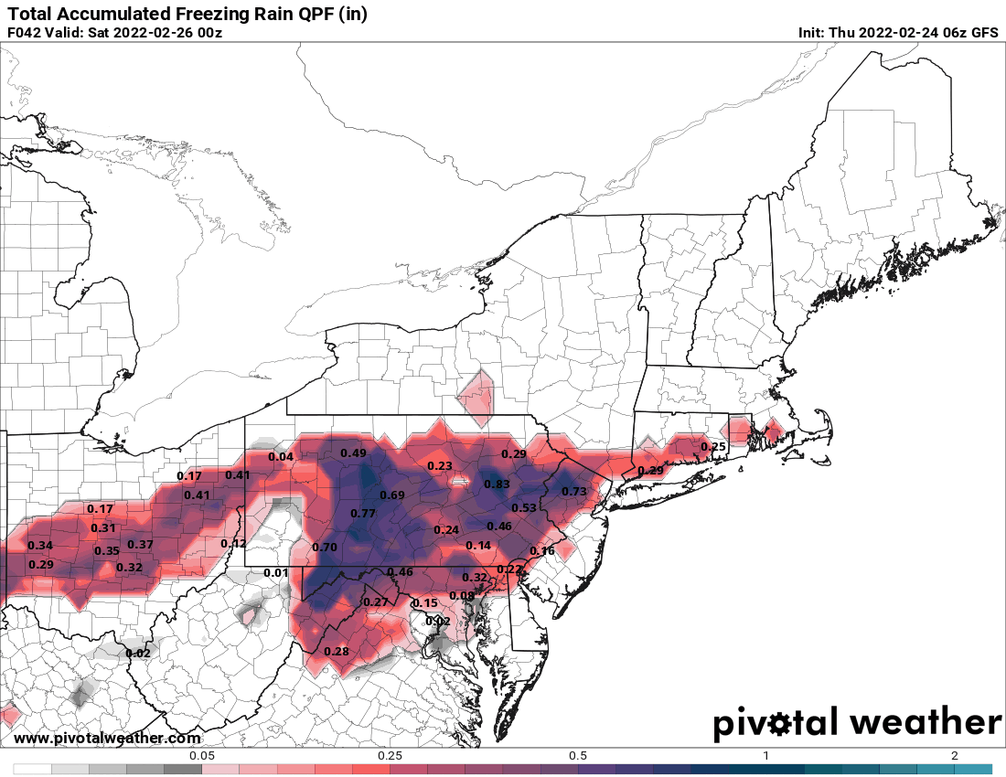
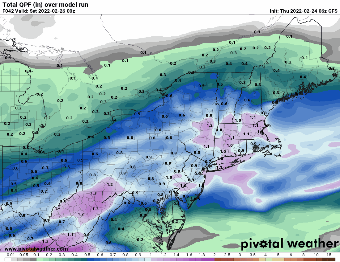
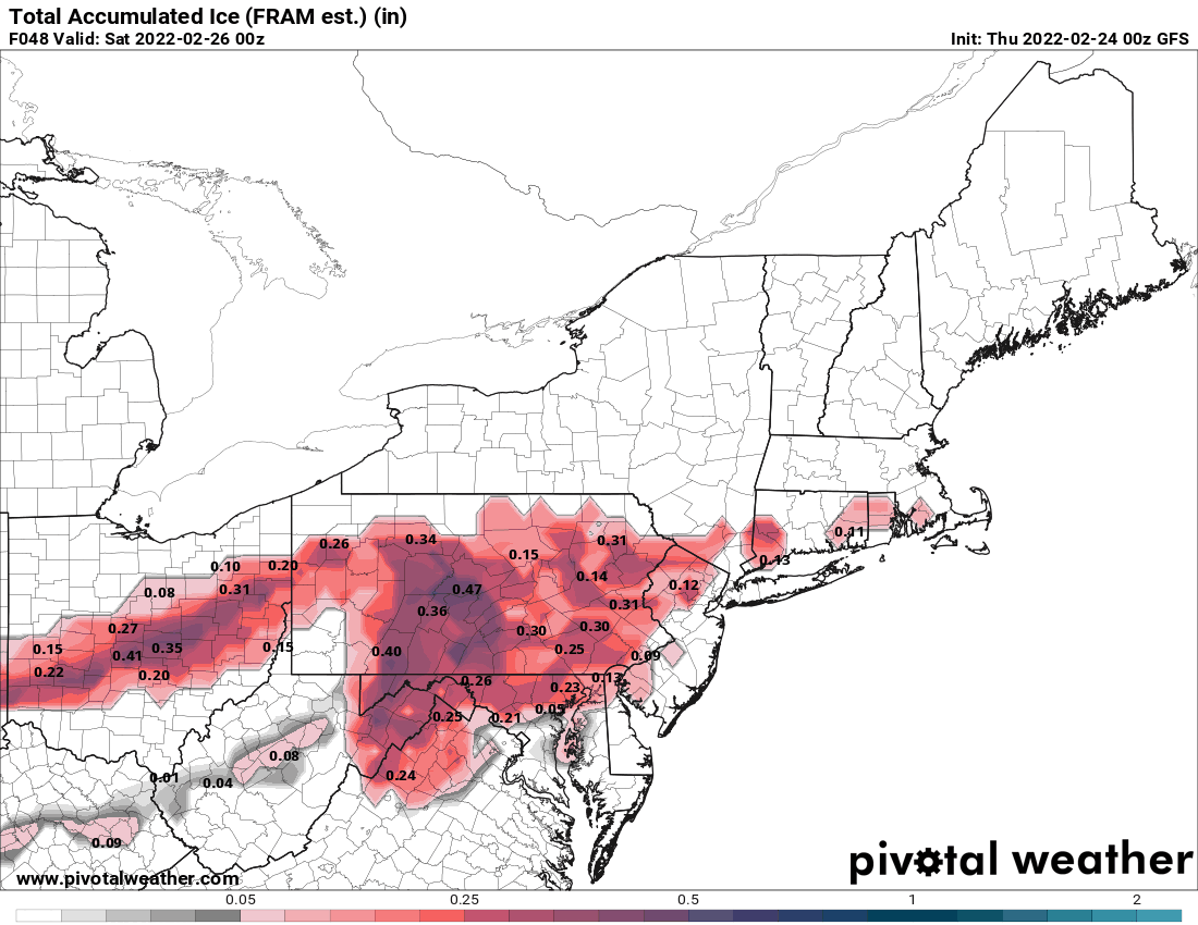
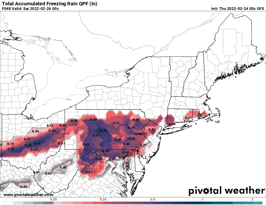
12z GFS keeping the heaviest precip to the west.
-
Okay. Some of those returns looked a little more "intense" (in quotes) so was wondering if any of it was making it to the ground. I know the dp down here IMBY is 17 (temp 32), so the air is fairly (although not excessively) dry.
-
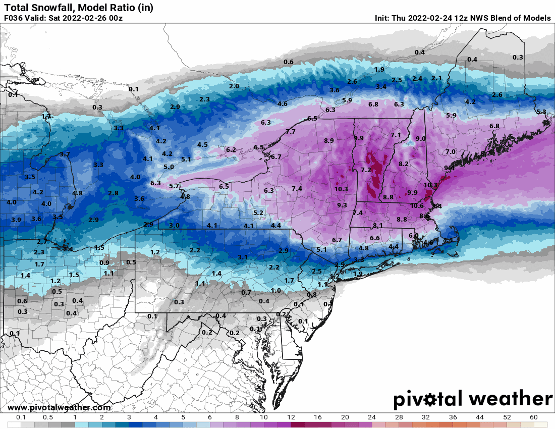
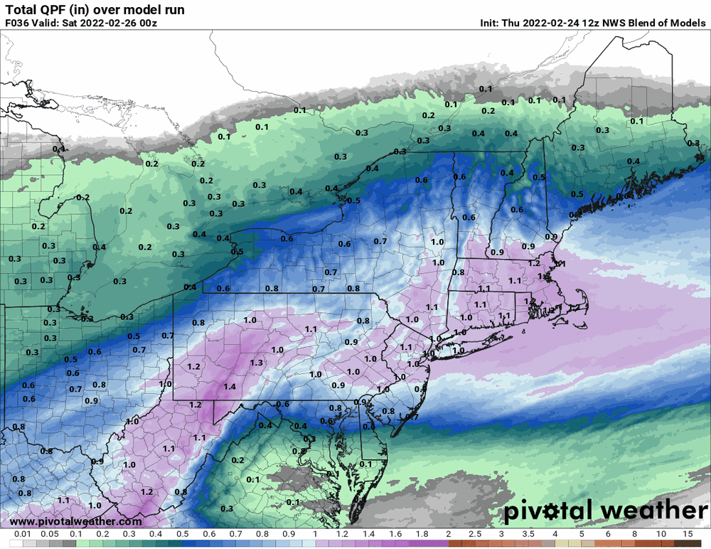
12z NBM sticking with the NAM idea.

-
Haven't played with Bufkit in awhile but just for the heck of it (skew-t).. NAM-bufkit-skew-t-2022-02-24_9-48-43.mp4
-
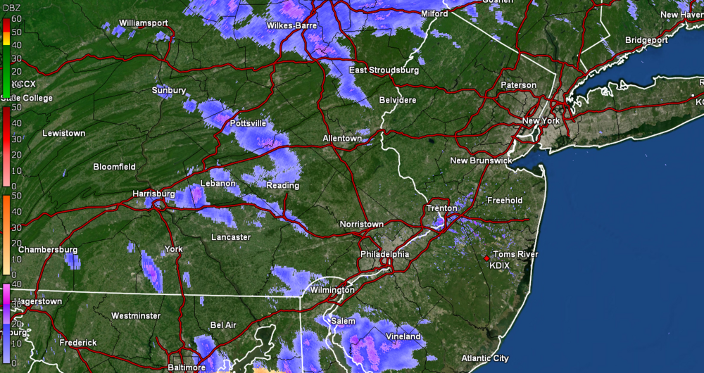
Okay thanks! Was hoping one of you guys up there would chime in on the radar regarding whether that was just vaporware returns.
-
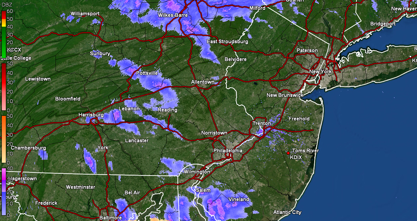
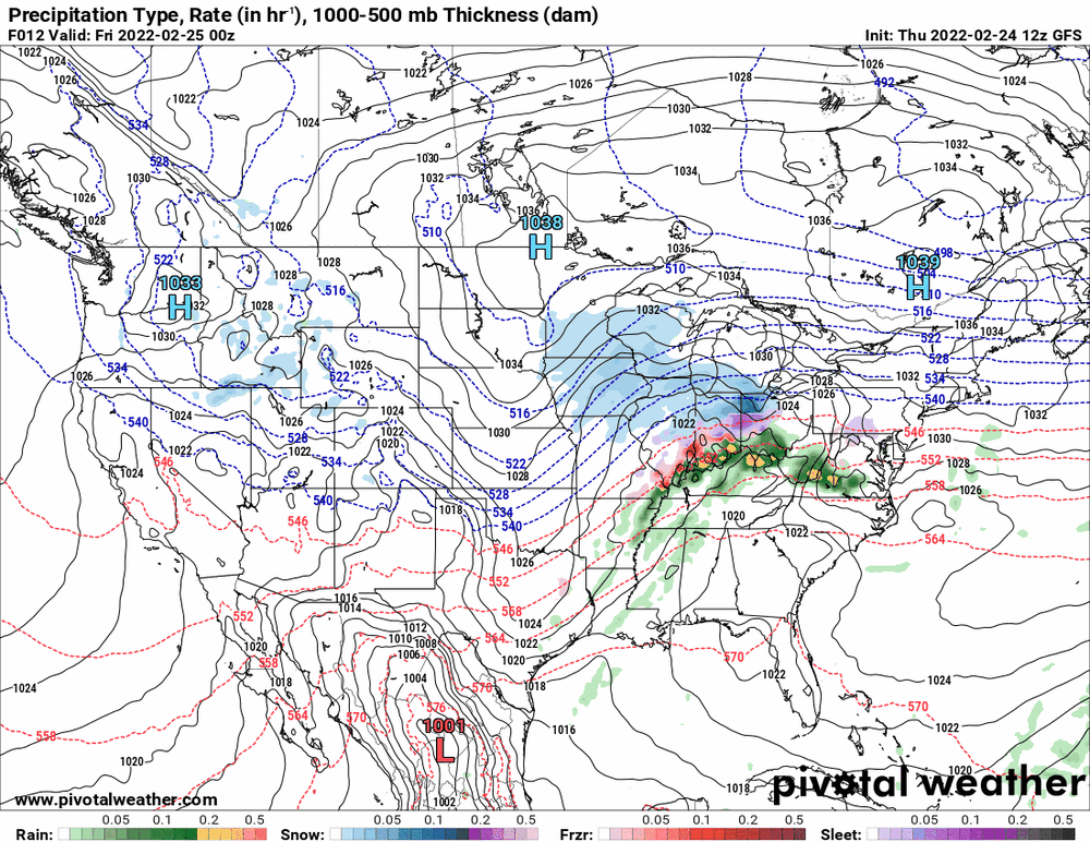
What is interesting is that they were capturing the little antecedent precip that is on the radar at the moment! Am curious if any of that is making it to the ground or is just virga.
-
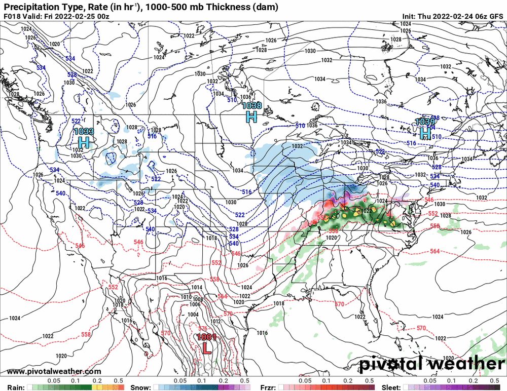
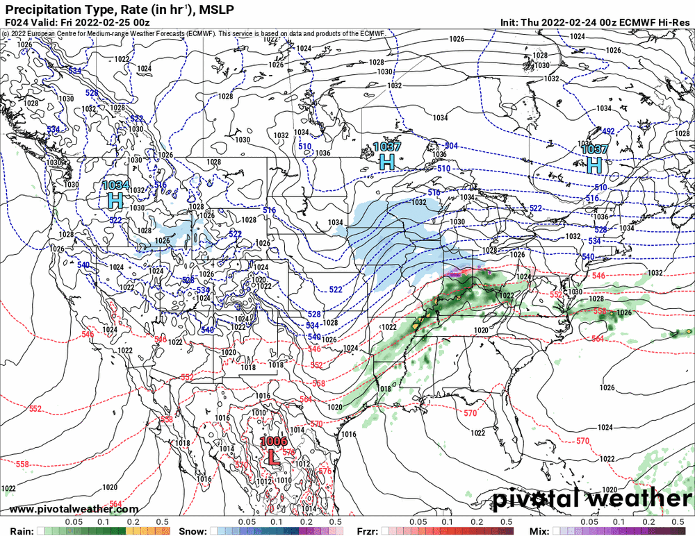
This was the 6z (last full) HRRR -

-
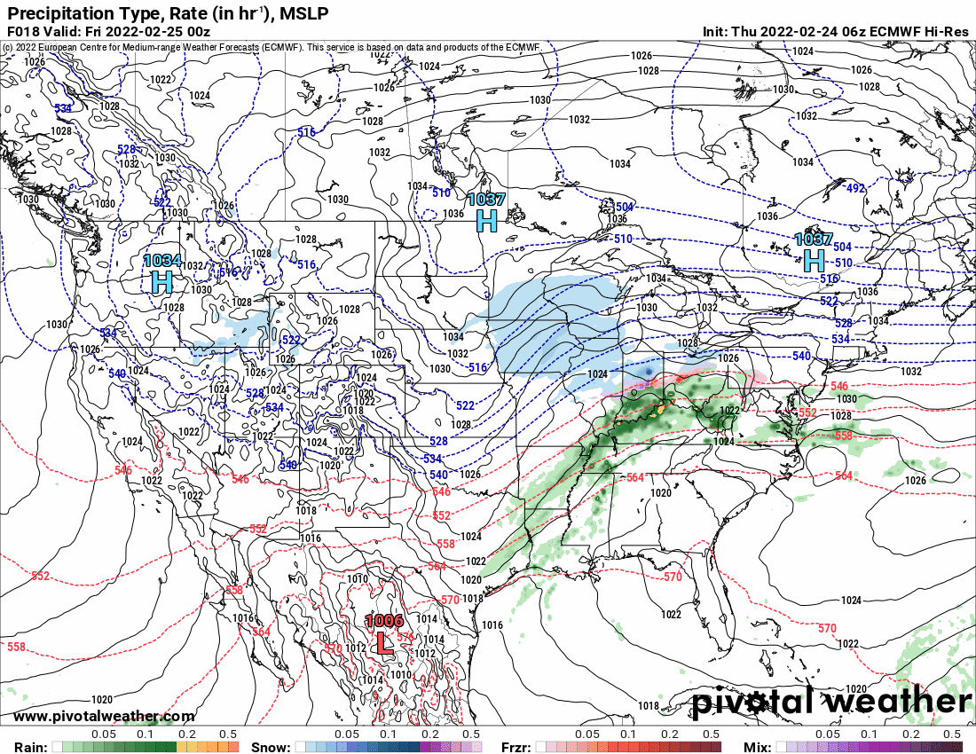
6z EC a little drier in the east.

-
Latest from Mt. Holly -
-
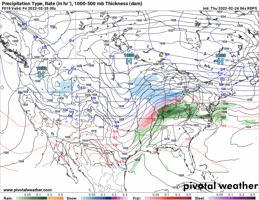
6z Canadian weigh-in (more of the same).
-
6z NBM guidance.
-
6z GFS a bit drier...


-
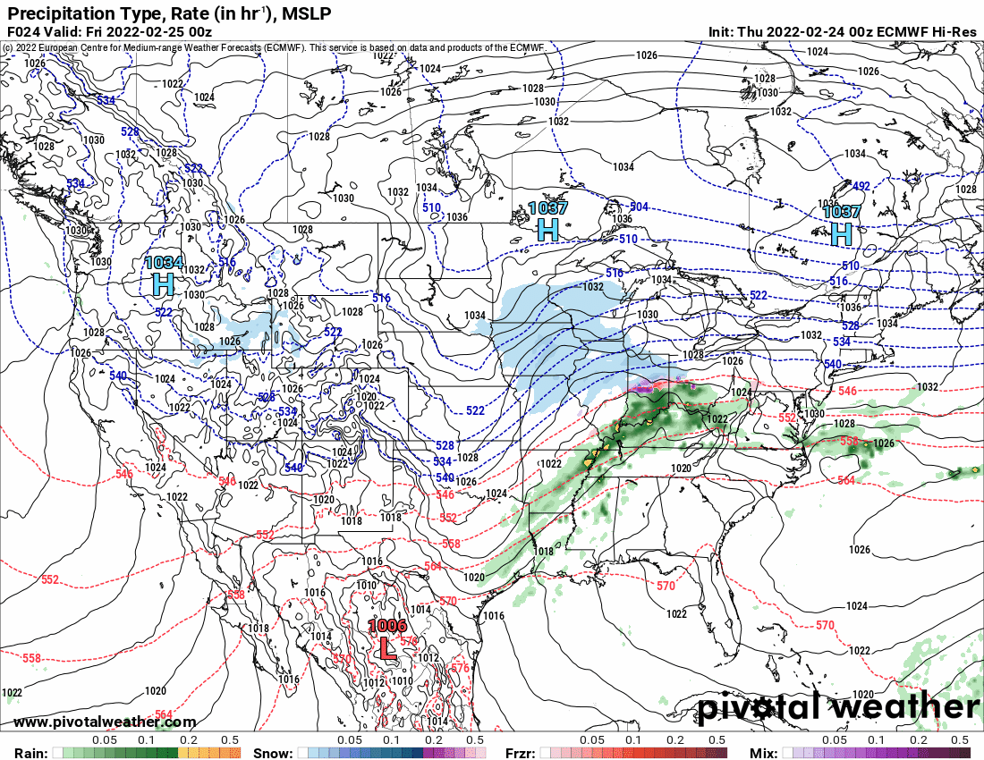
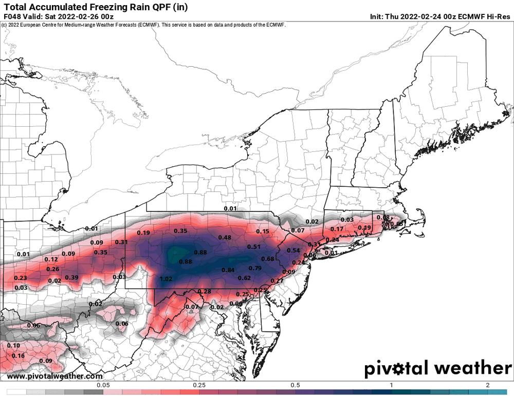
0z EC and the beat goes on...

-
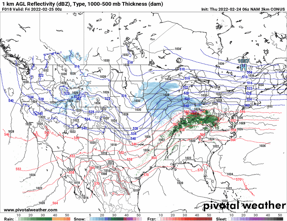
6z NAM still a slurpy.


-
E PA/NJ/ DE Winter 2021-22 OBS Thread
Hurricane Agnes replied to JTA66's topic in Philadelphia Region
Currently 32 with dp 20. -
WWAs up around the metro area. Currently down to 32 here with dp 20.
-
0z GFS looks like a mix to rain for the southern tier (hope that trend holds in the future).

-
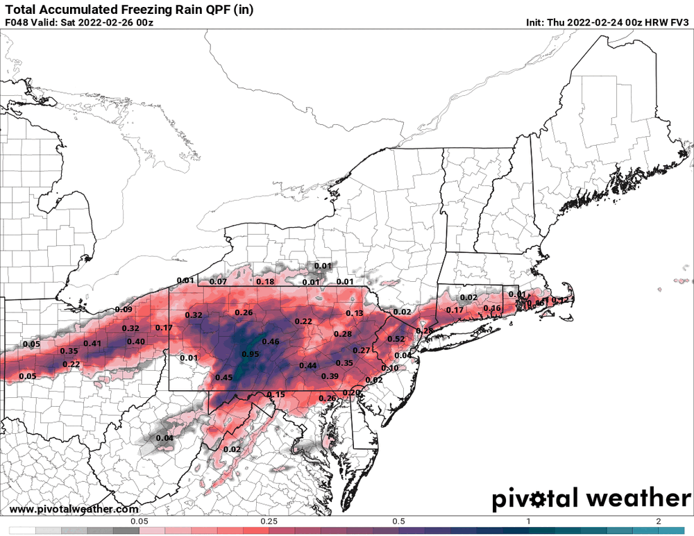
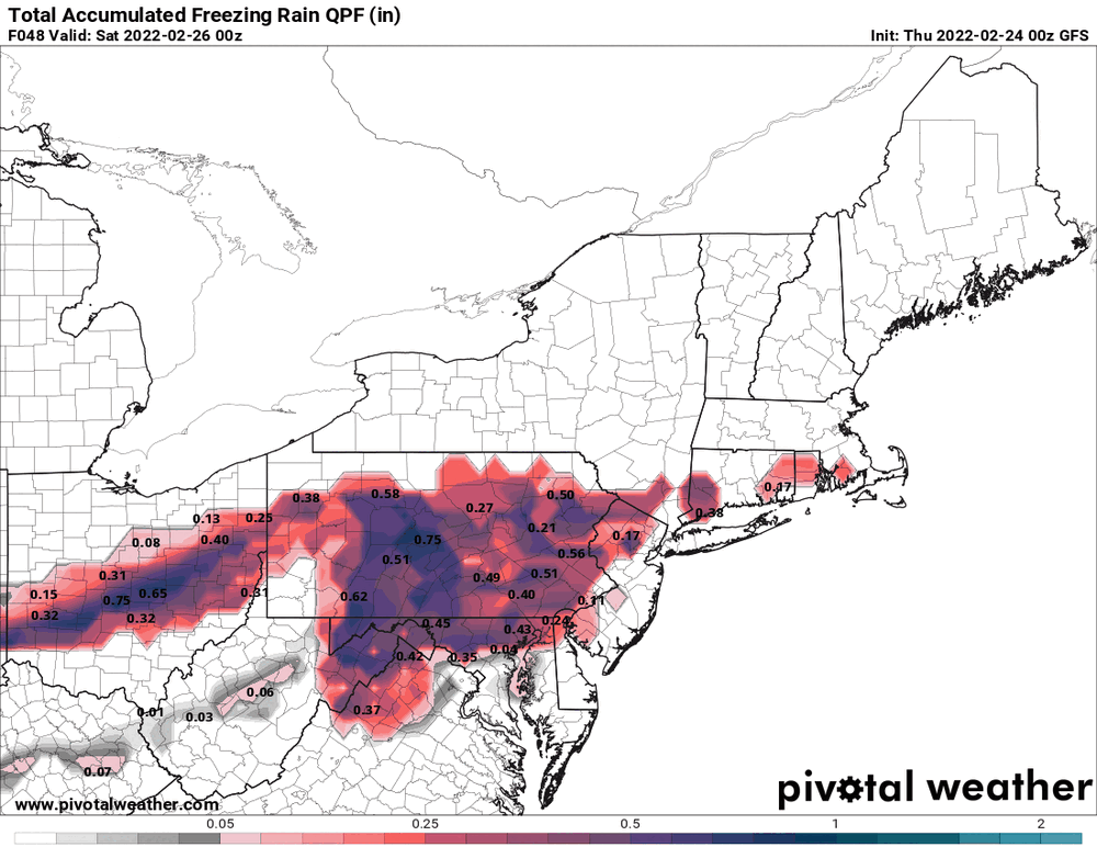
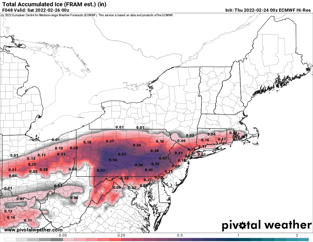
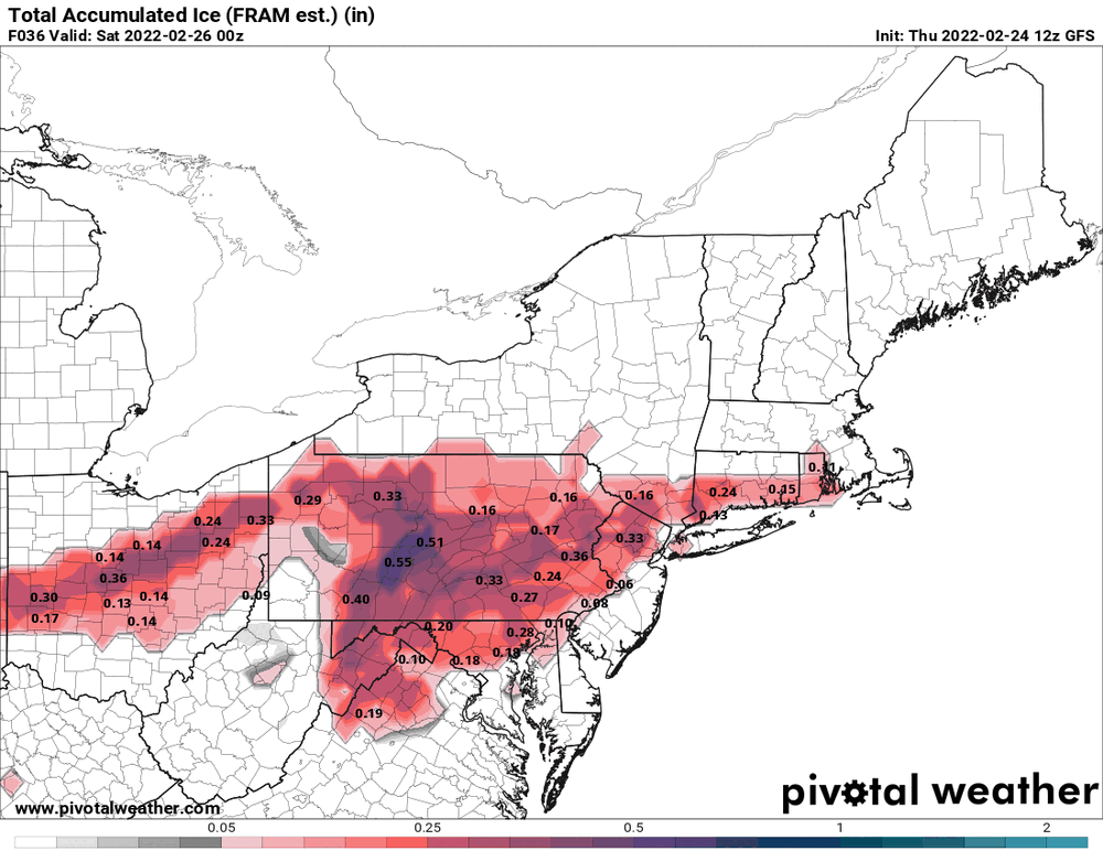
0z HRW FV3 (next gen GFS) icy... AND the hot off the press 0z GFS (still amped but not as excessive as previously).