Hurricane Agnes
-
Posts
9,344 -
Joined
Content Type
Profiles
Blogs
Forums
American Weather
Media Demo
Store
Gallery
Everything posted by Hurricane Agnes
-
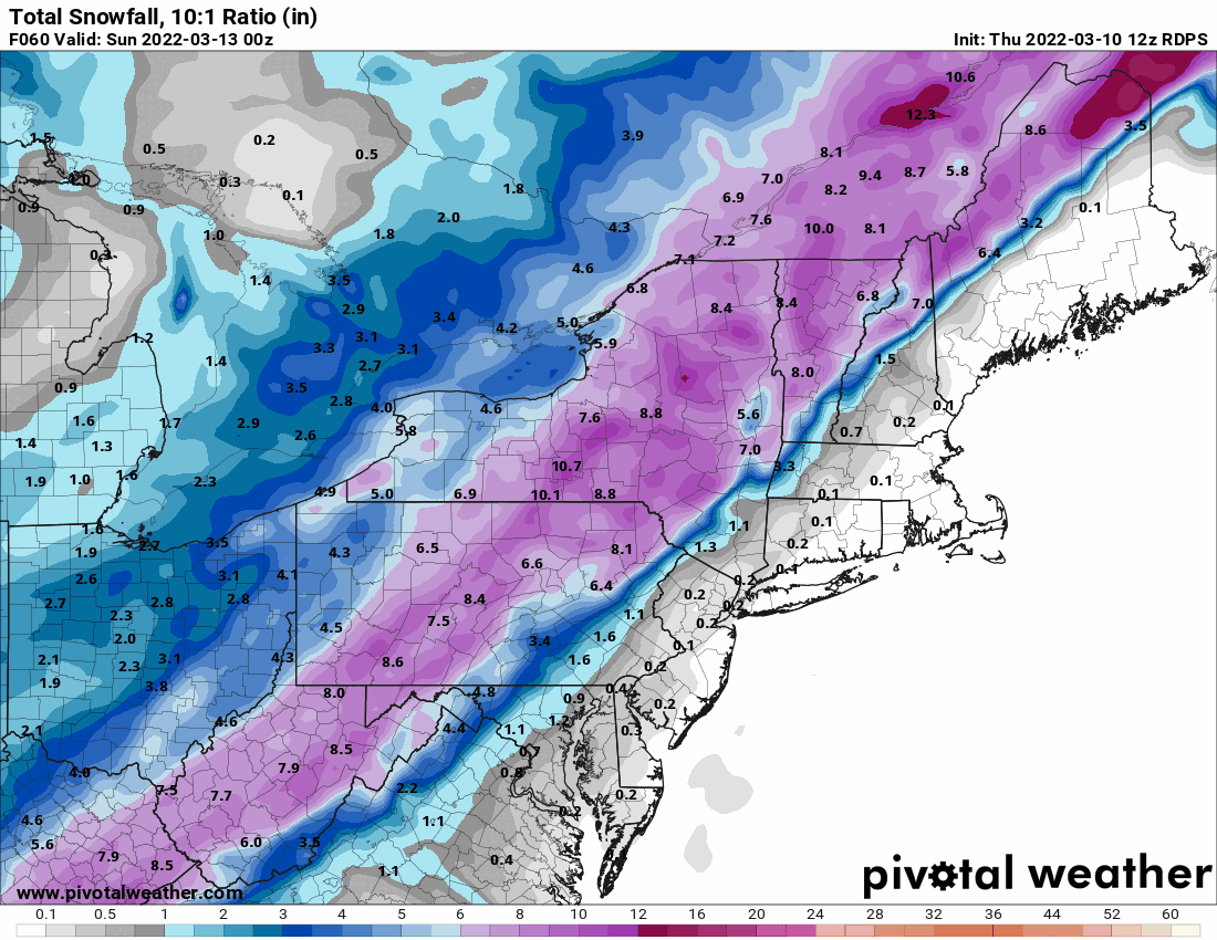
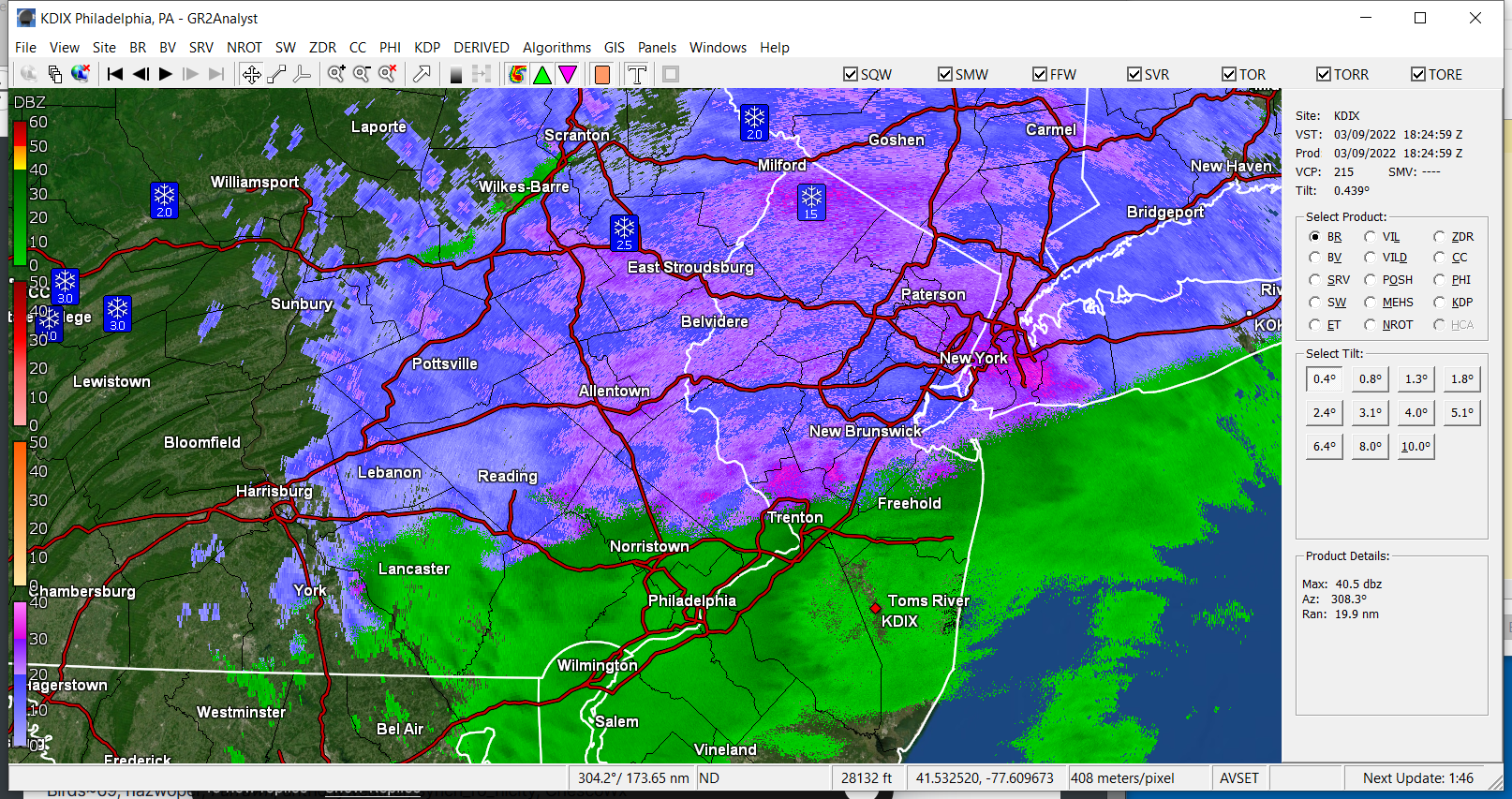
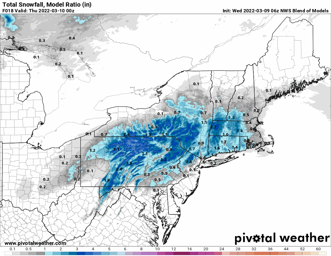
12z RGEM.

-
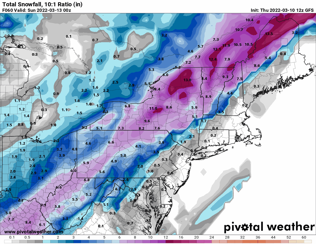
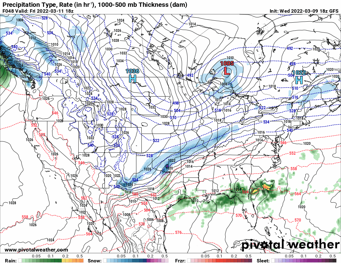
Will post what I had in the general obs thread regarding the 12z GFS. Back end thump (might not be enough for areas S and E).

-
E PA/NJ/DE Spring 2022 OBS Thread
Hurricane Agnes replied to Hurricane Agnes's topic in Philadelphia Region
12z GFS with a back-end thump corresponding with the cold front but might not be enough for the SE areas.

-
E PA/NJ/DE Spring 2022 OBS Thread
Hurricane Agnes replied to Hurricane Agnes's topic in Philadelphia Region
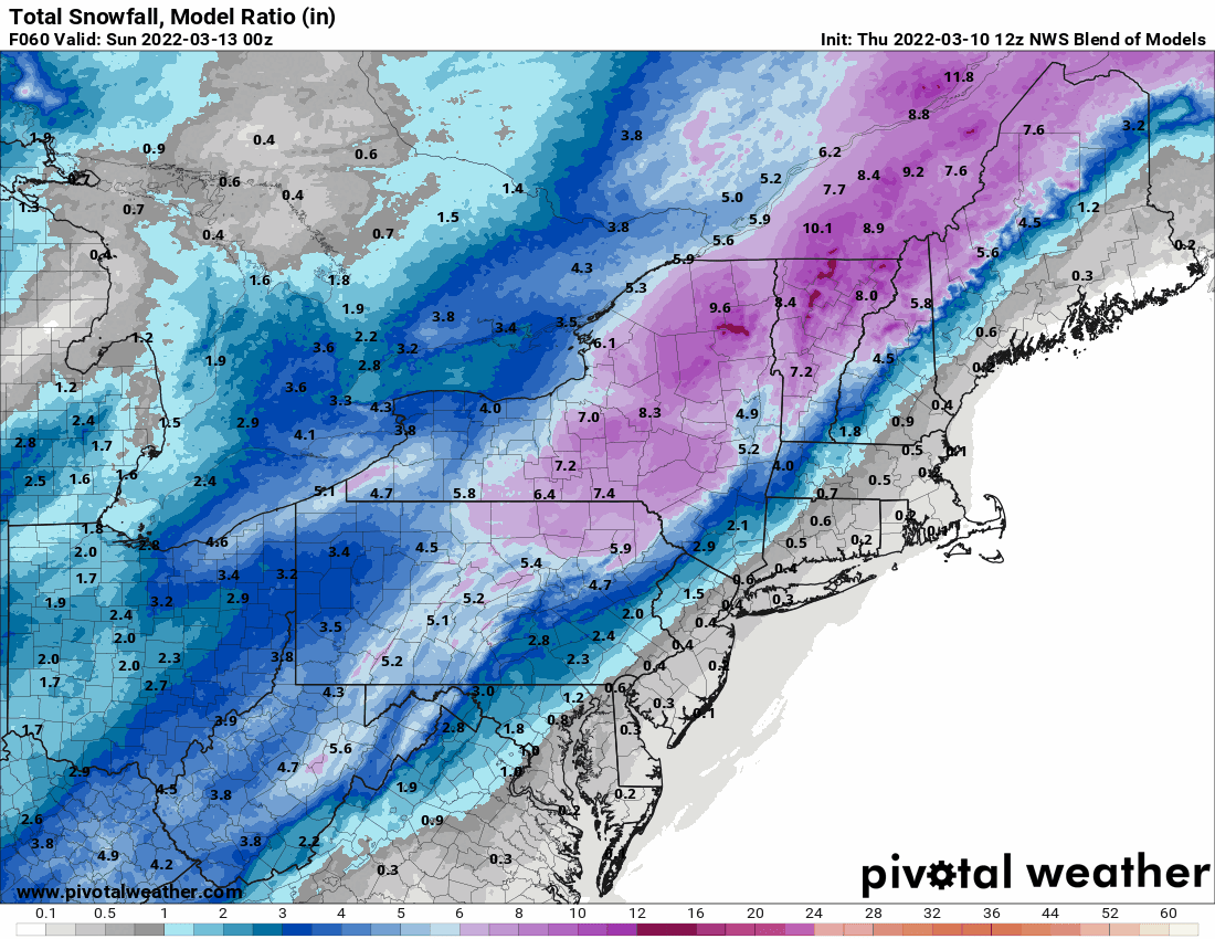
12z NBM (this is a stronger low/nor'easter than the last storm).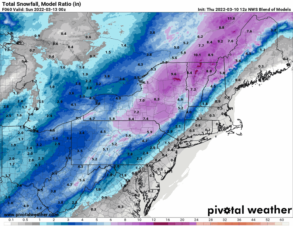
-
E PA/NJ/DE Spring 2022 OBS Thread
Hurricane Agnes replied to Hurricane Agnes's topic in Philadelphia Region
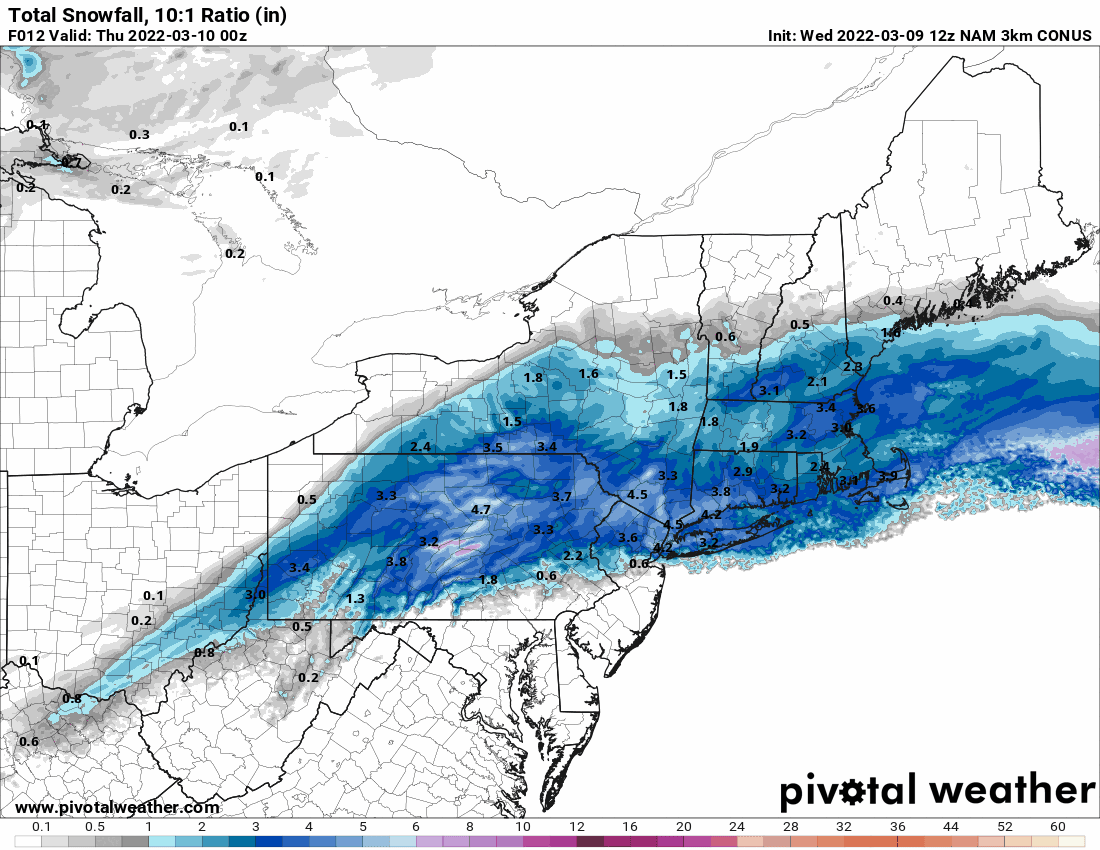
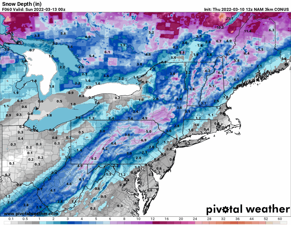
Here's the 10:1 and Snow Depth
-
E PA/NJ/DE Spring 2022 OBS Thread
Hurricane Agnes replied to Hurricane Agnes's topic in Philadelphia Region
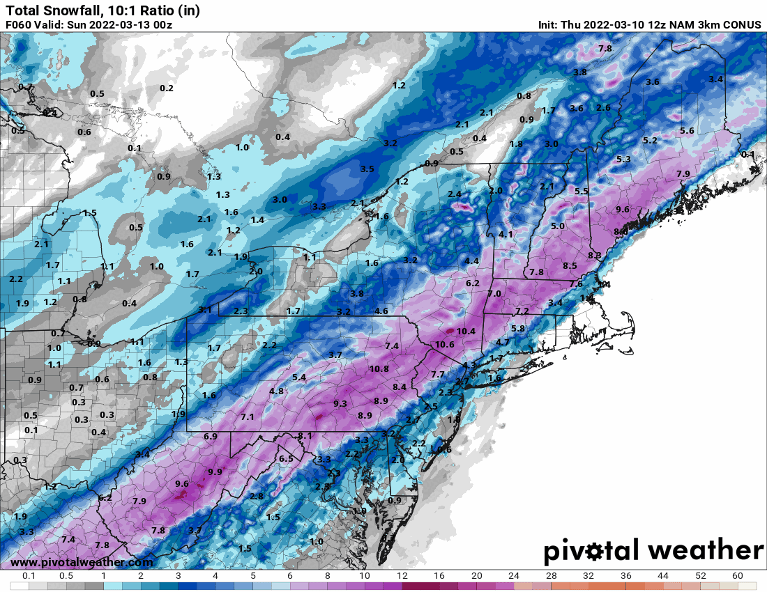
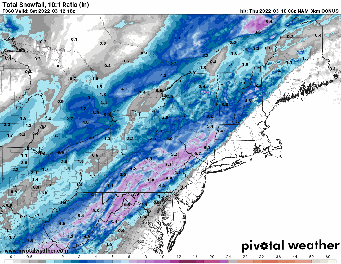
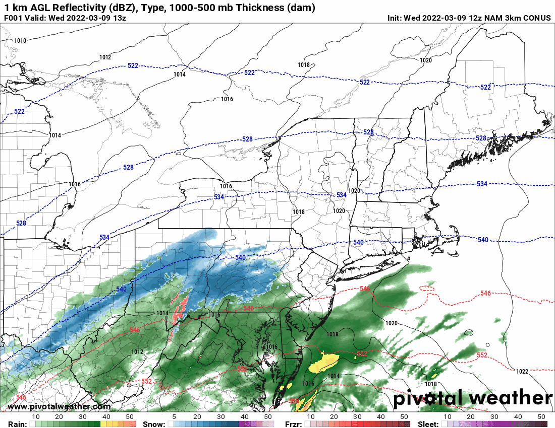
6z 3k NAM (as far out as it is going at the moment) - is showing more snow potential further east.

-
E PA/NJ/DE Spring 2022 OBS Thread
Hurricane Agnes replied to Hurricane Agnes's topic in Philadelphia Region
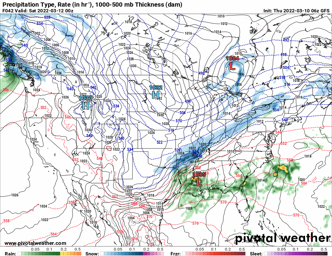
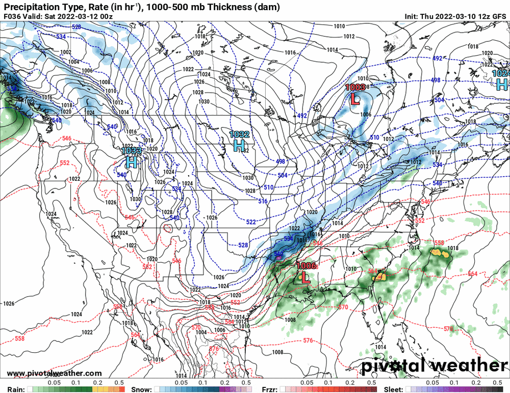
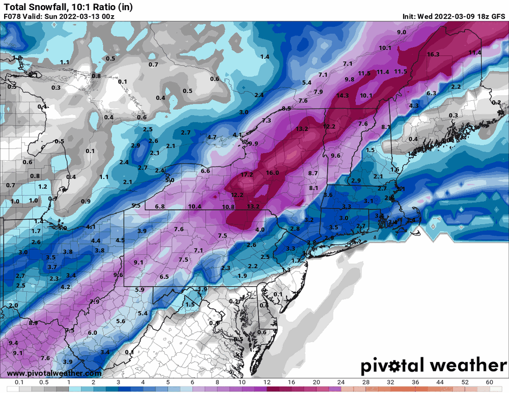
6z GFS FWIW. Basically an inland/coast-hugging nor'easter.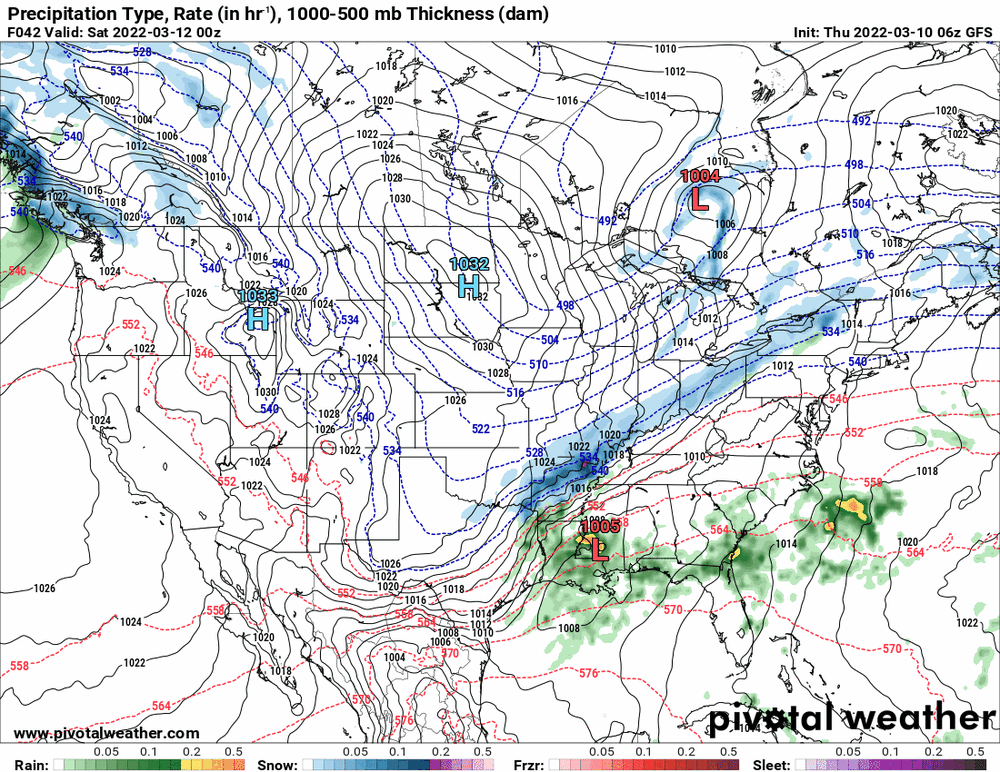

-
E PA/NJ/DE Spring 2022 OBS Thread
Hurricane Agnes replied to Hurricane Agnes's topic in Philadelphia Region
Have been getting light freezing fog and mist here this morning, although with the sunrise, the fog has mostly been dissipating, but the frost is everywhere on cold surfaces. Temp is 31 with dp 30. Looks like the winds went calm sometime around 4 am. -
E PA/NJ/DE Spring 2022 OBS Thread
Hurricane Agnes replied to Hurricane Agnes's topic in Philadelphia Region
18z Euro (further east with the heavier snow than others) -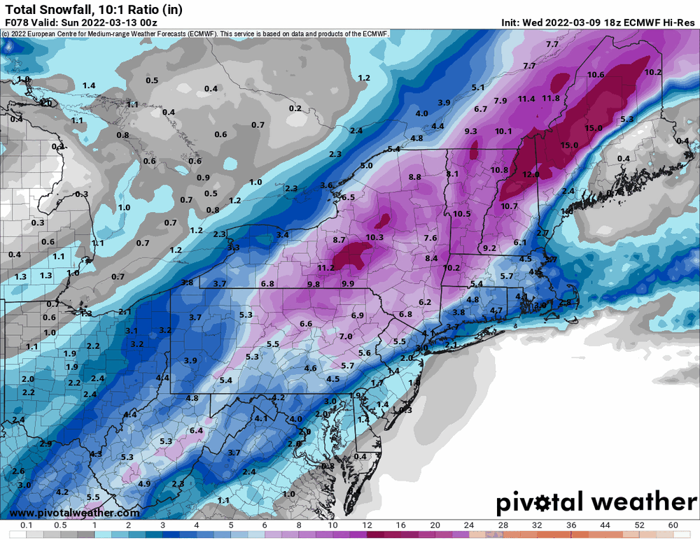
-
E PA/NJ/DE Spring 2022 OBS Thread
Hurricane Agnes replied to Hurricane Agnes's topic in Philadelphia Region
RGEM pretty much consistent with others as a N/W special. I know some weather outlets are calling for the low to bomb out once it gets past here.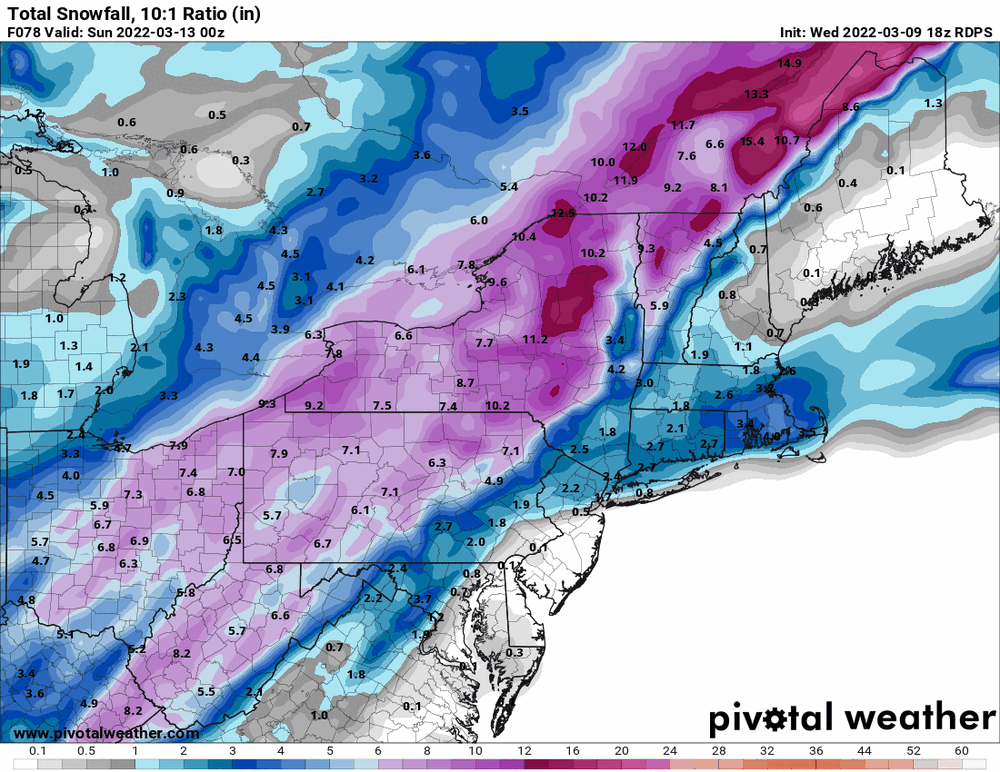
-
Looks like it's done here. Currently misty and 36 with dp 35. Ended up with 0.2" wet snow early and 0.54" rain/snow in the bucket. High for the day was 42 early this morning.
-
E PA/NJ/DE Spring 2022 OBS Thread
Hurricane Agnes replied to Hurricane Agnes's topic in Philadelphia Region
-
E PA/NJ/DE Spring 2022 OBS Thread
Hurricane Agnes replied to Hurricane Agnes's topic in Philadelphia Region
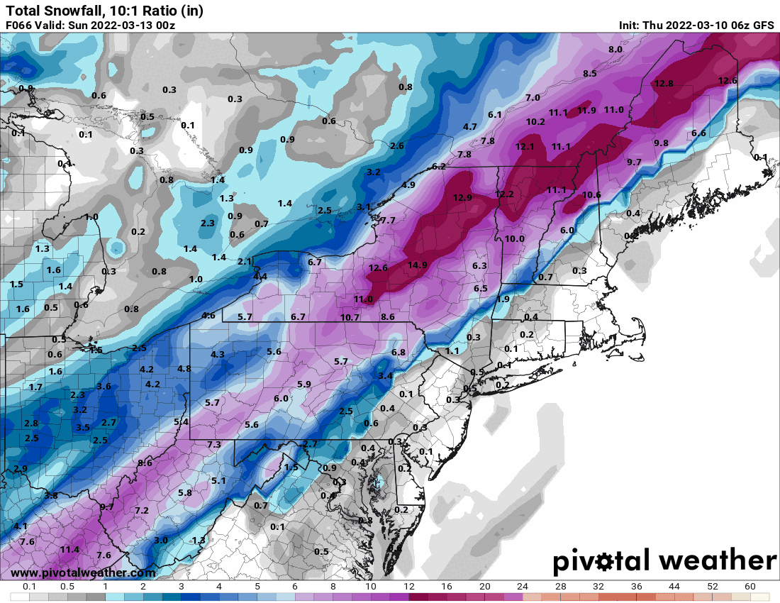
18z GFS has a coastal scraper for the weekend, throwing most of snow to the N/W.
-
So far received 0.54" of rain with temp 36 and dp 35. Still have some light rain.
-
Currently getting rain (no mix) with temp 37 and dp 36. Am up to 0.34" in the bucket. ETA - look like some colder air up north may be pushing south.
-
Switched over to light rain with some stray flakes mixed in. Ended up with 0.2" of a light coating before the rain melted it. Also have 0.20" in the in the bucket. Temp is 36 with dp 35.
-
Switched over to a rain/snow mix. Currently have 0.14" in the bucket and a dusting of wet snow on cold surfaces.
-
Coming down here as SN and am starting to get some stickage on the the colder surfaces, like my car's windshield and sticking on the grass although obviously the streets and walks are wet. Temp still 35 but dp down to 33.
-
LOL and the pancake breakfast has commenced! Temp down to 35 with dp 34. Not a mix (last I looked) but wet flakes.
-
The precipitation is not dropping down from the north, the cold air is. The precip is coming up from the southwest and we will have to see if it gets sheared away as it pushes up into some colder air in your area or what.
-
Temp here is now down to 37 with dp 35 and light rain. Have picked up 0.03" so far.
-
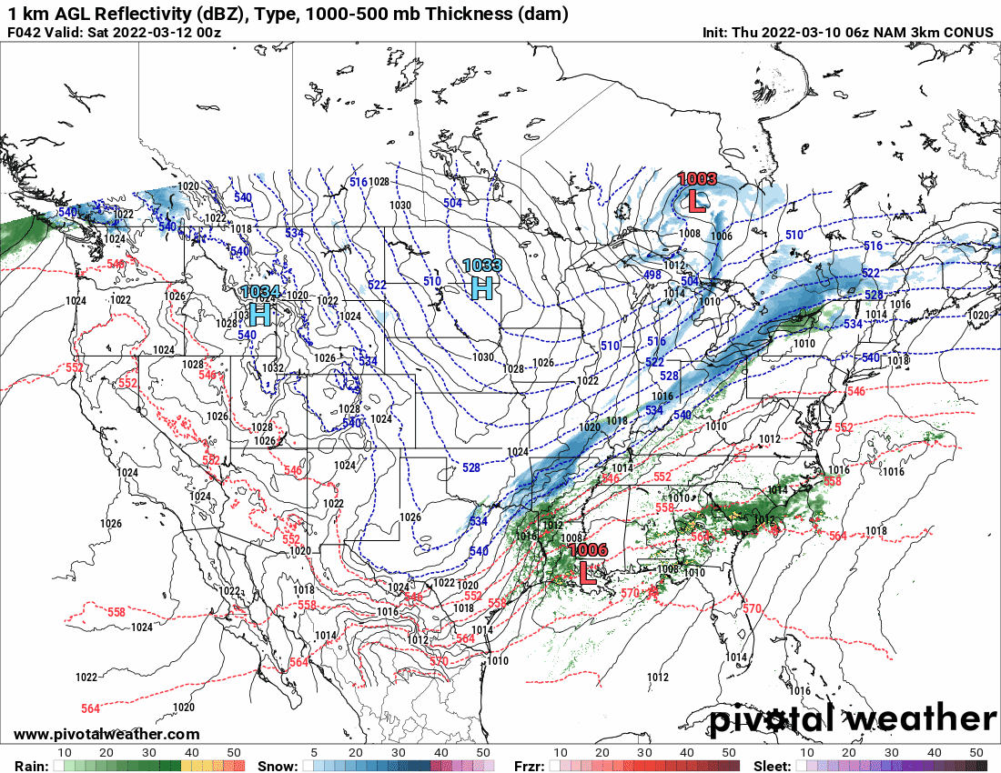
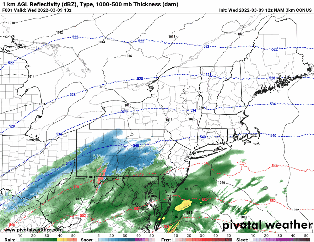
12z 3k NAM running.

-
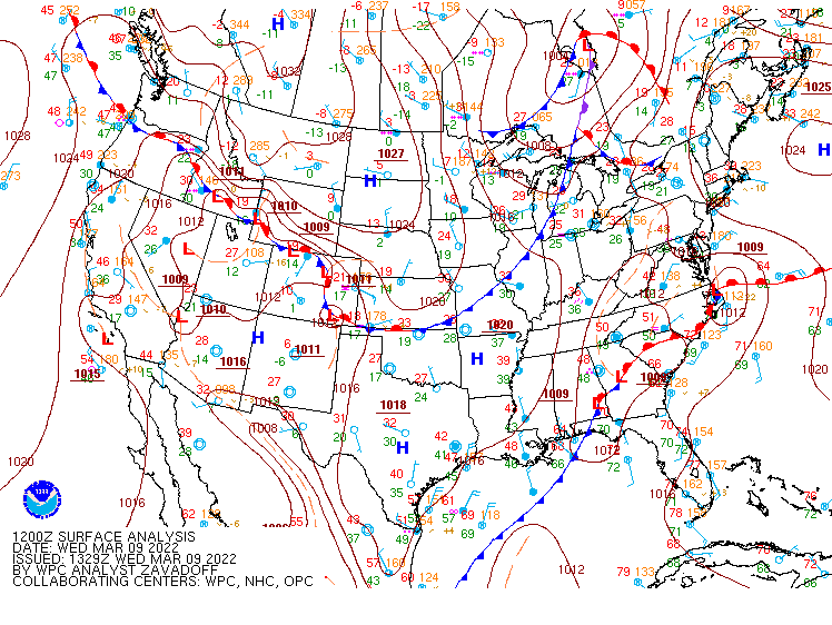
Remember this is just the start of the storm. It is pushing up from the southwest. It is supposed to go through the morning and into the afternoon. There's a low now sitting along the coast of NC.
-
Getting light rain here now (not enough for measurable yet) and temp has ticked down to 39 with dp 36.
-
This is what NWS has from the NBM and Mt. Holly's tweet about the upcoming event -