Hurricane Agnes
-
Posts
9,344 -
Joined
Content Type
Profiles
Blogs
Forums
American Weather
Media Demo
Store
Gallery
Everything posted by Hurricane Agnes
-
Yes - the MA folks (that you referenced earlier) have switched it up and are now talking about the back-building. For the snow lovers, anything like this in mid-March after a winter of despair, should be considered a bonus!
-
Went out and measured what was on the board and have 1" snow/sleet (compacted). Currently 29 with dp 28 and SN-.
-
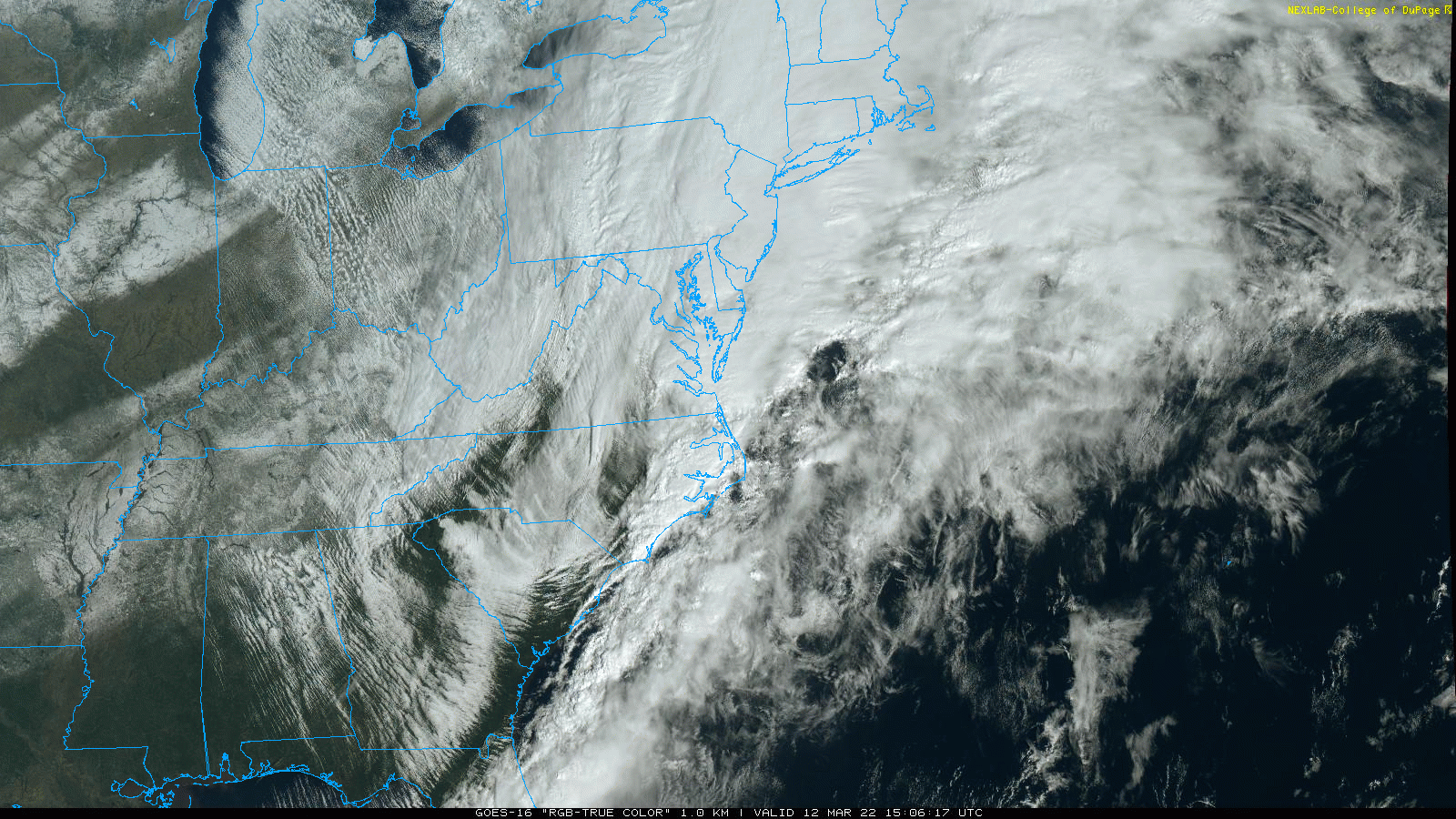
The models had been hinting at some low forming off the Carolina coast and if that happens and is close enough, there could be some wrap-around. What is cool is the massive lake-effect snow blowing off of Lake Michigan and I know over that way, it was in the -10s to -20s below 0 earlier this morning.
-
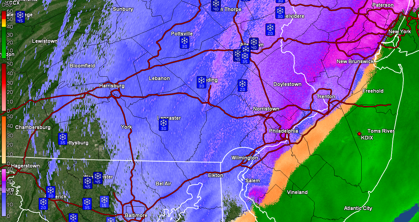
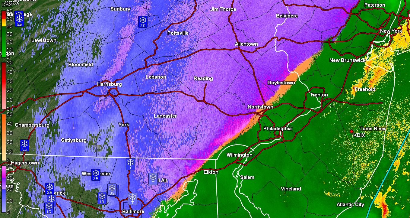
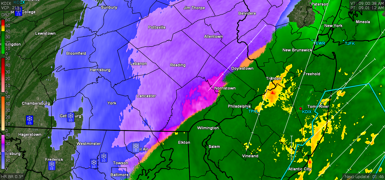
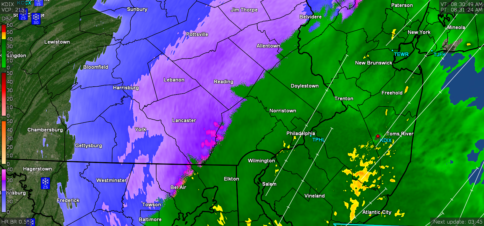
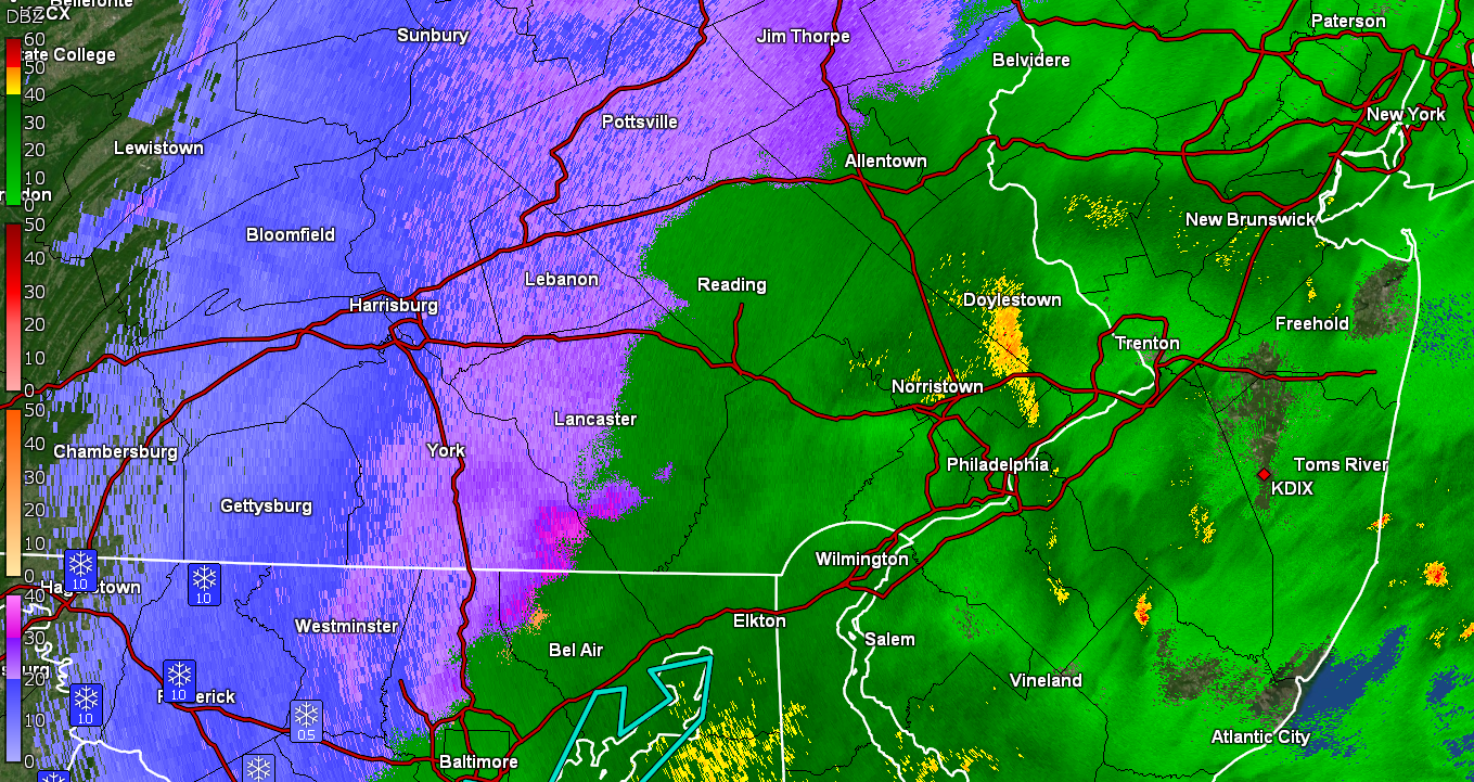
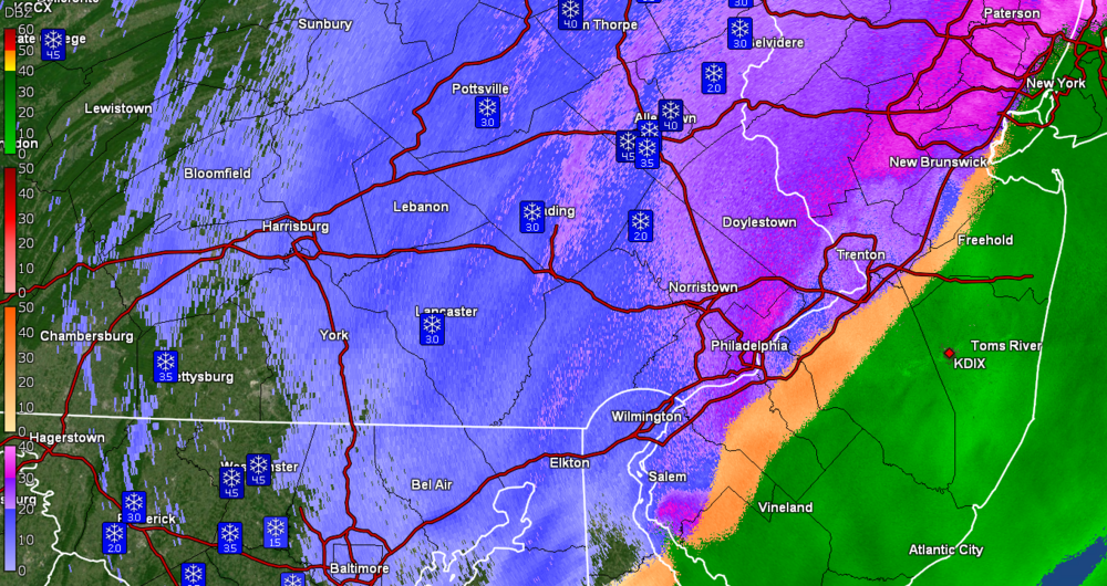
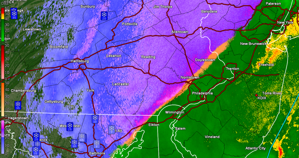
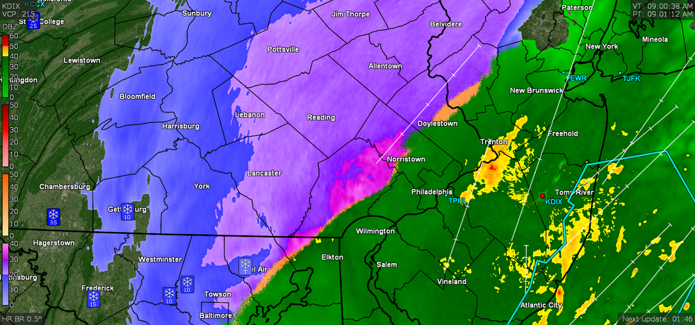
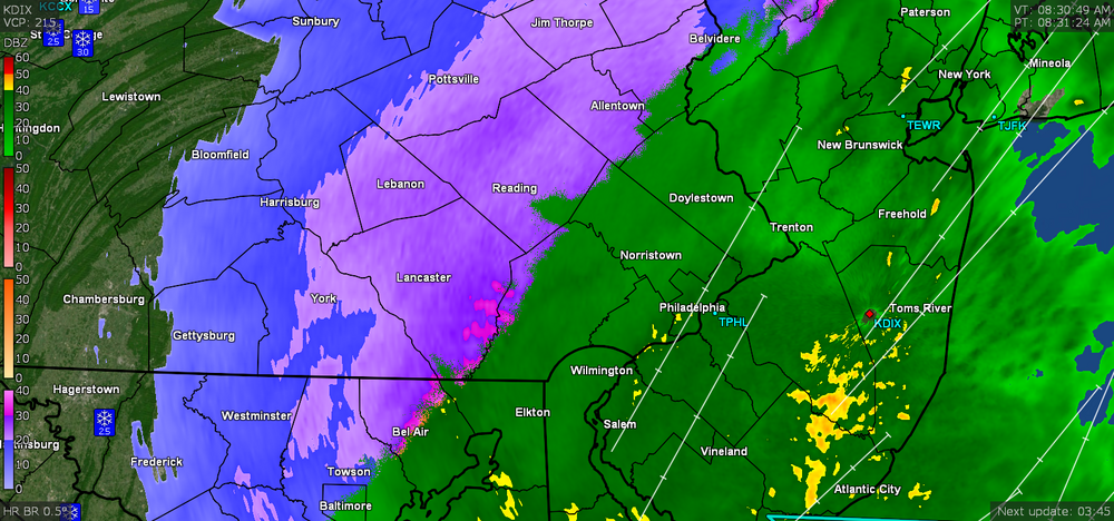
Here is State College's radar -
-
I was wondering where you were. Temp down to 29 with dp 28 and getting SN- fine flakes and blowing snow.
-
Temp now below freezing at 31 and getting sideways/blowing SN -SN+. Walks are starting to cave. dp is 30. Edit - now down to 30 with dp 30.
-
Snow in mid-March. Am now down to 32 with dp 32 and have some fine flaked snow and a little fog. Asphalt streets are starting to cave but sidewalk is still battling it.
-
I know you are like (yes I am messing with you this morning )
-
You just wait! I had the same - rain to sleet and then to a mix of sleet/rain, then to sleet/snow/rain, then to snow/rain, and now to all snow (and I am SW of you but not by too much).
-
All snow now. SN rate out of the NW and temp at 33 with dp 32. Grass and colder surfaces have caved.
-
Still getting a rain/snow mix with some pingers mixing in every once in awhile. Rate is pretty steady, temp is down to 33 with dp 33.
-
Foolishly popped out to do a quick measure of the sleet on the snowboard and had 0.1" and the pingers have stopped but am getting fine snow flakes that appear to be mixed with rain. Since there was that sleet and temps are still above freezing, there's lots of dripping at the moment. Temp is at 34 with dp 33. Have 0.48" liquid in the bucket so far.
-
Now getting a gourmet buffet of p-types - rain/sleet/fatties. Temp down to 34 with dp 33. Grass struggling to fight it but is starting to cave.
-
Talk about "nowcast". Here is SPC's tweet about this -
-
Sleet starting to lay a foundation down for what's to come. Starting to accumulate on the grass. Temp still at 35 but slowly continues to creep down with dp 34.
-
Getting E & NE gusty winds. Sleet is getting what may be graupel mixed in as larger pellets. Temp down to 35 with dp 35.
-
Now almost all sleet and it's starting to settle on colder surfaces. Temp down to 36 with dp 35.
-
Confirmed pingers here mixed with the rain. Temp now down to 37 with dp 36.
-
Temp continues to drop and down to 38 with dp 37 and moderate rain.
-
Just checked and I'm still all rain and 39 but will keep checking.
-
Hope you and The Iceman cash in - even if a little - 'cause I know you both were
-
Wanted to find you 'cause you are now IN "the yellow"!
-
Currently getting heavier rain and just over 1/2" per hour with 0.24" rain so far for the event. Temp is 45 with dp 45.

-
Mt. Holly mentioned some convection down in Delaware (need some of our Delaware folks to weigh in) - Also they had this interesting climatological tidbit - Will see if any of this verifies and we end up with some RERs.
-
Since there were hints at several lows (at least one coming from the GOM/mid-south and another to spin off the Carolina coast) that will probably factor in how this thing performs.