Hurricane Agnes
-
Posts
9,344 -
Joined
Content Type
Profiles
Blogs
Forums
American Weather
Media Demo
Store
Gallery
Everything posted by Hurricane Agnes
-
E PA/NJ/DE Spring 2022 OBS Thread
Hurricane Agnes replied to Hurricane Agnes's topic in Philadelphia Region
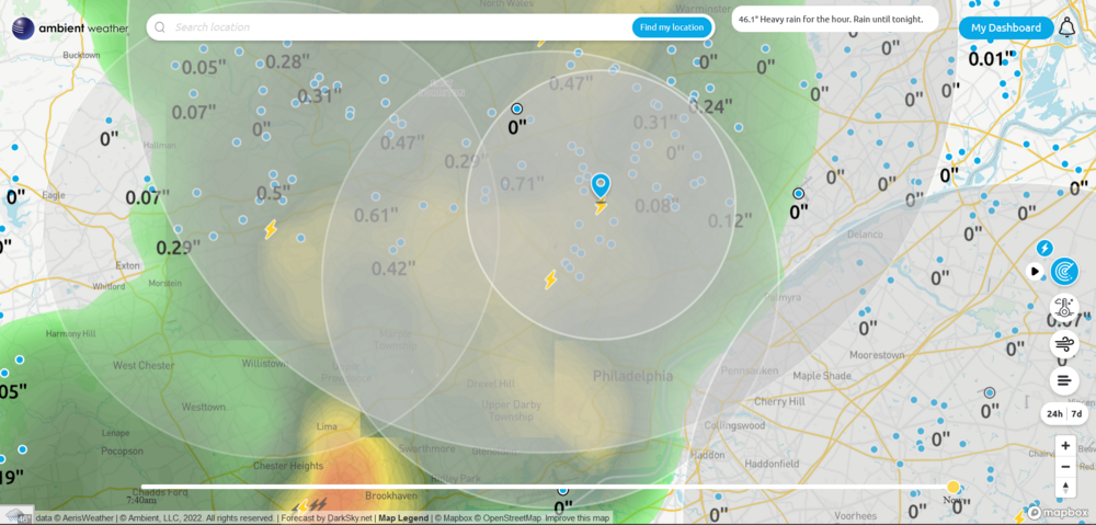
Have been getting a gully washer storm upwards of an inch/hour rates. Currently have 0.61" in the bucket so far. NWS bot syndicator retweeted from Mt. Holly with the Flood Advisory -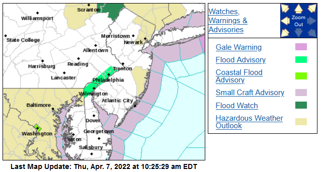
-
E PA/NJ/DE Spring 2022 OBS Thread
Hurricane Agnes replied to Hurricane Agnes's topic in Philadelphia Region
Just had some convection (lightning and thunder). It has been lightly raining for a bit but am now getting heavier rain. Currently 45 with dp 45.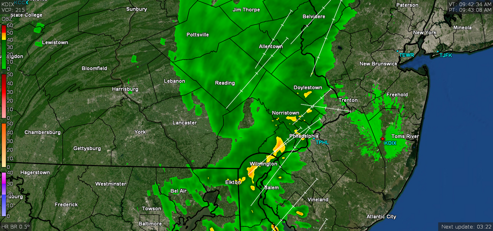
-
E PA/NJ/DE Spring 2022 OBS Thread
Hurricane Agnes replied to Hurricane Agnes's topic in Philadelphia Region
I know Mt. Holly AFD's have been mentioning this the past couple days but SPC has some "Marginal Risk" in the southern part of the CWA, now in SWDY1 - Meanwhile it's currently 45 and overcast/misty here with dp 45. -
Will be great to hear more from you then whenever you get chance!!!
-
E PA/NJ/DE Spring 2022 OBS Thread
Hurricane Agnes replied to Hurricane Agnes's topic in Philadelphia Region
Ended up with 1.23" with this round making for a 1.38" 2-day event total. Currently overcast, misty, and 52 with dp 50. -
E PA/NJ/DE Spring 2022 OBS Thread
Hurricane Agnes replied to Hurricane Agnes's topic in Philadelphia Region
Just hit the 1.00" mark here for today so far (with 0.15" for yesterday so 1.15" for the 2 days so far). It's a chilly 47 with dp 47. -
E PA/NJ/DE Spring 2022 OBS Thread
Hurricane Agnes replied to Hurricane Agnes's topic in Philadelphia Region
It's actually been mostly sunny here all day until now when it is starting to cloud up from the west, with some benign cumulus to the east. Ended up with a low of 37 this morning and it's currently mostly cloudy with breaks of sun and 52 with a dp of 34. -
E PA/NJ/DE Spring 2022 OBS Thread
Hurricane Agnes replied to Hurricane Agnes's topic in Philadelphia Region
I know NBC10 reports (via KYW) were mentioning the increased hail reports over in Jersey as soon as the line moved over the river. My Wyndmoor Montco sis reported hail but my Upper Darby Delco one said she didn't have any on her street - just rain (she's about 7 miles S/W of me). We're not even really in the depth of severe season here yet either although there was that EF1 tornado in Bucks County - the new Kansas. :googly: -
E PA/NJ/DE Spring 2022 OBS Thread
Hurricane Agnes replied to Hurricane Agnes's topic in Philadelphia Region
Getting a rain shower here at the moment but so far no hail. I know I had some pea-sized hail here last year for the first time in years but it seems to have become less common here in the city. -
E PA/NJ/DE Spring 2022 OBS Thread
Hurricane Agnes replied to Hurricane Agnes's topic in Philadelphia Region
My sis just texted that she is getting hail in Wyndmoor. She's about 2 miles N/W of me. It got real dark and am getting some big rain droplets. Not seeing any ip yet...
-
E PA/NJ/DE Spring 2022 OBS Thread
Hurricane Agnes replied to Hurricane Agnes's topic in Philadelphia Region
They are supposedly native to Europe and obviously hitched a ride here who knows how long ago, and are now just about everywhere in the continental U.S. http://molluscs.at/gastropoda/terrestrial.html?/gastropoda/terrestrial/limacidae.html http://molluscs.at/gastropoda/terrestrial.html?/gastropoda/terrestrial/limax.html -
E PA/NJ/DE Spring 2022 OBS Thread
Hurricane Agnes replied to Hurricane Agnes's topic in Philadelphia Region
Or April glugs bring May slugs... and of the huge variety! I have had a few in the 4" - 5" range. -
E PA/NJ/DE Spring 2022 OBS Thread
Hurricane Agnes replied to Hurricane Agnes's topic in Philadelphia Region
So far have 0.11" in the bucket from the earlier showers but looks like another batch may be incoming. It's been overcast all morning and into the early afternoon but the sun is attempting to break out (and has made an appearance a few times within the past 15 minutes) as the temp has started to creep up a bit. Had a low of 41 this morning and a brief high of 52 before dropping back to the current 51 with dp 42.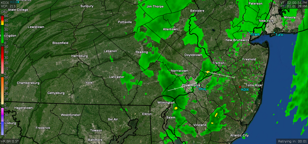
-
E PA/NJ/DE Spring 2022 OBS Thread
Hurricane Agnes replied to Hurricane Agnes's topic in Philadelphia Region
Ended up hitting a high of 51 earlier today after a 37 low and it's currently mostly sunny and 49 with dp 28. -
-
-
Still clearing and the sun has popped in and out of the cloud deck. Currently variable skies and 50 with dp 44.
-
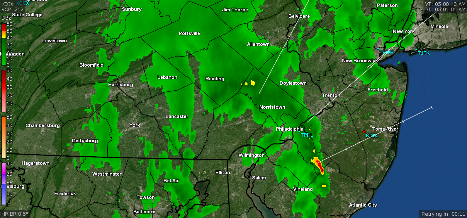
Heard some wind gusts come through about 6:15 am and I believe the cold front is coming through now as the temp has dropped to 50 and the dp is down to 45. Still have some scattered stuff coming through. Currently have 0.26" in the bucket for the day (0.66" total for the 2 day event).
-
Getting another batch of light rain at the moment that has added 0.03" from the earlier batch for a total of 0.25" for the day and 0.65" for the 2-day event. Temp currently 52 with dp 49.

-
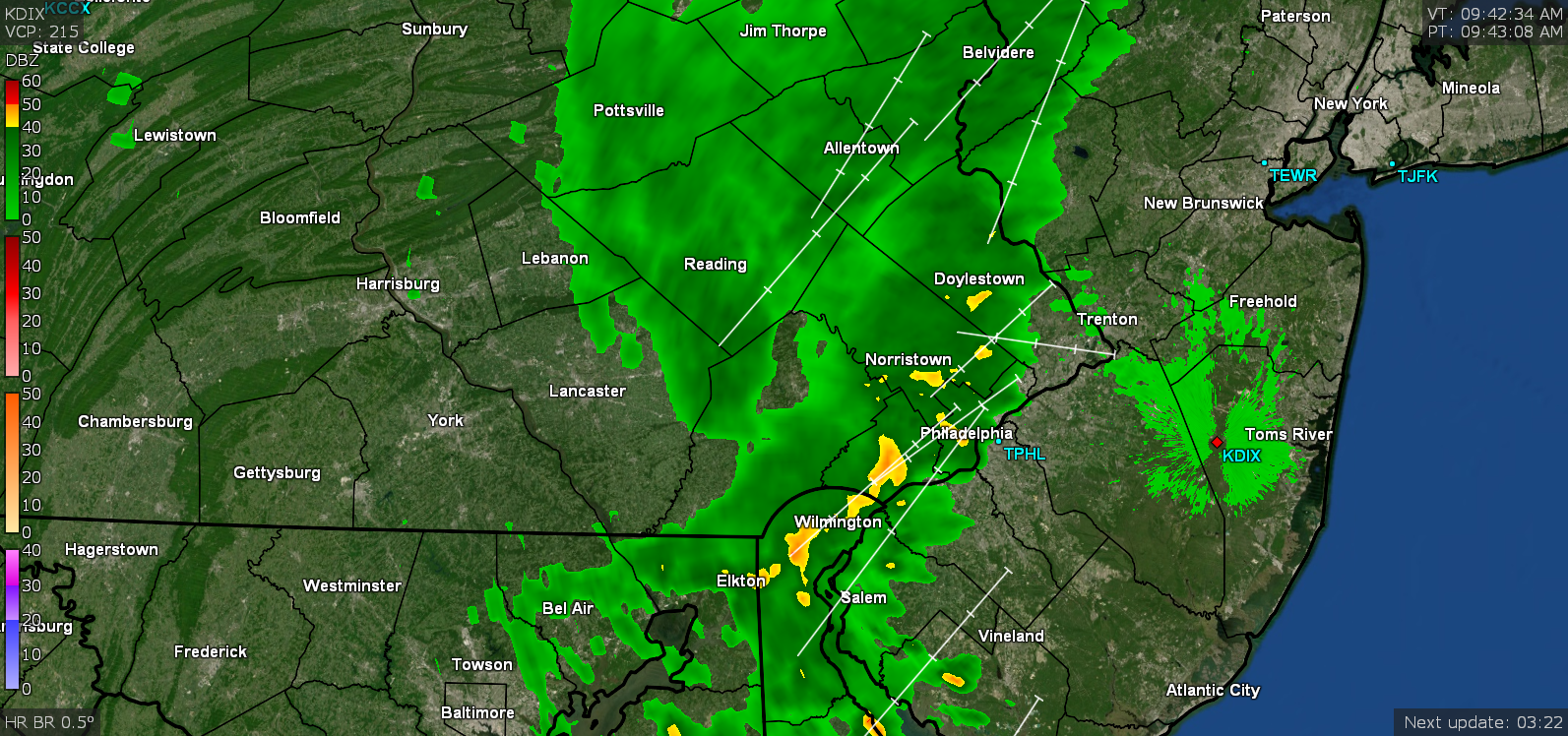
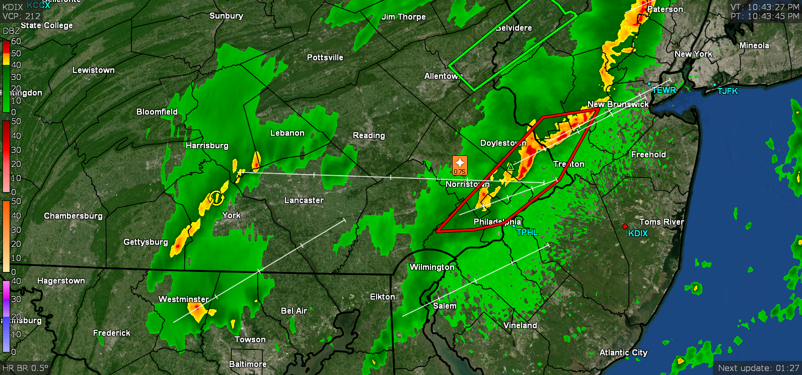
Looks like the line that became round 3 finally came through around 2 am and deposited another 0.22" of rain so 2-day (3-round) even total is 0.62". That final line triggered the temp drop and there appears to still be some more leftovers on radar so will see if that adds to today's totals. Attached the 2:30 am snapshot. Currently 53 with dp 50 and misty.

-
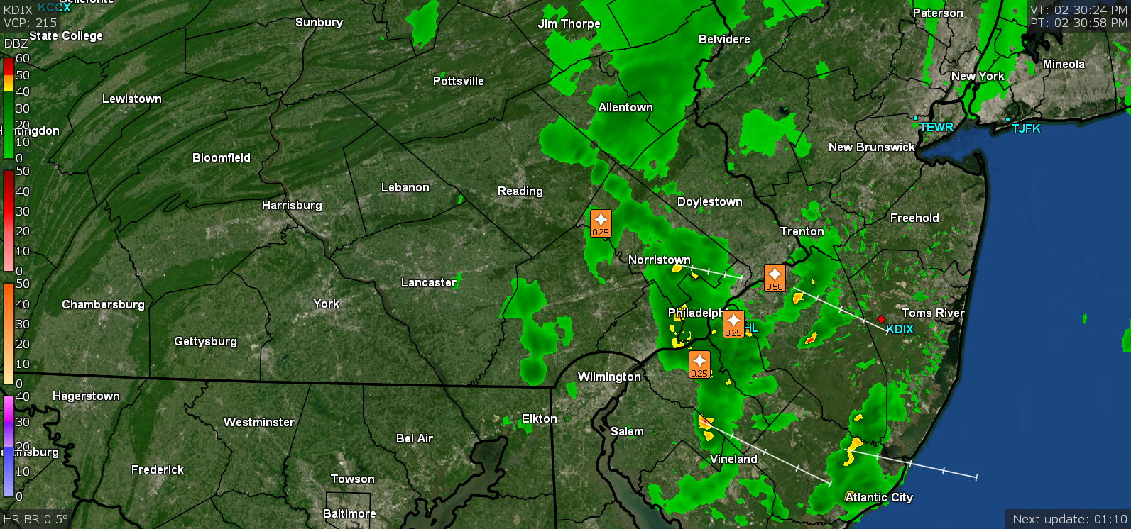
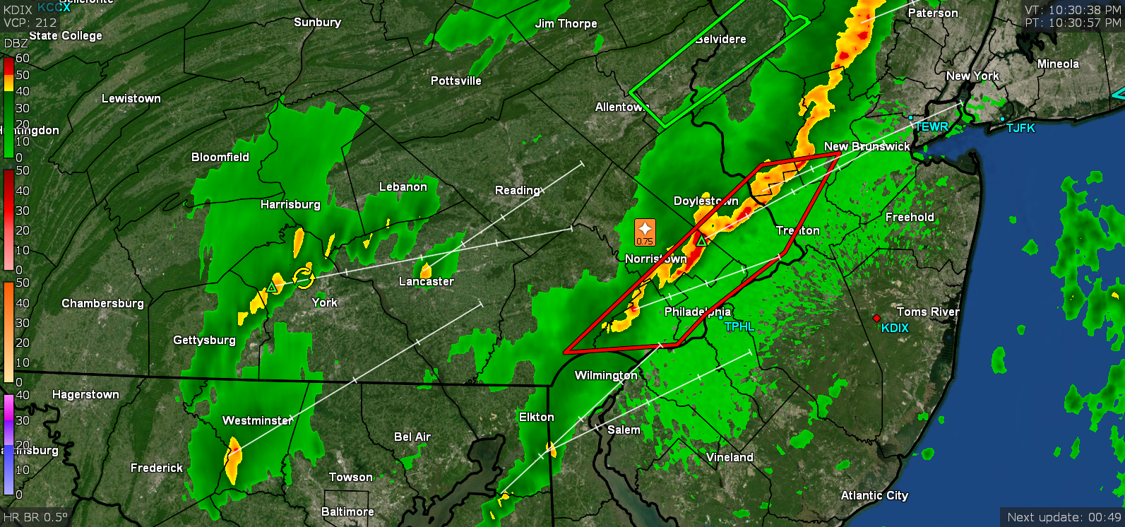
Looks like round 2 sortof passed through here now. Currently have 0.40" in the bucket (0.22" round and 0.18" so far from round 2). There looks to be one more blob out west by Reading although I don't know how much of that will survive by the time it gets here. Temp is 62 with dp 62 and misty.
-
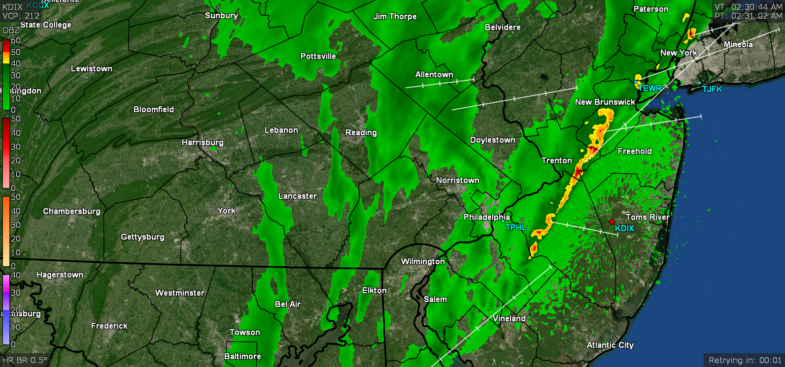
Getting about 1"/hr rates at the moment. Temp 62 with dp 61. Have 0.38" in the bucket (total for the day with 0.16 from this latest round).
-
Now I got a little piece of it over me with visible lightning and some thunder. ETA - now getting the heavier rain too. Temp is 63 dp 61.

-
LOL It's breaking apart as it goes over the hills and I'm sortof getting fringed.

-