Hurricane Agnes
-
Posts
9,344 -
Joined
Content Type
Profiles
Blogs
Forums
American Weather
Media Demo
Store
Gallery
Everything posted by Hurricane Agnes
-
E PA/NJ/DE Spring 2022 OBS Thread
Hurricane Agnes replied to Hurricane Agnes's topic in Philadelphia Region
Mt. Holly has a STS up - -
E PA/NJ/DE Spring 2022 OBS Thread
Hurricane Agnes replied to Hurricane Agnes's topic in Philadelphia Region
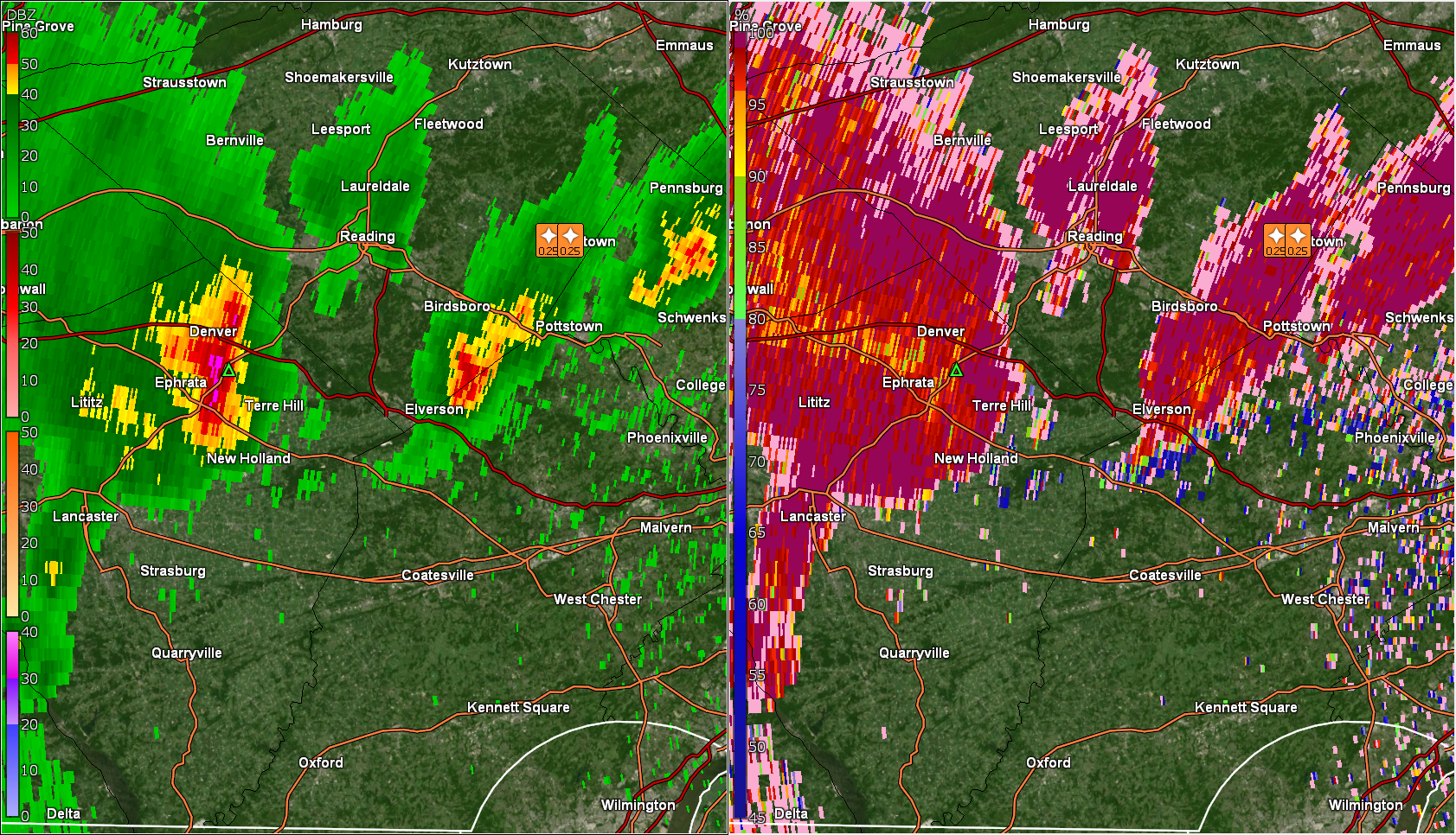
That is the CC (correlation coefficient). -
E PA/NJ/DE Spring 2022 OBS Thread
Hurricane Agnes replied to Hurricane Agnes's topic in Philadelphia Region

-
E PA/NJ/DE Spring 2022 OBS Thread
Hurricane Agnes replied to Hurricane Agnes's topic in Philadelphia Region
This was Mt. Holly's updated Watch - And an updated view of S/W Watches to include Sterling sites and Mt. Holly extensions - -
E PA/NJ/DE Spring 2022 OBS Thread
Hurricane Agnes replied to Hurricane Agnes's topic in Philadelphia Region
The front is sortof creeping along but it is cooler behind it. One of my sisters just texted and asked "What happened to all the rain and thunderstorms and tornadoes?????" She had pushed herself doing some outdoor weeding and other stuff in prep for the rain. Temps were in the 50s back behind the front (from a couple hours ago). -
E PA/NJ/DE Spring 2022 OBS Thread
Hurricane Agnes replied to Hurricane Agnes's topic in Philadelphia Region
This is the longest the sun has been out here today so far, and it shot the temp up to 78, with dp still juicy at 68. Looks to be more clouds to the N/E and just a few to the S/W. -
E PA/NJ/DE Spring 2022 OBS Thread
Hurricane Agnes replied to Hurricane Agnes's topic in Philadelphia Region
Getting the infamous "self-destruct sunshine" that destabilizes things, generates the clouds, produces the little pop up showers, drops the temp some and stabilizes the air. Wash. Rinse. Repeat. So far I've gotten up to 77 for a high, but with sun gone again, and 0.01" of rain (so far), temp dropped down to 72. Have crept up to 73 at post time. The dp of 69 is rough though! -
E PA/NJ/DE Spring 2022 OBS Thread
Hurricane Agnes replied to Hurricane Agnes's topic in Philadelphia Region
Norman, OK up with the Severe Thunderstorm Watch - -
E PA/NJ/DE Spring 2022 OBS Thread
Hurricane Agnes replied to Hurricane Agnes's topic in Philadelphia Region
There's a bunch of pop-ups and my lightning detector picked up a couple hits just before noon. The sun has not made an appearance until briefly just after noon here today and that had kept the temps in the upper 60s until the sun popped out and shot the temp up to where it is now at 76, with dp 70 (and you can feel it ). Have had some non-measurable drizzle about an hour ago enough to wet the walk and add the soup to the air.
-
E PA/NJ/DE Spring 2022 OBS Thread
Hurricane Agnes replied to Hurricane Agnes's topic in Philadelphia Region
I heard a robin still going at it at 8:22 pm last night well after the sun had set. One just started up here right now at post time (4:52 am). Made it up to 78 yesterday and of course there was a layer of clouds blurring the moon here. Have spotted it this morning as it's low in the SW sky starting to set but with some scattered clouds in that direction (and still have the high cloud deck still in the NE). Currently partly cloudy and 63 with dp 63. SPC SWDY1 holding with the Enhanced Risk for the entire CWA (except coastal NJ, which is under a Slight Risk). -
E PA/NJ/DE Spring 2022 OBS Thread
Hurricane Agnes replied to Hurricane Agnes's topic in Philadelphia Region
Was about to post that. We don't see this that often but I suppose it's the time of year! Currently 64 with dp 64 and misty but don't have as much low stratus as this time yesterday (and am not seeing any fog) here. Ended up with 0.29" of rain yesterday. -
E PA/NJ/DE Spring 2022 OBS Thread
Hurricane Agnes replied to Hurricane Agnes's topic in Philadelphia Region
SPC has the N & W parts of the CWA SWDY2 penciled in for "marginal risk" - Managed to make it up to 70 as a high today (so far) just after noon and it's currently raining lightly (0.24" in the bucket), 67, with dp 67. -
E PA/NJ/DE Spring 2022 OBS Thread
Hurricane Agnes replied to Hurricane Agnes's topic in Philadelphia Region
Wow. I did the same with my last car (that is my current and that I still have). I was chuckling that day when I was "saying goodbye" and trading-in my previous car in the rain, and then when they rolled up with my new one, and I was on the way home in it, the sun started to come out. Well today there is no sun and I just got a 0.01" shower, with more on the way, so.... Currently at 69 with dp now 67. A shame we will probably not be able to see this weekend's "Blood Moon" lunar eclipse. -
E PA/NJ/DE Spring 2022 OBS Thread
Hurricane Agnes replied to Hurricane Agnes's topic in Philadelphia Region
The trends seem to want to shove the TX heat this way. I know we are due for a pattern change but it would be odd for it to happen around Memorial Day given it's often chilly and sometimes even rainy that day, but this persistent La Nina has thrown all kinds of wild stuff at us this year. -
E PA/NJ/DE Spring 2022 OBS Thread
Hurricane Agnes replied to Hurricane Agnes's topic in Philadelphia Region
Saw that. Ended up hitting 75 as a high yesterday and managed 0.17" in the bucket. The low this morning was 64. When the fog/low stratus lifted, it left behind the soupy air. Currently an overcast 68 with a dp of 66... and you can feel it. -
E PA/NJ/DE Spring 2022 OBS Thread
Hurricane Agnes replied to Hurricane Agnes's topic in Philadelphia Region
Made it up to 76 yesterday after a low of 55, with some unsettled skies but overall nice despite the bump in humidity. Currently 61 with a light shower (have 0.04" in the bucket this morning from some scattered pop ups), after a low of 59 and a dp of 60. -
E PA/NJ/DE Spring 2022 OBS Thread
Hurricane Agnes replied to Hurricane Agnes's topic in Philadelphia Region
Ended up hitting 73 yesterday with low humidity after a low of 50. So far have had a low of 50 again this morning and it's currently sunny and 51 with dp 28. I do recall some Mays like this in the past and if anything, all the antecedent rain that we have had will probably put a nail in the coffin for the possibility of any triple digit temps this summer (not that we won't get hot but the "dry begets dry begets greater heat when dry" thing is a general foregone conclusion here and we seemed to have more than made up up the precip deficit from winter/early spring. -
E PA/NJ/DE Spring 2022 OBS Thread
Hurricane Agnes replied to Hurricane Agnes's topic in Philadelphia Region
And the 58 ended up being the high here. Currently 56 and partly sunny as we close in on sunset, with dp 33. What is interesting is that the coastal's rain bands from the cutoff low seem to be backing in to the coast again and parts of coastal central Jersey are getting impacted. -
E PA/NJ/DE Spring 2022 OBS Thread
Hurricane Agnes replied to Hurricane Agnes's topic in Philadelphia Region
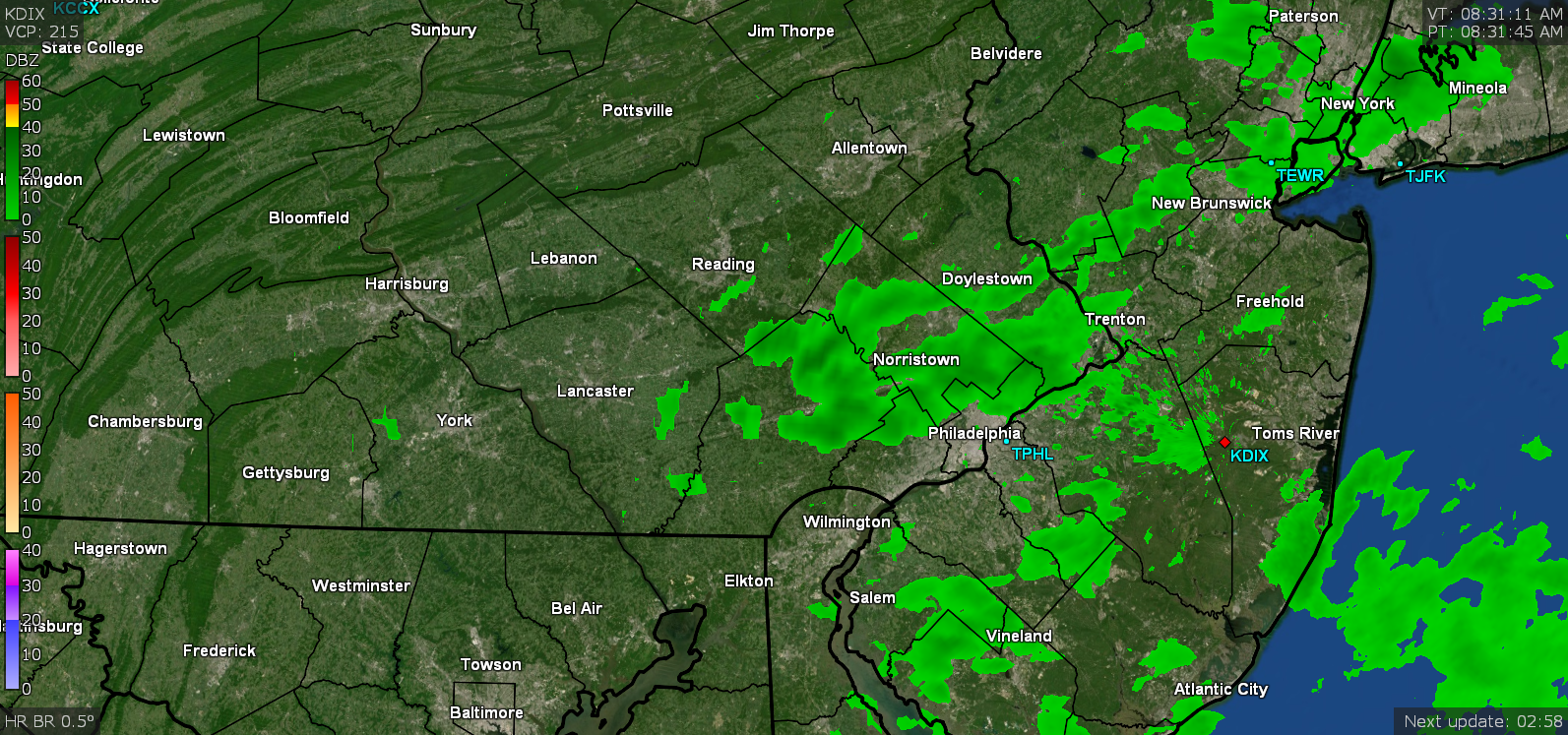
Well it took all day but the sun is belatedly trying to make an appearance through the cloud deck. You can see on radar how the low has sortof crawled and stalled and has thrown a couple narrow bands of some areas. Currently mostly cloudy with some breaks of sun and 58, with dp 36. -
E PA/NJ/DE Spring 2022 OBS Thread
Hurricane Agnes replied to Hurricane Agnes's topic in Philadelphia Region
Dribbed and drabbed my way to 0.20" for the day so far with some scattered returns on the radar occasionally drifting overhead. Currently at 3.08" for the 3-day event and still have overcast with a temp of 54 and dp of 35, with the moderate breezes continuing. -
E PA/NJ/DE Spring 2022 OBS Thread
Hurricane Agnes replied to Hurricane Agnes's topic in Philadelphia Region
I think you are in a sliver of a dry slot. Still overcast and 44 here with occasional dribbles. Now have 0.19" for the day and 3.07" total.
-
E PA/NJ/DE Spring 2022 OBS Thread
Hurricane Agnes replied to Hurricane Agnes's topic in Philadelphia Region
Saturday's total was 2.00" on the dot by midnight, making for a 2.88" 2-day total. Have had 0.16" this morning that tapered off after 4 am, for a 3.04" total for the 3-day event so far. There was low stratus earlier this morning and I appear to have bottomed out at 40 for a low this morning. It's currently overcast, misty and 42 with dp 37 and still a bit breezy but much reduced from the past 2 days. -
E PA/NJ/DE Spring 2022 OBS Thread
Hurricane Agnes replied to Hurricane Agnes's topic in Philadelphia Region
Have been trying to find what the record low max is for this date at PHL 'cause it seems we might be close. Also thinking it's possible to have record rainfall for this date at PHL too. There is a PNS and LSR for the winds but nothing for precip. Currently 45 and misty with occasional light rain and dp 44. Now have 1.61" for the day (2.49" for the 2-day event) and the winds seem to have let up some. -
E PA/NJ/DE Spring 2022 OBS Thread
Hurricane Agnes replied to Hurricane Agnes's topic in Philadelphia Region
Have managed to get under a heavier band and am now up to 1.26" for this morning (for a 2.14" 2-day total so far). Temp is back down to 48 with dp 47 and light to moderate rain. -
E PA/NJ/DE Spring 2022 OBS Thread
Hurricane Agnes replied to Hurricane Agnes's topic in Philadelphia Region
And the (obscured) sunrise has now brought the gusty winds out of the east (could hear them).