Hurricane Agnes
-
Posts
9,344 -
Joined
Content Type
Profiles
Blogs
Forums
American Weather
Media Demo
Store
Gallery
Everything posted by Hurricane Agnes
-
E PA/NJ/DE Spring 2022 OBS Thread
Hurricane Agnes replied to Hurricane Agnes's topic in Philadelphia Region
So far ended up with 1.69" yesterday and am at 0.44" this morning for a total of 2.13" for the 2-day event. That makes it a 7.20" rain total for the month of April so far. There looks like there may be one more little wrap-around band left to come through although it might or might produce anything by the time it gets here. Currently misty and 38 with dp 37.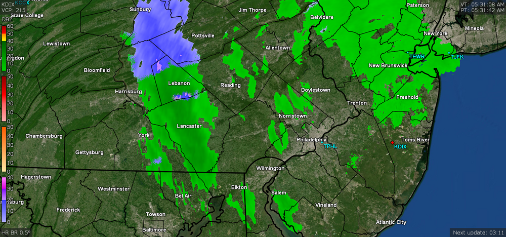
-
E PA/NJ/DE Spring 2022 OBS Thread
Hurricane Agnes replied to Hurricane Agnes's topic in Philadelphia Region
Now have 1.15" in the bucket with ~ 1/4" per hour rates. Currently 42 with dp 41, light - moderate rain, and a stiff breeze. -
E PA/NJ/DE Spring 2022 OBS Thread
Hurricane Agnes replied to Hurricane Agnes's topic in Philadelphia Region
Got scraped by a small heavier band but am currently 42, up to 0.92" of rain so far today, with near 1/2" per hour rates, dp at 41, and increasing winds. -
E PA/NJ/DE Spring 2022 OBS Thread
Hurricane Agnes replied to Hurricane Agnes's topic in Philadelphia Region
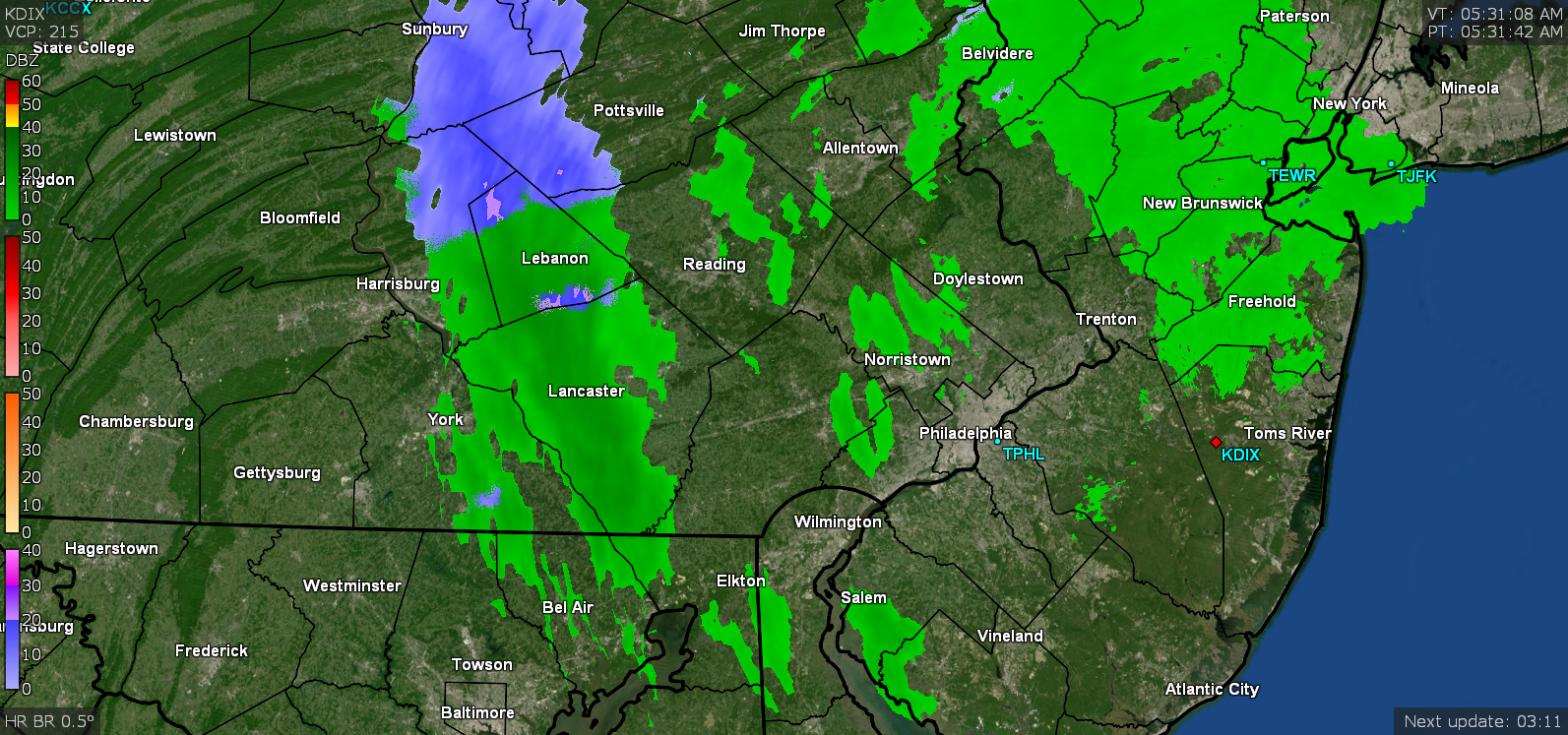
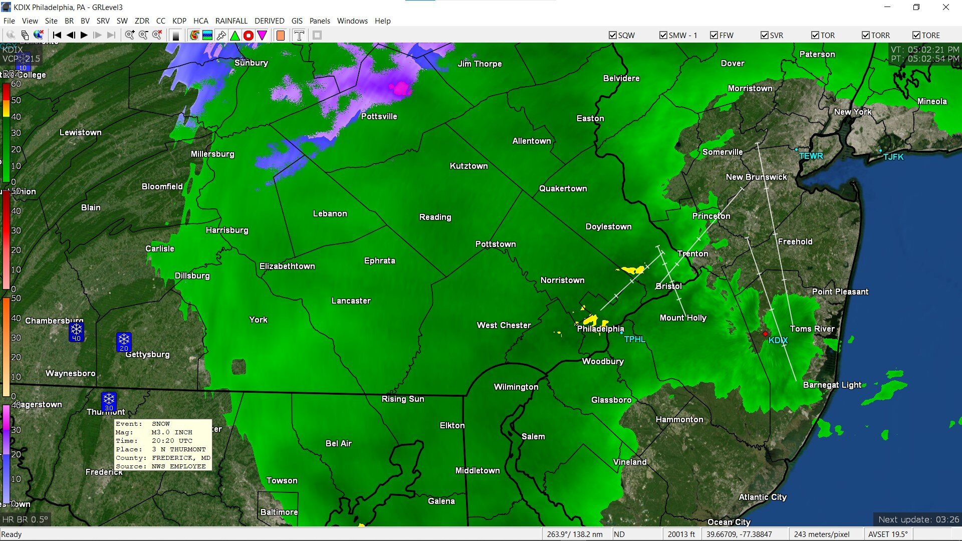
Under a little more more than drizzly rain now and am up to 0.06". I noticed the mPing reports had places like Thurmont (just north of Frederick, MD( reporting 3" of snow! Currently 43 with dp38 and light rain.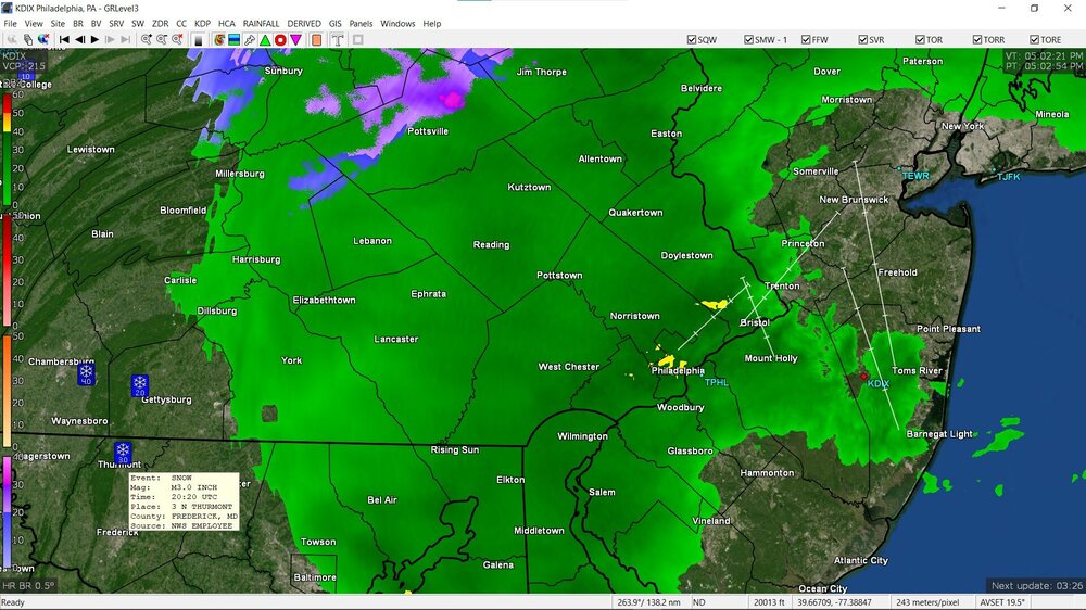
-
E PA/NJ/DE Spring 2022 OBS Thread
Hurricane Agnes replied to Hurricane Agnes's topic in Philadelphia Region
There are a couple upthread (in Chester County & Delaware County PA around the 1pm - 2 pm timeframe). -
E PA/NJ/DE Spring 2022 OBS Thread
Hurricane Agnes replied to Hurricane Agnes's topic in Philadelphia Region
Flood Watched issued - Had a little rain so far (0.01"). Temp is 46 with dp 35 and overcast. -
E PA/NJ/DE Spring 2022 OBS Thread
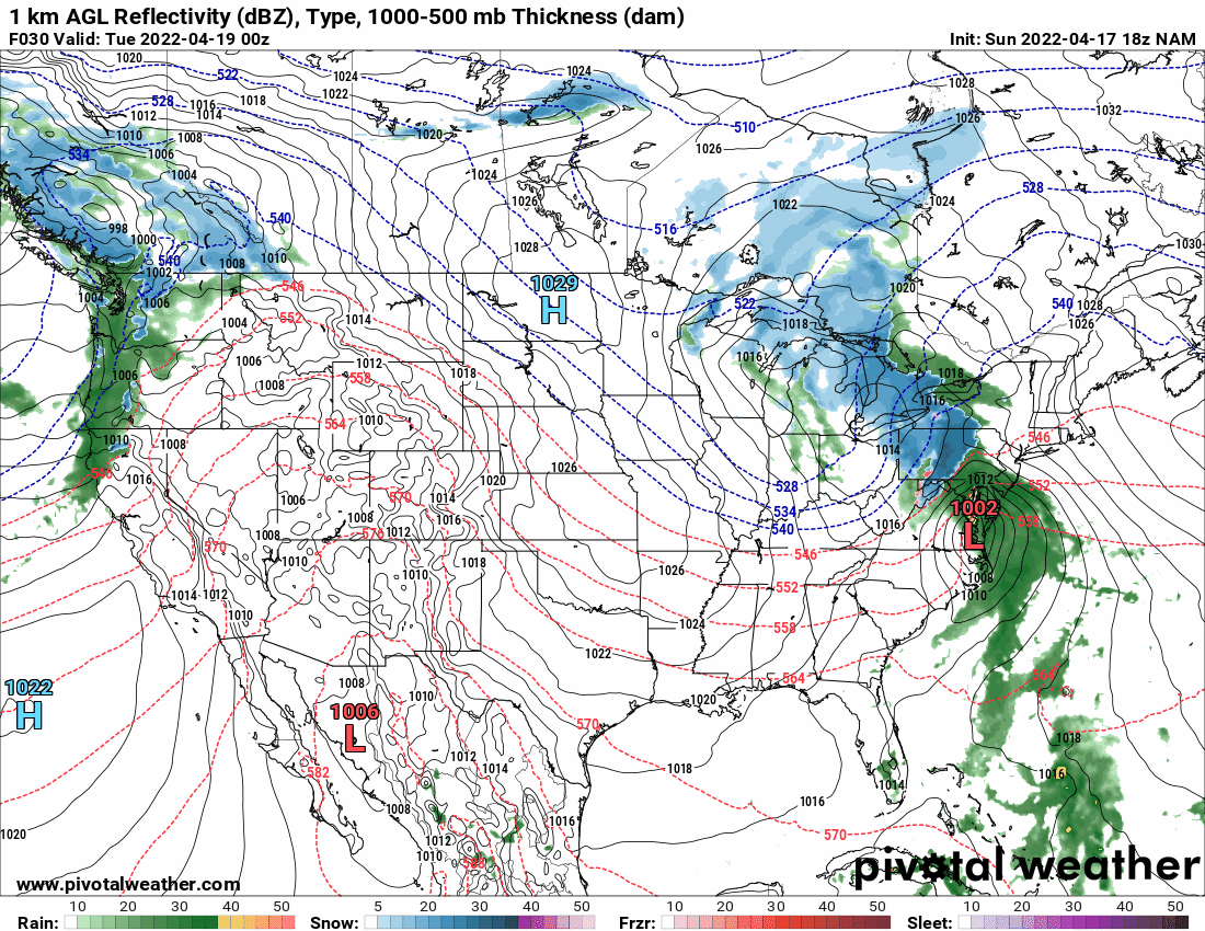
Hurricane Agnes replied to Hurricane Agnes's topic in Philadelphia Region
The precip shield on the SW border of the city.
-
E PA/NJ/DE Spring 2022 OBS Thread
Hurricane Agnes replied to Hurricane Agnes's topic in Philadelphia Region
I bottomed out at 35 here around 1:30 am when the winds briefly went calm. I didn't see any "visible" frost here earlier this morning as a light breeze started up again by ~2 - 2:30 am to mix things up a bit. Currently overcast, 49 with dp 30, and am seeing stuff slowly moving this way from the SW. -
E PA/NJ/DE Spring 2022 OBS Thread
Hurricane Agnes replied to Hurricane Agnes's topic in Philadelphia Region
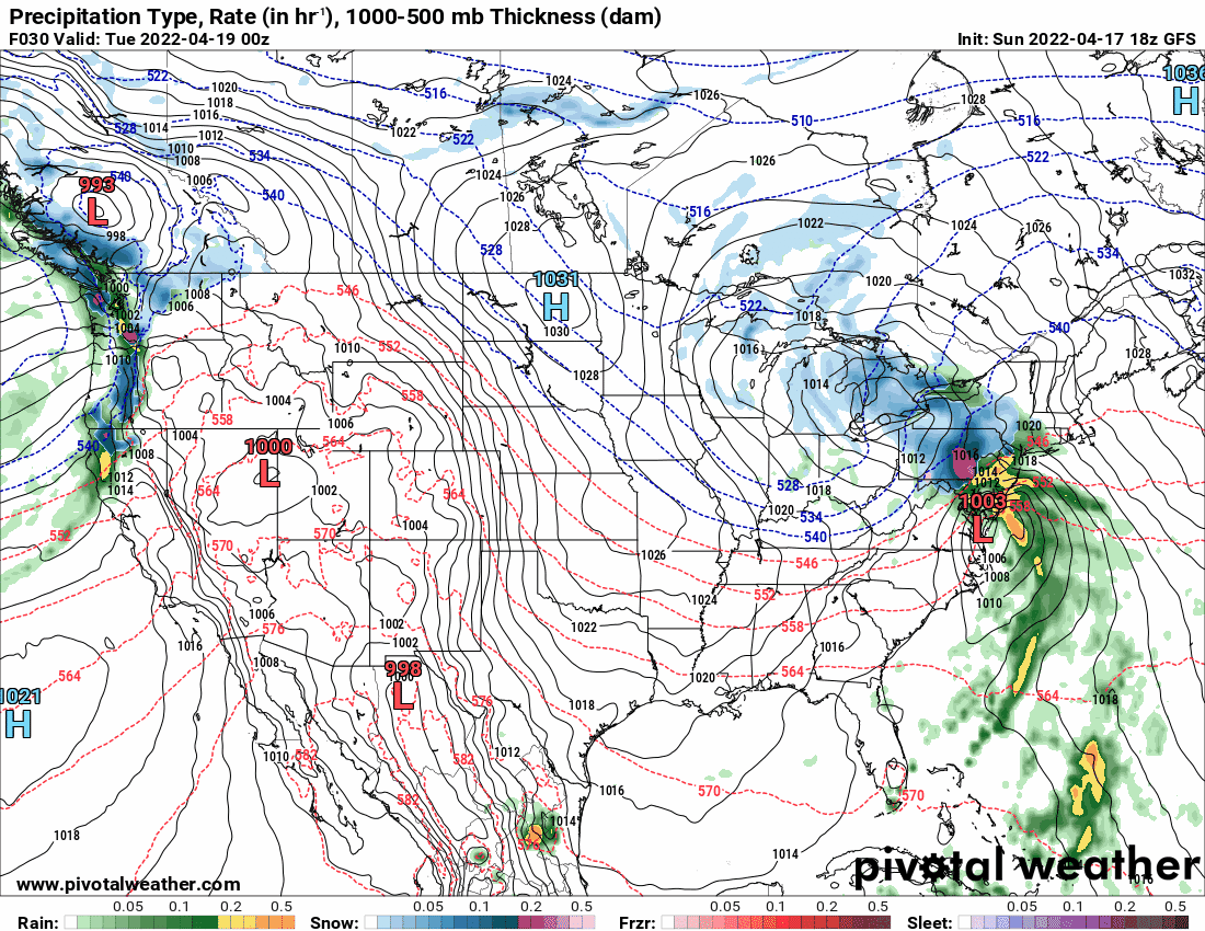
The 18z GFS is throwing some wrap-around snow (showers) down to our arae as it departs. The NAM still has much of that further N & W. I did make it up to 53 as a high today but much of the day had a chilly breeze (although it was warm in the sun). Currently 47, partly sunny and breezy as sunset approaches, with dp a now-drier 20.

-
E PA/NJ/DE Spring 2022 OBS Thread
Hurricane Agnes replied to Hurricane Agnes's topic in Philadelphia Region
Bottomed out at 41 this morning and will find out how high we go later today here. Ended up with 0.16" of rain from the passing front and convection yesterday. Currently changeable skies and 47 with lots of cumulus and peaks of sun here and there, with dp 31. -
E PA/NJ/DE Spring 2022 OBS Thread
Hurricane Agnes replied to Hurricane Agnes's topic in Philadelphia Region
Maxed out at 75 here today and had some convection come through here about an hour ago (picked up on the lightning detector but didn't see/hear anything). Only now starting to get enough rain to tip the bucket and I currently have moderate rain with temp 50 and dp 46, plus 0.08" rain (so far). -
E PA/NJ/DE Spring 2022 OBS Thread
Hurricane Agnes replied to Hurricane Agnes's topic in Philadelphia Region
Mt Holly lofted a Freeze Watch for tomorrow night in the Philly 'burbs and all of S. Jersey & N. Delaware (excludes Philly metro) - So far my high for the day has been 74, which is the current temp (with dp 44), but a deck of clouds with lots of breaks, has been advecting in much of the day. -
I guess it has more "WTF?" and "stare appeal" than Swoop? One of my sisters said it reminded her of this -
-
-
E PA/NJ/DE Spring 2022 OBS Thread
Hurricane Agnes replied to Hurricane Agnes's topic in Philadelphia Region
Had a high of 69 today after a low of 46 this morning. Sunny all day too. And my sis said it was "wet and forget" time to take the green off the deck and siding so... Currently 59 with the Full Pink Moon up above and dp 33. -
E PA/NJ/DE Spring 2022 OBS Thread
Hurricane Agnes replied to Hurricane Agnes's topic in Philadelphia Region
Sun breaking through in the west. Temp took a nose-dive though and is down to 63 with dp 59. Got 0.09" of rain (so far). -
E PA/NJ/DE Spring 2022 OBS Thread
Hurricane Agnes replied to Hurricane Agnes's topic in Philadelphia Region
Next Warnings up - -
E PA/NJ/DE Spring 2022 OBS Thread
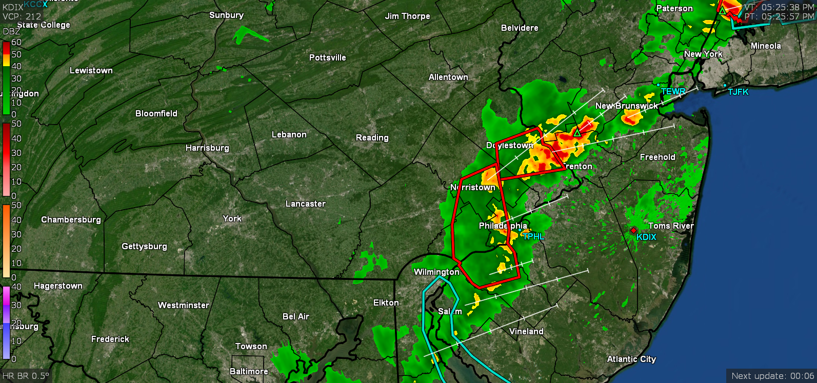
Hurricane Agnes replied to Hurricane Agnes's topic in Philadelphia Region
Here is what is happening here (I am in between those 2 cells coming through the city). The sidewalk was wet for the past few minutes but not enough to tip the bucket until now (am at 0.01").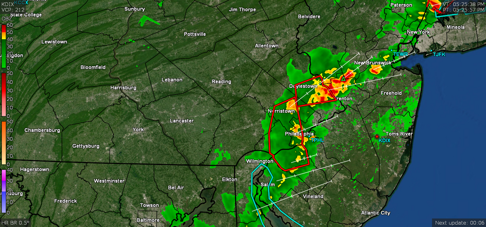
-
E PA/NJ/DE Spring 2022 OBS Thread
Hurricane Agnes replied to Hurricane Agnes's topic in Philadelphia Region
No rain yet but the temp surely dropped. Down to 69 with dp 61.
-
E PA/NJ/DE Spring 2022 OBS Thread
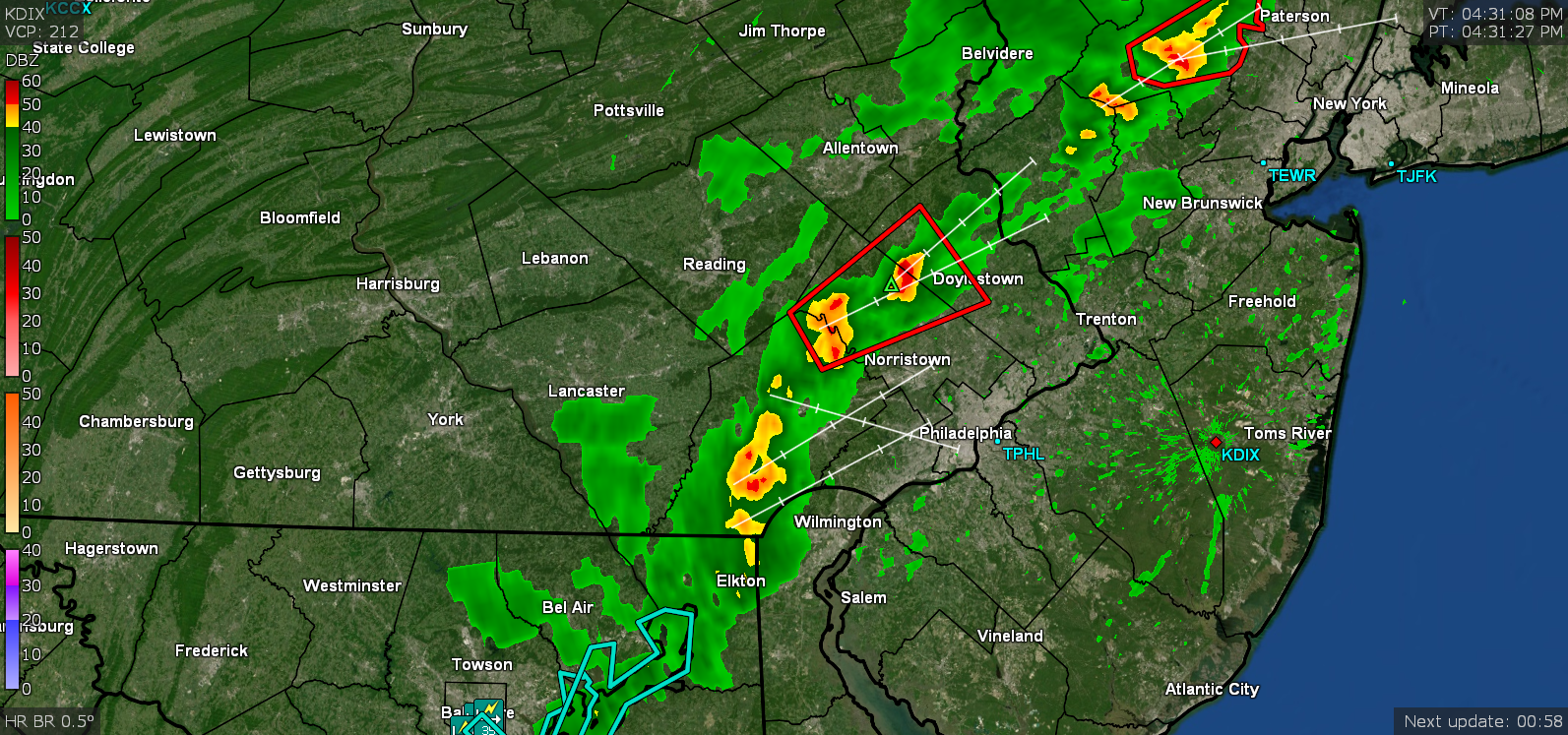
Hurricane Agnes replied to Hurricane Agnes's topic in Philadelphia Region
Here are the still active Warnings - -
E PA/NJ/DE Spring 2022 OBS Thread
Hurricane Agnes replied to Hurricane Agnes's topic in Philadelphia Region
Latest Warning up - -
E PA/NJ/DE Spring 2022 OBS Thread
Hurricane Agnes replied to Hurricane Agnes's topic in Philadelphia Region
Warnings up for my area - -
E PA/NJ/DE Spring 2022 OBS Thread
Hurricane Agnes replied to Hurricane Agnes's topic in Philadelphia Region
Currently 81 here with dp 61 and sun coming in and out. I see the cells moving in...
-
E PA/NJ/DE Spring 2022 OBS Thread
Hurricane Agnes replied to Hurricane Agnes's topic in Philadelphia Region
STSs up for parts of the CWA - -
E PA/NJ/DE Spring 2022 OBS Thread
Hurricane Agnes replied to Hurricane Agnes's topic in Philadelphia Region
So far I tapped 85 today as a high about 45 minutes ago after a low of 65, and with the on and off overcast, it's down to 83 here with dp 59.