Hurricane Agnes
-
Posts
9,344 -
Joined
Content Type
Profiles
Blogs
Forums
American Weather
Media Demo
Store
Gallery
Everything posted by Hurricane Agnes
-
I'm curious about Berks north of Reading...
-
My low so far this morning has been 39 and I'm currently at 41 with dp 35 and overcast.
-
WPC current surface conditions - temp, dews, wind (at ~7am).
-
Here was Mt. Holly's last event tweet with snow map -
-
6z EC running and it is maintaining the northern CWA jackpot regions.
-
E PA/NJ/DE Spring 2022 OBS Thread
Hurricane Agnes replied to Hurricane Agnes's topic in Philadelphia Region
I went on and made an event obs thread since we do have members up north who may get some surprise winter presents - -
Currently 40 with dp 34 here. Philly metro appears to be in a precip hole as the heavier stuff starts lifting to the north and east.
-
E PA/NJ/DE Spring 2022 OBS Thread
Hurricane Agnes replied to Hurricane Agnes's topic in Philadelphia Region
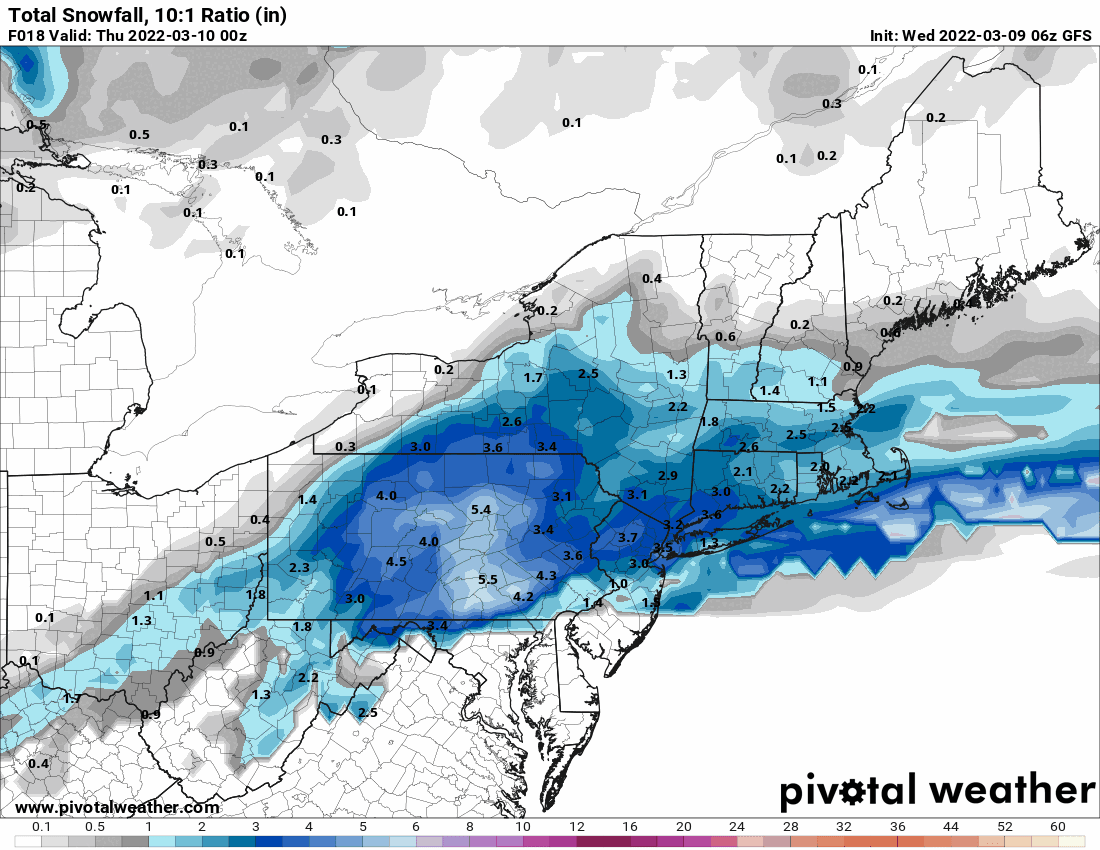
6z GFS & 3k NAM.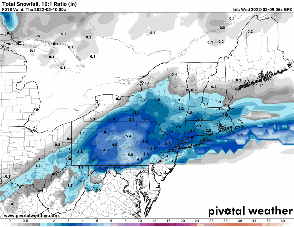
-
E PA/NJ/DE Spring 2022 OBS Thread
Hurricane Agnes replied to Hurricane Agnes's topic in Philadelphia Region
HRRR (last full one was 8z) -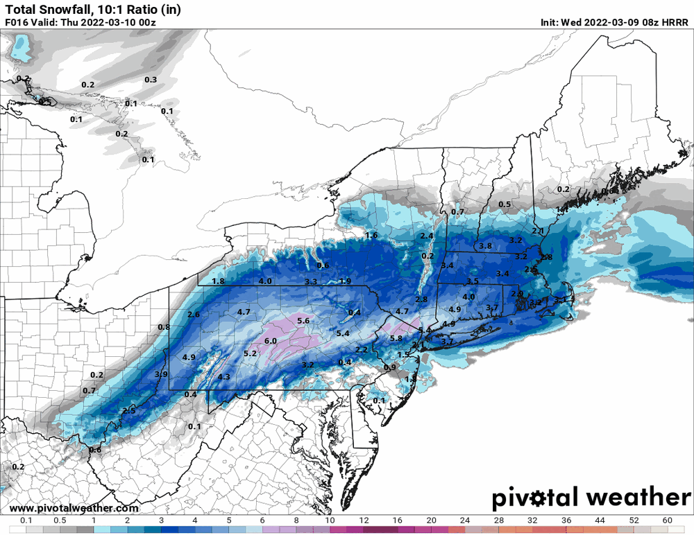
-
E PA/NJ/DE Spring 2022 OBS Thread
Hurricane Agnes replied to Hurricane Agnes's topic in Philadelphia Region
It's 40, with dp 32 here IMBY (just before 5 am) so there is definitely a temp gradient. I am assuming the precip is rising up from the south (based on radar and the way the models depicted it) with the cold air pushing down from the north (based on the temps where you are). How far that cold air sinks will be key. -
E PA/NJ/DE Spring 2022 OBS Thread
Hurricane Agnes replied to Hurricane Agnes's topic in Philadelphia Region
And the 0z RGEM. At this point, only the globals are in range for the weekend storm.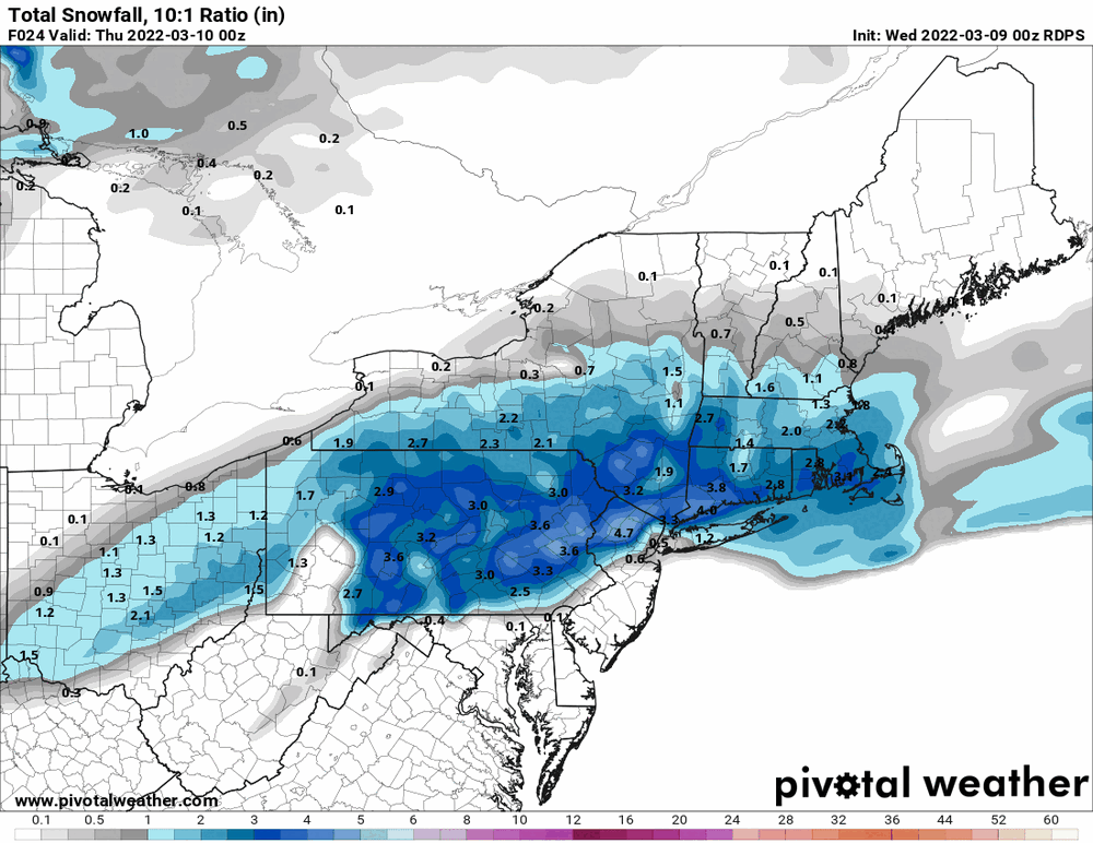
-
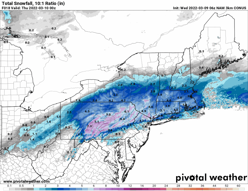
E PA/NJ/DE Spring 2022 OBS Thread
Hurricane Agnes replied to Hurricane Agnes's topic in Philadelphia Region
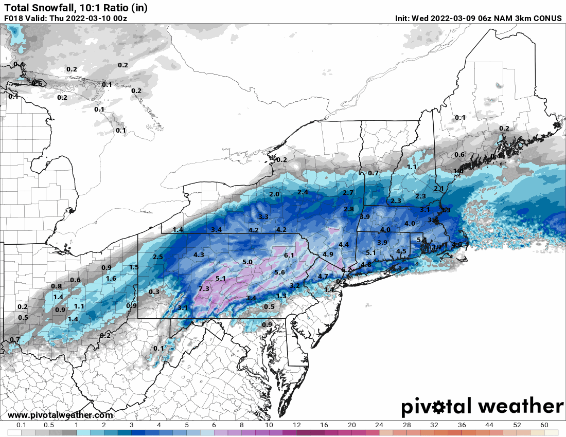
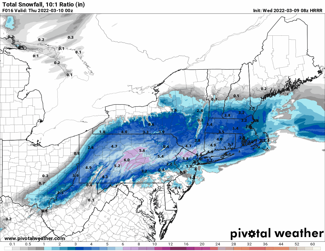
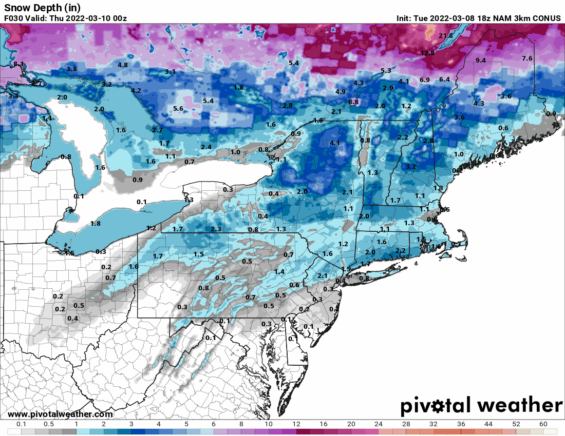
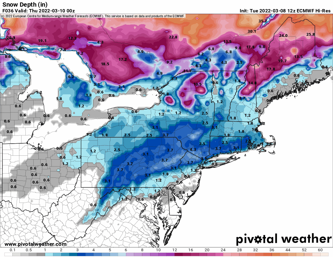
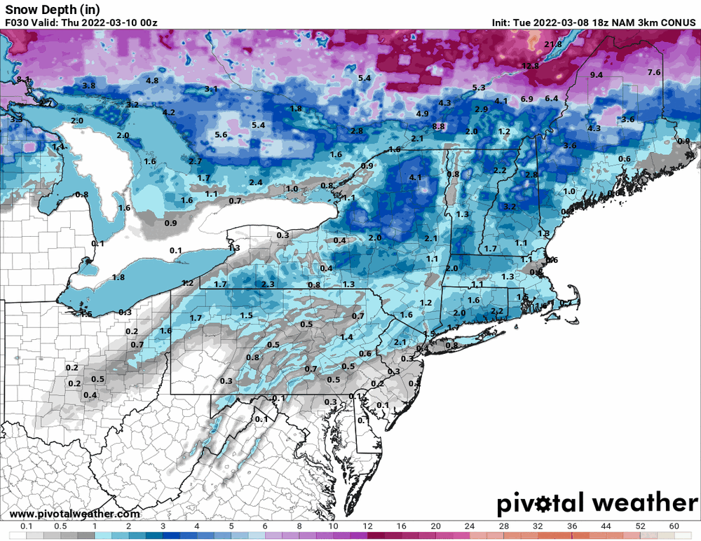
Here's the 3k NAM (Snowfall & Snow Depth) -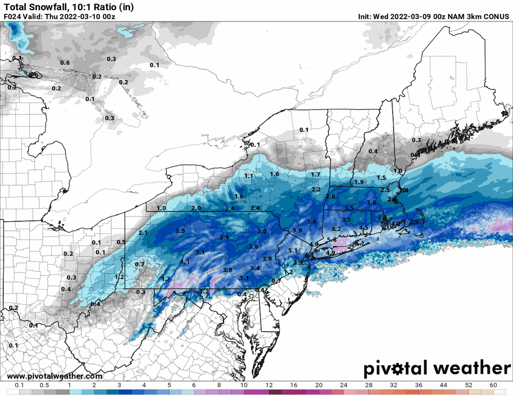
-
E PA/NJ/DE Spring 2022 OBS Thread
Hurricane Agnes replied to Hurricane Agnes's topic in Philadelphia Region
18z NAM with Snowfall vs Snow Depth. Looks like the Snowfall dry-up S/E trend continues (so far).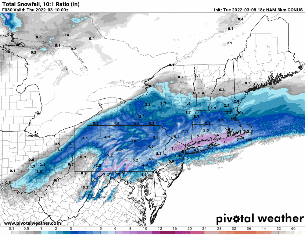
-
E PA/NJ/DE Spring 2022 OBS Thread
Hurricane Agnes replied to Hurricane Agnes's topic in Philadelphia Region
I was out earlier today with a t-shirt and a hoodie jacket (sortof a medium weight one with some lining but not like a heavily-lined sweatshirt type of lining). Was just fine and that is with the breeze too. -
E PA/NJ/DE Spring 2022 OBS Thread
Hurricane Agnes replied to Hurricane Agnes's topic in Philadelphia Region
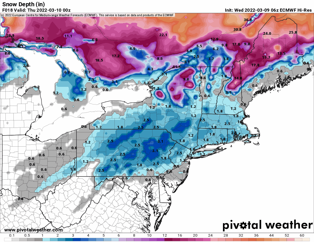
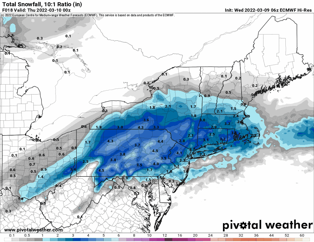
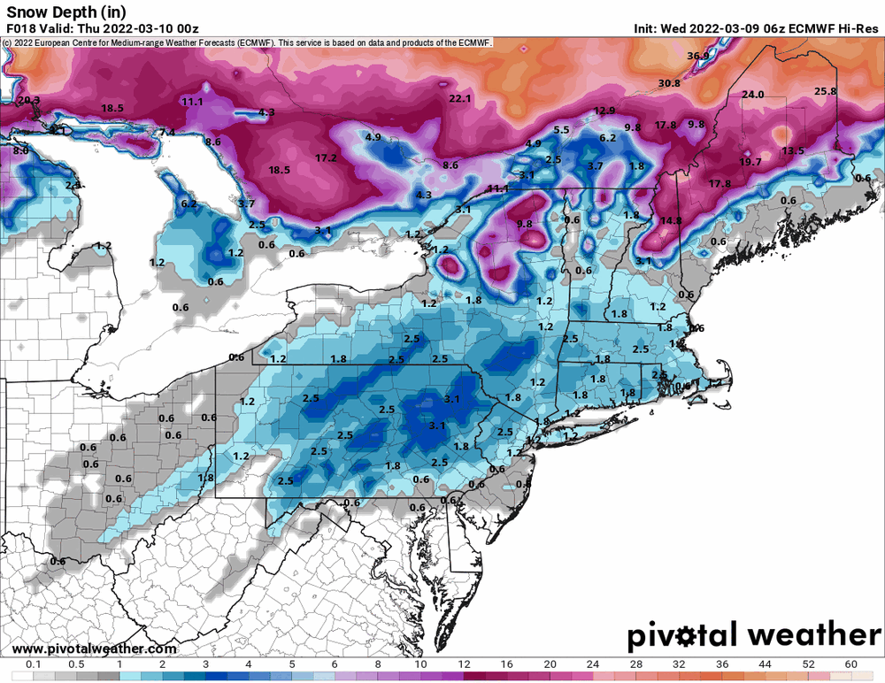
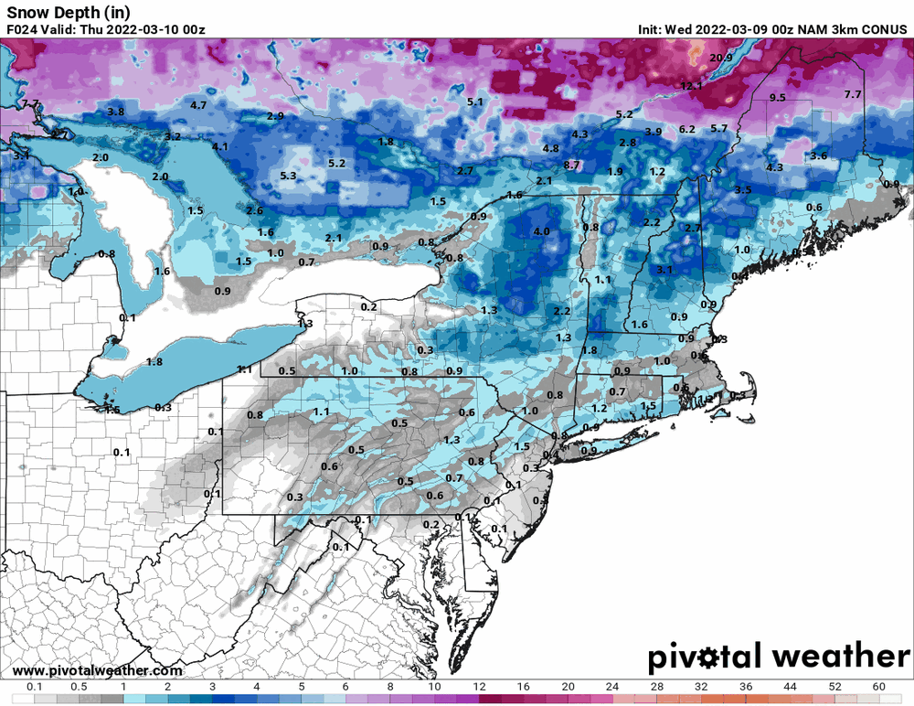
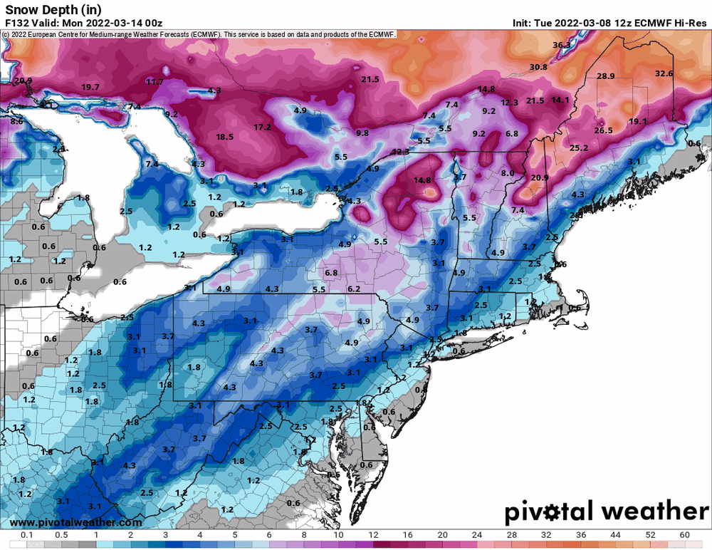
The Snow Depth for tomorrow is below which is probably closest to the potential.
-
E PA/NJ/DE Spring 2022 OBS Thread
Hurricane Agnes replied to Hurricane Agnes's topic in Philadelphia Region
I was doing a comparison and I think the issue with that is that the "Total Snowfall" is basically an aggregate of all snow that fell, whether it melted or not. I expect in this case (as mentioned by someone who posted in the thread earlier) that the "Snow Depth" is probably a bit better indicator of what is coming.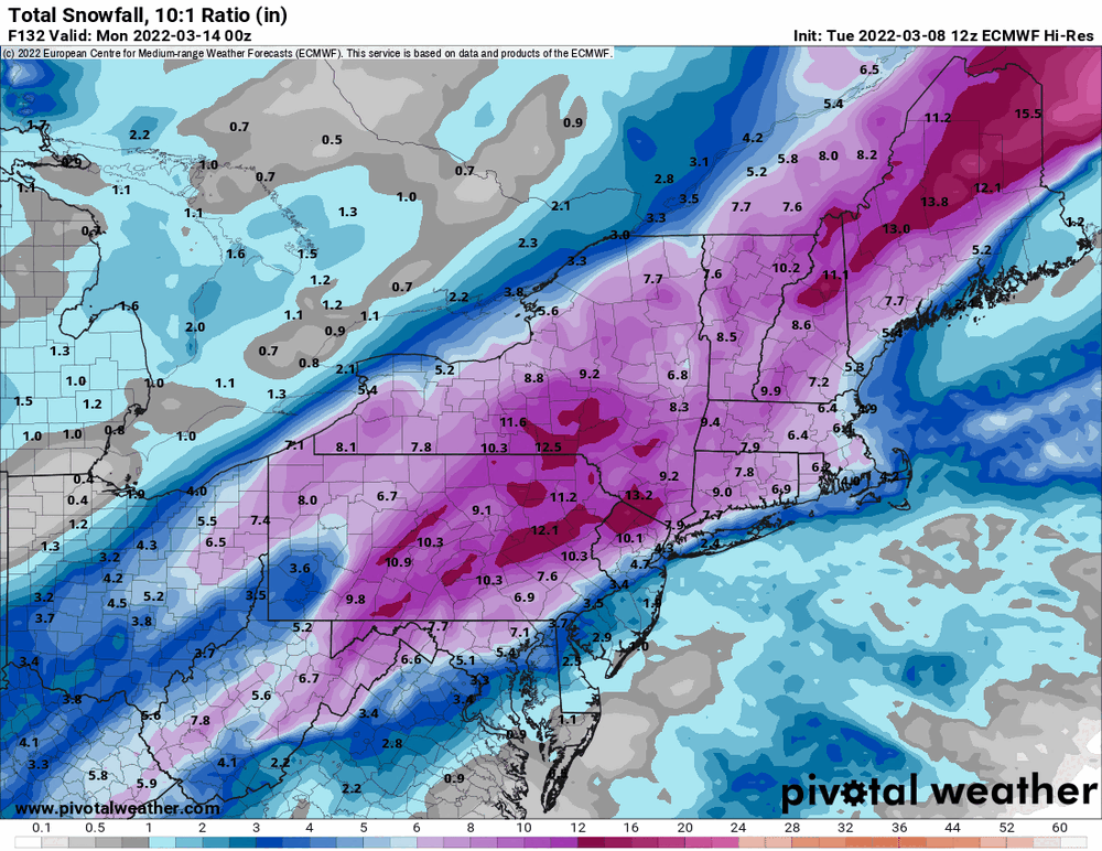
-
E PA/NJ/DE Spring 2022 OBS Thread
Hurricane Agnes replied to Hurricane Agnes's topic in Philadelphia Region
Yeah I saw that this morning in a LSR (posted upthread). That was pretty wild! I think I have hit my high for the day at 47. Currently bopping between 46 and 47, and a sun shining through a deck of cirrus, with dp 22. -
E PA/NJ/DE Spring 2022 OBS Thread
Hurricane Agnes replied to Hurricane Agnes's topic in Philadelphia Region
Whole pile of RERs for temps yesterday - -
E PA/NJ/DE Spring 2022 OBS Thread
Hurricane Agnes replied to Hurricane Agnes's topic in Philadelphia Region
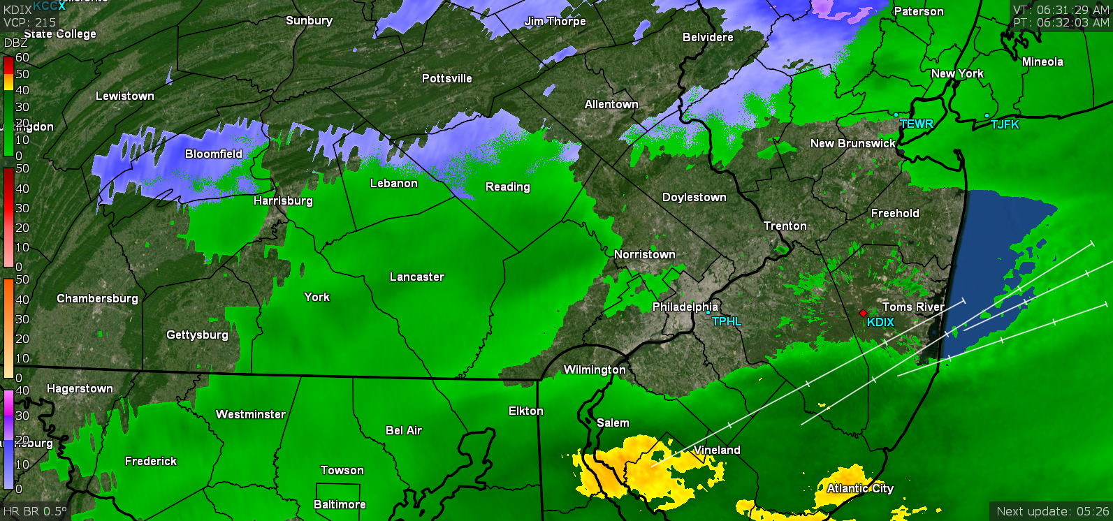
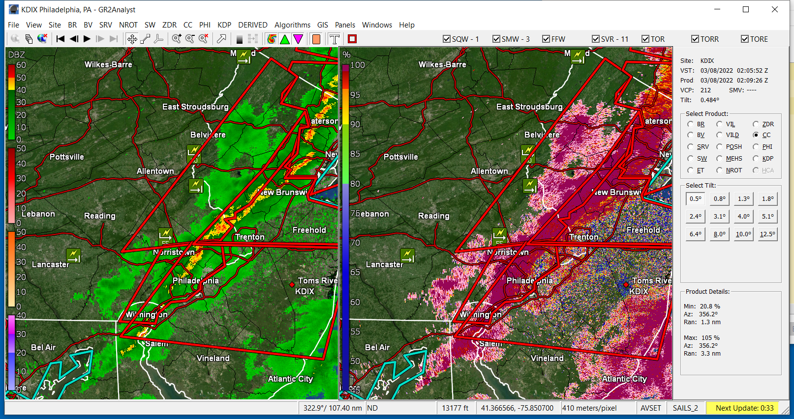
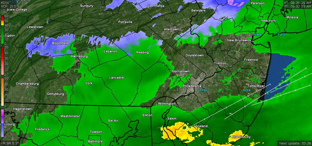
I recall seeing a trained spotter in Skippack report a 56 mph gust there. I didn't get chance to screencap their actual mPing report but it's the "55" tag in central Montco on the below map... ETA the PA PNS for wind reports - And I found the Skippack report and some airport/ASOS/AWOS reports in the LSR posted this morning -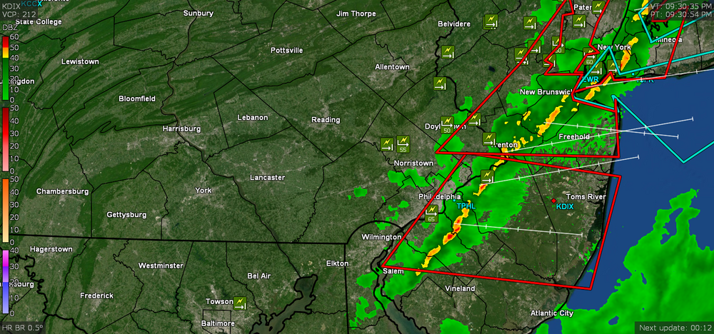
-
E PA/NJ/DE Spring 2022 OBS Thread
Hurricane Agnes replied to Hurricane Agnes's topic in Philadelphia Region
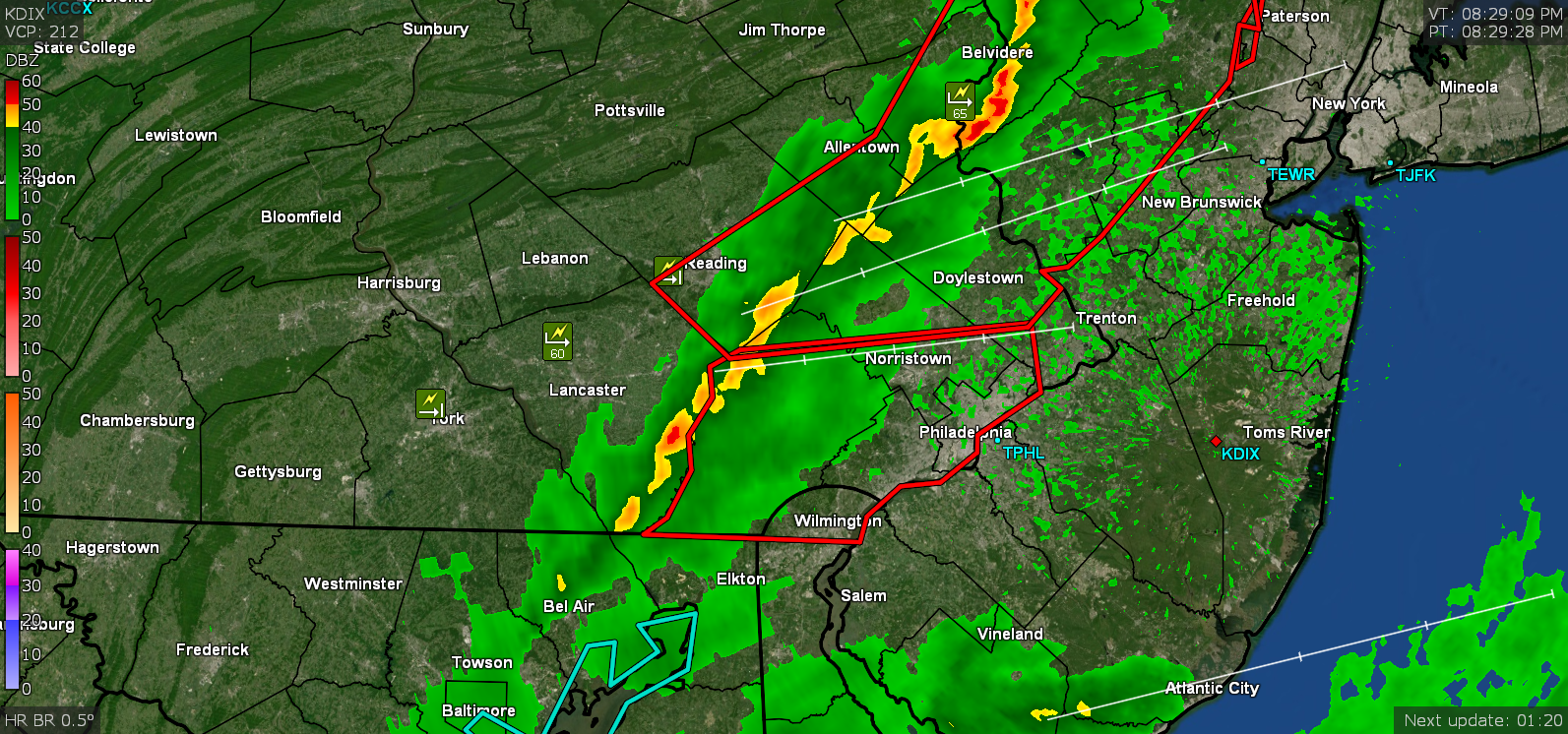
Looks like the last of the STSs along the Jersey coast - The line moved fairly quickly and almost off the coast. It's currently now down to 57 here with dp slowly dropping and at 47. -
E PA/NJ/DE Spring 2022 OBS Thread
Hurricane Agnes replied to Hurricane Agnes's topic in Philadelphia Region
Temp has dropped almost 10 degrees and it's currently down to 61 with dp 59. Have 0.11" in the bucket so far (which is 0.09" additional since the rain this morning)
-
E PA/NJ/DE Spring 2022 OBS Thread
Hurricane Agnes replied to Hurricane Agnes's topic in Philadelphia Region
Right on my door step. Current temp is 70 with dp 59 and breezy. ETA - gust front and gully washer coming through right now.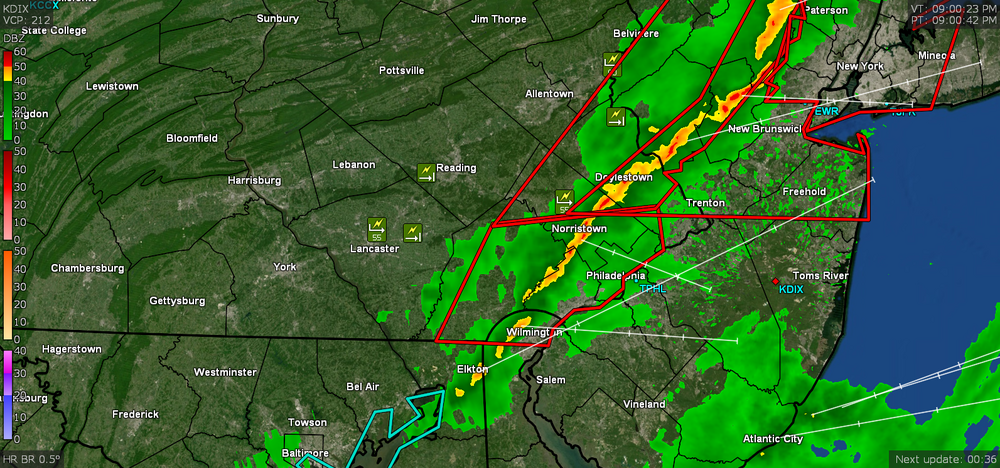
-
E PA/NJ/DE Spring 2022 OBS Thread
Hurricane Agnes replied to Hurricane Agnes's topic in Philadelphia Region
Mike is busy tonight! -
E PA/NJ/DE Spring 2022 OBS Thread
Hurricane Agnes replied to Hurricane Agnes's topic in Philadelphia Region
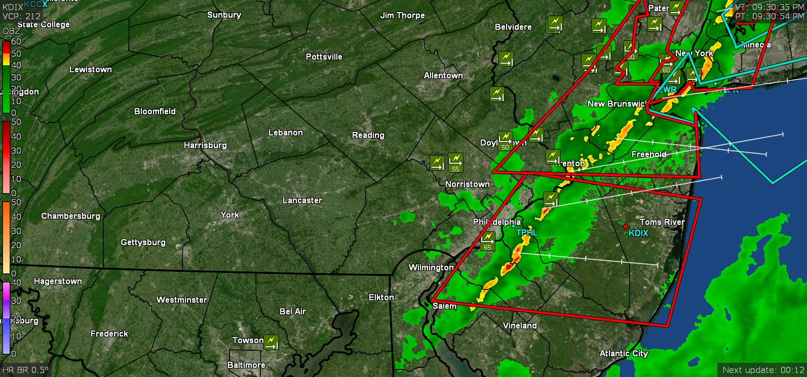
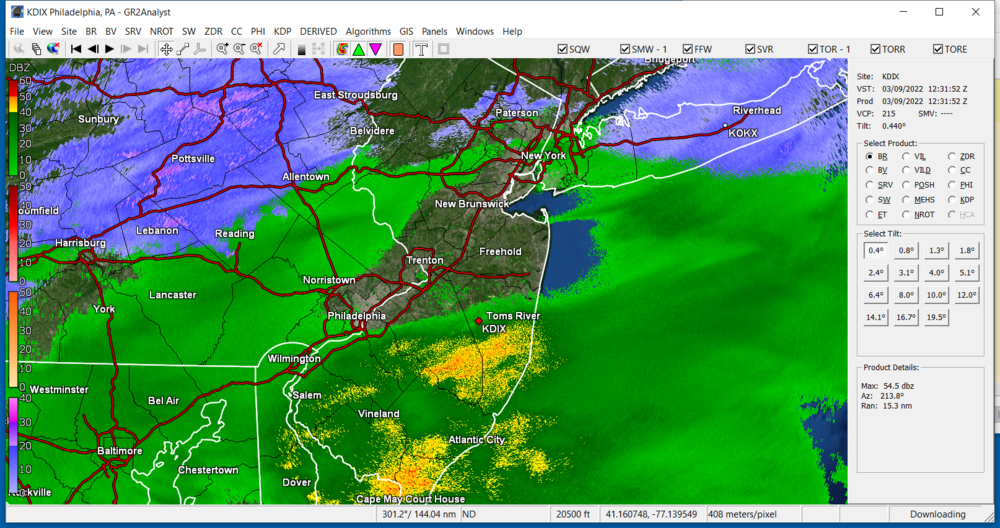
Another STS up in Jersey - -
E PA/NJ/DE Spring 2022 OBS Thread
Hurricane Agnes replied to Hurricane Agnes's topic in Philadelphia Region
Will have to see how much this holds together. What is wild is that once the rain stopped, the temps started going back up and I'm currently at 71 (am guessing down-sloping going on) with dp 59).