Hurricane Agnes
-
Posts
9,344 -
Joined
Content Type
Profiles
Blogs
Forums
American Weather
Media Demo
Store
Gallery
Everything posted by Hurricane Agnes
-
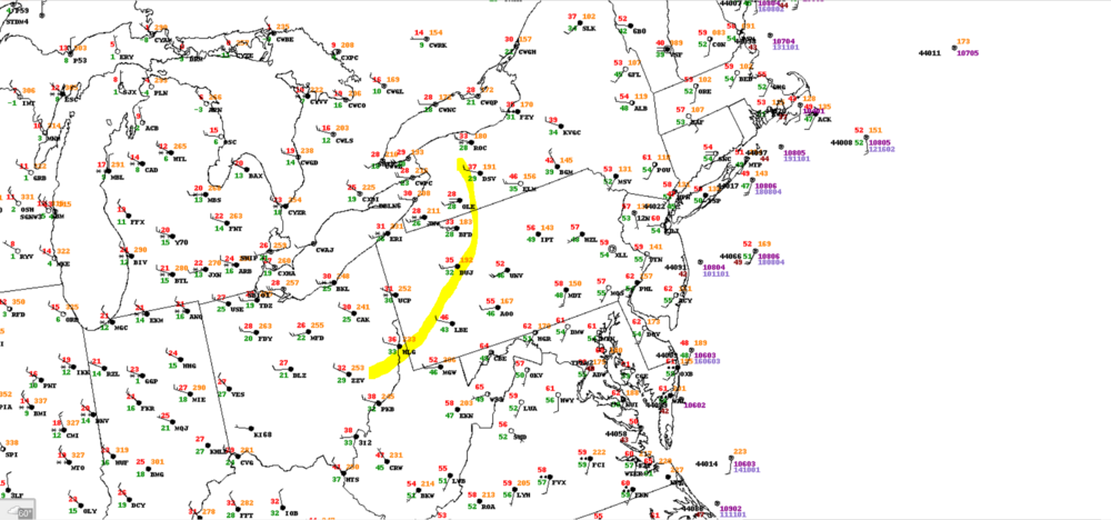
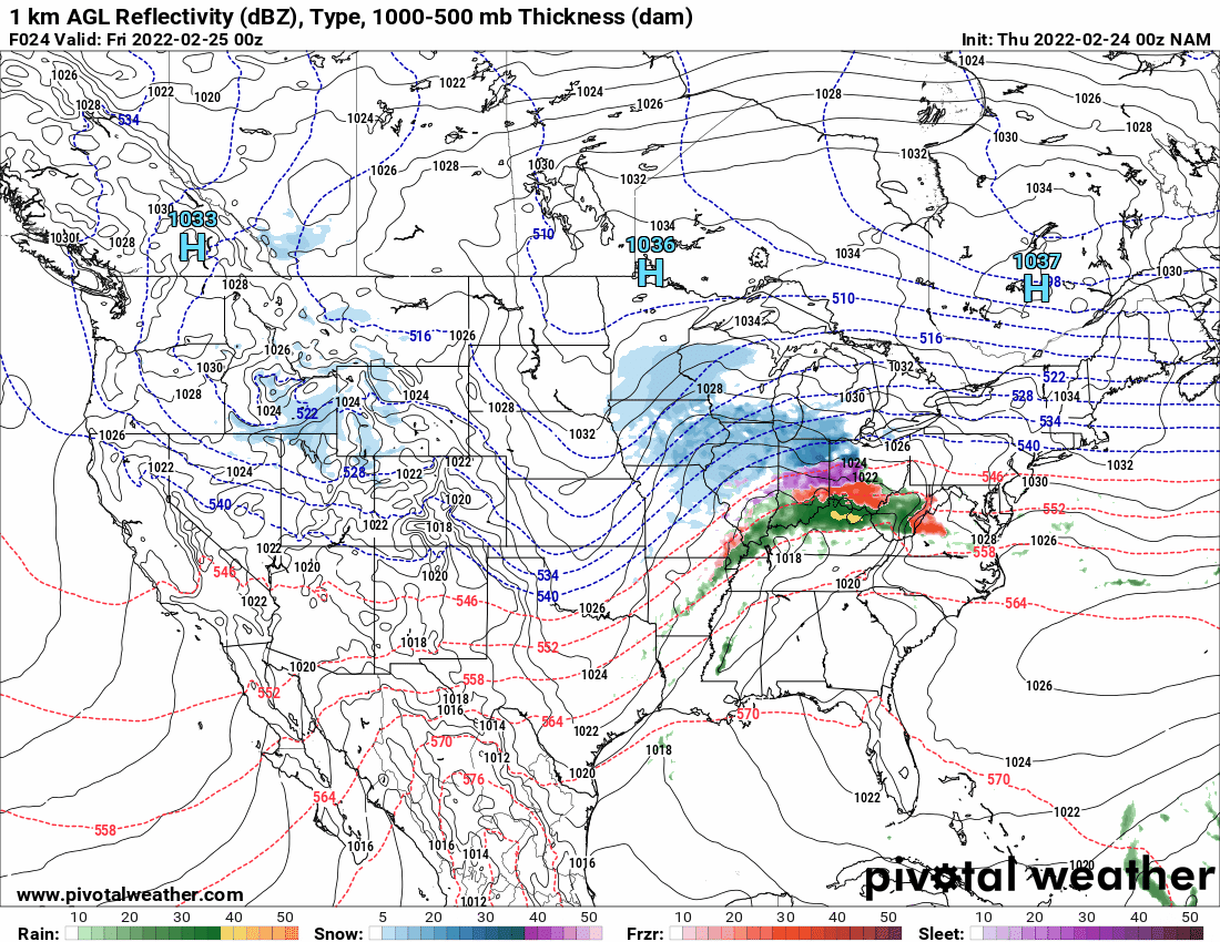
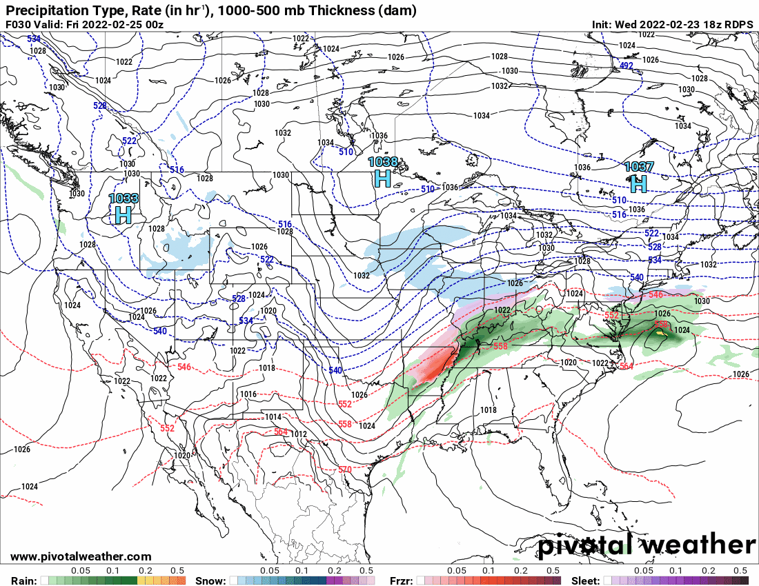
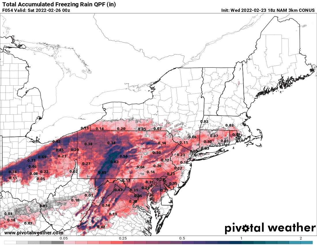
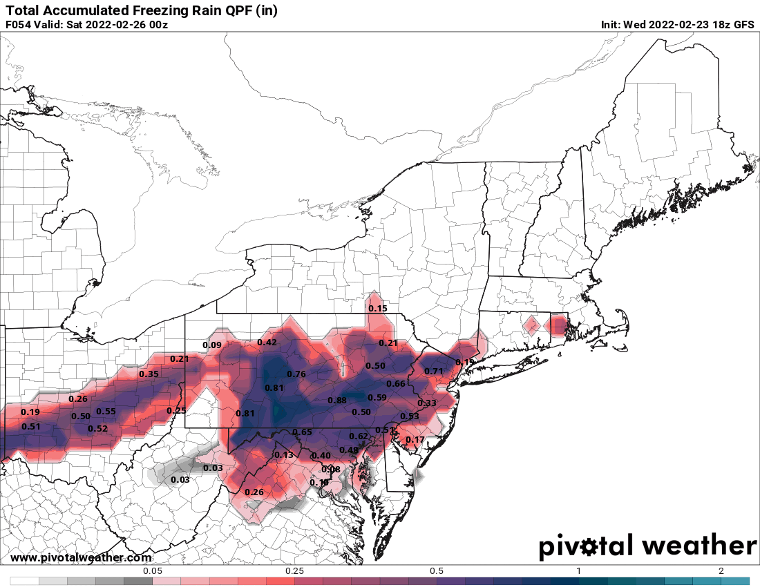
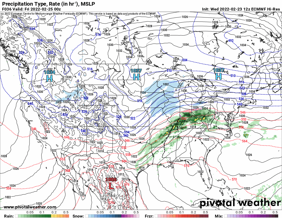
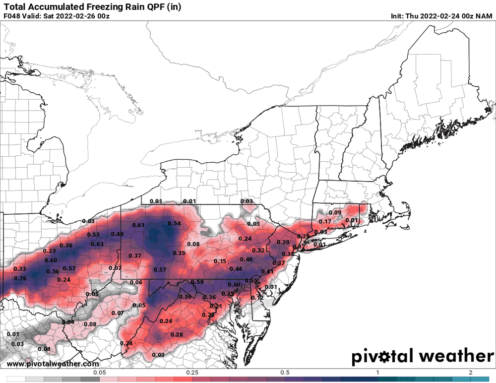
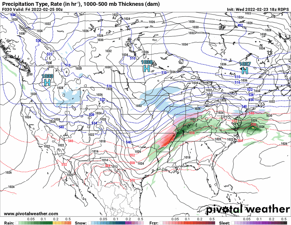
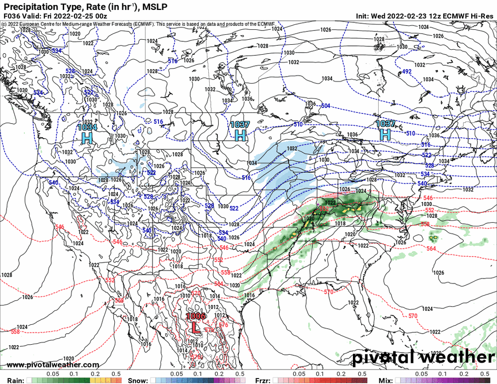
I was looking out west at Pittsburgh's WFO forecast and they are talking about a heavy moisture plume there coming out of WV, and may need to have flood watches/advisories go up at some point once the storm begins. So the question will be whether that plume translates over to the east or gets shredded by the mountains, lessening the amounts. Until now, most of the models outside of the NAM, seemed to think mountains schmountains and shunts that moisture, unabated, all the way east. Meanwhile the NAM chose to assume a disrupted flow instead. However now that the 0z NAM is out, it seems to have caved to a more moisture laden set of systems and... We have seen many convective lines "dry up" and fizzle on the way east so will see if this overrunning precip idea continues or what.

-
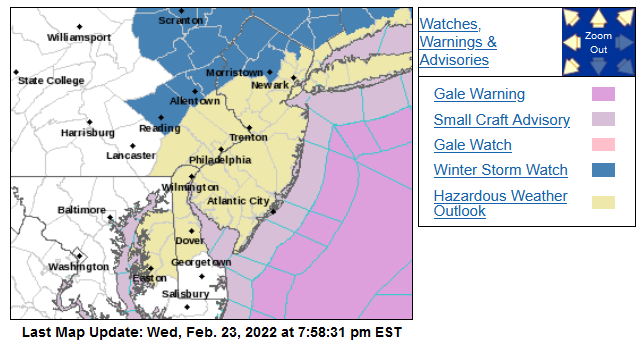
I did see the Watch was extended down a row of counties. The other Watches up further north (including N. Jersey) are also being done by 2 other WFOs.
-
The NBM is ignoring all the firehoses and seems to be leaning towards the NAM solution.
-
18z RGEM all in on firehose precip.

-
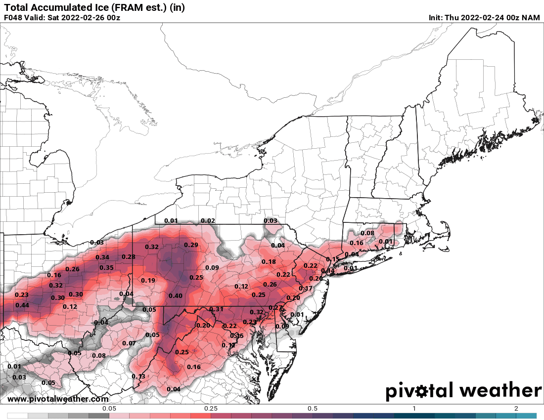
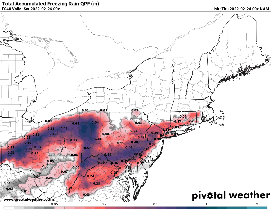
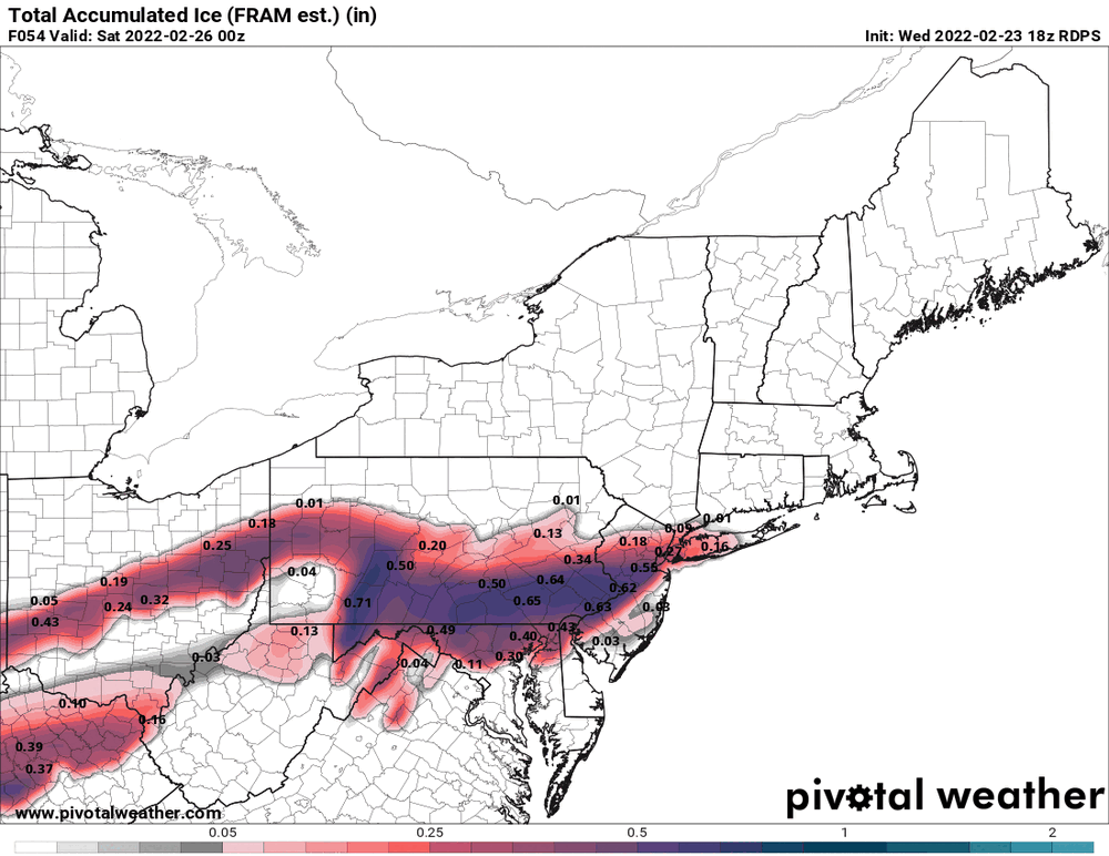
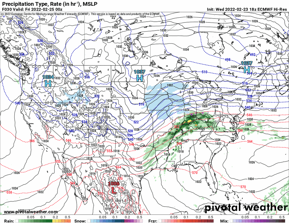
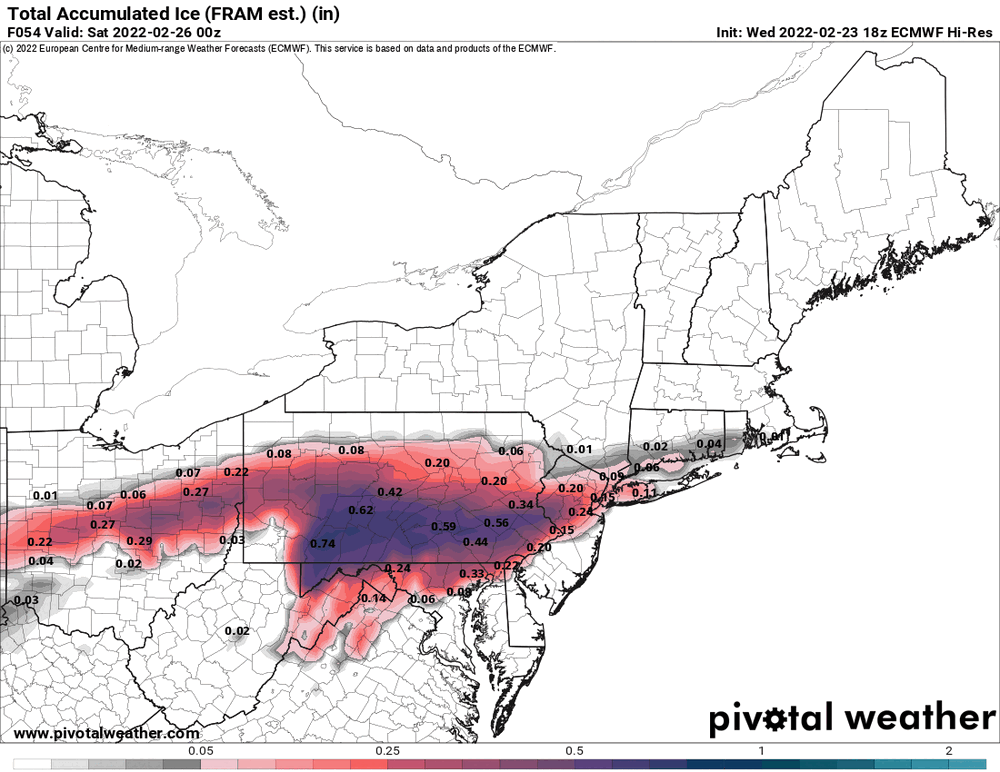
The 18z Euro put the bulk of the icy precip out in Central PA. Of course it's the 18z... There will be many adjustments as we get closer and the short range models will be helpful.

-
E PA/NJ/ DE Winter 2021-22 OBS Thread
Hurricane Agnes replied to JTA66's topic in Philadelphia Region
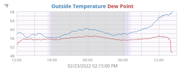
The 68 did end up being my high for the day and it's currently 53 with dp 33. There were 3 record highs today per Mt. Holly (ILG, ACY, Atlantic City Marina). -
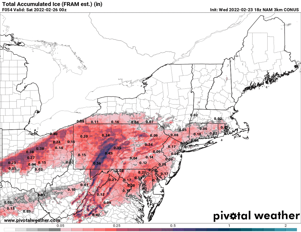
18z 3k NAM seems realistic assuming the overruning is not a fire-hose like the other models seem to continue to show.

-
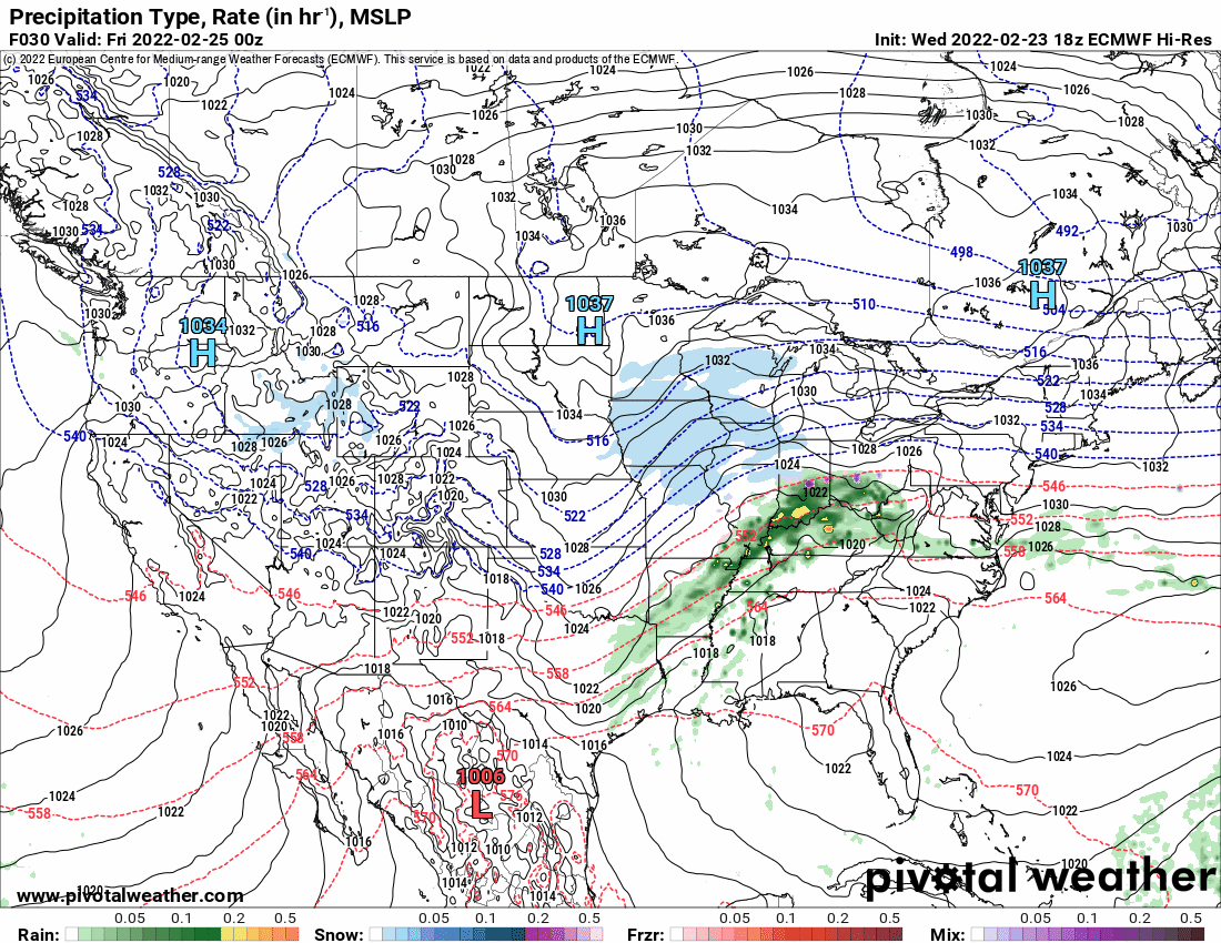
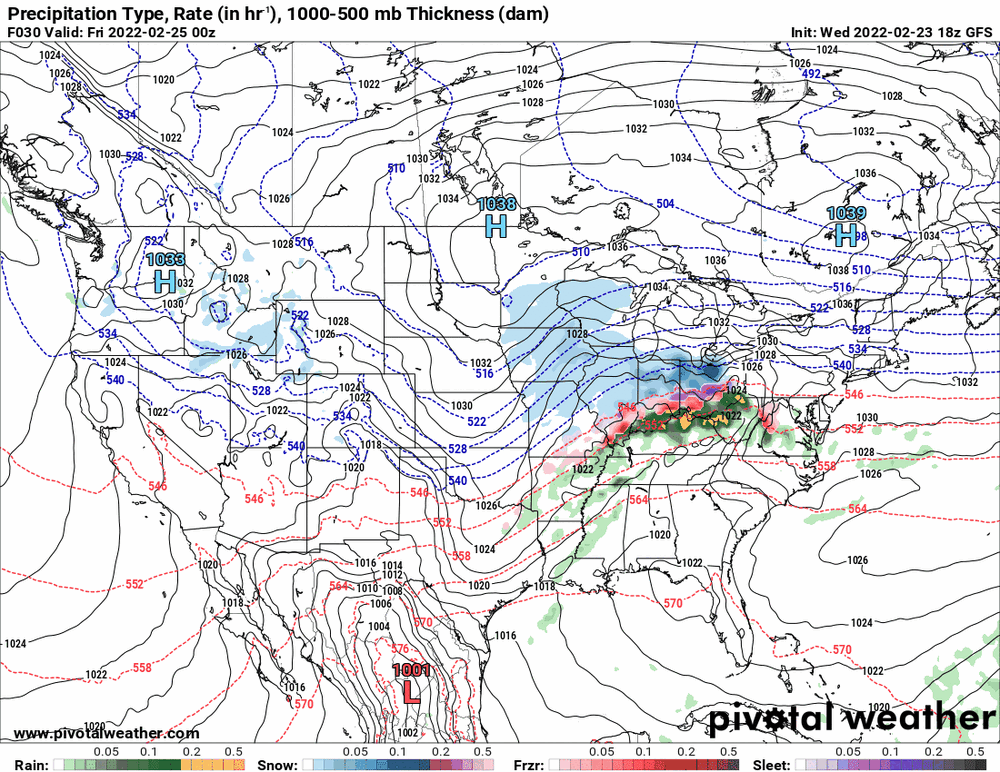
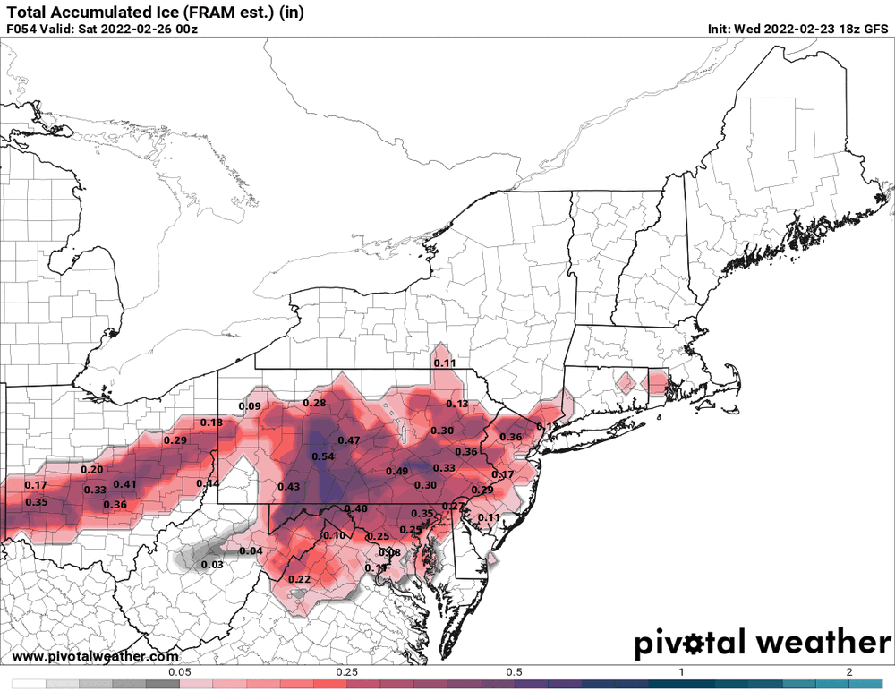
18z GFS keeping with the theme... I know this whole setup has a big bust potential (going either way).

-
Mt. Holly's last tweet from about a half hour ago.
-
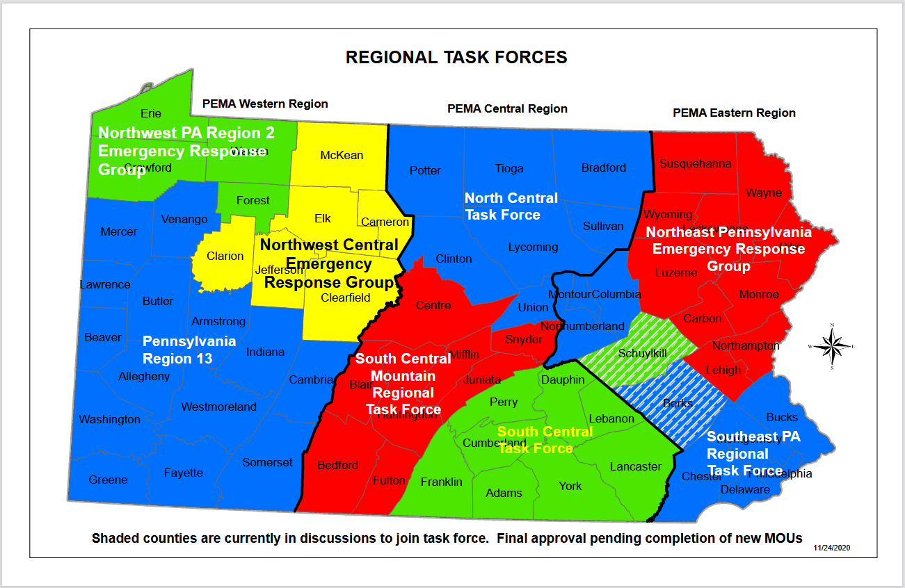
You do realize the Emergency Managers in each county work with PEMA, right? And they all also work with their federal counterparts through task forces. https://www.pema.pa.gov/About-Us/Pages/default.aspx None of these people operate in a vacuum and they coordinate with each other to deal with major disruptive events - whether there is hazardous weather or a hazardous chemical release in an area. So for example, this was from PEMA and PennDOT this past October regarding how they planned to handle what would be the upcoming winter season - So the county EMs are the point people when it comes to knowledge of the immediate area and can help inform decisions that might require state/federal responses.

-
E PA/NJ/ DE Winter 2021-22 OBS Thread
Hurricane Agnes replied to JTA66's topic in Philadelphia Region
Currently sunny and 68 (my high so far today) but with a falling dp since about 2 pm with cold frontal passage, and now down to 45 after an earlier high of 57. -
It got threateningly dark here at the time too - like an attempt at a gust front (but a bit disorganized). However it has since cleared out with blue sky dotted with some cumulus.
-
I'm just amazed at the little flood warnings that will run right along the sides of a river, which can be a tiny area on a map compared to the Warning areas for other products. That's probably about as hyper-local as I have seen.
-
I think the front has been moving through now. The winds have picked up significantly in the last 30 minutes or so. So far I hit 68 for a high and am bopping between 67/68 but the dp has taken a big hit and is now down to 46.
-
There is no way you can do "hyper-local" forecasting (at least with the tech that is available today) and even then, it would be TMI for the average person. Keep up the good work!
-
12z EC tries to fade a dryslot in with lesser precip to sortof look like the NAM.
-
Well remember too that the interstates (and roads in general) were built to deal with that actual geography (or better, "topography") of the land, so you will see roads that are actually running along natural dips between hills. I live in a hilly area myself and see that, especially because where I am is where the Piedmont begins. The roads will also follow along creeks and rivers. And thus you have I-95 that is running right along the fall line! There was kindof a cool little blog article that I found that sortof talks about that - https://www.lastwordonnothing.com/2018/02/15/following-the-fall-line/ If you look at the criteria, it's not solely dividing along the N/S fall line, which essentially separates the flat coastal plain of NJ from areas west, but they also subdivide by latitude as well. And the interesting issue of the mountains that run across PA, is that the chains run SW to NE on a diagonal, so where they bisect land areas, will have an impact differently vs based solely on latitude. But it would be near impossible to try to micro-tailor the Warnings/Advisories based on climatology down to the degree that you want to see (at least at the moment). I think it was only recently when they were able to actually do "parallelogram" designations of smaller areas (vs county-wide) for the products they issue (notably important for the Warning products like FFW/TOR/TORE, etc). I know the Warning/Advisory criteria have changed over the years and gets tied to area impact. Where I am here in Philly in Chestnut Hill, I know we had a handful of local mets (broadcast ones, the few who were actually mets) who were familiar with hyper-local conditions including northwest Philly. So for example, someone like Elliot Abrams (who many on here know about, who was a co-founder of Accuweather) went to school a few miles from where I live. Similarly, Hurricane Schwartz went to high school here in the city at a school about 5 miles from me (and a block from where I went to HS). So whenever there were local forecasts, those local mets who were actually from here, would take the NWS info as supplementary guidance and would then tailor it to the locale. They knew, for example, that here in the higher elevations of the city, the temps ran several degrees cooler than downtown and we often got more snow here because of that, so adjustments were always made. So remember that they are not just forecasting for up there or for down here but across parts of PA, NJ, all of DE, and parts of MD.
-
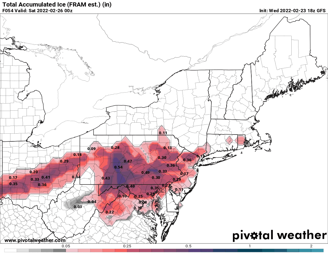
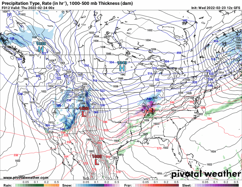
12z 3k NAM by ptype.

-
12z 3k NAM in range (12z EC just started).

-
It threw in a baby dryslot (showing a quick pause between systems).
-
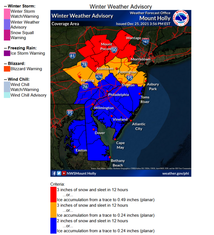
I think that Watch up there was aimed at snow for up that way (since the early morning and current AFDs) - I think they are going to throw a WWA up for the LV and maybe have a SPS for the northern portions of the next set of counties below that and then nothing for Philly metro S/E where a mix/rain would not have much of an impact outside of nuisance stuff.
-
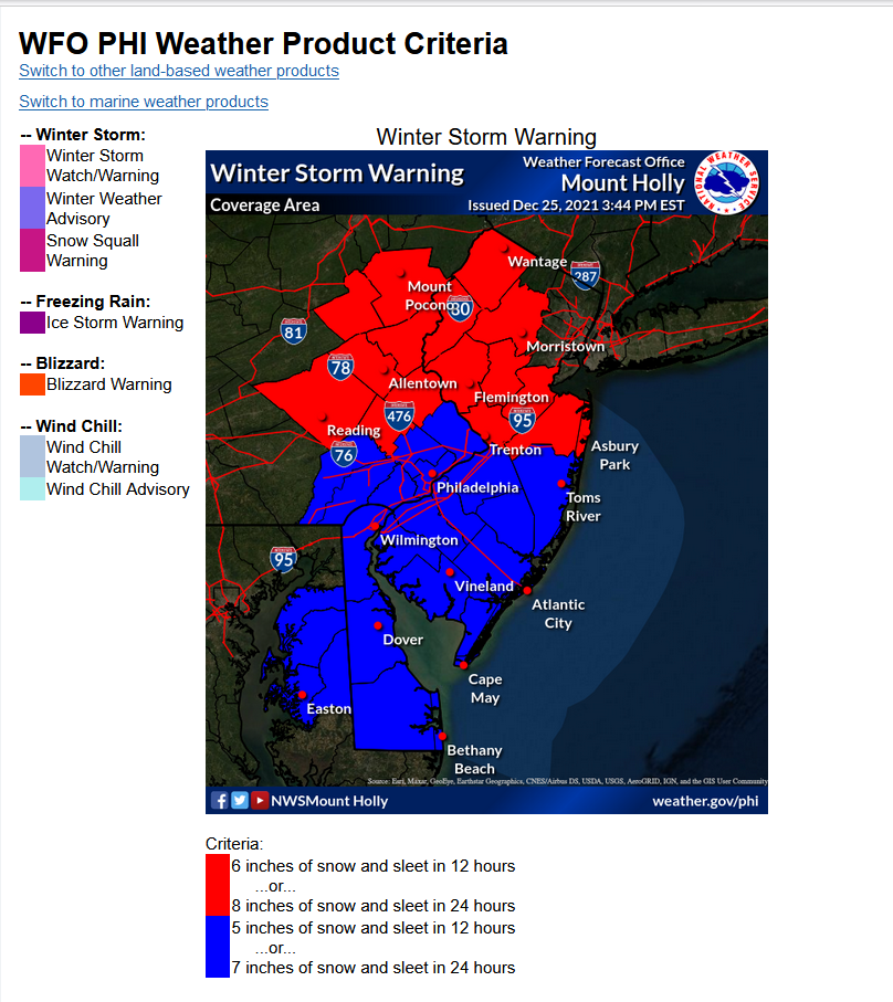
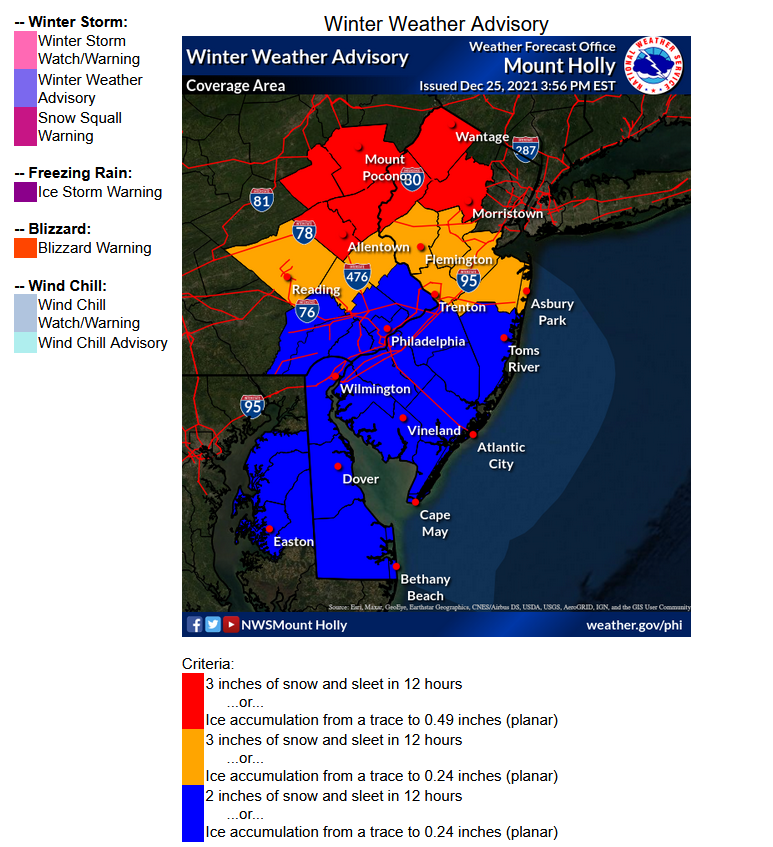
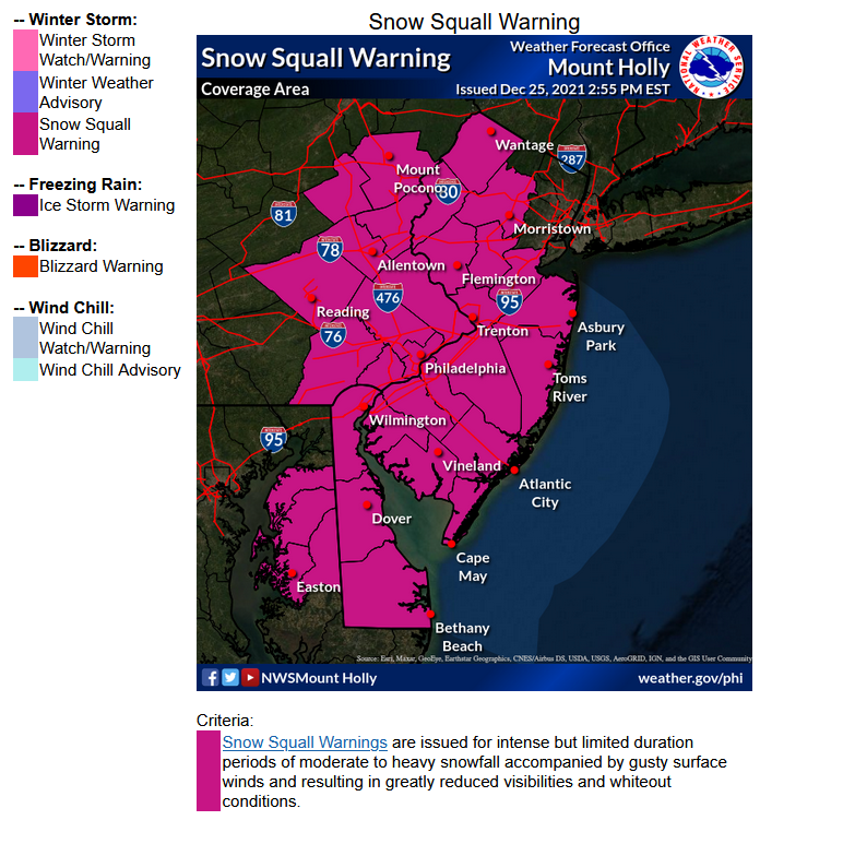
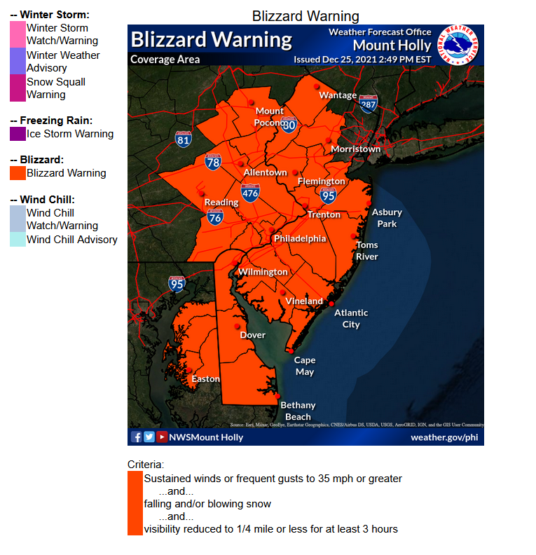
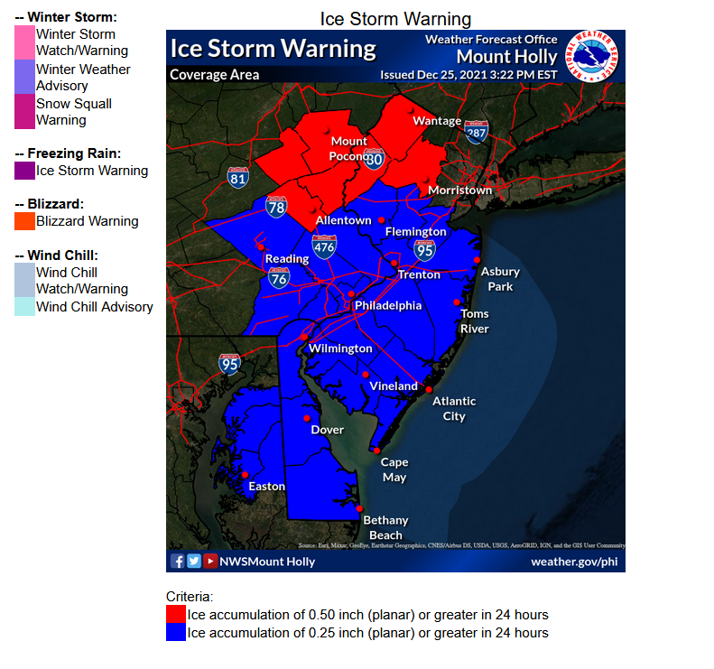
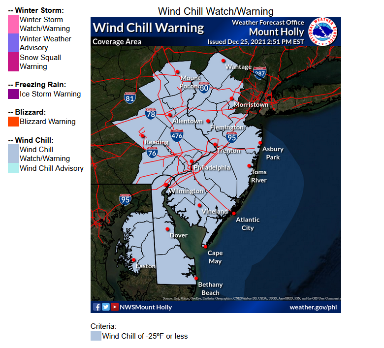
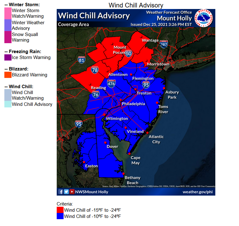
Here is a link to Mt. Holly's Winter Weather Criteria for Warnings/Advisories (the page uses a mouse-over feature to show the regions and it will display the criteria legends at the bottom but I snap-shotted them to make it easier) - https://www.weather.gov/phi/criteria-winter Each region within the CWA has different criteria for what triggers use of each product.


-
The 7 am update from Mt. Holly - The NAM continues with the dryslotting although a bit more drawn-out type of event.
-
E PA/NJ/ DE Winter 2021-22 OBS Thread
Hurricane Agnes replied to JTA66's topic in Philadelphia Region
Had an earlier "low" (because that won't end up being today's "low") of 57 and am currently overcast and 61 w/dp 56. You can sortof see the front on the move on satellite!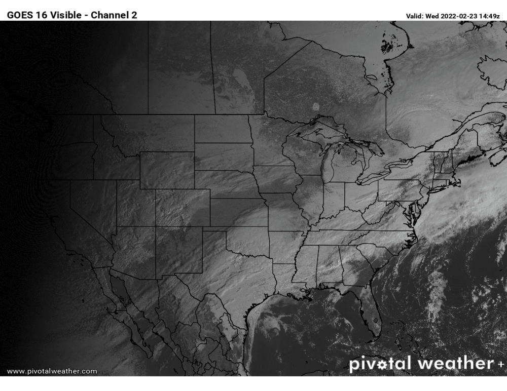
-
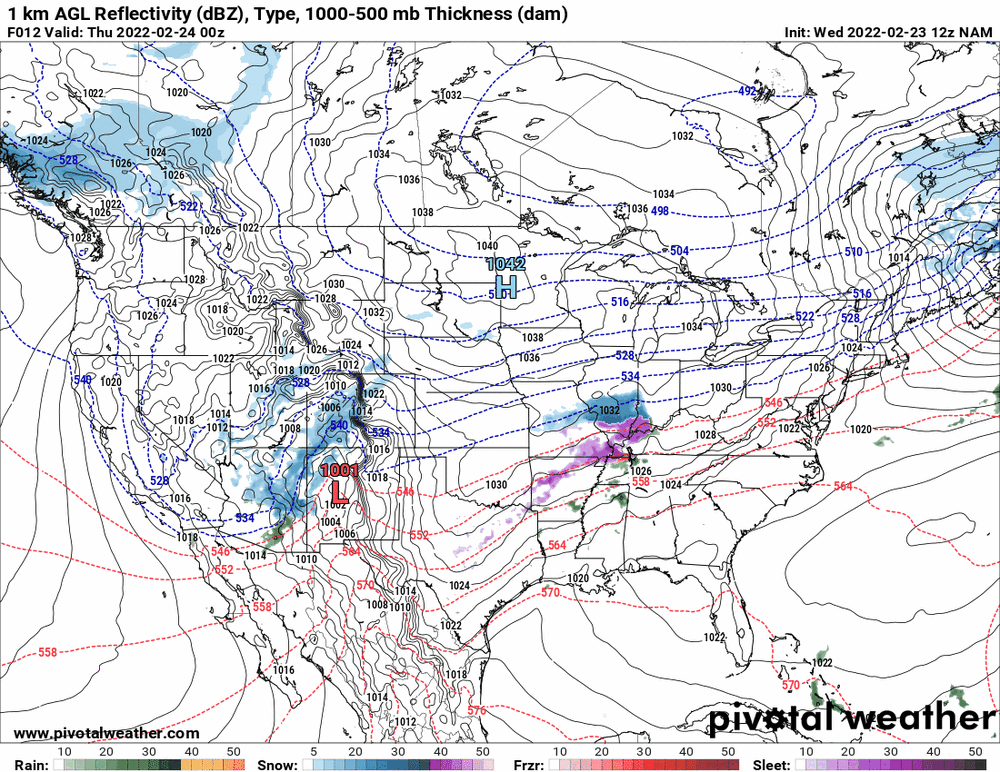
Generally we do switch from a mix to rain down this way but we have a number of members who are from up there and even the closer-in NW 'burbs, so I definitely wouldn't dismiss this. I don't think it will get to be 70 outside of maybe the most southern parts of the CWA (e.g., Delmarva, etc) and that warmth is ahead of the down-sloping caused by an incoming cold front with some serious (but modified as it moves east) cold from the upper MW. Right now, the cold air has just moved across the western PA border from OH (image from NCEP's 9:30 am surface temp obs) and the front is supposed to come through later this afternoon. The high tomorrow is going to be in the low to mid 30s before the event actually starts (which is supposed to be in the afternoon and go overnight). It will be a thread the needle thing depending on where the freezing line sets up.