Hurricane Agnes
-
Posts
9,344 -
Joined
Content Type
Profiles
Blogs
Forums
American Weather
Media Demo
Store
Gallery
Everything posted by Hurricane Agnes
-
E PA/NJ/ DE Winter 2021-22 OBS Thread
Hurricane Agnes replied to JTA66's topic in Philadelphia Region
My final low yesterday was 28 just before midnight after a high of 62. This morning I bottomed out at 23 and am currently mostly sunny and up to 31 with dp 21. -
E PA/NJ/ DE Winter 2021-22 OBS Thread
Hurricane Agnes replied to JTA66's topic in Philadelphia Region
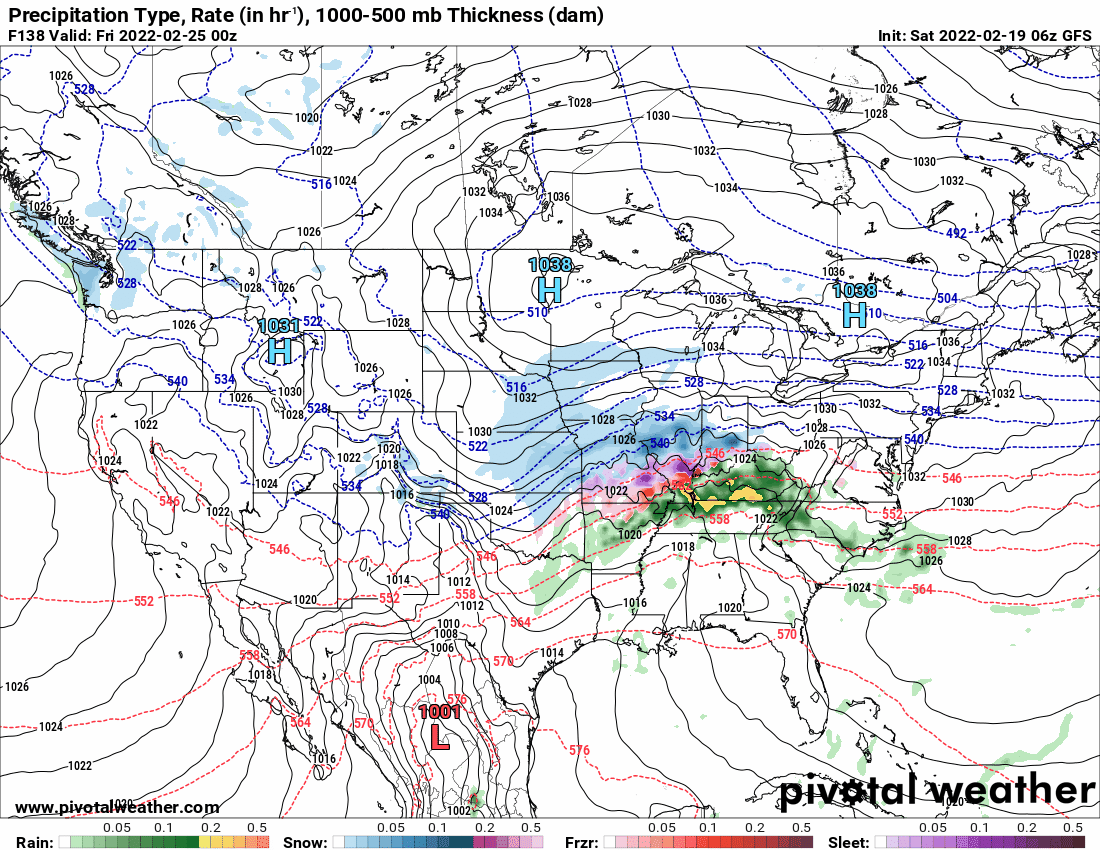
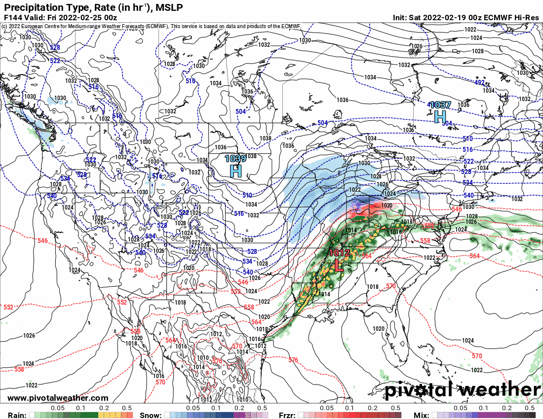
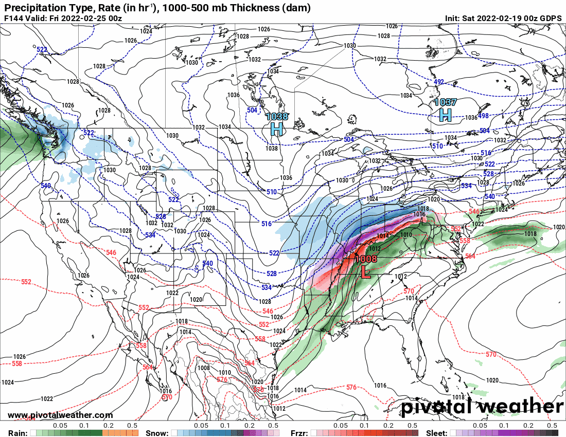
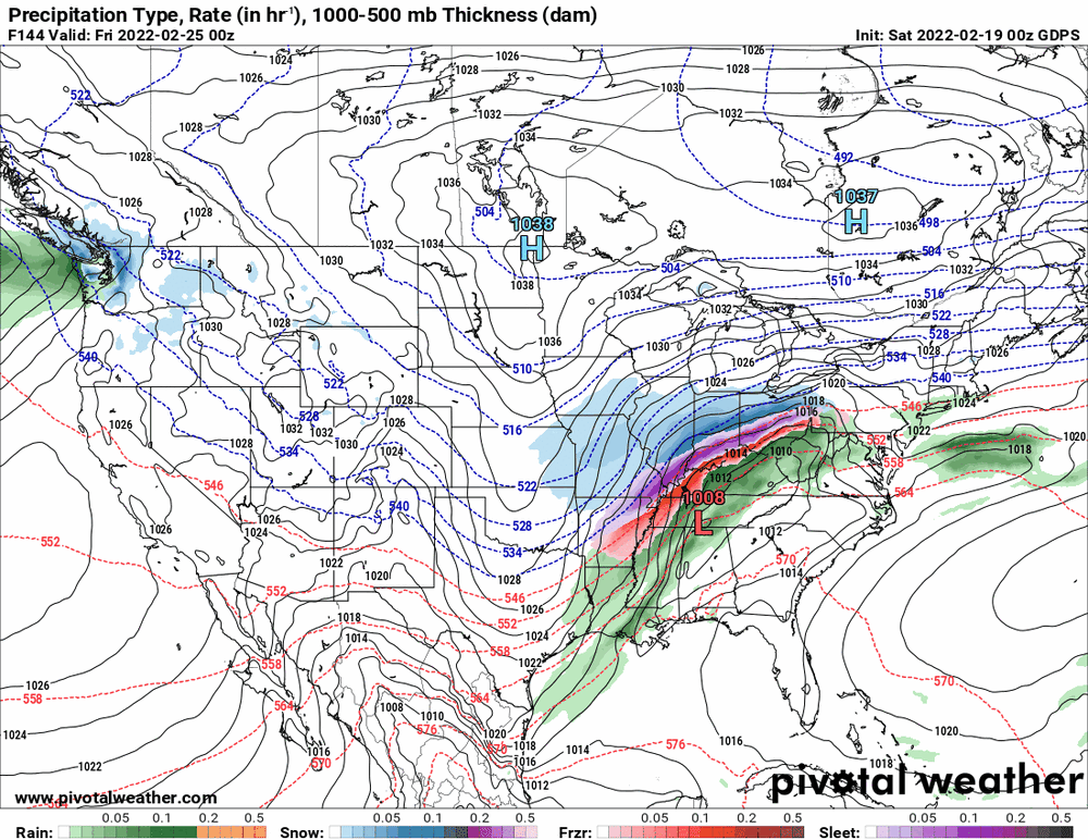
6z GFS and 0z EC for the potential mix storm Feb. 25 - 26 (edited to add the Canadian).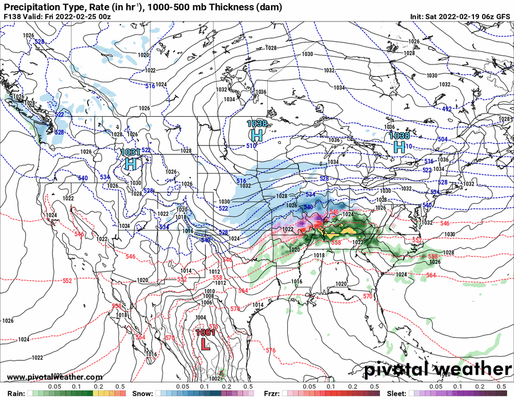

-
E PA/NJ/ DE Winter 2021-22 OBS Thread
Hurricane Agnes replied to JTA66's topic in Philadelphia Region
Temp has dropped further to 42, dp 33, a changeable sky with the sun trying to poke out, and gusty winds. -
E PA/NJ/ DE Winter 2021-22 OBS Thread
Hurricane Agnes replied to JTA66's topic in Philadelphia Region
Now down to 48 but what took the faster hit was the dp, which is now down to 37. -
E PA/NJ/ DE Winter 2021-22 OBS Thread
Hurricane Agnes replied to JTA66's topic in Philadelphia Region
KPNE had a 52 mph gust too! I had an initial drop from 62 to 57 and it has sortof leveled out at 57.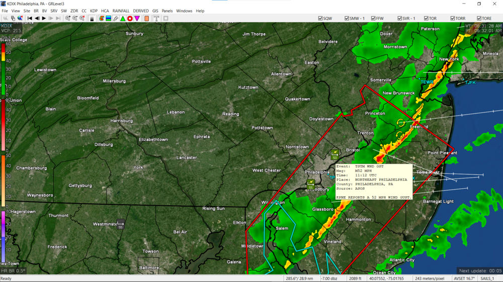
-
E PA/NJ/ DE Winter 2021-22 OBS Thread
Hurricane Agnes replied to JTA66's topic in Philadelphia Region
KPHL reported a 56 mph gust.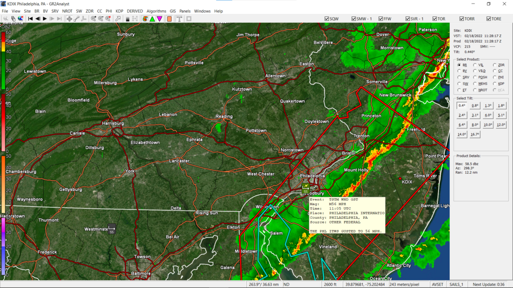
-
E PA/NJ/ DE Winter 2021-22 OBS Thread
Hurricane Agnes replied to JTA66's topic in Philadelphia Region
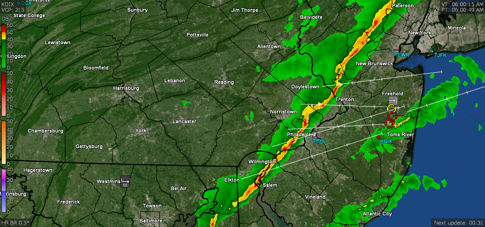
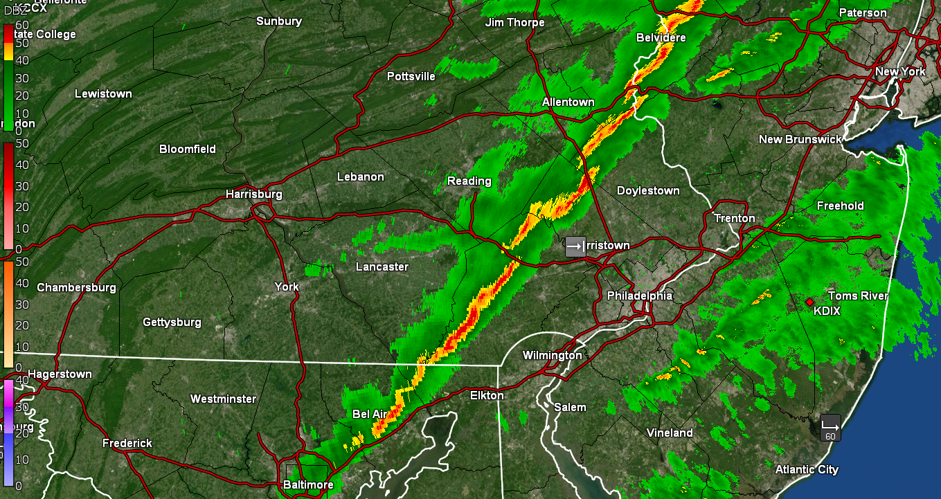
STS issued - (a bit late because the line is past here) -
E PA/NJ/ DE Winter 2021-22 OBS Thread
Hurricane Agnes replied to JTA66's topic in Philadelphia Region
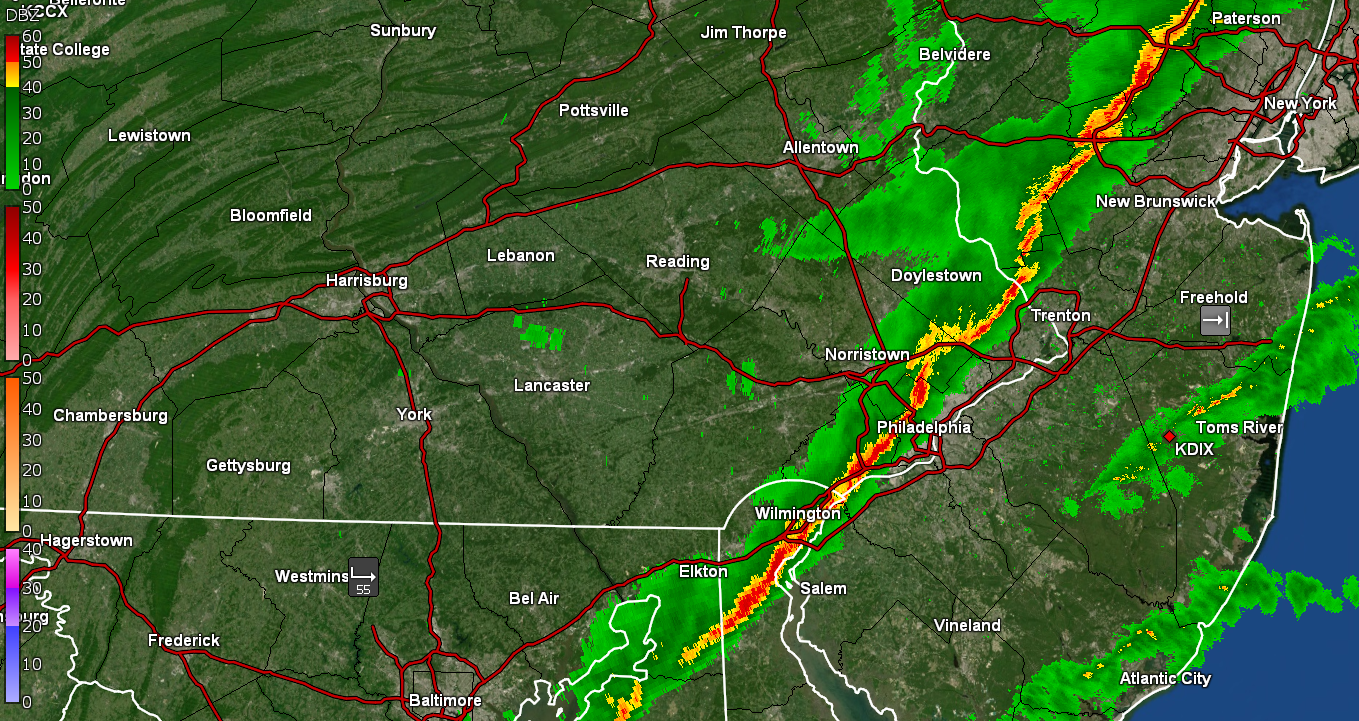
Fast moving line and it is past me now with a max of about 0.66"/hr rates but dropping. Currently have 0.20" in the bucket and the winds are definitely picking up. Temp is dropping as well and now down to 59.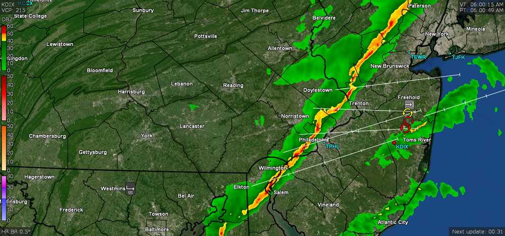
-
E PA/NJ/ DE Winter 2021-22 OBS Thread
Hurricane Agnes replied to JTA66's topic in Philadelphia Region
Starting to get the heavy rain now from the line ahead of the front. Temp 62 with dp 60.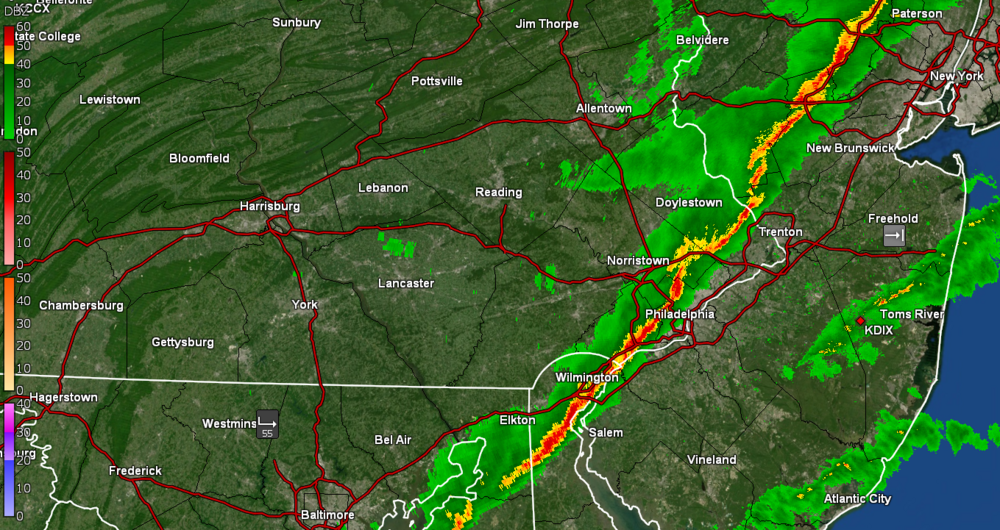
-
E PA/NJ/ DE Winter 2021-22 OBS Thread
Hurricane Agnes replied to JTA66's topic in Philadelphia Region
The line appears to be forming segments. Currently breezy and 62 with dp 60.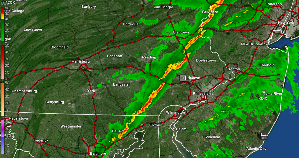
-
E PA/NJ/ DE Winter 2021-22 OBS Thread
Hurricane Agnes replied to JTA66's topic in Philadelphia Region
Mt Holly's analysis of the expected wind event today - -
E PA/NJ/ DE Winter 2021-22 OBS Thread
Hurricane Agnes replied to JTA66's topic in Philadelphia Region
Diurnal low was just after midnight and am now back up to 61, with dp 59 in anticipation of a roller coaster non-diurnal temperature change day. Had 0.13" yesterday and am currently at 0.09" at post time. -
E PA/NJ/ DE Winter 2021-22 OBS Thread
Hurricane Agnes replied to JTA66's topic in Philadelphia Region
SPC has the area in their SWDY1 for Thunderstorms - -
E PA/NJ/ DE Winter 2021-22 OBS Thread
Hurricane Agnes replied to JTA66's topic in Philadelphia Region
Yup - so far, 3 RERs issued (Philly, Reading, Wilmington) - -
E PA/NJ/ DE Winter 2021-22 OBS Thread
Hurricane Agnes replied to JTA66's topic in Philadelphia Region
Looks like I topped out at 65. So far KPHL has tied the record (68F). Currently overcast, stormy-looking and 64 with dp 52. I did see this mention from Mt. Holly about "wet" walks that might have been observed this morning and that answered my question wondering about that since I experienced it here - here -
E PA/NJ/ DE Winter 2021-22 OBS Thread
Hurricane Agnes replied to JTA66's topic in Philadelphia Region
Am now up to 62, partly sunny and breezy, with dp 51. Definitely a huge change from the weekend! -
E PA/NJ/ DE Winter 2021-22 OBS Thread
Hurricane Agnes replied to JTA66's topic in Philadelphia Region
Bottomed out at 41 this morning and am off to the races at 56 at post time, with dp 49 and overcast with a thick layer of high clouds. And yup, the area is under a Wind Advisory. I also saw that Mt. Holly mentioned some records that might be challenged today (also saw it mentioned in the AFT Climo section) - -
E PA/NJ/ DE Winter 2021-22 OBS Thread
Hurricane Agnes replied to JTA66's topic in Philadelphia Region
Had a low of 23 this morning but once the sun was up, the temp began that fast climb until I hit 48 as a high. The south/west-facing snow is pretty much gone but there are still patches on the grassy areas that are more in protected locations and are north/east-facing. The plowed mounds have held their ground though, but with the shrinkage more pronounced. My snowdrops are in full bloom and I did catch a glimpse of the setting Full Snow Moon early this morning. Currently 43 with dp 36 and some persistent high clouds. -
E PA/NJ/ DE Winter 2021-22 OBS Thread
Hurricane Agnes replied to JTA66's topic in Philadelphia Region
I made it to 30 for a high today and much of the snow in the south and west-facing areas, underwent some pretty strong sublimation. The north and east-facing snow pack remains. Currently 24 with dp 9. -
February 1899 Blizzard in Chester County PA
Hurricane Agnes replied to ChescoWx's topic in Philadelphia Region
Okay... am wondering if that was added before he turned it in (I noticed the rounding off of extra decimals for some of the numbers too with the cross-outs - I remember at work if we had to make a change to our worksheets, we would cross the original out, and then add the update but initial and date the modification so it wasn't considered "erased"... just updated ). -
February 1899 Blizzard in Chester County PA
Hurricane Agnes replied to ChescoWx's topic in Philadelphia Region
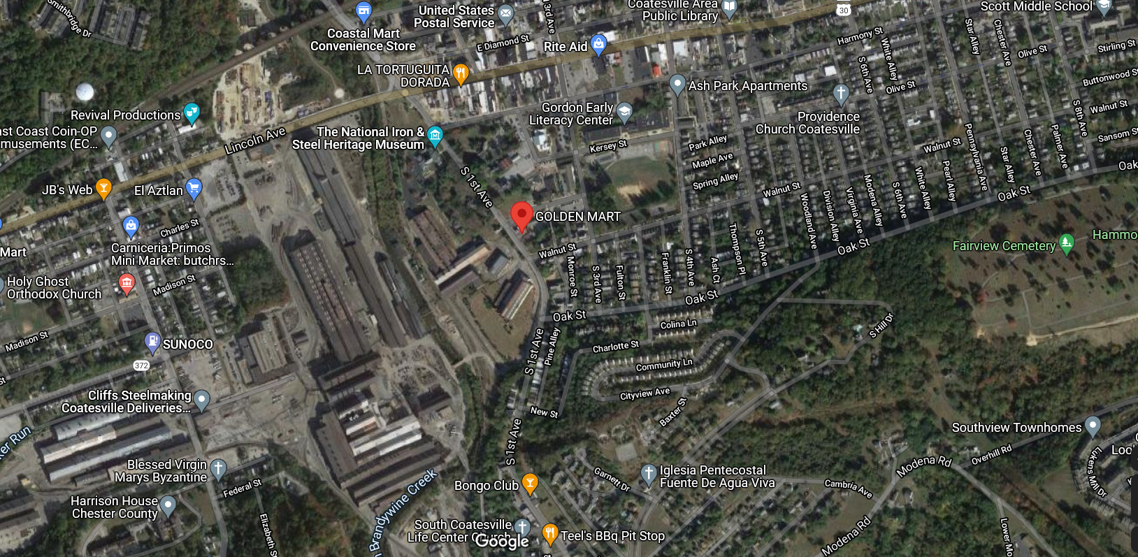
The distance between Coatesville and Kennett Square is 14 miles and between Coatesville and West Chester is 18 miles. Coatesville is also further away (west - ~44 miles) from the city of Philadelphia than either Kennett Square (~39 miles, where Kennett Square is also only 12 miles from Wilmington, DE) or West Chester (~36 miles). Coatesville is also NW of both Kennett Square and West Chester. So not sure what the relevance is? I am about 20 miles from KPHL and am about 13 miles from my old work site downtown Philly (before I retired) that is located near the Delaware River, and it can literally be like day and night (like the last storm). So none of these locations are "close enough" to each other to be that comparative other than West Chester and Kennett Square being closer to each other (about 12 miles apart). And even with those two, the data that you selected is distinctly showing the significant differences between the Kennett Square and West Chester measurements for the 1899 and 1905 storms as it is, so the argument is silly. As a side note - this is what dominated Coatesville in 1899 (big steel mill - Lukens Steel Company) - And the same complex about 30 years later - And believe it or not, based on they guy's reported latitude/longitude, he would have been reporting literally right across from that big steel plant which has the Brandywine Creek running alongside it (unless he was generically reporting the lat/long for the center of the town at that time for the records and he lived further out from there). The below is what the area looks like today with the remnants of that steel plant and that red marker showing the approx. location of that lat/long on his report.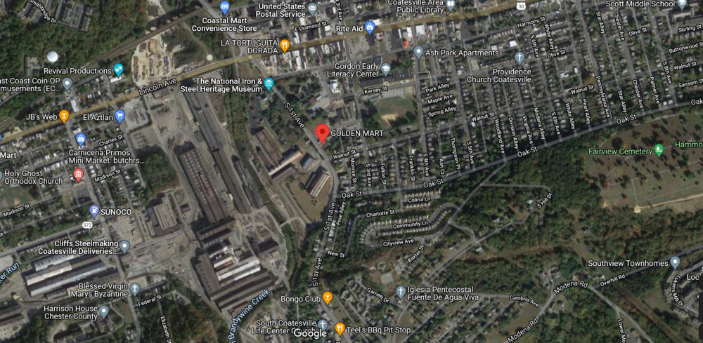
-
February 1899 Blizzard in Chester County PA
Hurricane Agnes replied to ChescoWx's topic in Philadelphia Region
The report image that was posted with that total of 69.8", appears to be the total snowfall for the whole month of February 1899. Based on that report, it was a recording of daily readings with snow having fallen on Feb. 1st, 5th, 6th, 7th, and 8th and then nothing until the blizzard event, where there is a report for Feb. 11th, 12th, 13th, and 14th. And then there was no more snow for the rest of February. So that 69.8" measurement was the total of a bunch of days of snow between Feb. 1st - Feb. 15th, where out of those first 15 days of February, 9 of them produced some kind of snow. There was 1 day in that period where it appears there was some rain (or a mix) and the other 5 days during those first 2 weeks, there was no measurable precipitation. The column for "depth on ground at time of observation" does not appear to be filled out so he apparently measured whatever snow fell each day and then cleared the board for daily individual readings that got totaled at the bottom of the column. I know there is an option to do whatever the depth is (without clearing) to establish what the snow coverage is as it changes from day to day, but he apparently didn't do that and just totaled the individual snowfall readings. With no further snow for the month after the 15th, and that figure got transferred to the far right "Monthly Summary" section for both the pre-printed "15th" (mid-month) total "on the ground" and final monthly "total". There is some "5.24" lightly-written annotation diagonally across the Feb. 12 - 13 entries in that depth column, but I don't know what that means or if it is something that was done by the archivist later in the history of the document because it doesn't appear to match the observer's handwriting. What is fascinating about that report though is that it almost mirrors some of the types of things that happened in 1996 (although 1996 didn't have the brutal cold of 1899).... I.e., there were several little snowfalls around the big one and a warm up in there too - in fact for the 1899 reported record on Feb. 19,20, 21, 22, & 23 the highs were 50, 58, 58, 59, and 50! It looks like it also started out cold on Feb. 16, then the warm air came in and there was 1.20" mix (sleet/rain - and he did list the 16th as being a day with sleet) and then the next couple days registering more light rain. Then more warmth and more sleet/mix (the 26th) and rain (27th). -
February 1899 Blizzard in Chester County PA
Hurricane Agnes replied to ChescoWx's topic in Philadelphia Region
From Mt Holly's records (for the Feb. entries listed on that calendar) - https://www.weather.gov/phi/hist_phi So from the Feb. 11 entry (which gave a summary and total for the 4-day event), they are indicating 44" for Philly, which if the Feb. 12/13 dates are showing each day's measurement, would mean Feb. 11 had the bulk of the snow and would have been 26.3". But from the PDF "Monthly" report from the Weather Bureau (linked in my earlier post) for February 1899, they list PHL having 31.2" for the month (unless that is just indicating what was still "left on the ground" at the end of the month, which would make sense if there were no warmups/rain after that storm). -
E PA/NJ/ DE Winter 2021-22 OBS Thread
Hurricane Agnes replied to JTA66's topic in Philadelphia Region
Am watching the lows this morning but it appears that my low (with 35 minutes still to go before sunrise) has been 12. Currently 13 with dp 7 (and a Full Snow Moon soon to be in the offing for the next couple days). -
February 1899 Blizzard in Chester County PA
Hurricane Agnes replied to ChescoWx's topic in Philadelphia Region
I was scanning Accuweather this morning and saw this story that they had about that storm and extreme cold outbreak - https://www.accuweather.com/en/winter-weather/the-snow-king-blizzard-great-arctic-outbreak-of-1899/1140132 The U.S. Department of Agriculture's Weather Bureau Weather Map for Feb. 13, 1899, shows a large low-pressure system bringing snow from South Carolina to Maine, with temperatures in the Florida Panhandle dipping into the teens and the freezing line (32 F) two-thirds of the way through Florida. NOAA An animation from the 20th Century Reanalysis (V3) project shows estimated mean sea-level pressure in the U.S. between Feb. 12 and Feb. 14, 1899. The strong low-pressure system off the east coast, shown as purple, is the "Snow King" storm. NOAA There was a copy (PDF) of the Weather Bureau monthly summary for February 1899 linked as well, which is here - https://www.ncdc.noaa.gov/sites/default/files/attachments/Monthly-Weather-Review-February-1899.pdf (the Coatesville COOP report is on pg. 75 of the scanned Bureau monthly summary report in the PDF)