Hurricane Agnes
-
Posts
9,344 -
Joined
Content Type
Profiles
Blogs
Forums
American Weather
Media Demo
Store
Gallery
Everything posted by Hurricane Agnes
-
E PA/NJ/ DE Winter 2021-22 OBS Thread
Hurricane Agnes replied to JTA66's topic in Philadelphia Region
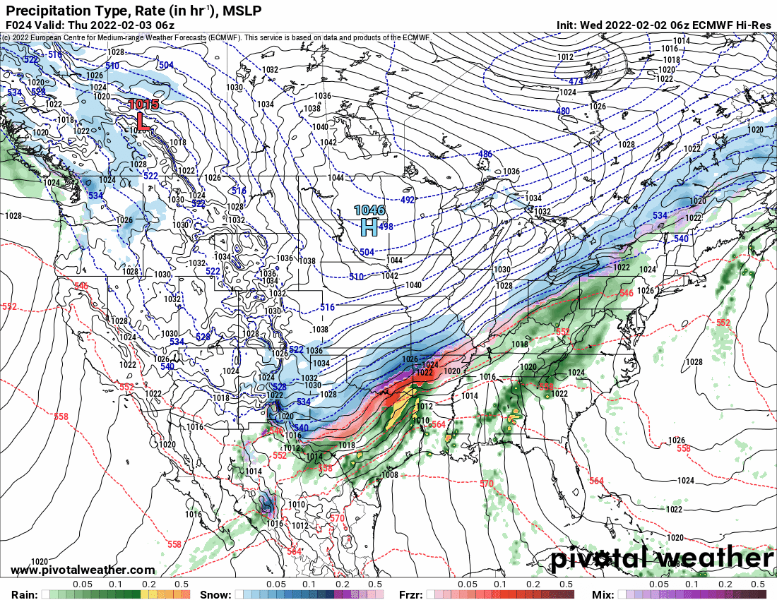
6z Euro warms the column and keeps it rain into Philly metro.
-
E PA/NJ/ DE Winter 2021-22 OBS Thread
Hurricane Agnes replied to JTA66's topic in Philadelphia Region
Well Punxsutawney Phil gave a nod to this subforum. 6 more weeks of winter. -
E PA/NJ/ DE Winter 2021-22 OBS Thread
Hurricane Agnes replied to JTA66's topic in Philadelphia Region
An obs and although progged, I guess I didn't expect it - have some stratus and (freezing) fog settling in with vis < 1/4 mile or so). And yes, it's currently below freezing here with temp 27 (27.3) and dp the same (26.8). -
E PA/NJ/ DE Winter 2021-22 OBS Thread
Hurricane Agnes replied to JTA66's topic in Philadelphia Region
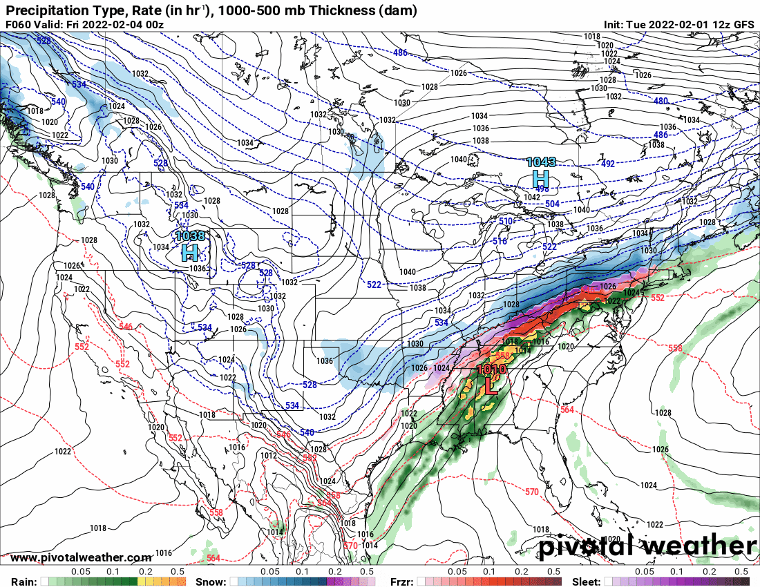
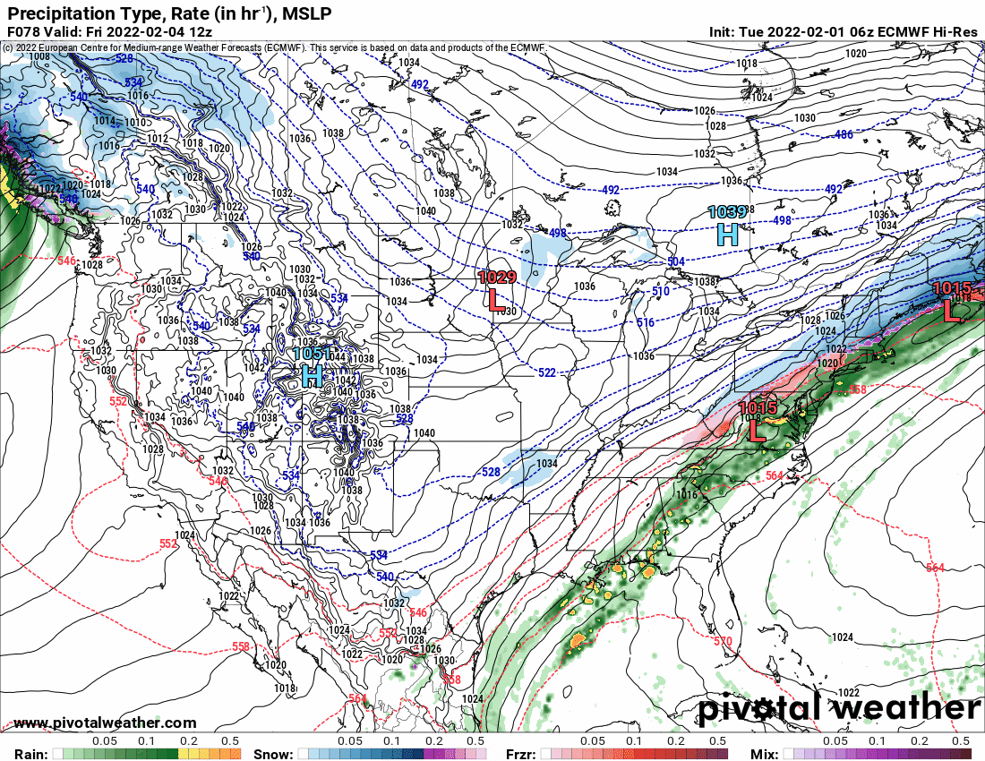
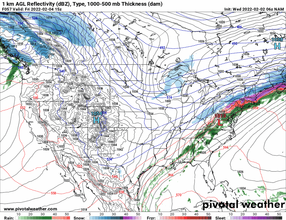
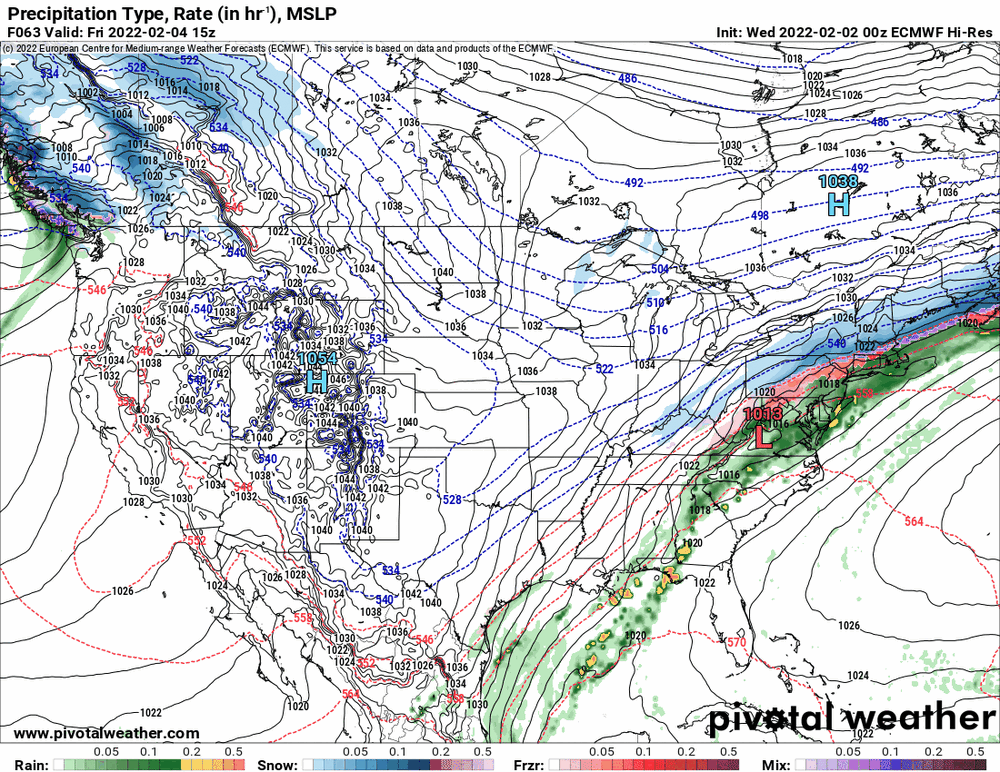
Interesting (and I think Mike suggested this in the AFD) that both the 6z NAM and 0z Euro are generally keeping tomorrow's event as generally rain along the the southern I-95 corridor, shunting the ice/snow across north of that area, where the 6z GFS shows more mix/ice as far south as Philly during the same time frame ("colder").
-
E PA/NJ/ DE Winter 2021-22 OBS Thread
Hurricane Agnes replied to JTA66's topic in Philadelphia Region
As an obs, after a low of 20 this morning, I did make it up to 37 and am currently back down to 30 with dp 25. -
E PA/NJ/ DE Winter 2021-22 OBS Thread
Hurricane Agnes replied to JTA66's topic in Philadelphia Region
Seems the 18z is doubling up the northern high compared to the 12z.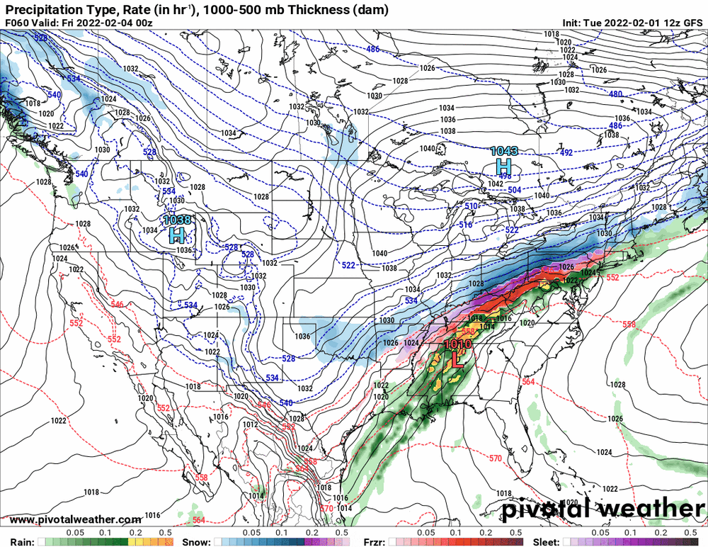
-
E PA/NJ/ DE Winter 2021-22 OBS Thread
Hurricane Agnes replied to JTA66's topic in Philadelphia Region
You are a blast from the past. Hope you are well... I think it is supposed to be colder up that way although more of a possibility of ice and snow than further south. The 18z GFS looks like a stronger and longer-lasting icing system vs the NAM.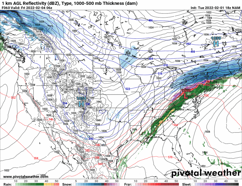
-
E PA/NJ/ DE Winter 2021-22 OBS Thread
Hurricane Agnes replied to JTA66's topic in Philadelphia Region
It kinda stalls the low out for a few beats and then has it do a quarterback sneak over the CWA goal line. The northern high doesn't drop down as much.
-
E PA/NJ/ DE Winter 2021-22 OBS Thread
Hurricane Agnes replied to JTA66's topic in Philadelphia Region
6z Euro is similar to its 0z except the northern high is shifted a bit.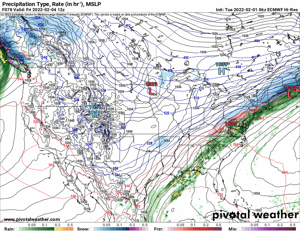
-
E PA/NJ/ DE Winter 2021-22 OBS Thread
Hurricane Agnes replied to JTA66's topic in Philadelphia Region
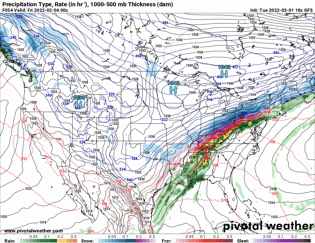
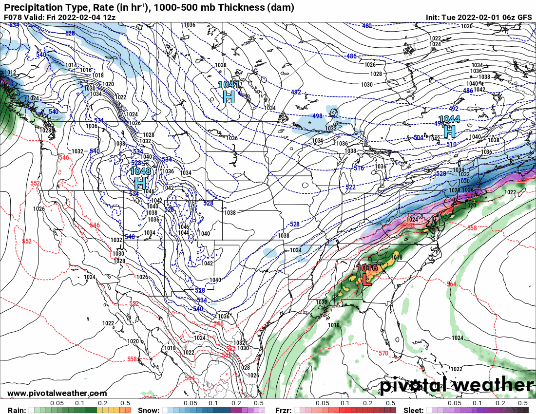
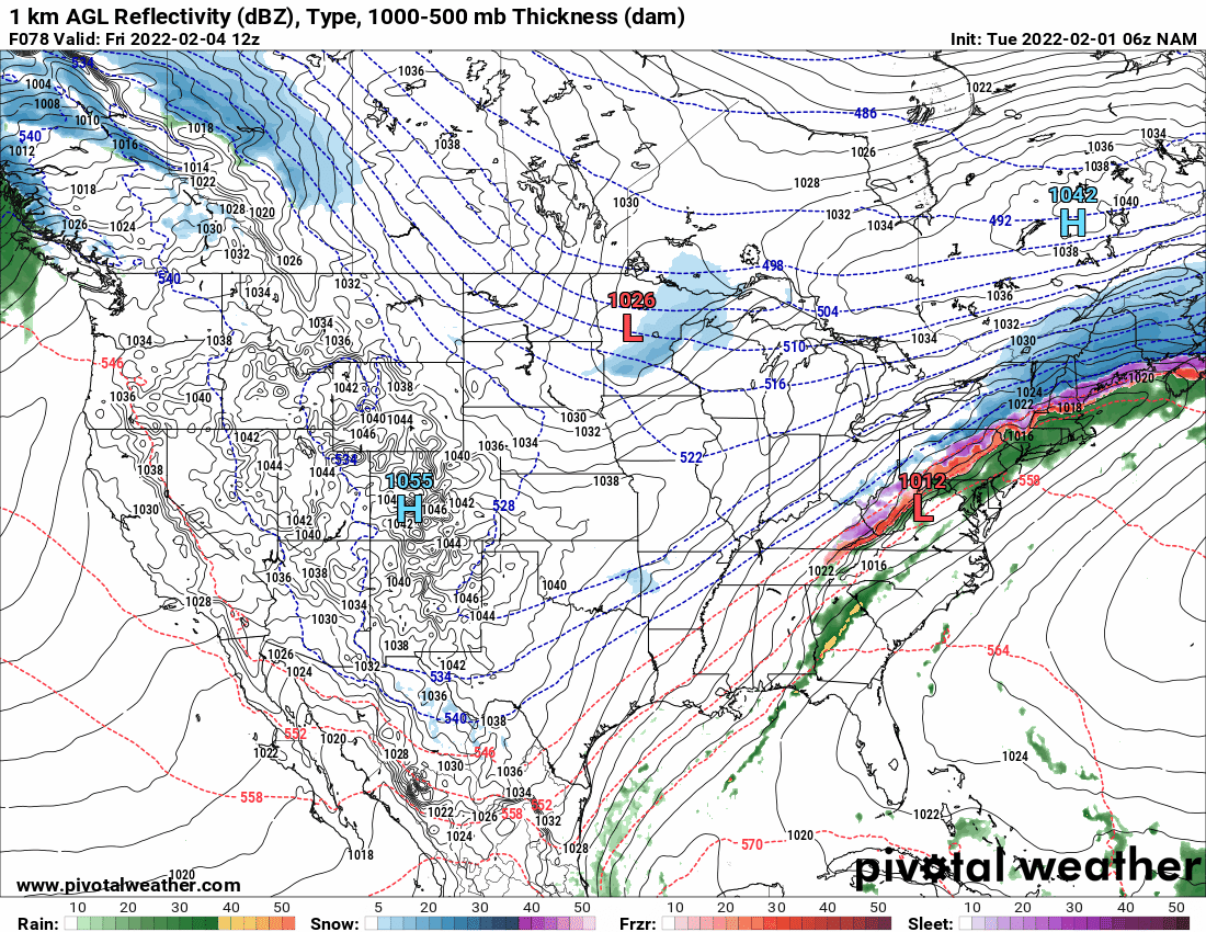
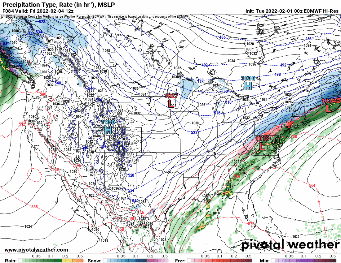
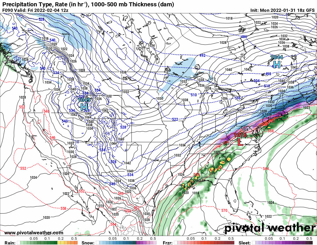
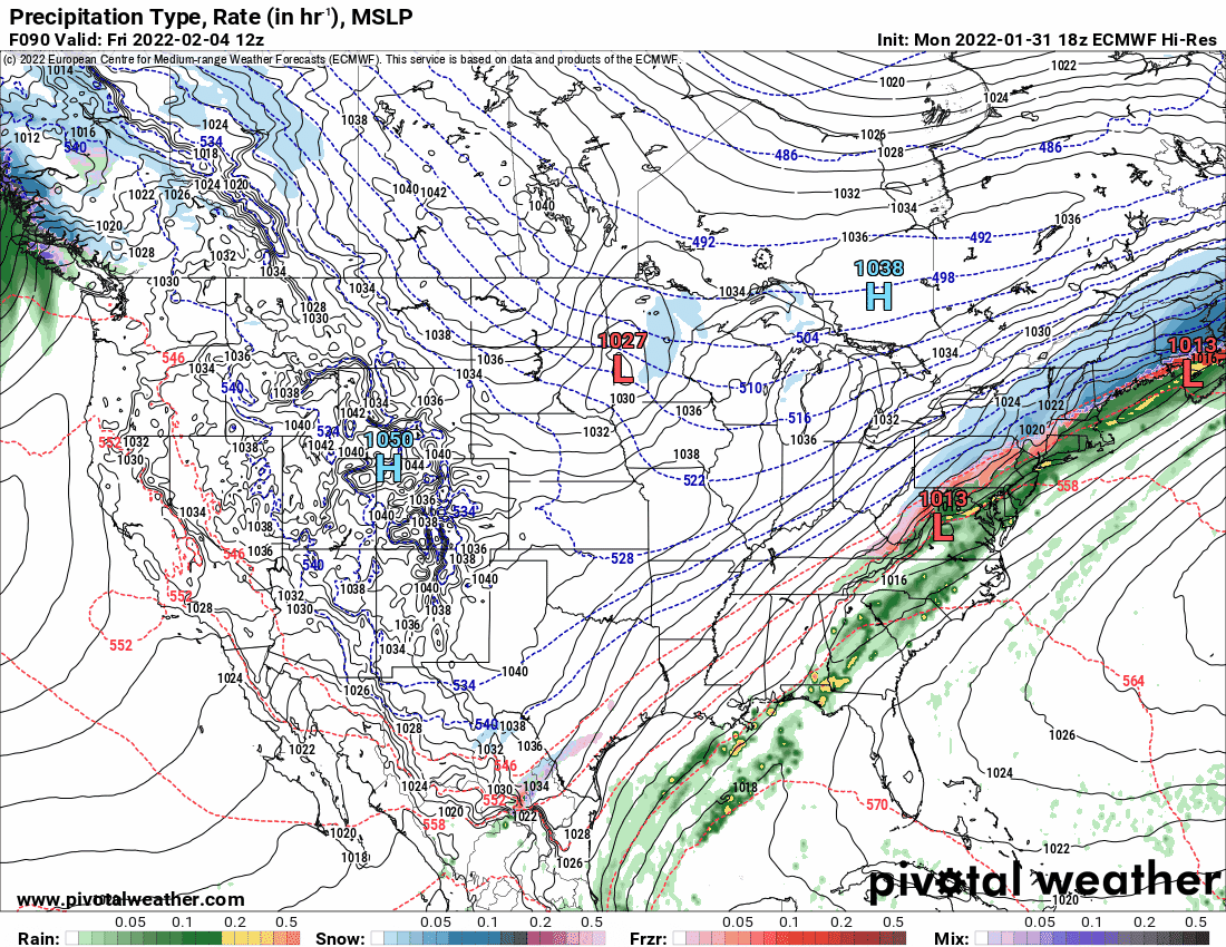
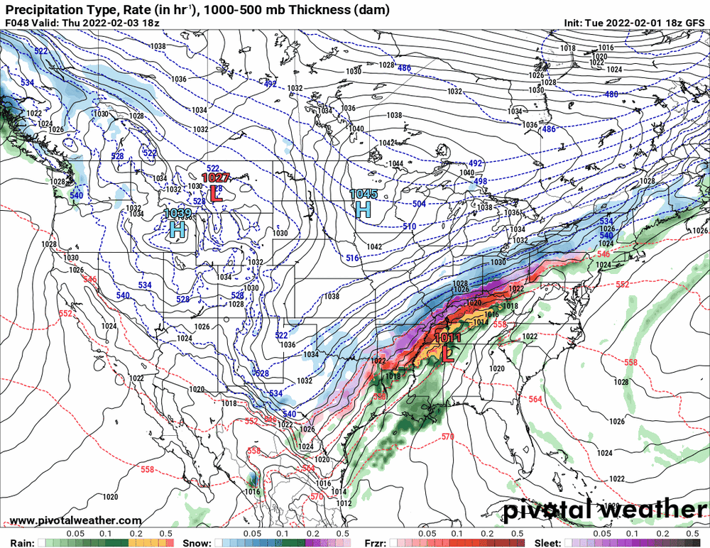
Picking a time frame for the 6z GFS & NAM and 0z EC, the NAM and EC are warmer and GFS continues with the ice threat. Euro has a double-low solution -


-
E PA/NJ/ DE Winter 2021-22 OBS Thread
Hurricane Agnes replied to JTA66's topic in Philadelphia Region
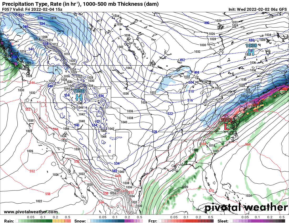
18z GFS vs 18z Euro (from the Euro's last panel) -

-
E PA/NJ/ DE Winter 2021-22 OBS Thread
Hurricane Agnes replied to JTA66's topic in Philadelphia Region
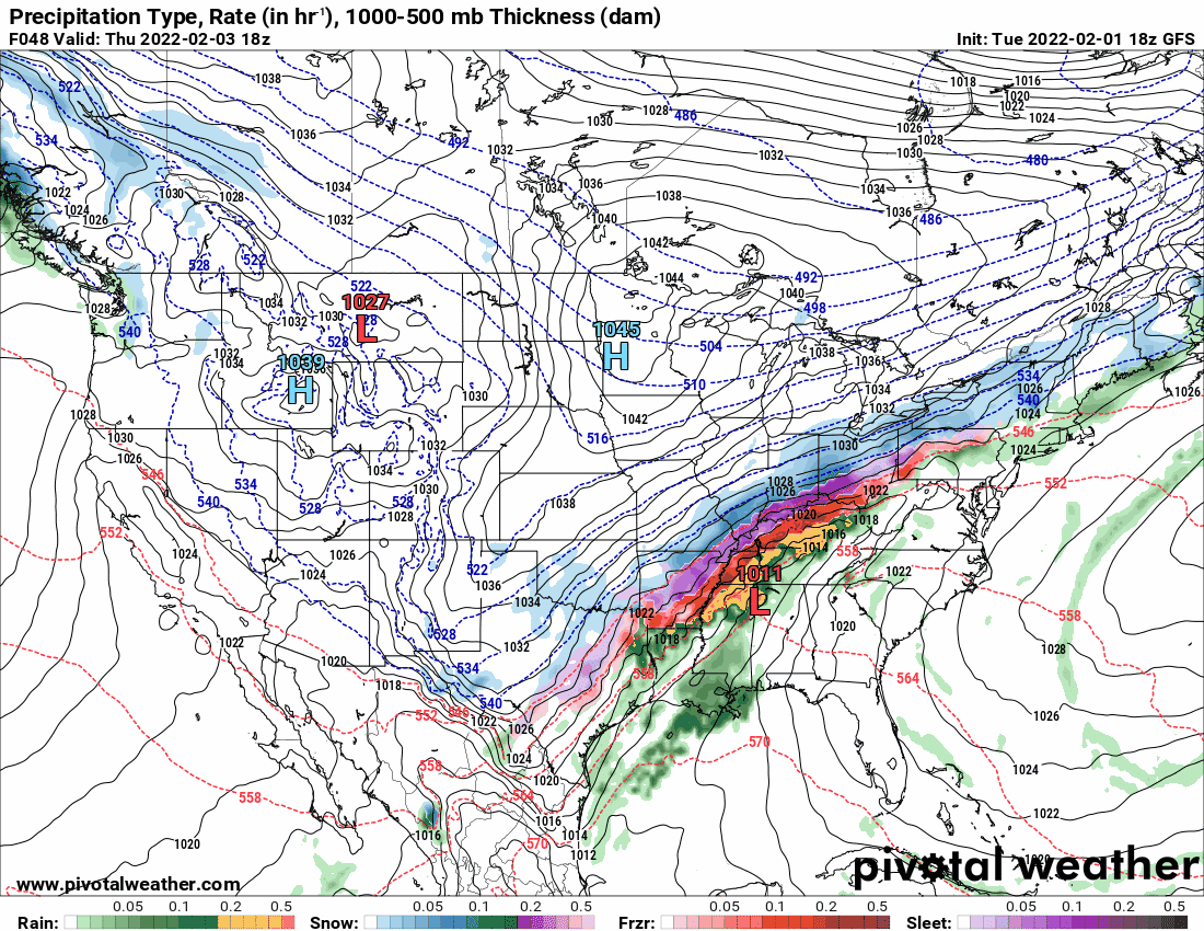
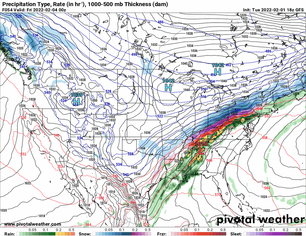
The NAM and GFS 18zs (GFS is still running too). NAM has a little more antecedent rain and appears a tick faster compared to the 12z. Edit to add in the Canadian... running slower than the American models.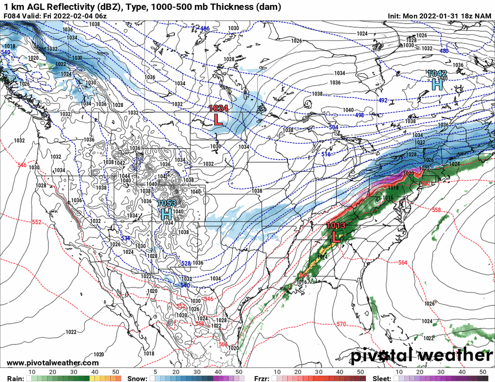
-
E PA/NJ/ DE Winter 2021-22 OBS Thread
Hurricane Agnes replied to JTA66's topic in Philadelphia Region
And the state ran out of consumer (and road) salt! I had to go on a work trip to Baltimore in January '94 during one of what became ~17 ice storms that season, and planned to take Amtrak but drive to the station and park in their garage, so eased on down to 30th St. Station and thankfully decided against getting on I-76 otherwise I would have been trapped there for 8 hours, because the ramps iced up and cars/trucks were stuck and blocked it so no on could get on or off. When I got down to Baltimore, they only had rain and plenty of salt, so I brought back 2 bags of halite in my luggage. 1994 (January 19) was also the last time KPHL recorded a below 0 temp (-5) -
E PA/NJ/ DE Winter 2021-22 OBS Thread
Hurricane Agnes replied to JTA66's topic in Philadelphia Region
Looks like a pear with a big bite out of it! -
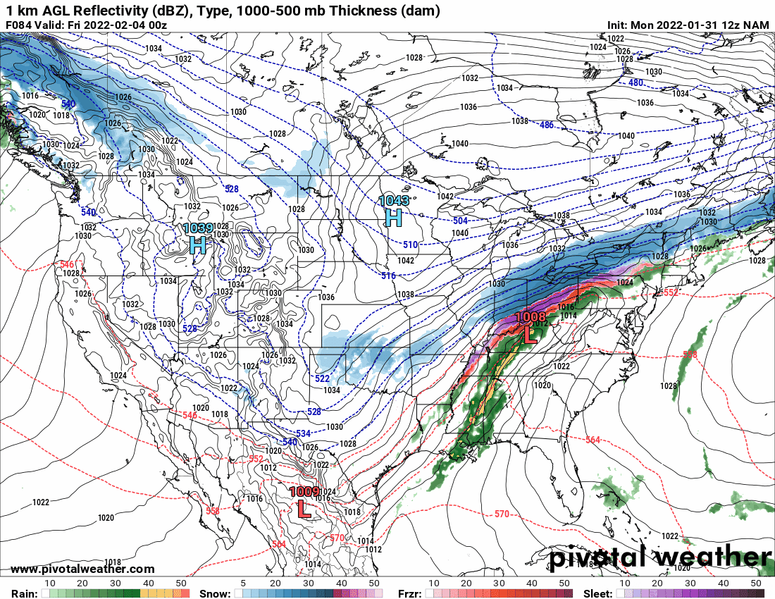
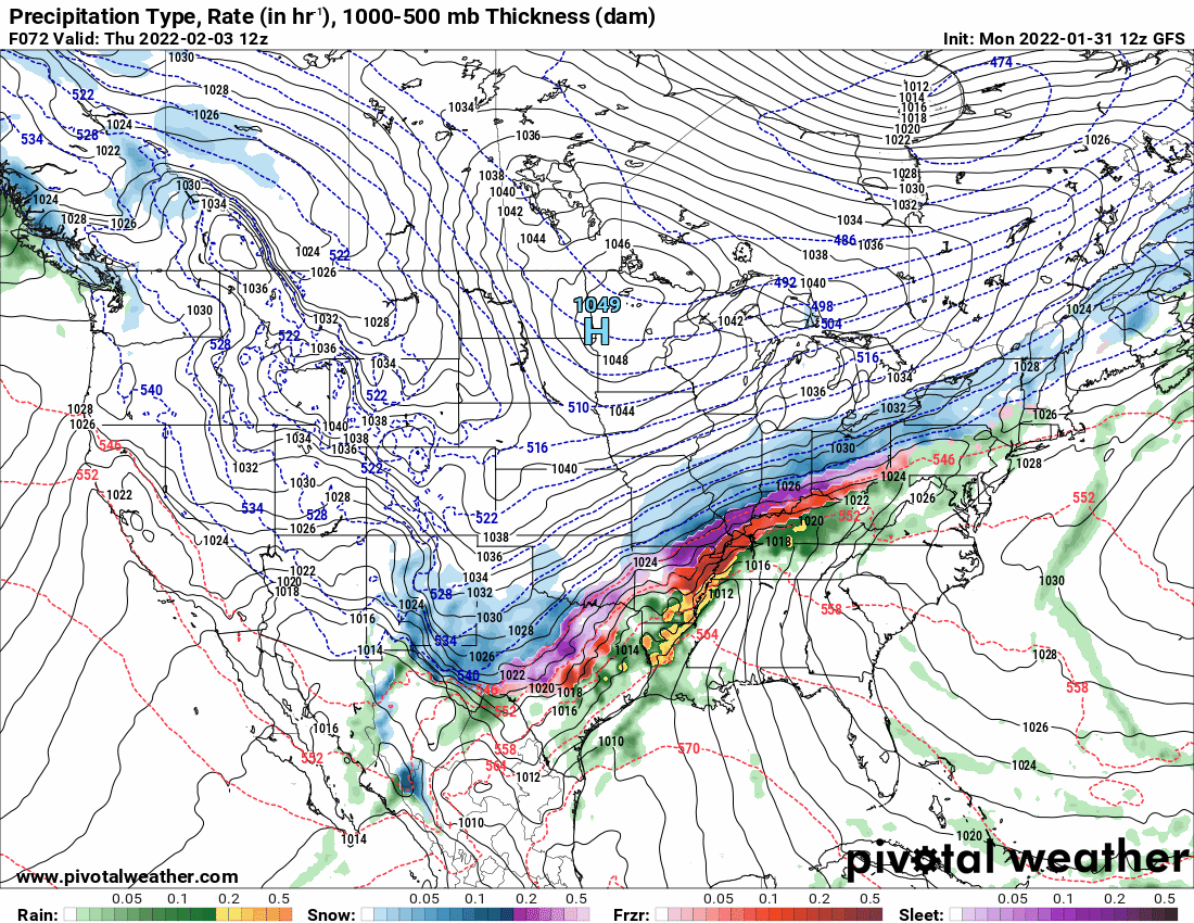
E PA/NJ/ DE Winter 2021-22 OBS Thread
Hurricane Agnes replied to JTA66's topic in Philadelphia Region
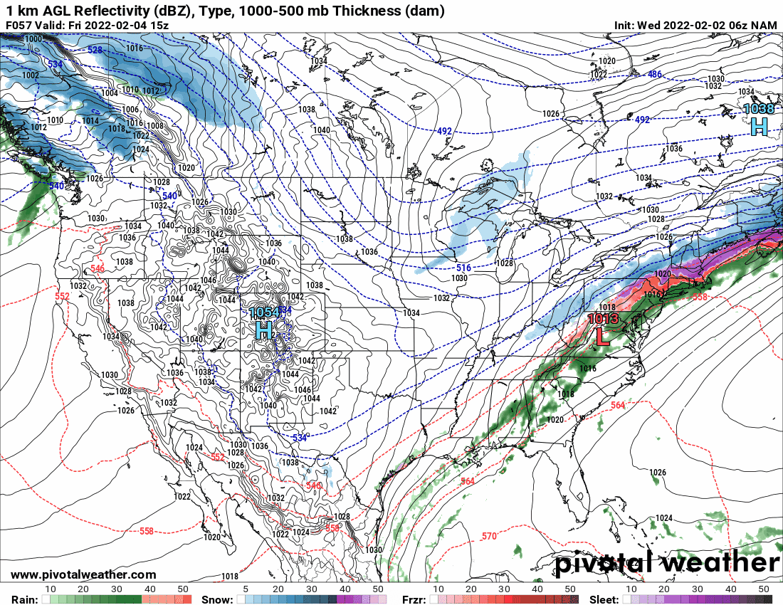
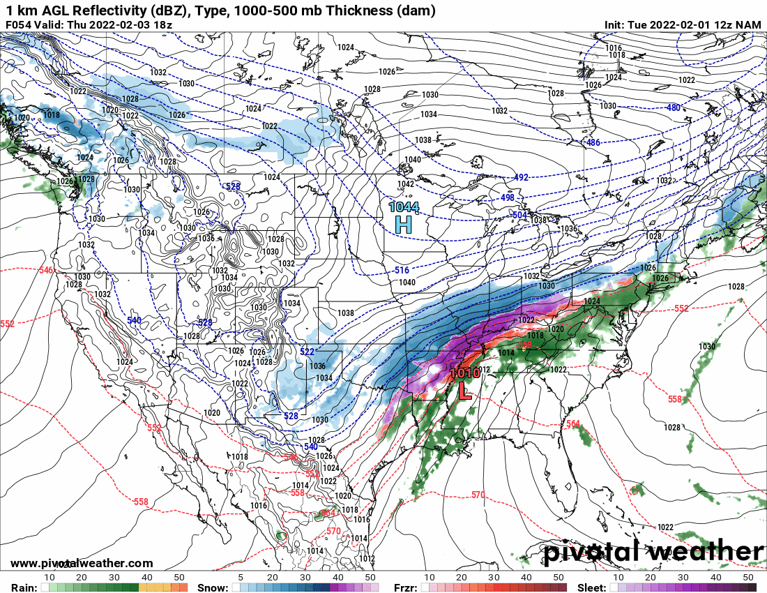
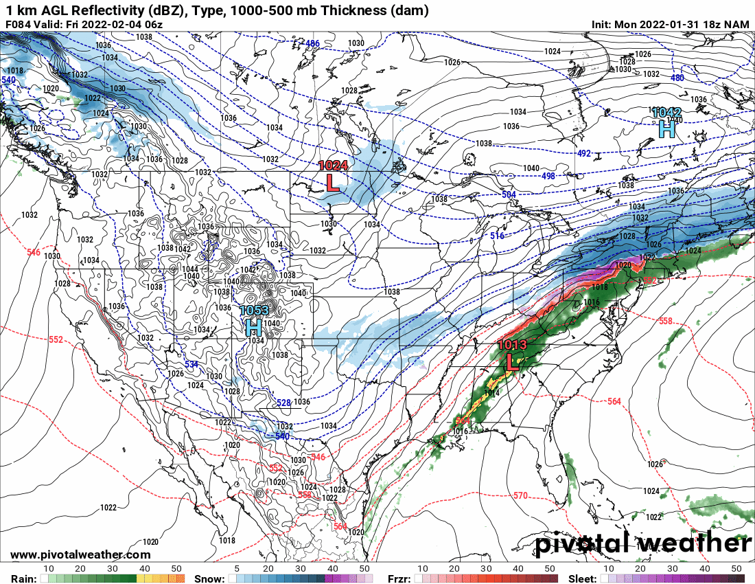
The beginning of it is showing up on the last panel of the 12z NAM.
-
E PA/NJ/ DE Winter 2021-22 OBS Thread
Hurricane Agnes replied to JTA66's topic in Philadelphia Region
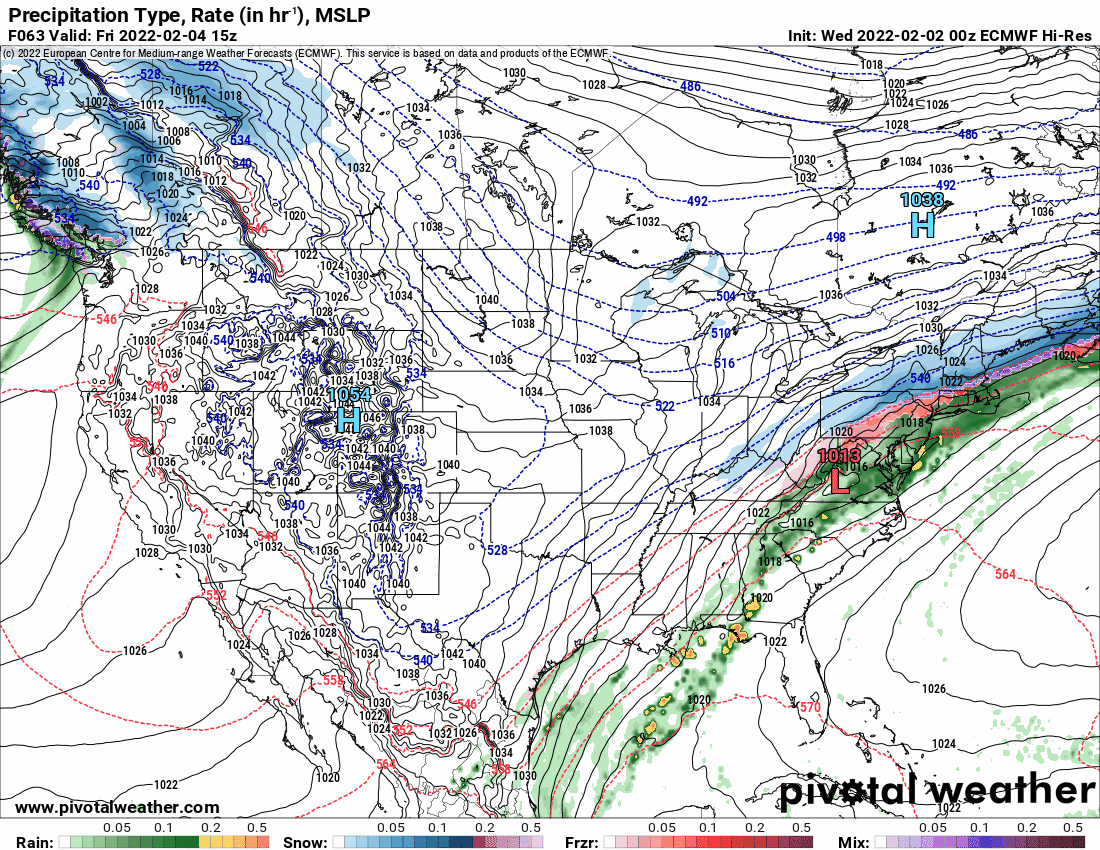
Looks like an overrunning ZR/sleet fest with some snow on top.
-
E PA/NJ/ DE Winter 2021-22 OBS Thread
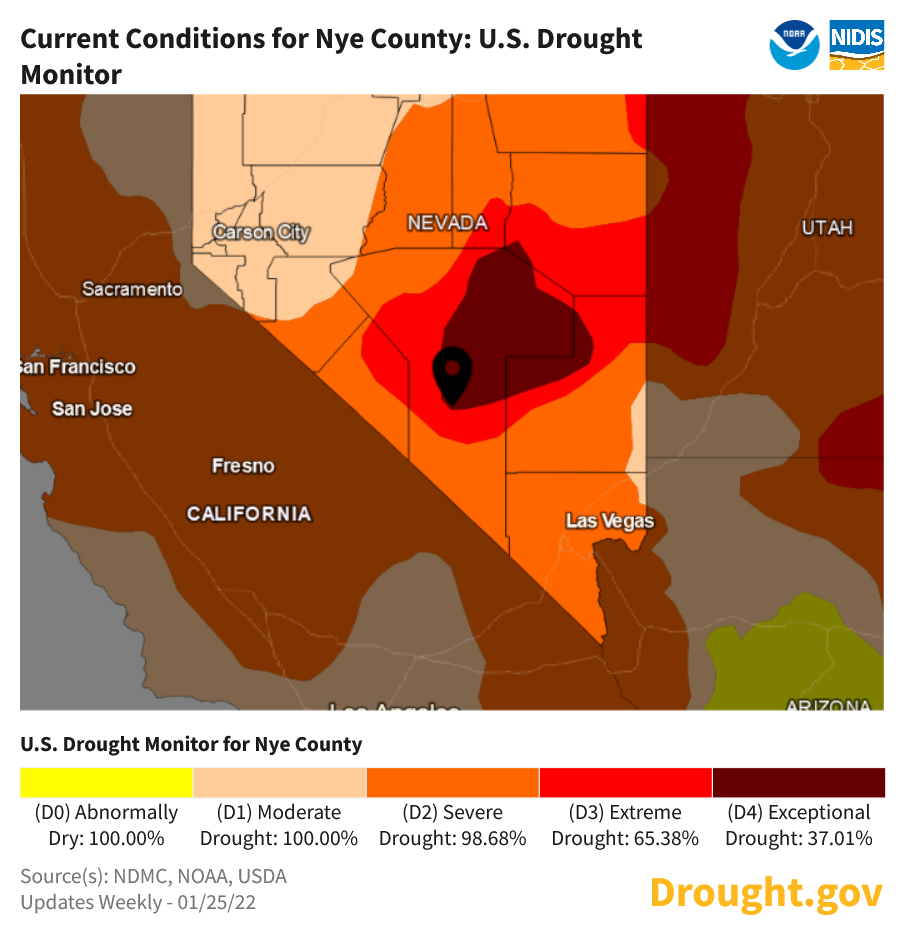
Hurricane Agnes replied to JTA66's topic in Philadelphia Region
Nye County, NV.
-
E PA/NJ/ DE Winter 2021-22 OBS Thread
Hurricane Agnes replied to JTA66's topic in Philadelphia Region
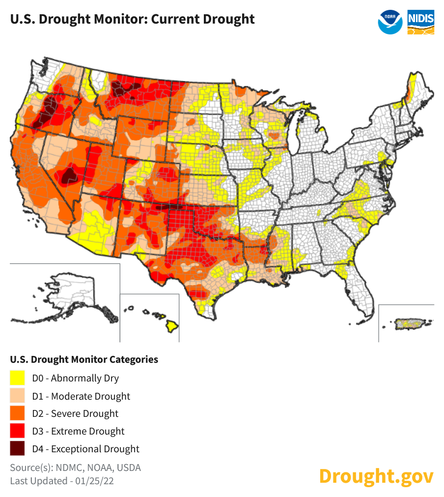
From the same site, there are also areas to your south and west in similar circumstances in terms of "dryness" but none of the areas here in the east are at the "drought" level yet like some spots in VA or in the MW (especially northern WI and MN). I won't even talk about the southwest and west. As an obs, am now up to 27 with dp finally in the double digits at 12.
-
E PA/NJ/ DE Winter 2021-22 OBS Thread
Hurricane Agnes replied to JTA66's topic in Philadelphia Region
Dropped down to 14 this morning as a low and am currently at 22 with dp bopping between 8/9. There was a colorful yellow/orange/reddish sunrise this morning and a deck of cirrus has since been moving in. -
January 28th/29th Event Obs - From KU to FU?
Hurricane Agnes replied to JTA66's topic in Philadelphia Region
I'm hoping others here realize that yours is reflecting a typical "urban" setup for those who even have a patio, terrace, or small back or front yard to take a reading from. Many of the older city row homes (e.g., the huge housing stock of such built in the '20s - '30s through the '50s) have a shared driveway out back with a cement entrance strip to a garage and possibly a strip of grass along the side of that. I.e., something along the lines of this - Those without a garage usually have some sort of small patio out back. Other housing stock of "twins" (semi-deattached) homes may have a larger back/front yard but not by much. Many of the older rim towns have similar housing setups that were built before the advent of the sprawling rancher/split-level/Cape Cod-style housing developments and these older, more densely-built homes may be adjacent to those developments. Unfortunately, much of the criteria strives for "perfect conditions" and that can miss "the reality" of urban/older town dwellers by being biased towards suburban developments and rural areas (whether it is for temperature readings or snow measurements). -
E PA/NJ/ DE Winter 2021-22 OBS Thread
Hurricane Agnes replied to JTA66's topic in Philadelphia Region
Philly's #42! -
E PA/NJ/ DE Winter 2021-22 OBS Thread
Hurricane Agnes replied to JTA66's topic in Philadelphia Region
Made it up to 24 as a high today (low did end up being 10) and was out clearing off the car under a blue sky, noticing that about 1/4 of the snowpack had disappeared (from blowing and insolation/sublimation) - and that was while the temps had mostly been in the low-20s most of the day. Currently 22 with a dp that finally got above 0 and is at 9. -
January 28th/29th Event Obs - From KU to FU?
Hurricane Agnes replied to JTA66's topic in Philadelphia Region
I agree that Mt. Holly did an excellent job trying to deal with what I have continually referenced as the "dancing lows" and the east/west model mayhem that ensued because of that. I live in Chestnut Hill and I saw that report, which was higher than what I measured, although it was done via a "Public" report (not mine) and not by a Co-Op/trained spotter. The neighborhood itself has residences of many types, from small 2-story row homes to large mansions and estates that have horse stables, and all are scattered at many different elevations, including those at the highest points of the city, and that can impact the observations (I expect dependent on whether they are on the windward or lee sides of the hills). I know what is usually joked about with respect to measurements that involve simply sticking a yardstick or ruler through the snowpack to the grass then submitting that (this is what most who are perhaps more than casually following the weather, but who are not quite at the higher "hobby" level of interest, will do)... I know what all is involved with really trying to "do it right" and also know that I have so many hobbies that trying to dedicate to actually doing it on a regular/consistent basis to be part of the "official record", is a pretty significant investment in time. And that includes the need to really live in a place that could meet the criteria for measurements (which many of us in the city do not have the luxury of being in because our properties are not "suburban" with 1/3rd or 1/2 or more acres where snowboards can be placed in an unobstructed location - for example, at least twice the distance away as the height of the house and other "obstacles", etc.). Most who live in urban locations have no backyard at all and may just have a roof terrace or have postage stamp sized backyards or patios or courtyards, myself included. And you saw a pic from the guy in South Philly (I presume taken from his window) looking out on what was probably a 1-way, 1 lane South Philly street with parking on one side, and a typical row of 3-story older "townhouse" style/front-stoop houses that might only have a small yard or paved courtyard out back. But it's a good experience to get the IMBY readings - and in my case as an avid gardener (particularly container plants including tropicals, subtropicals, and tender perennials) - the weather is a critical factor in the success of those plants surviving and thriving. -
E PA/NJ/ DE Winter 2021-22 OBS Thread
Hurricane Agnes replied to JTA66's topic in Philadelphia Region
Am now up to 12 but dp is still below 0. Have to change out the humidifier filters because they got worn out the past couple weeks (even with flipping and periodically re-soaking). The forced air heat does a number on the humidity in here. -
E PA/NJ/ DE Winter 2021-22 OBS Thread
Hurricane Agnes replied to JTA66's topic in Philadelphia Region
Temp here slowly dropped to 10 after midnight and has stayed steady through the early morning. Currently, about 10 minutes after sunrise, it is 10 with dp still below 0 at -1.