Hurricane Agnes
-
Posts
9,344 -
Joined
Content Type
Profiles
Blogs
Forums
American Weather
Media Demo
Store
Gallery
Everything posted by Hurricane Agnes
-
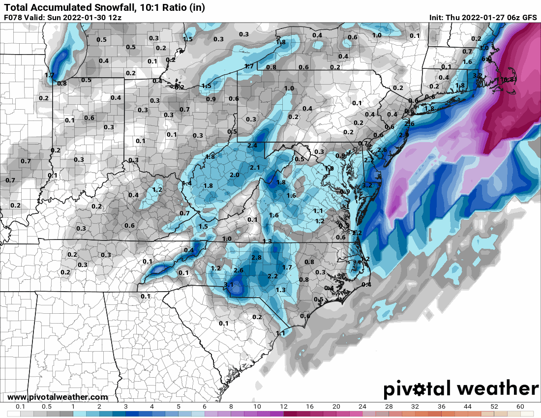
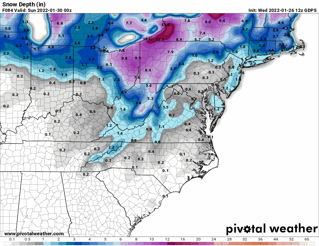
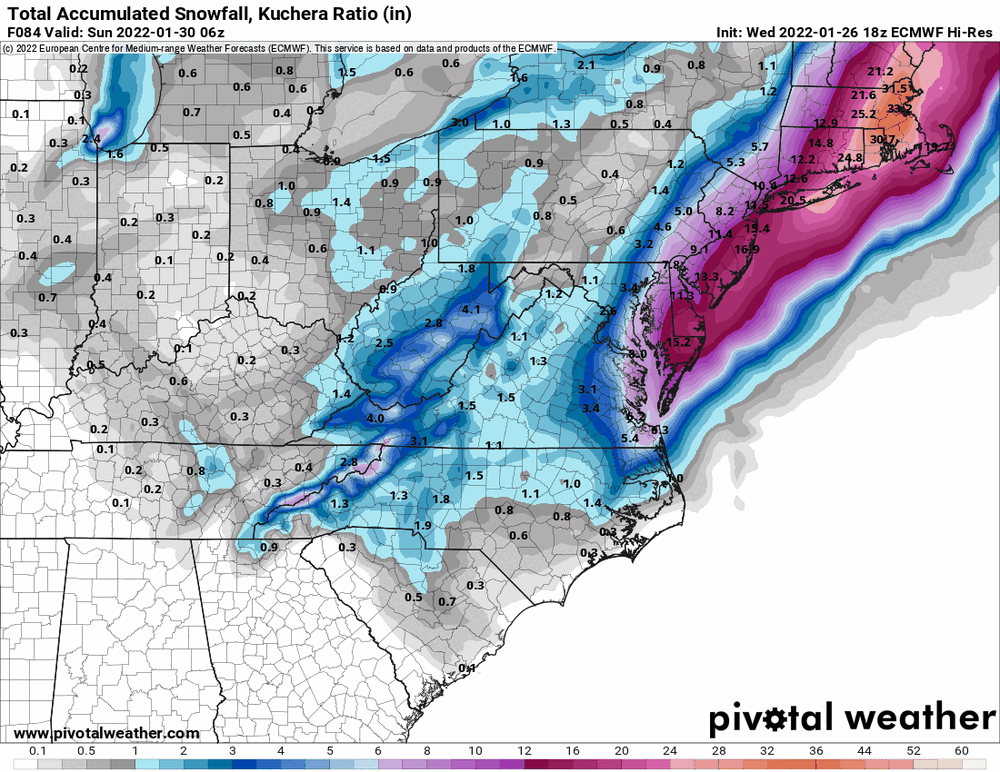
January 28th/29th Event Obs - From KU to FU?
Hurricane Agnes replied to JTA66's topic in Philadelphia Region
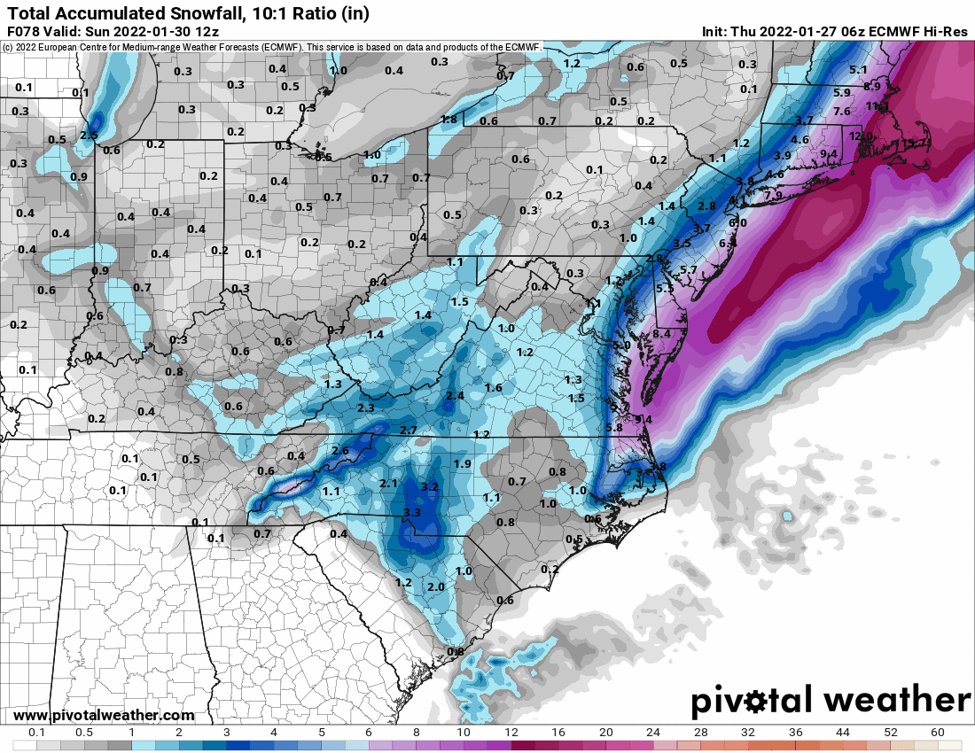
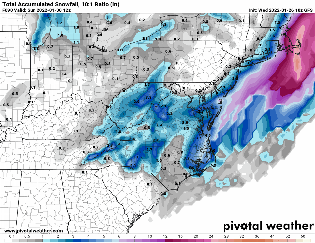
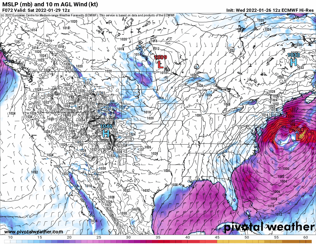
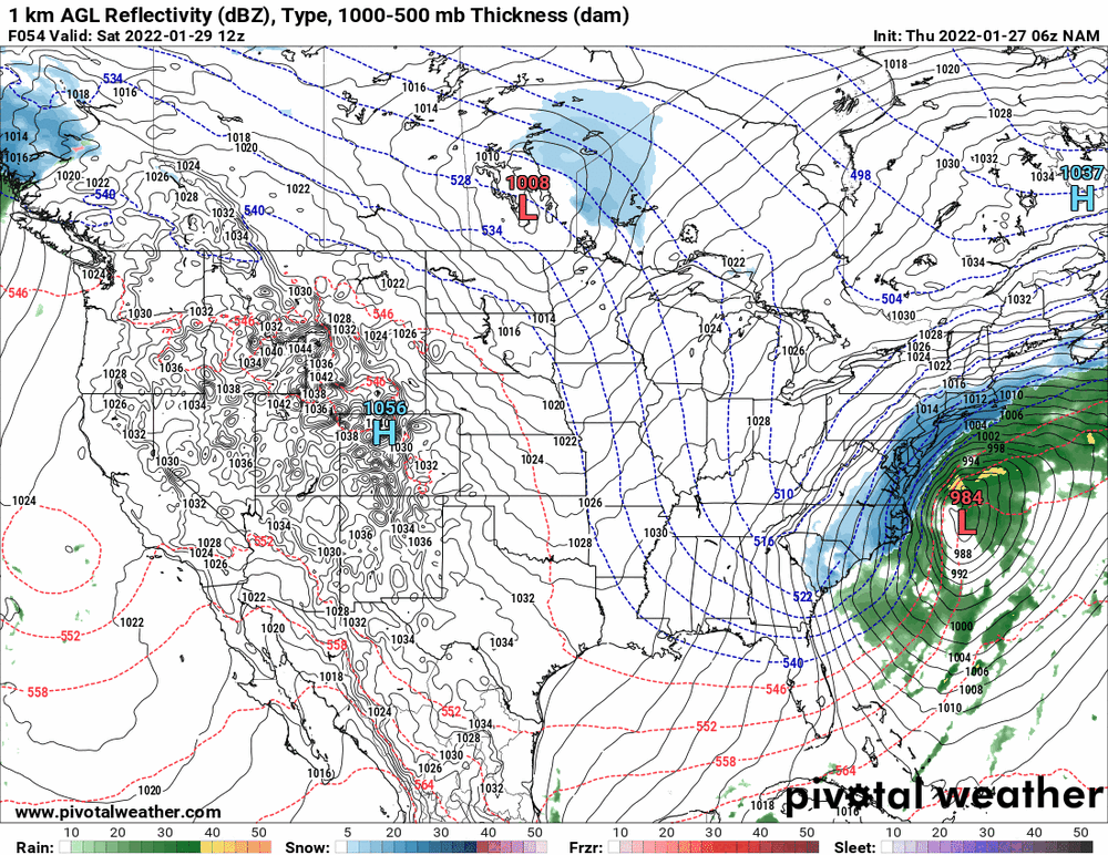
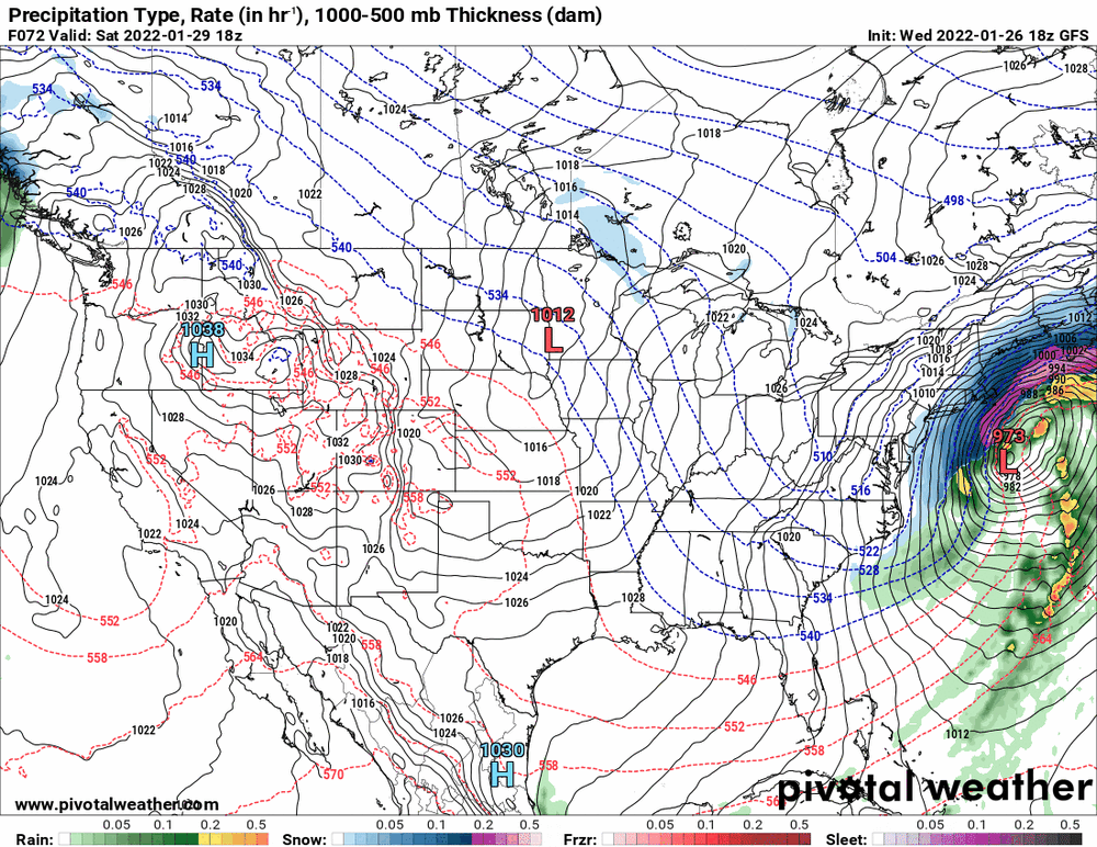
6z Euro and its snow map.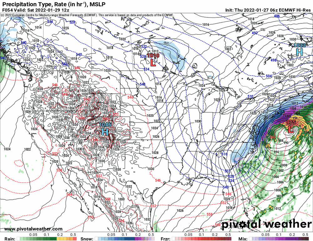

-
E PA/NJ/ DE Winter 2021-22 OBS Thread
Hurricane Agnes replied to JTA66's topic in Philadelphia Region
It's all calculus! I had to take 3 semesters in college as a chem major and in the case of these models, it's all multi-variable calculus (and then they add the statistics piece in). -
E PA/NJ/ DE Winter 2021-22 OBS Thread
Hurricane Agnes replied to JTA66's topic in Philadelphia Region
In this forum, people are sometimes afraid to do it lest they jinx it! I know Paul did the last couple. You could go ahead and start one since we are a bit more then 2 days out from start time. -
E PA/NJ/ DE Winter 2021-22 OBS Thread
Hurricane Agnes replied to JTA66's topic in Philadelphia Region
Thanks! What that basically does is get into the weeds about how "mother nature" "must come into equilibrium" and shows the mechanisms (and equations) to explain how that happens with "weather". Adjacent high pressure and low pressure will "move" to try to equalize and come to some sort of "steady state". Same goes for differing temperatures and humidity. I kind of compare that (as the "macro" application) with what goes on with the ideal gas law too - PV=nRT. -
E PA/NJ/ DE Winter 2021-22 OBS Thread
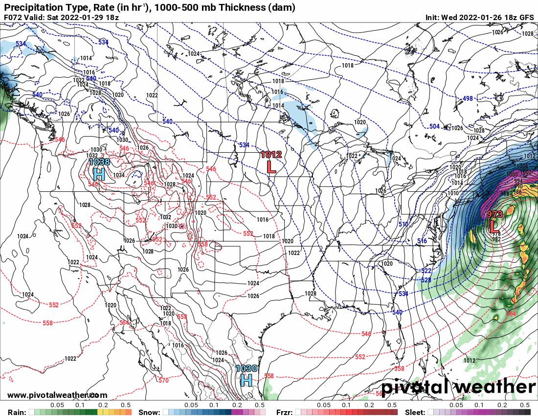
Hurricane Agnes replied to JTA66's topic in Philadelphia Region
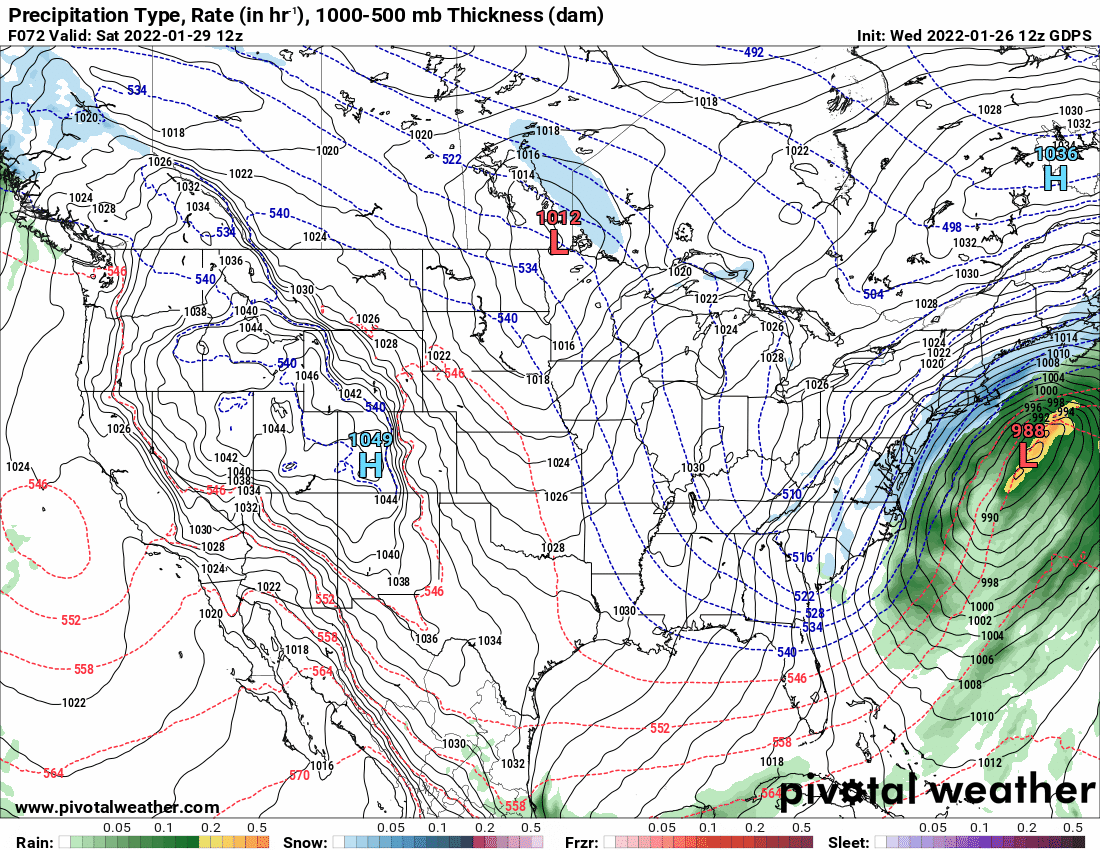
The Euro and NAM were also doing that "hot potato" move of the low from one place to another earlier and it seems it might have to do with some "double-barrel" / pair of lows that were in play. The earliest depictions had some weak low strolling along the southern U.S. moving due east, and off the coast of FL, and then "something happens" and that low fades and a new low forms off the coast of the Carolinas... And somewhere along the line, there is this far-away interaction in the atmosphere between the remnants of the old low and the newly-formed one and then that whole mess gets dragged up the coast along the jetstream. You then see what I call a "sloppy" system of convection slapping around a core and periodically stretching and contracting and undulating just off the coast. I know that description probably sounds silly. But that is exactly what it "looks like" after running the animations over the past few days. -
E PA/NJ/ DE Winter 2021-22 OBS Thread
Hurricane Agnes replied to JTA66's topic in Philadelphia Region
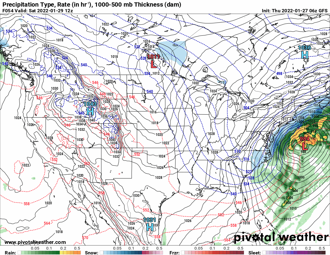
Battle of the cutoffs for the 6zs. And as a quick obs, my low may end up being 13 (it's been wavering around that). Currently 14 with dp 8.

-
E PA/NJ/ DE Winter 2021-22 OBS Thread
Hurricane Agnes replied to JTA66's topic in Philadelphia Region
0z Euro pretty much stayed put compared to the earlier 18z.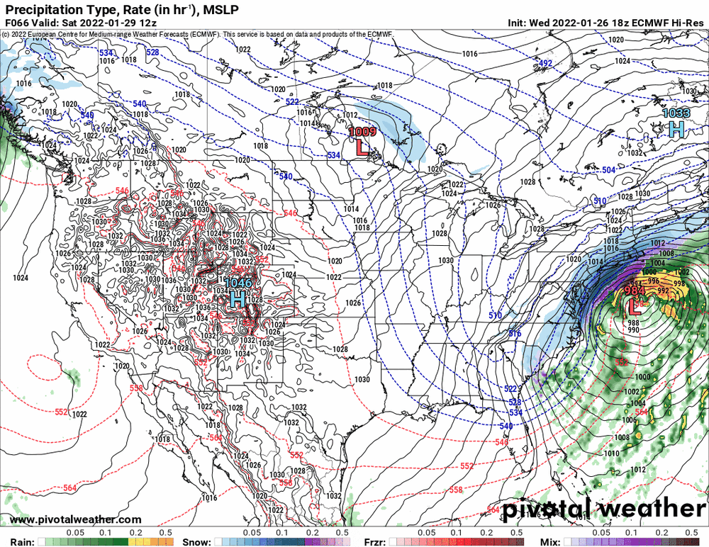
-
E PA/NJ/ DE Winter 2021-22 OBS Thread
Hurricane Agnes replied to JTA66's topic in Philadelphia Region
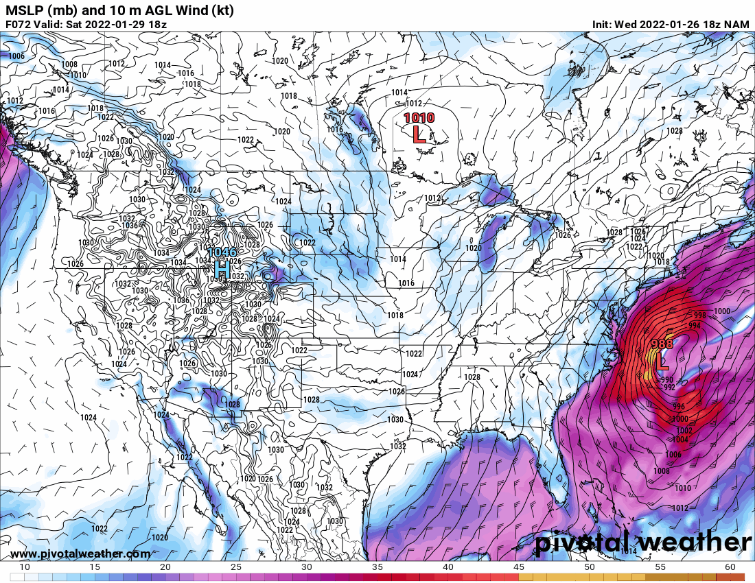
NAM did the opposite of the GFS by speeding up the low in the 6z.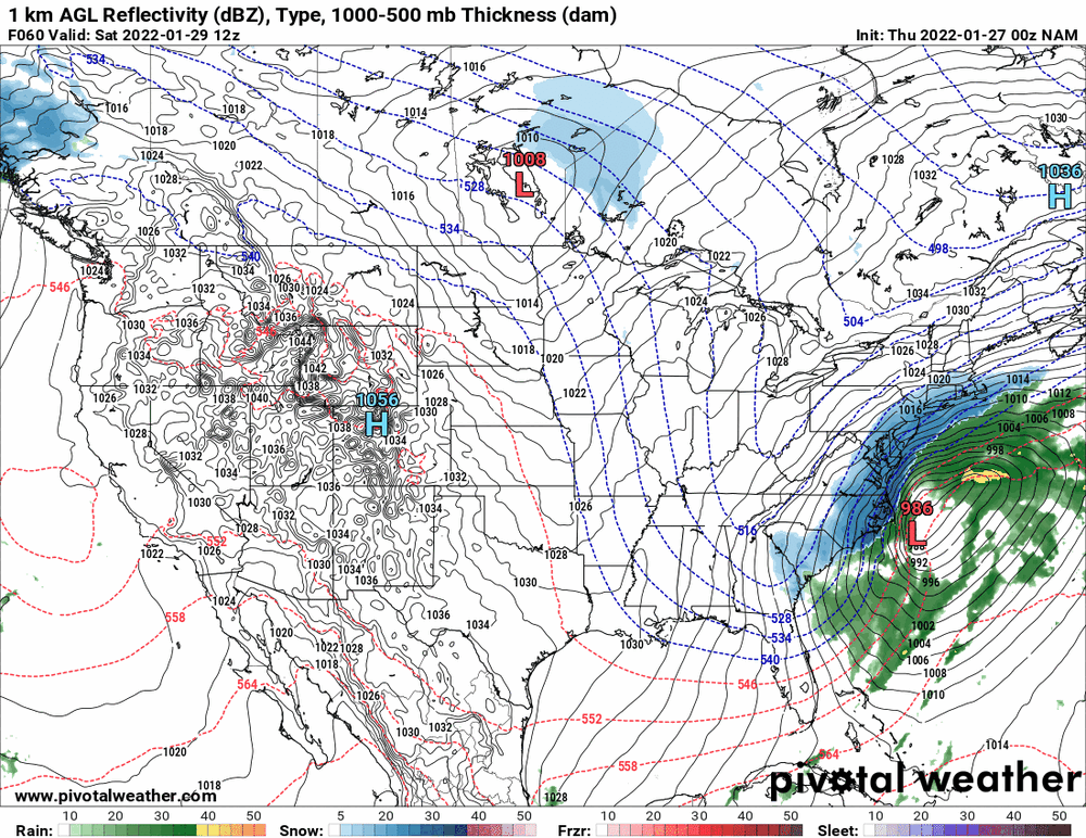
-
E PA/NJ/ DE Winter 2021-22 OBS Thread
Hurricane Agnes replied to JTA66's topic in Philadelphia Region
The 6z GFS brought the low a bit west compared to the 0z and slowed it down.

-
E PA/NJ/ DE Winter 2021-22 OBS Thread
Hurricane Agnes replied to JTA66's topic in Philadelphia Region
Mt. Holly's latest hot off the press - I thought the below tweet was hilarious! -
E PA/NJ/ DE Winter 2021-22 OBS Thread
Hurricane Agnes replied to JTA66's topic in Philadelphia Region
-
E PA/NJ/ DE Winter 2021-22 OBS Thread
Hurricane Agnes replied to JTA66's topic in Philadelphia Region
At least the low in this latest depiction isn't slapping around itself like a zombie.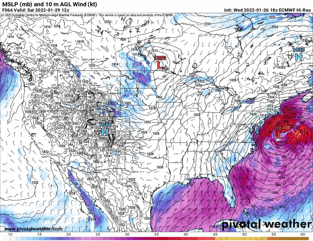

-
E PA/NJ/ DE Winter 2021-22 OBS Thread
Hurricane Agnes replied to JTA66's topic in Philadelphia Region
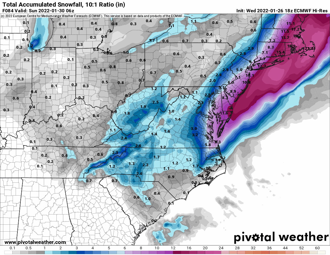
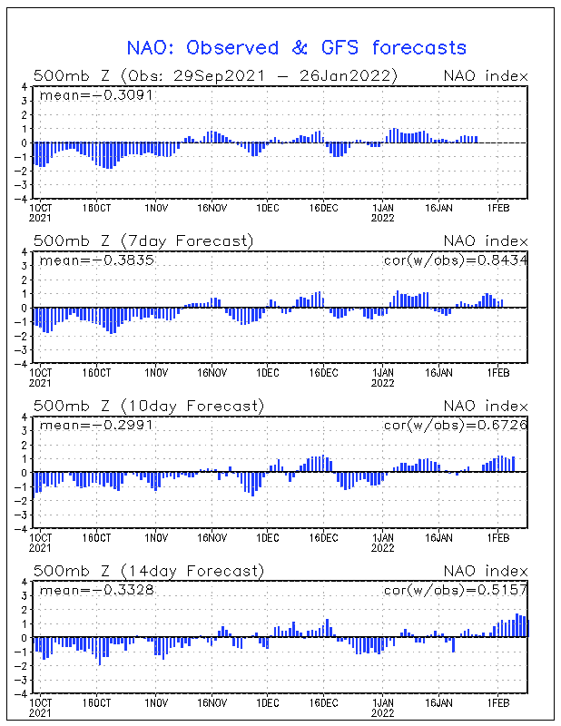
There you are... Figured you were cookin' up quite a storm at work today. You can't discount the NAO trend though... and meanwhile, the 18Z GFS looks like it sped up and but continues the precip scrape trend (although it's just the 18z). And as a quick obs, I did make it up to 28 today with a low of 19 and it's currently 24 with dp 7.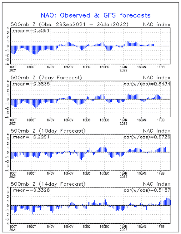

-
E PA/NJ/ DE Winter 2021-22 OBS Thread
Hurricane Agnes replied to JTA66's topic in Philadelphia Region
Mt. Holly's and WPC's updates - -
E PA/NJ/ DE Winter 2021-22 OBS Thread
Hurricane Agnes replied to JTA66's topic in Philadelphia Region
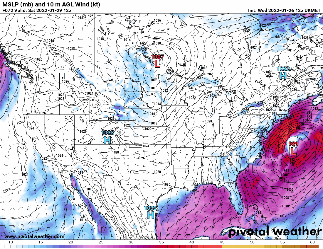
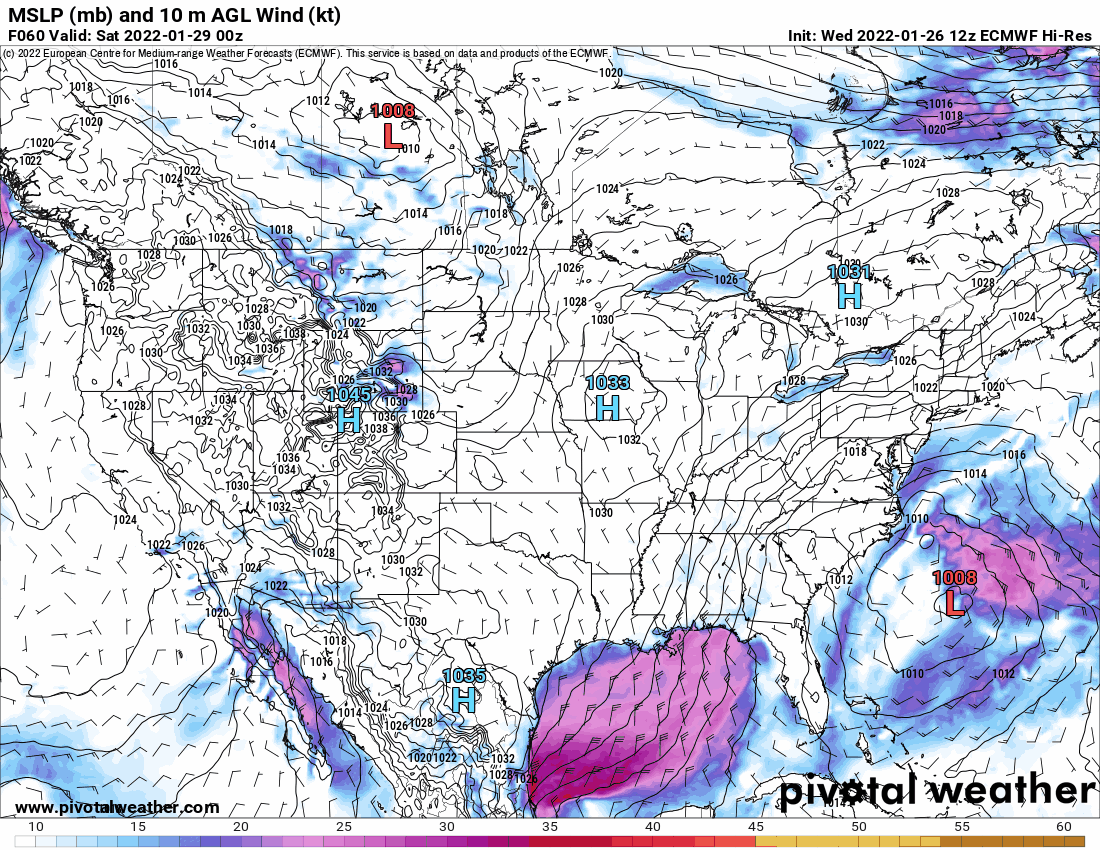
The Euro has had the low looking like this - -
E PA/NJ/ DE Winter 2021-22 OBS Thread
Hurricane Agnes replied to JTA66's topic in Philadelphia Region
No comment.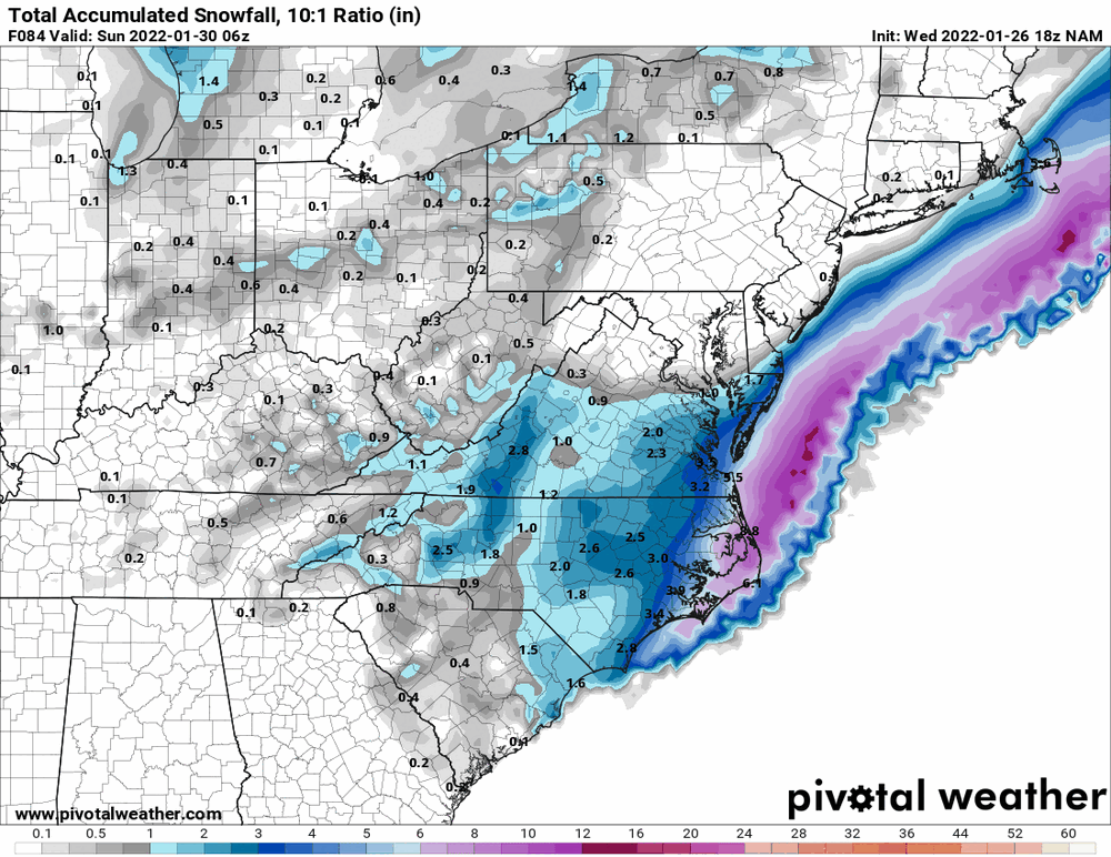
-
E PA/NJ/ DE Winter 2021-22 OBS Thread
Hurricane Agnes replied to JTA66's topic in Philadelphia Region
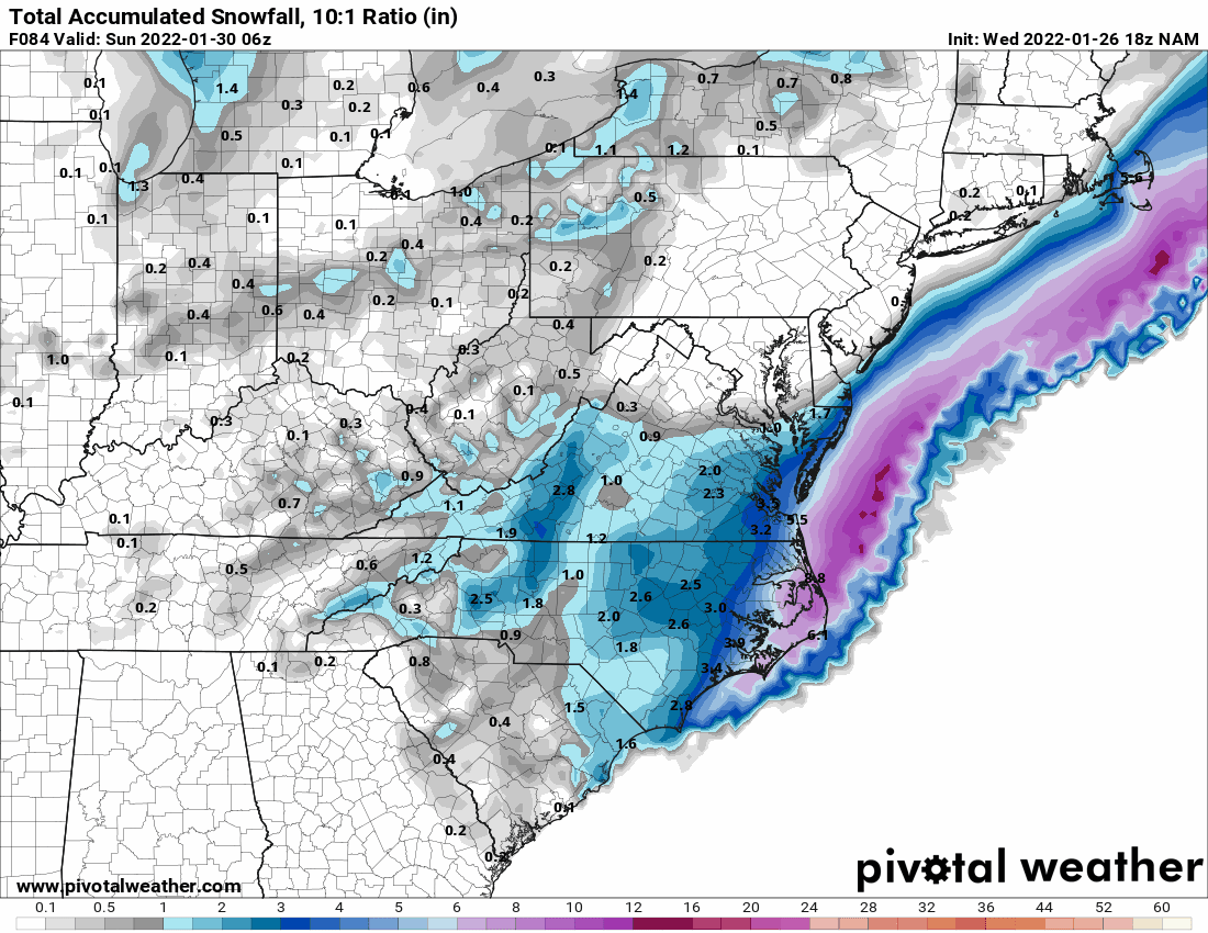
18z NAM looks to be moving to the GFS without all the junky feedback (but then it's the 18z).
-
E PA/NJ/ DE Winter 2021-22 OBS Thread
Hurricane Agnes replied to JTA66's topic in Philadelphia Region
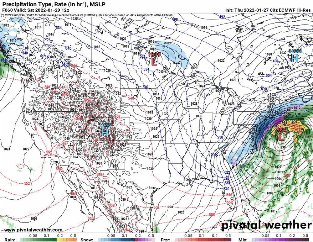
I was looking more closely at the 12z Euro and 12 NAM and they both have the double-barrel lows that sortof become like a Pushi-pullyu. Am wondering if there's something like convective feedback going on considering it seems there was a consensus that the storm would undergo bombogenesis at some point. -
E PA/NJ/ DE Winter 2021-22 OBS Thread
Hurricane Agnes replied to JTA66's topic in Philadelphia Region
Ukie's been holding steady with the position with the 12z run.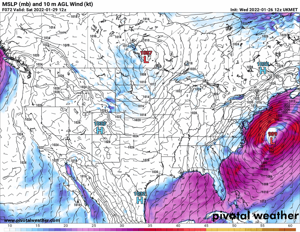
-
E PA/NJ/ DE Winter 2021-22 OBS Thread
Hurricane Agnes replied to JTA66's topic in Philadelphia Region
The 12 Euro is all spastic. It seems to follow the Canadian at the same time frame but when you loop a range, it keeps jerking the low east and west like a tug-o-war.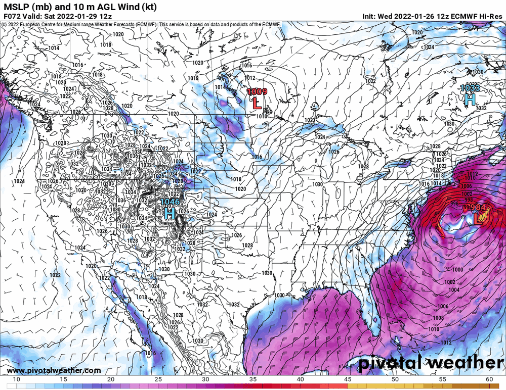

-
E PA/NJ/ DE Winter 2021-22 OBS Thread
Hurricane Agnes replied to JTA66's topic in Philadelphia Region
That's why I noted "at least with their early morning tweet". -
E PA/NJ/ DE Winter 2021-22 OBS Thread
Hurricane Agnes replied to JTA66's topic in Philadelphia Region
WPC seems to be going along with a blend by not discounting the Euro (a least with their morning tweet). -
E PA/NJ/ DE Winter 2021-22 OBS Thread
Hurricane Agnes replied to JTA66's topic in Philadelphia Region
This may end up as a "nowcast storm" where people hope some kind of deformation band sets up over top of them and others hope they don't get trapped in the dryslot screw zone. -
E PA/NJ/ DE Winter 2021-22 OBS Thread
Hurricane Agnes replied to JTA66's topic in Philadelphia Region
Canadian is faster and is like "bye guys".

-
E PA/NJ/ DE Winter 2021-22 OBS Thread
Hurricane Agnes replied to JTA66's topic in Philadelphia Region
I kept saying that to myself when I saw that. And I thought I saw signals for a thaw period (and possible re-establishment of the western trough/eastern ridge per the AFD I saw... although I don't know if that is transient or not).