Hurricane Agnes
-
Posts
9,344 -
Joined
Content Type
Profiles
Blogs
Forums
American Weather
Media Demo
Store
Gallery
Everything posted by Hurricane Agnes
-
E PA/NJ/ DE Winter 2021-22 OBS Thread
Hurricane Agnes replied to JTA66's topic in Philadelphia Region
The "man made heat island" is the very definition of a cause of "climate change". I suppose that could be quantitated and you can see what the temps SHOULD be without effects of lots of concrete, asphalt, brick, stone, metal, and industrial exhaust, but that won't reflect the reality. But I know your position on this and it would be really OT in this thread to delve into that. -
E PA/NJ/ DE Winter 2021-22 OBS Thread
Hurricane Agnes replied to JTA66's topic in Philadelphia Region
It's representative of the city of Philadelphia with 1.6 million people. KPNE is in a less populated part of the city (I remember when it was almost completely undeveloped up there in the "Far Northeast" but that has changed substantially too in recent years) and I live about 5 miles from KLOM (Wings Field in Bluebell) but they are always about 3 - 5 degrees cooler than me (where KPHL is about 3 - 5 degrees warmer). So these readings are really for their immediate surrounding areas. I wouldn't expect to have a temp from a unit 35 miles away be representative of me either so I get that. -
E PA/NJ/ DE Winter 2021-22 OBS Thread
Hurricane Agnes replied to JTA66's topic in Philadelphia Region
For those who live in dense residential neighborhoods in the city of Philadelphia, the temps would probably be even higher in their neighborhoods than the airport, where that ASOS is sitting near the river by an unused runway (at least the last overhead shot that I saw of it some time ago). So trying to make the temp "less" does no good for the people who live in the city. There is the need to reflect the reality of their immediate environment and that needs to be factored in for heat advisories or warnings. -
E PA/NJ/ DE Winter 2021-22 OBS Thread
Hurricane Agnes replied to JTA66's topic in Philadelphia Region
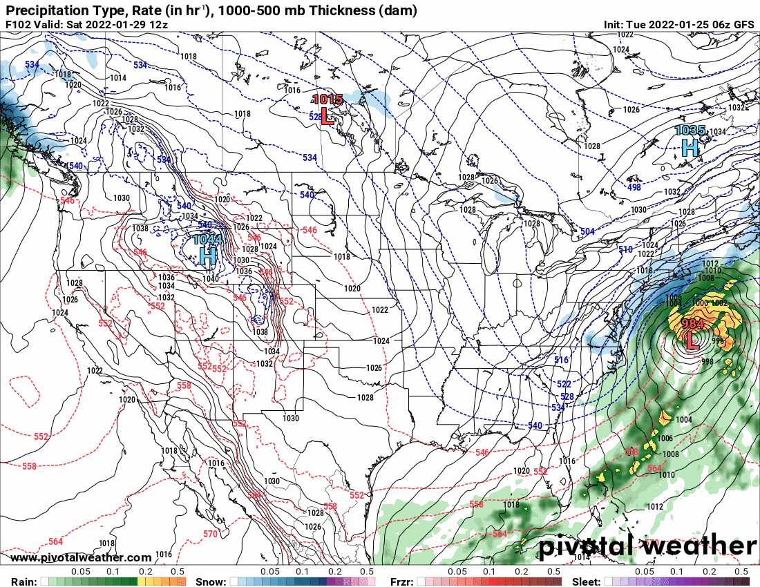
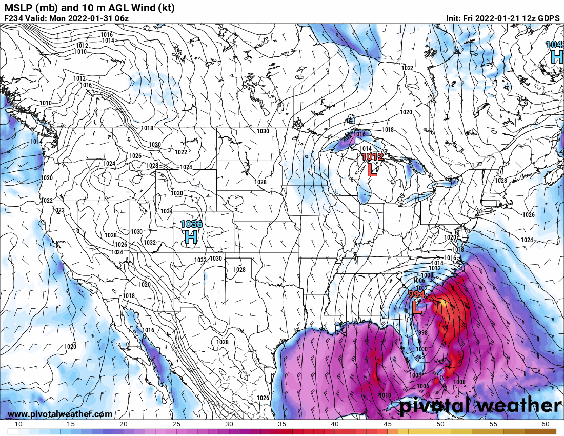
As an obs, I noticed the non-diurnal temp trend last night where I actually hit a high yesterday of 34 about 10 minutes before midnight and the temp continued rising until just after 12:30 am with a high of 35, but had finally been on the downswing. Currently 32 with dp 28. I know it's the 6z but here are the latest GFS and its ensembles.
-
E PA/NJ/ DE Winter 2021-22 OBS Thread
Hurricane Agnes replied to JTA66's topic in Philadelphia Region
Coastal Washington state hasn't really been dry (in fact, the precip was excessive earlier in the winter) but other parts along the west coast have dried out recently where wild fires have been firing up sortof "off season".
-
E PA/NJ/ DE Winter 2021-22 OBS Thread
Hurricane Agnes replied to JTA66's topic in Philadelphia Region
La Nina - https://www.climate.gov/news-features/blogs/enso/december-2021-la-niña-update-visual-aids -
E PA/NJ/ DE Winter 2021-22 OBS Thread
Hurricane Agnes replied to JTA66's topic in Philadelphia Region
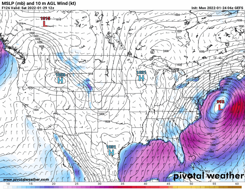
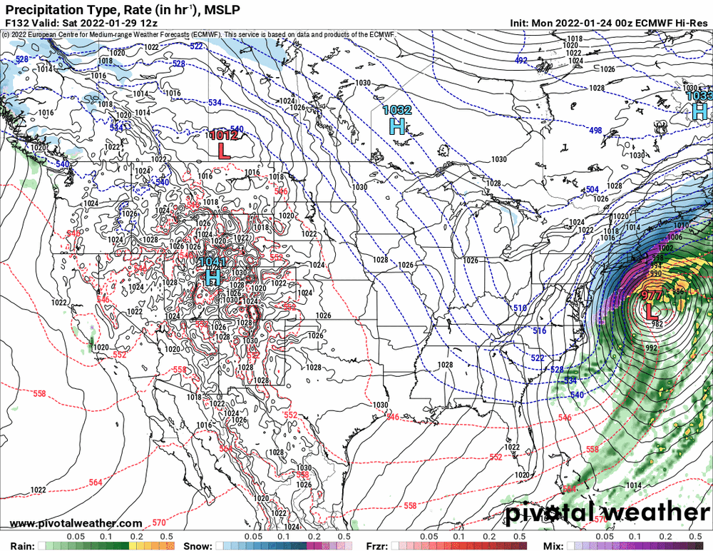
Yup - too deep and it will come inland or crawl along the coast but too shallow and OTS it goes. It's in the amplification (and might also be dependent on what happens with the west coast ridge). There have been some arctic incursions involved in that push. -
E PA/NJ/ DE Winter 2021-22 OBS Thread
Hurricane Agnes replied to JTA66's topic in Philadelphia Region
It will depend on the amplitude of any propagating trough and whether that system gets kicked OTS or crawls up along the coast. We are firmly in the midrange territory where these models tend to do poorly, jockeying back and forth with solutions, although they at least all agree "something" is afoot. Looks like I bottomed out at 23 and currently partly cloudy, with lots of cirrus scattered around, and back up to 24 with dp 18. -
E PA/NJ/ DE Winter 2021-22 OBS Thread
Hurricane Agnes replied to JTA66's topic in Philadelphia Region
As an interesting note this morning, apparently a snow shower/squall came through here overnight/early this morning and dusted the cars and some of the grass. It was actually more than anything that I got with that band yesterday, which yielded a few flurries at best. I expect the fact that the temps finally went below freezing after midnight might have helped with any stickage. Currently 24 with dp 20. -
E PA/NJ/ DE Winter 2021-22 OBS Thread
Hurricane Agnes replied to JTA66's topic in Philadelphia Region
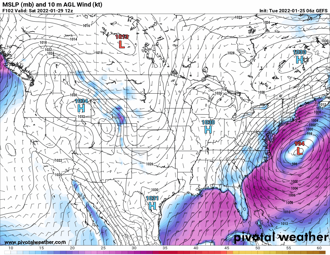
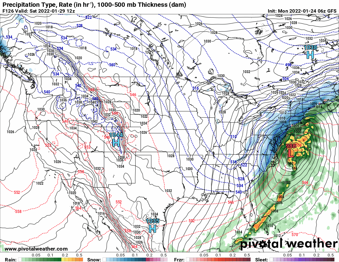
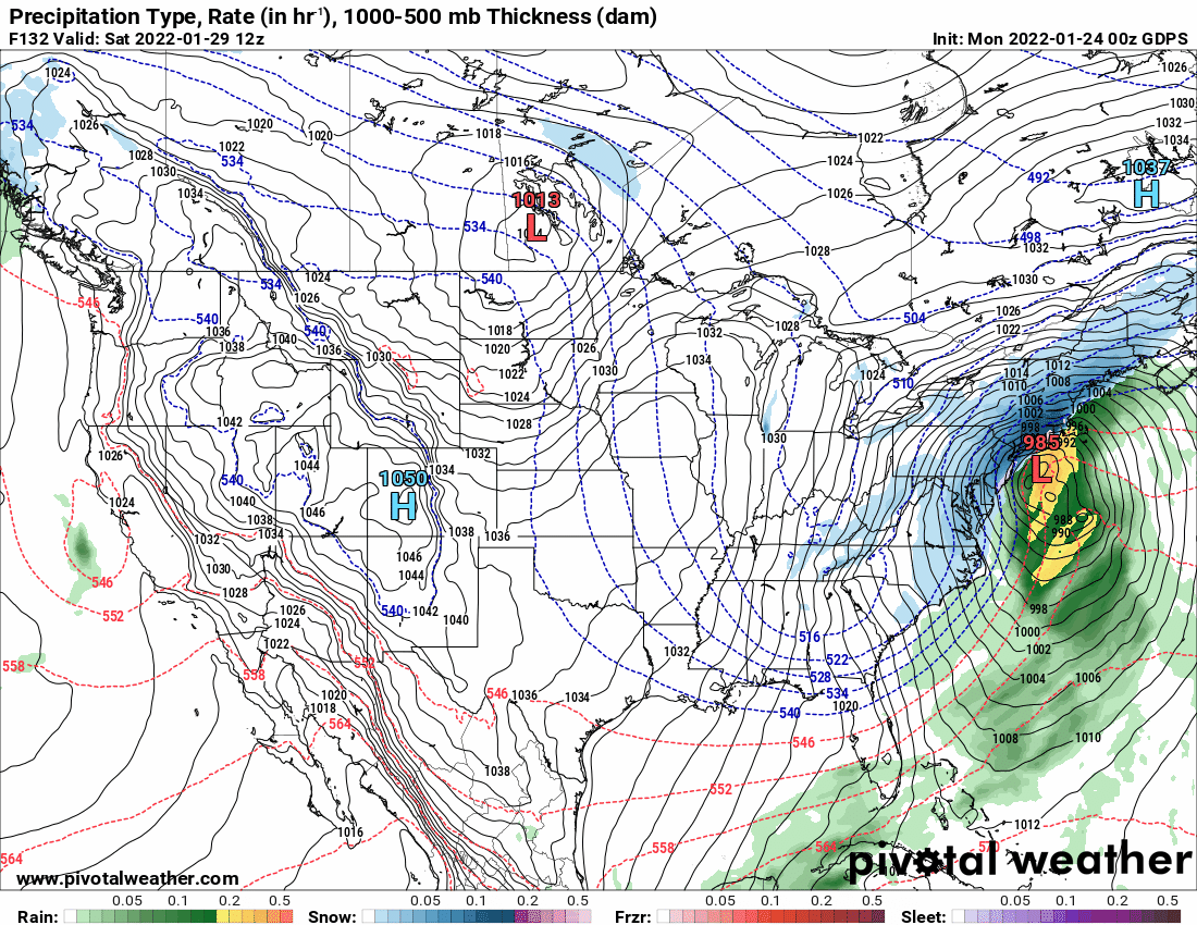
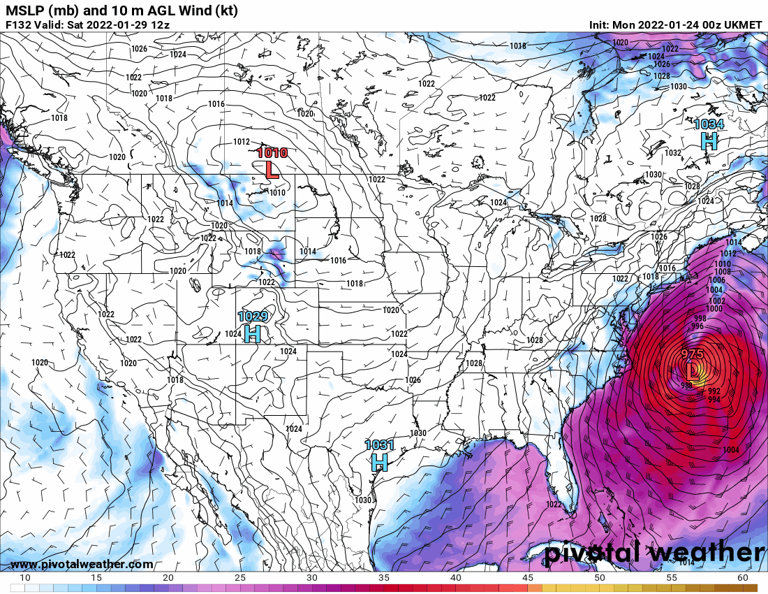
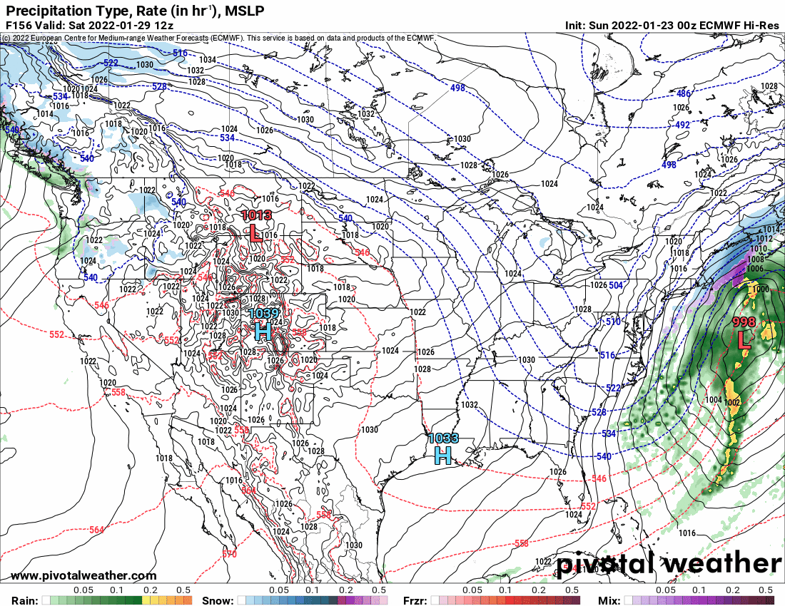
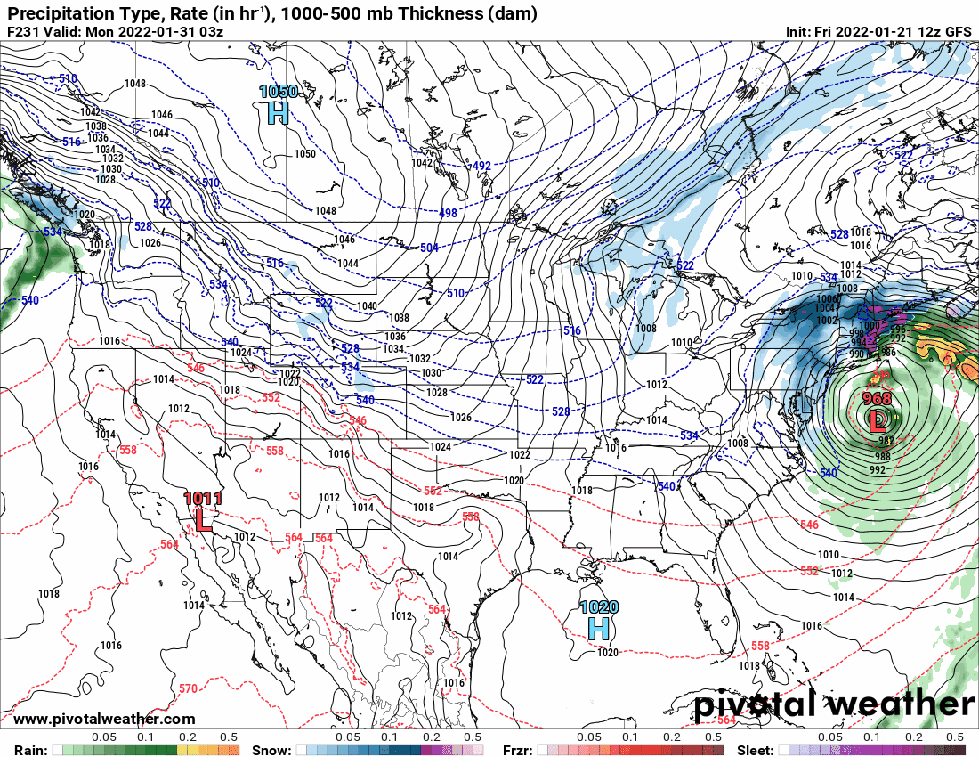
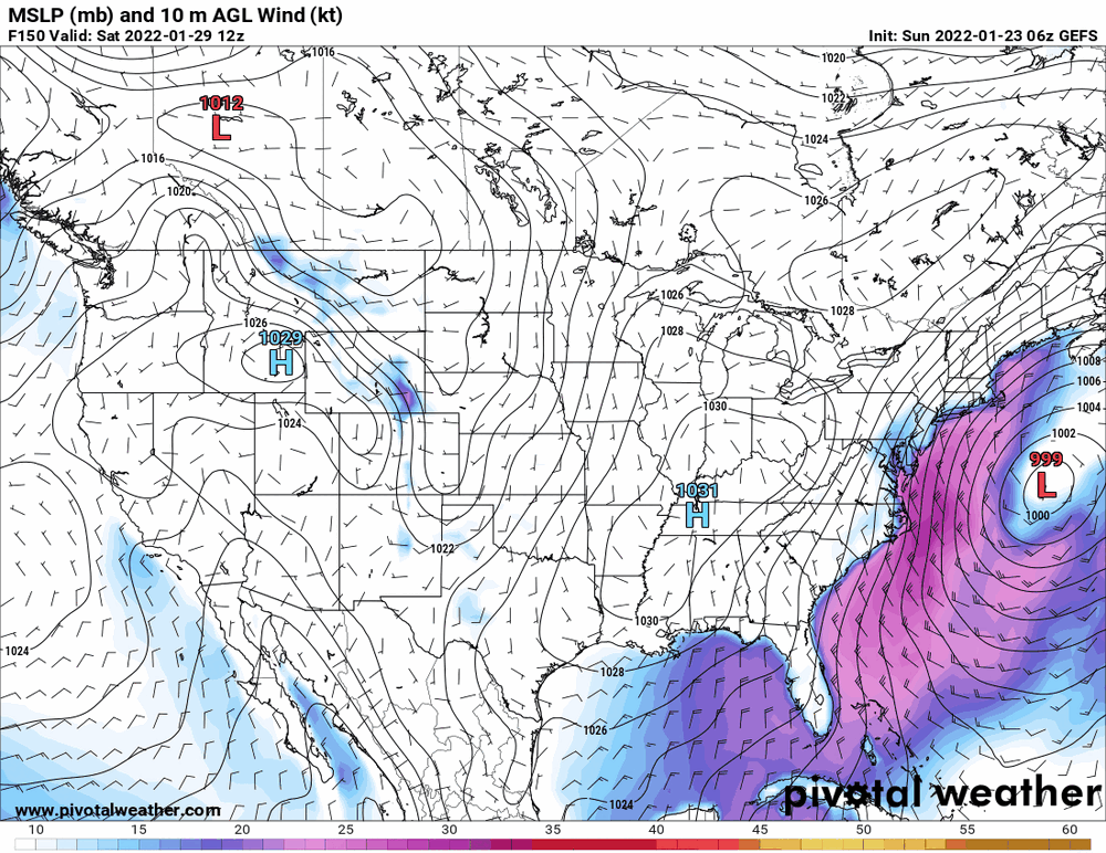
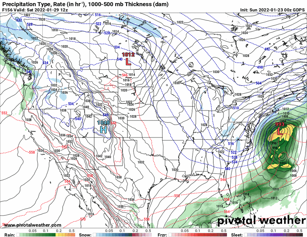
Well most if not all of the models see "something" for the Jan. 29 timeframe. There are some variations of "where" but it seems pretty interesting that they lined up (although the Ukie is way to the SE)... Otherwise I'm currently at 25 with dp 22.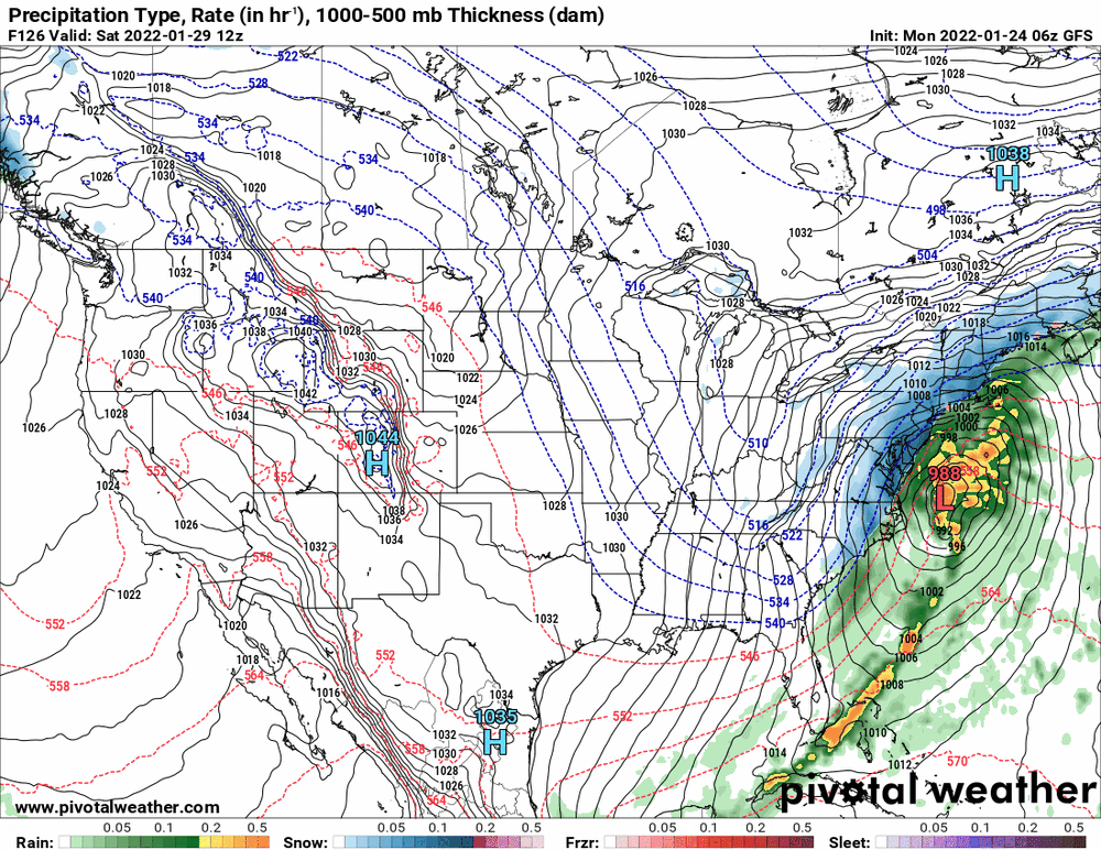


-
E PA/NJ/ DE Winter 2021-22 OBS Thread
Hurricane Agnes replied to JTA66's topic in Philadelphia Region
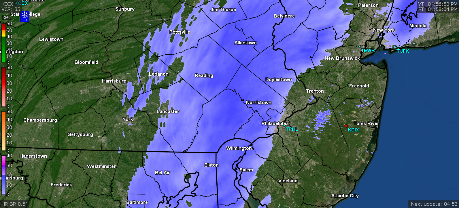
Radar is now breaking up. Final total = Trace (a brief period of light flurries and nothing else - not even a dusting on colder surfaces). Temp stayed above freezing the whole time so whatever might have fallen while not looking may have just melted. Currently overcast and 33 with dp 23. -
E PA/NJ/ DE Winter 2021-22 OBS Thread
Hurricane Agnes replied to JTA66's topic in Philadelphia Region
The flakes were transitory and are gone. Still 33 with dp 23. -
E PA/NJ/ DE Winter 2021-22 OBS Thread
Hurricane Agnes replied to JTA66's topic in Philadelphia Region
FINALLY getting some flakes. Temp down to 33 with dp 23.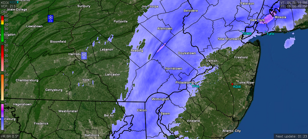
-
E PA/NJ/ DE Winter 2021-22 OBS Thread
Hurricane Agnes replied to JTA66's topic in Philadelphia Region
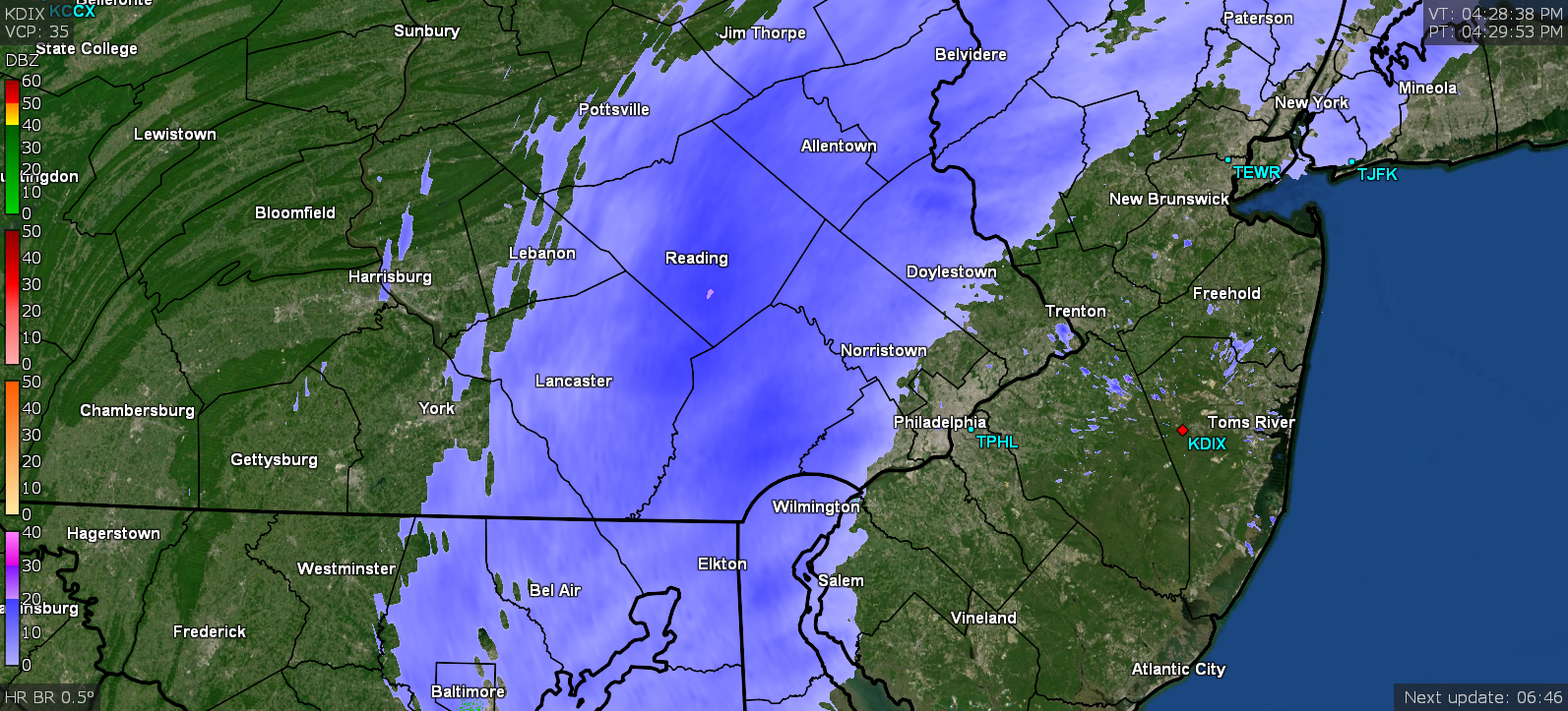
Stared at a house light and sidewalk lights and nada. Not even fine stuff. Still virga but you can feel the biting chill. Temp is down a tick to 34 with dp now up to 22 so could be the atmosphere was so dry that whatever precip was falling from on high has been evaporating. -
E PA/NJ/ DE Winter 2021-22 OBS Thread
Hurricane Agnes replied to JTA66's topic in Philadelphia Region
Am under virga and currently 35 with dp 19. Still nothing yet.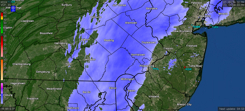
-
E PA/NJ/ DE Winter 2021-22 OBS Thread
Hurricane Agnes replied to JTA66's topic in Philadelphia Region
LOL And I didn't have to even look at the radar to tell what was happening when this forum lit up. Currently overcast and 36 with dp 17 and a band on my doorstep. Feels like snow out there but not getting anything yet.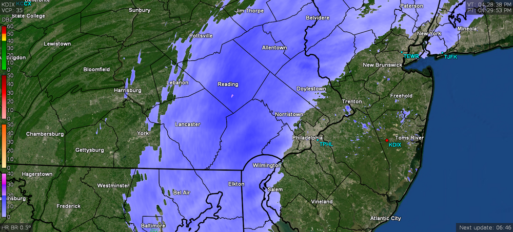
-
E PA/NJ/ DE Winter 2021-22 OBS Thread
Hurricane Agnes replied to JTA66's topic in Philadelphia Region
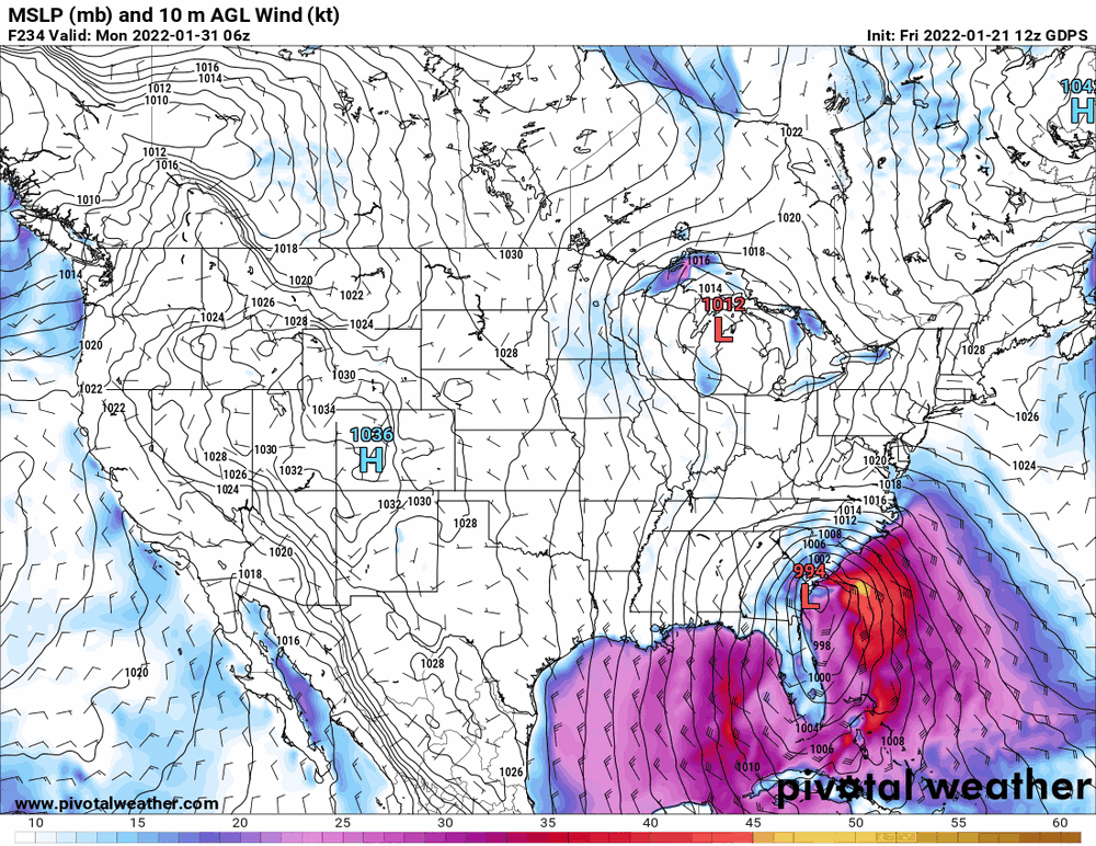
Well as of the 0zs or 6zs, there are whiffs for the end of month storm at the moment but I do think something is going to be out there around that time (they seem to bop around between late Jan - early Feb.). Meanwhile I did make it up to 29 yesterday and had a low of 20 this morning. It's currently partly sunny (it clouded over since earlier this morning) and 27 with dp 12 (after a low dp of 7). And as a note, I just a tiny bit over 6" of snow so far, season to date.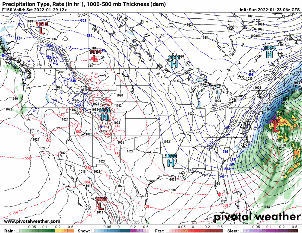

-
E PA/NJ/ DE Winter 2021-22 OBS Thread
Hurricane Agnes replied to JTA66's topic in Philadelphia Region
Well I bottomed out at 10 this morning with the lowest dp so far at -1 (-0.7). It's currently clear and 14 with dp 0 (0.1). The humidifiers are struggling. -
E PA/NJ/ DE Winter 2021-22 OBS Thread
Hurricane Agnes replied to JTA66's topic in Philadelphia Region
CMC is definitely slower (added the ones for the same time frame). Plus am trying to help the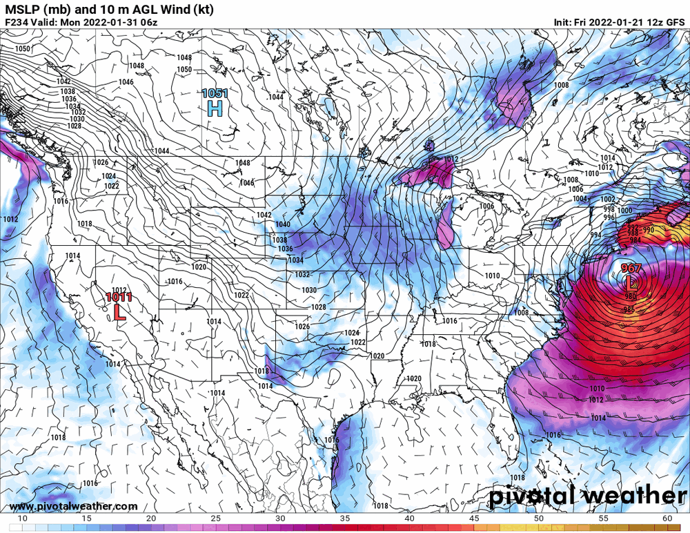
-
E PA/NJ/ DE Winter 2021-22 OBS Thread
Hurricane Agnes replied to JTA66's topic in Philadelphia Region
Your avatar changes are cracking me up. I bottomed out at 14 this morning and am currently 20 partly cloudy with dp down to 4. Was just looking at that. CMC sortof has it too but further east where it suddenly "pops" into place.
-
E PA/NJ/ DE Winter 2021-22 OBS Thread
Hurricane Agnes replied to JTA66's topic in Philadelphia Region
After sitting at or above freezing all day, I finally dropped below it sometime after sunset (5 pm) and at that point, the dp began to fall off the cliff. Currently a breezy 27 with dp down to 11 and continuing to fall. -
E PA/NJ/ DE Winter 2021-22 OBS Thread
Hurricane Agnes replied to JTA66's topic in Philadelphia Region
Gives me practice fooling around with the model outputs. -
E PA/NJ/ DE Winter 2021-22 OBS Thread
Hurricane Agnes replied to JTA66's topic in Philadelphia Region
I agree. I think it has been habit to still embrace it and continue to trash the upgraded GFS and NAM (the NAM actually has improved). -
E PA/NJ/ DE Winter 2021-22 OBS Thread
Hurricane Agnes replied to JTA66's topic in Philadelphia Region
Well the Euro sortof verified that.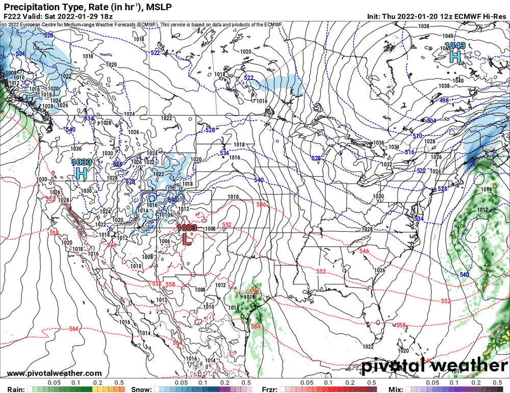
-
E PA/NJ/ DE Winter 2021-22 OBS Thread
Hurricane Agnes replied to JTA66's topic in Philadelphia Region
Waiting for the 12z Euro (not all the way done yet).