Hurricane Agnes
-
Posts
9,344 -
Joined
Content Type
Profiles
Blogs
Forums
American Weather
Media Demo
Store
Gallery
Everything posted by Hurricane Agnes
-
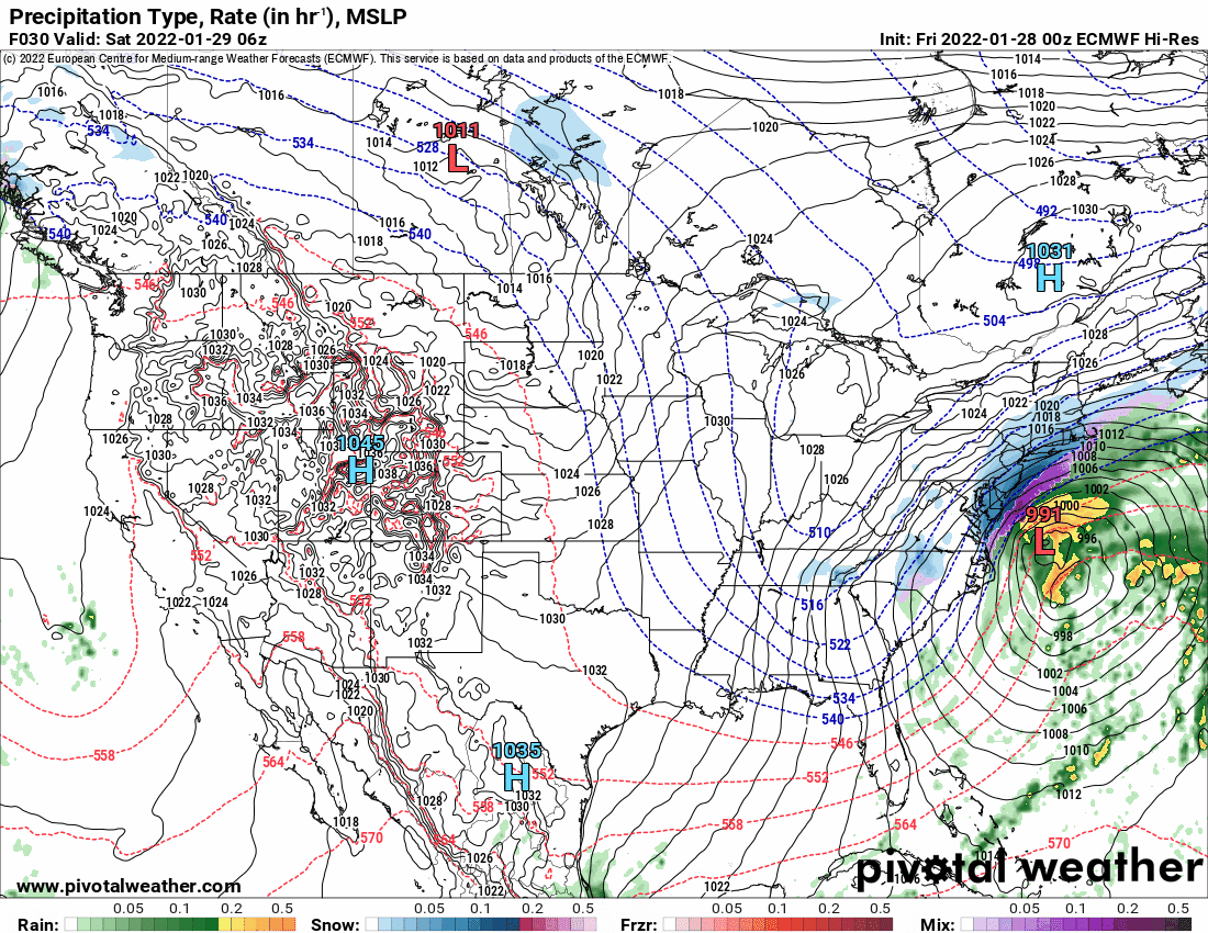
January 28th/29th Event Obs - From KU to FU?
Hurricane Agnes replied to JTA66's topic in Philadelphia Region
Whatever that is, it has been causing the continual "west - east - west" model dance, depending on how much "weight" they put on that. The GFS seemed to have ignored it early on but has drunk the koolaid and is now having to deal with it, whereas the NAM and Euro completely embraced the chaos early on. This also impacts whether you end up with a SECS whiff or a HECS. -
January 28th/29th Event Obs - From KU to FU?
Hurricane Agnes replied to JTA66's topic in Philadelphia Region
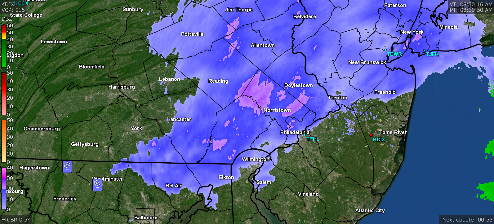
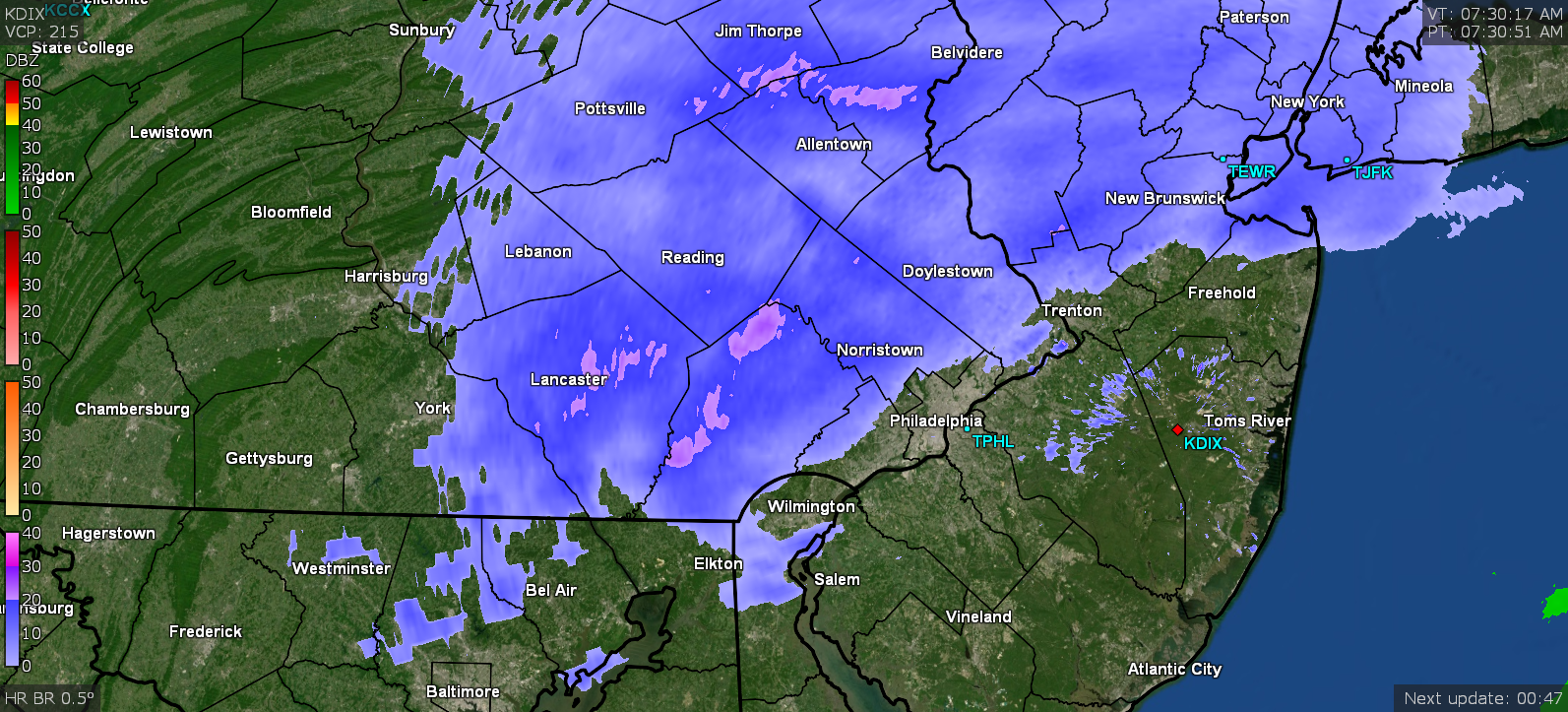
Current obs - temp 29 with dp 23 and SN-. Have a dusting on the colder/non-treated surfaces.
-
January 28th/29th Event Obs - From KU to FU?
Hurricane Agnes replied to JTA66's topic in Philadelphia Region
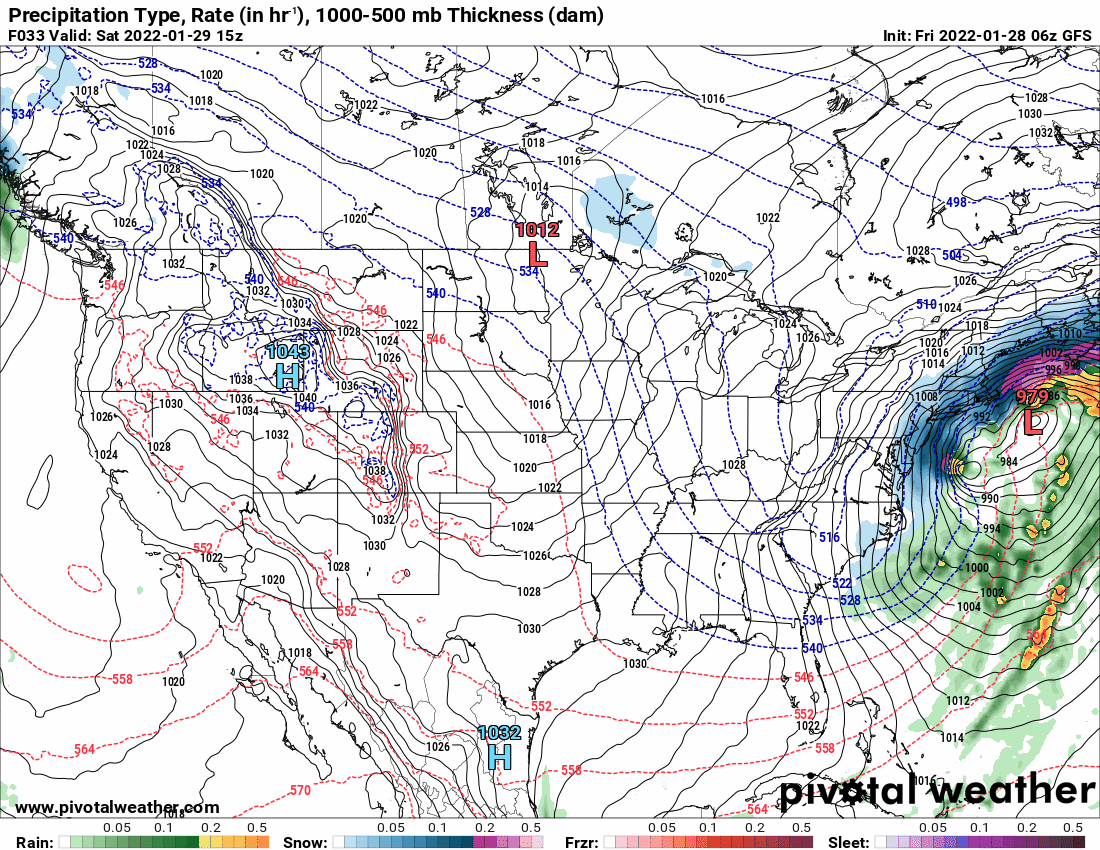
6z GFS and a later wild panel with that damn "ball and chain other low".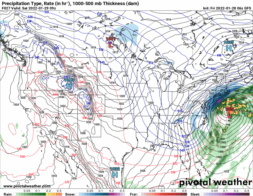

-
January 28th/29th Event Obs - From KU to FU?
Hurricane Agnes replied to JTA66's topic in Philadelphia Region
I am just posting model images for the benefit of this subforum for people to look at since there are those who lurk here who are watching the play by plays and who have expressed a desire to "learn". I have given no weight or "analysis" of which one(s) I think is "correct". They all constitute "data points", nothing more, nothing less. -
January 28th/29th Event Obs - From KU to FU?
Hurricane Agnes replied to JTA66's topic in Philadelphia Region
Looks like you work where hazwoper lives. -
January 28th/29th Event Obs - From KU to FU?
Hurricane Agnes replied to JTA66's topic in Philadelphia Region
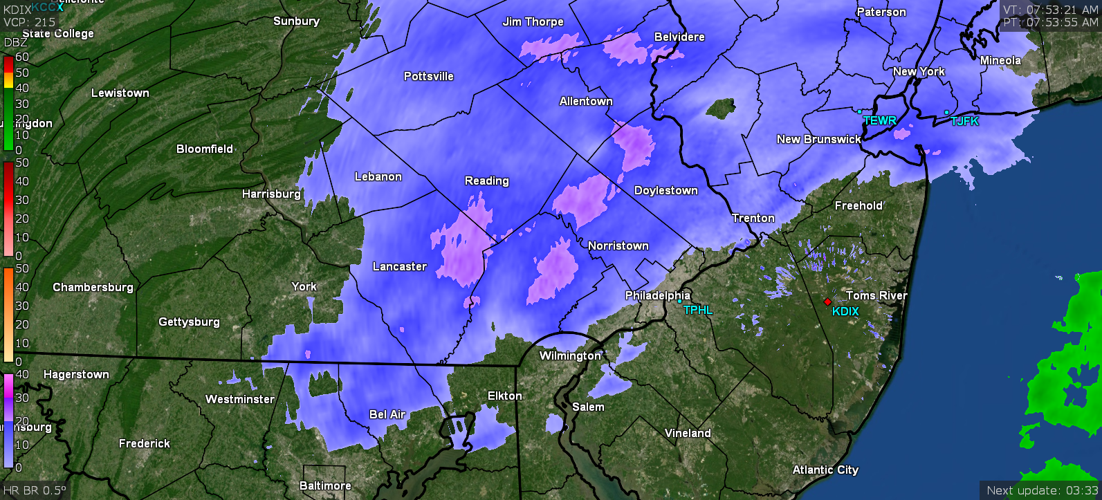
And just checked since the returns have come overhead and there be very fine snowflakes - more than flurries but still light.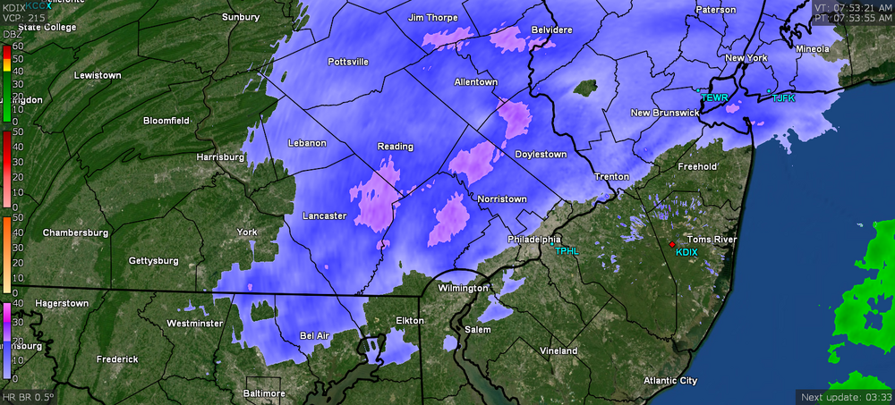
-
January 28th/29th Event Obs - From KU to FU?
Hurricane Agnes replied to JTA66's topic in Philadelphia Region
Last Ukie run (0z).
-
January 28th/29th Event Obs - From KU to FU?
Hurricane Agnes replied to JTA66's topic in Philadelphia Region
Right on the city doorstep!
-
January 28th/29th Event Obs - From KU to FU?
Hurricane Agnes replied to JTA66's topic in Philadelphia Region
-
January 28th/29th Event Obs - From KU to FU?
Hurricane Agnes replied to JTA66's topic in Philadelphia Region
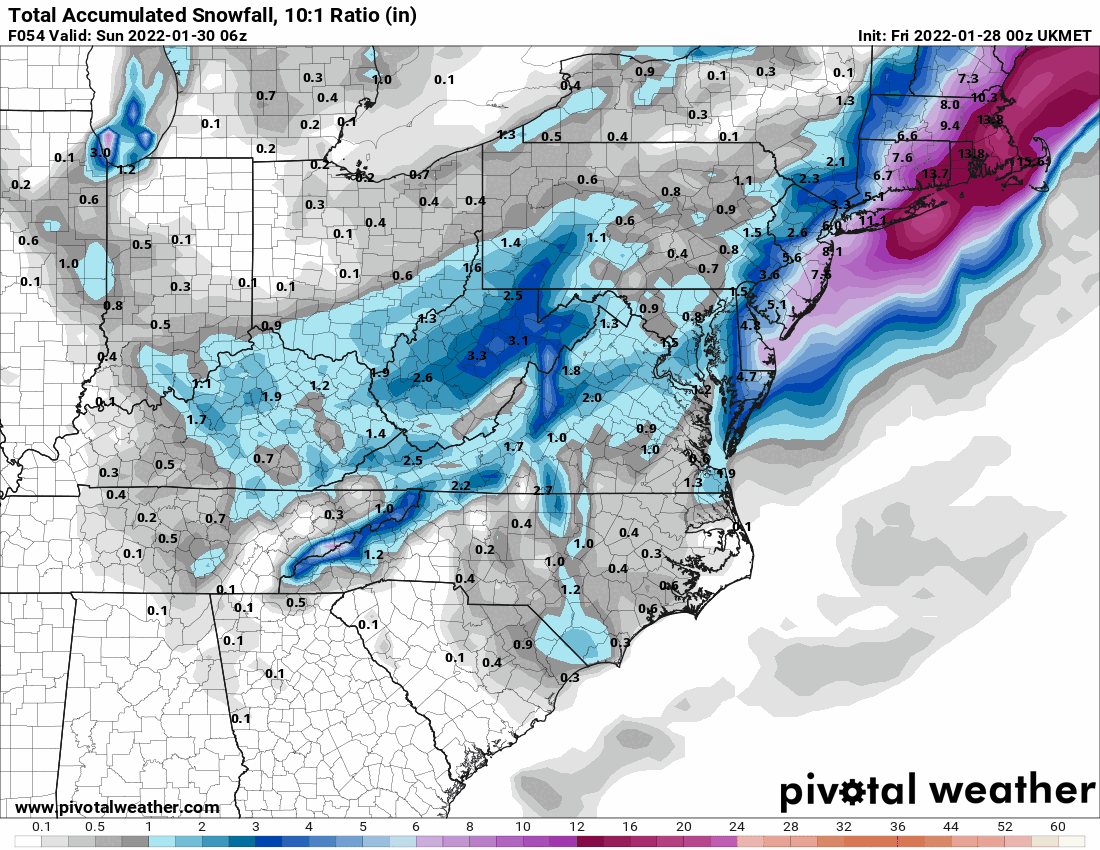
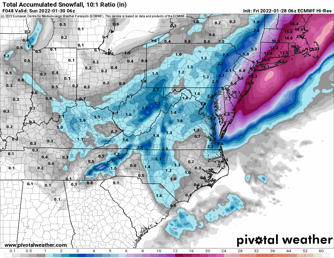
6z Euro (Euro still faster than earlier runs).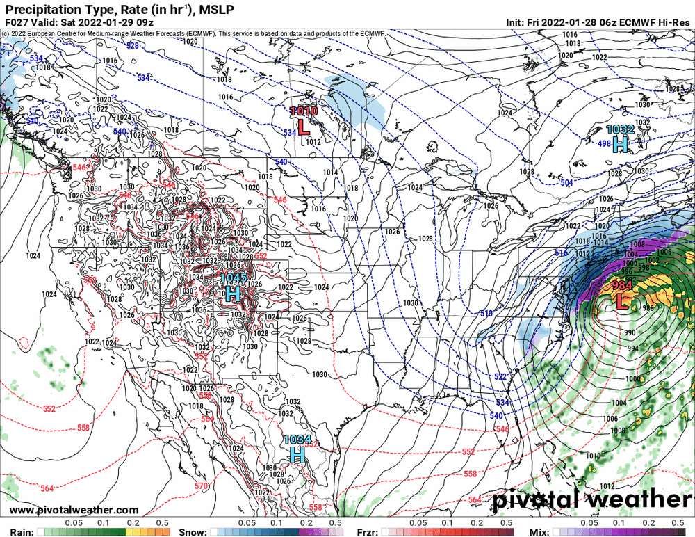

-
January 28th/29th Event Obs - From KU to FU?
Hurricane Agnes replied to JTA66's topic in Philadelphia Region
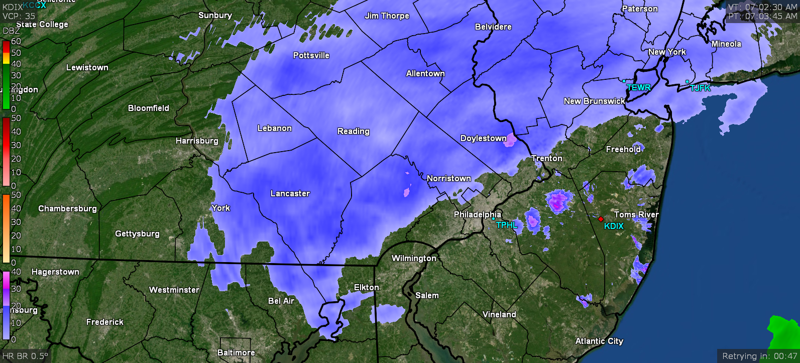
Currently 29 with dp 20.
-
January 28th/29th Event Obs - From KU to FU?
Hurricane Agnes replied to JTA66's topic in Philadelphia Region
We may need you over this way to plow. Good morning! -
January 28th/29th Event Obs - From KU to FU?
Hurricane Agnes replied to JTA66's topic in Philadelphia Region
-
January 28th/29th Event Obs - From KU to FU?
Hurricane Agnes replied to JTA66's topic in Philadelphia Region
At the shore - I-95 corridor - N/W 'burbs - -
January 28th/29th Event Obs - From KU to FU?
Hurricane Agnes replied to JTA66's topic in Philadelphia Region
-
January 28th/29th Event Obs - From KU to FU?
Hurricane Agnes replied to JTA66's topic in Philadelphia Region
The Vineland native heave ho crew got busy from thousands of miles away - -
January 28th/29th Event Obs - From KU to FU?
Hurricane Agnes replied to JTA66's topic in Philadelphia Region
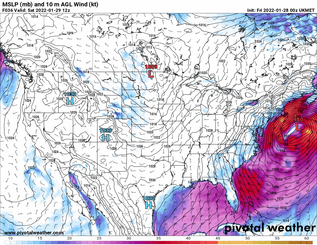
0z Euro wasn't as amped as the NAM but has the crazy flappy low and was also faster.

-
January 28th/29th Event Obs - From KU to FU?
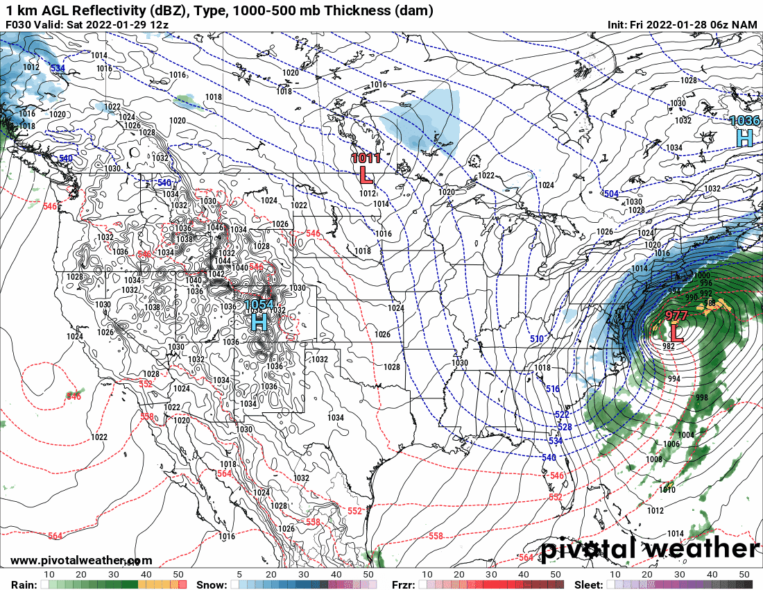
Hurricane Agnes replied to JTA66's topic in Philadelphia Region
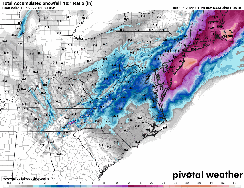
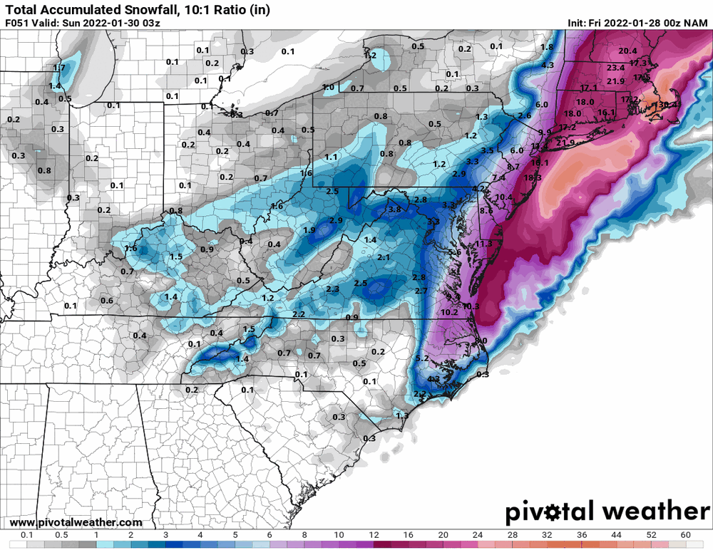
6z 3k NAM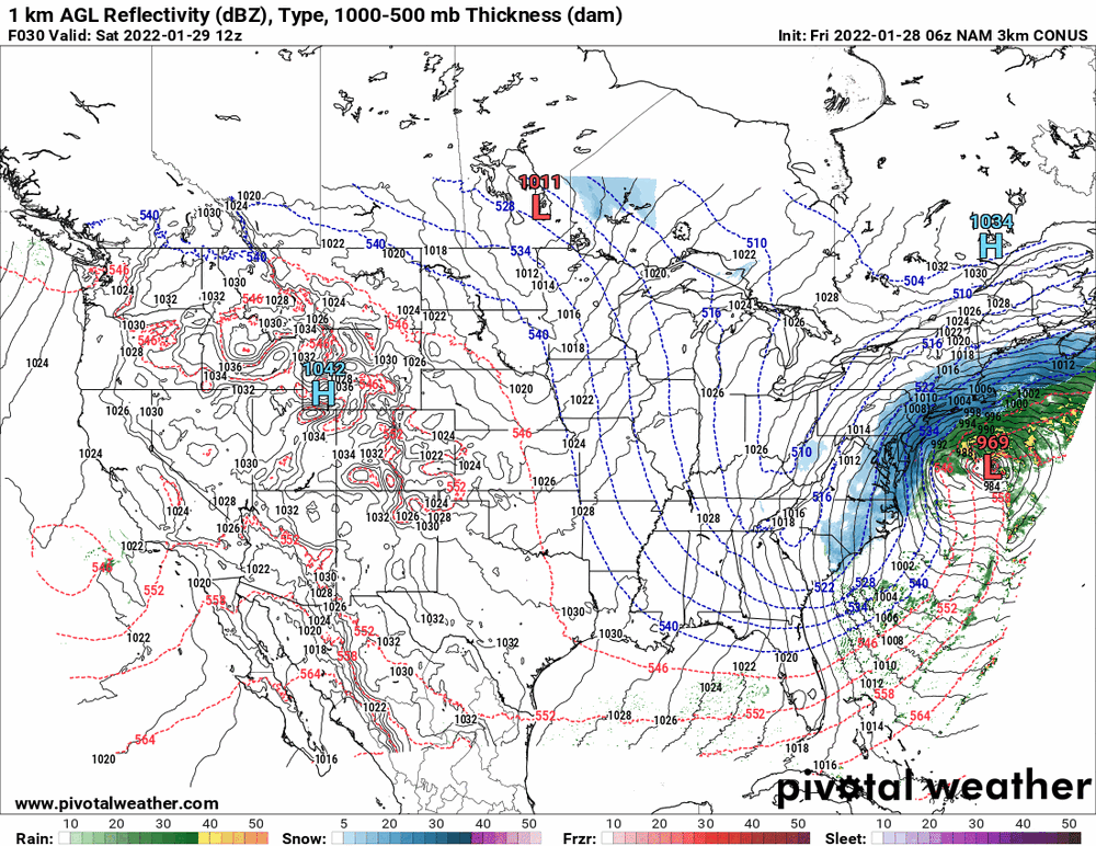
-
January 28th/29th Event Obs - From KU to FU?
Hurricane Agnes replied to JTA66's topic in Philadelphia Region

-
January 28th/29th Event Obs - From KU to FU?
Hurricane Agnes replied to JTA66's topic in Philadelphia Region
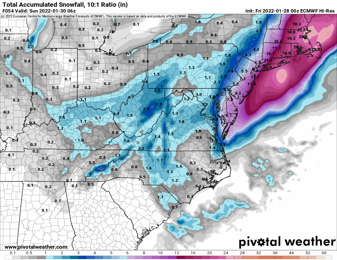
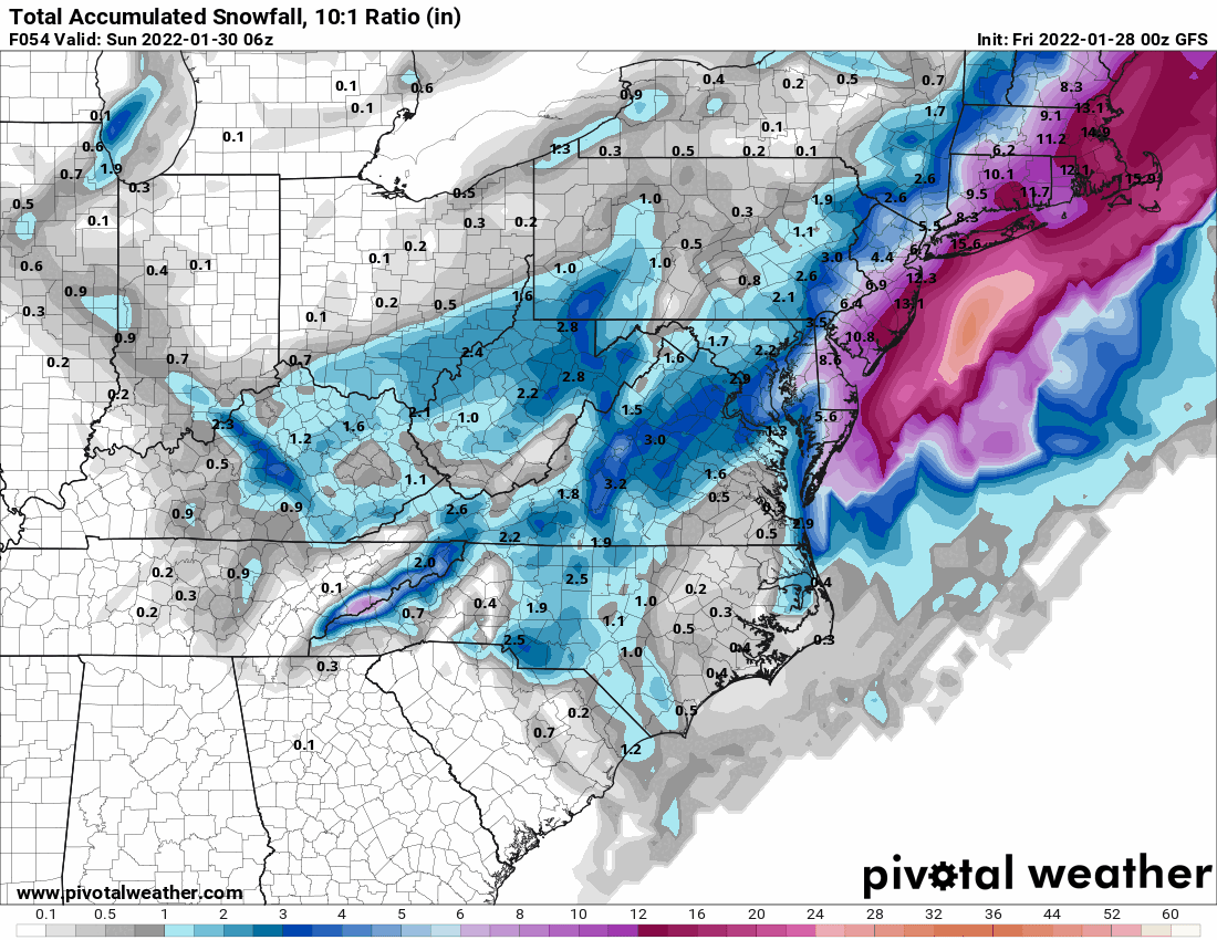
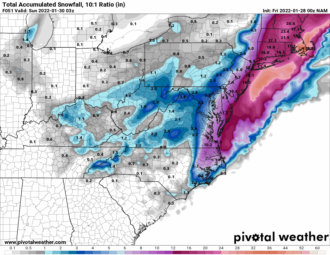
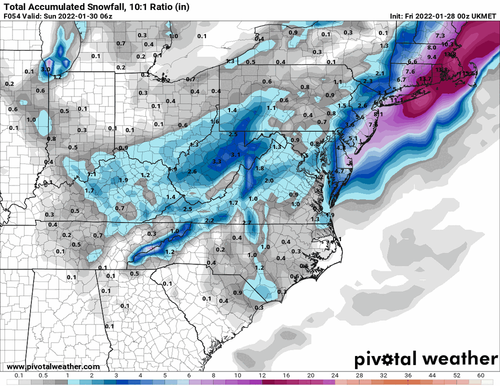
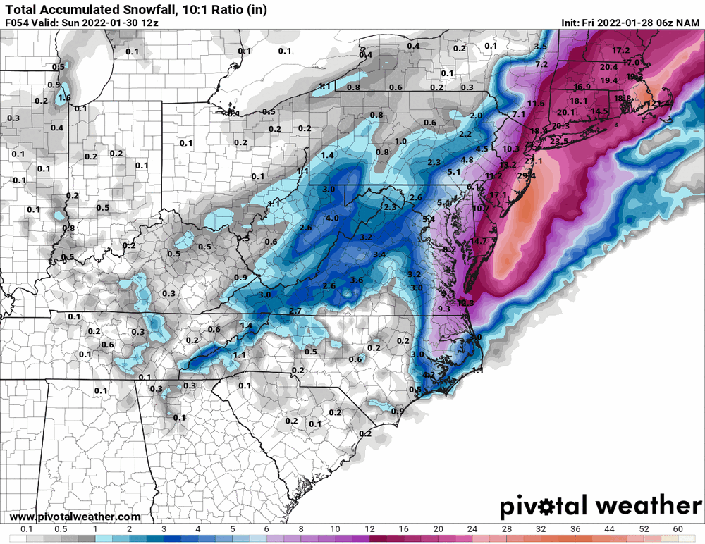
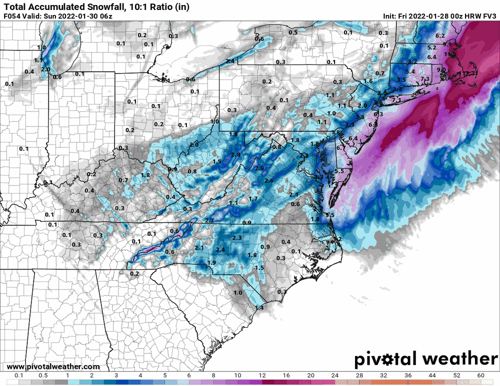
Canadian is bombing that sucka out right off the coast (and had that "double low" thing going on to boot). ETA the snow map.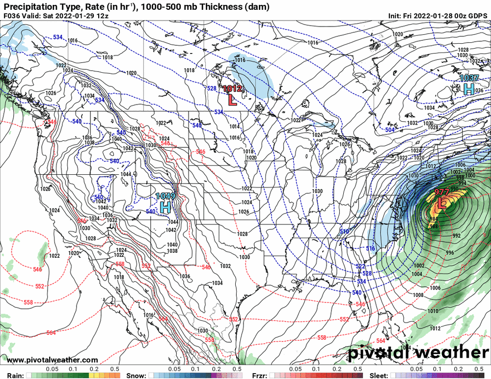

-
January 28th/29th Event Obs - From KU to FU?
Hurricane Agnes replied to JTA66's topic in Philadelphia Region
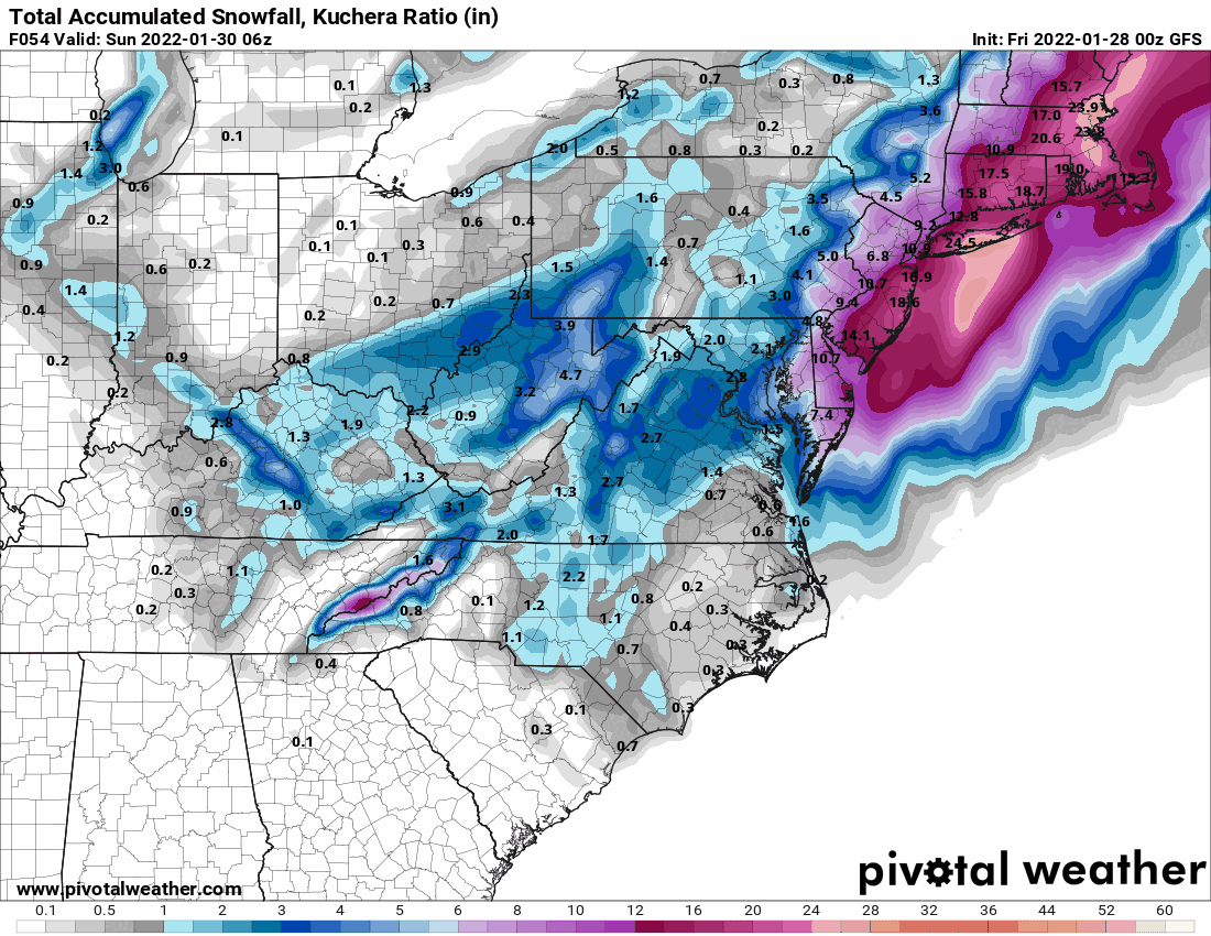
Some eye candy for ya!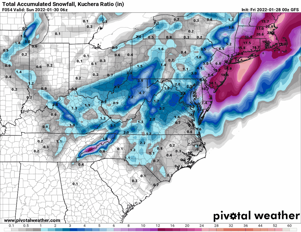
-
January 28th/29th Event Obs - From KU to FU?
Hurricane Agnes replied to JTA66's topic in Philadelphia Region
0z GFS back to that (phantom) double-low issue.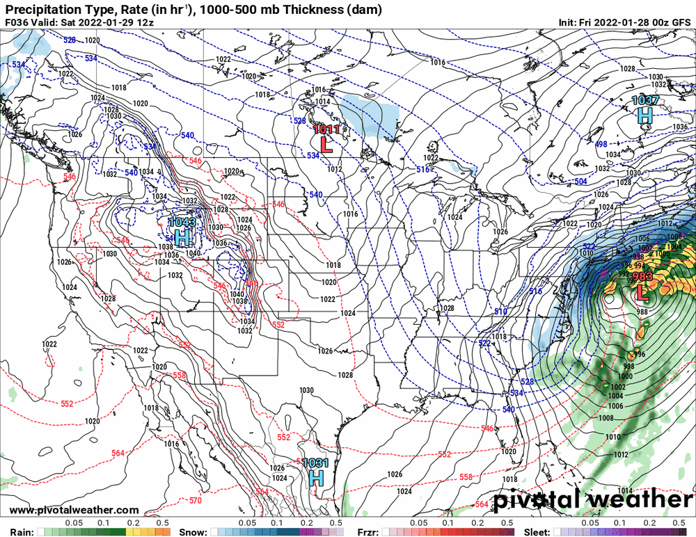

-
January 28th/29th Event Obs - From KU to FU?
Hurricane Agnes replied to JTA66's topic in Philadelphia Region
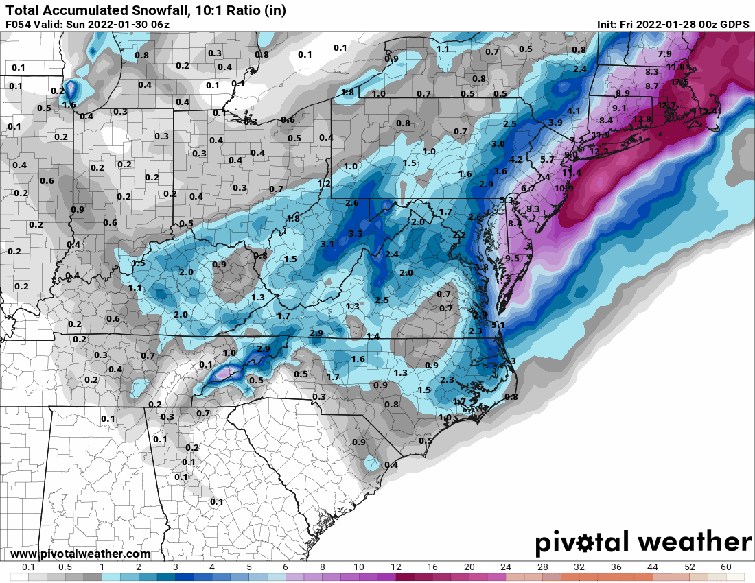
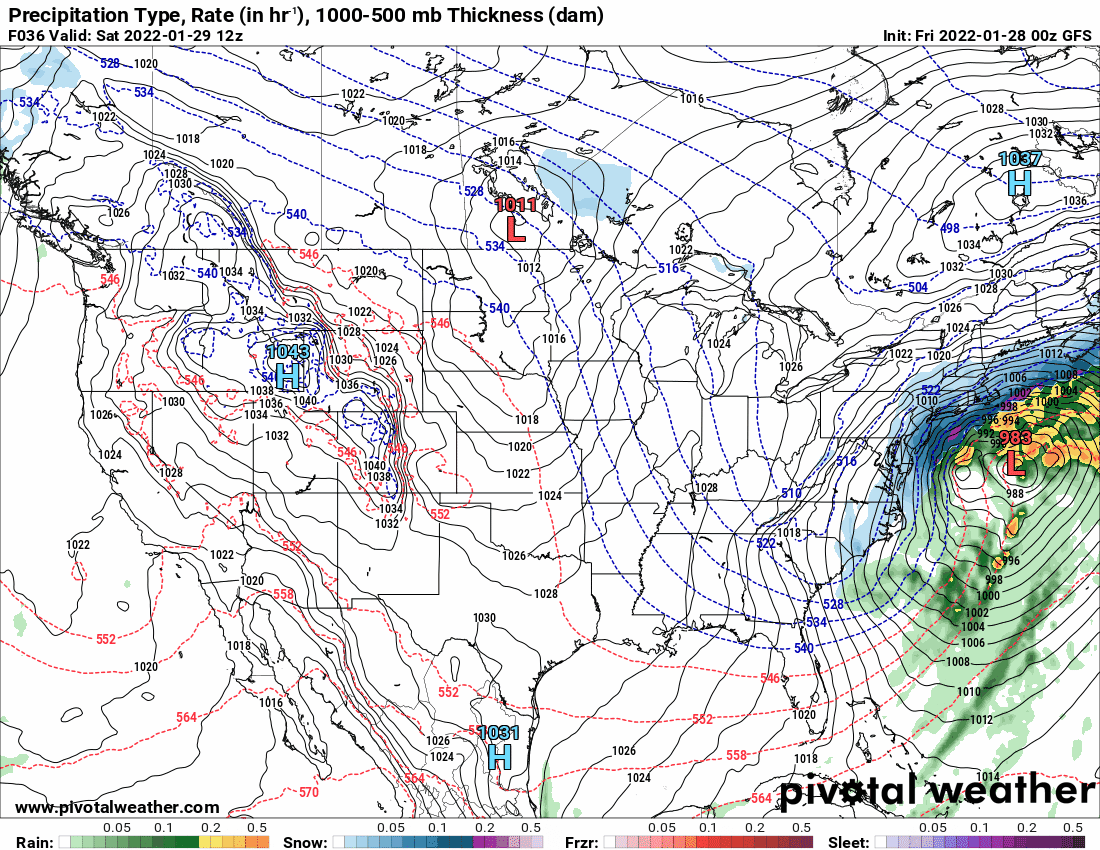
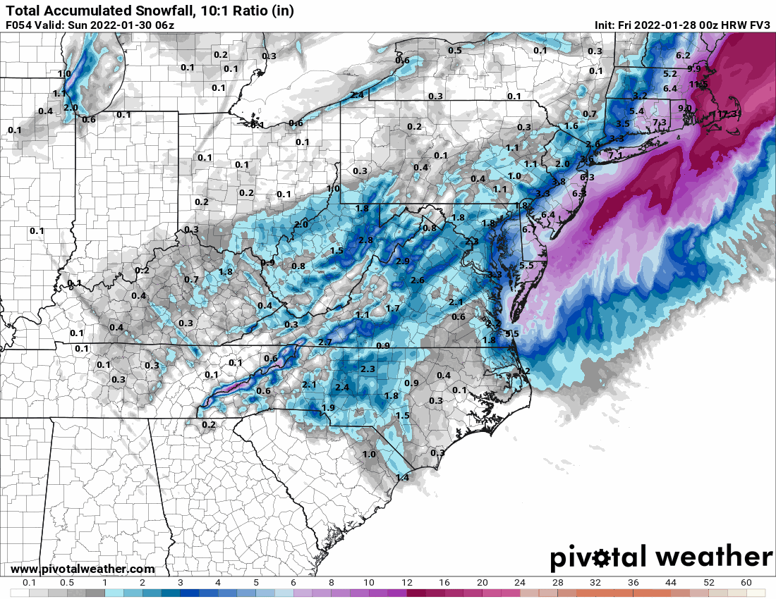
Here is the 0z HRW FV3 -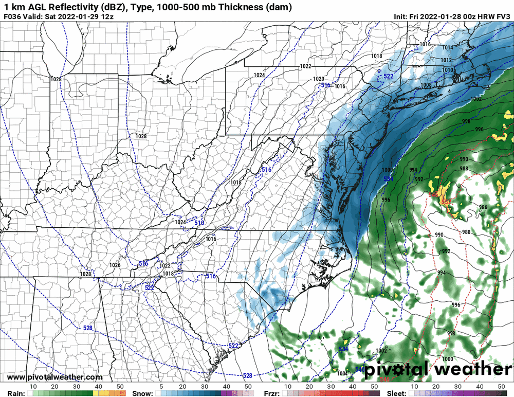
-
January 28th/29th Event Obs - From KU to FU?
Hurricane Agnes replied to JTA66's topic in Philadelphia Region
-
January 28th/29th Event Obs - From KU to FU?
Hurricane Agnes replied to JTA66's topic in Philadelphia Region
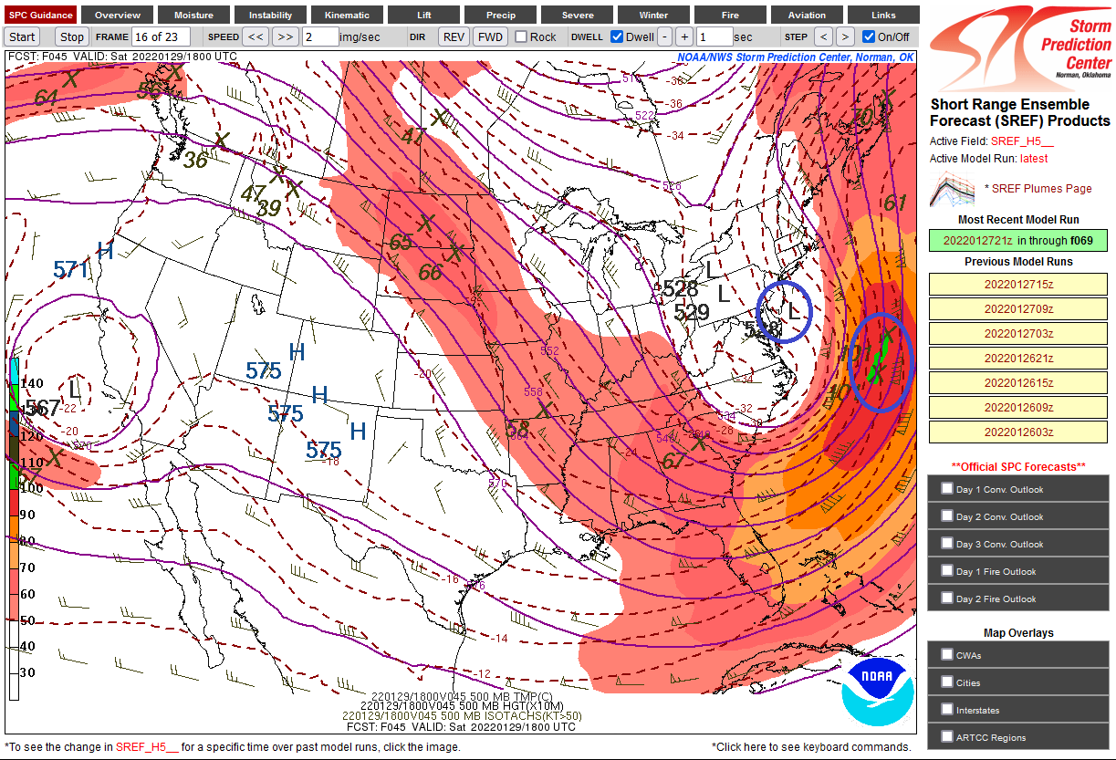
I just took a look at the SREFs and there's a panel showing that other low. Someone posted about it actually still being around coming off of Florida and then heading up to the NE with the Carolina low chasing it and you sortof see that here. So it seems the east-west jogs might be associated with that interaction.