Hurricane Agnes
-
Posts
9,344 -
Joined
Content Type
Profiles
Blogs
Forums
American Weather
Media Demo
Store
Gallery
Everything posted by Hurricane Agnes
-
January 28th/29th Event Obs - From KU to FU?
Hurricane Agnes replied to JTA66's topic in Philadelphia Region
Plus Monday is the New Moon so some higher tides. -
January 28th/29th Event Obs - From KU to FU?
Hurricane Agnes replied to JTA66's topic in Philadelphia Region
Comparison for up in NE -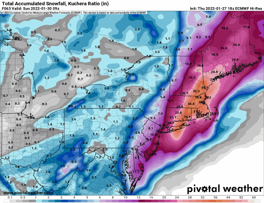
-
January 28th/29th Event Obs - From KU to FU?
Hurricane Agnes replied to JTA66's topic in Philadelphia Region
-
January 28th/29th Event Obs - From KU to FU?
Hurricane Agnes replied to JTA66's topic in Philadelphia Region
18z NBM...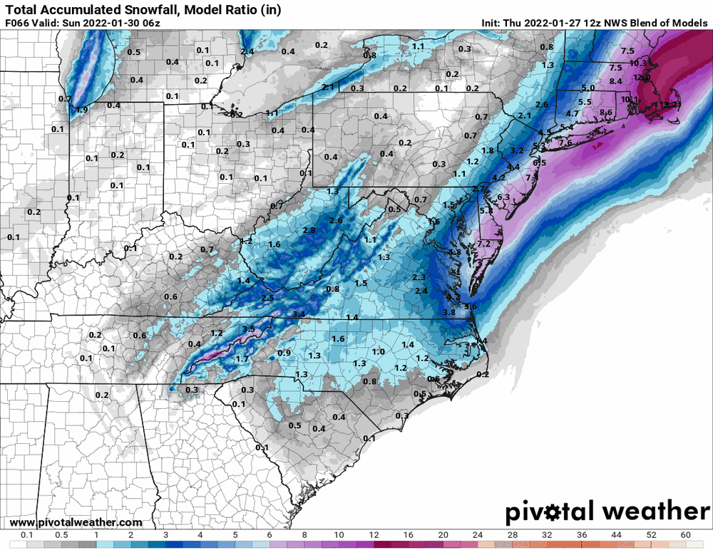
-
January 28th/29th Event Obs - From KU to FU?
Hurricane Agnes replied to JTA66's topic in Philadelphia Region
Main drawback of doing that is that it will be windy as hell down there with flooding and power outages (although the storm will be moving quickly). Definitely expect Wind Advisories possibly back this far from the coast, and along the coast itself, possibly High Wind Warnings. -
January 28th/29th Event Obs - From KU to FU?
Hurricane Agnes replied to JTA66's topic in Philadelphia Region
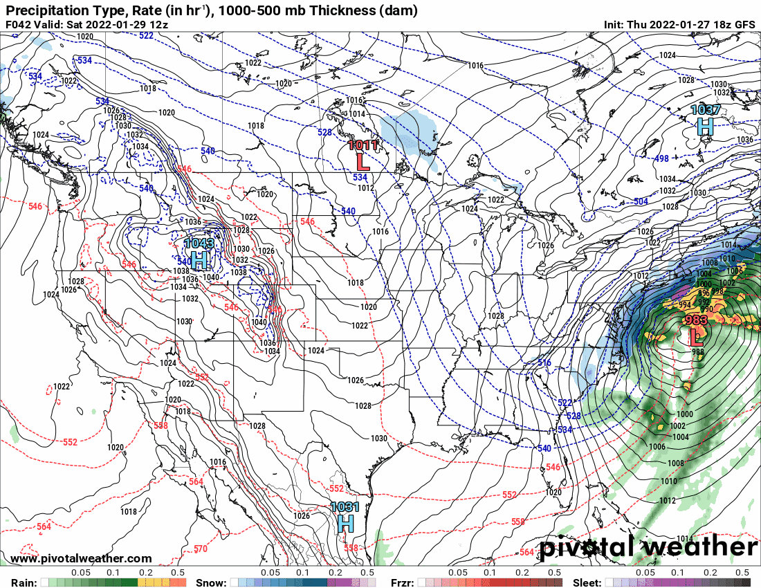
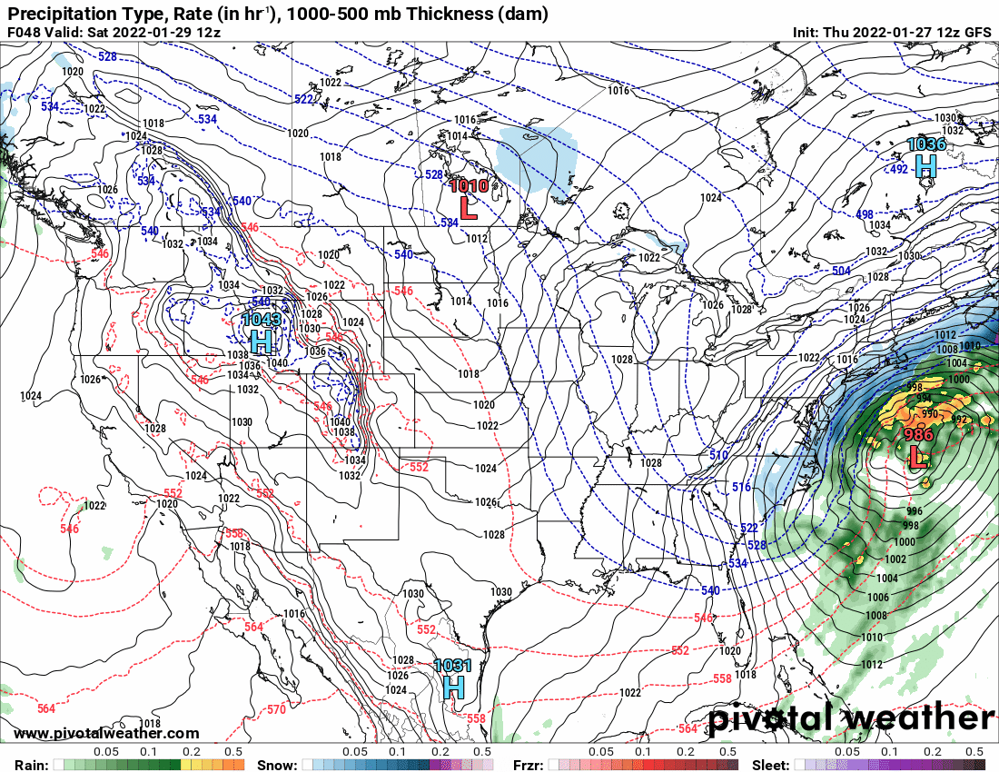
And the 18z GFS caved. Will have to see if the 0z holds and that might be a wrap or at least making the forecast a tiny bit easier.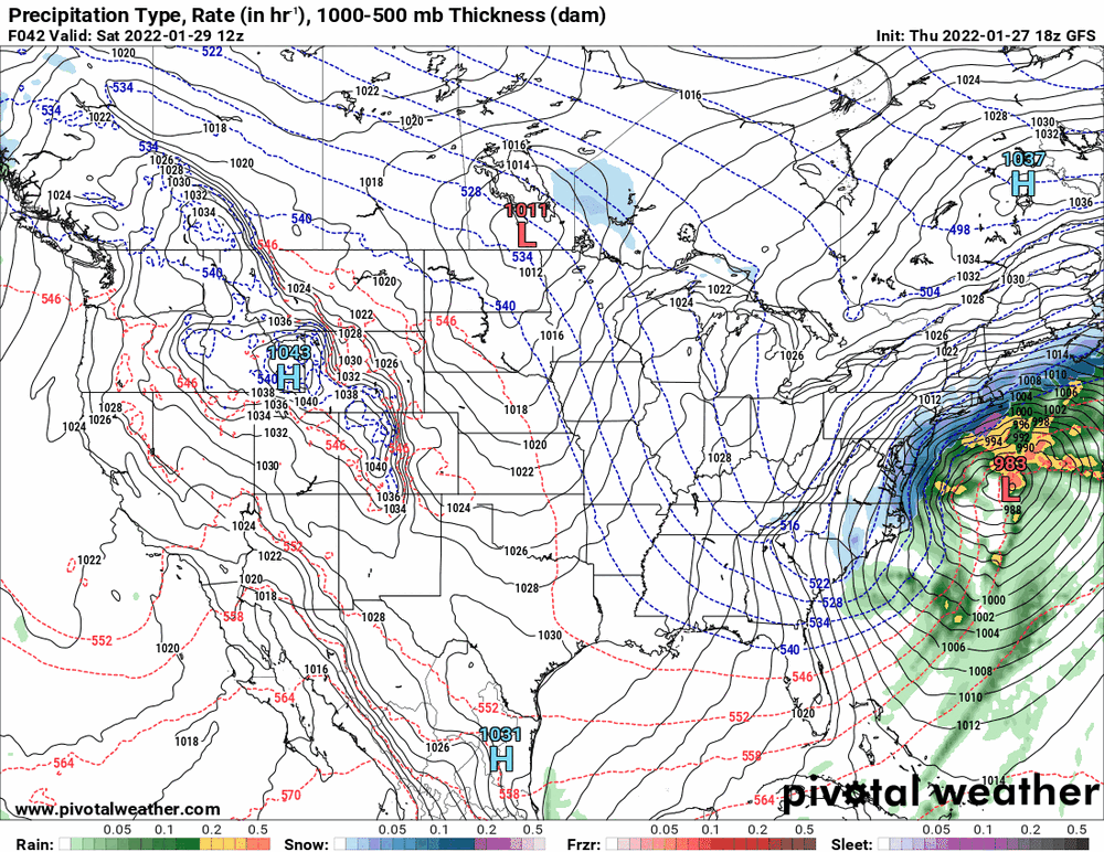

-
January 28th/29th Event Obs - From KU to FU?
Hurricane Agnes replied to JTA66's topic in Philadelphia Region
Current WSW - And Watch - -
January 28th/29th Event Obs - From KU to FU?
Hurricane Agnes replied to JTA66's topic in Philadelphia Region
i expect that was going to be a given and what to do with the potential gradient areas would be a bit trickier to decide regarding where to draw the line between a WSW and WWA. -
January 28th/29th Event Obs - From KU to FU?
Hurricane Agnes replied to JTA66's topic in Philadelphia Region
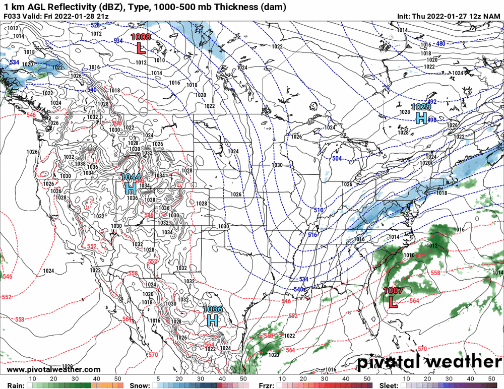
18z NAM holding steady with an amped-up low.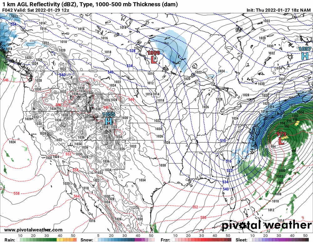
-
E PA/NJ/ DE Winter 2021-22 OBS Thread
Hurricane Agnes replied to JTA66's topic in Philadelphia Region
Unless those "females" are going through hot flashes. Have to have a fan and heater right next to you to deal with that. I think my high is probably going to end up being 31 and the dews finally got into the double digits (currently 10). Otherwise it's sunny and 30. -
January 28th/29th Event Obs - From KU to FU?
Hurricane Agnes replied to JTA66's topic in Philadelphia Region
KYW repeated Sosna's report and this time I caught when he said "don't be surprised if some areas get "a coating to an inch" outta that. -
January 28th/29th Event Obs - From KU to FU?
Hurricane Agnes replied to JTA66's topic in Philadelphia Region
18z NAM is running right now and has this interesting thing. I just heard Steve Sosna on KYW talking about that being "a front" (which is what I had termed it earlier). He even said don't be surprised to get "snow showers", etc., but was obviously not the "main event".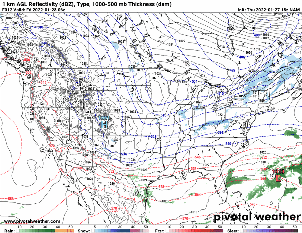
-
January 28th/29th Event Obs - From KU to FU?
Hurricane Agnes replied to JTA66's topic in Philadelphia Region
I agree. The progressiveness of it will certainly limit the potential. Probably an artifact of La Nina and that +NAO. -
January 28th/29th Event Obs - From KU to FU?
Hurricane Agnes replied to JTA66's topic in Philadelphia Region
-
January 28th/29th Event Obs - From KU to FU?
Hurricane Agnes replied to JTA66's topic in Philadelphia Region
Mt. Holly current Watches/Warnings - -
January 28th/29th Event Obs - From KU to FU?
Hurricane Agnes replied to JTA66's topic in Philadelphia Region
No cliff jumping!!!! Will throw the 12z ICON in.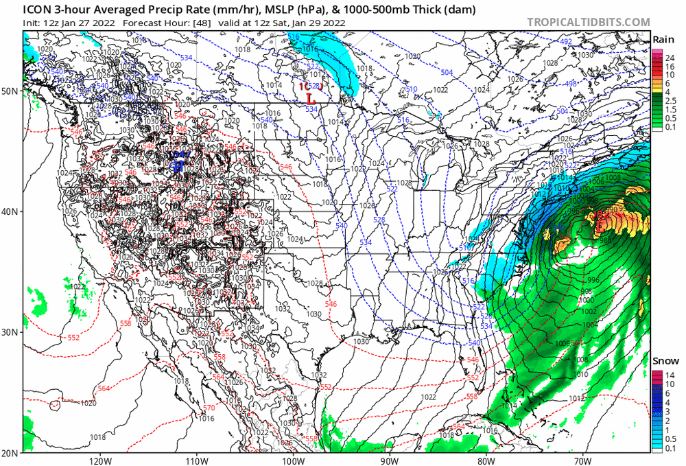
-
E PA/NJ/ DE Winter 2021-22 OBS Thread
Hurricane Agnes replied to JTA66's topic in Philadelphia Region
I saw that over-running rain storm for earlier and the Feb 5 - 6 one looks like an ice storm nightmare for the Carolinas!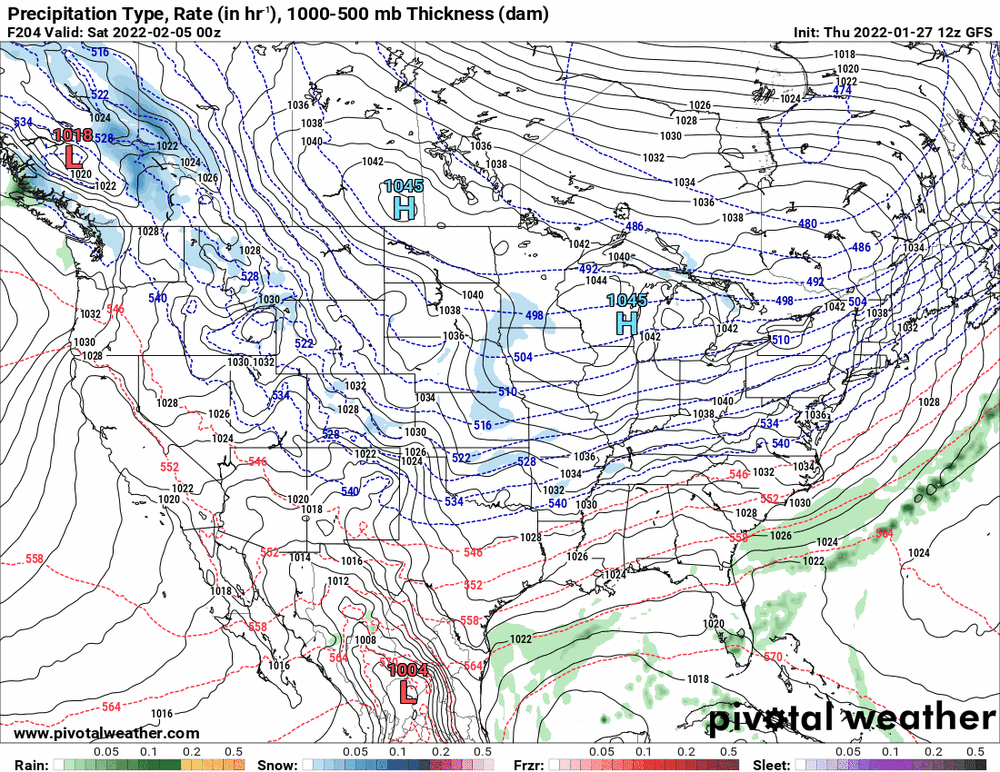
-
January 28th/29th Event Obs - From KU to FU?
Hurricane Agnes replied to JTA66's topic in Philadelphia Region
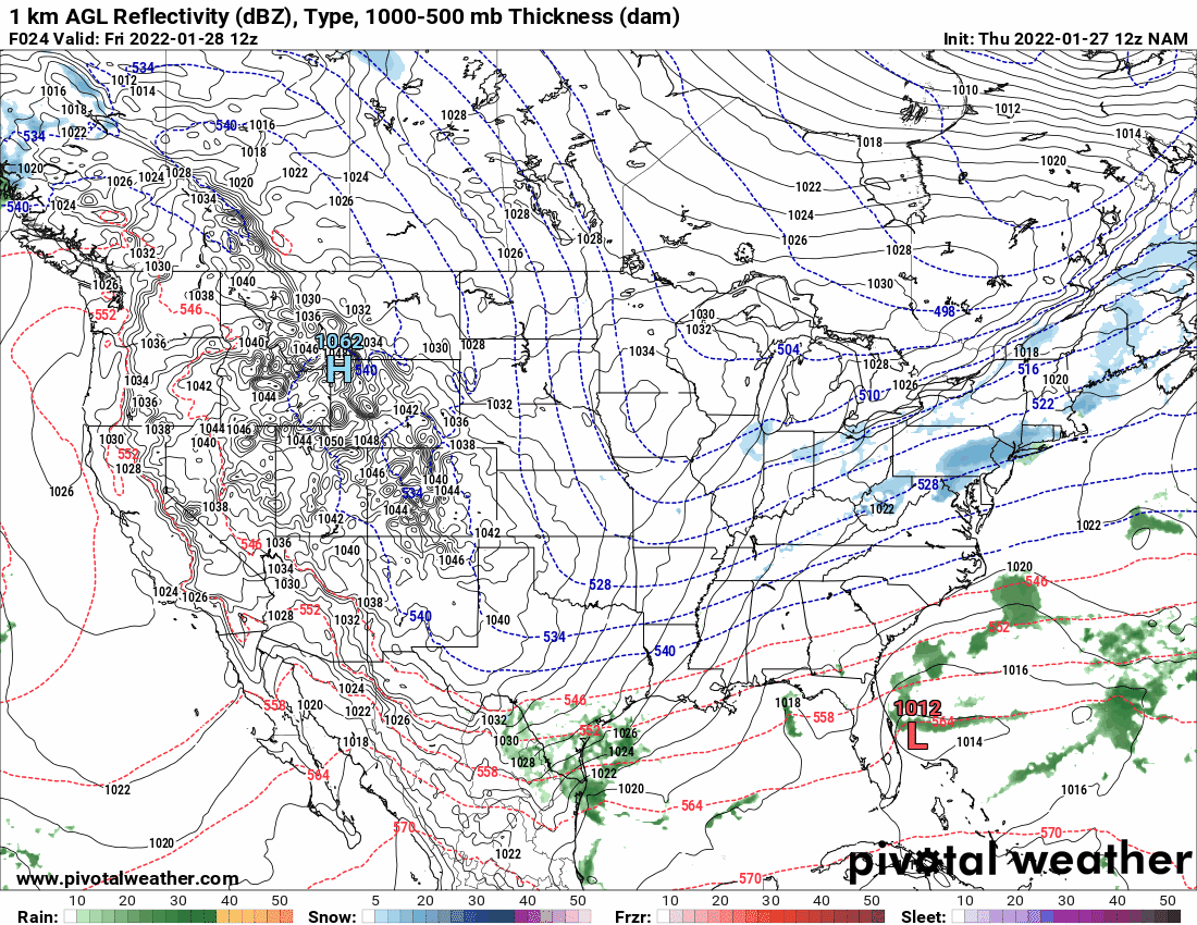
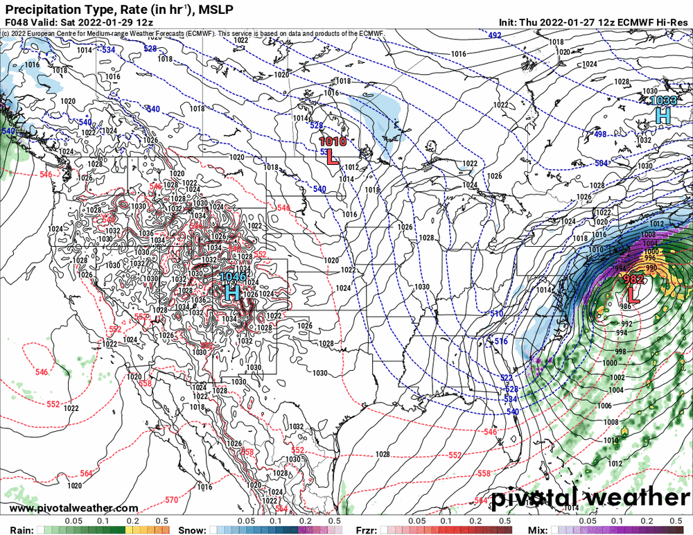
FWIW - the HRW FV3 (although it's not in range yet for the latter part of the storm).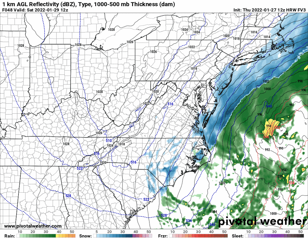
-
January 28th/29th Event Obs - From KU to FU?
Hurricane Agnes replied to JTA66's topic in Philadelphia Region
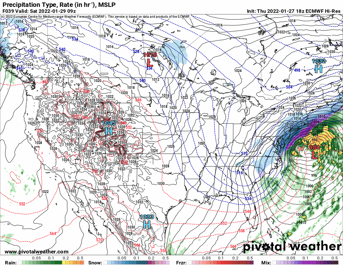
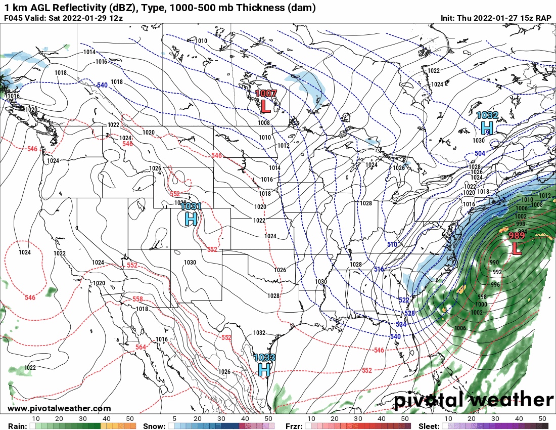
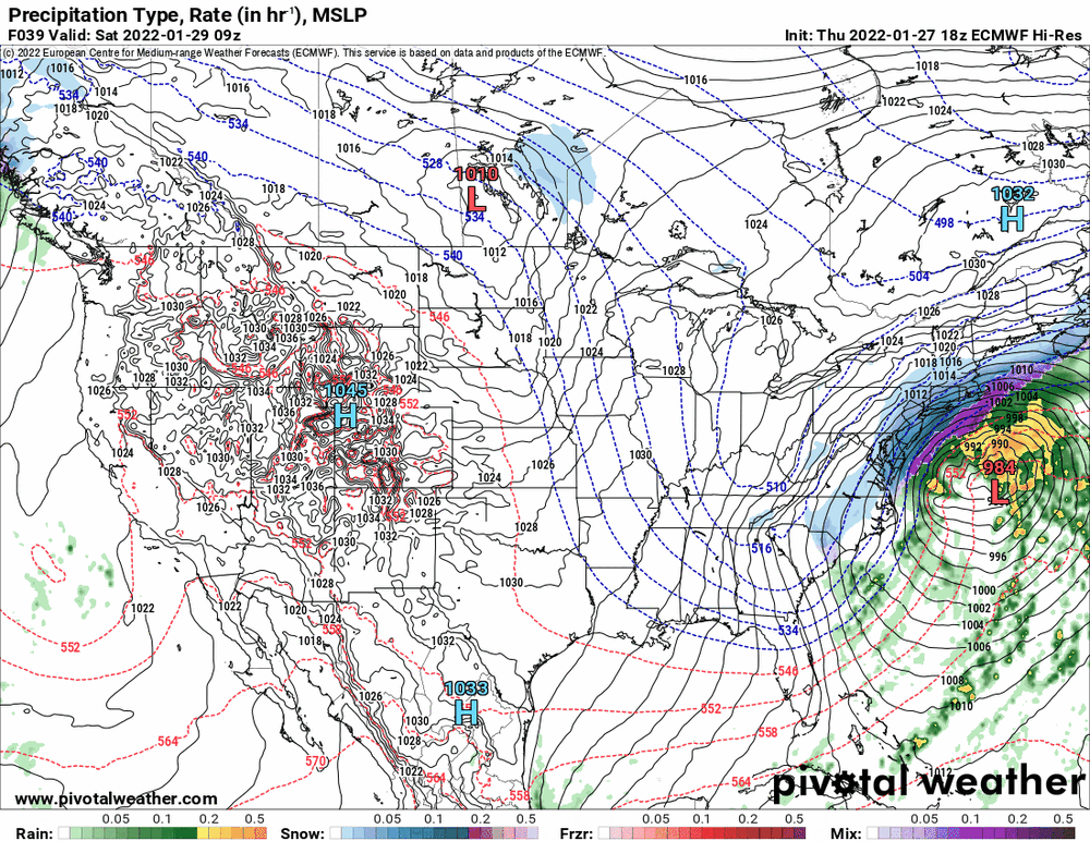
I know Ralph likes to sometimes post the RAP and since it is in range, I noticed that (well...since it updates hourly) it was hugging that same Florida low and then suddenly loses it and that continues to suggest how these models are dealing with that and the low that forms off the Carolinas. I am in the camp of not to completely discount the GFS but to perhaps weight to towards the others because if some kind of dry slot appears with any banding, some might get a bigger thump initially and they are done but others might have to wait to make up for it if they get under a band as it pivots over them when the storm moves away to the NE. This will be a fast mover so that might be a factor too.
-
January 28th/29th Event Obs - From KU to FU?
Hurricane Agnes replied to JTA66's topic in Philadelphia Region
12z GFS is still a bit further east from the others but not as much and has a "weaker" low (in relative terms because it is still pretty strong)than the 12z NAM.
-
January 28th/29th Event Obs - From KU to FU?
Hurricane Agnes replied to JTA66's topic in Philadelphia Region
I'm gonna posit a guess - and we have to see how it pans out - but right now it is 26 where I am with dp of 8. So the air is very very dry. And what has been mentioned on and off for the past week is that there is supposed to be an arctic intrusion of cold air for this (meaning some high ratio snow as a result). SO I think maybe the GFS is thinking subsidence and atmospheric drying (or over-thinking it - like the opposite "convective feedback" that happens with some model runs of the NAM). I don't know how many storms some of us have been through where returns were directly overhead but resulted in nothing but virga. The last event is exactly what happened to me where I registered "Trace" (as just some flurries) and didn't get anything "measurable" until later that night, and even then, it was just a dusting. The 12z GFS is just starting so will see where it goes... -
January 28th/29th Event Obs - From KU to FU?
Hurricane Agnes replied to JTA66's topic in Philadelphia Region
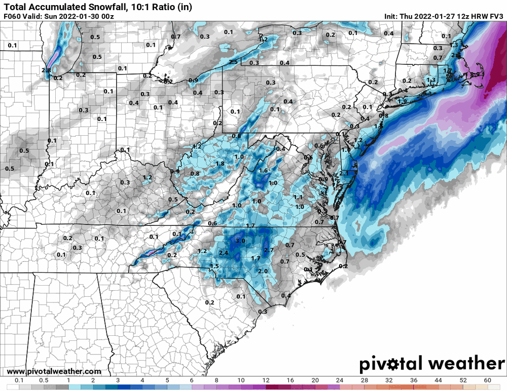
The HRW WRF-ARW is reflecting that earlier small event. Kinda cool.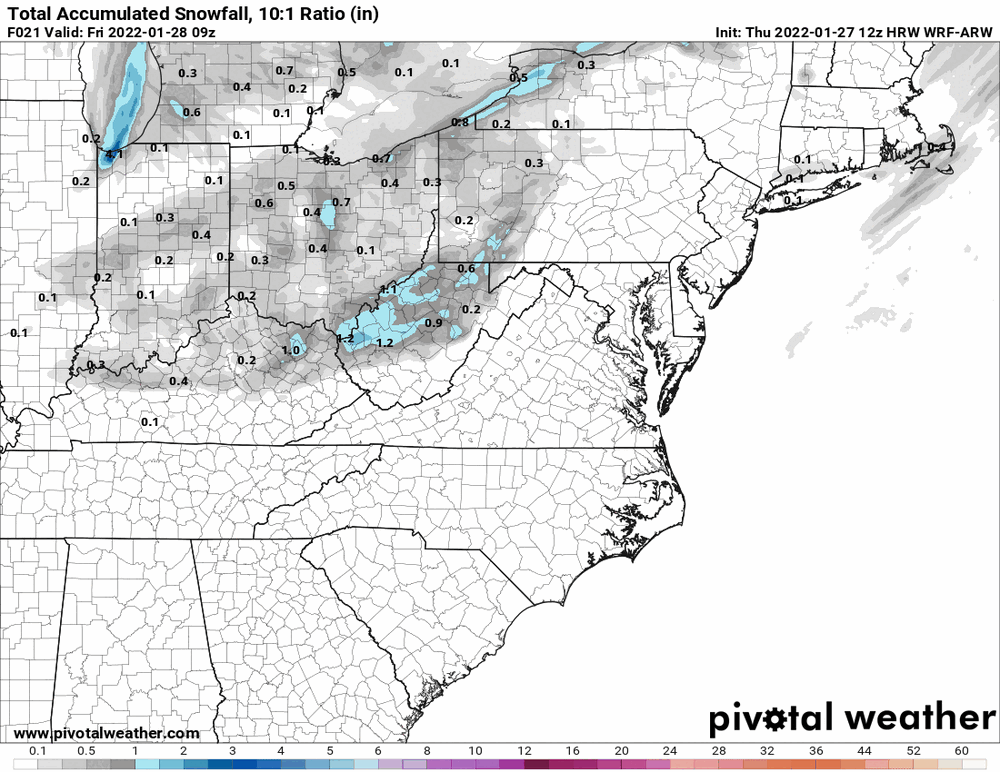
-
January 28th/29th Event Obs - From KU to FU?
Hurricane Agnes replied to JTA66's topic in Philadelphia Region
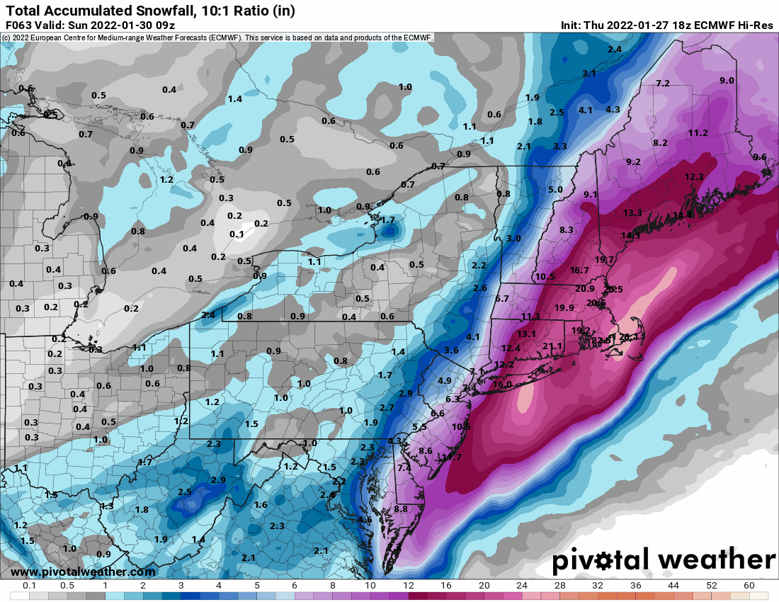
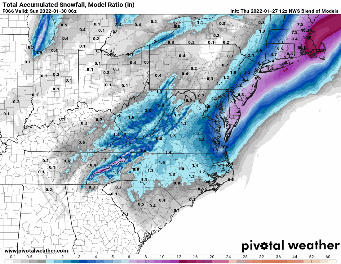
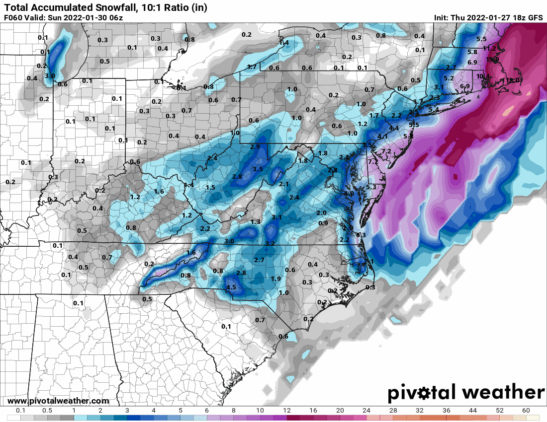
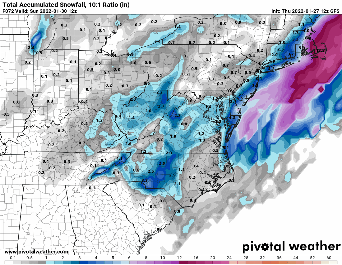
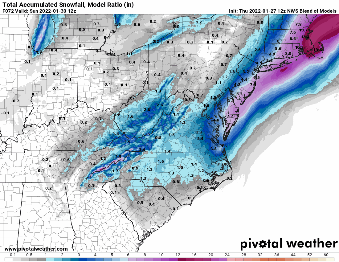
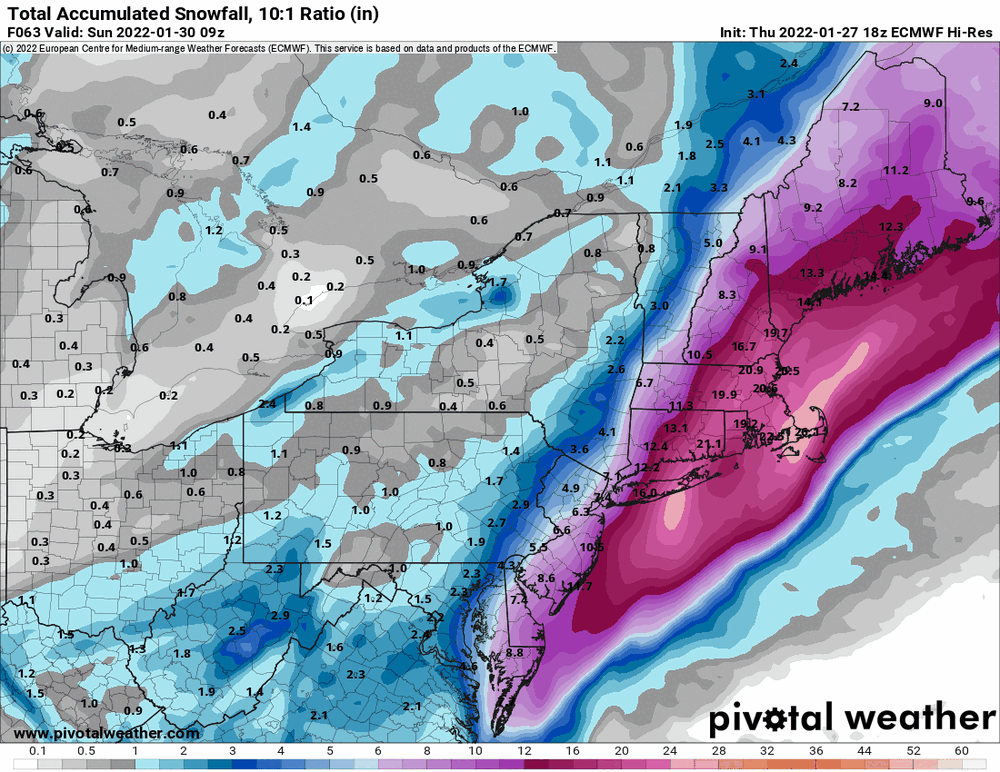
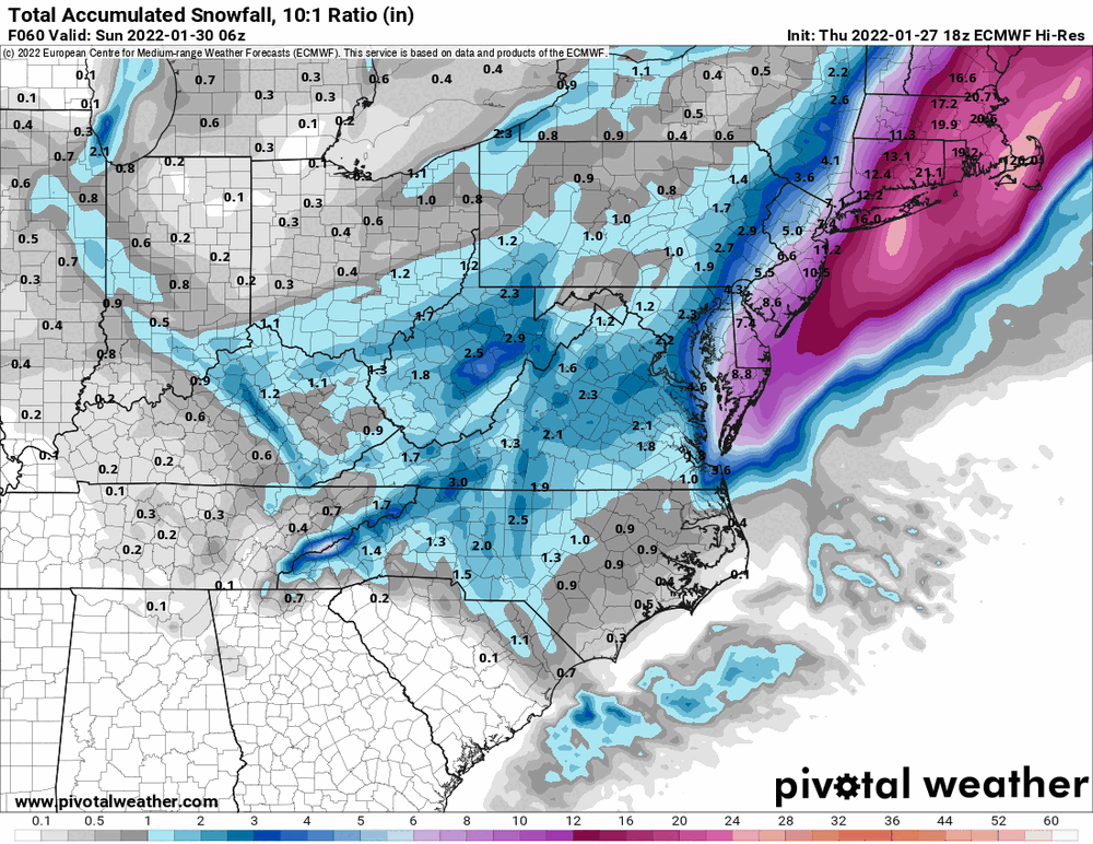
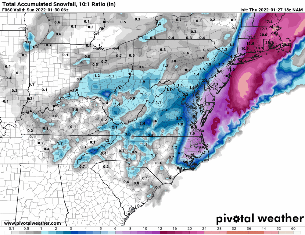
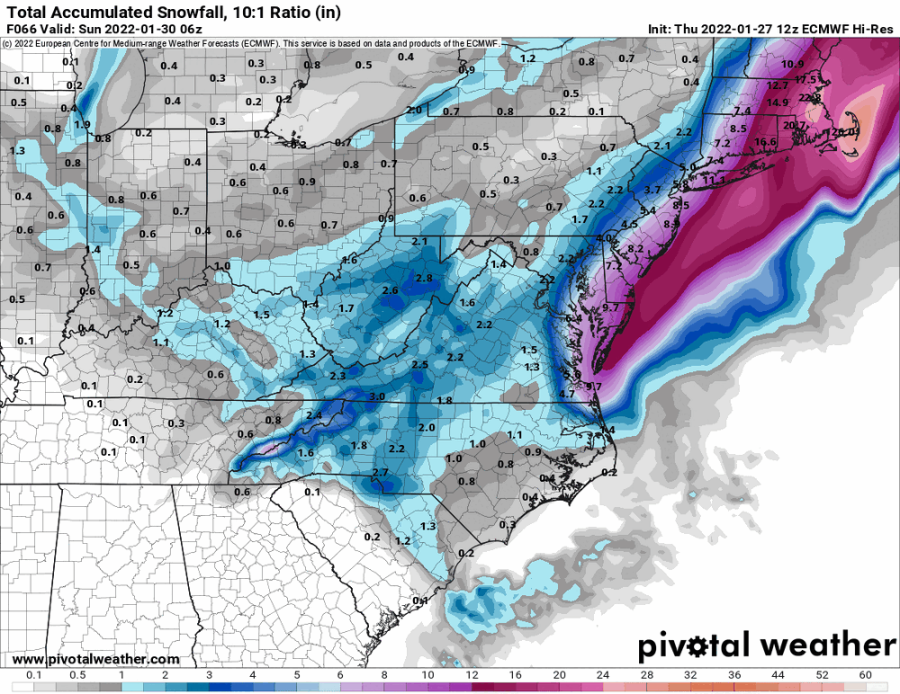
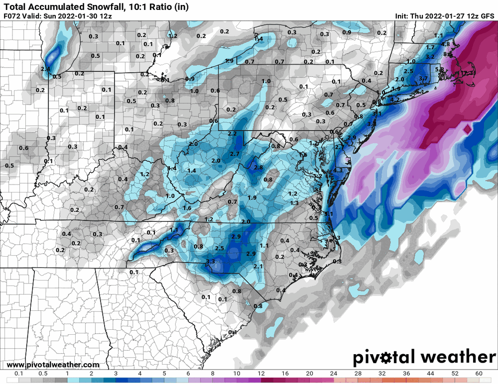
12z NBM (looks like what the current forecast seems to go with).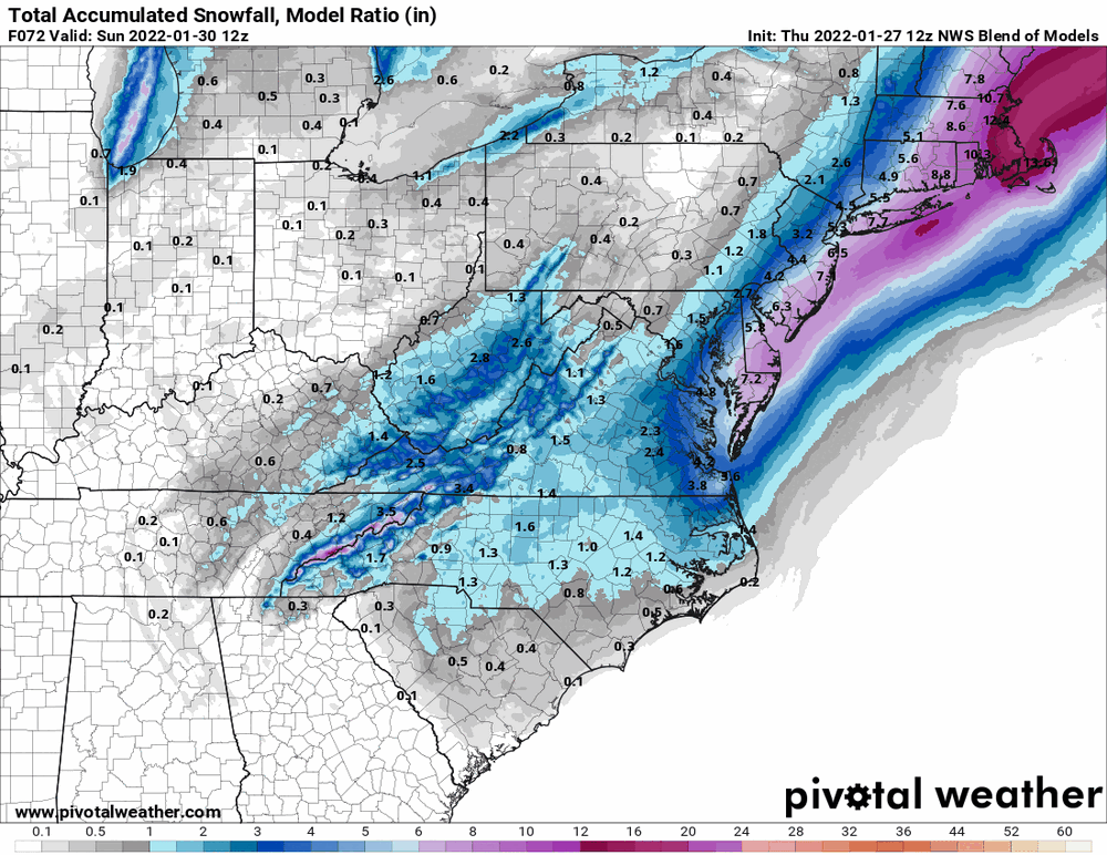
-
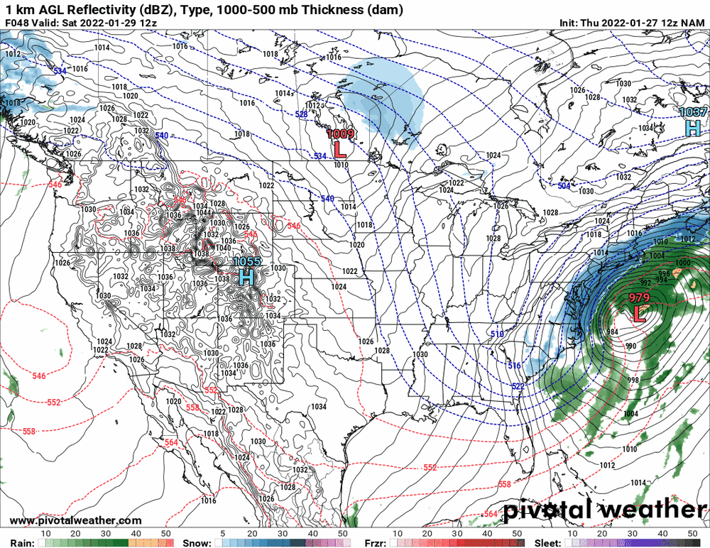
January 28th/29th Event Obs - From KU to FU?
Hurricane Agnes replied to JTA66's topic in Philadelphia Region
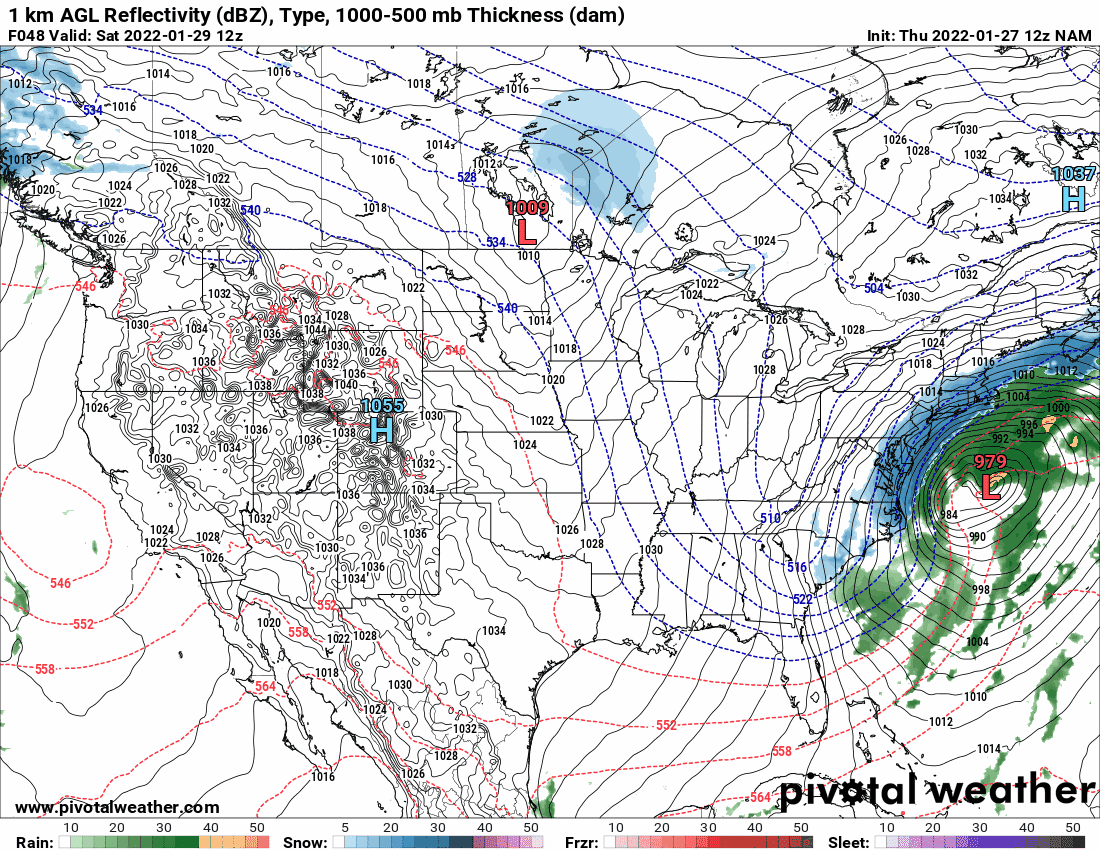
Well interestingly enough, between 12z on Jan. 28 to 12z on Jan 29, there is a 33 mb change (deepening) on the NAM, so at least that model appears to be having it "bomb" as it comes past here.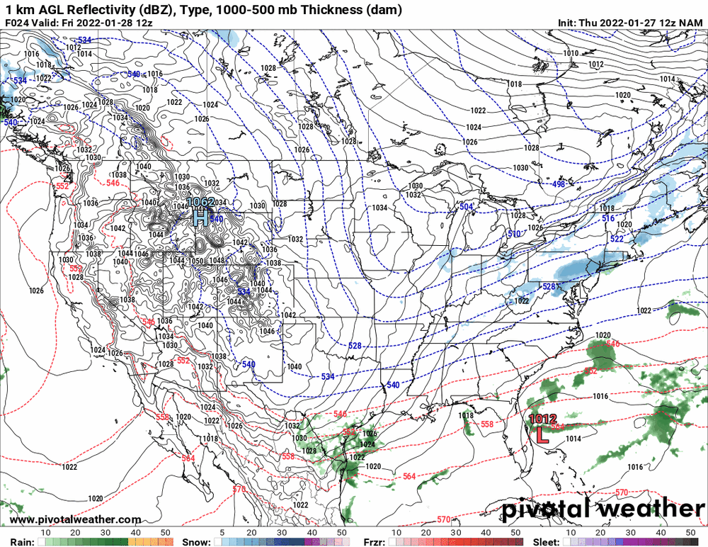
-
January 28th/29th Event Obs - From KU to FU?
Hurricane Agnes replied to JTA66's topic in Philadelphia Region
Looks almost like a cold front. Waiting for the 12z to finish.