Hurricane Agnes
-
Posts
9,287 -
Joined
Content Type
Profiles
Blogs
Forums
American Weather
Media Demo
Store
Gallery
Everything posted by Hurricane Agnes
-
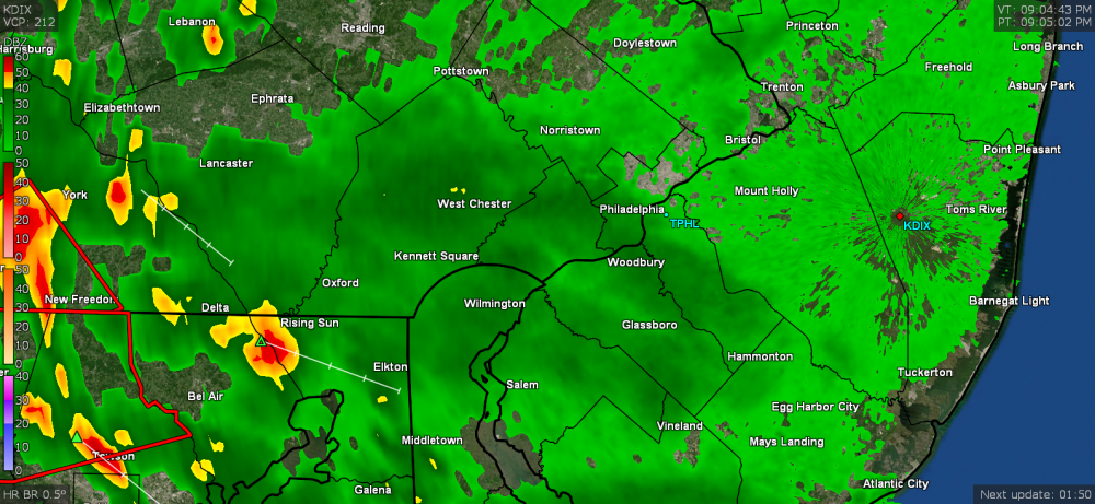
Mt. Holly tweeted an animation of that excitement from yesterday - Although it didn't get as hot here as yesterday (I just barely tapped 90 today), the dews were awful and it was pretty rough the brief times I was outside. Currently 80, mostly cloudy and soupy.. and I saw some pop-ups that formed in Montco and Bucks within the past couple hours moving SW --> NE into Jersey.
-
Ended up with another hundredth of an inch around 8 pm last night and final total was 3.13" for that wild event. Literally a month's worth of rain in a couple hours. Currently 66 at post time (and @ sunrise) and fair.
-
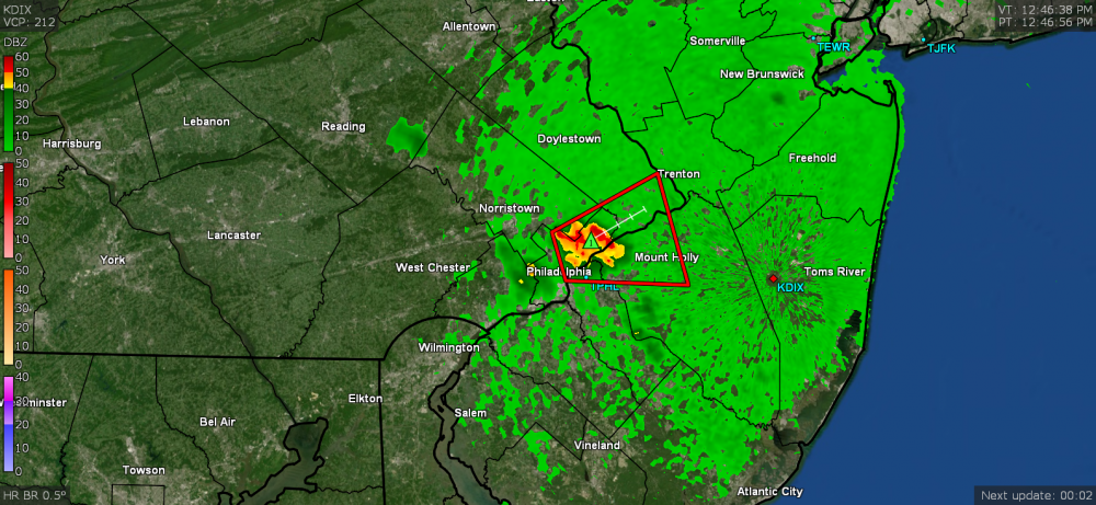
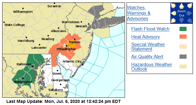
Looks like Mt. Holly picked up the Watch ball in the past hour now and does include the tristate area (ETA it looks like most of the convection has been backing to the west and south now) -
-
Wanted to add that Norman, OK had put in the Severe Thunderstorm Watch until 11 pm and the way these cells are building and back-building, that might verify!
-
Looking at my data, I had about 5 minutes worth (from 2:09 pm - 2:14 pm) of 4.82"/hr rates! You would think at this time of the evening, the convection would start dying out but it keeps coming. Still 70 and overcast here.
-
Sun just popped out here. Temp is still at 70 and everything smells fresh and clean out there!
-
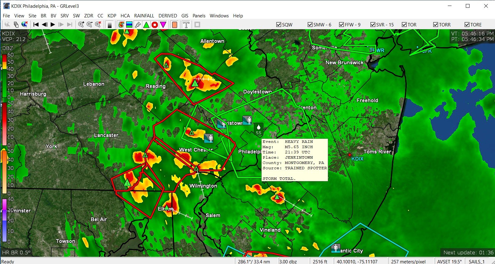
Jenkintown spotter reported 5.65" of rain so far for the event (I am still at 3.12" with temp now up to 70)!

-
Yes but then if I go to the stores in Erdenheim or Flourtown during heavy rains like this, there's a big hill I would go down along Bethlehem Pike, and I know it probably floods there at Bethlehem Pk and Montgomery at the bottom of the hill. That is why I am always impressed with Springfield Township because they have equipment to keep their storm drains cleared!!! They also have a catch pond near there too and it's all part of the Wissahickon Watershed that they have been continually working on improving too.
-
I'm about 4 miles to the SW of Cheltenham Twp. I know that my sis in the next door Springfield Twp (in Wyndmoor) just had her power go out on her street in the past hour. Transformer was sparking and then blew.
-
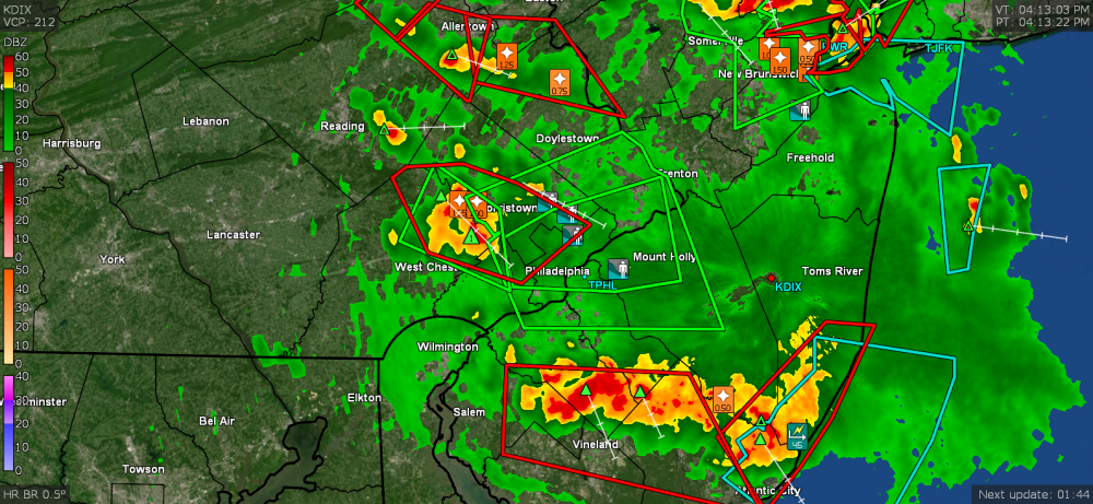
Yeah that blob is expanding and contracting and expanding (back-building) and it looks like it is sagging towards Delco.
-
So far I have 3.09" of rain since ~1:00 pm (max rain rate hit 3.19"/hr so far). Temp is sitting at 69 now but I see the new batch coming this way. The cells are slow-moving and dumping like crazy apparently. Heard Hurricane Schwartz on and off on KYW the past hour and he was talking about all the back-building of the thunderstorms. The latest cluster might sideswipe me to the south if it continues the current storm motion.
-
This thing looks like a MCS developed right over the area! Now up to 3.04" of rain at post time. Temp is still 68.

-
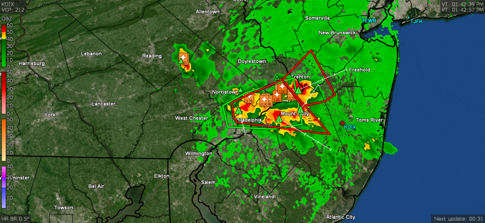
Rare Flash Flood Emergency issued -
-
EAS and all hell breaking loose on phones and whatnot again. Temp down to 68. Rain is up to 2.87" after having let up some.
-
Have already surpassed the entire amount of rain that I got in June in just an hour! Now up to 2.24".
-
Now getting some winds... it has been mostly a lot of rain, thunder and lightning with just moderate wind. Temp is holding at 69. Now up to 2.02" of rain from this event so far. Rain rate is averaging around 4.5"/hr. Huzzah!

-
Temp down to 69, 25 degrees less than 2 hours ago. Rain rates runing over 4"/ hr and am now up to 1.75" at post time and moving up fast! " ETA OMFG now at 4.75"/hr.
-
Now up to 0.87" rain.
-
Temp is now down to 72, 22 degrees less than at noon. Currently up to 0.77" of rain (over 3"/hr rate) so far at post time.
-
OMG HAIL. I have not seen hail around here in at least 20 years. It always melted before it reached the ground. Getting pea-size hail.
-
Like a full frontal assault on the city. Getting heavy rain here now (of course after I watered this morning) and temp is down to 78 - literally 16 degrees lower than 90 minutes ago!
-
All hell just broke loose on my phones and weather radio! Good afternoon Mt. Holly. Finally got enough rain to tip the bucket (0.02" so far).

-
Flood advisory now issued too. Am geting some big droplets but not any of the "rain". The temp was knocked back almost 10 degrees here now (down to 85).
-
Hearing thunder and temp now down to 87 but that big blob is missing me to the south and east. They are also issuing a Flash Flood watch now -
-
Mike is on it - Severe Thunderstorm Warning