Hurricane Agnes
-
Posts
9,287 -
Joined
Content Type
Profiles
Blogs
Forums
American Weather
Media Demo
Store
Gallery
Everything posted by Hurricane Agnes
-
Hale-Bopp was the be-all end-all because it was still visible for a long time and at some point, both during the day and at night! I still haven't been able to catch Neowise thanks to the damn continual streams of cirrus clouds (in addition to other days when it was rainy/overcast here). Currently at 91 with dp 72 with some fair weather cumulus dotted all around.
-
My low this morning is much warmer than yesterday (76 vs 72) and we're off to the races at 87 and mostly sunny with dp 72.
-
I topped off at 95 today and the humidity pretty much stayed in check but is slowly creeping back. Currently 89 and mostly sunny.
-
It's been really nice here early this morning. Low was 72 and with dews in the mid-60s, it was so much better than yesterday around the same time. But with that, the temp has been on the rise and is currently 76 (although still with a "lower" dp of 66) and partly sunny (after a red sunrise earlier).
-
Made it up to 93 today but fortunately the dews did drop a bit by the afternoon, so it wasn't like last night and earlier this morning. Currently 80 with lots of comet-blocking cirrus.
-
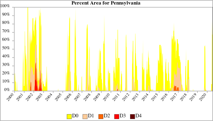
I'm surprised 2002 didn't end up on that list. That was a brutal hot and dry summer, with a bad drought that finally broke in the fall. https://www.drought.gov/drought/states/pennsylvania Currently 92 and mostly sunny. Am guessing I am "officially" starting a new heatwave period!
-
Was outside last night around 10 pm fruitlessly comet-hunting and pretty much failing due to the continual cirrus cloud presence and not only heard my first crickets but my first katydid. So we are now officially in the depths of summer. It has been humid as slop, both last night and this morning. Current temp is 83 with a horrible 76 dewpoint and partly sunny.
-
Ended up just missing 90 today, with high of 89. Currently a sticky 86 (dp 71) and mostly sunny.
-
Sun is out here - at least the most that it has been all day, but still mostly cloudy with some breaks in the cloud deck, and temp at 75.
-
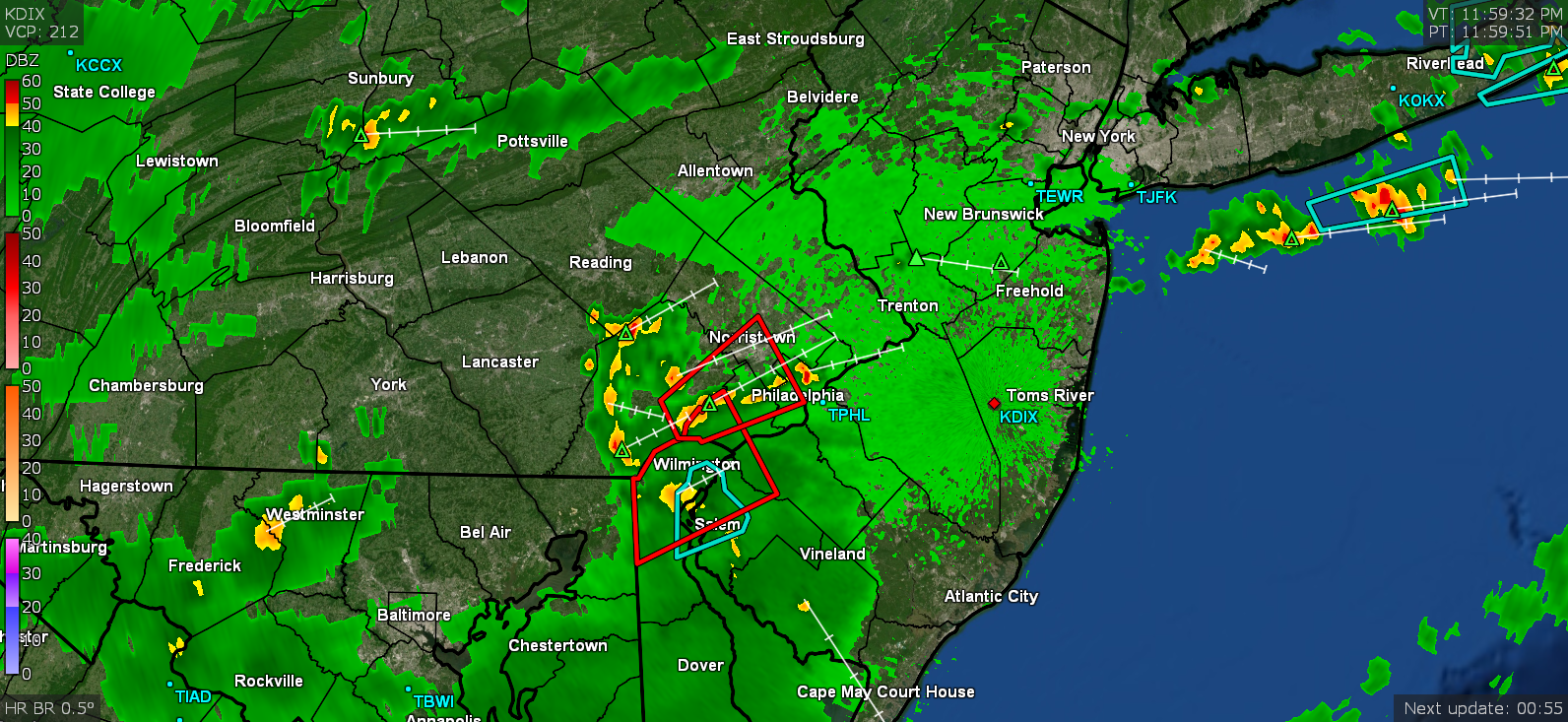
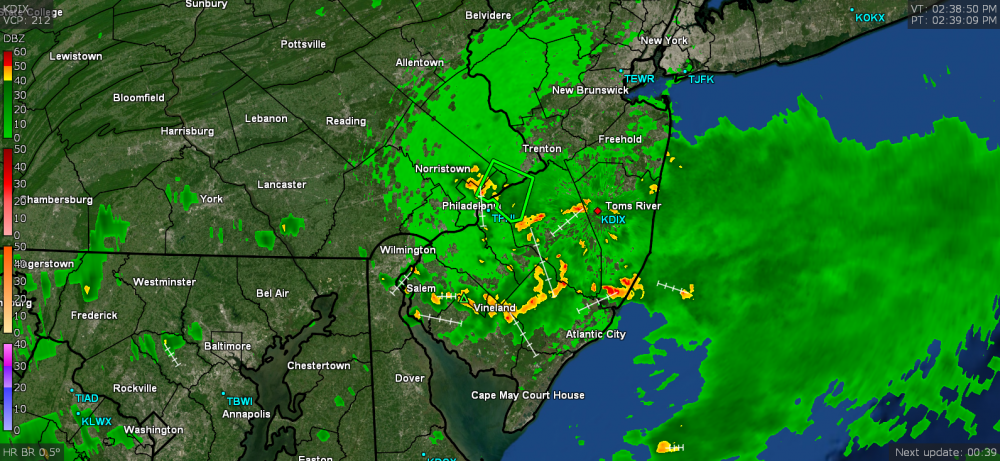
OMFG the thing that was hitting the NE and southern Bucksco pivoted around to here. I saw it moving this way but I HAD to go out and do some errands (and had a damn truck parked such that I couldn't get out). When it finally moved and I zoomed out, as soon as I pulled in the lot to the post office, gully washer. I did bring my umbrella because I knew it was coming and had hoped to beat it, but nope. Lots of ponding in parking lots and streams running down streets. Anyway, between 2:30 pm and post time, I got another 0.63" of rain for a daily total of 2.28" (so far). The max rate here hit 1.77"/hr. Currently light rain and 73. ETA - added the radar shot when I was in the parking lot of the little shopping complex right near me.
-
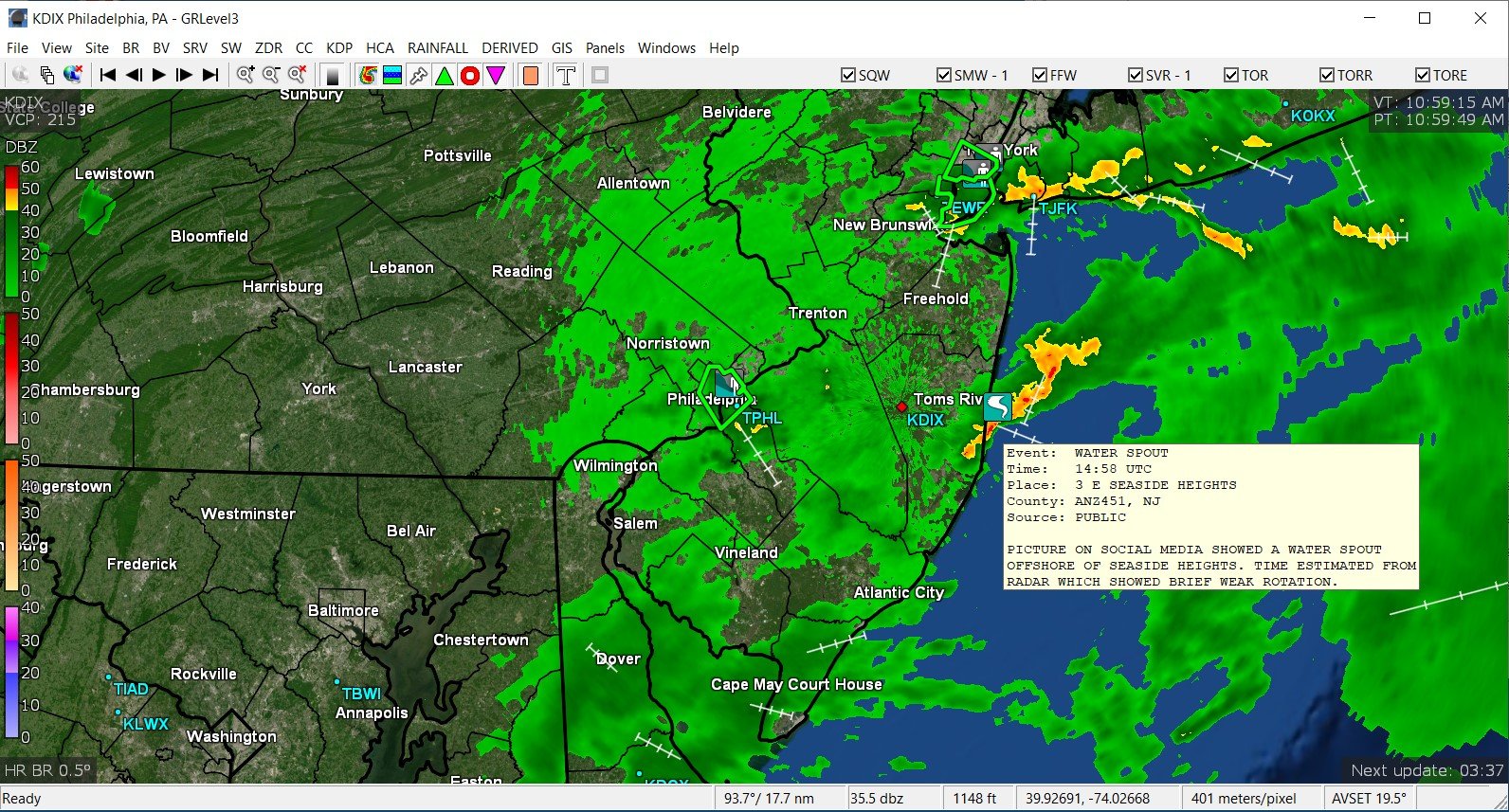
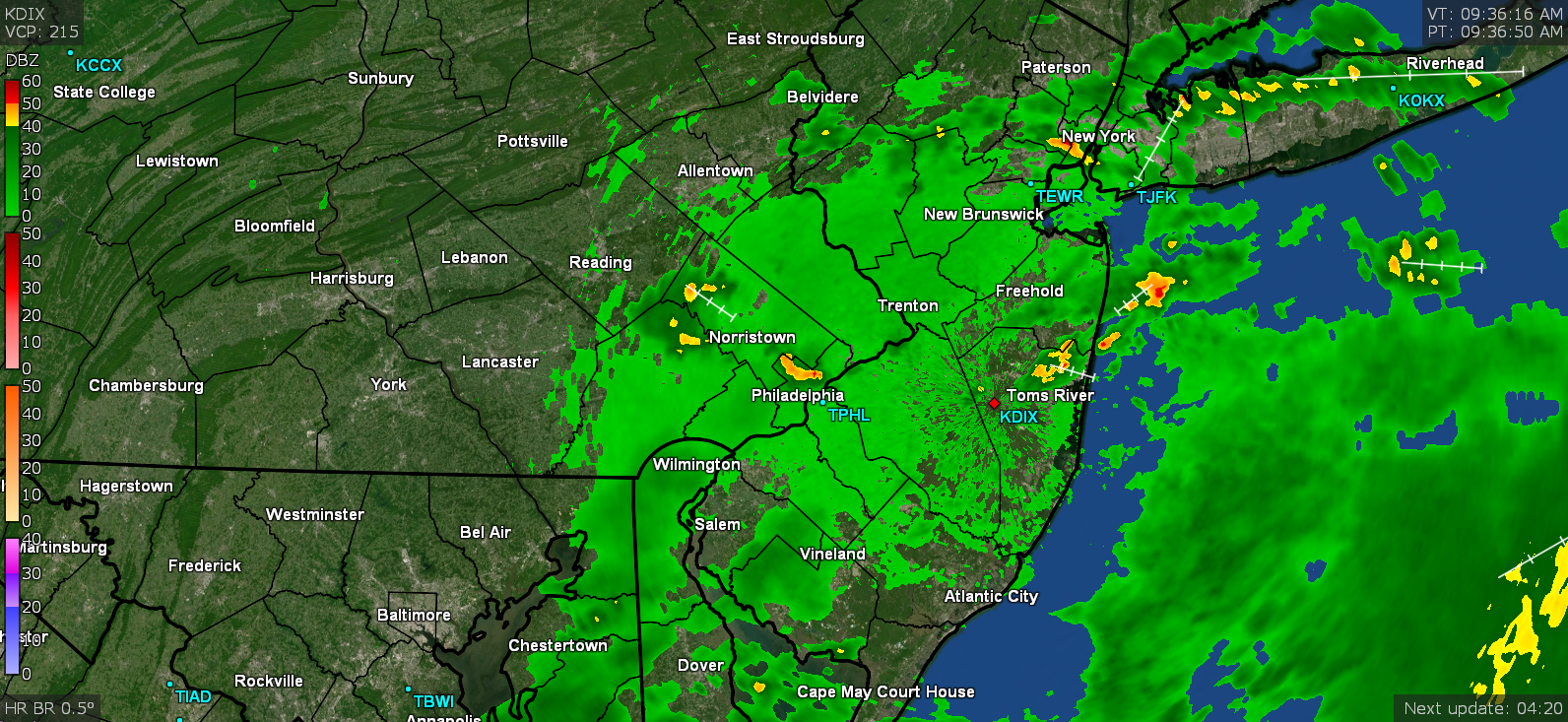
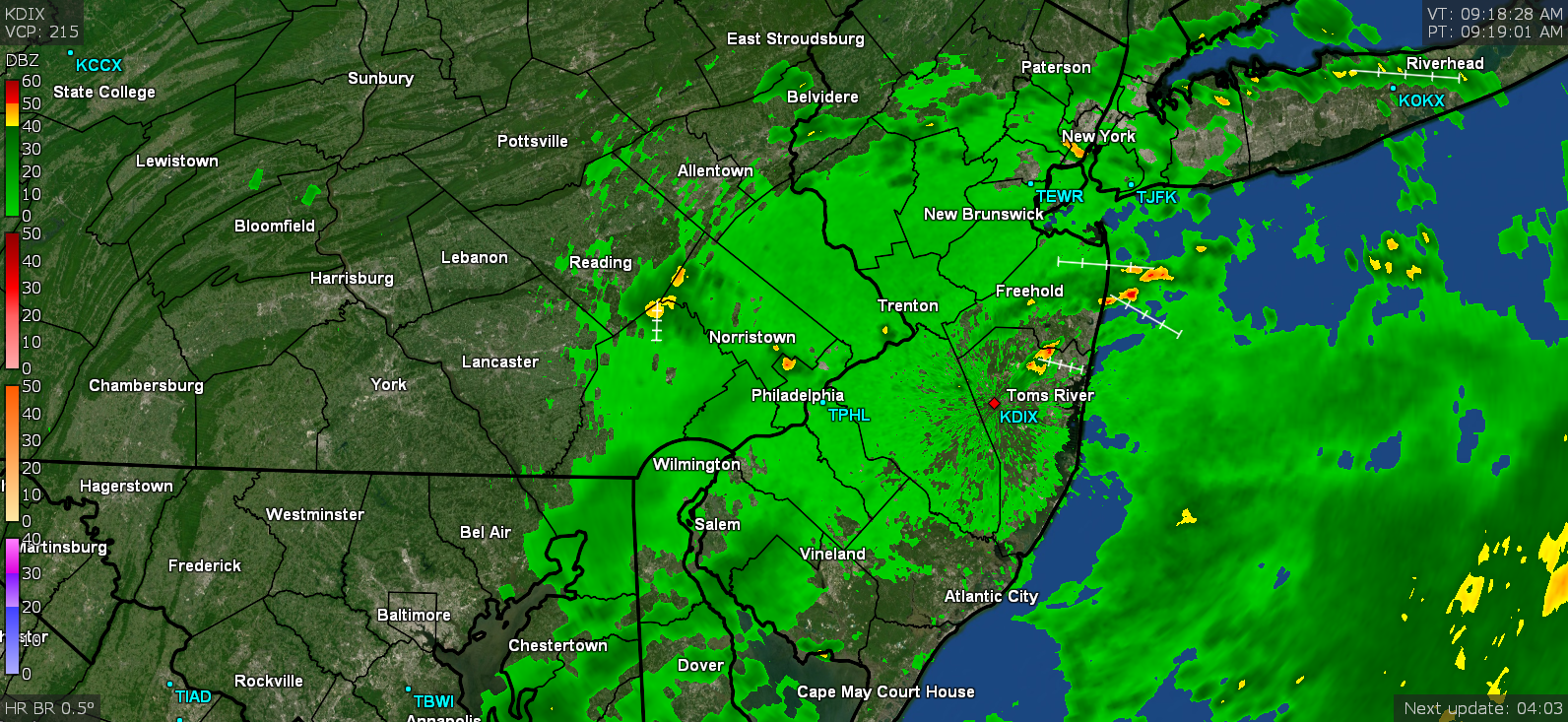
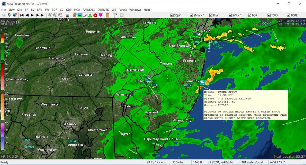
I was just going through some of the earlier radar shots an apparently there was a report of a water spout off the coast near Tom's River. As an obs, it finally hit 80 here and still overcast.
-
Nice! I bought a new station (just delivered yesterday) and am thinking of getting a lightning sensor for it (if anything, as a geek option since they are obviously not as accurate as the pro detectors ).
-
Kinda delayed based on how often the USGS gauge updates on the Wissahickon (the "at the mouth" gauge which is where it comes out into the Schuylkill) but it is starting to register whatever is flowing into it (11 am update) - I don't live that far from the Cresheim Creek (which is a feeder to the Wissahickon Creek) and that little creek runs at the bottom of several hills and floods Cresheim Valley Drive all the time with even just run-of-the-mill heavy rain.
-
And thank you! Since we have had wet conditions the past week, I know the ground is saturated in this area of the city (1.29" even before today, from 7/22 & 7/23 rainfall).
-
And the summer of azz follows your winter of azz no matter where you are.
-
I haven't been out but I know some places right down the street (and hill) from me that tend to flood with rain rates like that. I got 1.48" of rain between about 9:20 am and 10:20 am where I am (Chestnut Hill). The highest rate on my station was 2.41"/hr at 10:09 am.
-
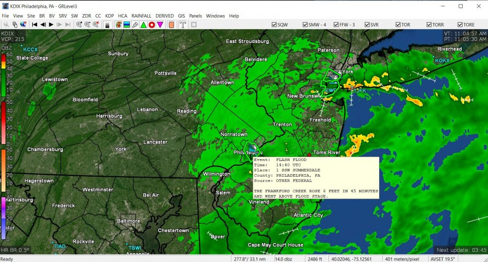
Wow. Report of Frankford Creek rising 6 feet in 45 minutes and right on out of its banks from that stationary blob of rain. Currently overcast and misty here and 75.
-
Thank you Mike!!!
-
Am almost at 1.50" of rain just from that alone. Currently sitting at 1.65" for the day (1.48" from my earlier total). That brings my July total rain up to 9.57" (so far). The heaviest portion finally moved just south and east of me and the sky is making an attempt to brighten a bit.
-
Hello Mt. Holly? We got a cell sitting stationary right over NW Philly. Now up to 1.52" (1.35" in the past hour).

-
Another intensified cell just blew up and threw me past the 1" rain mark total (since midnight) for today. Currently at 1.17" (1.00" at post time more since just after midnight) with temp 74 and heavy rain. ETA - now at 1.29" (2"/hr rates again) for the day and with the antecedent wet conditions, this may cause ponding and whatnot.
-
Well this thing evolved into a little thunderstorm with just over 2"/hr rates. Already have 0.66" added onto my last report (total 0.83" day total now at post time). I suppose when it crosses the Delaware River to Jersey, it'll finally get an SPS there.
-
Well the bright overcast didn't last long and I'm getting rain again. Just as I typed this, the skies opened up and a pop-up blew up right over me with almost 1"/hr rates. Currently 75 with a rain shower. In the meantime, this morning offered the rare opportunity to turn the oven on and get a casserole in and out, and not have to worry about long-lasting house-as-furnace.
-
Got a couple hundreds more of light rain this morning and the sky has been brightening and finished up (so far) with 0.17" from overnight and earlier this morning. Currently bright overcast and 74.
-
Figured the stuff out west would move this way but wasn't sure how much it would hang together but it did (mainly because of the front moving it along). The lightning/thunder woke me up around midnight and deposited 0.09" just before 1 am and the on and off light rain has deposited another 0.05" since, with a total of 0.14" at post time. Was able to grab a snapshot of that stuff that woke me up. Currently misty and 73.