Hurricane Agnes
-
Posts
9,274 -
Joined
Content Type
Profiles
Blogs
Forums
American Weather
Media Demo
Store
Gallery
Everything posted by Hurricane Agnes
-
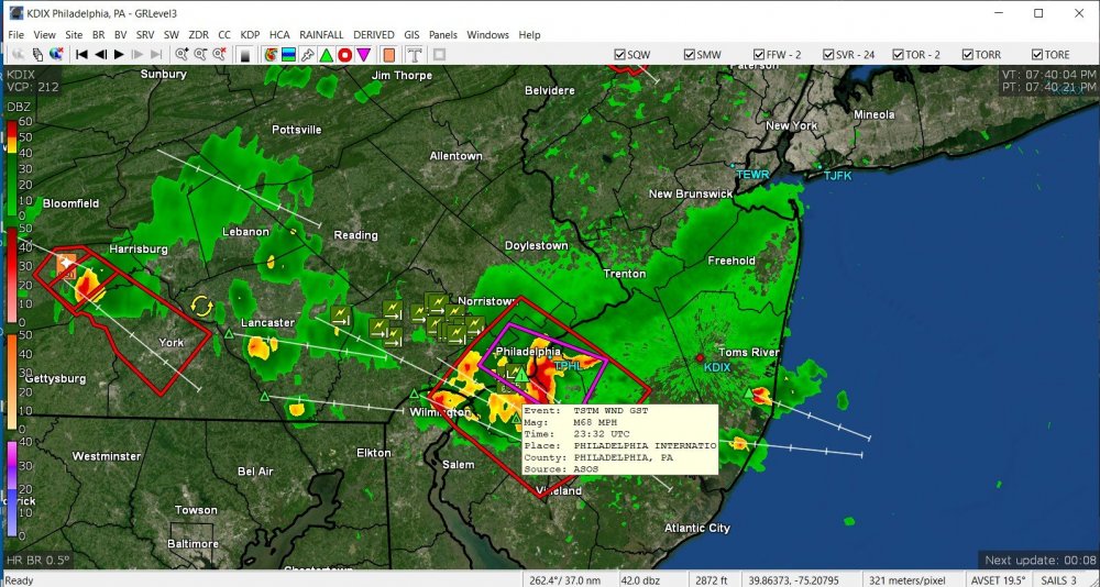
TOR just expired but KPHL reported a 68 mph gust.
-
The heaviest stuff is rolling just south of me.
-
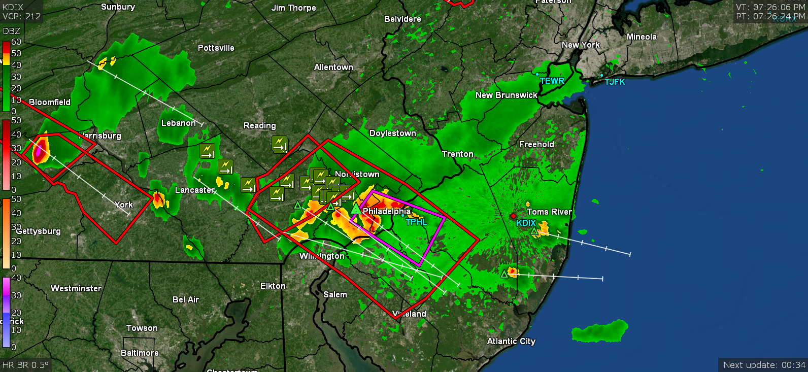
Tornado Warning in eastern Delco area.
-
TOR lofted -
-
This is a noisy storm. Popped outside and am hearing continual thunder and seeing some lightning flashes. The other one had a couple rumbles of thunder but this one is "blabby". Temp is down to 80.
-
That should be interesting when sea breeze meets juiced-up stuff in front of a cold front.
-
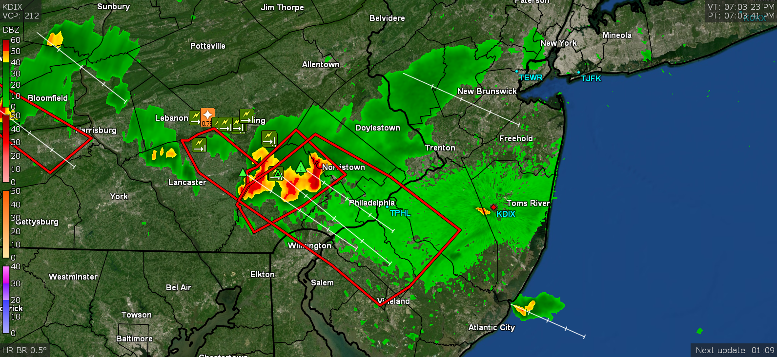
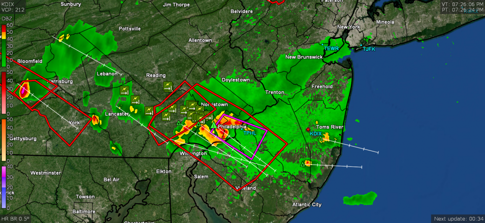
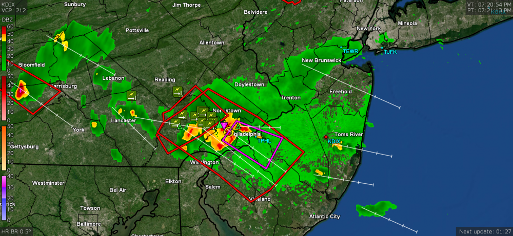
Blob incoming.

-
Looks like these 3 cells sortof congealed into a blob over northern Chesterco and is heading for Delco. I might get side-swiped by some of it on its northern fringe.
-
It managed to recover to 83 here before the hazy overcast rolled in and dropped me down to 82. Juicy out though and there is some incoming on the radar if it holds together.

-
Norman, OK lofted a new Watch -
-
Saw this posted on 6Abc's site (looks almost like that was a cell with some rotation and maybe even a funnel trying to start up) - Currently up to 79 here.
-
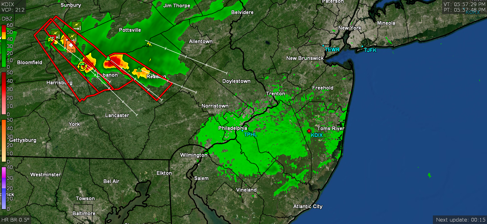
Just heard Hurricane Schwartz on KYW and he mentioned some of the cells out in Central PA that may eventually migrate eastward to our are later tonight (not as a line but probably a bunch of discrete cells). Temp continues to increase and it is now up to 75 here and mostly sunny. Not sure if it will get back to the mid-80s by evening (like it was earlier today) but it is still juicy out there.
-
Go for it!
-
Sun is out, peonies are down, and the sauna has commenced. Currently partly sunny and temp is up to 70 and rising, with dp 68.
-
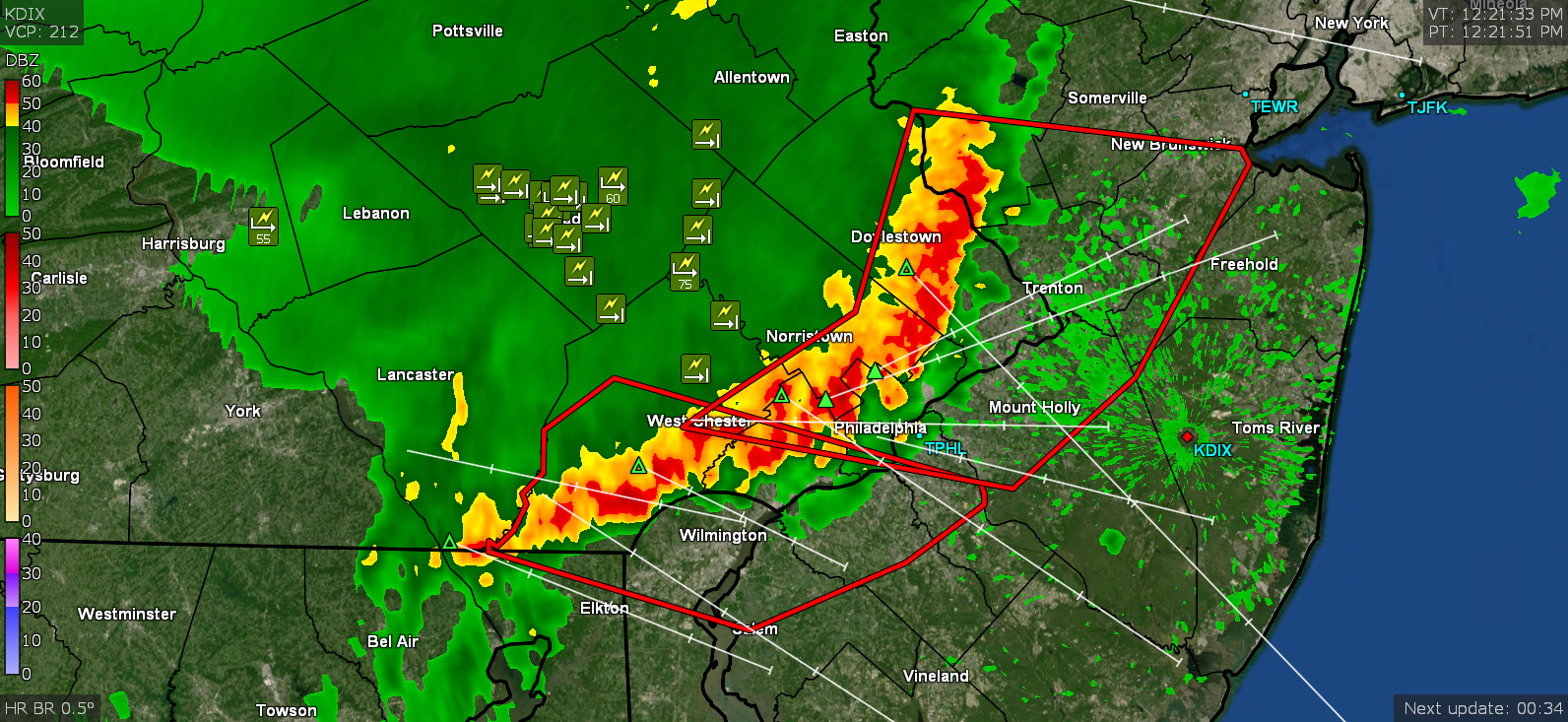
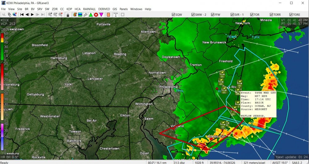
Wow. Straight-line winds? Sky is starting to clear here and the sun is trying to bust out. The temp is also starting to creep back up. Now at 68 and rising. Finished up with 0.27" from that round here. Most of the line is now off the coast of Jersey except the far southern portion that has been rolling through AC and south. A mesonet in Brick Ocean, NJ reported an 87 mph wind gust.
-
Still getting some back edge rain and am up to 0.26" with light rain. Temps have still been holding at 67.
-
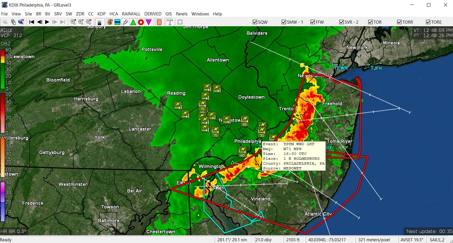
KPNE reporting 68 mph gust and KPHL a 61 mph gust. Mesonet in Holmesburg reported a 71 mph gust. Temp here now down to 67. Also have 0.22" in the bucket.

-
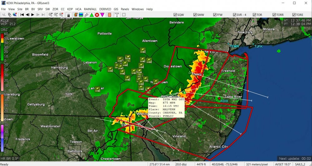
Someone in Malvern reported a 75 mph gust. Meanwhile the line has moved over into Jersey and temp here is down to 72 with light rain.
-
I ran outside to see that when it approached here. Thank goodness I put my patio umbrella down.
-
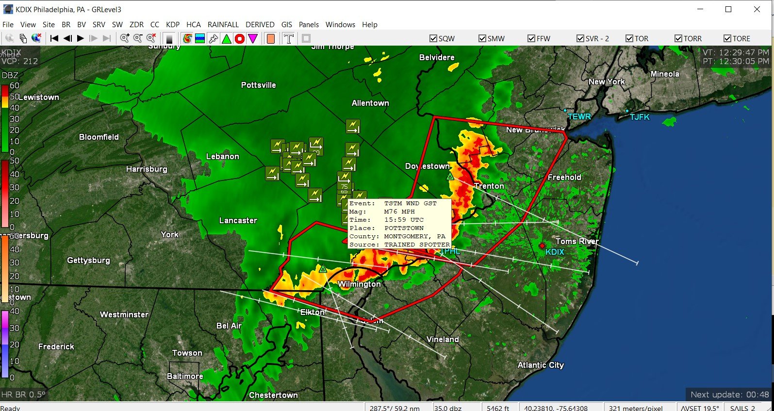
Pottstown spotter reported a 76 mph gust. The back edge is moving through now and so far (since it's moving so fast) I got 0.20" with 0.85"/hr rate at the peak. Temp is down to 75 at post time. ETA - PWS reported final max rate was 1.06"/hr at peak.

-
Gully washer. Front of storm is over me.

-
Gust front coming through. Temp was 85. Power keeps trying to go out. Hope it holds! Heard some thunder too.
-
Incoming on my doorstep. Got real dark and power briefly blipped.

-
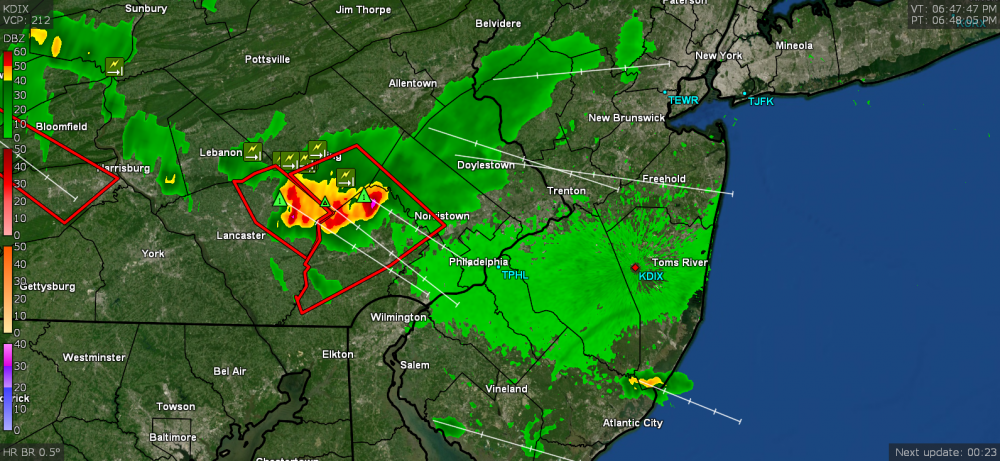
Got some stuff bubbling up, warnings lofted, and all moving this way from the NW. Currently 85 here and hazy.

-
Ended up with a high of 74 yesterday after a low of 54 but the humidity started creeping in late in the day. The low was much warmer this morning at 62 and after I was completely missed by the showers this morning, I had to counter-intuitively pull out the hose (given the forecast for the rest of the week) because the poor plants were bone dry. It's now off to the races with a temp of 83 and dews back into the 60s this morning.