Hurricane Agnes
-
Posts
9,344 -
Joined
Content Type
Profiles
Blogs
Forums
American Weather
Media Demo
Store
Gallery
Everything posted by Hurricane Agnes
-
MLK Storm - something for everyone
Hurricane Agnes replied to ChescoWx's topic in Philadelphia Region
Mt. Holly expanded the WWA into Philly and some areas east (into Bucks and Mercer/Somerset Counties NJ) with the early morning update - -
MLK Storm - something for everyone
Hurricane Agnes replied to ChescoWx's topic in Philadelphia Region
Mt. Holly's 5 pm hazards - -
MLK Storm - something for everyone
Hurricane Agnes replied to ChescoWx's topic in Philadelphia Region
Full Wolf moon coming up. 18z Euro gives a little something...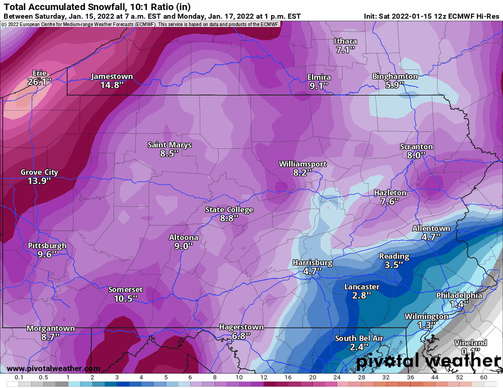
-
E PA/NJ/ DE Winter 2021-22 OBS Thread
Hurricane Agnes replied to JTA66's topic in Philadelphia Region
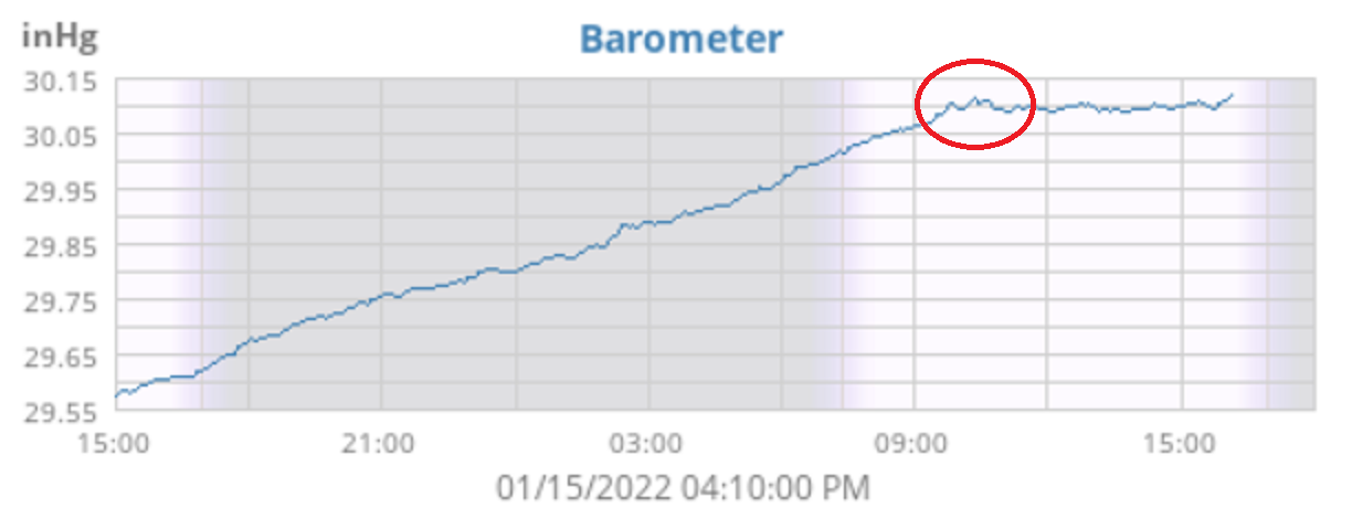
I actually made it up to 22 as a high today and I just saw this cool tweet from Mt. Holly - I was looking at a graph of my barometric pressure from my Ambient and there is a little ripple appearing on the plot (attached snapshot of my weewx plot taken at 4:10 pm EST). Otherwise it's currently mostly cloudy and 20 with dp -4 (and yes, I had to pull out the humidifier in the bedroom and it's on - humidity there has risen now from 25% to 35%, which is much better. My front bedroom is 20% and the basement is 12% (I do have stuff overwintering down there under T5 lights and different spectrums of LEDs but gotta get back to that - I have a portable humidifier down there too if necessary but haven't needed to use it in a few years).
-
MLK Storm - something for everyone
Hurricane Agnes replied to ChescoWx's topic in Philadelphia Region
WSWs, WWAs , Wind Advisories are up around the CWA -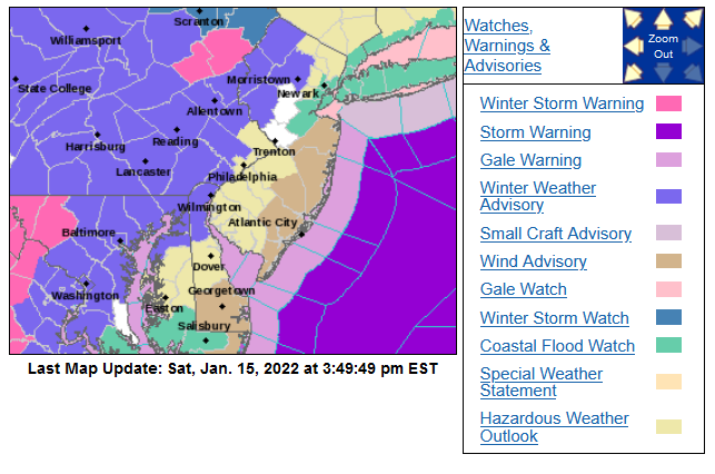
-
E PA/NJ/ DE Winter 2021-22 OBS Thread
Hurricane Agnes replied to JTA66's topic in Philadelphia Region
Mine go in the dryer! But then I wear sweats most of the time anyway. I have a humidifier in my bedroom that I haven't really needed to turn on since I have one of those "bigger" ones on the first floor near a wide central air intake that flows past the bedroom but my bedroom is registering 26% humidity and that is a no-go (the first floor had dropped down to 29%). Luckily my floors are wood laminate and the only "wall to wall" carpet is on the steps to the 2nd floor (and basement). Otherwise I would be showing up on a radar as convection! I'm now up to 17 but that dp has settled in the -7 range pretty consistently now. -
E PA/NJ/ DE Winter 2021-22 OBS Thread
Hurricane Agnes replied to JTA66's topic in Philadelphia Region
Looks like I bottomed out at 12 but my dp has continued to go down (so far the lowest was -7). Currently mostly sunny and "up to" 14 with dp -6. Time to boil some sweet potatoes (or something) because the humidifiers are no match!
-
E PA/NJ/ DE Winter 2021-22 OBS Thread
Hurricane Agnes replied to JTA66's topic in Philadelphia Region
Temp this morning is down to 14 and the dp did the dive and is -2. -
MLK Storm - something for everyone
Hurricane Agnes replied to ChescoWx's topic in Philadelphia Region
Mt. Holly's (post-) 5pm call - -
E PA/NJ/ DE Winter 2021-22 OBS Thread
Hurricane Agnes replied to JTA66's topic in Philadelphia Region
Temp has been dropping steadily after a high of 44 earlier today. Now down to 28 - but the big story is the dp that got up to 34 earlier this afternoon and has now crashed to 16. I expect the dp will be near or even below 0 sometime tomorrow (or at least sometime this weekend). -
MLK Storm - something for everyone
Hurricane Agnes replied to ChescoWx's topic in Philadelphia Region
Ukie went all in to the west (I don't think the storm is going to go that far west but it will depending on the digging trough for where it will go).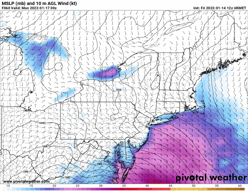
-
MLK Storm - something for everyone
Hurricane Agnes replied to ChescoWx's topic in Philadelphia Region
As clarification, "move east" compared to most of the other guidance the past couple days that had it much further inland. The 6z Euro is still running it mostly inland.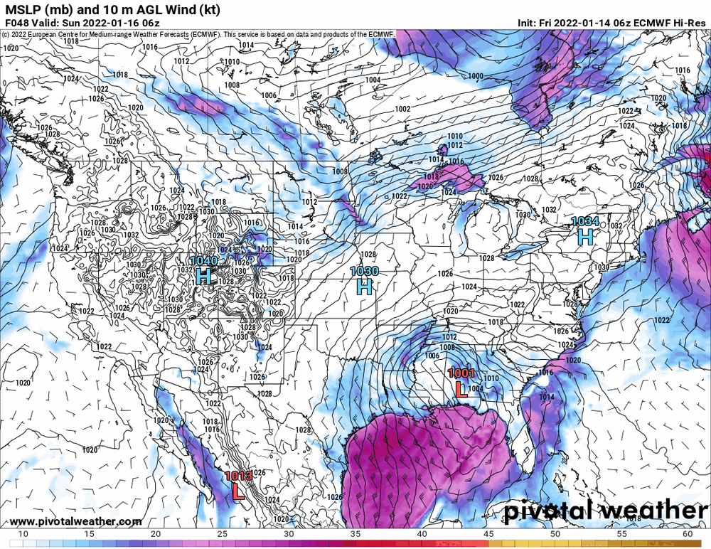
-
MLK Storm - something for everyone
Hurricane Agnes replied to ChescoWx's topic in Philadelphia Region
6z GEFS shows a move east...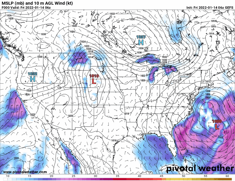
-
MLK Storm - something for everyone
Hurricane Agnes replied to ChescoWx's topic in Philadelphia Region
Mt. Holly's initial thoughts yesterday afternoon - And WPC's take - -
E PA/NJ/ DE Winter 2021-22 OBS Thread
Hurricane Agnes replied to JTA66's topic in Philadelphia Region
Made it up to 48 here as a high and with some high clouds that were around on and off most of the day, it's currently 41 with dp 28. -
MLK Storm - something for everyone
Hurricane Agnes replied to ChescoWx's topic in Philadelphia Region
It's just coming into range on the last panel.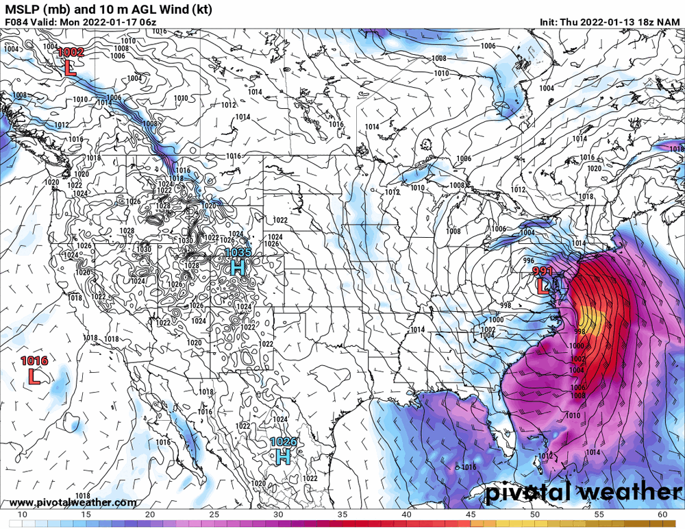
-
MLK Storm - something for everyone
Hurricane Agnes replied to ChescoWx's topic in Philadelphia Region
LOL he's crying in his beer too after he laughed at the GFS losing the hoochie mama storm and has now joined him. -
MLK Storm - something for everyone
Hurricane Agnes replied to ChescoWx's topic in Philadelphia Region
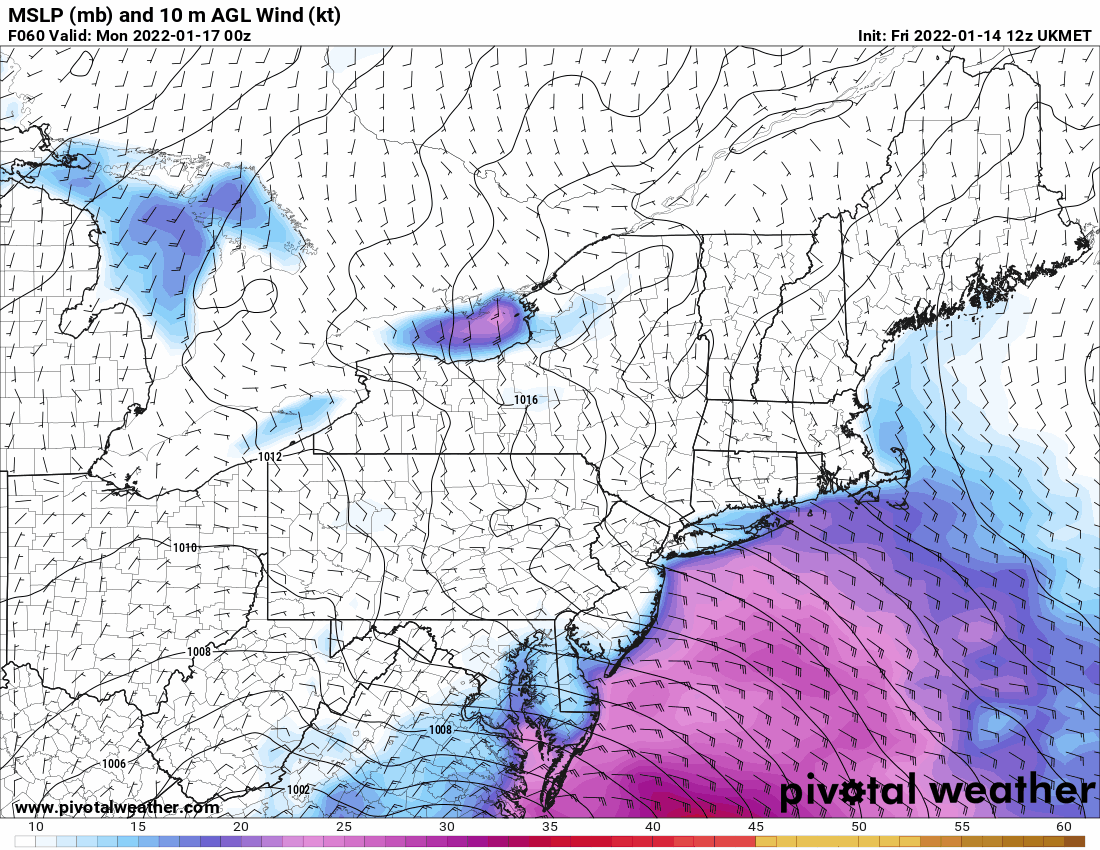
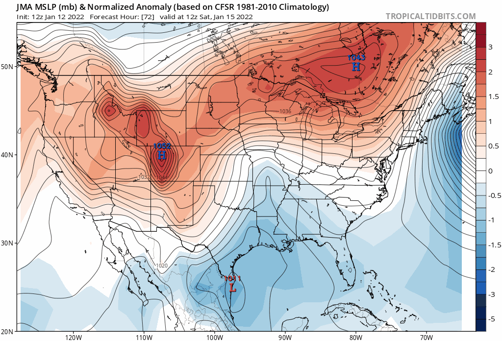
As a note about this storm regardless of p-type, the full moon is Monday so the tides will be running high and any winds that mixed down can exacerbate flooding along the coast and other waterways. Could be a LV "drought buster" (although it looks like it is a fast mover). Here was Mt. Holly's take last evening - WPC yesterday - -
MLK Storm - something for everyone
Hurricane Agnes replied to ChescoWx's topic in Philadelphia Region
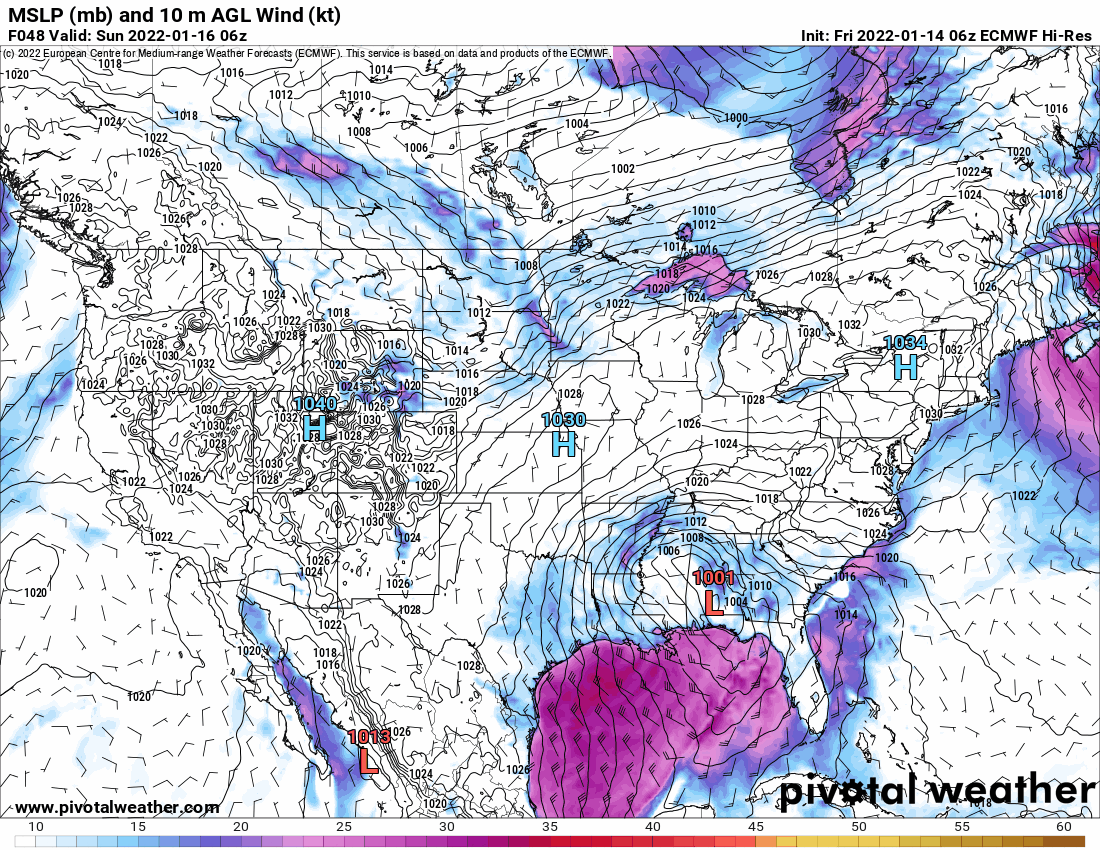
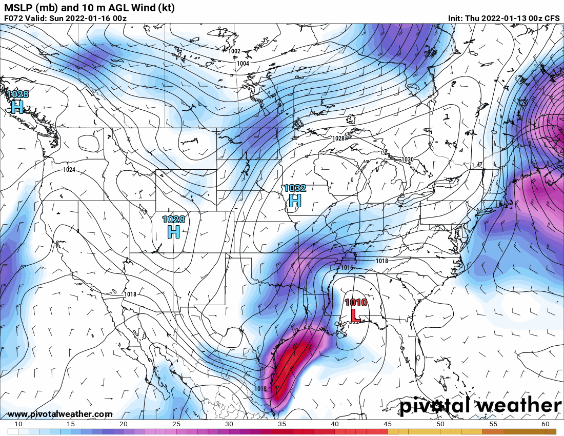
Here's some eye candy from NCEP's CFS model.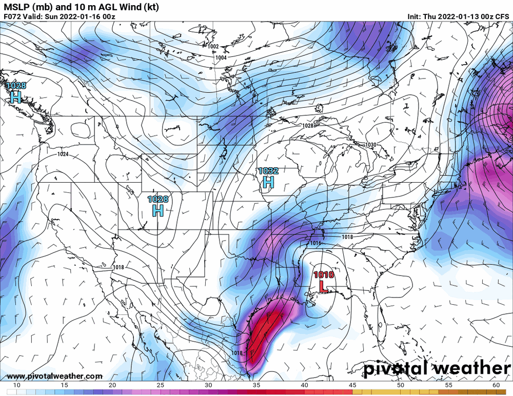
-
MLK Storm - something for everyone
Hurricane Agnes replied to ChescoWx's topic in Philadelphia Region
0z Euro seems to have gone way west (the 6z not in range from how they do their runs).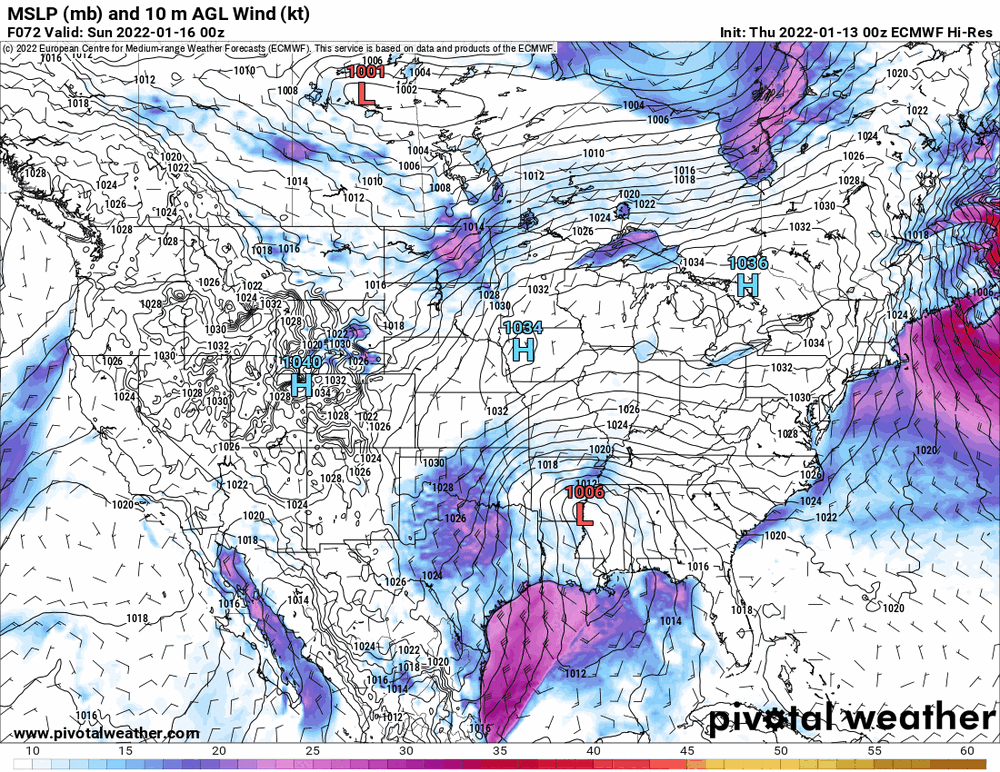
-
E PA/NJ/ DE Winter 2021-22 OBS Thread
Hurricane Agnes replied to JTA66's topic in Philadelphia Region
Ended up hitting 40 for a high yesterday and bottomed out at 26 this morning. Currently partly cloudy and 31 with dp 25. -
MLK Storm - something for everyone
Hurricane Agnes replied to ChescoWx's topic in Philadelphia Region
I'll throw the Ukie in -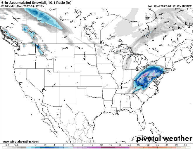
-
E PA/NJ/ DE Winter 2021-22 OBS Thread
Hurricane Agnes replied to JTA66's topic in Philadelphia Region
Oh man.... I was literally just mumbling that to myself about 5 minutes ago. "Power outage storm". I got one of my sisters a set of 4 portable LED lanterns for Christmas to put around her house because where she lives in Montco, the power lines for her side of the street are strung along a row/stand of woods with a creek in the middle at the other end of the backyard, and the breaking branches take down portions of the lines and/or the transformers, over and over with storms (even with PECO continually pruning around the lines). -
E PA/NJ/ DE Winter 2021-22 OBS Thread
Hurricane Agnes replied to JTA66's topic in Philadelphia Region
The runs have really been showing an amped up storm for sure. We are not in NAM range for it yet but it will be interesting to see what that does with it. -
E PA/NJ/ DE Winter 2021-22 OBS Thread
Hurricane Agnes replied to JTA66's topic in Philadelphia Region
Well you have to look at the ENSO states too because the jetstream(s) is(are) what move these systems and the past fall and early winter, the systems have continued to move fairly rapidly (no blocks). You see front after front just rolling through. If any of those systems get cut off and stall, that is when you get walloped. The GFS had that hoochie mama days ago, lost her, and is crying in his beer!