Hurricane Agnes
-
Posts
9,344 -
Joined
Content Type
Profiles
Blogs
Forums
American Weather
Media Demo
Store
Gallery
Everything posted by Hurricane Agnes
-
Thank you. Thank you guys too! Best birthday present. A troll be in timeout.
-
Today is my 60th birthday. I could be your mother but am thankfully not. You need to be on a time out.
-
Sunday Morning Ice Event - January 9th
Hurricane Agnes replied to ChescoWx's topic in Philadelphia Region
Apparently an Accuweather met tweeted out a 0.25" accretion out their way near State College.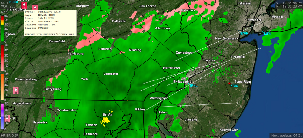
-
Sunday Morning Ice Event - January 9th
Hurricane Agnes replied to ChescoWx's topic in Philadelphia Region
That possibility was there but apparently didn't happen on this side of the state. I was concerned that even with above freezing temps, the ground was so cold that rain would freeze on contact but at least where I am, the precip held off until the past couple hours or so. -
Sunday Morning Ice Event - January 9th
Hurricane Agnes replied to ChescoWx's topic in Philadelphia Region
When that arctic front comes through, everything wet is going to flash freeze! -
Sunday Morning Ice Event - January 9th
Hurricane Agnes replied to ChescoWx's topic in Philadelphia Region
And to echo the above, the sun finally popped out a bit (albeit briefly and obscured when it does appear since we are in a dry slot), although there is still a thick cloud deck and what looks to be more precip out in central PA. Temp crept up to 36 with dp 32 and got 0.03" in the bucket (so far). -
Sunday Morning Ice Event - January 9th
Hurricane Agnes replied to ChescoWx's topic in Philadelphia Region
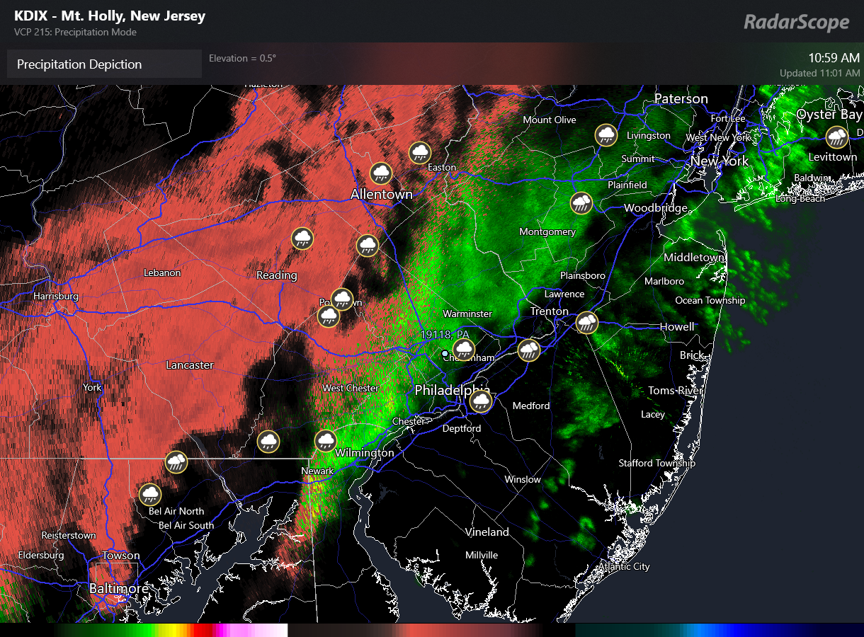
Updated Mt. Holly WWA map with mPING locations - When I had checked RadarScope earlier, there was one report in then NW 'burbs reporting IP too. Still at 35 with drizzle but dp now up to 30.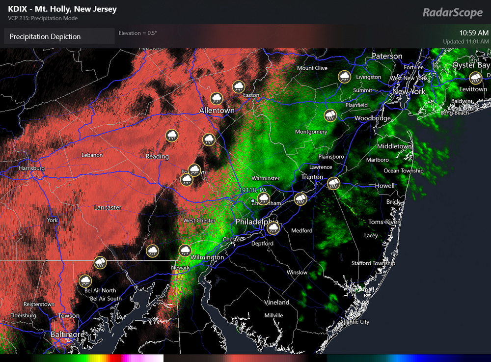
-
Sunday Morning Ice Event - January 9th
Hurricane Agnes replied to ChescoWx's topic in Philadelphia Region
Just saw the ice storm warning - Currently 35 with dp 29 and now getting some drizzle and light rain. -
Sunday Morning Ice Event - January 9th
Hurricane Agnes replied to ChescoWx's topic in Philadelphia Region
Here was the updated WWA map issued earlier this morning from Mt. Holly - -
Sunday Morning Ice Event - January 9th
Hurricane Agnes replied to ChescoWx's topic in Philadelphia Region
Temp here now up to 36 with dp 28 and overcast. Sun hasn't made an appearance here as yet through the cloud deck. My low so far this morning was actually at midnight at 25. Half the snowpack is gone and lots of melting going on.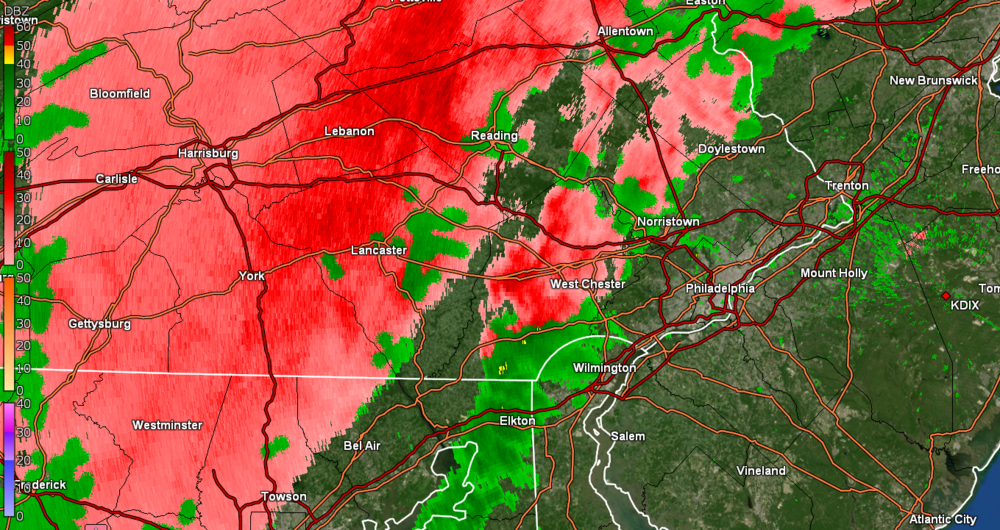
-
Sunday Morning Ice Event - January 9th
Hurricane Agnes replied to ChescoWx's topic in Philadelphia Region
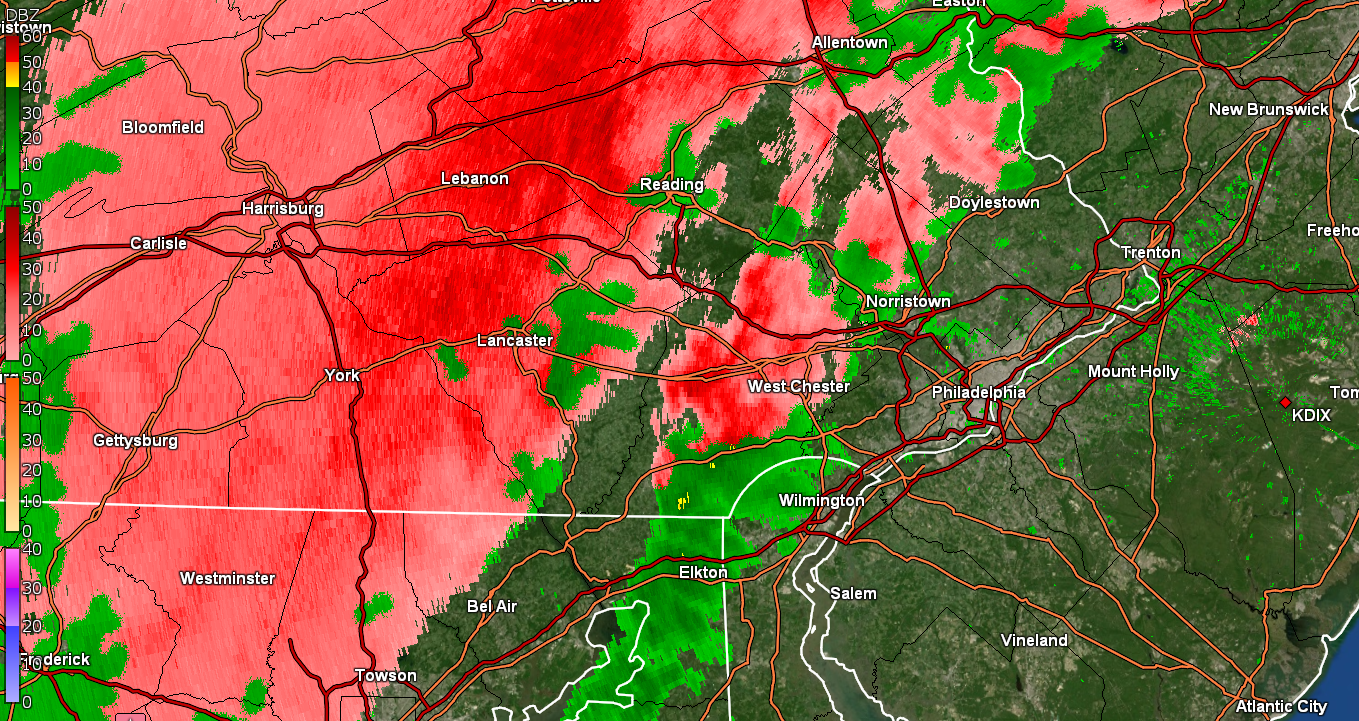
WWA tweaked to remove Philly, New Castle, DE & Mercer/Middlesex, NJ - When I pulled up the radar about 90 minutes ago, I was a bit surprised to see that it was generally void of precip, so it's moving slower than progged and is hitting that subsidence from the dry air. However it has moistened up gradually here overnight. My current 24 dp is like day and night compared to the 9 that got down to yesterday. Temp here is now up to 30 and there is a distinct deck of clouds overhead. -
January 7th First Snow for some N&W folks Discussion
Hurricane Agnes replied to ChescoWx's topic in Philadelphia Region
Non-diurnal trend continued overnight IMBY and I am now up to 29 with dp 23, with a deck of clouds overhead. -
E PA/NJ/ DE Winter 2021-22 OBS Thread
Hurricane Agnes replied to JTA66's topic in Philadelphia Region
Probably whoever is left posting in the Tropical forum. -
E PA/NJ/ DE Winter 2021-22 OBS Thread
Hurricane Agnes replied to JTA66's topic in Philadelphia Region
He has to "manage" the elves who are making all the toys all year and then train all the up and coming "Rudolphs" so they can light the way for the next generation. As a quick obs - The high just tapped 30 here (low was 19) and then dropped down to ~23 late this afternoon but is now on the rise again and is currently 25. The dp had dropped down to as low as 9 but has actually gone up and is now 16. There have been a few puffs of breeze but otherwise, with a clear sky, fresh snowpack, and not much wind, will see how it responds overnight or continues the non-diurnal rise. -
E PA/NJ/ DE Winter 2021-22 OBS Thread
Hurricane Agnes replied to JTA66's topic in Philadelphia Region
I'm trying to remember but I think way back, one of the mods here had Heat Miser (maybe Rib?). -
E PA/NJ/ DE Winter 2021-22 OBS Thread
Hurricane Agnes replied to JTA66's topic in Philadelphia Region
-
E PA/NJ/ DE Winter 2021-22 OBS Thread
Hurricane Agnes replied to JTA66's topic in Philadelphia Region
I didn't even recognize you! Around these parts, you would be swamped by a pile of these guys - -
E PA/NJ/ DE Winter 2021-22 OBS Thread
Hurricane Agnes replied to JTA66's topic in Philadelphia Region
It's like blizzarding for 24 hours. Classic juicy Miller A from the GOM and up the coast.
-
Sunday Morning Ice Event - January 9th
Hurricane Agnes replied to ChescoWx's topic in Philadelphia Region
Yeah... my dp is down to 10 at the moment although once the warm front lifts, I expect it to gradually moisten up. -
Sunday Morning Ice Event - January 9th
Hurricane Agnes replied to ChescoWx's topic in Philadelphia Region
And hopefully well above freezing by then although the ground and other surfaces are very cold. I left a windshield cover on my car (that I put on before this last event) just in case. -
Sunday Morning Ice Event - January 9th
Hurricane Agnes replied to ChescoWx's topic in Philadelphia Region
WWA coverage from Mt. Holly - -
Honey Brook maybe?
-
E PA/NJ/ DE Winter 2021-22 OBS Thread
Hurricane Agnes replied to JTA66's topic in Philadelphia Region
The bottom dropped out overnight (at least for early January) and I had a low of 19 this morning. It's currently sunny and 21 with a dp of 10. Need to swap out my humidifier filters this morning (was due to put new ones in anyway) because the humidity in here is down to 25%. -
January 7th First Snow for some N&W folks Discussion
Hurricane Agnes replied to ChescoWx's topic in Philadelphia Region
That's not bad at all!! If it survives the wind, a little warmup. and whatever intensity of rain is forecast for Sunday, it could flash-freeze into a thick glacial base for any future frozen precip. -
1 Jeff Bezos 2 Elon Musk 3 MGorse? 4 Mark Zuckerberg