Hurricane Agnes
-
Posts
9,344 -
Joined
Content Type
Profiles
Blogs
Forums
American Weather
Media Demo
Store
Gallery
Everything posted by Hurricane Agnes
-
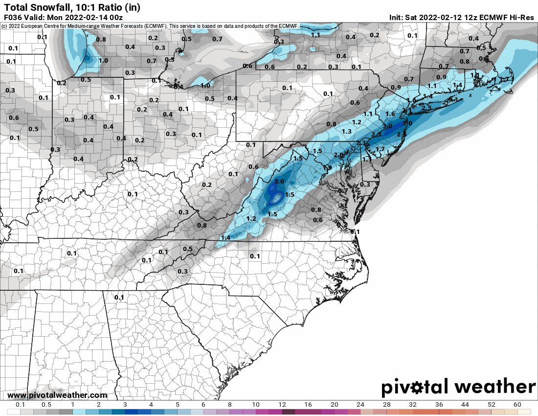
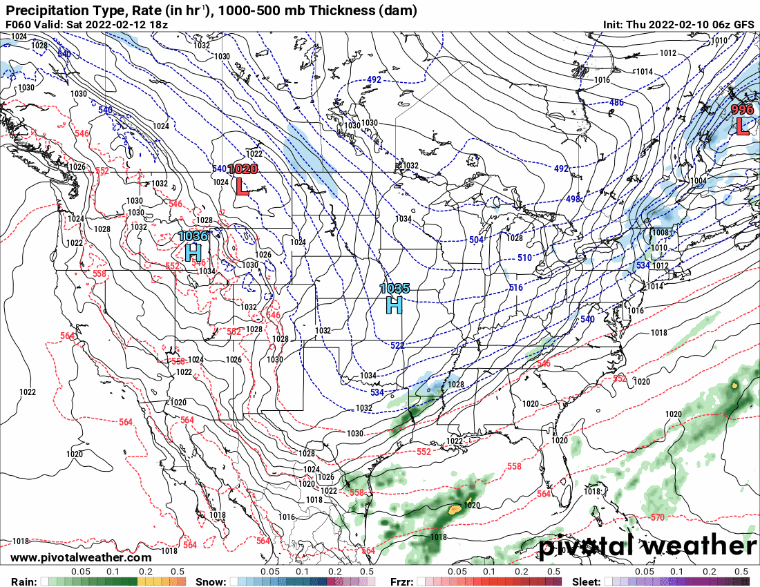
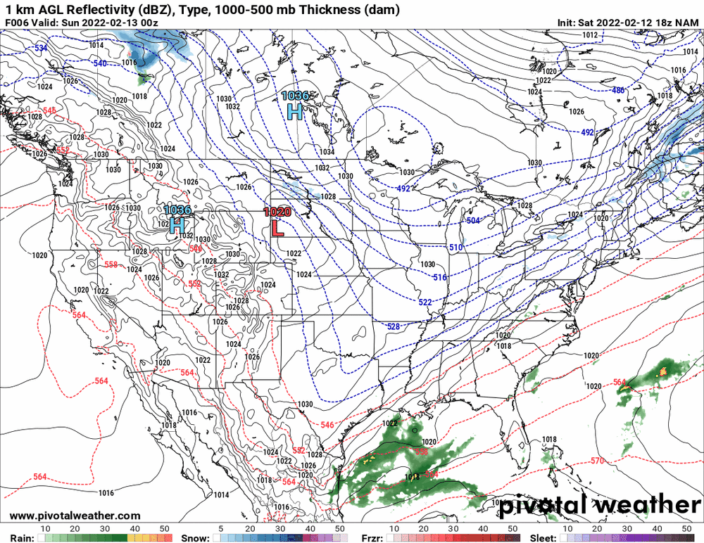
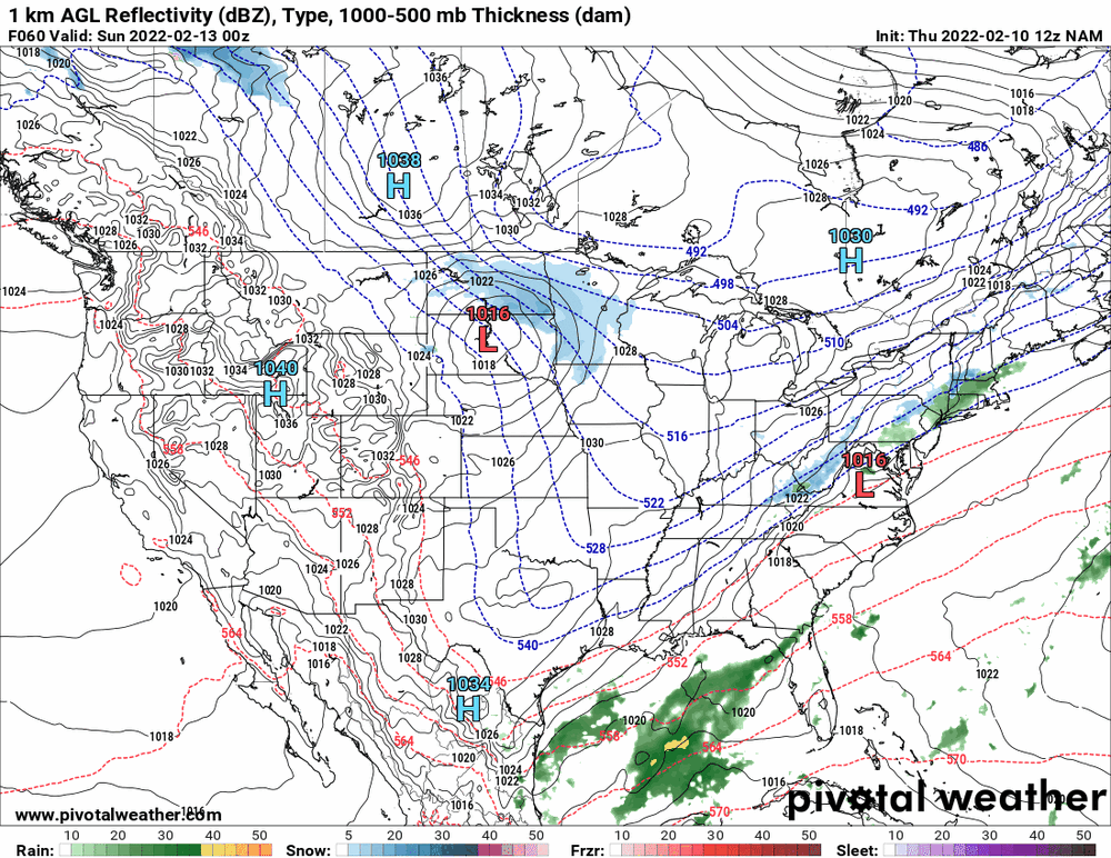
The 18z NAM still has this double-low/sortof "overruning" precip thing going on...
-
Only one that has that (so far) is the NAM. The GFS and Euro do have some inland... The 18z NBM sortof averages the NAM and GFS/Euro solutions.

-
And even more so if the Phils are still locked out!
-
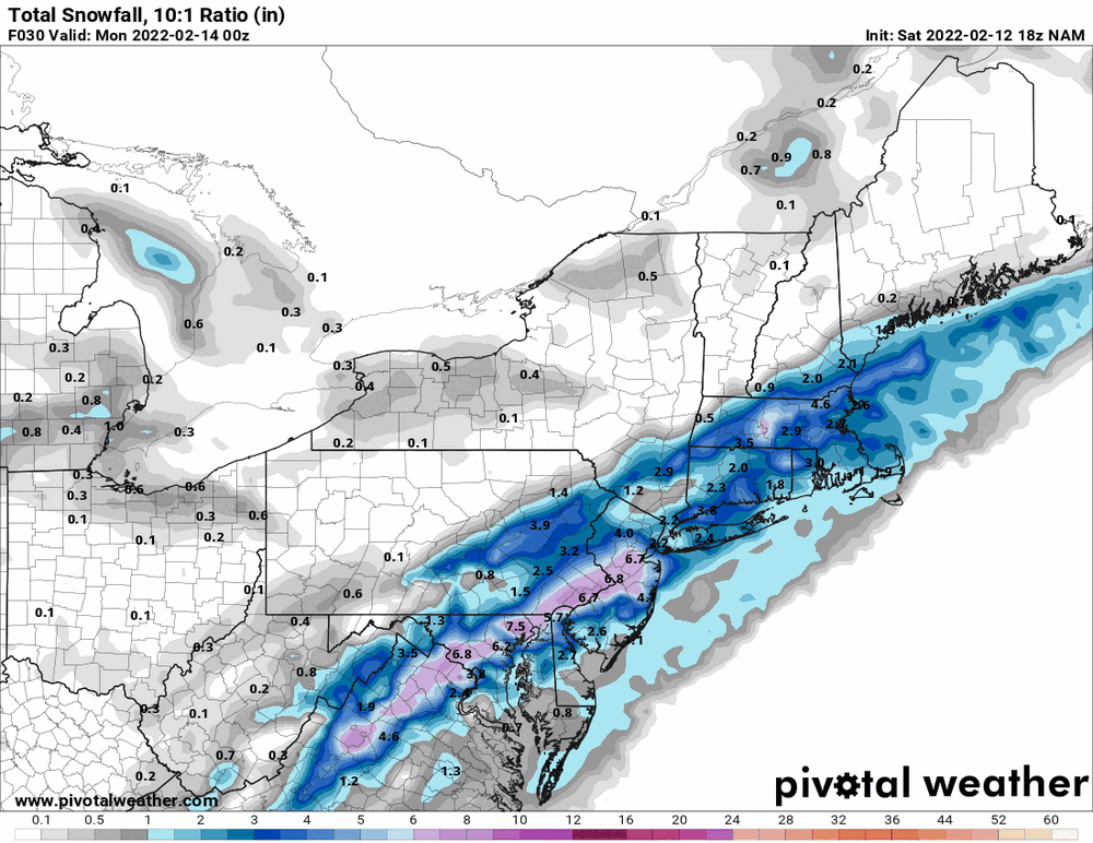
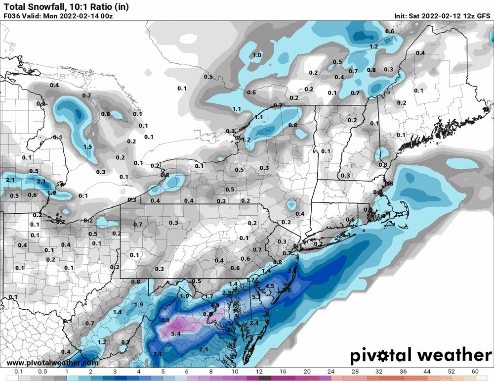
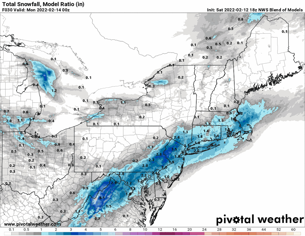
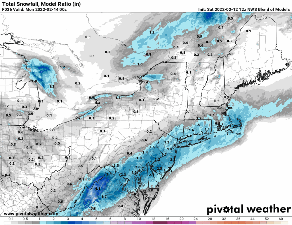
NBM throws a few inches over the area...
-
Usually the "snow" comes around Memorial Day when you are trying to fire up the grill, but figure this year we'll have a late late freeze!
-
The Flower Show is outside again due to COVID-19 and will be held in June (11th - 19th) in FDR Park in South Philly near the stadiums.
-
E PA/NJ/ DE Winter 2021-22 OBS Thread
Hurricane Agnes replied to JTA66's topic in Philadelphia Region
After a low of 29 this morning, I topped out at 59 today. I wasn't really expecting it to get to the upper 50s here (figured maybe mid-50s) but there it went. Currently 53 with dp 32 and even with today's temps, there are still some remnants of plowed mounds around. -
IIRC, with all the fantastic stats that Harden has racked up over the years, he has never been on a team that won a championship (the same issue seen with people like Allen Iverson or Patrick Ewing). So as long as Embiid doesn't get injured and given where they stand at the moment (even without any Simmons at all this season), and if the chemistry works out somehow (with Harden becoming the sort of "vet" of the team), then he could help propel the '76ers into the playoffs. IMHO, Simmons probably never wanted to be here in the first place and we ended up with what we got...
-
E PA/NJ/ DE Winter 2021-22 OBS Thread
Hurricane Agnes replied to JTA66's topic in Philadelphia Region
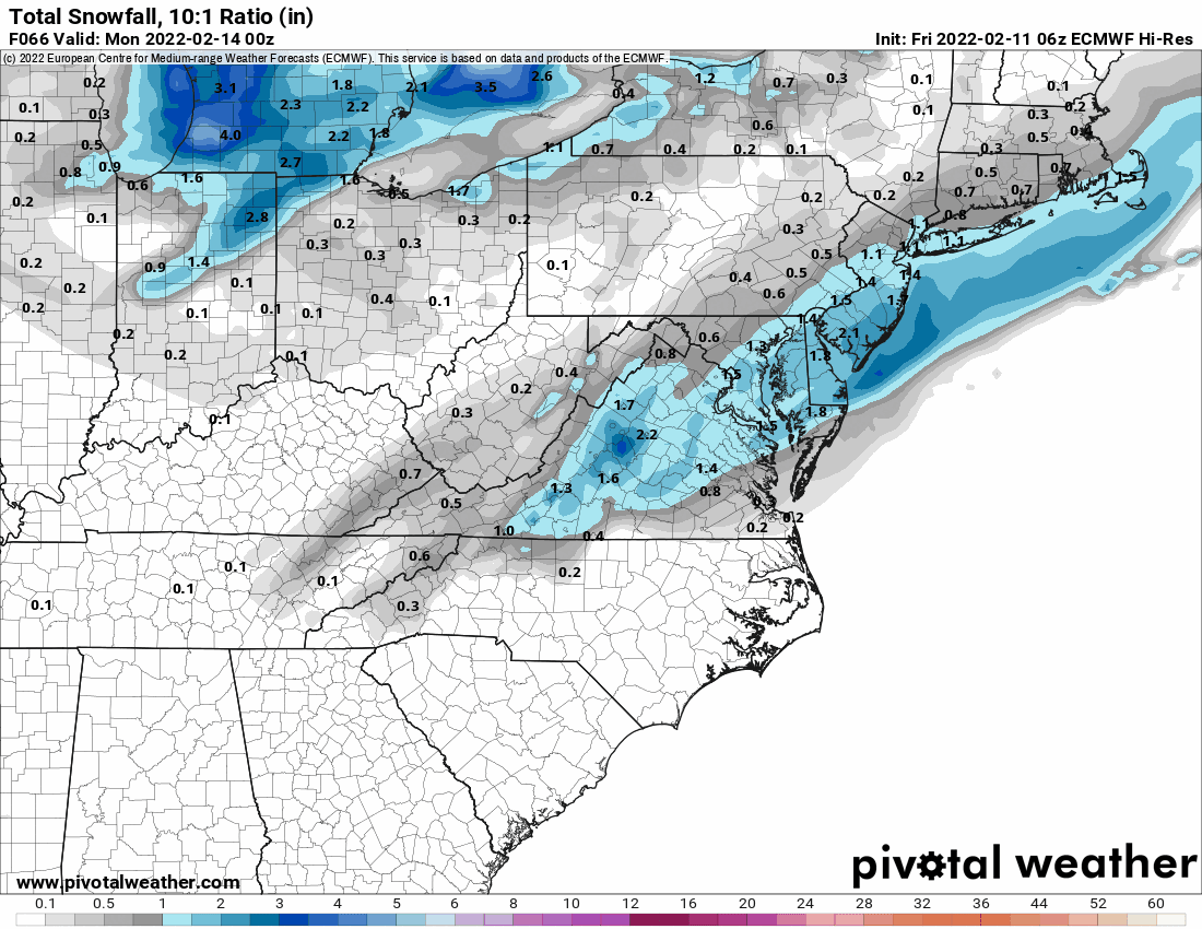
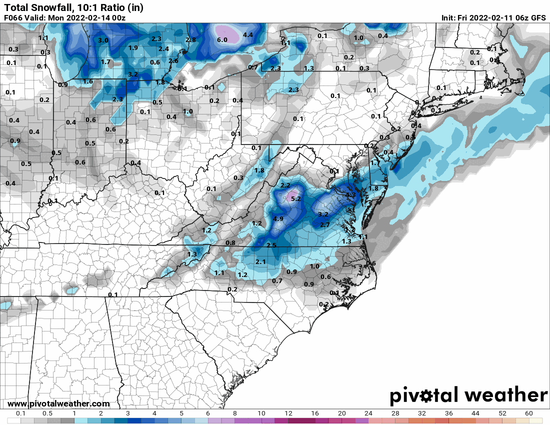
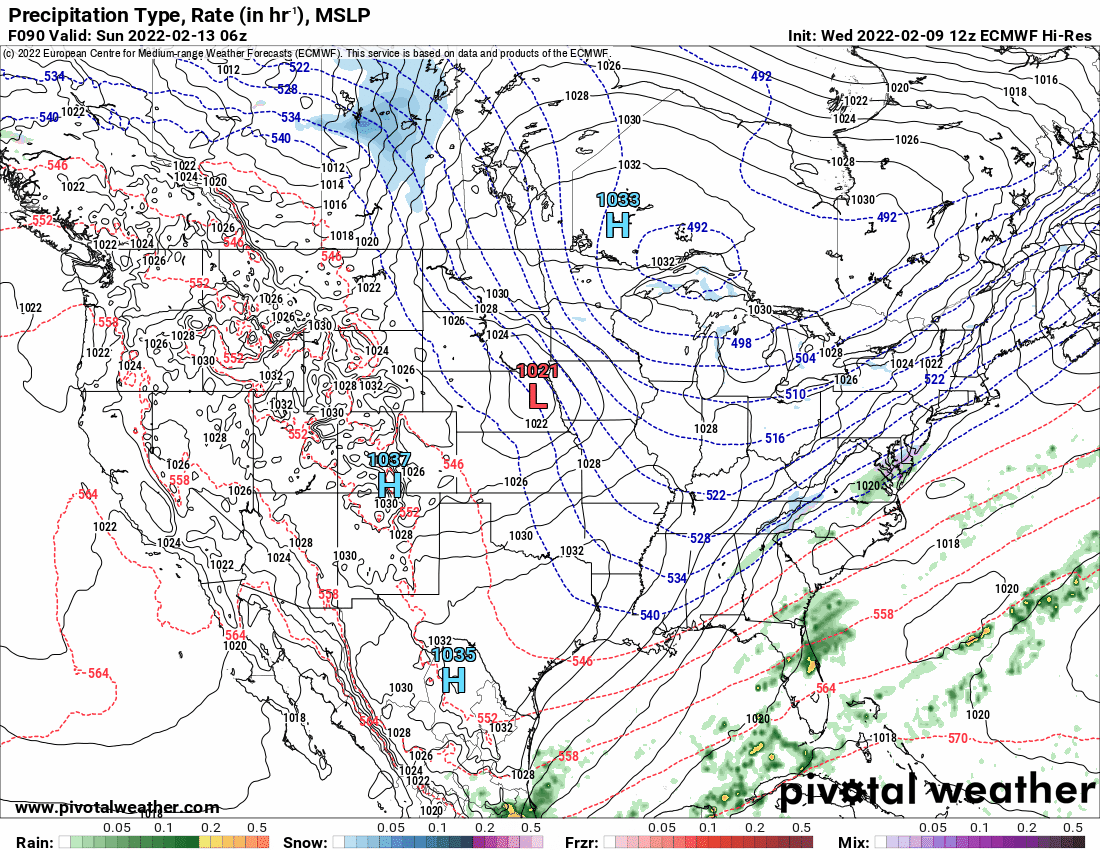
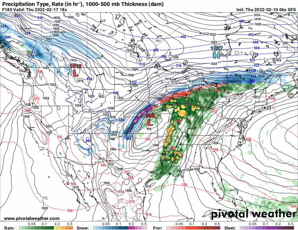
LOL The Euro & GFS have a similar "double low" thing going but the Euro has less than half the precip that the NAM shows, but is midway between the NAM and GFS's whiff. I think something is going to happen but it's dependent on whatever antecedent snow might make it to the ground before the larger system gears up.

-
E PA/NJ/ DE Winter 2021-22 OBS Thread
Hurricane Agnes replied to JTA66's topic in Philadelphia Region
Made it up to 54 today and it's currently clear and 48 with dp 26. I did notice that my snowdrops were throwing up their little bloom buds so this week will get them blooming before the arctic blast due over the weekend to remind them about their name. -
E PA/NJ/ DE Winter 2021-22 OBS Thread
Hurricane Agnes replied to JTA66's topic in Philadelphia Region
Heatwave going on in California to boot! Sortof like the training camp time of year. Drought buster! For the weekend - 12z GFS seems to be "seeing" some kind of other low out there and does a slide, although tossing some pity flakes back over the area. The NAM outright shows 2 different systems for a double whammy. Currently up to 52 now with dp 30 and lots of cumulus that I haven't seen in awhile. Have mainly had cirrus the past few weeks.
-
E PA/NJ/ DE Winter 2021-22 OBS Thread
Hurricane Agnes replied to JTA66's topic in Philadelphia Region
-
E PA/NJ/ DE Winter 2021-22 OBS Thread
Hurricane Agnes replied to JTA66's topic in Philadelphia Region
6z EC sortof did the same thing as the GFS... And as an obs, I bottomed out at 32 this morning but rebounded up to a current partly sunny and 39 with dp 31.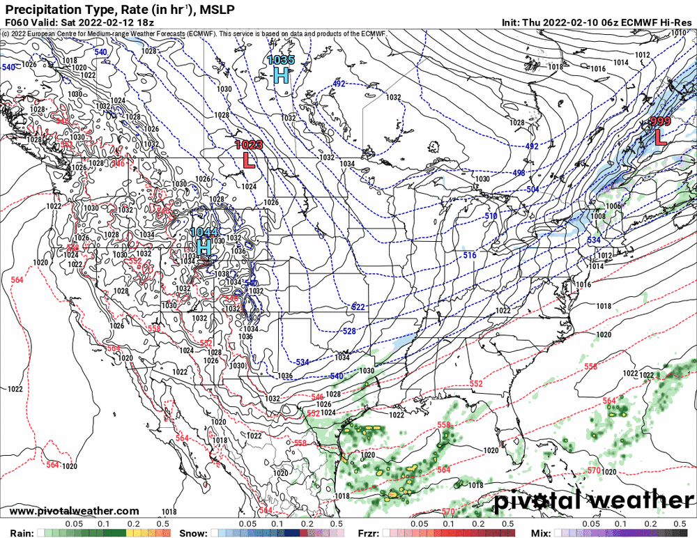
-
E PA/NJ/ DE Winter 2021-22 OBS Thread
Hurricane Agnes replied to JTA66's topic in Philadelphia Region
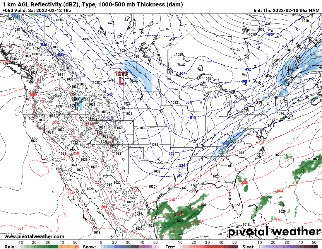
6z GFS looks to be doing some cold frontal-type snow and then brushes S. Jersey whereas the 6z NAM is inland much of the time and does a rain/mix --> snow thing (6z Euro is still running at post time).

-
E PA/NJ/ DE Winter 2021-22 OBS Thread
Hurricane Agnes replied to JTA66's topic in Philadelphia Region
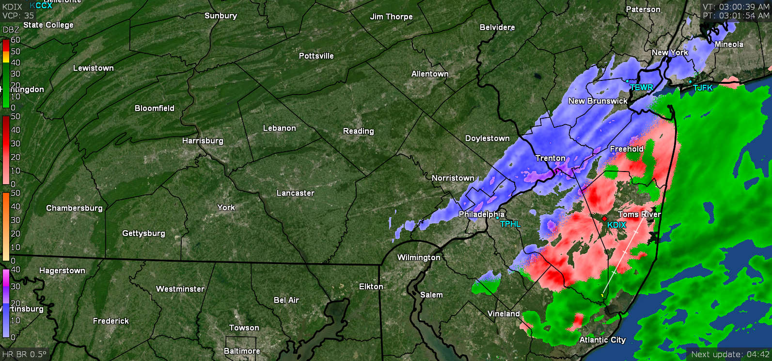
The scrapple model (NBM) gave the area some love...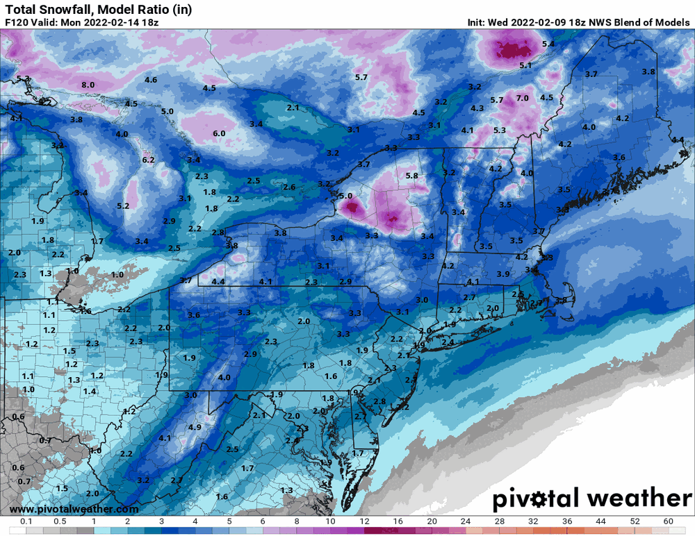
-
E PA/NJ/ DE Winter 2021-22 OBS Thread
Hurricane Agnes replied to JTA66's topic in Philadelphia Region
12z Euro is a swing and a miss... As a quick obs - my low this morning was 24 and high so far has been 50. Currently sunny and 50 with dp 27.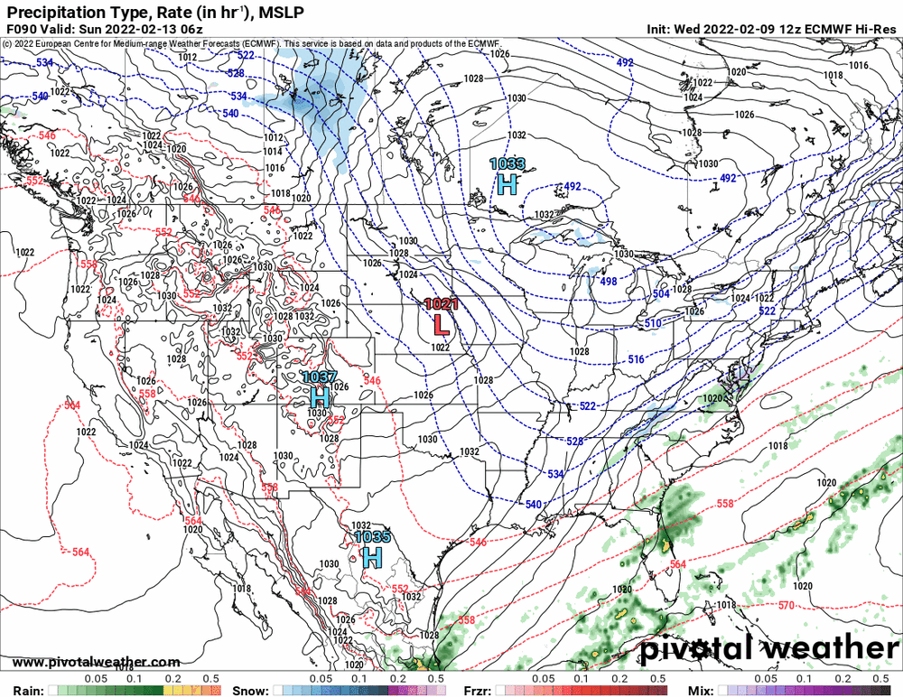
-
E PA/NJ/ DE Winter 2021-22 OBS Thread
Hurricane Agnes replied to JTA66's topic in Philadelphia Region
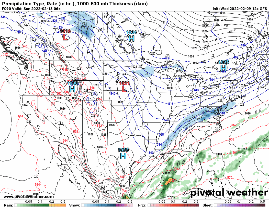
The 12z GFS is dragging some little baby guy after it as it moves on out...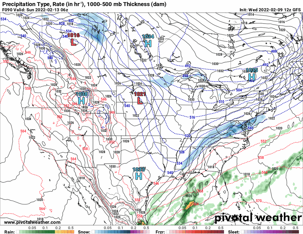
-
E PA/NJ/ DE Winter 2021-22 OBS Thread
Hurricane Agnes replied to JTA66's topic in Philadelphia Region
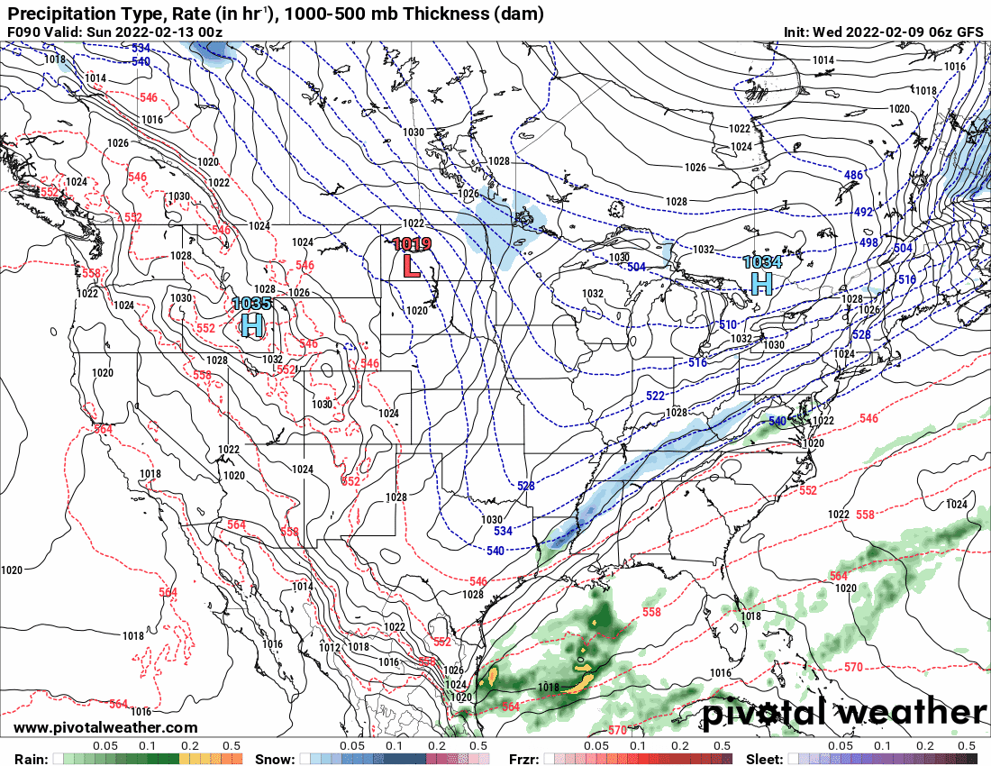
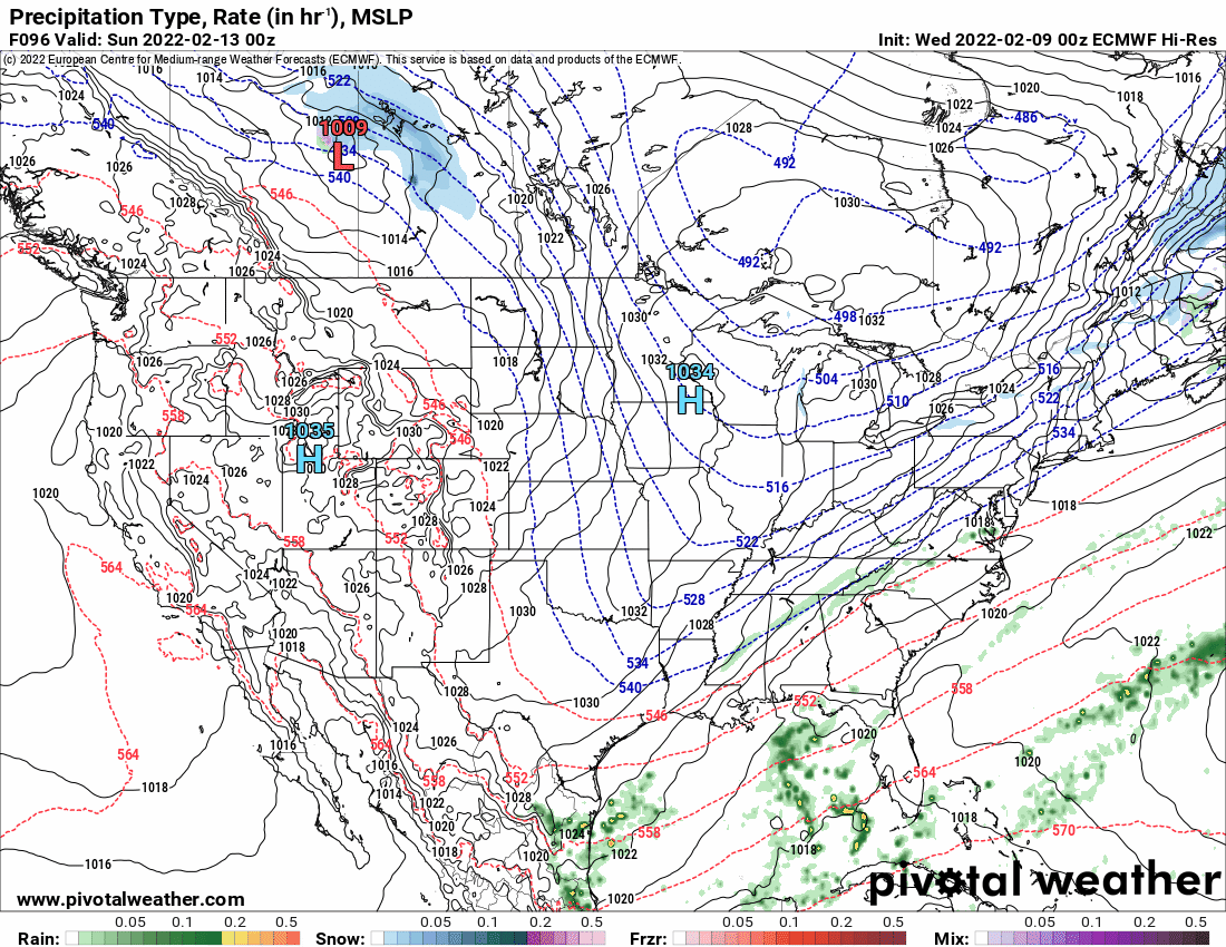
Since the 6z EC only goes out to 90, this is what you get comparing the 6z GFS to the 0z ECMWF (same time frame) -

-
E PA/NJ/ DE Winter 2021-22 OBS Thread
Hurricane Agnes replied to JTA66's topic in Philadelphia Region
Dropped down to 31 as a low this morning with some freezing fog/mist but as soon as it started getting light, the fog dissipated. Currently sunny with some scattered cirrus and 37 with dp 32. -
E PA/NJ/ DE Winter 2021-22 OBS Thread
Hurricane Agnes replied to JTA66's topic in Philadelphia Region
I figured you were still Still getting freezing drizzle with temp and dp both 30. -
E PA/NJ/ DE Winter 2021-22 OBS Thread
Hurricane Agnes replied to JTA66's topic in Philadelphia Region
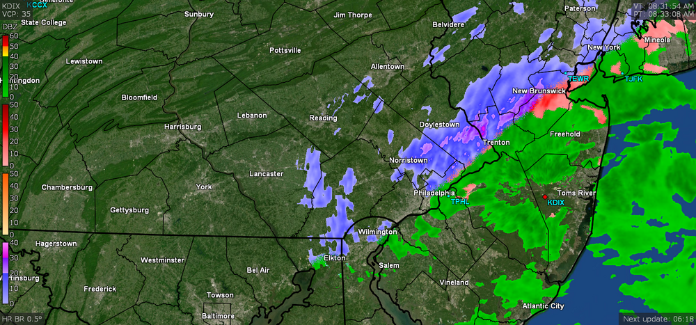
I got a legit dusting early this morning and am getting FRDZ at the moment with temp 30 and dp 29.
-
E PA/NJ/ DE Winter 2021-22 OBS Thread
Hurricane Agnes replied to JTA66's topic in Philadelphia Region
WWA was lofted & expanded with the morning package - -
E PA/NJ/ DE Winter 2021-22 OBS Thread
Hurricane Agnes replied to JTA66's topic in Philadelphia Region
Woke up to a dusting on all the cars, grassy areas, and cold/untreated surfaces. Got sideswiped this far west between 2 - 4 am. Currently overcast and 30 with dp 28.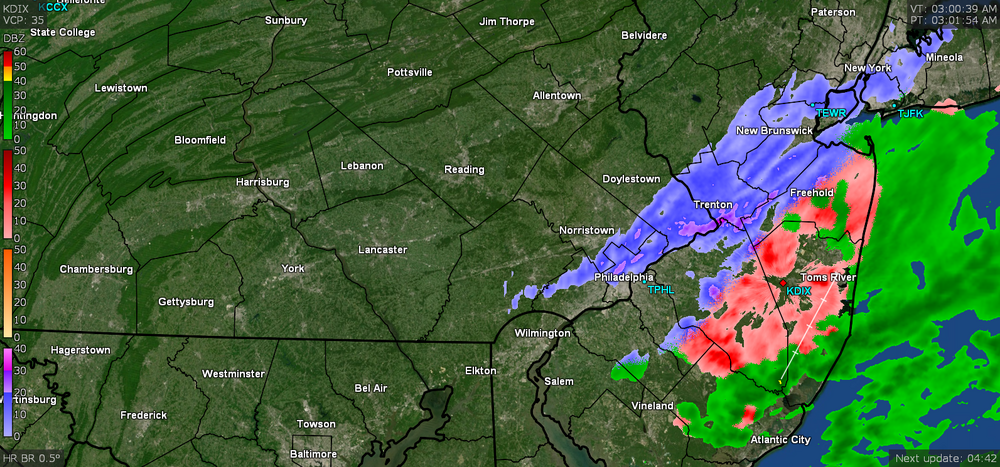
-
E PA/NJ/ DE Winter 2021-22 OBS Thread
Hurricane Agnes replied to JTA66's topic in Philadelphia Region
LOL it does... or even a sycamore - Am down below freezing again and at 30 with dp 20. -
E PA/NJ/ DE Winter 2021-22 OBS Thread
Hurricane Agnes replied to JTA66's topic in Philadelphia Region
Missed this from Mt. Holly yesterday - I think that speaks for itself! I did end up with a low of 15 this morning and struggled to get to a high of 34 around 3:30 pm today. It's currently 33 with dp 17 and a deck of cirrus overhead.