Iceresistance
-
Posts
4,190 -
Joined
-
Last visited
Content Type
Profiles
Blogs
Forums
American Weather
Media Demo
Store
Gallery
Everything posted by Iceresistance
-
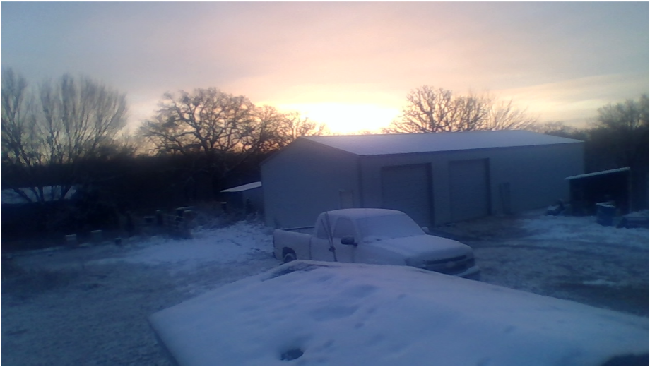
 My Grandmother woke me up for a Tornado Warning over us, it's missed us by 1-2 miles
 -
I've noticed that @buckeyefan1 has not been here lately, I hope she's alright.
-
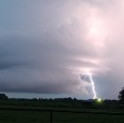
Storms are starting to develop in Southern Kansas, this is likely the start of what it could be the Late March 2022 Severe Weather Outbreak.
-
I saw one that had 90 mph wind gusts.
-
March 2022 General Discussion
Iceresistance replied to SchaumburgStormer's topic in Lakes/Ohio Valley
Ice Storm Warning for Northern Lower Michigan -
Yes, all it takes is one
-
That wind right now is something else . . .
-
March 2022 General Discussion
Iceresistance replied to SchaumburgStormer's topic in Lakes/Ohio Valley
@weatherboIt looks like that your area may get a foot of snow from this storm system. That's what the NBC-6 (WLUC-TV) from Marquette said. -
Yes, wind gusts could reach Hurricane Force in the OV, & Thunderstorm gusts could reach 100 mph, that's why they've put up a very large Hatched area & Moderate risk for that, they may need to upgrade to a High Risk for destructive wind gusts between 90 & 100 mph.
-
March 2022 General Discussion
Iceresistance replied to SchaumburgStormer's topic in Lakes/Ohio Valley
Damaging Wind event appears very possible for the Ohio Valley & Southward tomorrow, wind gusts maybe as close as Hurricane Force. -
The New Tornado Alley? This area is already a tornado alley. It's named Dixie Alley, & Dixie Alley has characteristics that are way different compared to Tornado Alley.
-
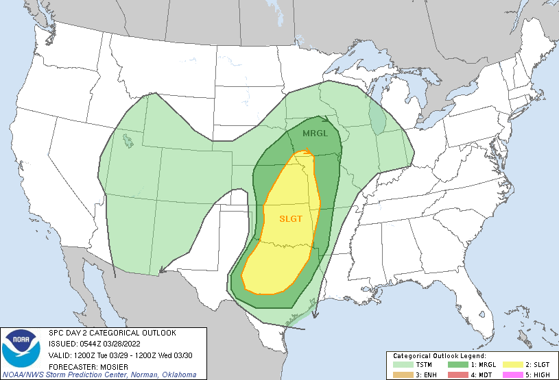
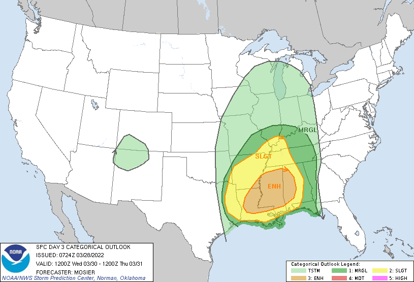
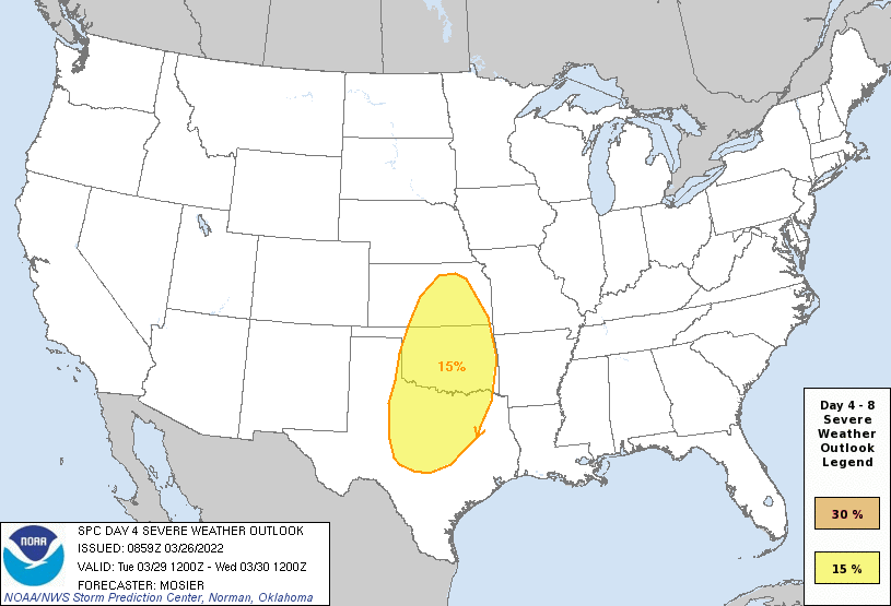
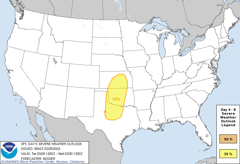
Slight Risk extended into Missouri, there's an update for it at 12:30 PM CDT. The SPC is thinking it's going to become linear very quickly. And here's the new D3 Severe Weather Forecast
-
No change in placement of the Slight Risk since Yesterday, this is the SPC Discussion on this: Broad cyclonic flow is expected to be in place across the CONUS on D4/Thursday morning. Several shortwave troughs will be embedded within this larger upper trough, with the lead wave expected to move from the upper OH Valley northeastward through the Mid-Atlantic and Northeast early during the day. Another wave will follow quickly in the wake of the first, moving across the OH Valley and Mid-Atlantic. The evolution of this second wave will encourage the eastward progression of a cold front through the Mid-Atlantic. Modest buoyancy and strong wind fields support the potential for damaging wind gusts with storms along and ahead of this front.
-
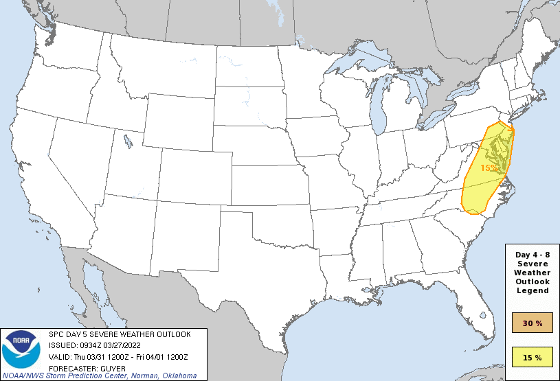
Spring is coming up on Y'all, & fast! On Thursday/Day 5, a severe risk will likely continue eastward into the Mid-Atlantic/Southeast States, including the potential for fast-moving low-topped storms capable of wind damage in the Mid-Atlantic region.
-
General Severe Weather Discussion
Iceresistance replied to nwohweather's topic in Southeastern States
Very strong wording from the SPC
-
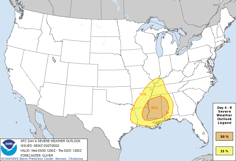
BIG Enhanced risk in place for Dixie Alley on D4, very strong wording from the SPC ...SEVERE WEATHER OUTBREAK POSSIBLE ON D4/WED... ...DISCUSSION... An appreciable severe-weather risk appears increasingly likely across the Lower Mississippi Valley and Middle Gulf Coast region on Wednesday/Day 4. This includes the potential for widespread damaging winds and tornadoes, including the possibility of a regional tornado outbreak including strong (EF2+) tornadoes.
-
2022 Mid-Atlantic Severe Wx Thread (General Discussion Etc)
Iceresistance replied to Kmlwx's topic in Mid Atlantic
@yodaYou beat me to it by 3-4 hours -
General Severe Weather Discussion
Iceresistance replied to nwohweather's topic in Southeastern States
This one is unique, it's not common to have a D6 Slight Risk, let alone the Mid-Atlantic. -
General Severe Weather Discussion
Iceresistance replied to nwohweather's topic in Southeastern States
Going to start a Severe Weather forum because the SPC has put out a Slight Risk of Severe Storms for North Carolina & Virginia on D6 -
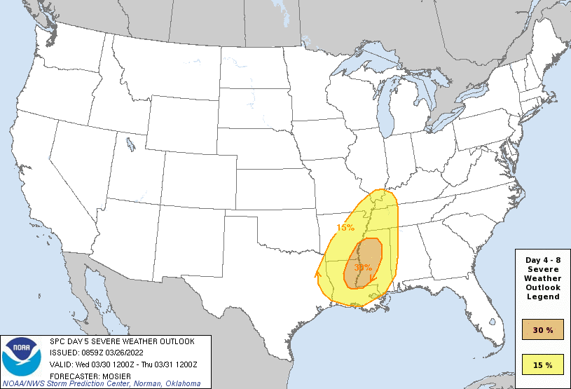
D4 is a very large Slight Risk, D5 is now Enhanced.
-
I forgot to post it, but my Aunt's relatives were affected by the Kingston, OK Tornado (EF-2), they're fine, but their friends to the east was struck by the Tornado, they are also fine, but they've lost their homes.
-
SPC introduces Slight Risks on D5 & D6. D5 is a classic setup for the Great Plains. While D6 is a Dixie Alley setup.
.gif.c396c5dbba4cc8cbd727627075d1683d.gif)
-
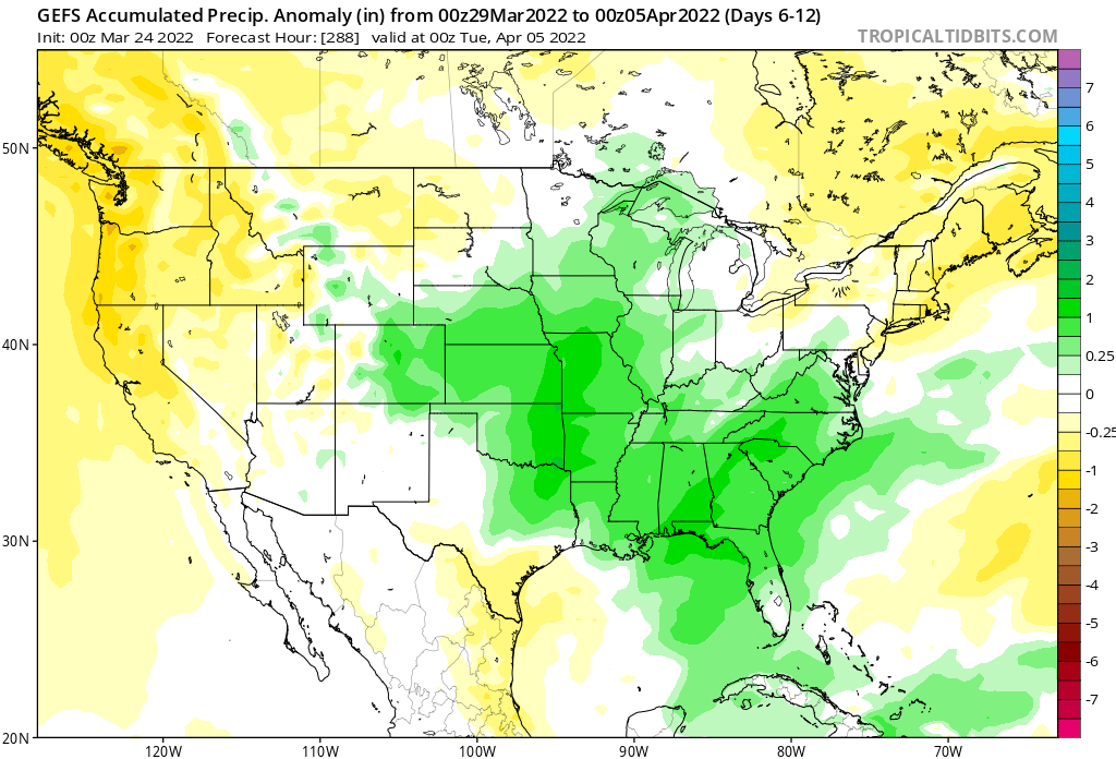
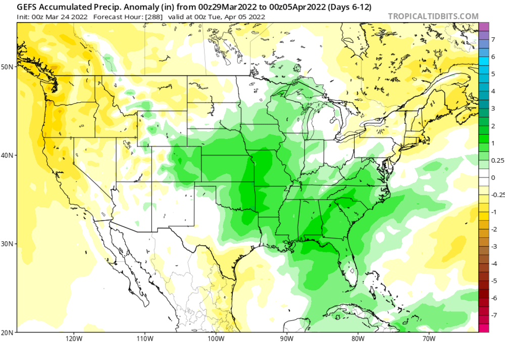
More consistency with the models to have it start the Severe Weather setups on the 29th, even the WPC is showing good rainfall for the Southern Plains on the 30th as well.
-
Already a potential rainmaker for the Southern Plains
-
Ventrice has this (Treating the forecast with a grain of salt)