.jpg.949052775cf13715749e9bd3740a4bd3.jpg)
Bigbald
-
Posts
253 -
Joined
-
Last visited
Content Type
Profiles
Blogs
Forums
American Weather
Media Demo
Store
Gallery
Everything posted by Bigbald
-
I thought the ole Northwest jog got phased out of the GFS a couple years ago.
-
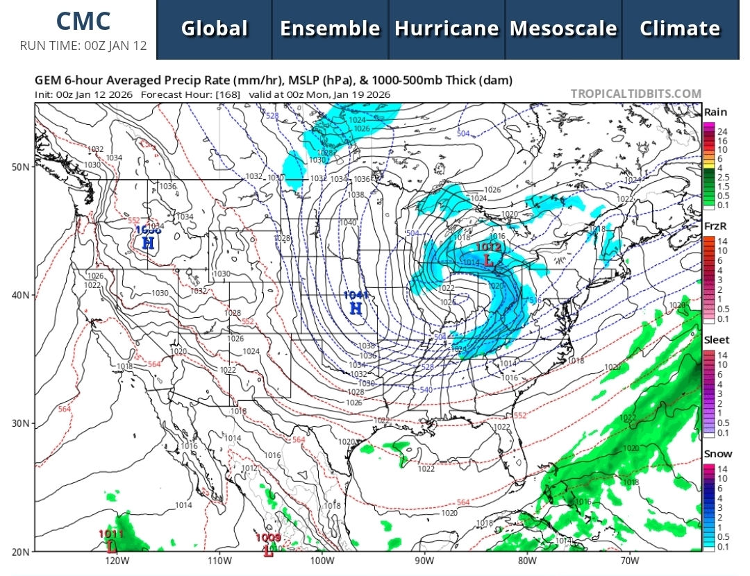
I mean Carver just posted the GEM 12z that dumps 5-10 inches of high ratio snow across a big chunk of the area. We might not get any snow but its depicted on several models within 7 days.
-
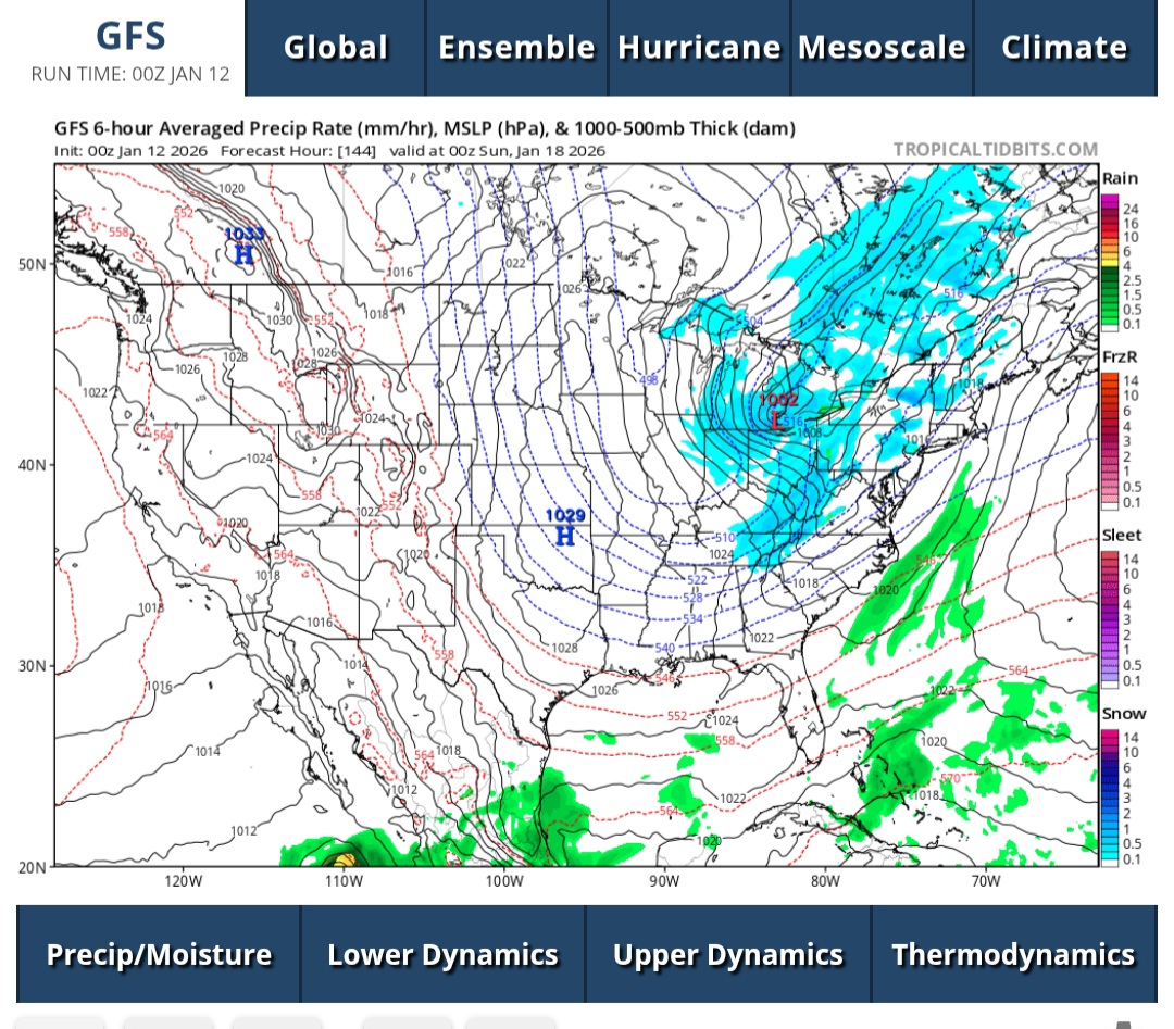
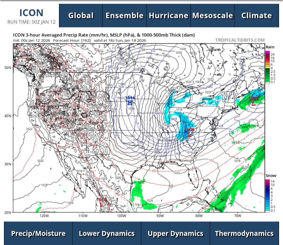
Pretty good consensus sunday-monday out of the 0z CMC-GFS-icon. Wide spread 2-4 inch (higher mountains) cold high ratio stuff.


-
12z gfs clipper blizzard, maybe only in our dreams but fun to look at!
-
Anything like the 18z Ai where it snows for 2 weeks ?
-
Great looking 12z suite, all the models are now honing in on the two system punch next week. Ai-euro and GFS looked identical to me.
-
When is the last time we had a negative tilt storm? It seems like its been forever.
-
An immense amount of rain fell in east tn/swva tonight. With whats coming next week I fear major flood concerns similar to what has already occurred winter on the nolichucky. Really hope the rainfall totals are over done on the models.
-
-
12z cmc has some areas in Tennessee valley snowing for 30 plus hours!
-
I am sure nobody will be looking at the 12z suite :). This feels like something big is brewing for somebody in the southeast. I'll be interested to see how the models hone in on timing, 6z gfs sees it starting 18z thursday, last night cmc had it Tuesday midnight.
-
I wish I could bet money on the cmc sniffing this out. It's crazy to think we are basically 5 days out from this event.
-
.thumb.jpg.9707d4addca3d84715ae3d888c5c10d6.jpg) Dissapointing here in Tri but really appreciate all the disco provided. Sure seems like the RGEM is money in meso world. I don't have validation scores at hand but it really seems to nail the short horizon once it locks in on a trend.
Dissapointing here in Tri but really appreciate all the disco provided. Sure seems like the RGEM is money in meso world. I don't have validation scores at hand but it really seems to nail the short horizon once it locks in on a trend. -
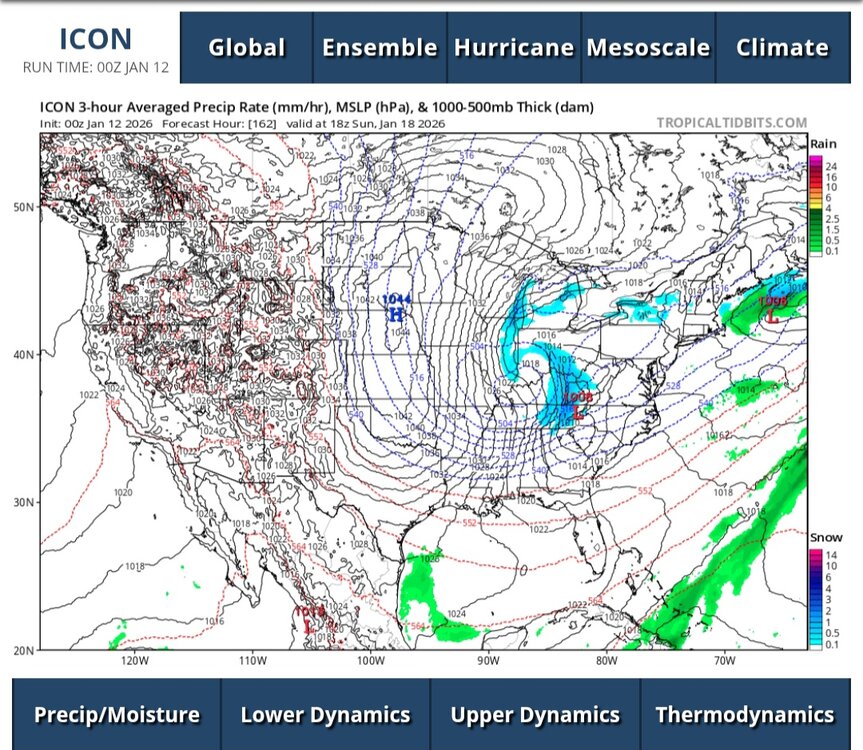
One battle that is brewing is cmc vs gfs, which at this point is prolly a fruitless endeavor, but man they are miles apart at 0z on qpf.
-
12/18z Nam and 12z gfs killer runs for east tn. Hopefully happy hour gfs agrees
-
John, how the heck do you stay awake for like 72 hours at a time?
-
Looks like some decent returns showing up in Hawkins County moving back in to Sullivan.
-
Has been pixie dusting snow in Wise (swva) all morning. It doesn't show up but on the most sensitive radars. More visible returns in east ky. No real snow melt up here and I don't think there will be much.
-
GFS big dog run for the forum when Kuchera
-
Totally shocked this a.m. to see about an inch in kingsport
-
Hard to beat the track of the 0z cmc and 0z gfs for east tennessee, even if models are showing slightly lessening qpf at the moment.
-
Shew, hard to imagine that NAM run would not have been widespread 6-12 per visual duration left..
-
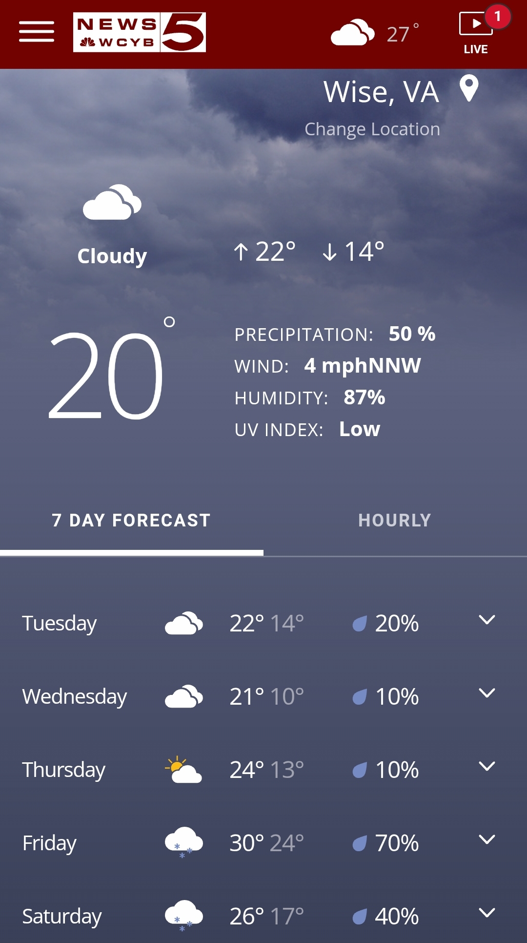
The cold leading up to this event is pretty stellar, check out Wise, va..barely making it to 25 degrees, won't be a wasted flake on that ground.

-
The 12z gfs snow axis pretty spot on with where the RGEM is at the end of its run.
-
Nam 12km res has been honking at that for days, I bet the ski resorts are loving this.