SnowenOutThere
-
Posts
5,666 -
Joined
-
Last visited
Content Type
Profiles
Blogs
Forums
American Weather
Media Demo
Store
Gallery
Everything posted by SnowenOutThere
-

Feb 22nd/23rd "There's no way..." Obs Thread
SnowenOutThere replied to Maestrobjwa's topic in Mid Atlantic
Pictures from my final Jebwalk up in NOVA before I head back south to UVA.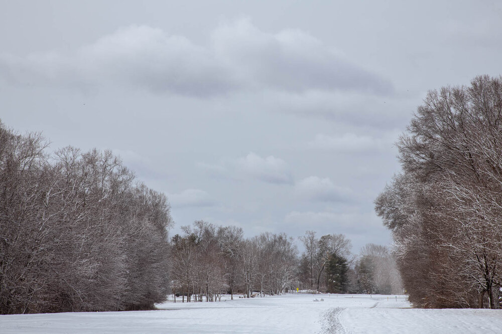
-
Late February/Early March 2026 Mid-Long Range
SnowenOutThere replied to WxUSAF's topic in Mid Atlantic
Right to Charlottesville -
Feb 22nd/23rd "There's no way..." Obs Thread
SnowenOutThere replied to Maestrobjwa's topic in Mid Atlantic
Just now finishing up a 3 mile post storm jebwalk. No complaints about this storm. Was beautiful and have all the trees a nice coating. -
Feb 22nd/23rd "There's no way..." Obs Thread
SnowenOutThere replied to Maestrobjwa's topic in Mid Atlantic
Not sure I buy IAD total. I have to be around 3.2 otg -
Feb 22nd/23rd "There's no way..." Obs Thread
SnowenOutThere replied to Maestrobjwa's topic in Mid Atlantic
Ehhhh the H5 setup is more B than A. Honestly it’s a freak setup where the jet streams aren’t doing what they should be for a miller storm but they manage to still get positioned correctly -
Feb 22nd/23rd "There's no way..." Obs Thread
SnowenOutThere replied to Maestrobjwa's topic in Mid Atlantic
True, but from an upper level perspective we were always relying on everything going right on those runs. We had the initial phase out west work perfectly, then we had the secondary vort help negatively tilt the trough super early. Then we had a strong enough primary low and SW vort that didn't run out east too quickly... there were just so, so many steps required to get those amazing snow maps. Not that someday the stars won't align but every individual storm you can bet against the snow maps until they are supported by a reasonable synoptic progression. IMO this is why the Jan 25th storm hurt so much because for once we had the H5 setup that was a reasonable, even expected, way to get a 2ft plus storm... then the stars aligned to turn it into a sleetfest. On the other hand this storm didn't really deserve the expectations placed upon it by the snowfall maps. -
Feb 22nd/23rd "There's no way..." Obs Thread
SnowenOutThere replied to Maestrobjwa's topic in Mid Atlantic
Quick Rant Here. I think some people here are more in love with the concept of snow or a winter storm than the physical thing itself! This rant is not aimed at the genuinely unlucky few who have next to no snow OTG at all; for you guys I feel for you and it sucks, I wish it went differently. However, the rest of you all need to get a grip as it did snow! From five days out this looked like a pie in the sky longshot to get nearly anything; for Pete's sake our initial posts were making fun of banking on a Miller B daytime storm with a trash airmass. Now, in the meantime we've seen our odds increase but frankly nothing ever looked absolutely amazing. For all of us fortunate enough to get snow please for the love of god instead of posting here about how much less you got than expected go out and enjoy it!! Most of my pictures and Jebwalk occurred while it was 33 degrees and less than a half inch of the ground (or deer). Something that constantly amazes me is that it only takes a 1/2 inch of snow to transform the landscape into something completely different. While I wish we all got more than what we did please just go and enjoy it. It's not worth the angst of tracking otherwise. -
Feb 22nd/23rd "There's no way..." Obs Thread
SnowenOutThere replied to Maestrobjwa's topic in Mid Atlantic
Personally I’ve loved this storm. Might not be the high end totals but beautiful sticky snow makes it feel like a winter wonderland -
The February 22-23 Late Season Miracle: JV Disco/Banter Thread
SnowenOutThere replied to bncho's topic in Mid Atlantic
I’ve posted a bit on this but man what a great synoptic system. Literally would be an example in my weather and atmosphere class at uva of how the jet influences H5 levels which influence 850 down lift and cyclogenesis. -
Feb 22nd/23rd "There's no way..." Obs Thread
SnowenOutThere replied to Maestrobjwa's topic in Mid Atlantic
I think it might be the thing over DC. The western band is dying out -
Feb 22nd/23rd "There's no way..." Obs Thread
SnowenOutThere replied to Maestrobjwa's topic in Mid Atlantic
I’m now from 2 miles outside the yellows to a singular mile. So close -
Feb 22nd/23rd "There's no way..." Obs Thread
SnowenOutThere replied to Maestrobjwa's topic in Mid Atlantic
The western and intensifying band is exactly 2 miles to my west. Still getting some good blowing snow but nothing crazy like it was from the 5-7pm hours. Hoping it slowly shifts east to get me in the goods. Either way not going to worry about it and hop on into the hot tub for a bit. -
Feb 22nd/23rd "There's no way..." Obs Thread
SnowenOutThere replied to Maestrobjwa's topic in Mid Atlantic
I think today was a great example of the margins we lose. I'm at around 2 inches of snow and waited till 2pm for snow to start mixing into the rain. We run that back 2-3 degrees colder and I'm below freezing a whole hour or two ahead of time which is probably around an inch extra of snow. Now, to truly get this storm further we would need 5+ degrees colder to get it all snow from morning onwards. -
Feb 22nd/23rd "There's no way..." Obs Thread
SnowenOutThere replied to Maestrobjwa's topic in Mid Atlantic
One last picture from my two hour Jebwalk. Three second exposure by the creek bed. -
Feb 22nd/23rd "There's no way..." Obs Thread
SnowenOutThere replied to Maestrobjwa's topic in Mid Atlantic
Yeah right now we both seem to be in a nice secondary band of snow. Doesn't seem like its really going anywhere from radar so maybe we'll be fine. -
Feb 22nd/23rd "There's no way..." Obs Thread
SnowenOutThere replied to Maestrobjwa's topic in Mid Atlantic
Both our houses look to be right next to the western edge... either way has been a fun night. -
Feb 22nd/23rd "There's no way..." Obs Thread
SnowenOutThere replied to Maestrobjwa's topic in Mid Atlantic
Some pictures more focused on the snow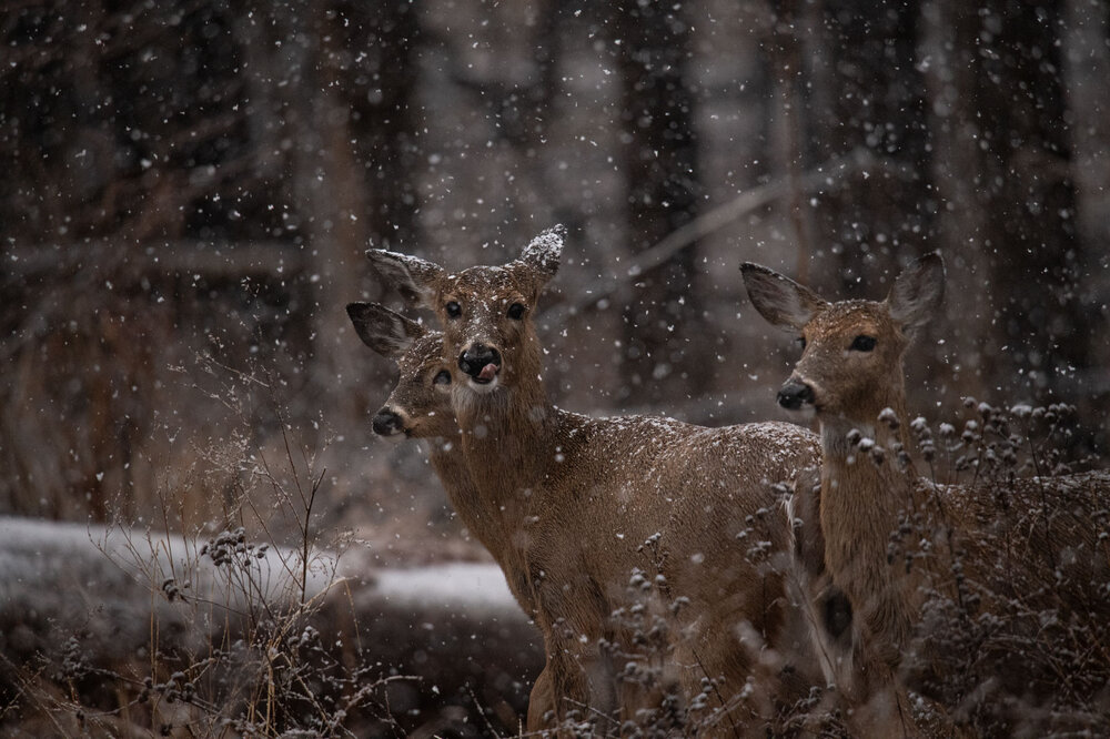

-
Feb 22nd/23rd "There's no way..." Obs Thread
SnowenOutThere replied to Maestrobjwa's topic in Mid Atlantic
One of the best Jebwalks I've taken. Pictures are from around 5:30pm.
-
Feb 22nd/23rd "There's no way..." Obs Thread
SnowenOutThere replied to Maestrobjwa's topic in Mid Atlantic
Trying to work out what pictures I want to include for my post. Got some fantastic deer pictures. -
Feb 22nd/23rd "There's no way..." Obs Thread
SnowenOutThere replied to Maestrobjwa's topic in Mid Atlantic
Still snowing nice under the bands out near the FFX Louden border. Must be closing in on two inches. Has been an amazing weather evening with windy blowing snow. Just wish someday to experience it for a whole night. -
Feb 22nd/23rd "There's no way..." Obs Thread
SnowenOutThere replied to Maestrobjwa's topic in Mid Atlantic
What time will we start seeing it develop? -
Feb 22nd/23rd "There's no way..." Obs Thread
SnowenOutThere replied to Maestrobjwa's topic in Mid Atlantic
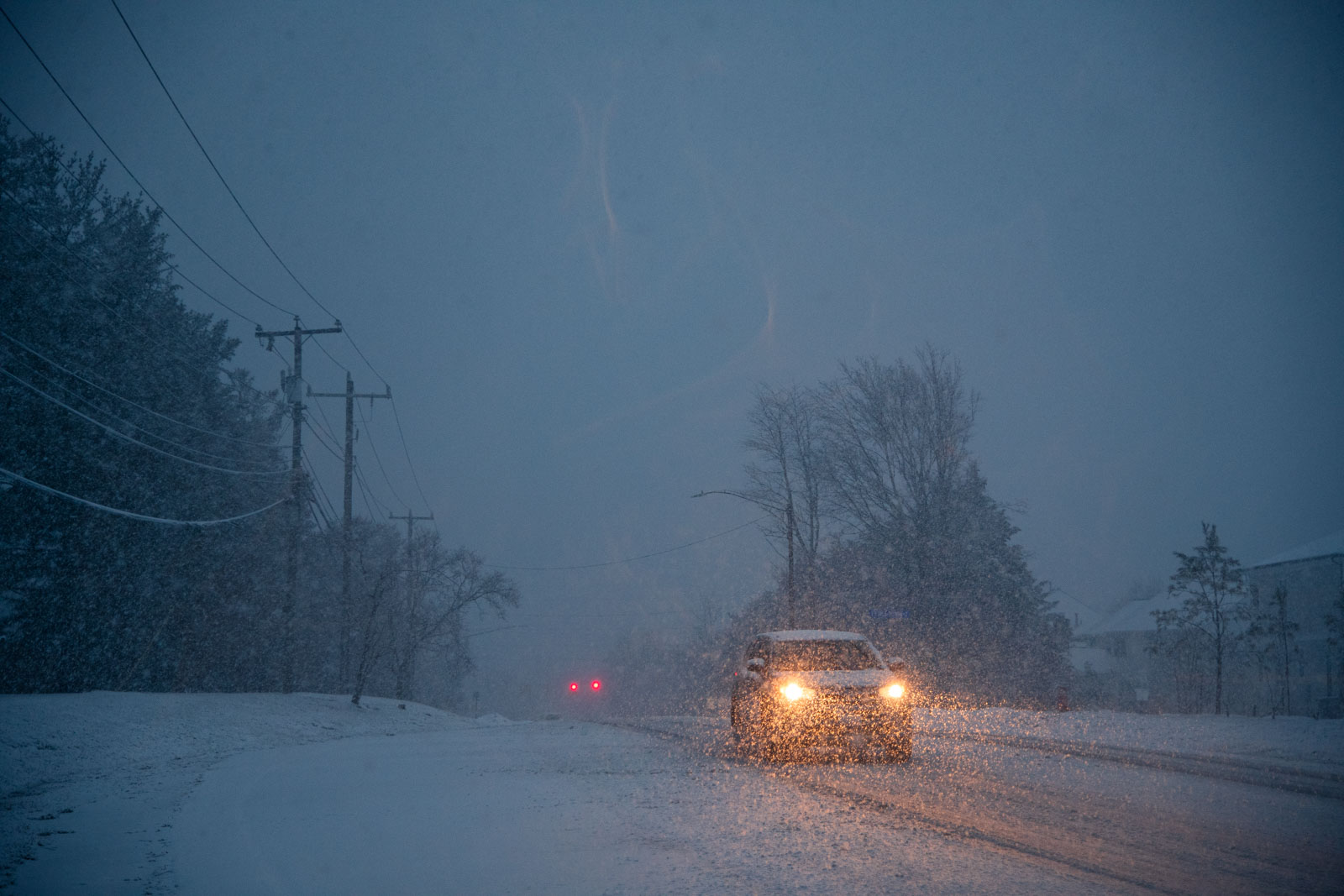
Beautiful two hour jebwalk done and now heavy snow with winds blowing it. So worth driving up for this -
Feb 22nd/23rd "There's no way..." Obs Thread
SnowenOutThere replied to Maestrobjwa's topic in Mid Atlantic
Just outside the heaviest reflectivity but regardless everything is caved and heavy dendrites. Got some awesome pictures I can’t wait to post. Anyone know if the IVt will shift east? -
Feb 22nd/23rd "There's no way..." Obs Thread
SnowenOutThere replied to Maestrobjwa's topic in Mid Atlantic
Going on a jebwalk to take some pictures! -
Feb 22nd/23rd "There's no way..." Obs Thread
SnowenOutThere replied to Maestrobjwa's topic in Mid Atlantic
Wow. I’m at 33.1 with heavy snow and nothing has really stuck yet. For the last 15 minutes I think I’ve still lived with just enough rain to stop accumulations. Now it’s all snow and slush is building up