WXNewton
-
Posts
872 -
Joined
-
Last visited
Content Type
Profiles
Blogs
Forums
American Weather
Media Demo
Store
Gallery
Everything posted by WXNewton
-
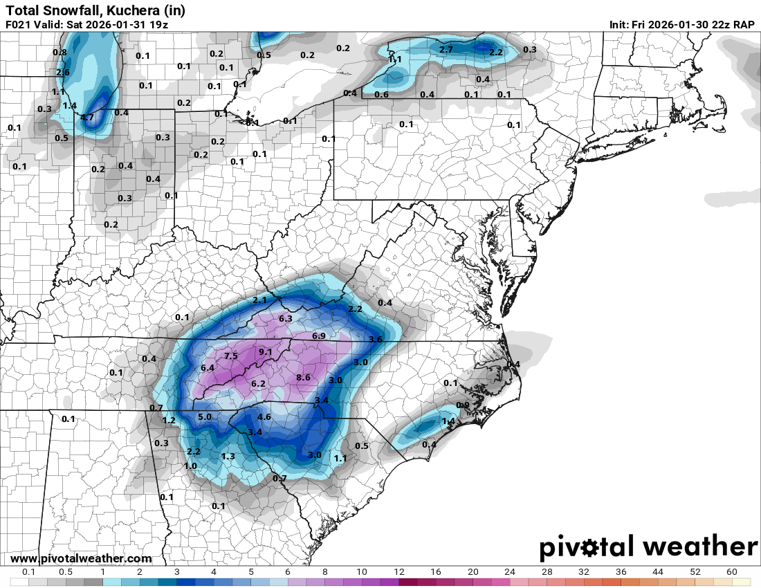
Latest RAP has almost 9" in HKY by 2 p.m!! Still a lot to go after that!! This thing is looking good!

-
I remember getting down to about 20-23 during that storm. So yes, this one very well maybe colder.
-
Can't ask for more than this guys! Pretty much all 12z global models give us 6"+, Lets GO!!
.gif.65dfd05f313609e97aaf1e249eebebb4.gif)
-
Back to back winter storms with temps in the teens just makes my heart happy! Wow what a great week of weather this has been, little to no sleep has been worth it!
-
January 30th- Feb 1st ULL and coastal storm obs
WXNewton replied to JoshM's topic in Southeastern States
Hit 21.2, currently up to 25.2/12.4. North side of the yard is still sleet packed! -
If you had to extend this over Catawba County, would you be 4-8 there too?
-
The “I bring the mojo” Jan 30-Feb 1 potential winter storm
WXNewton replied to lilj4425's topic in Southeastern States
Euro,GFS,icon,nam, RRFS 6z.gif.1b8de3dc137f276e34bc444fda14e994.gif)
-
This past weekend storm, it showed a lack in precip when compared to the globals. The actual QPF was a lot closer to what the NAM was showing 24 hrs before the storm than what any of the globals had.
-
The “I bring the mojo” Jan 30-Feb 1 potential winter storm
WXNewton replied to lilj4425's topic in Southeastern States
GEFS is locked in the past 3 runs and closely resemble the op as well.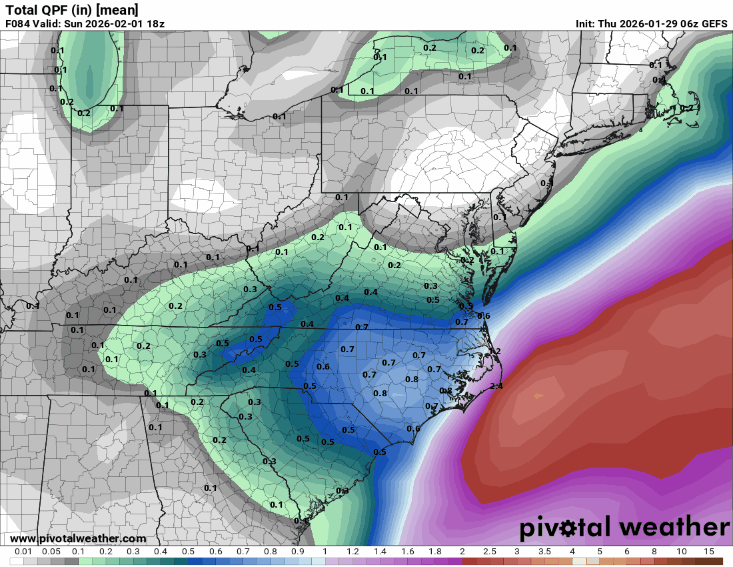
-
The “I bring the mojo” Jan 30-Feb 1 potential winter storm
WXNewton replied to lilj4425's topic in Southeastern States
Last 3 runs of GFS...pretty locked in!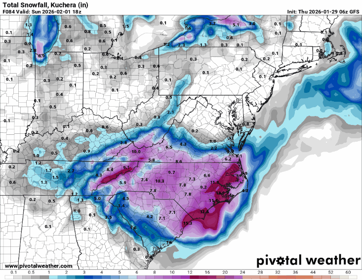
-
06 EPS another step our way! Also shows that precip maxima on the 06z Euro AI in the same general area.
.gif.7e9b0b63416d3f22700f6bf5837c588c.gif)
-
The “I bring the mojo” Jan 30-Feb 1 potential winter storm
WXNewton replied to lilj4425's topic in Southeastern States
06z EPS vs 00z EPS.gif.5734d6d406d676abb196c7d9d45d1916.gif)
-
The “I bring the mojo” Jan 30-Feb 1 potential winter storm
WXNewton replied to lilj4425's topic in Southeastern States
Nam, 3km looked to be on track for a much better run than 12km. -
The “I bring the mojo” Jan 30-Feb 1 potential winter storm
WXNewton replied to lilj4425's topic in Southeastern States
NBM...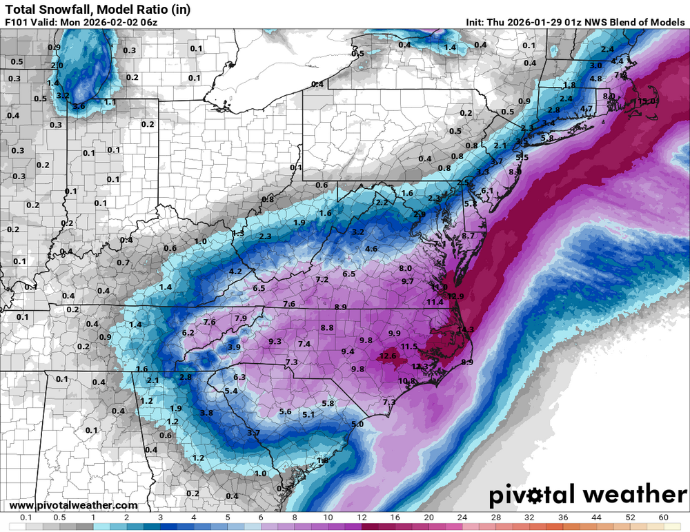
-
18z ICON was a good hit this evening for our area
-
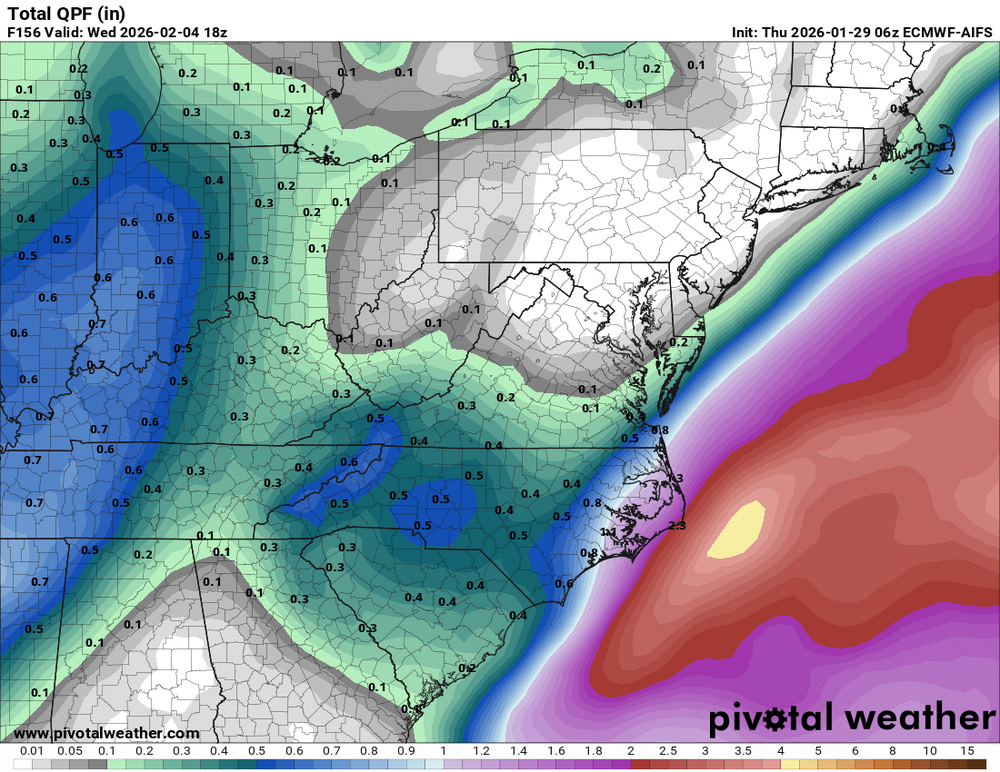
One interesting thing to note, over the past 3 runs in MBY the GFS AI and EURO AI have only made small adjustments in QPF in the amount of .05-.08 either up or down. Where-as the OP EURO and OP GFS over the past three runs have had more wild swings in QPF of .22"-.27". When looking at the ensembles for both EURO and EURO AI as well as GFS those QPF swings are much smoother and the difference is not as much of a wild swing as the OPs have been showing from time to time. Thinking about the models this way and really digging into the ensembles has helped me to not ride each single OP run for the potential wild ups and downs that it may show. All and all after looking at many different averages and taking the fairly rock steady ensembles into account I am starting to feel confident that my area will see somewhere between .35"-.45" of precip and factoring in about a 16-17:1 ratio, amounts should be in the range of 6"-7".
-
The “I bring the mojo” Jan 30-Feb 1 potential winter storm
WXNewton replied to lilj4425's topic in Southeastern States
The only model that didn't follow the further east trend was the GFS AI, I wonder how it's been performing? -
The “I bring the mojo” Jan 30-Feb 1 potential winter storm
WXNewton replied to lilj4425's topic in Southeastern States
Yeah, I was more focusing on the footprint of the storm, I have to look closely at it to make sure it wasn't the run before lol. -
The “I bring the mojo” Jan 30-Feb 1 potential winter storm
WXNewton replied to lilj4425's topic in Southeastern States
Remained consistent! -
The “I bring the mojo” Jan 30-Feb 1 potential winter storm
WXNewton replied to lilj4425's topic in Southeastern States
The trend on the GFS AI is really impressive....gif.dfcb756bd31bbcf162c5454693165a3f.gif)
-
The “I bring the mojo” Jan 30-Feb 1 potential winter storm
WXNewton replied to lilj4425's topic in Southeastern States
Does anyone remember the website for cmc-collaboration model. I remember it used to have a cool look to it! -
The “I bring the mojo” Jan 30-Feb 1 potential winter storm
WXNewton replied to lilj4425's topic in Southeastern States
NWS blend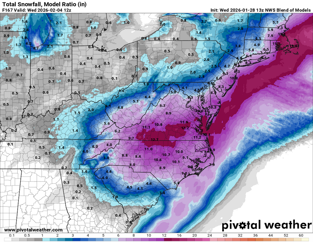
-
Yes. I just was thinking the same thing.
-
RGEM was going to be nice too!
-
The “I bring the mojo” Jan 30-Feb 1 potential winter storm
WXNewton replied to lilj4425's topic in Southeastern States
GEFS becoming pretty consistent of the overall totals and area to be affected. Looks like major jumps, have turned into wobbles at this point. I would expect minor shifts each run, with the overall footprint starting to lock in..gif.3ba9f1340bb8dd58f0c78f8410743e50.gif)