WXNewton
-
Posts
882 -
Joined
-
Last visited
Content Type
Profiles
Blogs
Forums
American Weather
Media Demo
Store
Gallery
Everything posted by WXNewton
-
Yeah I agree, the track and setup pretty much scream Miller-B so if anything were to fall as anything frozen more than likely going it's to be zr or sleet. My point is the models don't have it figured out yet and a lot folks seem to be writing it off. I feel like anytime a wedge setup could happen we won't really have the answers until almost go time, especially if the models are somewhat close over the next few days with temps in the mid 30s.
-
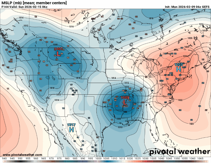
12z GEFS definitely with a colder push and much more pronounced wedge this run, it's not over yet!
.gif.c5ccb952d960dcd4f0062f6d70cb3005.gif)
-
12z GEFS definitely building the high in stronger this run, might still look decent for WNC.
-
12z CMC comes in a little bit colder and has some ice around the I40 north area. This was actually the coldest run the Canadian has had in several runs, it usually does good at sniffing out the CAD, so this might lead to other models showing a colder solution as we get closer. Definitely an outlier at this point, but might not be too far off as far as the wedge placement looks.

-
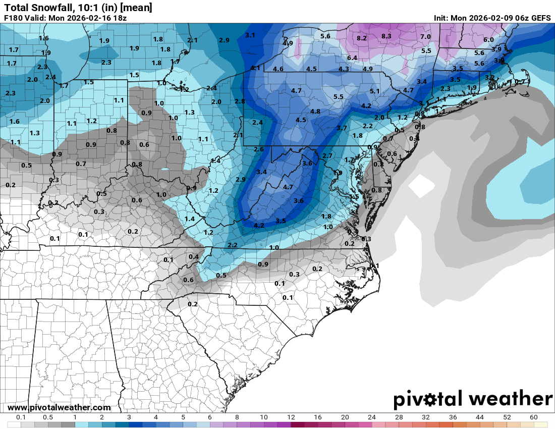
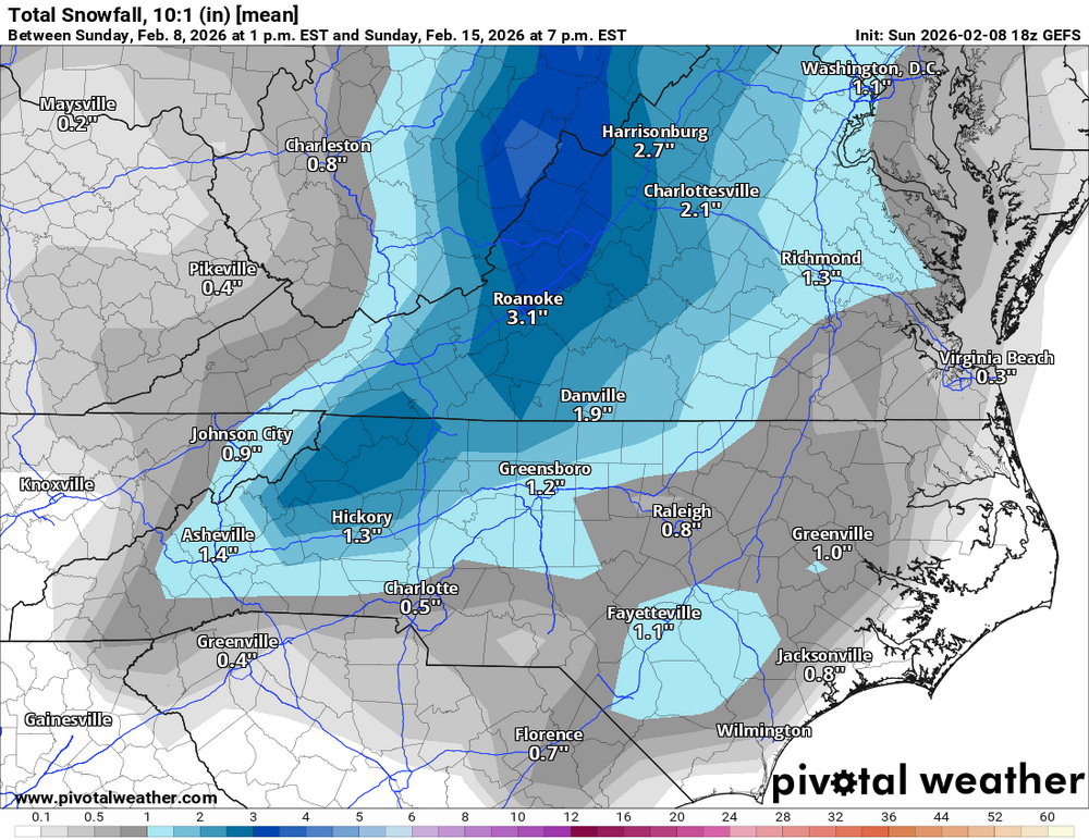
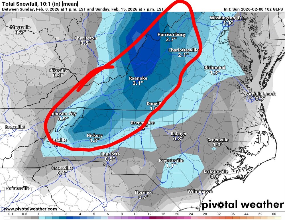
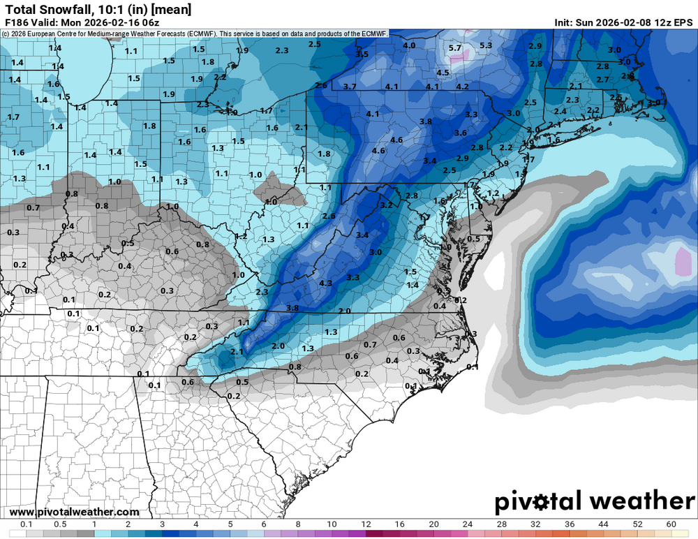
Overnight runs were not great, ops and ens are all more in agreement with less wintry precip at this point. 00z-EPS 00z- CMCE 06z-GEFS

-
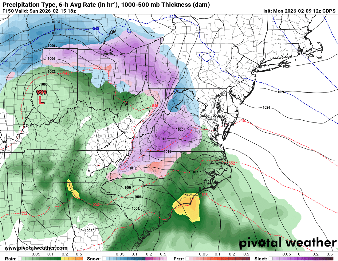
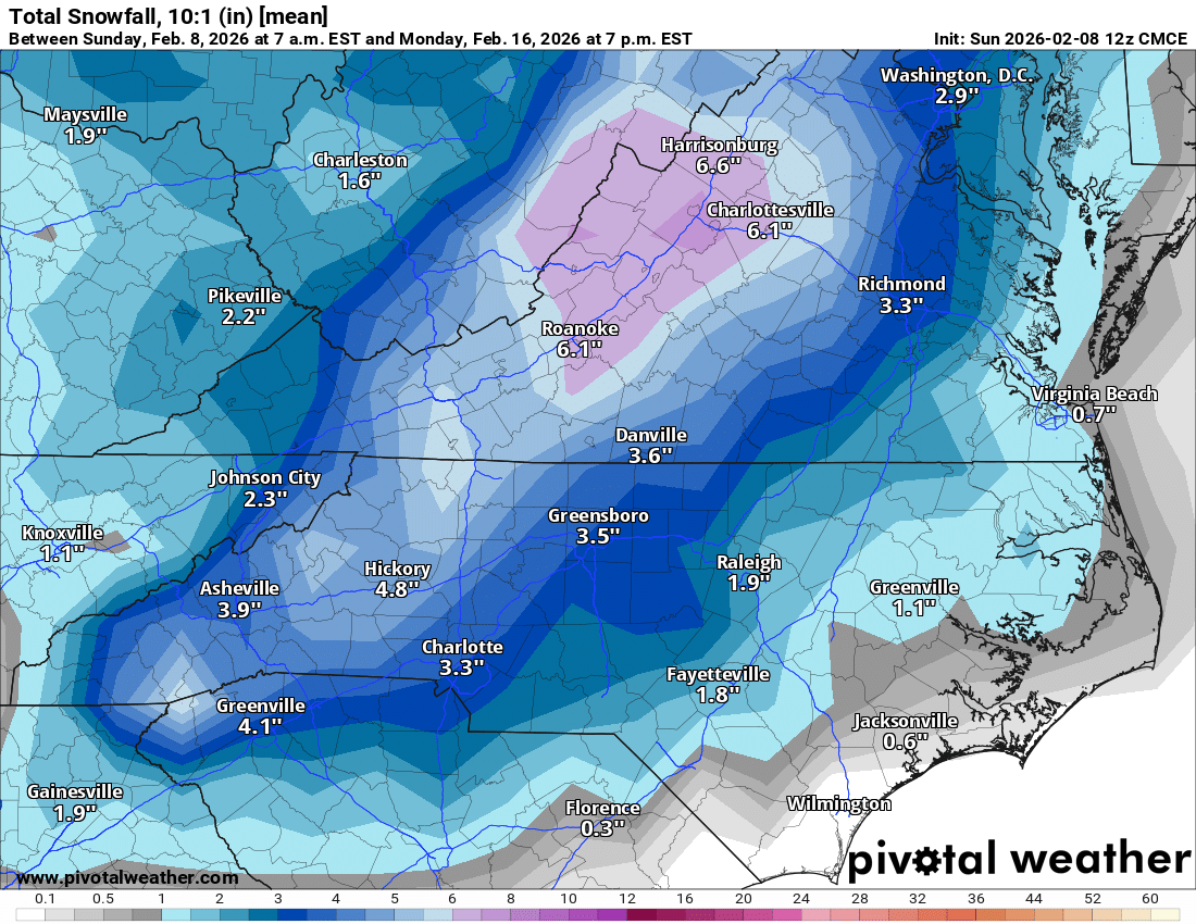
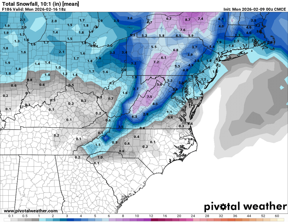
18z GEFS looking to be a little more widespread area of snow similar to the Canadian ensembles. Right now it's looking like north of 40 Foothills, mountains, throughout Western Virginia. Out of all the ensembles today, the area in red seems to be the favored area and the purple area even higher chances.
-
Yes similar overall footprint to EPS. I would feel pretty good at the chances if you live NW of 85 into Virginia.

-
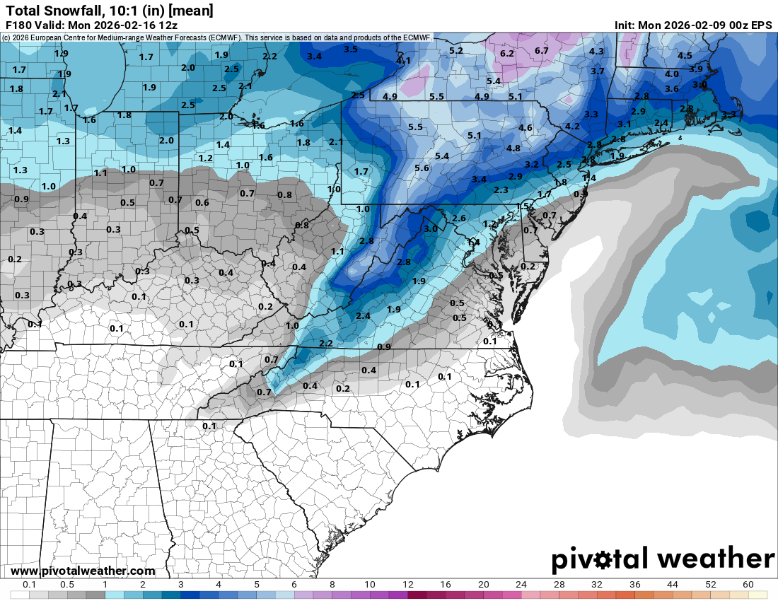
12z EPS...
-
12z Euro tries to run a sub-990 low across the heart of an eroding CAD, I would take the OPs with a grain of salt at this point. Mainly focus on what the ensembles are showing at this range. It only shifted the low 500 mi since last night, so hard to take serious at this point. Also moves the High from Erie to Norfolk in 6 hrs, I don't really buy that solution. This storm will all come down to timing, and that's not going to be figured out for a few more days.
-
Not really lack of ensemble support, I'd argue that EPS and GEFS both have some support. Especially in the CAD regions. No use to look at wedge potential until Wednesday - Thursday timeframe, if the threat is still there a few days from now, wedge will over perform especially in MBY.
-
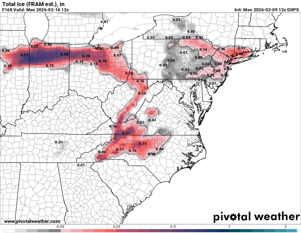
12z ICON verbatim is a major winter storm I40-I85 north into VA on Sat-Sun. There's also an area of freezing rain in there too, just south of I40.
-
Definitely a good shot at breaking through, moisture movement more north to south and entering through Ashe County and not getting shredded as much as it would trying to come in from TN.
-
There were some bad spots on roads this morning. Saw two wrecks on Highway 16 due to black ice. I was amazed at how fast people were travelling with temps in the low 20s and "wet looking roadways." Crazy how common sense to slow down doesn't register with everyone.
-
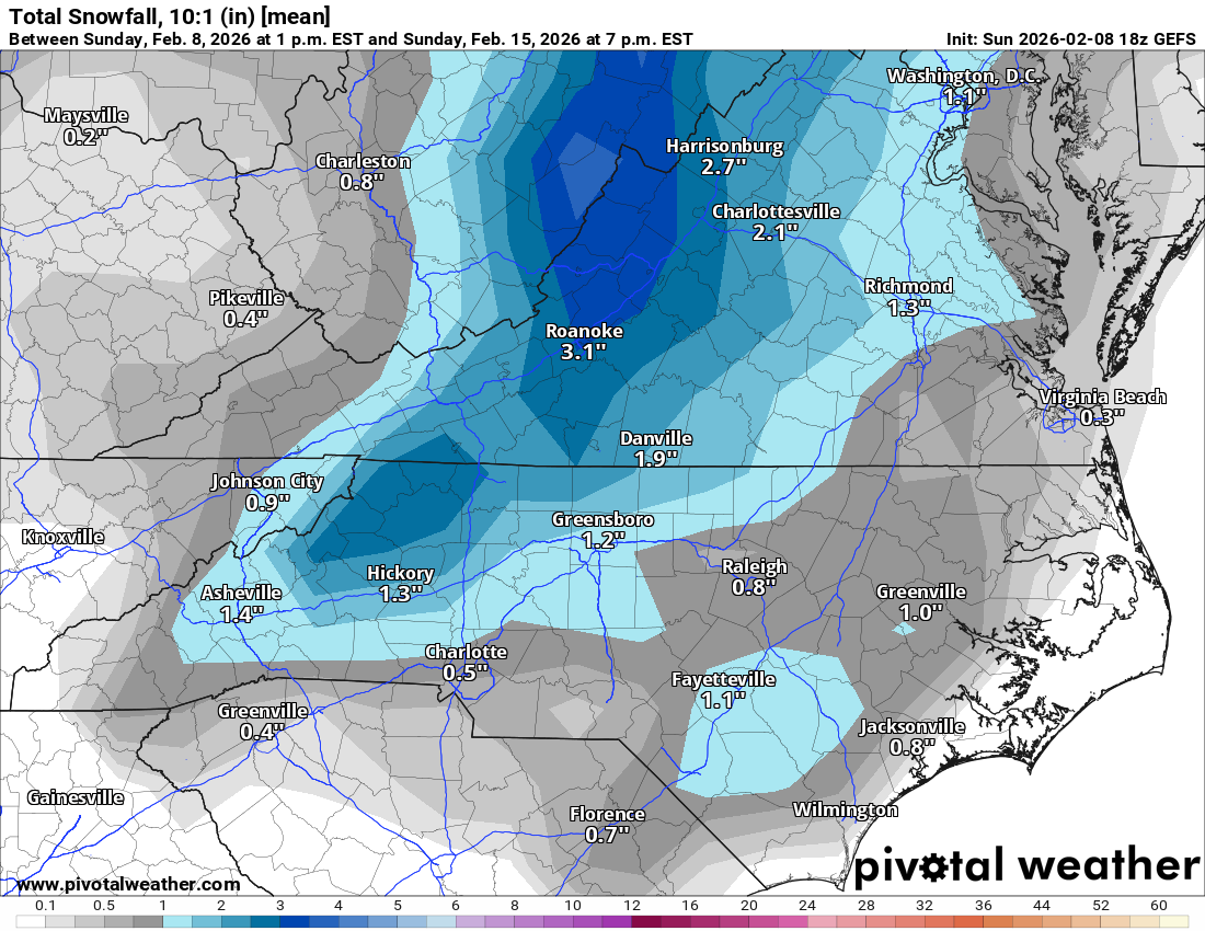
Still snowing in Newton, just had some of the best rates since midnight. I have been up since midnight and it has been very few times where it wasn't snowing. Crazy to think that it has been light snow for almost 12 hrs. This storm could have been a big hit if we had a little stronger storm and heavier rates. So cool to see three events in the past 2 weeks. Two major and one just enjoyable to watch! I will say most of the models did a poor job at showing any of this redevelopment of precipitation.
-
About a 1/4" here schools went from a 3 hour delay to closed. Been closed for 9 consecutive school days now!
-
Looking at that radar someone between Morganton to Lenoir to Hickory is going to overachieve tonight!
-
Solid coating here in Newton too, shady spots on the road are white, slushy build up on the cars. 31.6
-
My friend in Maiden is reporting the roads turning white. Down to 31.8
-
Light snow in Newton. 32.4
-
GFS last 4 runs, likes I40 in and around to Greensboro area...
-
Would make some Catawba County folks pretty happy!
-
18z GFS remains consistent with accumulations over the NW Piedmont and foothills/MTNs area.
-
18z NAM 3km, RRFS and HRRR tries to get us a little love going this run.
-
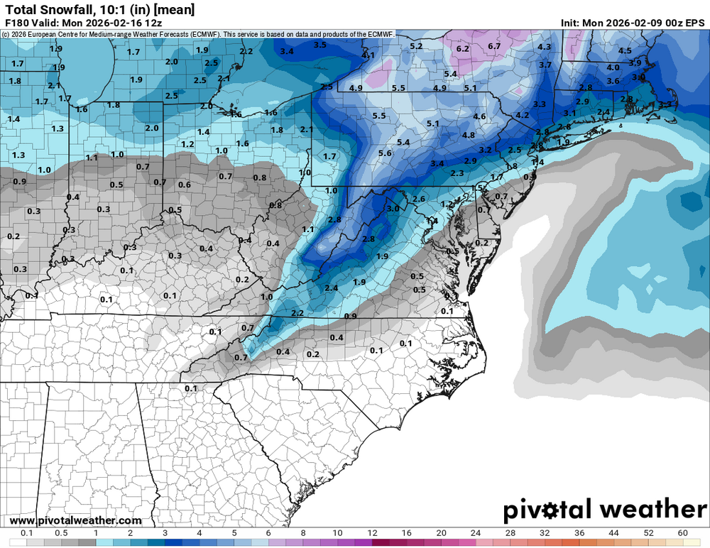
Euro really hammers Ashe and Allegheny counties!
-
12z GFS...