Intensewind002
-
Posts
882 -
Joined
-
Last visited
Content Type
Profiles
Blogs
Forums
American Weather
Media Demo
Store
Gallery
Everything posted by Intensewind002
-
 Now that I’m back in Albany I might get back to back snowstorms
 -
January 28/29 Blizzard Observations/Discussion/Nowcasting
Intensewind002 replied to Northof78's topic in New York City Metro
-
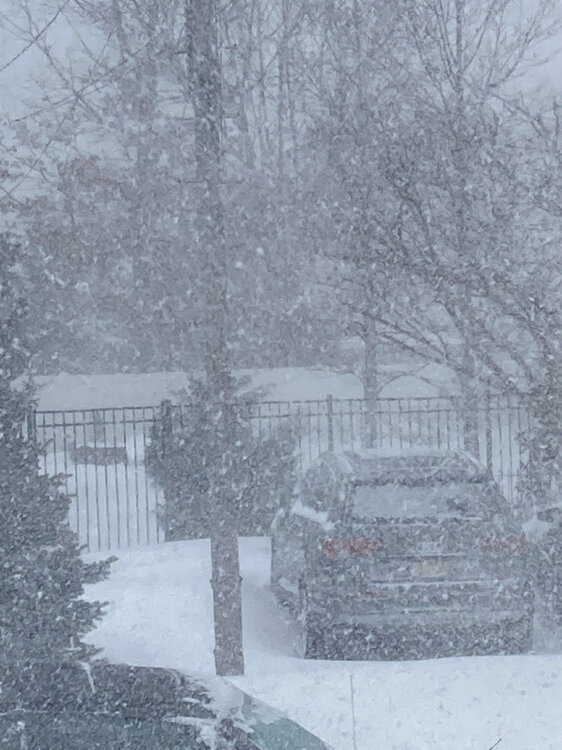
January 28/29 Blizzard Observations/Discussion/Nowcasting
Intensewind002 replied to Northof78's topic in New York City Metro
I accidentally took this yesterday when I meant to take a picture but it actually came out pretty good https://streamable.com/0fgwjr -
January 28/29 Blizzard Observations/Discussion/Nowcasting
Intensewind002 replied to Northof78's topic in New York City Metro
Peak of the storm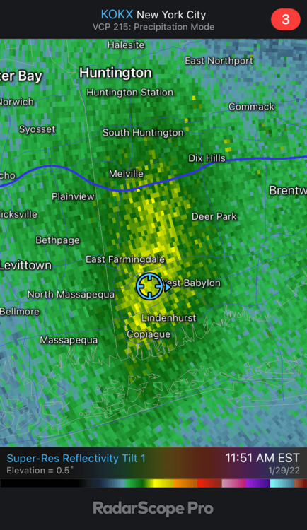
-
January 28/29 Blizzard Observations/Discussion/Nowcasting
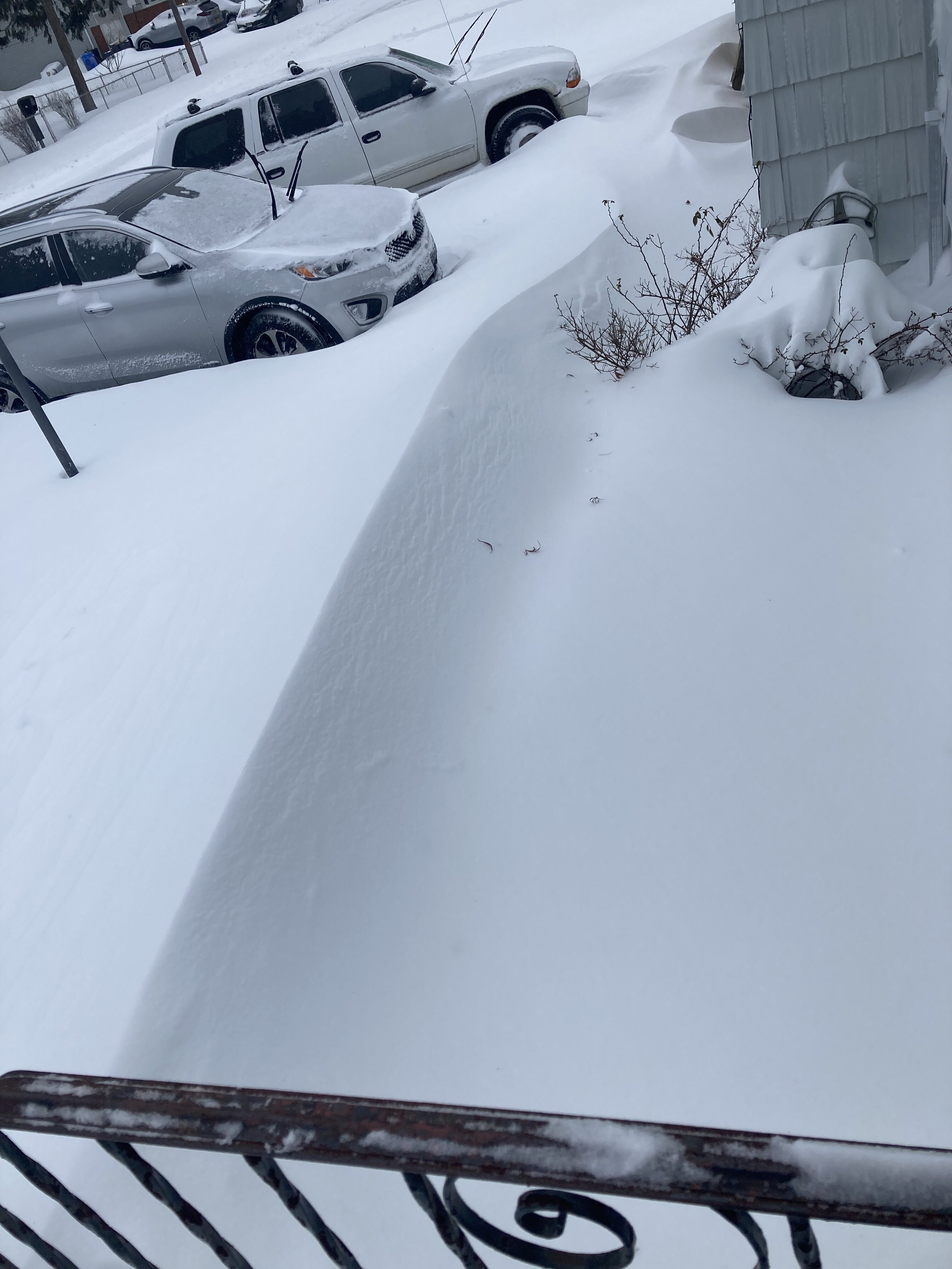
Intensewind002 replied to Northof78's topic in New York City Metro
In front of my house, by the time the wind died down, this drift was around 40” high
-
January 28/29 Blizzard Observations/Discussion/Nowcasting
Intensewind002 replied to Northof78's topic in New York City Metro
Imagine the January 2018 blizzard with its 949 mb pressure made a loop south of montauk instead of speeding away just east of the benchmark? That would of been the blizzard to end all blizzards. I have to agree in regards to wind that January 2018 was stronger, I remember getting frequent gusts into the 50s with that one, this one was still obviously a blizzard out here in western suffolk but gusts were mostly in the 35-45 mph range besides a few isolated around 50. Snowfall rates 2018 wins too 3”/hr here then, today was 2”/hr at worst, but the duration of this event allowed it to still pull ahead in the final snowfall totals department -
January 28/29 Blizzard Observations/Discussion/Nowcasting
Intensewind002 replied to Northof78's topic in New York City Metro
Yeah I’m leaning towards about 18-20” in lindenhurst, that final band really pushed us to bust high after it sat over us for a couple of hours -
January 28/29 Blizzard Observations/Discussion/Nowcasting
Intensewind002 replied to Northof78's topic in New York City Metro
Almost impossible to measure due to all the drifting, (some spots are literally bare while some drifts are nearly 4 ft high) but Im thinking I got somewhere around 14-16” (maybe as high as 18”) of snow here. Definitely worth the (literal) price of admission. -
January 28/29 Blizzard Observations/Discussion/Nowcasting
Intensewind002 replied to Northof78's topic in New York City Metro
Still getting some pretty strong wind gusts here, one to 49 mph not to long ago. 51 mph was the peak here around daybreak -
January 28/29 Blizzard Observations/Discussion/Nowcasting
Intensewind002 replied to Northof78's topic in New York City Metro
Jan 2016 is the king for the south shore. Only storm I’ve gotten more than 2 feet of snow in -
January 28/29 Blizzard Observations/Discussion/Nowcasting
Intensewind002 replied to Northof78's topic in New York City Metro
They’ve been cranking under the core of that little band for a good couple hours now, probably had 2”/hr rates -
January 28/29 Blizzard Observations/Discussion/Nowcasting
Intensewind002 replied to Northof78's topic in New York City Metro
I’ve been choking on subsidence for a couple hours now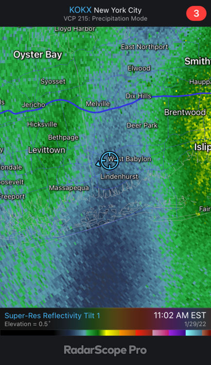
-
January 28-29 2022 Miller abcdefu Storm Obs/Discussion
Intensewind002 replied to mappy's topic in Mid Atlantic
Temp 14, wind chill -4 right now -
January 28/29 Blizzard Observations/Discussion/Nowcasting
Intensewind002 replied to Northof78's topic in New York City Metro
Last time I checked I had about 7.0” of snow here, that was maybe 2 hours ago -
Just came in from measuring, 6.4” total snow so far. Expecting another 9-12” here, winds aren’t too bad right now. Strongest gust in the past 30 min was about 34 mph, but I did have a gust to about 44 mph around 4:00 am, and that remains the peak so far for this storm
-
January 28/29 Blizzard Observations/Discussion/Nowcasting
Intensewind002 replied to Northof78's topic in New York City Metro
As of 2:15 AM: Nice moderate snowfall here right now, along with winds gusting to about 35 mph. 4.3” on the ground with drifts maybe twice that height -
Whatever model drops the most snow in my backyard is correct
-
As long as I don’t lose power, yeah… I’ve been kind of a wind weenie since Sandy happened when I was a kid (well not that im exactly old lol). I would take snow rates over wind though any day
-
Ok I got my ticket and I’m on my way back to LI, if I get anything less than a foot this trip wasnt worth $90
-
Lindenhurst, in western suffolk
-
Im up in albany rn for school, would it be worth it to buy a train ticket this afternoon to go back home for this storm?
-
That was Jan 2018 im pretty sure
-
Out here on LI it was like 11 hours straight lol The only other ones that even came close to that was February 2017 with 7 hours and January 2018 with 8 hours
-
We had an 18” storm only a few years ago in suffolk, march 2018. Did western Nassau get shafted in that one?
-
Had a dusting in Lindenhurst only on the coldest parts of the grass and trees, all gone now. My expectations were low though since we rarely score on these frontal situations so I’m not exactly feeling any dissapointment