Intensewind002
-
Posts
923 -
Joined
-
Last visited
Content Type
Profiles
Blogs
Forums
American Weather
Media Demo
Store
Gallery
Everything posted by Intensewind002
-
Not much rain here last night .10”, .25” for this week though, around half the total I got in all of July
-
.16” of rain here, first time this month getting any accumulation
-
Holy crap, actual precipitation on the south shore of long island
-
Temp dropped slightly with the sea breeze, still 91/76
-
92/76 imby right now, heat index is currently 105
-
Only .02” of rain from my weather station last night. I’m in Virginia and last night i saw some heavy rain for the first time since like June. July finished with only around half an inch of rain imby
-
Finally past half an inch today with .15” this morning, .60” for the month now
-
So close yet so far

-
Maxxed out at 94 today, down to 90/70 now
-
I was only an 11 year old kid but I remember that being the hottest day I’ve ever experienced, it was like 102 with a dewpoint of 75. Heat index was like 115-120
-
Highs imby for the heatwave: Tuesday: 90 Wednesday: 94 Thursday: 86 (dewpoint of 78) Friday: 92 Today: 97
-
97/65 for the high here, easily the hottest day here since July 2020, the lack of humidity really helped. Temps have backed off to 94 now that the seabreeze has picked up. I would be in the pool rn if I didn’t get a nasty sunburn on Wednesday
-
Agreed, I had a dewpoint of 78 with that high of 86 and it felt way worse out there compared to today
-
92/70 currently, yesterday’s 86 screwed up the chance for a 6 day heatwave here. The criteria should be lower for place on the shore…
-
86/78 for the high today here so technically no heatwave (although I think it should qualify with a Td that high). .13” of rain from that storm earlier so finally reached half an inch on the month
-
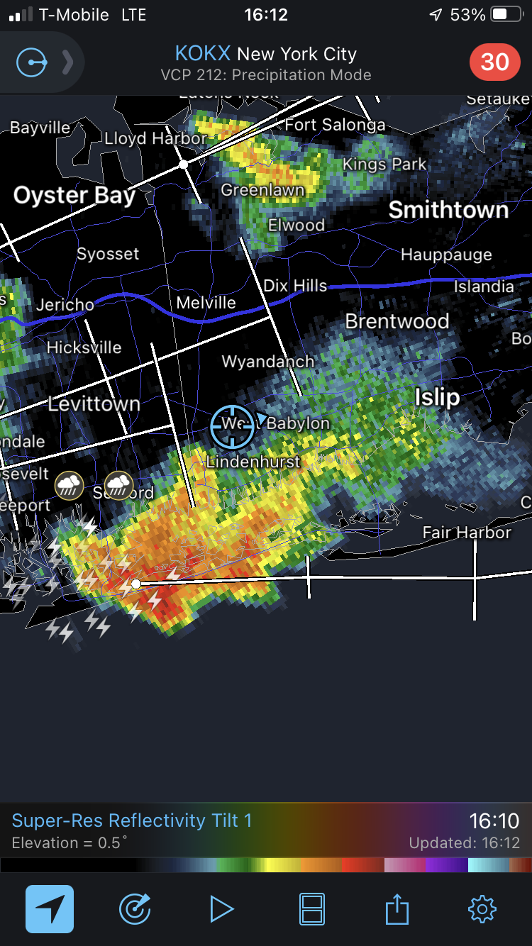
FRG had 30 mph sustained winds with gusts to 41 at the last hourly Obs right as that hook moved over
-
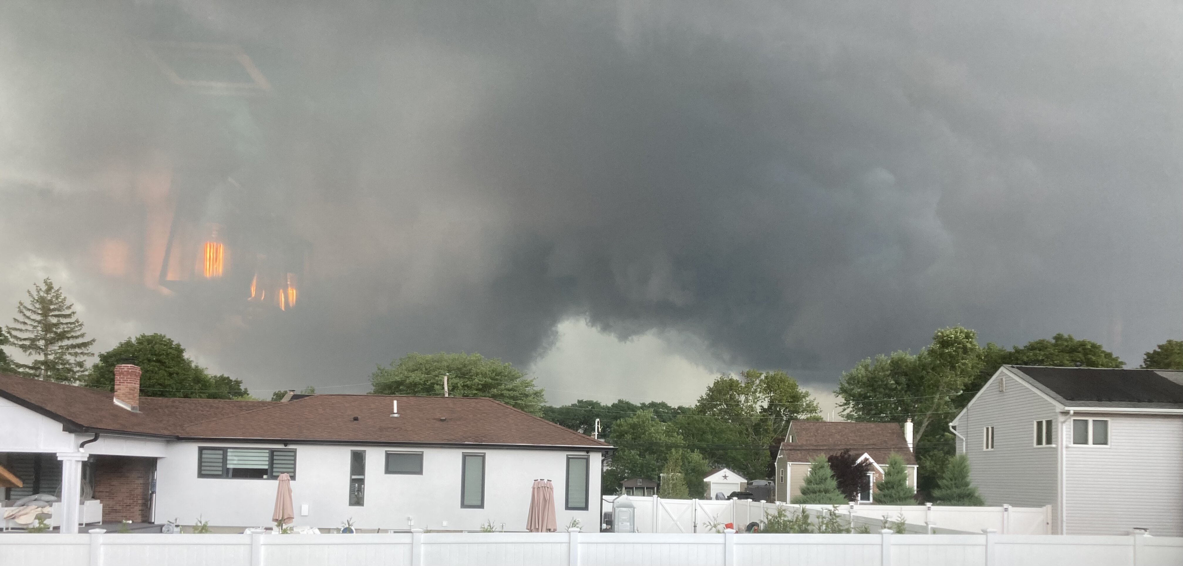
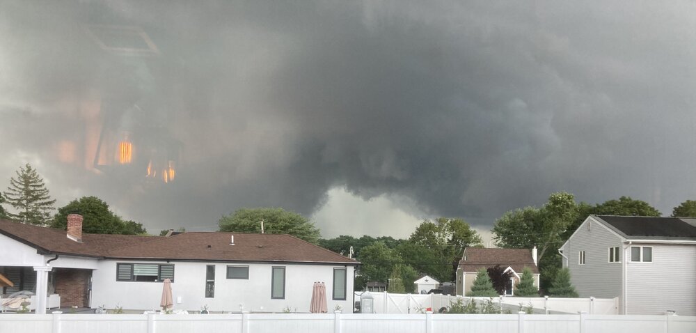
I saw the wall cloud just to my north from Lindenhurst, that looked like it was close to touching down for sure

-
Wow big gusts moving through maybe 40-50 mph
-
I might be just having weenie hallucinations but, possible wall cloud just to my north?
-
The north shore of Long Island is the new south jersey, temp is really struggling to rise here with so much humidity and the seabreeze, only 86/76 for the high so far
-
Temperature holding steady at 91/72/99 here, after a high of 96 at 12:00
-
Temp going down now post seabreeze front, 94/73, HI: 104
-
96/74 imby hottest day of the year so far. Heat index is 107
-
Wasn’t it like 104 there a couple of days ago
-
Managed to hit 90 now that the wind shifted to westerly, first 90 here since I hit 94 on May 31st