MN Transplant
-
Posts
17,662 -
Joined
-
Last visited
Content Type
Profiles
Blogs
Forums
American Weather
Media Demo
Store
Gallery
Everything posted by MN Transplant
-
The good(?) news is that the surface is hanging in there so far. I’m 66/61. IAD is 69 still.
-
Brother is reporting the same in Middletown
-
Was at Huntley Meadows earlier and a few of the gusts made me wonder if that was the right time to be walking the trails.
-
Yeah, that's wild. The messaging has been good, so hopefully the tornadoes steer clear of populated areas.
-
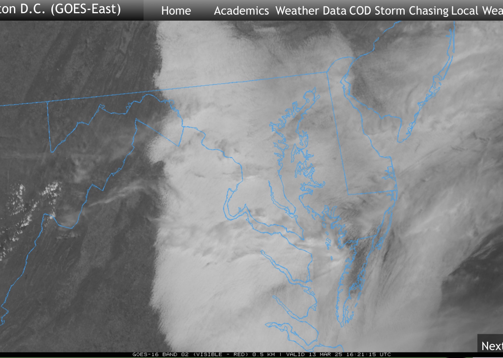
Some thinning just west of 95. We’ll probably clear out quicker than yesterday, but it’ll stay cool.
-
Completely overcast. Bummer.
-
Finally burned off. Late day high incoming.
-
Mid-60s and full sun. Spectacular day.
-
Bringing over the discussion of Thursday's temps, the NAM is still significantly cooler than the other models, even the other mesos. Mid-40s vs mid-50s.
-
71.1 for the high so far and same exact timeline as you for the prior 70.
-
68.7. Trying to make a run at 70.
-
C+. Below average, above median snow. Long period of snowcover gives it a +.
-
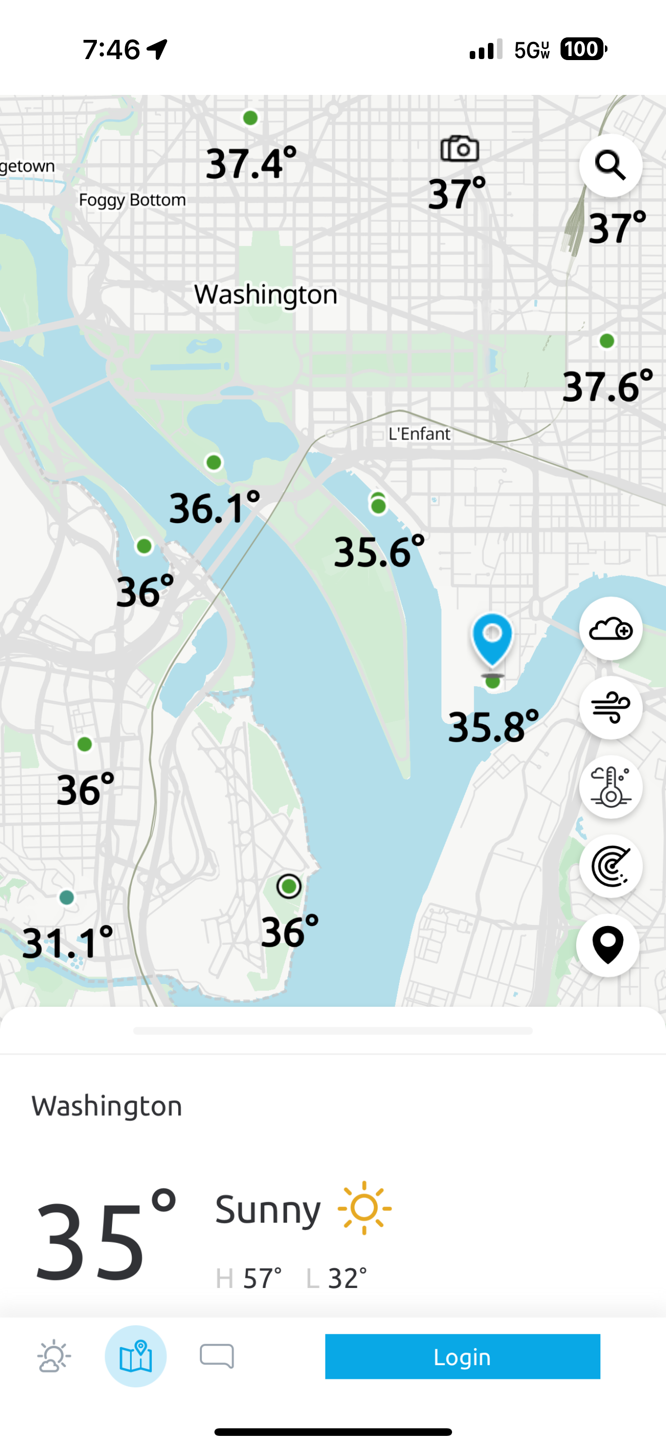
Decent chance that growing season has already started in the warmer spots. Grabbed this earlier as a good example of the heat island.
-
Hail with the cell west of Frederick
-
There was maybe a scan or two where you could squint and see some rotation.
-
It might rain. 58.8
-
Again, we are talking about representativeness, not accuracy. DCA is accurate, but not representative of the vast majority of the DC-area population. There's nothing to be "fixed". You are free to use Andrews or IAD or BWI for your temperatures.
-
DCA got down to 30. The surrounding weather stations near the river were mostly 28/29. In fact, the PWS at Buzzard Point had a low of 30.
-
19 this morning. So, it ended up being 46 degrees in 18 hours. Brrr.
-
Because mine started earlier I’m not going to hit any of those metrics. Was still 50 at 4pm and then took an additional dive. Still, 65 to the 20s is a tumble.
-
If this were early winter or pre-storm, we would be talking about how impressive a temperature drop this was. I’m down 35 degrees from my 11am high. Got a second surge of wind at about 8pm too.
-
Wow, I liked his time series output of the models. Simple but effective.
-
Airports have gusted to the mid-40s. I was working outside under some trees and thought better of it.
-
65.5 today. Overperformer of course.